Mackenzie River delta
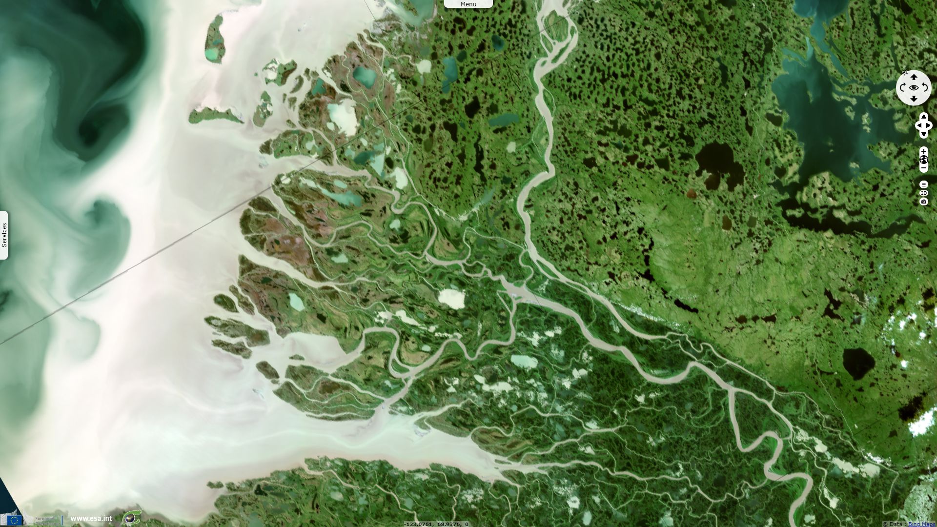
Sentinel-2 MSI acquired on 30 June 2017 at 20:50:19 UTC
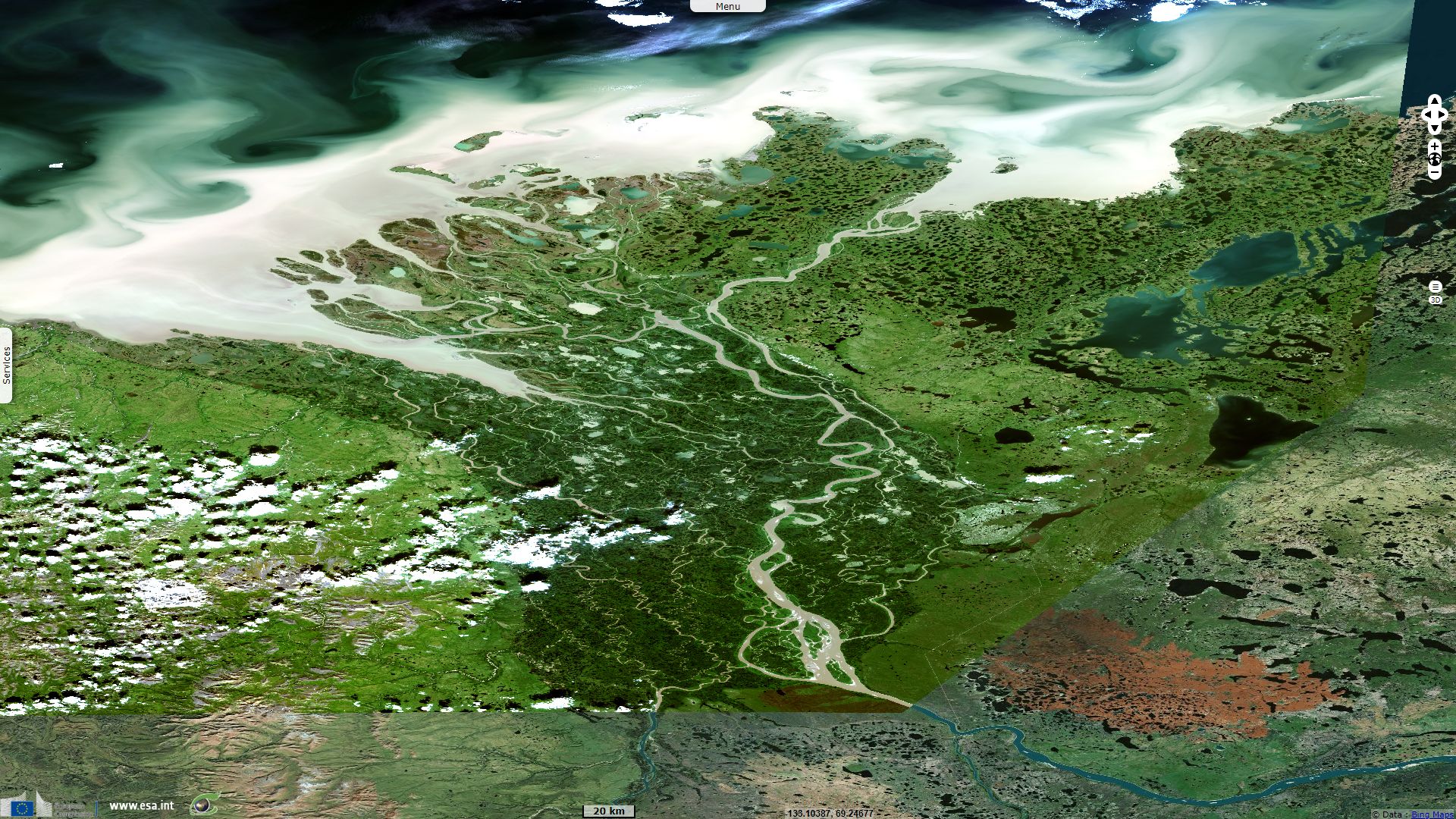
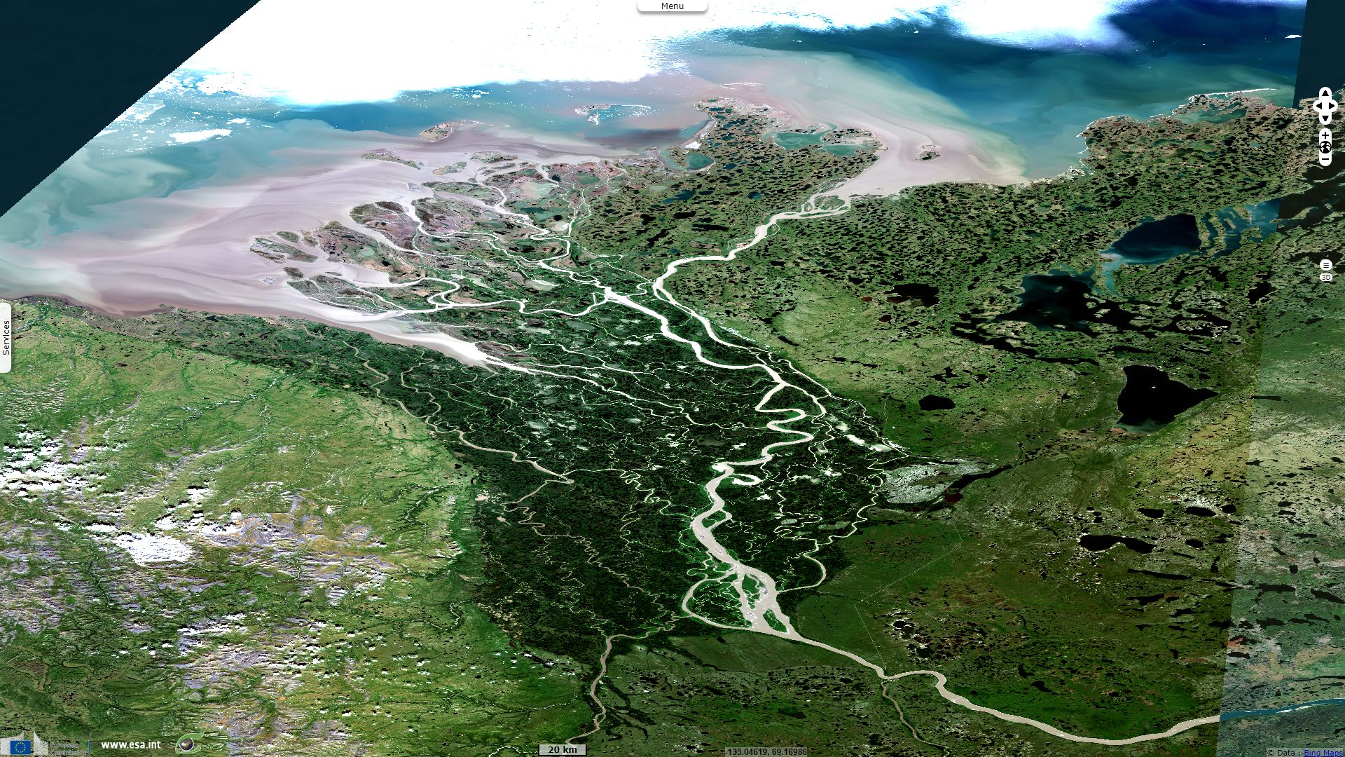
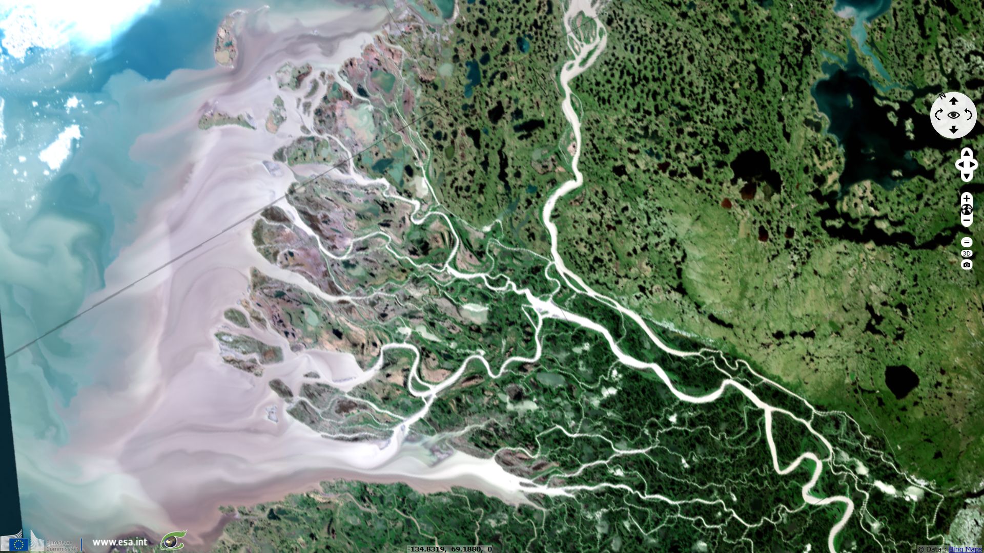
Sentinel-2 MSI acquired on 23 July 2018 at 21:00:21 UTC
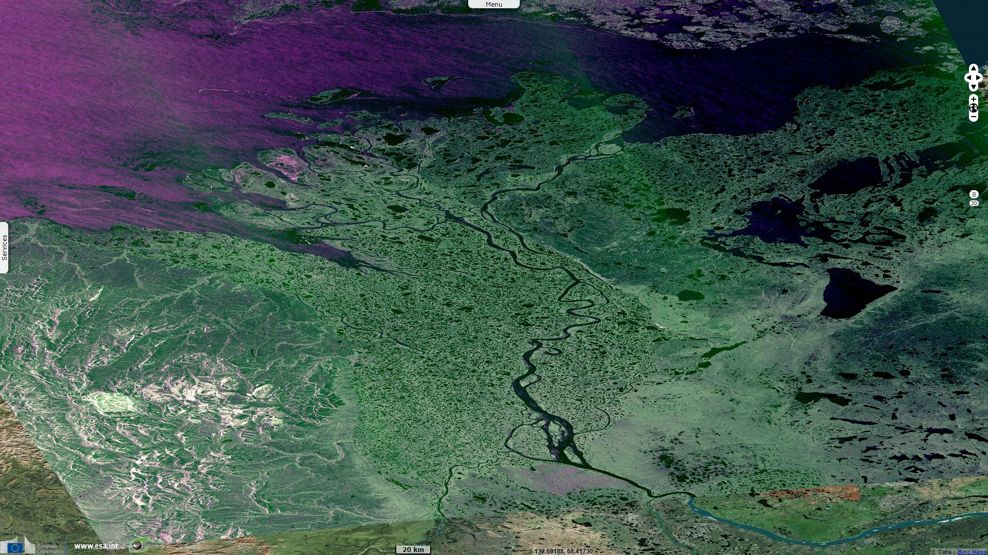
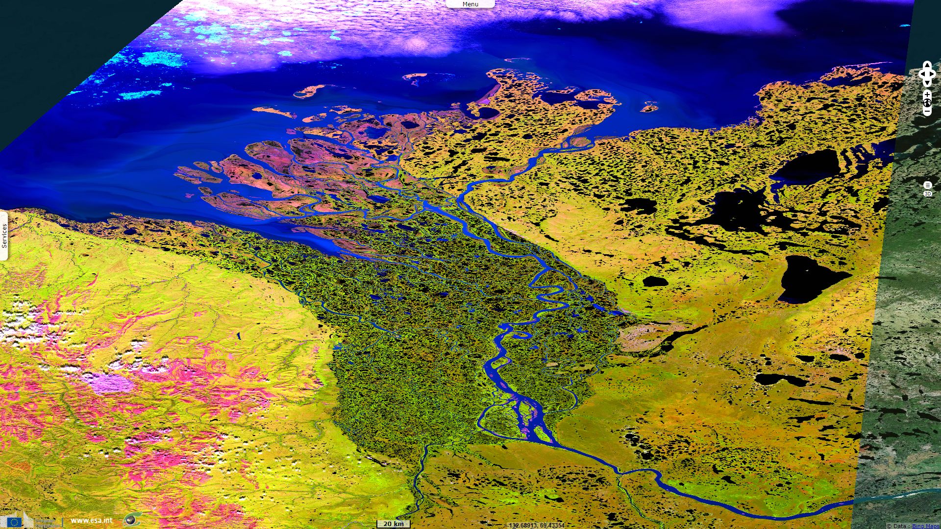
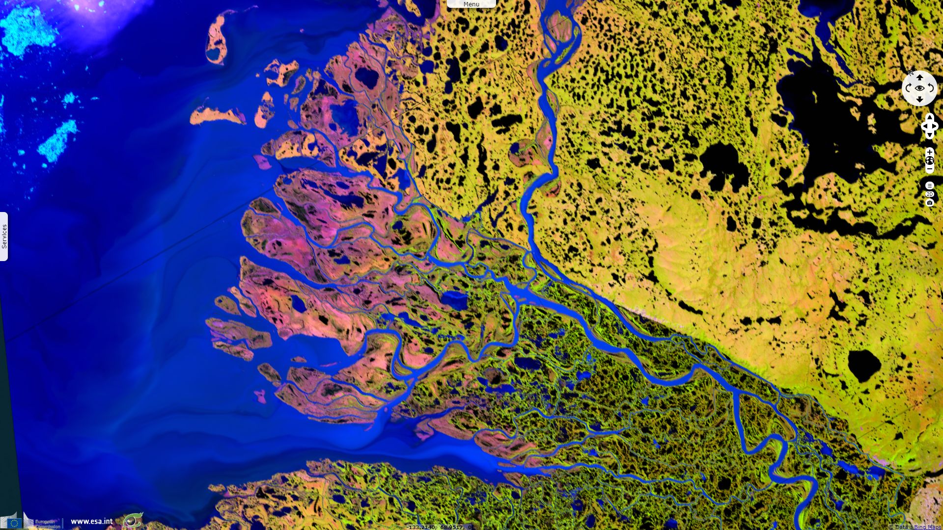
Sentinel-1 CSAR IW acquired on 24 July 2018 from 02:24:17 to 02:24:42 UTC
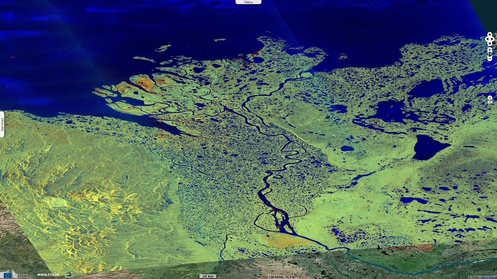
Sentinel-1 CSAR IW acquired on 04 October 2018 from 02:24:20 to 02:24:45 UTC
Sentinel-2 MSI acquired on 23 July 2018 at 21:00:21 UTC
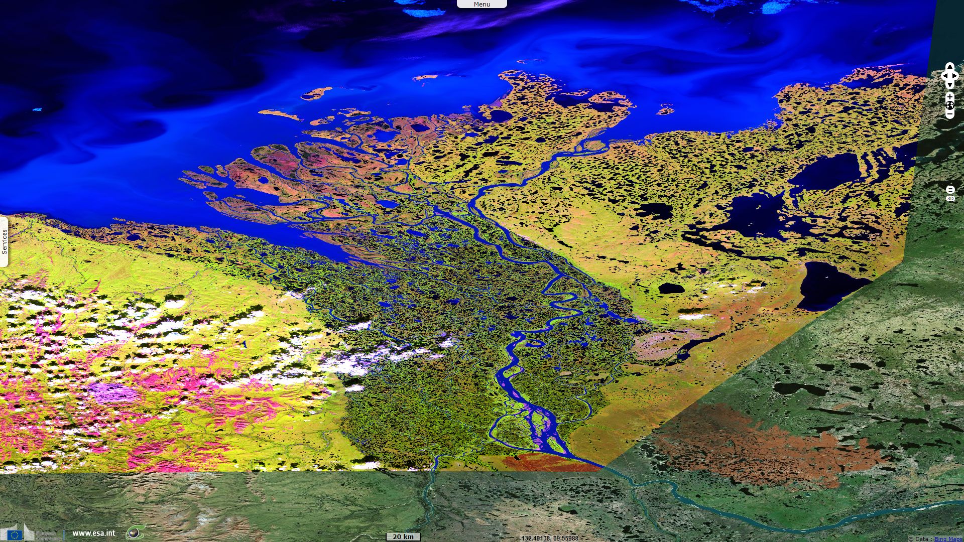
Sentinel-1 CSAR IW acquired on 24 July 2018 from 02:24:17 to 02:24:42 UTC
Sentinel-1 CSAR IW acquired on 04 October 2018 from 02:24:20 to 02:24:45 UTC
Keyword(s): Hydrology, river, polar, cryosphere, coastal, water colour, sediments, Canada, Alaska, Arctic Ocean
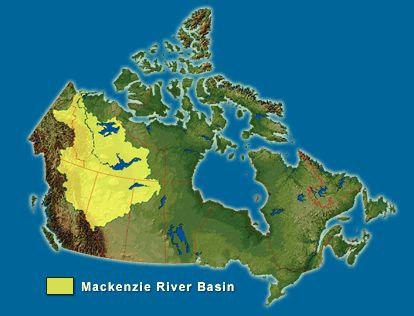
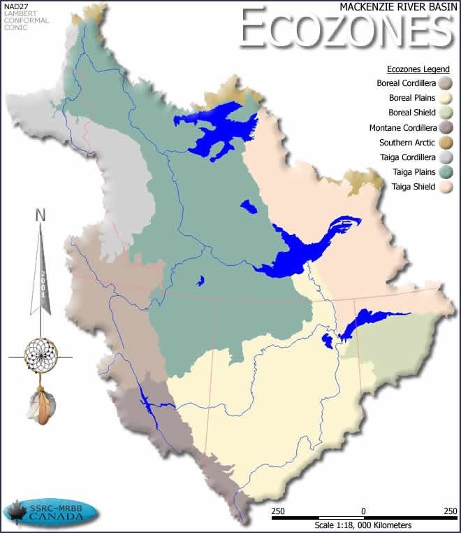
Location of the Mackenzie River Basin - Source: Mackenzie River Basin Board
In its State of the Aquatic Ecosystem Report 2003, the Mackenzie River Basin Board describes the Mackenzie River system: "The Mackenzie River system flows 4 241 kilometres from the Columbia Ice-field in Jasper National Park and the deep snowfields of the upper Peace in northeastern British Columbia to its mouth on the Beaufort Sea of the Arctic Ocean. The Mackenzie River Basin is the tenth largest river basin in the world. It covers about 1.8 million square kilometres or about 20% of the landmass of Canada. The average annual discharge of the Mackenzie River is 9 910 cubic meters per second. In Canada, this volume of stream flow is second only to the St. Lawrence River. It accounts for 60% of the freshwater that flows into the Arctic Ocean from Canada and about 9% of the freshwater discharged to all the oceans by all Canadian watersheds."
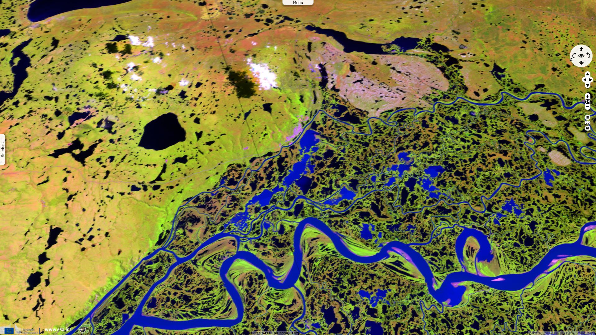
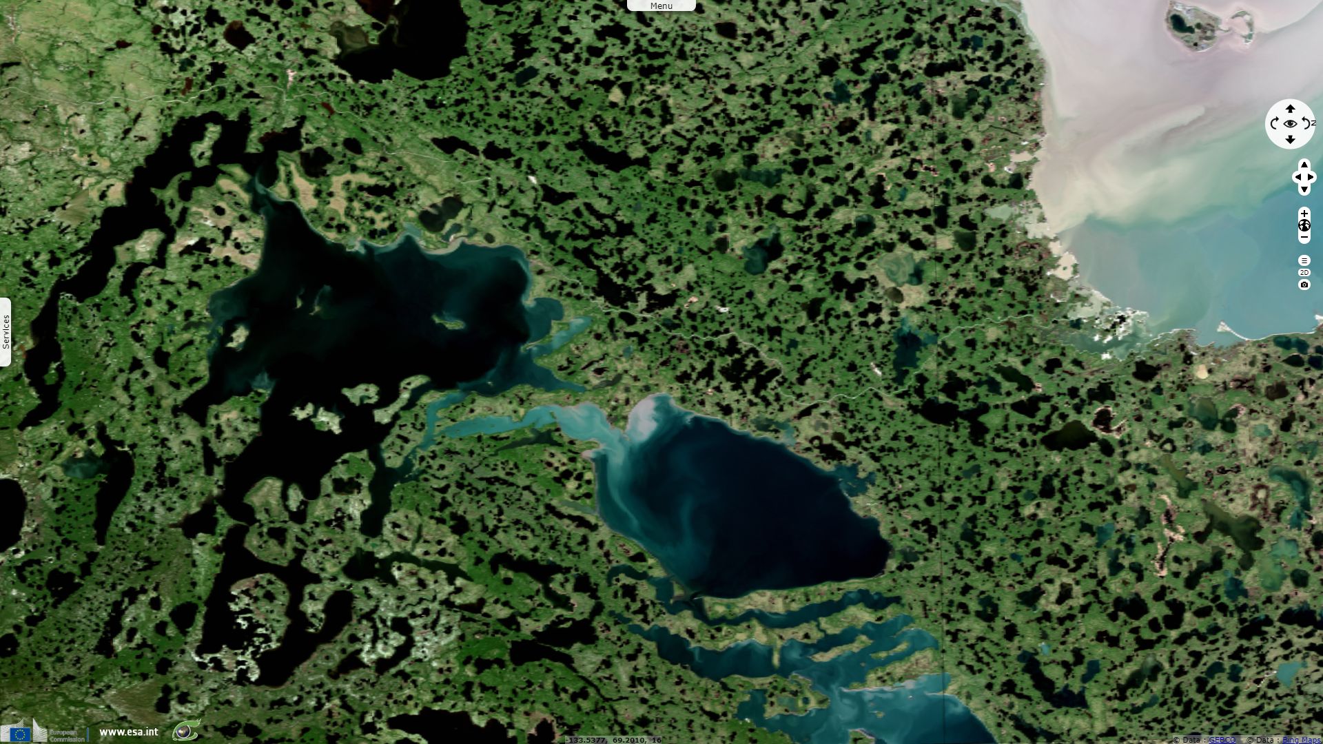
The Canadian Encyclopedia introduces: "The Mackenzie Delta is a vast fan of low-lying alluvial islands (i.e., islands composed of river sediment), covered with black spruce, thinning northward. The delta is 80 km across, bordered by the Richardson Mountains in the west and the Caribou Hills in the east. Below Point Separation the river splits into three main, navigable channels." The report of the Mackenzie River Basin Board goes further: "The Mackenzie Delta is the largest delta in Canada, and the 12th largest in the world. It covers an area of approximately 13 500 square kilometres. The area boasts a variety of stunning landscapes including mountains and plains. The majority of the delta is situated within discontinuous permafrost, with the northeastern corner encroaching into continuous permafrost. Away from the influence of the Mackenzie River, the permafrost layer is greater than one hundred meters thick."
"Sedimentary rocks, built up by deposition from the Mackenzie, Peel and Rat rivers, cover the Precambrian Shield in a wedge-shaped fan. There has been almost continuous washing of sediment into the delta for much of the last sixty-five million years, resulting in a sedimentary rock layer up to fifteen kilometres in thickness. The last major geologic event to impact the delta was the Wisconsin Ice Age, during which the Laurentide Ice Sheet extended from the Keewatin to the Tuktoyaktuk Peninsula between 18 000 and 20 000 years ago. These continental glaciers retreated 12 000 to 13 000 years ago."
"The climate of the Mackenzie Delta is characterized by long cold winters and short cool summers. The mean annual precipitation in the delta is 257 millimetres, which is low compared to the average across the whole Mackenzie River Basin (410 millimetres). Snow and ice cover the lakes and the channels of the Mackenzie Delta for up to eight months of the year."
"The Mackenzie River creates a warming effect on the surrounding landscape. As a result, the tree line extends considerably farther north in the western arctic than in the east. The Mackenzie Delta is predominantly forested with stands of stunted black spruce, white spruce and tamarack. Low, shrubby vegetation such as willow and ground birch occupies the transitional zone between the tree line and the tundra. In the central part of the delta, vegetation distribution is controlled by water levels. From the air, the forested areas appear as narrow ribbons along the channels with the remainder of the area being covered in willows, sedge flats and alders."
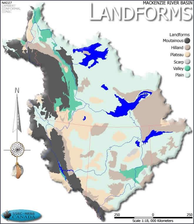
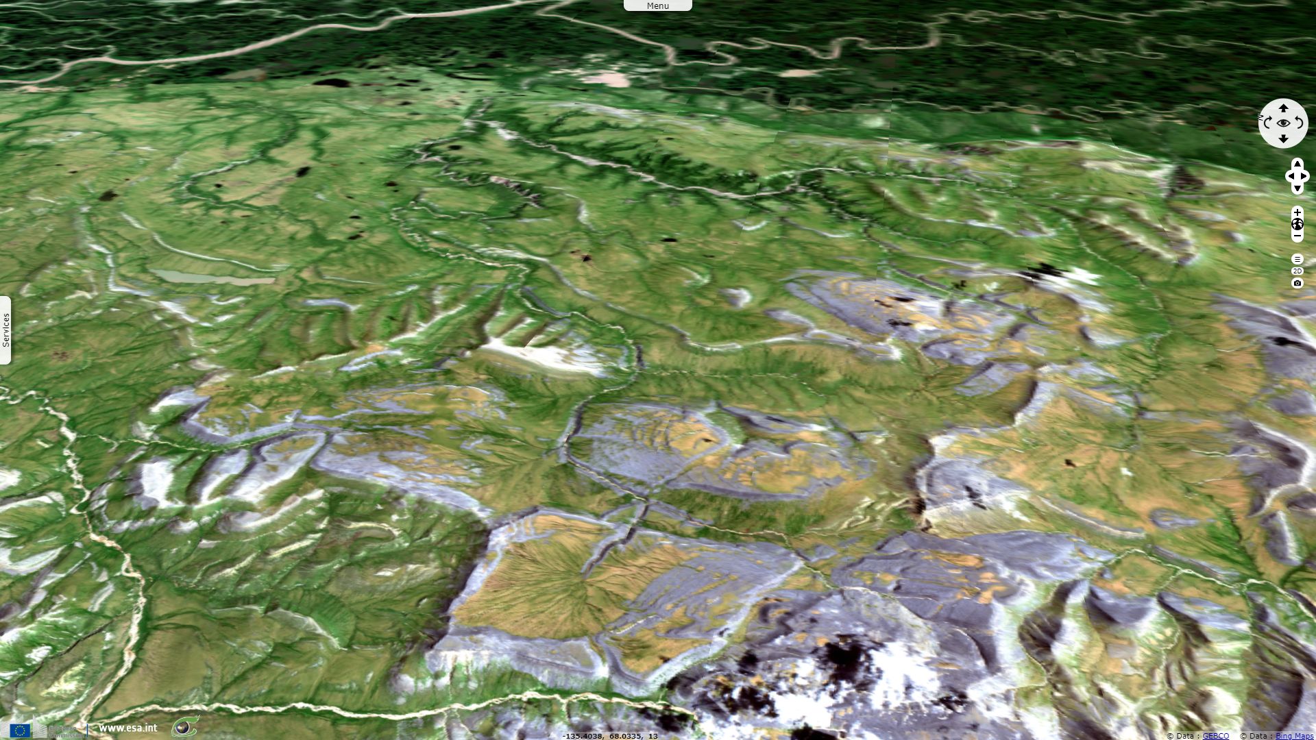
Left: landforms of the Mackenzie River Basin, Right: its ecozones - Source: Mackenzie River Basin Board
Encyclopedia Britannica describes the delta as: "a maze of branching, intertwining channels, numerous cutoff lakes, and circular ponds."
The report of the Mackenzie River Basin Board adds: "There are roughly 25 000 lakes in the Mackenzie Delta. Their shapes and sizes are constantly changing in response to sediment deposition, changes in permafrost and cycles of flood and drought. Lakes affect permafrost distribution, support fish and wildlife, and store water, sediment and pollutants. Delta lakes are shallow and their depths are controlled mainly by discharge of the Mackenzie and Peel rivers, growth of river ice, ice break-up and jamming, changes in sea level, permafrost conditions and precipitation and evaporation. Floods are required to replenish the water supplies of delta lakes. The frequency of flooding is likely to decrease in the future because of climate change. As a result, many of the lakes in the inner delta will disappear and others will become shallower."
"As the Laurentide Ice Sheet receded 13 000 years ago, people living in Alaska and Yukon began to migrate into the Mackenzie Delta. There were an estimated 4 000 people living in the delta in 1848. However, small pox and other diseases decimated Aboriginal populations. Fort McPherson was established as a Hudson Bay Company trading post and the traders began to focus more on the delta and its valuable fur trade. Today there are five settled communities within or very close to the Mackenzie Delta: Inuvik, Aklavik, Tuktoyaktuk, Tsiigehtchic and Fort McPherson. The current population of the Mackenzie Delta is approximately 5 500 people."
"The high sediment load of the Mackenzie River provides a rich supply of nutrients that are the basis for food chains in the river and in the highly productive Mackenzie Delta." The report of the Mackenzie River Basin Board concludes: "Wildlife within the Mackenzie Delta consists of muskrat, beaver, moose, mink, lynx, red fox, wolf, wolverine, snowshoe hare and black bear. Beluga whales migrate from Alaska to the outer delta to calve in the summer. Common fish species include broad whitefish, lake whitefish, inconnu, northern pike, arctic grayling, cisco, Dolly Varden, and arctic char. During the warmer months, the delta is used by numerous species of birds, including tundra swans, several species of ducks and geese, bald and golden eagles, peregrine falcons, loons, ptarmigan and several smaller species of birds."
The views expressed herein can in no way be taken to reflect the official opinion of the European Space Agency or the European Union.
Contains modified Copernicus Sentinel data 2026, processed by VisioTerra.
Contains modified Copernicus Sentinel data 2026, processed by VisioTerra.
| More on European Commission space: |  |
 |
 |
||||
| More on ESA: | |
|
|
S-1 website | S-2 website | S-3 website | |
| More on Copernicus program: | |
|
|
Scihub portal | Cophub portal | Inthub portal | Colhub portal |
| More on VisioTerra: | |
|
|
Sentinel Vision Portal | Envisat+ERS portal | Swarm+GOCE portal | CryoSat portal |