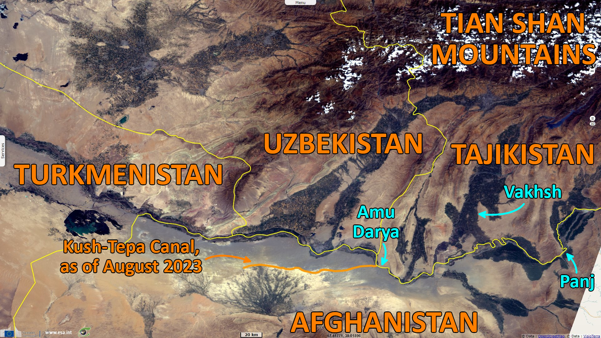
Construction of the Kush-Tepa canal and sharing of water from the Amu Darya river, Afghanistan
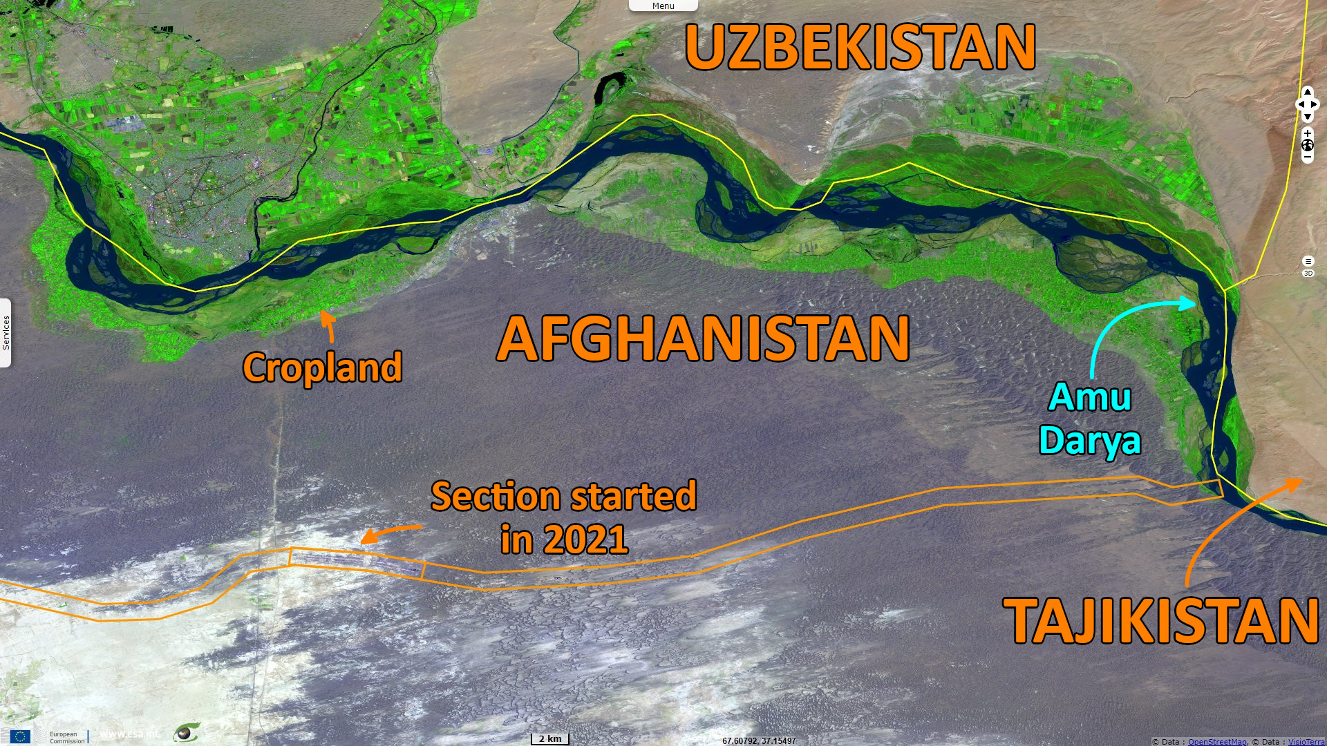
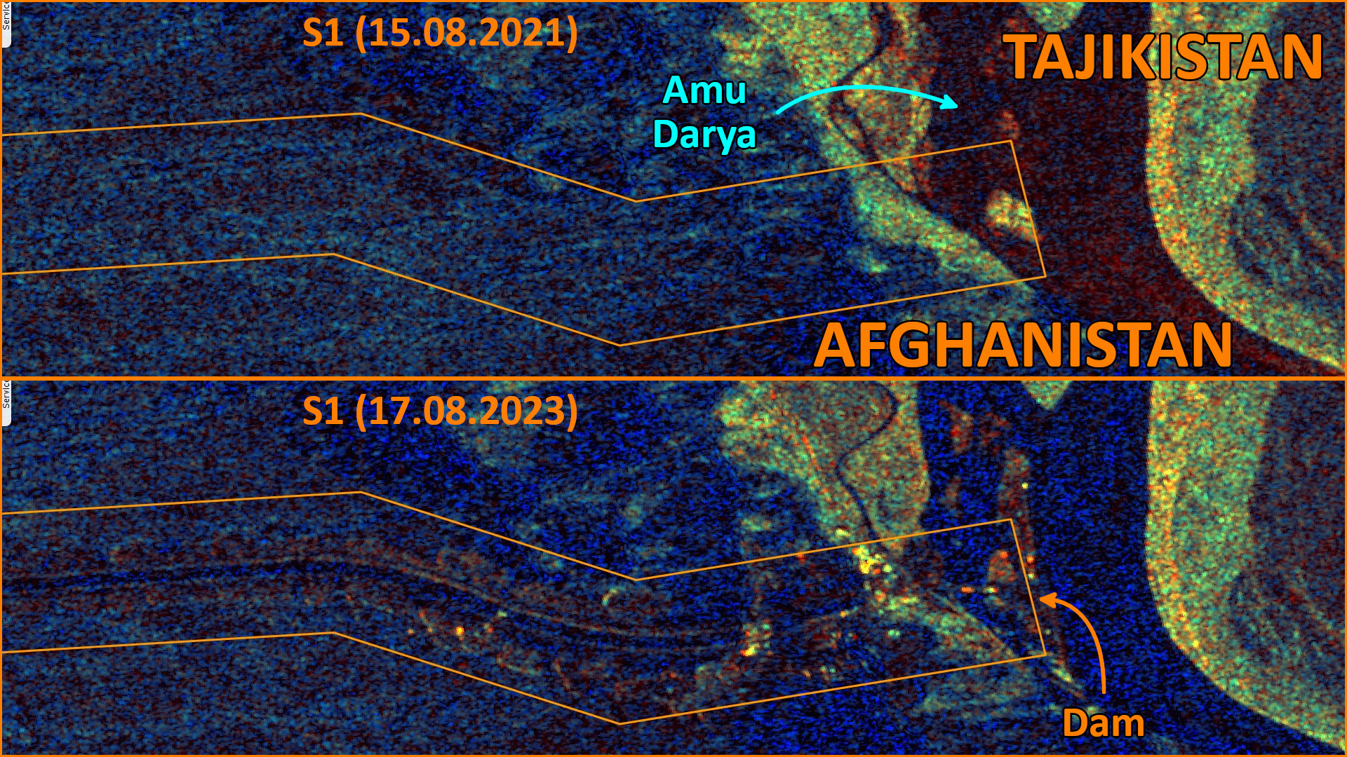
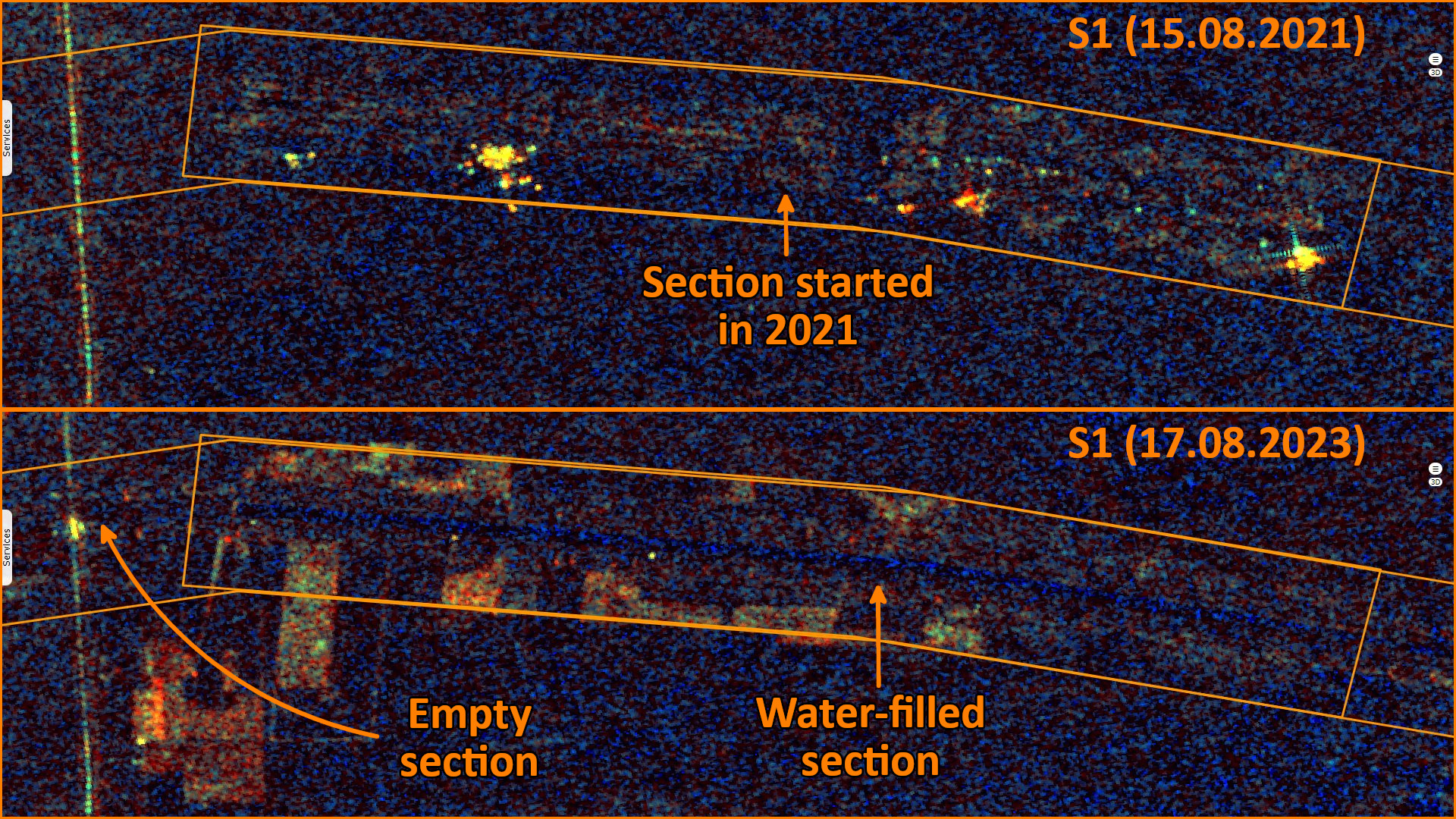
Sentinel-1 CSAR IW acquired on 15 August 2021 at 13:30:47 UTC
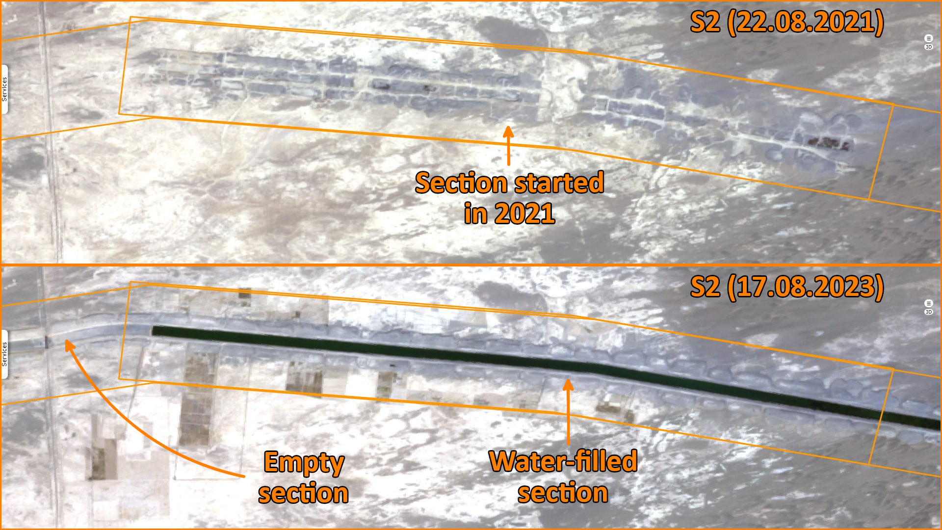
Sentinel-2 MSI acquired on 22 August 2021 at 06:16:31 UTC
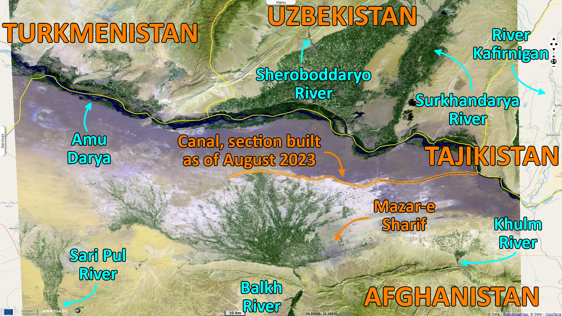
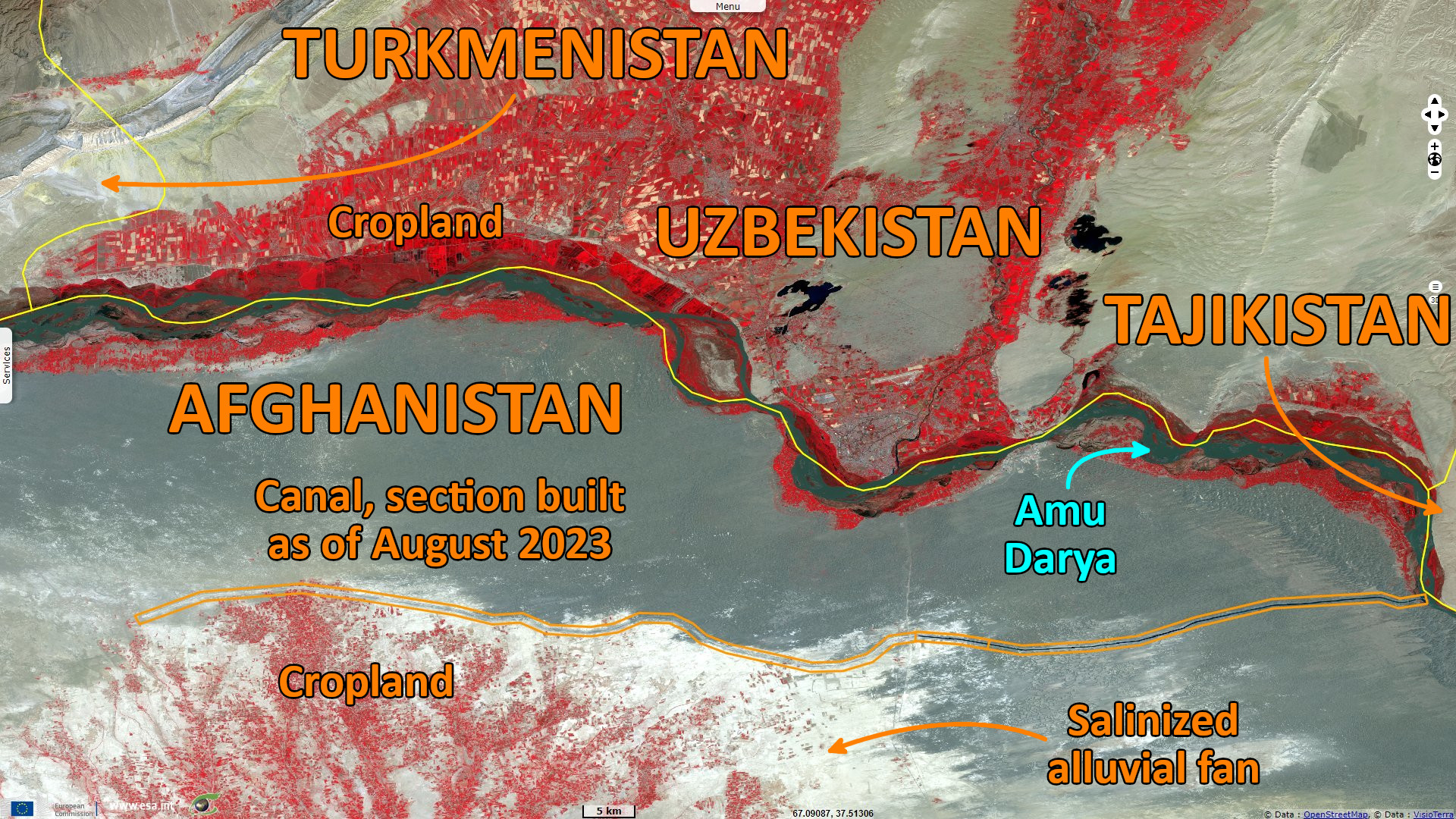
Sentinel-3 OLCI FR & SLSTR RBT acquired on 14 August 2023 from 05:58:42 to 06:01:42 UTC
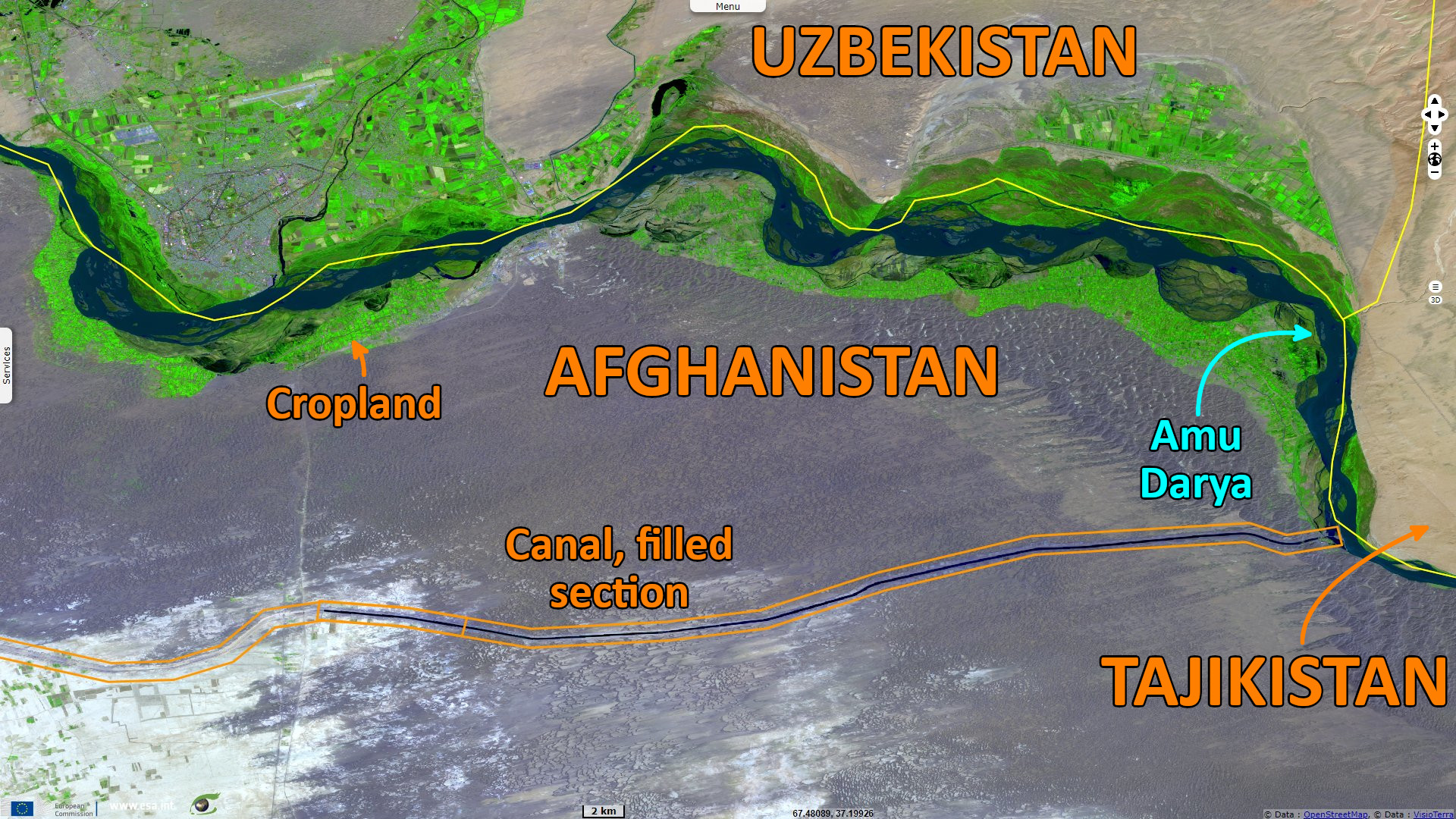
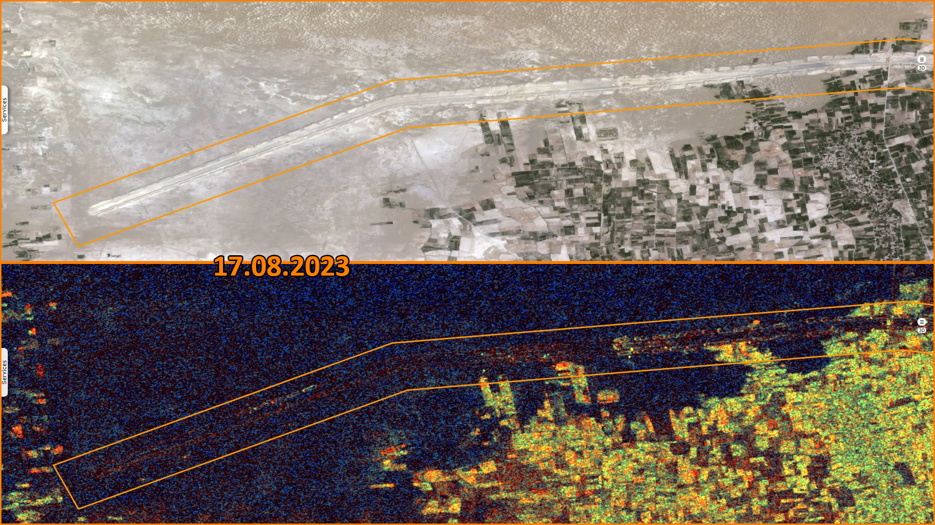
Sentinel-2 MSI acquired on 17 August 2023 at 06:16:39 UTC
Sentinel-1 CSAR IW acquired on 17 August 2023 at 13:30:58 UTC
Sentinel-2 MSI acquired on 22 August 2021 at 06:16:31 UTC
Sentinel-3 OLCI FR & SLSTR RBT acquired on 14 August 2023 from 05:58:42 to 06:01:42 UTC
Sentinel-2 MSI acquired on 17 August 2023 at 06:16:39 UTC
Sentinel-1 CSAR IW acquired on 17 August 2023 at 13:30:58 UTC
Keyword(s): Land, climate change, hydrology, river, agriculture, irrigation, infrastructure, dam, desertification, food security, Afghanistan, Tajikistan, Uzbekistan, Turkmenistan
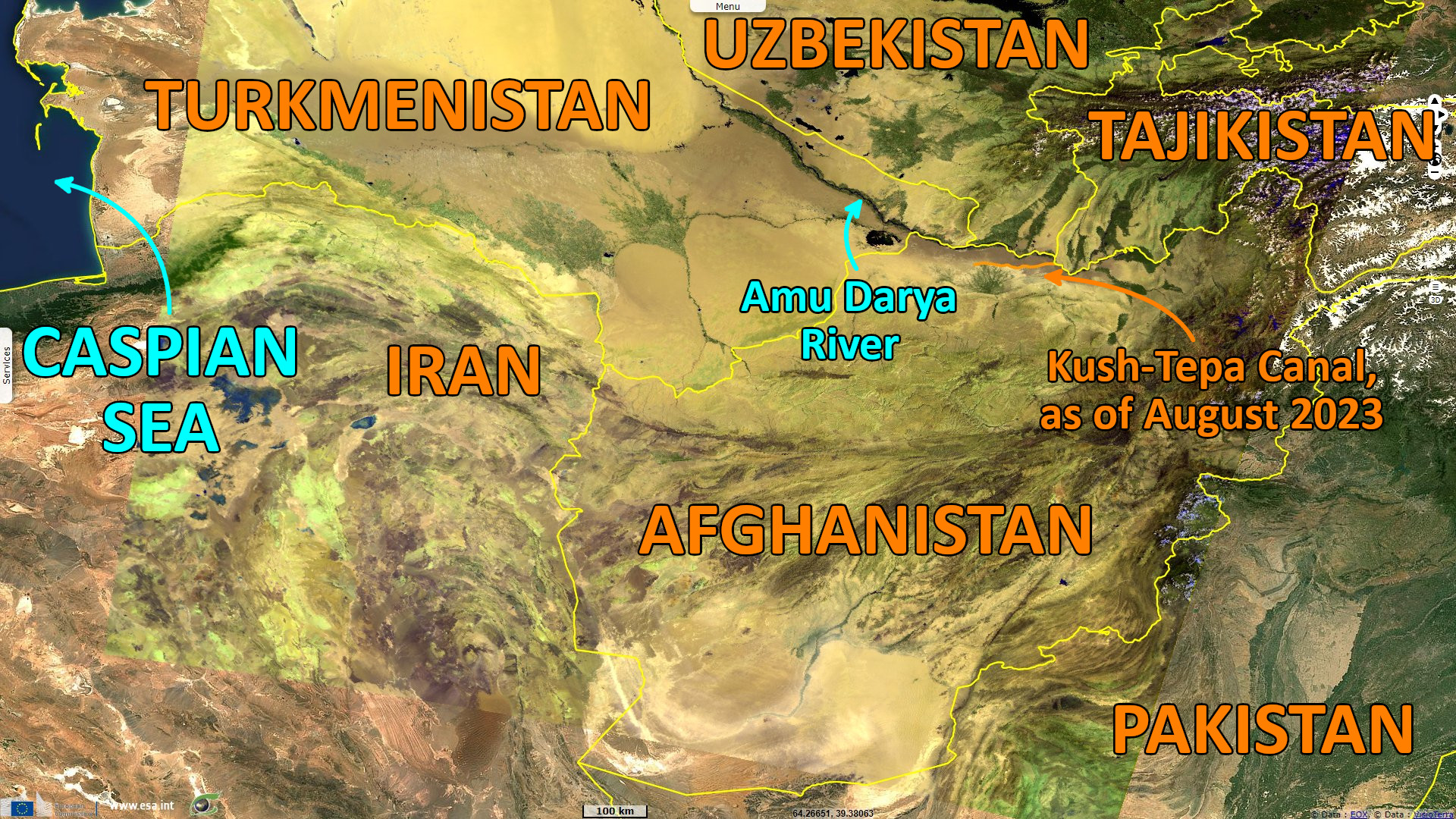
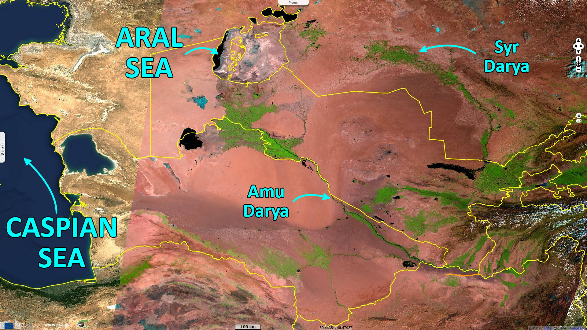
Amu Darya river is a critical source of water for Central Asia, it feeds irrigated crops with the water they need in this arid climate. This river marks a part of the north border of Afghanistan, a country that largely relies on agriculture but lacks the infrastructure to benefit from a significant part of this source of water. To answer this need, the Kush-Tepa canal has been planned in northern Afghanistan for several years which is now being built by the new regime of Afghanistan.
An article written by Kunduz Adylbekova has been published by the Institute for War & Peace Reporting (IWPR) in the Central Asian region in late July 2023 deals with the Kush-Tepa canal:
"In March 2022, the self-proclaimed Islamic Emirate of Afghanistan set in motion an ambitious plan for the Qosh Tepa irrigation canal, a potential lifeline for drought-ridden Afghanistan. However, its construction casts a looming shadow over Uzbekistan and Turkmenistan downstream, exacerbating water scarcity threats. Central Asian nations can no longer afford to overlook Afghanistan’s water concerns. Amid the growing influence of climate change in the region, strategic preparations are essential to tackle the imminent challenges posed by the water crisis."
"The Qosh Tepa Canal stands as a remarkable irrigation endeavour, marking a decade of ambitious projects in Central Asia. Spearheaded by Afghanistan’s National Development Company and funded by public resources, the canal’s reach spans an impressive 285 kilometres, boasting a width of 100 meters and a depth of 8 meters. Once completed, it aims to transform the agricultural landscape of Afghanistan’s arid northern provinces—Kaldar, Balkh, Jowzjan, and Faryab—by providing essential irrigation to over 550 000 hectares of farmland. This significant undertaking holds the promise of revitalizing the region’s agricultural prospects."
"Interestingly, the Qosh Tepa Canal project had been in the works for several years before the Taliban ascended to power, a group labelled as a terrorist organization, forbidden in Central Asian nations. Notably, the groundwork and feasibility studies were initiated during Afghanistan’s former government, supported by USAID."
"Afghanistan grapples with an unparalleled humanitarian crisis as reported by the Food and Agriculture Organization of the United Nations (FAO). Nearly 17 million people, constituting 40% of the nation’s population, confront severe food insecurity, as per the latest IPC assessment published on April 1, 2023 (categorized as IPC Level 3 Crisis or IPC 4 Emergency). The country’s economic and political turmoil, along with the ramifications of climate change, exacerbates the prevailing food insecurity."
"With 80% of the populace reliant on agriculture for sustenance, the impact of climate change—evident through widespread droughts and natural disasters—profoundly influences crop growth periods and yields, escalating the peril of food shortages.", wrote Kunduz Adylbekova.
"Despite this natural wealth, Afghanistan grapples with a glaring deficiency in water supply infrastructure, posing colossal challenges in guaranteeing uninterrupted access to sufficient water for consumption. The backdrop of prolonged conflict and occupation has hindered the development of extensive hydraulic structures and canals, crucial for adequately catering to the population’s water needs. In response, the Qosh Tepe Canal project emerges as a vital endeavour, seeking to alleviate water scarcity in semi-desert Afghanistan."
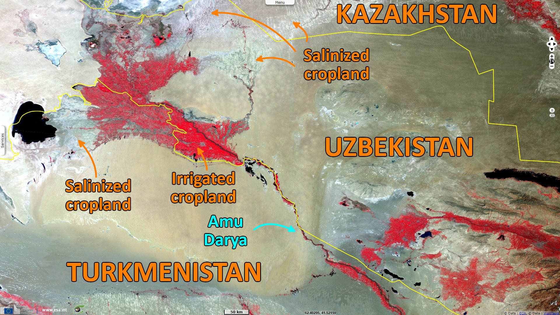
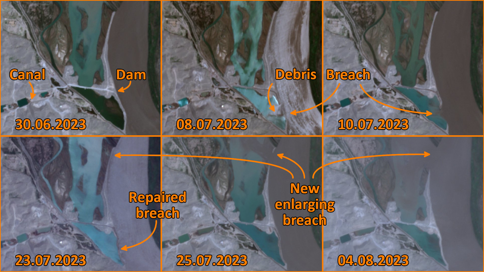
"Assessing the quality of the canal’s construction raises serious doubts, evident from accessible materials and satellite imagery. The construction methods employed appear remarkably rudimentary, with a mere “digging” approach devoid of proper reinforcement or lining for the canal’s bottom and banks."
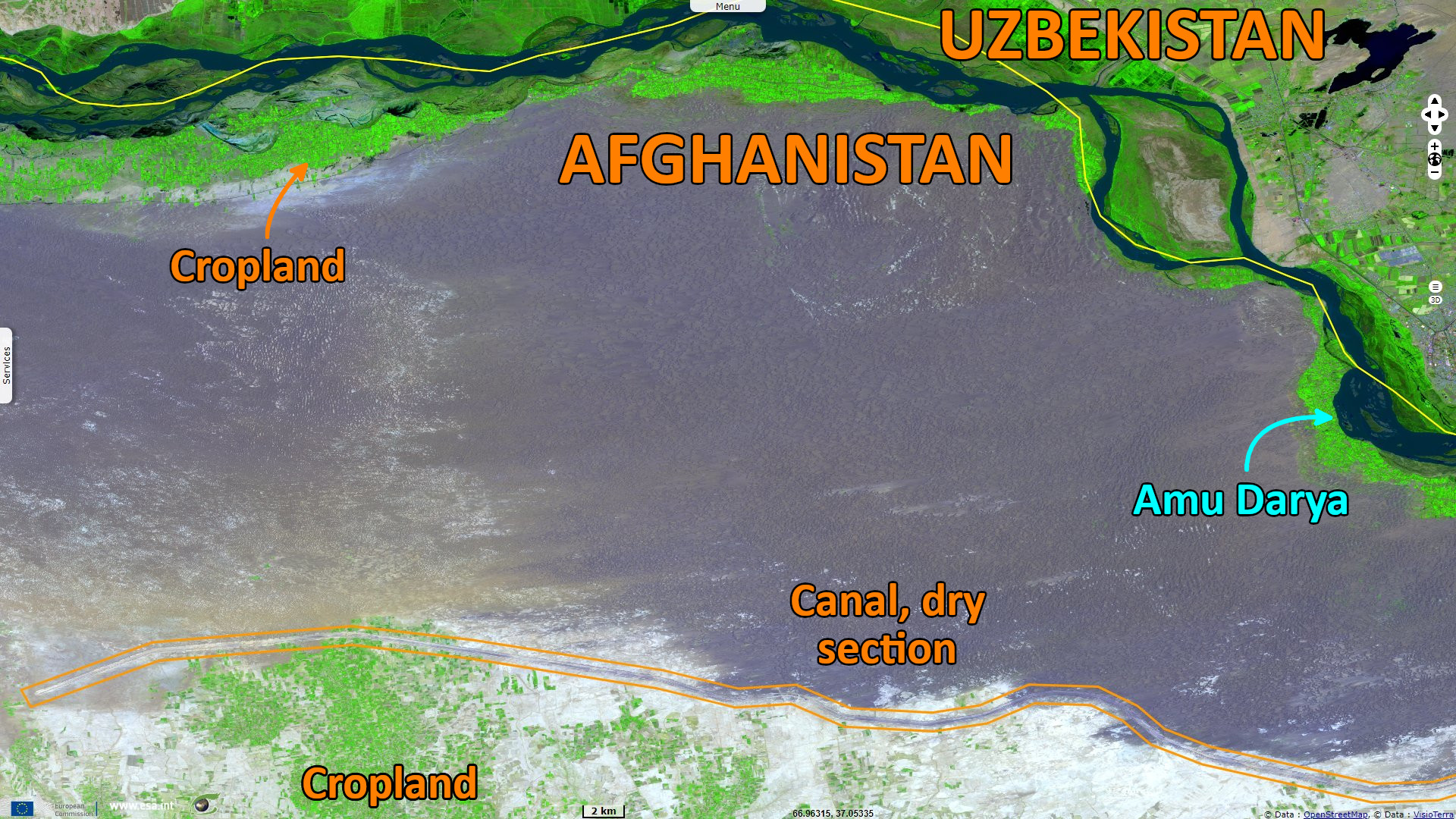
"Such an approach poses a grave risk, as significant water losses may occur due to seepage into the dry, sandy soil. The resulting loss of water in canals exacerbates the already pressing issues of salinization and waterlogging in irrigated lands, amplifying the risks of water loss to an alarming extent."
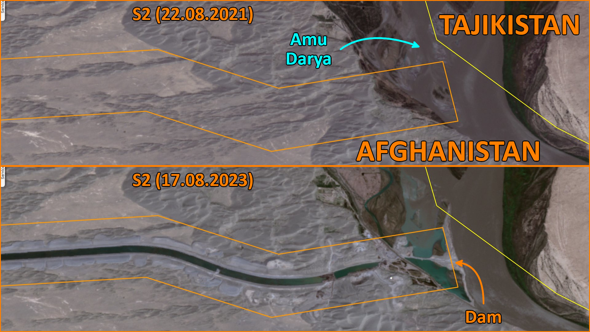
According to IWPR: "Water and environmental expert, Najibullah Sadid, sheds light on recent developments, noting erosion in parts of the canal’s diversion dam. Satellite images depict the dam brimming with water, an anticipated consequence given the prevailing doubts surrounding the canal’s design and construction. These observations underscore the urgent need to address concerns surrounding the canal’s quality and sustainability."
"Moreover, the issue of canal construction holds significant transboundary implications, particularly for Central Asian countries. As transboundary water cooperation remains crucial on the international stage, the canal’s impact on neighbouring nations draws close attention and necessitates engagement with the Taliban. Through diplomatic collaboration, the Taliban can establish crucial ties and augment their legitimacy on the global stage."
"Qosh Tepa’s construction casts a profound shadow of influence over the neighbouring states of Central Asia, unleashing substantial repercussions. Diverse assessments suggest that in the span of 5-6 years, upon the canal’s completion and operation, Turkmenistan and Uzbekistan will face a notable decline in their average water intake capacity along the middle and lower reaches of the transboundary river—dropping from 80% to 65%. As a lifeblood for these nations, the Amu Darya’s waters hold immense significance, contributing a staggering 80% of all accessible water resources in the region."
"With cotton reigning as the nation's primary agricultural crop, accounting for approximately 17% of its GDP, Uzbekistan's agricultural sector plays a pivotal role in the livelihoods of nearly 40% of its populace—directly and indirectly. Such reliance on irrigation is virtually all-encompassing for the cultivation of major crops. As per the Uzbekistan Statistical Committee, the nation's annual water consumption stands at an average of 51 km³, with agriculture alone accounting for about 90% of this total or roughly 46.8 km³."
"Moreover, the cotton monoculture system's water-intensive practices have perpetuated a significant environmental calamity—the desiccation of the Aral Sea. This profound ecological fallout reverberates throughout the surrounding ecosystem, underscoring the far-reaching impacts of Uzbekistan's water management choices.", adds the article.
"Considering cotton's dominant role in Turkmenistan's agricultural landscape, akin to Uzbekistan, cotton monoculture constitutes approximately 10% of the country's GDP, and an astonishing 91% of all water resources are channelled towards its sustenance."
The views expressed herein can in no way be taken to reflect the official opinion of the European Space Agency or the European Union.
Contains modified Copernicus Sentinel data 2026, processed by VisioTerra.
Contains modified Copernicus Sentinel data 2026, processed by VisioTerra.
| More on European Commission space: |  |
 |
 |
||||
| More on ESA: | |
|
|
S-1 website | S-2 website | S-3 website | |
| More on Copernicus program: | |
|
|
Scihub portal | Cophub portal | Inthub portal | Colhub portal |
| More on VisioTerra: | |
|
|
Sentinel Vision Portal | Envisat+ERS portal | Swarm+GOCE portal | CryoSat portal |