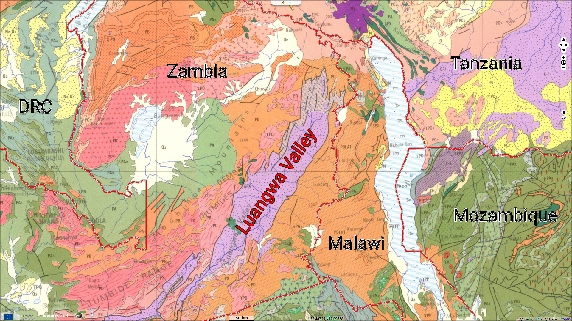
Luangwa Rift Valley, Zambia
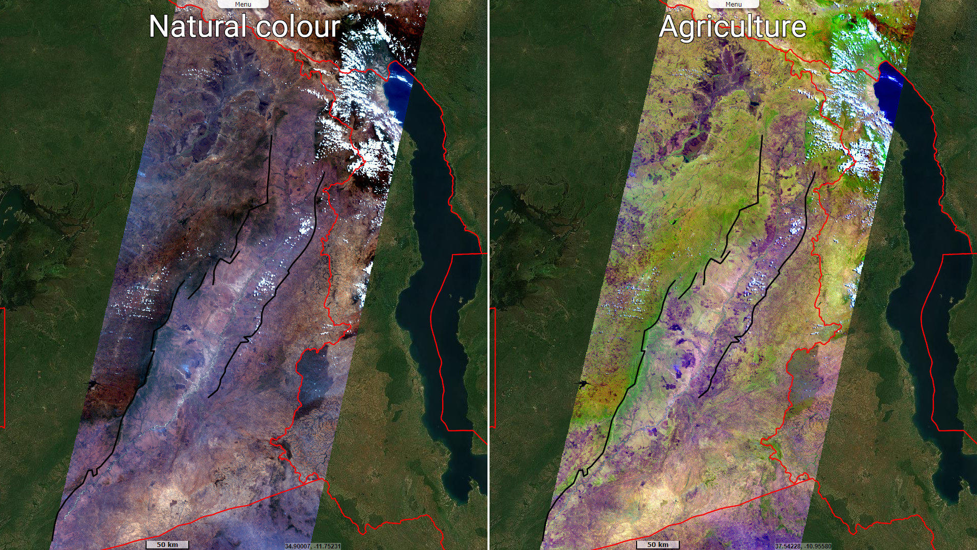
Sentinel-2 MSI acquired on 08 September 2023 at 07:46:21 UTC
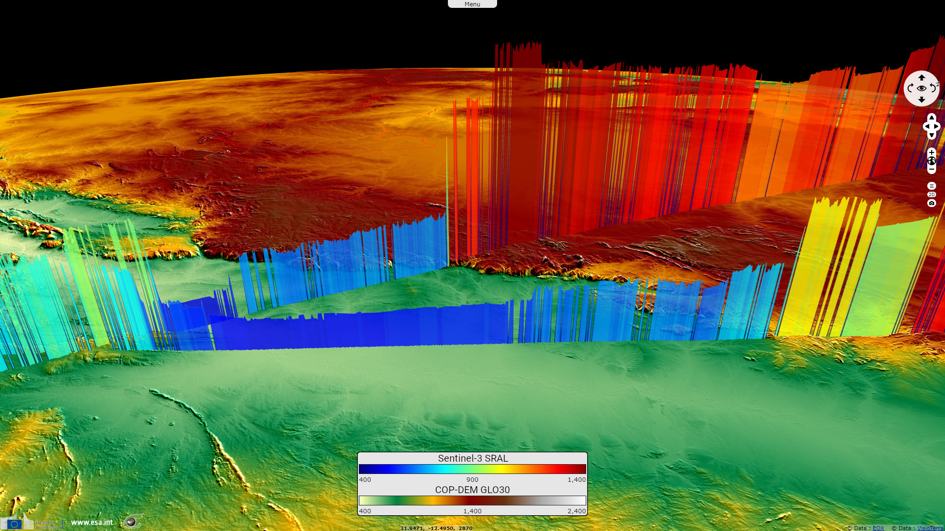
Sentinel-3 SRAL LAND acquired on 09 September 2023 at 07:16:13 UTC
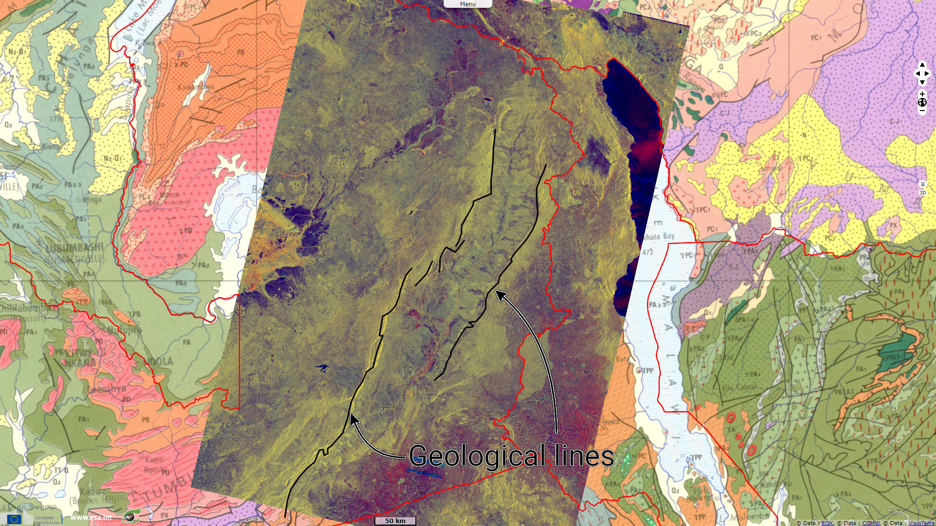
Sentinel-1 CSAR IW acquired on 11 September 2023 at 03:23:04 UTC
Sentinel-3 SRAL LAND acquired on 11 September 2023 at 19:40:10 UTC
Sentinel-1 CSAR IW acquired on 16 September 2023 at 03:31:09 UTC
Sentinel-3 SRAL LAND acquired on 09 September 2023 at 07:16:13 UTC
Sentinel-1 CSAR IW acquired on 11 September 2023 at 03:23:04 UTC
Sentinel-3 SRAL LAND acquired on 11 September 2023 at 19:40:10 UTC
Sentinel-1 CSAR IW acquired on 16 September 2023 at 03:31:09 UTC
Keyword(s): Land, Geology, Rift Valley, Zambia, Africa
The views expressed herein can in no way be taken to reflect the official opinion of the European Space Agency or the European Union.
Contains modified Copernicus Sentinel data 2026, processed by VisioTerra.
Contains modified Copernicus Sentinel data 2026, processed by VisioTerra.
| More on European Commission space: |  |
 |
 |
||||
| More on ESA: | |
|
|
S-1 website | S-2 website | S-3 website | |
| More on Copernicus program: | |
|
|
Scihub portal | Cophub portal | Inthub portal | Colhub portal |
| More on VisioTerra: | |
|
|
Sentinel Vision Portal | Envisat+ERS portal | Swarm+GOCE portal | CryoSat portal |