French croplands shown for Bastille day
Sentinel-2 MSI acquired on 24 June 2016 at 10:37:21 UTC
Sentinel-2 MSI acquired on 10 July 2016 at 10:52:47 UTC
...
Sentinel-2 MSI acquired on 18 June 2017 at 10:56:21 UTC
Sentinel-2 MSI acquired on 10 July 2016 at 10:52:47 UTC
...
Sentinel-2 MSI acquired on 18 June 2017 at 10:56:21 UTC
Keyword(s): Land, agriculture, crops, cereals, grapes, lavender, beet, potatoes, oleaginous, Beauce, Provence, Landes, Champagne, Picardy, France
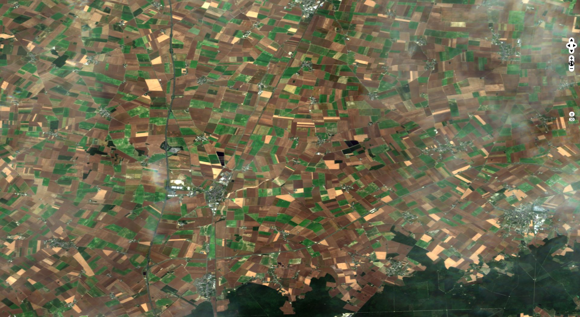
France remains the first agricole country in the UE; the soil quality of Paris Basin, which makes up most of the northern half of France, contributes to this position. This natural region is a large sedimentary basin in which a thick layer of good quality limestone is covered by a rich layer of loess and silt. The first allowed the construction of numerous churches, gothic cathedrals, renaissance castles. The second made possible the development of a productful agriculture in Beauce, Brie and Artois which contributed to the dominance of the French kings over their vassals and induced a centralized economy.
The climate of these large low-lying gently-sloped plains is temperate degraded oceanic, with regular and moderate precipitations as well as moderate temperature spread. The soils are used for intensive cultivation of cereals (mainly wheat and barley), colza, sugar beet and potato with up to 75% of the land used for plant cultivation.
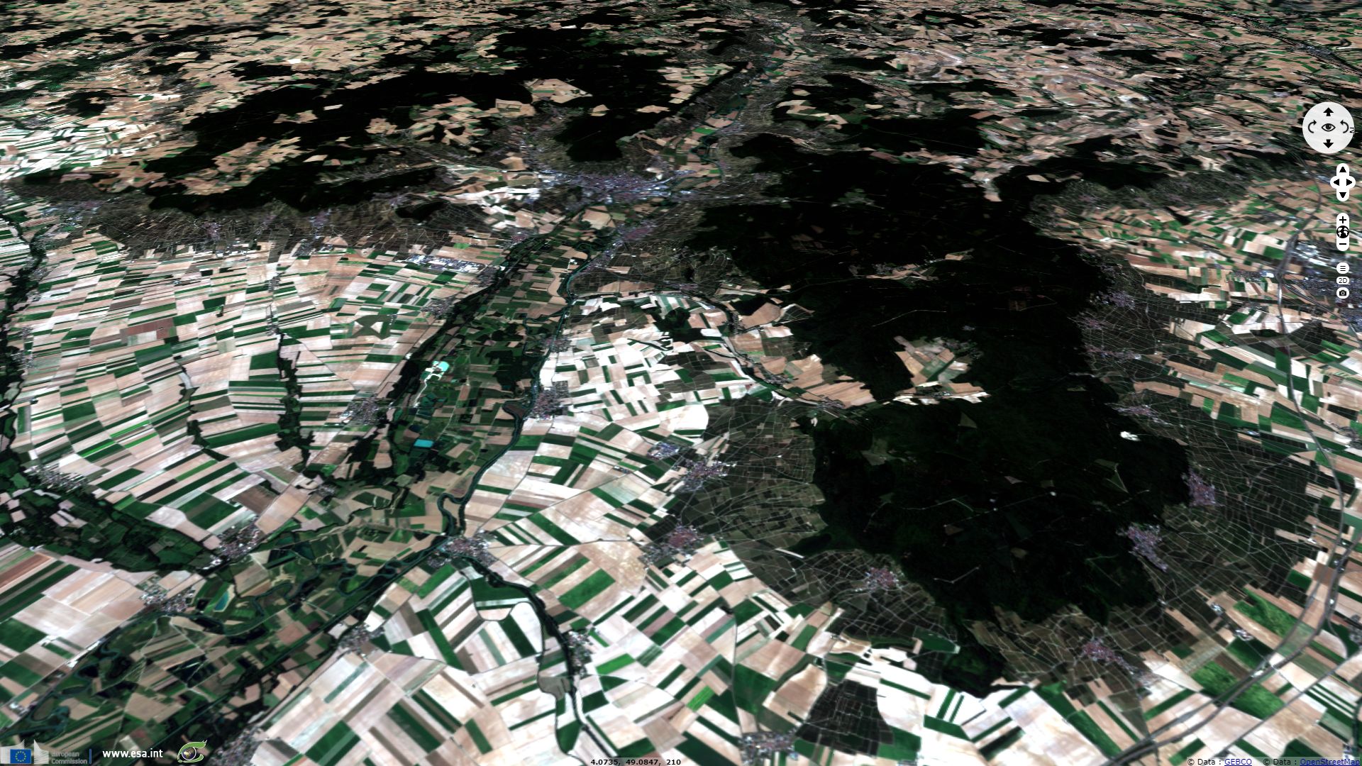
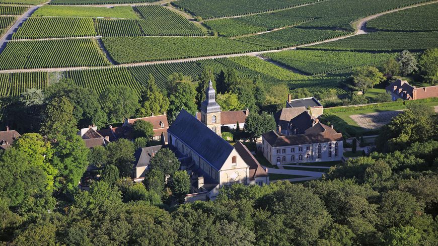
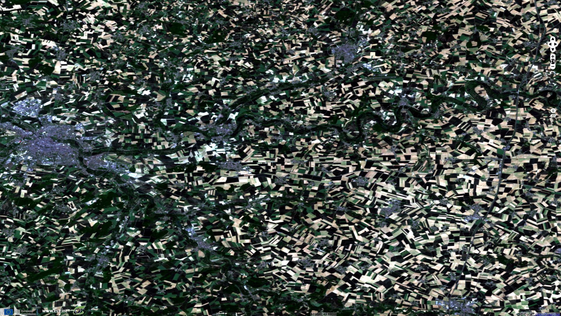
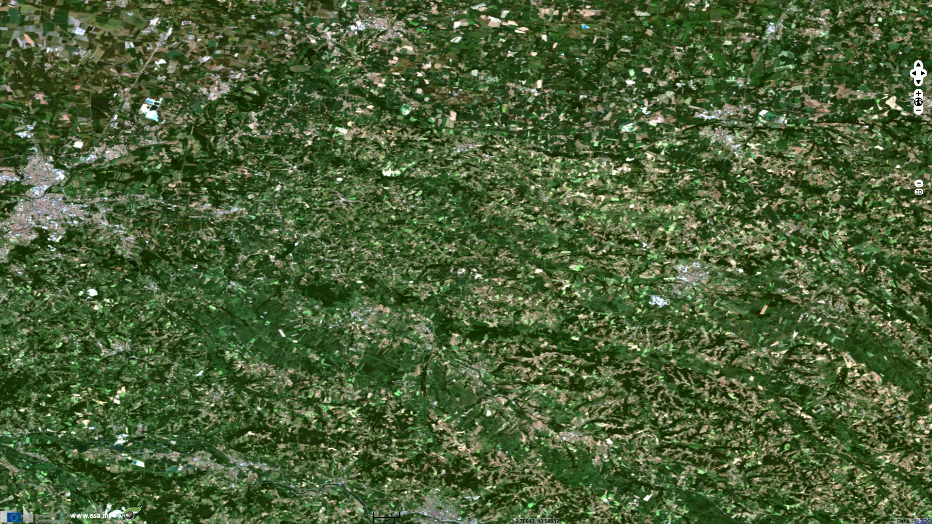
Reims and Epernay are located 150km east of Paris along a cuesta which marks the beginning of Dry Champagne. While it is in the Paris basin, this cuesta is marked by steeper slopes and the absence of silts or loess above the porous limestone layer. This makes the area naturally less favorable for cultivation of cereals but makes it a very good terroir to grow grapes. Fig 3. shows Champagne vineyards on Marne river hillsides, visible in dark green, where they benefit from the sunny slopes.
While it was historically poorer that the Brie region on the other side of the cuesta, modern agriculture now allows Dry Champagne to develop a varied and productful agriculture, but pedology still explains why it was and remains sparcely populated.
Aquitaine Basin is the second biggest sedimentary basin in France. This image features Landes on north between Dax and Mont de Marsan and Pyrénnées Atlantiques on south between French Basque country and Pau. The climate is tempered by the Atlantic. Oceanic influence brings relatively high but regular rainfalls, more important in the southern part of the image due to orographic lift caused by the Pyreneans.
Heat and level of precipitations allow cultivation of corn which represents 60% of crops in the region. Corn crops are then used to feed both population and livestock which of famed farm ducks.
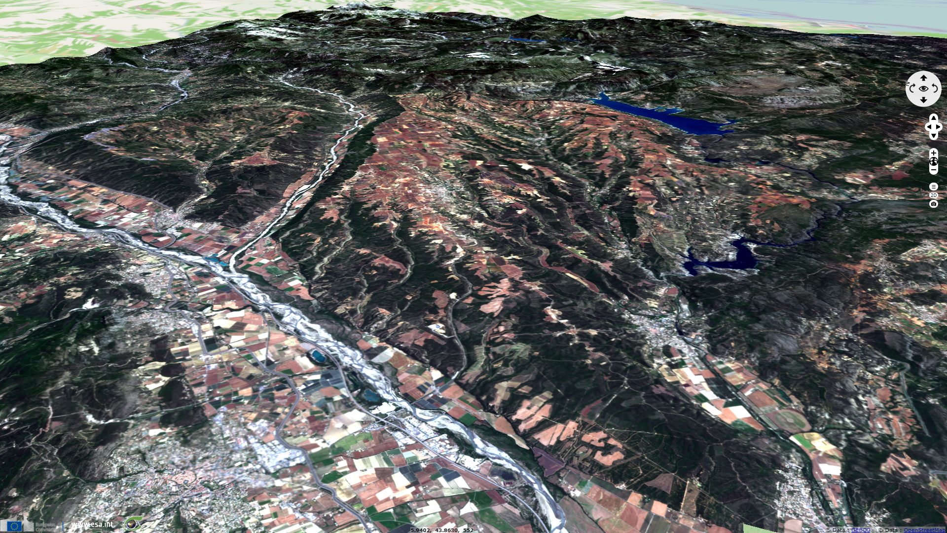
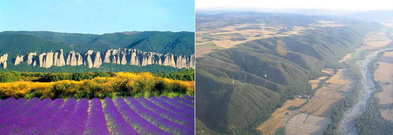
Valensole plateau in Provence is a 800km² plateau 550m above sea level. It is delimited by Durance river on its Western border, Verdon gorges on the south and Bleone river on the north. Asse river separates its smaller heart-shaped northern section from the main part of the plateau. On its sides, alignments of truncated spurs shows the area's glacial past. The centre of both the northern and southern parts are ridden with ravines favoring fast water drainage in this area where hot and mildly dry Mediterranean climate meets pre-alpine colder nights.
Solar conditions made this plateau a valuable site for solar energy production in France, its air quality and altitude allowing increased efficiency. Observatoire de Haute Provence, known for the discovery of the first exoplanet, was built on the plateau on the other side of Durance river for similar reasons.
Valensole plateau is a terroir allowing a renown production of lavender (here visible in Burgundy to violet hues), alongside wheat and truffles. Crops are used in cosmetics and perfumes such as L'Occitaine factory based in nearby Manosque, west of the view.
The views expressed herein can in no way be taken to reflect the official opinion of the European Space Agency or the European Union.
Contains modified Copernicus Sentinel data 2026, processed by VisioTerra.
Contains modified Copernicus Sentinel data 2026, processed by VisioTerra.
| More on European Commission space: |  |
 |
 |
||||
| More on ESA: | |
|
|
S-1 website | S-2 website | S-3 website | |
| More on Copernicus program: | |
|
|
Scihub portal | Cophub portal | Inthub portal | Colhub portal |
| More on VisioTerra: | |
|
|
Sentinel Vision Portal | Envisat+ERS portal | Swarm+GOCE portal | CryoSat portal |