Yasuni ITT initiative
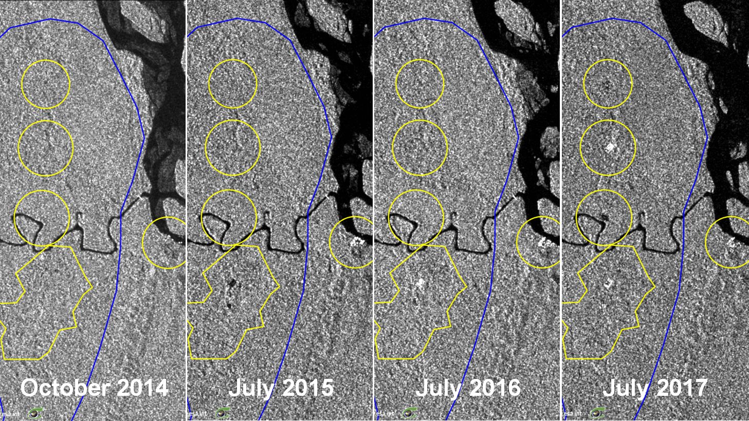
Sentinel-1 CSAR IW acquired on 08 October 2014 at 23:20:12 UTC
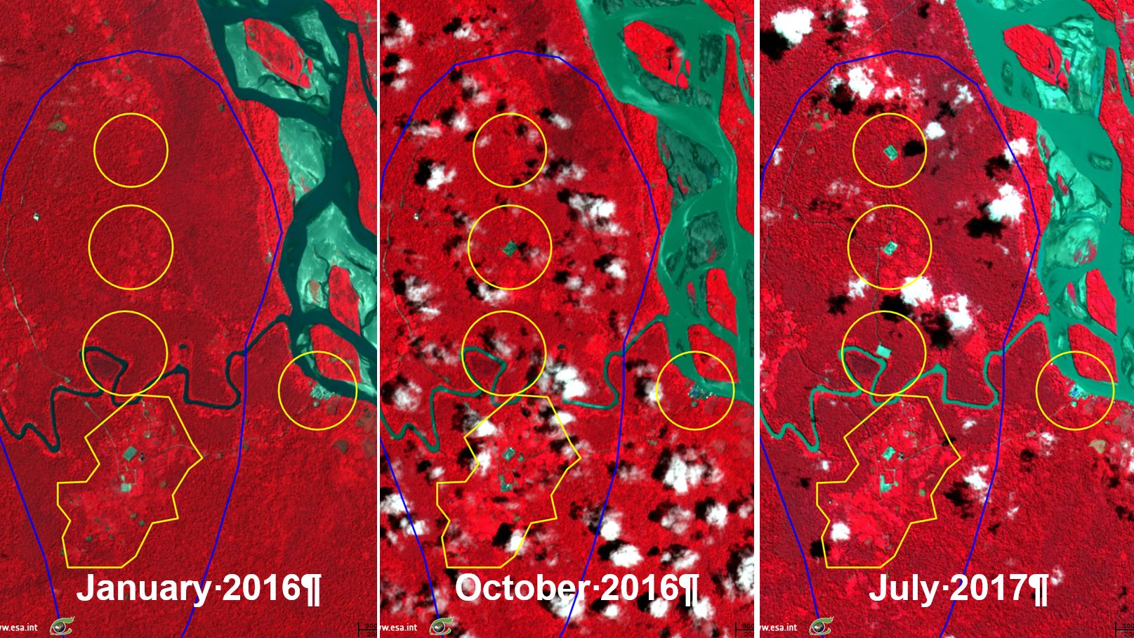
Sentinel-2 MSI acquired on 30 January 2016 at 15:31:09 UTC
...
Sentinel-2 MSI acquired on 13 July 2017 at 15:31:11 UTC
Sentinel-2 MSI acquired on 30 January 2016 at 15:31:09 UTC
...
Sentinel-2 MSI acquired on 13 July 2017 at 15:31:11 UTC
Keyword(s): land, forestry, deforestation, oil, natural resources, Yasuni, Ecuador
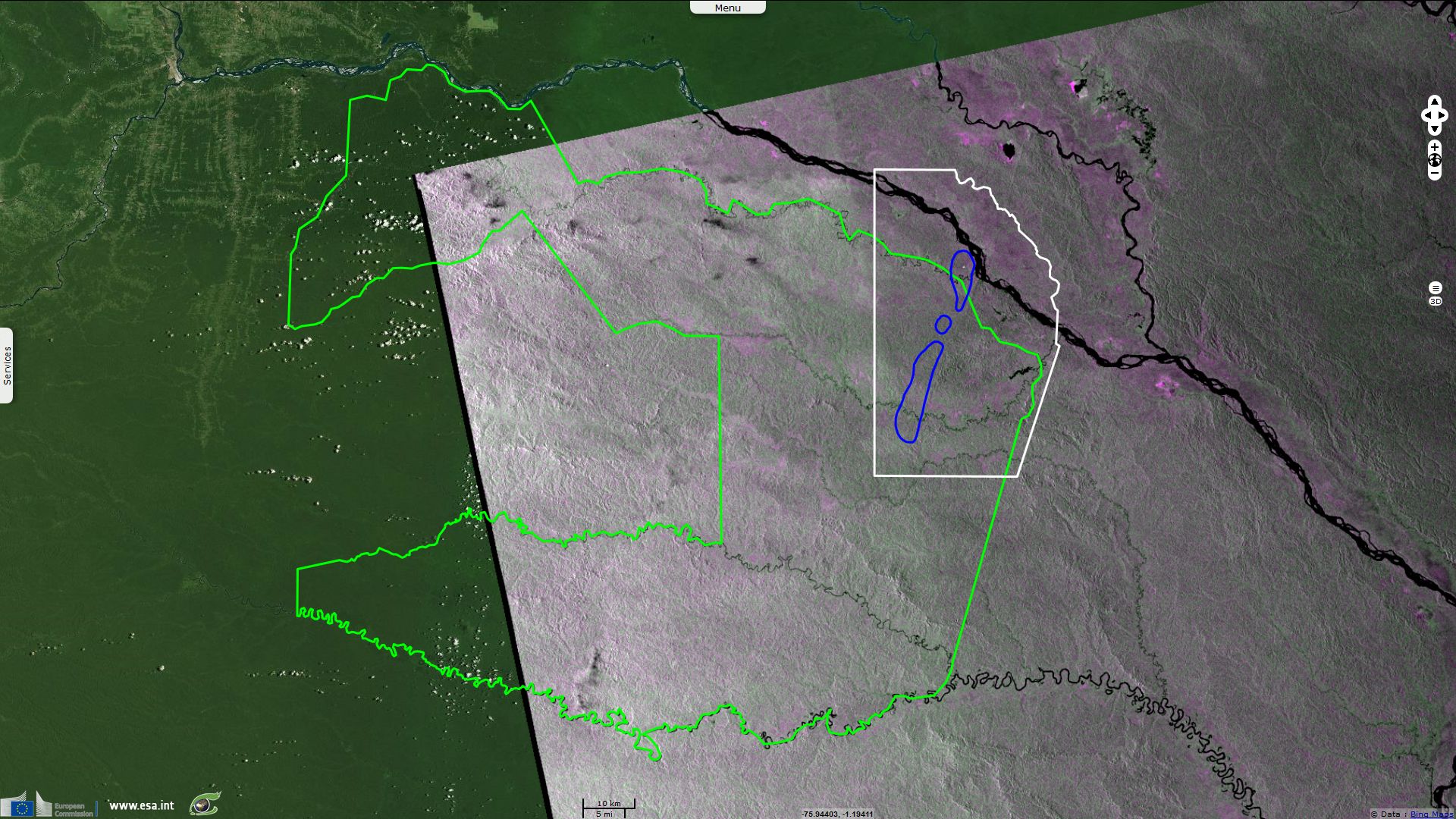
Yasuní-ITT Initiative
"In the year 2007, President Rafael Correa of Ecuador, initiated the Yasuni-ITT project by means of which Ecuador offered a perpetual suspension of oil extraction in part of the Yasuni National Park called Ishpingo-Tambococha-Tiputini (ITT) in return for payments of $3.6 billion from the international community (half of what Ecuador would have realized in revenue from exploiting the resources at 2007 prices). It envisioned the transition to a sustainable economy, using the funds to create jobs in such sectors as renewable energy while respecting the region's biodiversity and social equality.
By 2013 only $300 million had been pledged. The reserve has around 846 million barrels, or 20% of the country's proven oil reserve. The aim of the initiative is to conserve biodiversity, protect indigenous peoples living in voluntary isolation, and avoid the release of CO2 emissions. ITT acronym is also used as “Intangible Tagaeri Taromenane” to designate the untouchable territory of two indigenous groups living on this territory. The Yasuni-ITT Trust Fund was officially launched on 3 August 2010 and is managed by the United Nations Development Programme (UNDP).
After receiving pledges totalling $200 million by 2012, the Ecuadorian government announced that it would move forward with the Yasuni-ITT Initiative. However, in July 2013, Ecuador's president concluded that economic results were insufficient, leading Rafael Correa to scrap the plan on August 15, 2013. As of early 2014, campaign groups are still attempting to save Yasuní-ITT from oil activities."
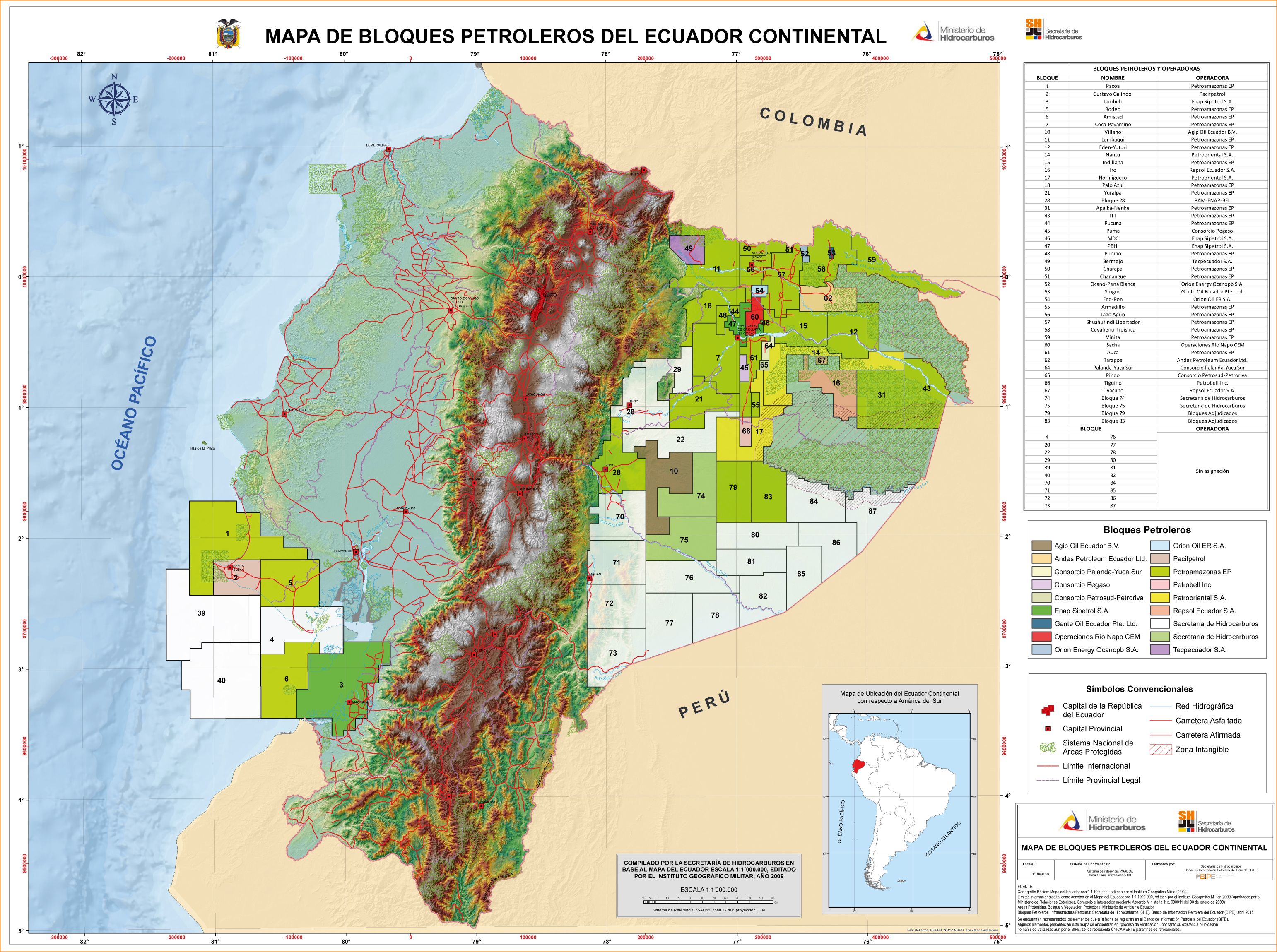
Map of petroleum blocks of Ecuador showing the eastern block 43 (ITT) within Yasuni National Park.
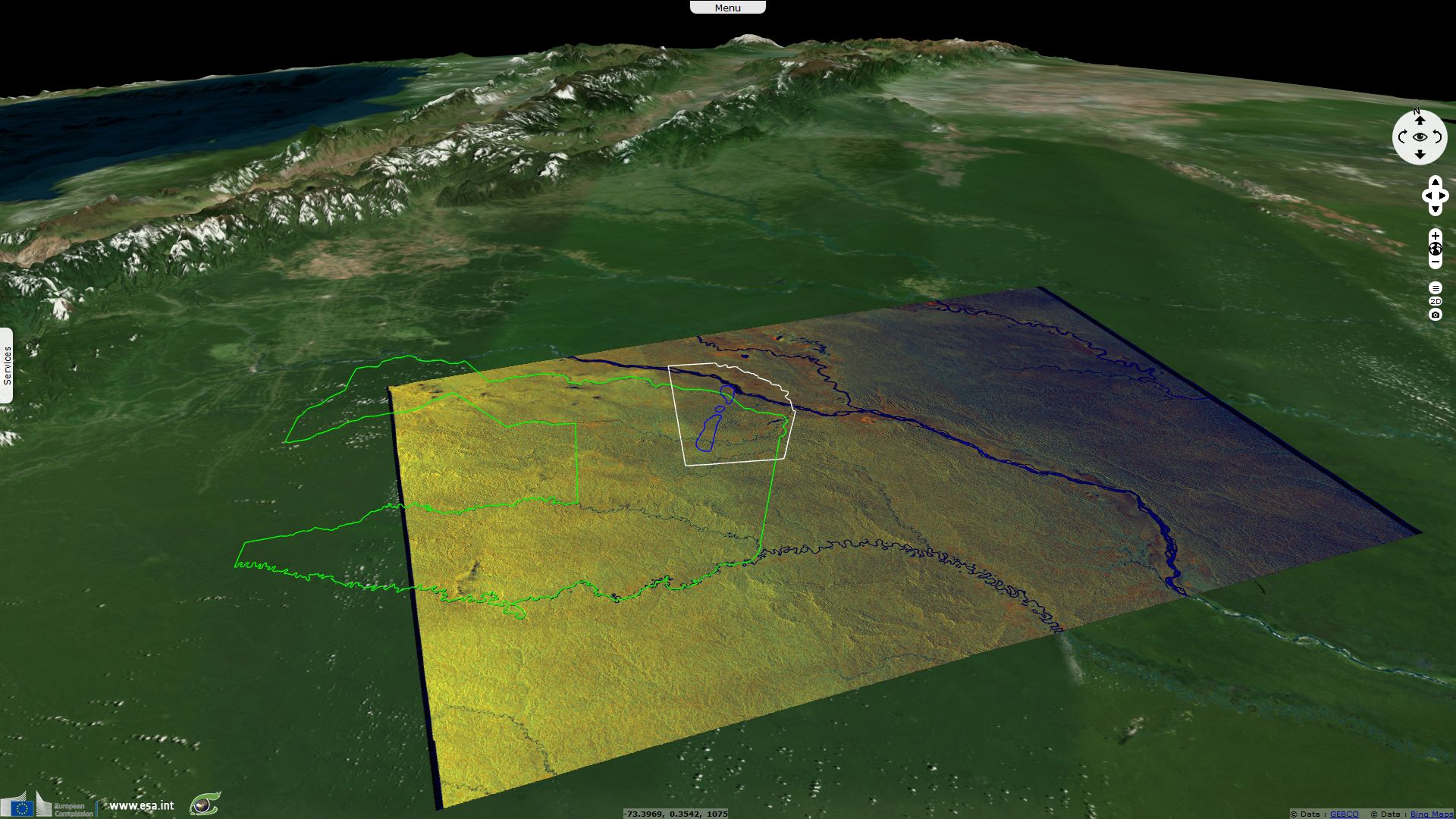
Yasuni Biosphere Reserve and National Park (MAB of UNESCO)
"The Yasuni Biosphere Reserve and National Park is situated in the Amazonian region, in Napo Province in the north of the country. The terrain is very sinuous, despite of being in the Amazonian plains. With the exception of Rio Napo, which originates in the foothills of the Andean Cordillera, rivers crossing the national park originate at altitudes from 300 meters to 600 meters above sea level. The topography is represented by low plains alternating with the foothills of the Andean chain, with a softly inclined platform supported by the Guyano-Brasilian shield that extends from the south of Colombia to Peru. Three main types of vegetation occur: 'Terra firme', found on the high reliefs areas and not subject to flooding; 'Varzea', a forest type subject to periodic flooding, and 'Irapo' in the permanent or near permanent flooded forest."
The views expressed herein can in no way be taken to reflect the official opinion of the European Space Agency or the European Union.
Contains modified Copernicus Sentinel data 2026, processed by VisioTerra.
Contains modified Copernicus Sentinel data 2026, processed by VisioTerra.
| More on European Commission space: |  |
 |
 |
||||
| More on ESA: | |
|
|
S-1 website | S-2 website | S-3 website | |
| More on Copernicus program: | |
|
|
Scihub portal | Cophub portal | Inthub portal | Colhub portal |
| More on VisioTerra: | |
|
|
Sentinel Vision Portal | Envisat+ERS portal | Swarm+GOCE portal | CryoSat portal |