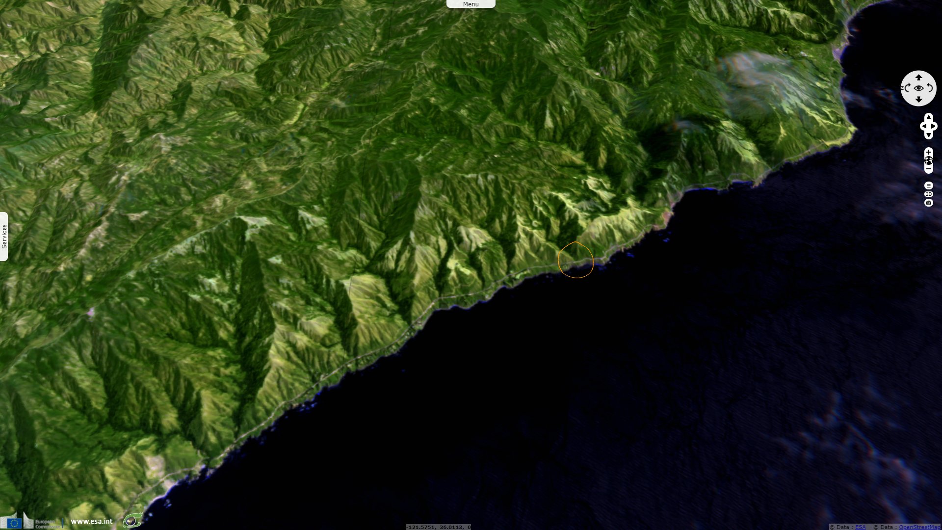
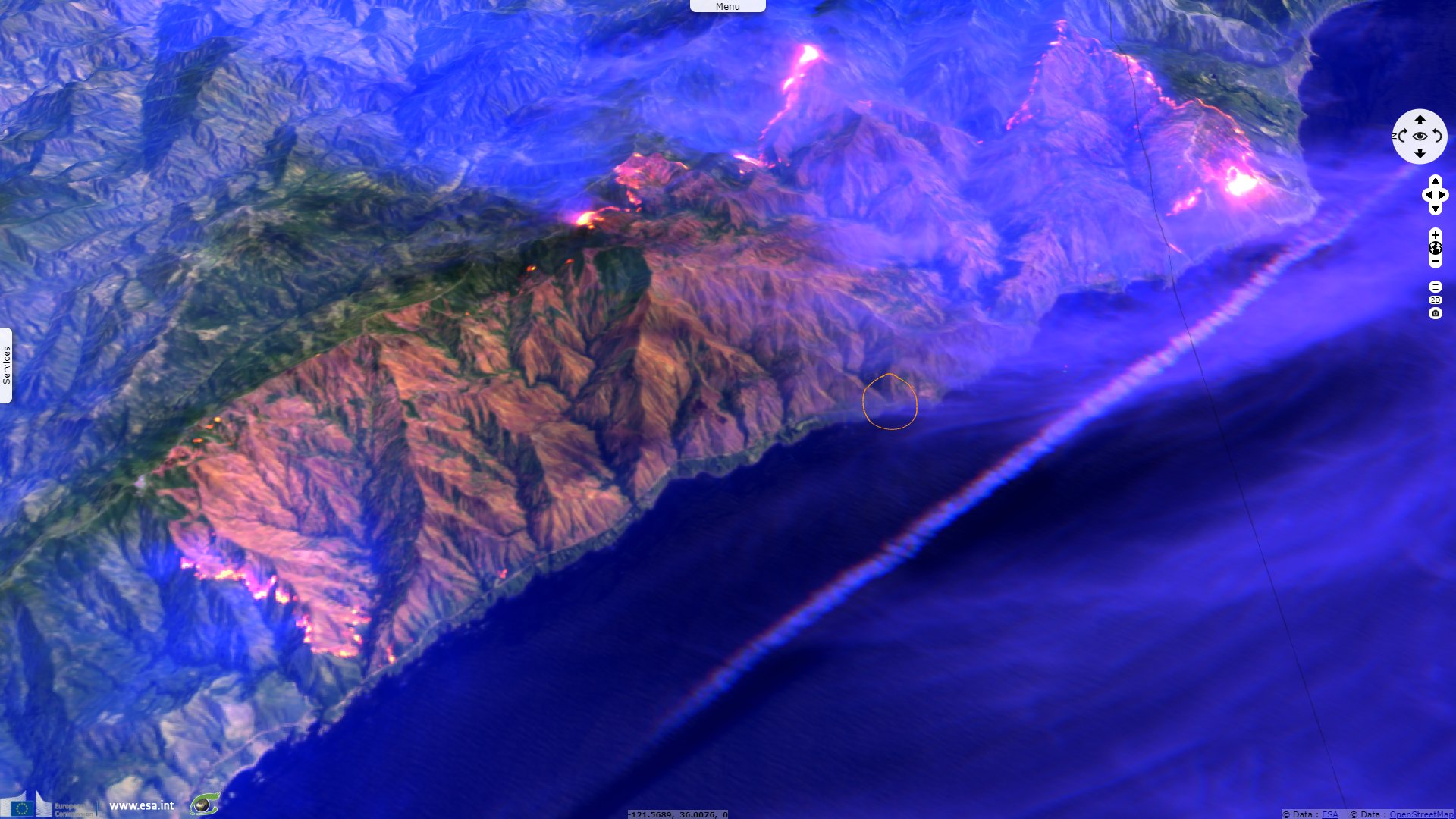
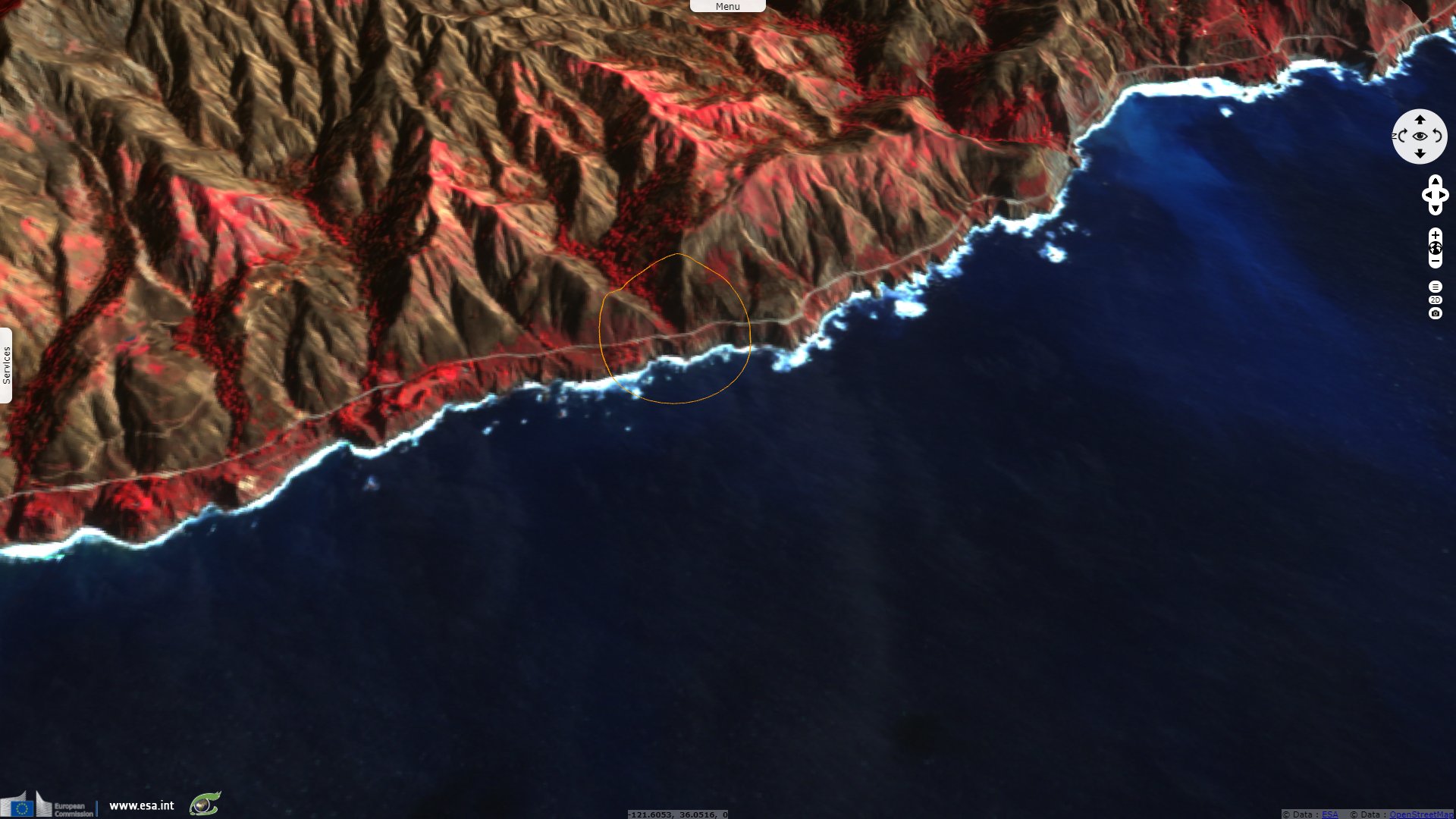
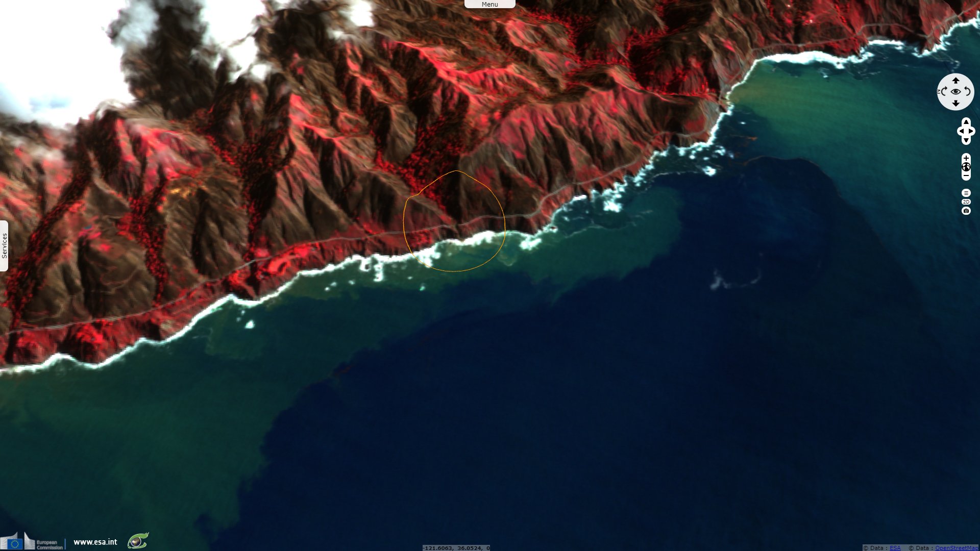
Part of a roadway slips into the sea after a burnscar is eroded
Sentinel-2 MSI acquired on 17 August 2020 at 18:49:19 UTC
Sentinel-2 MSI acquired on 22 August 2020 at 18:49:21 UTC
Sentinel-2 MSI acquired on 19 January 2021 at 18:57:11 UTC
Sentinel-2 MSI acquired on 29 January 2021 at 18:56:31 UTC
Keyword(s): Precipitations, burn scar, climate change, road, infrastructure, erosion, California, United States, USA
The views expressed herein can in no way be taken to reflect the official opinion of the European Space Agency or the European Union.
Contains modified Copernicus Sentinel data 2026, processed by VisioTerra.
Contains modified Copernicus Sentinel data 2026, processed by VisioTerra.
| More on European Commission space: |  |
 |
 |
||||
| More on ESA: | |
|
|
S-1 website | S-2 website | S-3 website | |
| More on Copernicus program: | |
|
|
Scihub portal | Cophub portal | Inthub portal | Colhub portal |
| More on VisioTerra: | |
|
|
Sentinel Vision Portal | Envisat+ERS portal | Swarm+GOCE portal | CryoSat portal |