Emi Koussi, roof of the Sahara desert, Chad
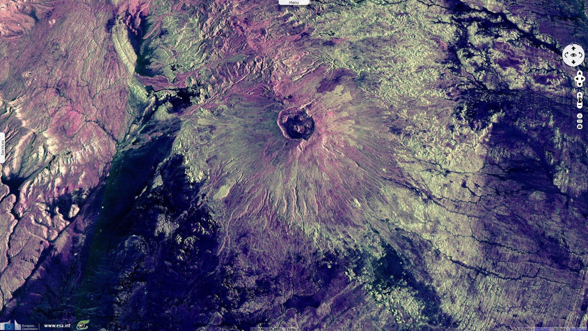
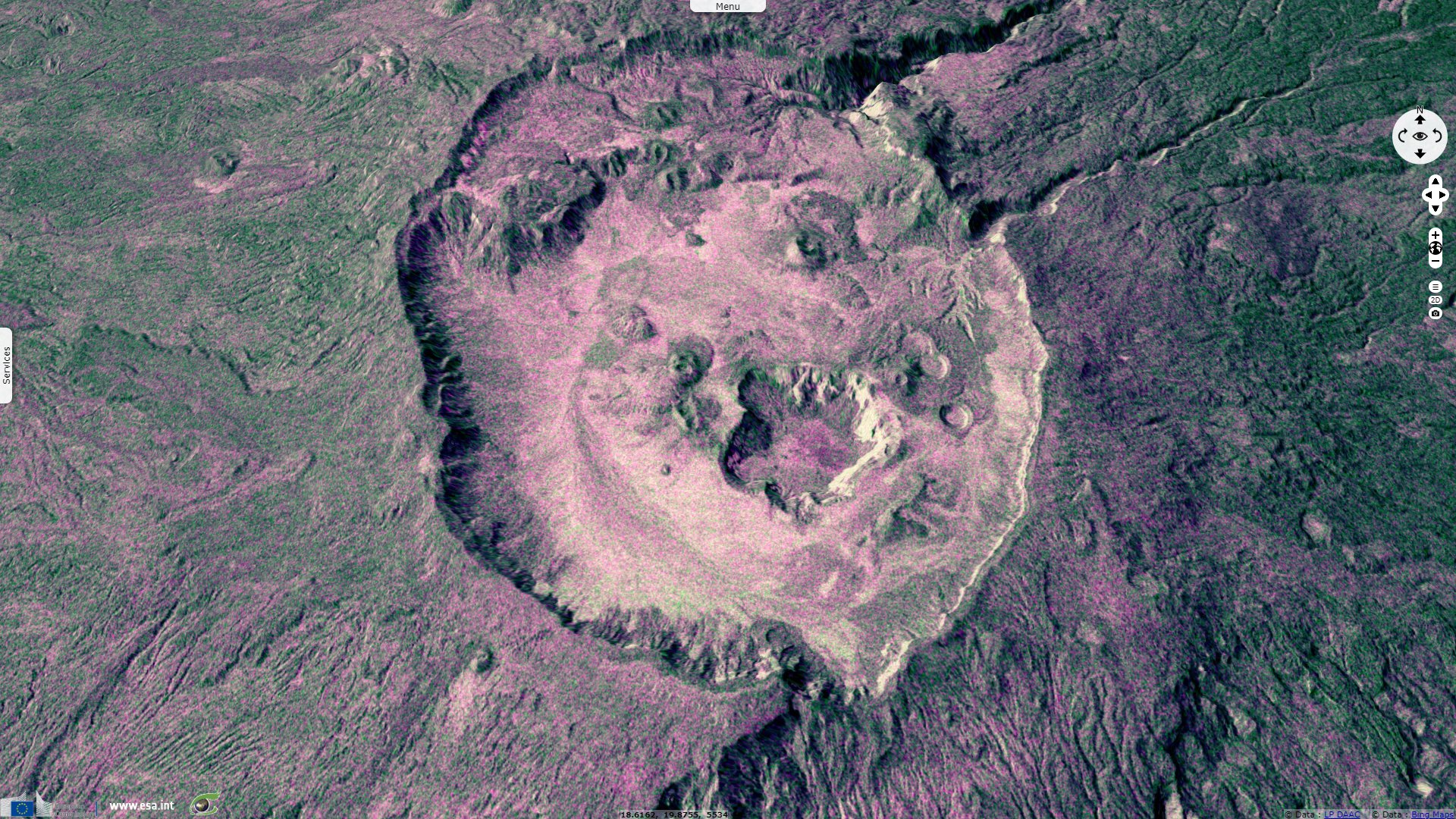
Sentinel-1 CSAR IW acquired on 22 June 2018 at 04:44:04 UTC
...
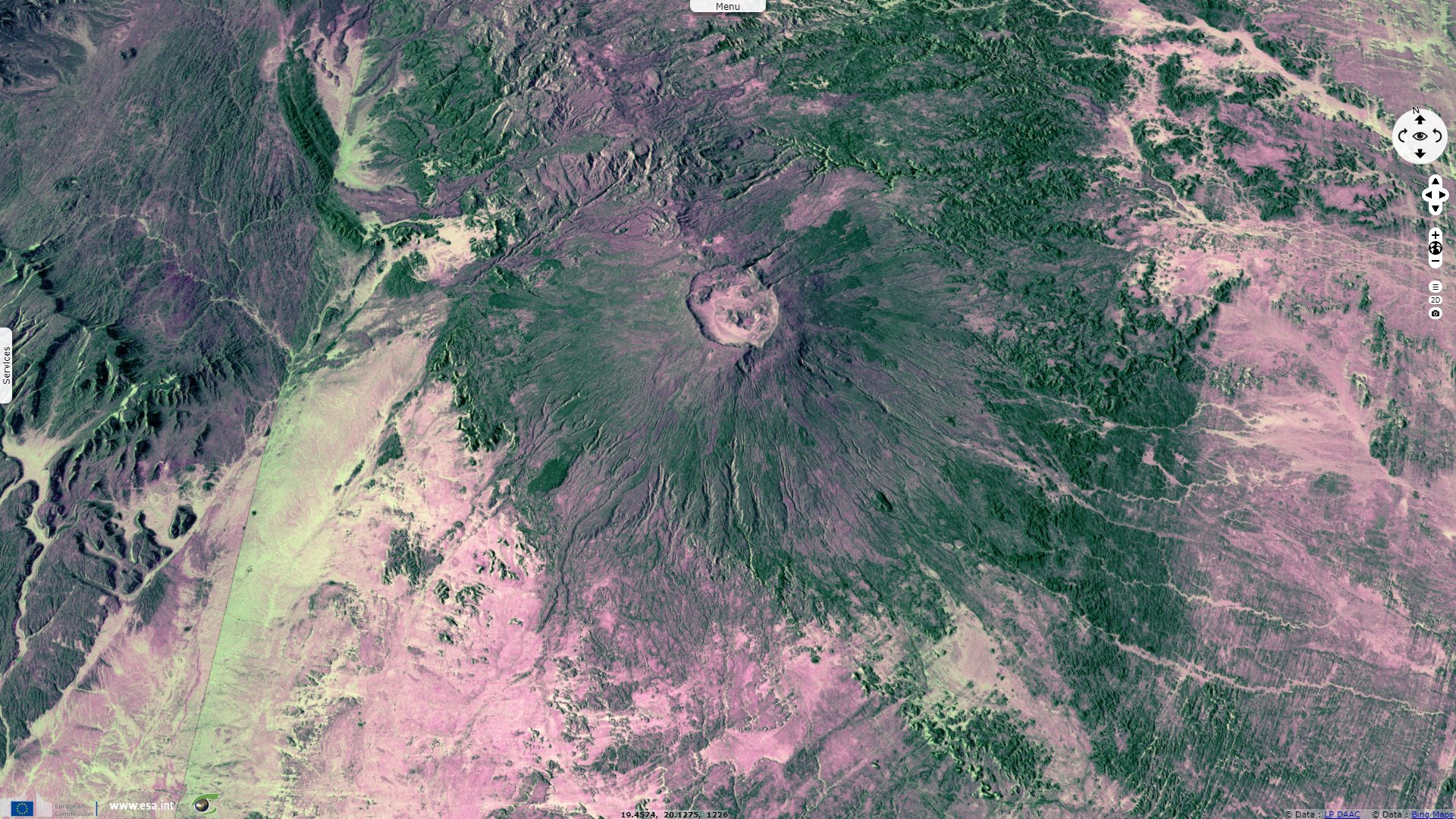
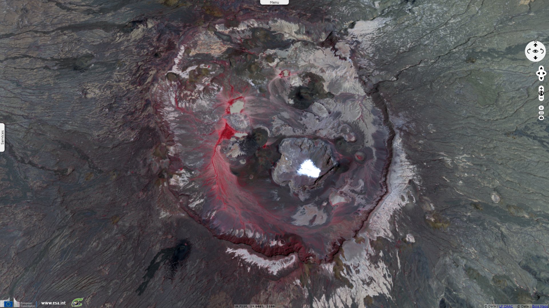
Sentinel-1 CSAR IW acquired on 26 December 2018 at 04:36:04 UTC
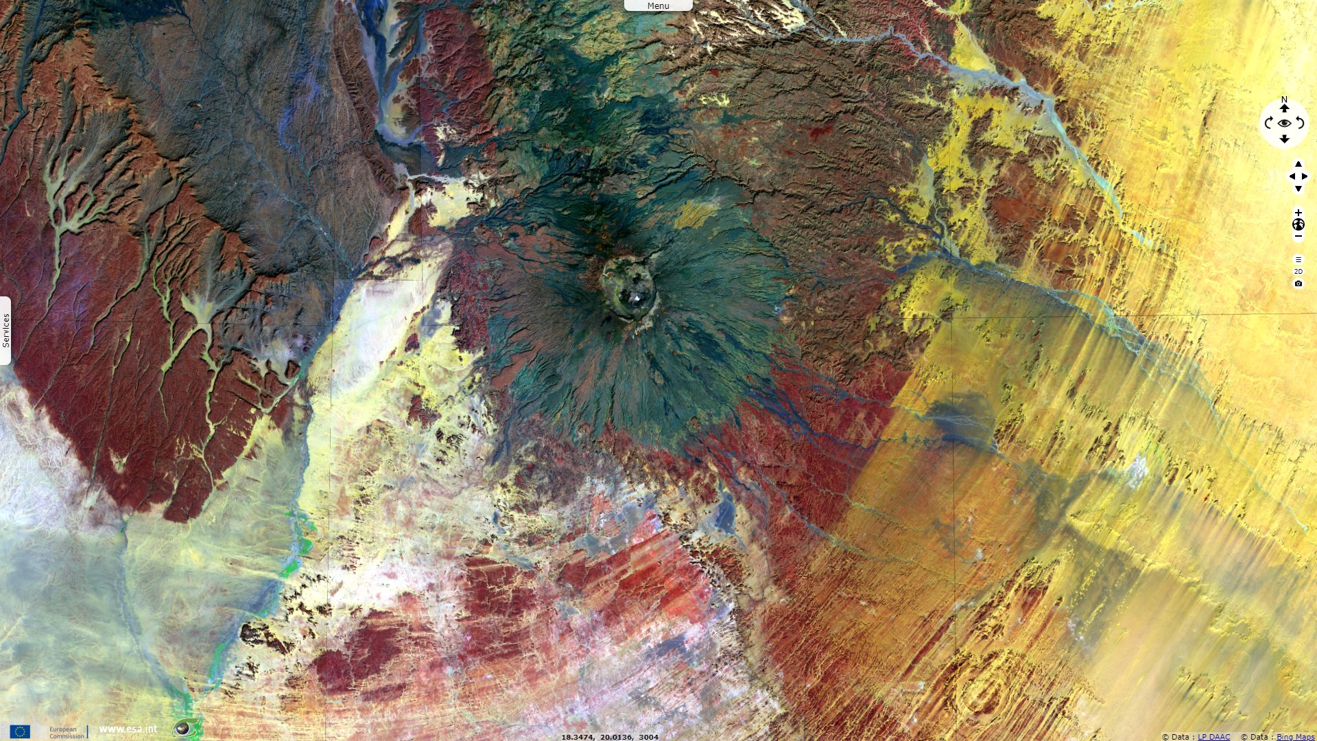
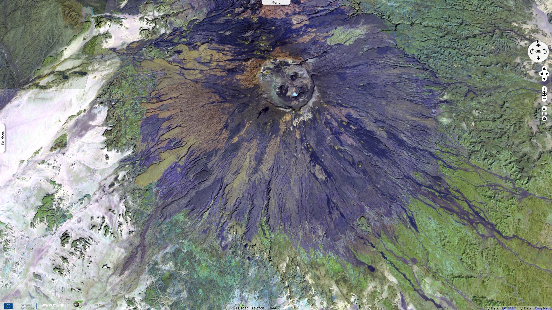
Sentinel-2 MSI acquired on 13 September 2019 at 09:05:51 UTC
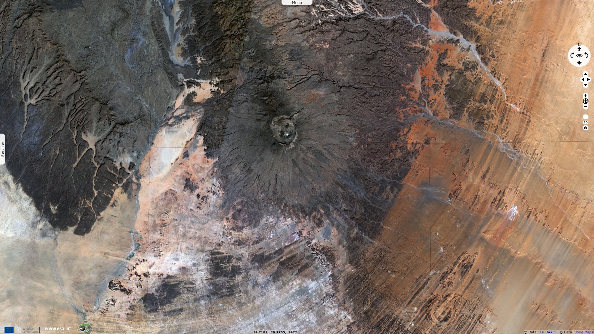
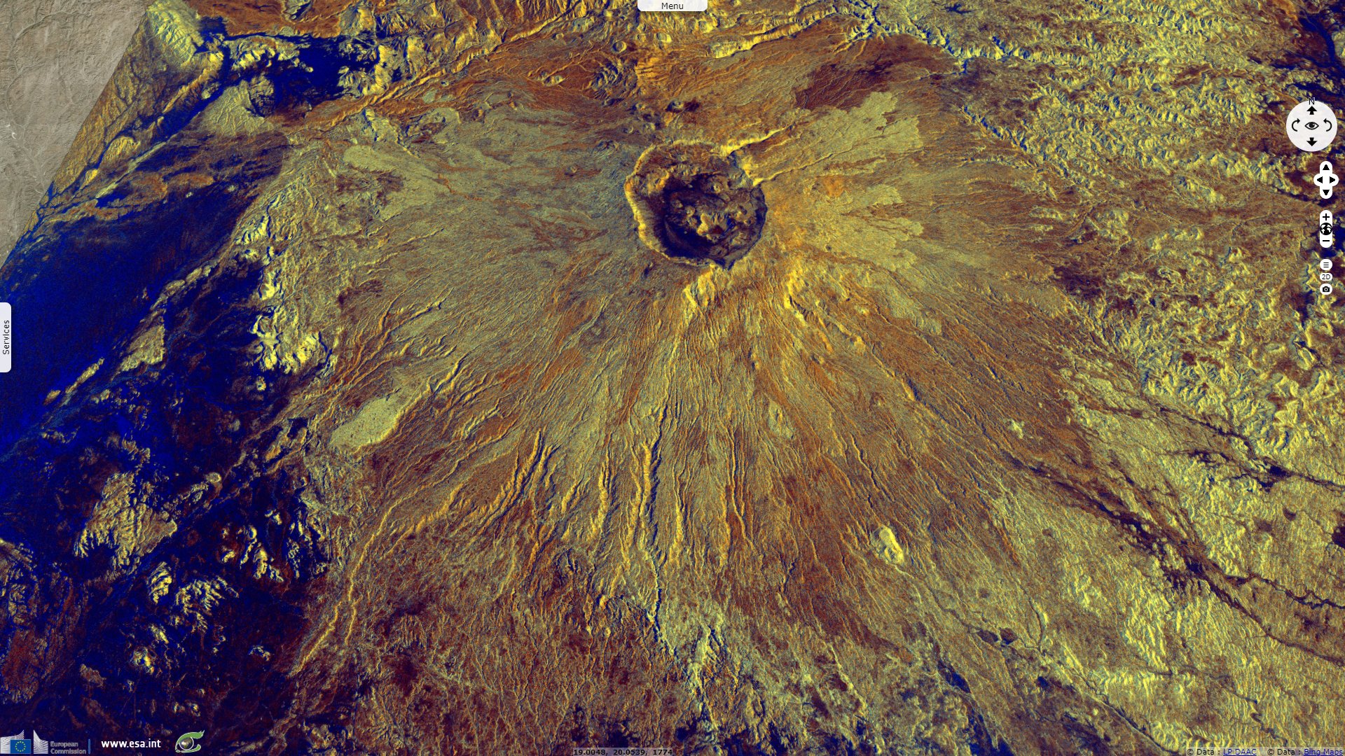
Sentinel-2 MSI acquired on 21 January 2020 at 09:13:01 UTC
...
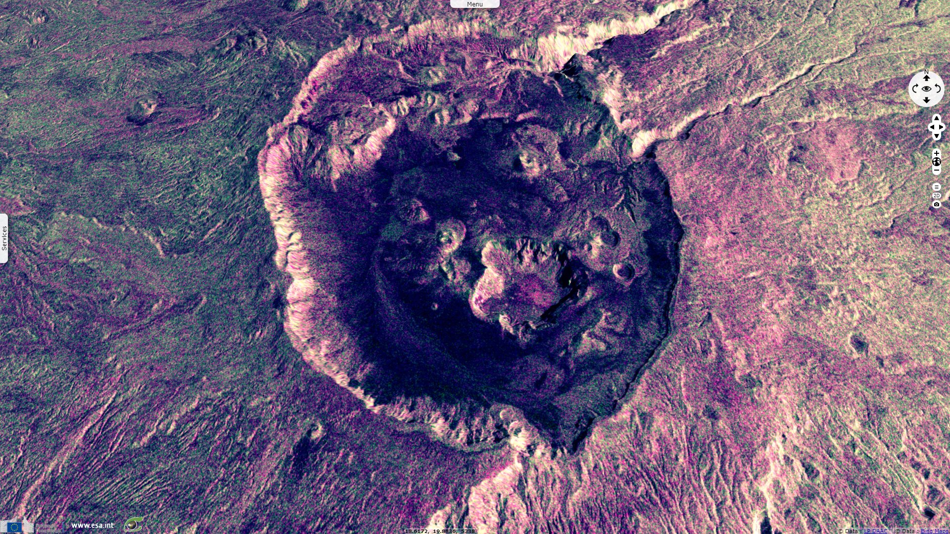
Sentinel-1 CSAR IW acquired on 26 December 2018 at 04:36:04 UTC
Sentinel-2 MSI acquired on 13 September 2019 at 09:05:51 UTC
Sentinel-2 MSI acquired on 21 January 2020 at 09:13:01 UTC
Keyword(s): Shield volcano, geohazard, geology, lava flows, caldera, salt lake, Tibesti mountain range, Sahara desert, Chad
The Smithonian Institution defines shield volcanoes as follows: "Shield volcanoes contrast with stratovolcanoes both in origin and morphology. Their name derives from their low-angle profile, which resembles the personal shields carried by warriors. They are formed primarily by the successive accumulation of fluid lava flows, which descend from summit or flank fissure systems. Although shield volcanoes are not as visually dramatic as stratovolcanoes, they are often much larger features. Their volumes can exceed that of stratovolcanoes by several orders of magnitude. Most shield volcanoes are formed of fluid basaltic lava flows. A less common type of shield volcano [like the Emi Koussi] is a pyroclastic shield, whose broad low-angle slopes are formed by accumulation of fragmental material from powerful explosive eruptions."
Emi Koussi is a high pyroclastic shield volcano in the northern Borkou Region of northern Chad rising above the surrounding sandstone plains. According to its sheet: "The large volcano of Emi Koussi at the SE end of the Tibesti Range forms the highest summit of the Sahara. The 60 x 80 km massif was constructed over a basement of Cretaceous and Paleozoic sandstones. Two nested calderas, 12 x 15 km in size, truncate the dominantly trachytic volcano, whose 3415 m high point lies on the southern caldera rim of the low-angle pyroclastic shield volcano. The calderas contain several explosion craters, lava domes, and young scoria cones, along with lava flows of recent and pre-modern age."
"The spectacular Era Kohor (Trou au Natron du Koussi or Natron Hole) caldera on the SE floor of the 2nd caldera is 2-3 km wide and 350 m deep." Trachytic lava flows are exposed in its walls, and sodium carbonate has been deposited on its floor, which lies at an elevation of 2670 m and contains a salt lake. The floor of Era Kohor is thus deep white.
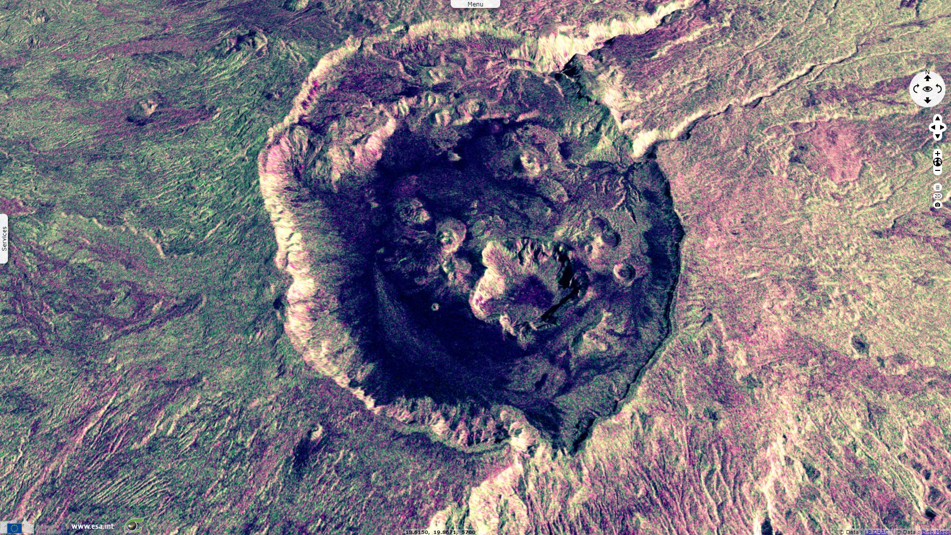
Two nested overlapping calderas cap the volcano, the outer one being an ellipse about 15 x 11 km in size. The northern caldera formed first, then the southern caldera which is about 50 m deeper below the northern one. 300–400 m high scarps form the inner margin of the southern caldera, with the floor at an elevation of 2970 m."The latest activity in the calderas produced three maars, and numerous basaltic cinder cones and associated lava flows have been constructed both within the calderas and on their outer flanks. The Yi-Yerra thermal area is located on the S flank."
Emi Koussi was active more than one million years ago, but some eruptions may be more recent, and there is ongoing fumarolic and hot spring activity. Before the formation of the calderas, the volcano may have reached a height of 4000 m. The caldera rim is cut by one outlet, the Porte de Modiounga, from which gorges emanate into the caldera. Debris from explosive eruptions fills the calderas. The Kohor pumices and two sets of ignimbrites cover the flanks of Emi Koussi, which steepen as they approach the summit. Scoria cones on the slopes are accompanied by lava flows. On the upper sectors of the volcano, lavas are crisscrossed by cracks, which are known as "lappiaz".
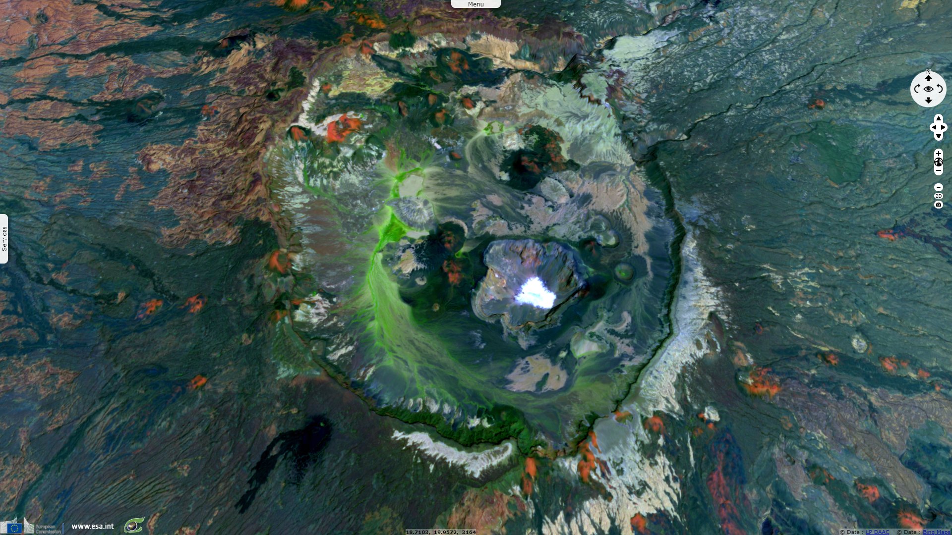
Generally, in the Tibesti vegetation occurs in five different belts depending on elevation. On Emi Koussi, Erica arborea is found up to elevations of 2900 m, in the past it was probably more widespread. The summit region features montane vegetation, including Artemisia-Ephedra steppes which cover large parts of the caldera floor and may have been used as pastures. The lava flows high on the mountain have characteristic environmental traits which allow the development of a particular vegetation. This vegetation encompasses ferns, liverworts and mosses; several species grow at fumaroles.
The views expressed herein can in no way be taken to reflect the official opinion of the European Space Agency or the European Union.
Contains modified Copernicus Sentinel data 2026, processed by VisioTerra.
Contains modified Copernicus Sentinel data 2026, processed by VisioTerra.
| More on European Commission space: |  |
 |
 |
||||
| More on ESA: | |
|
|
S-1 website | S-2 website | S-3 website | |
| More on Copernicus program: | |
|
|
Scihub portal | Cophub portal | Inthub portal | Colhub portal |
| More on VisioTerra: | |
|
|
Sentinel Vision Portal | Envisat+ERS portal | Swarm+GOCE portal | CryoSat portal |