Wollaston Lake, uranium mines straddling on a continental drainage divide
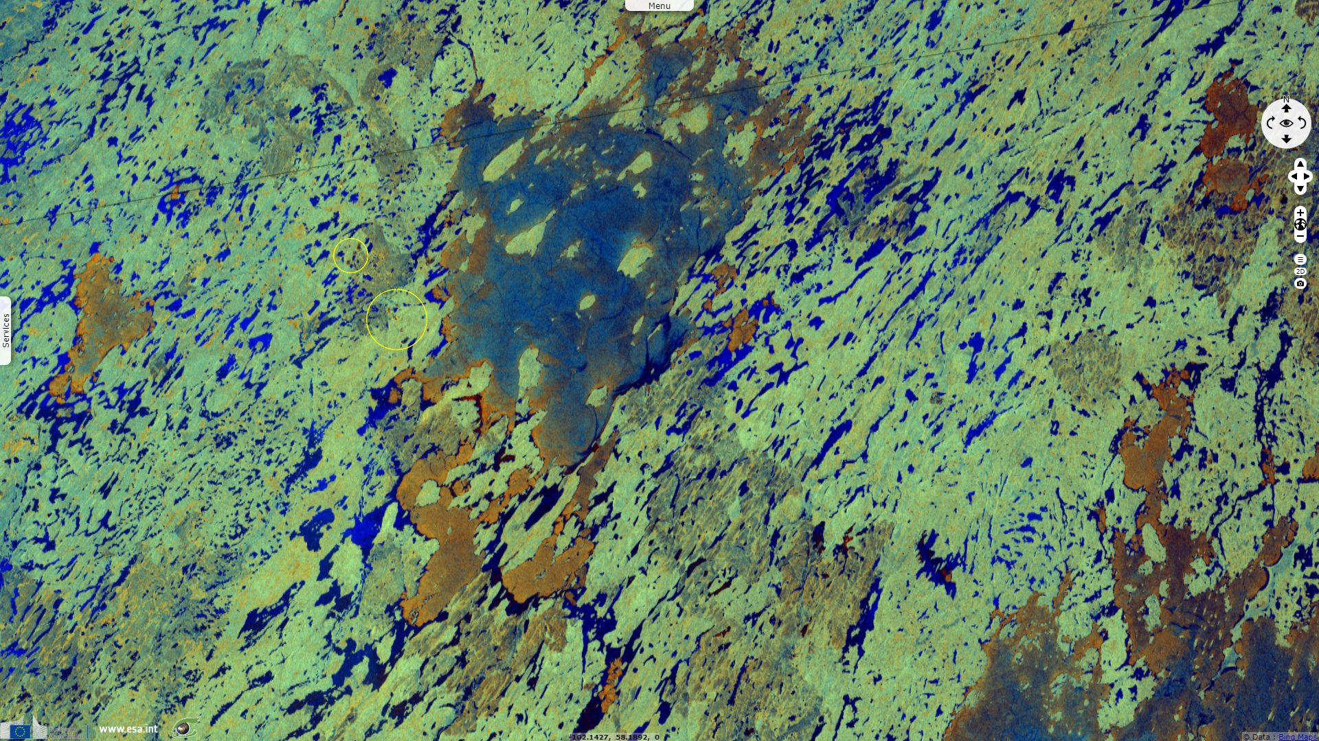
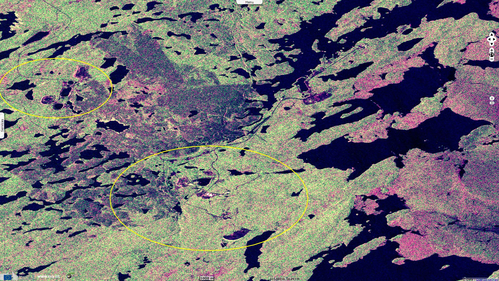
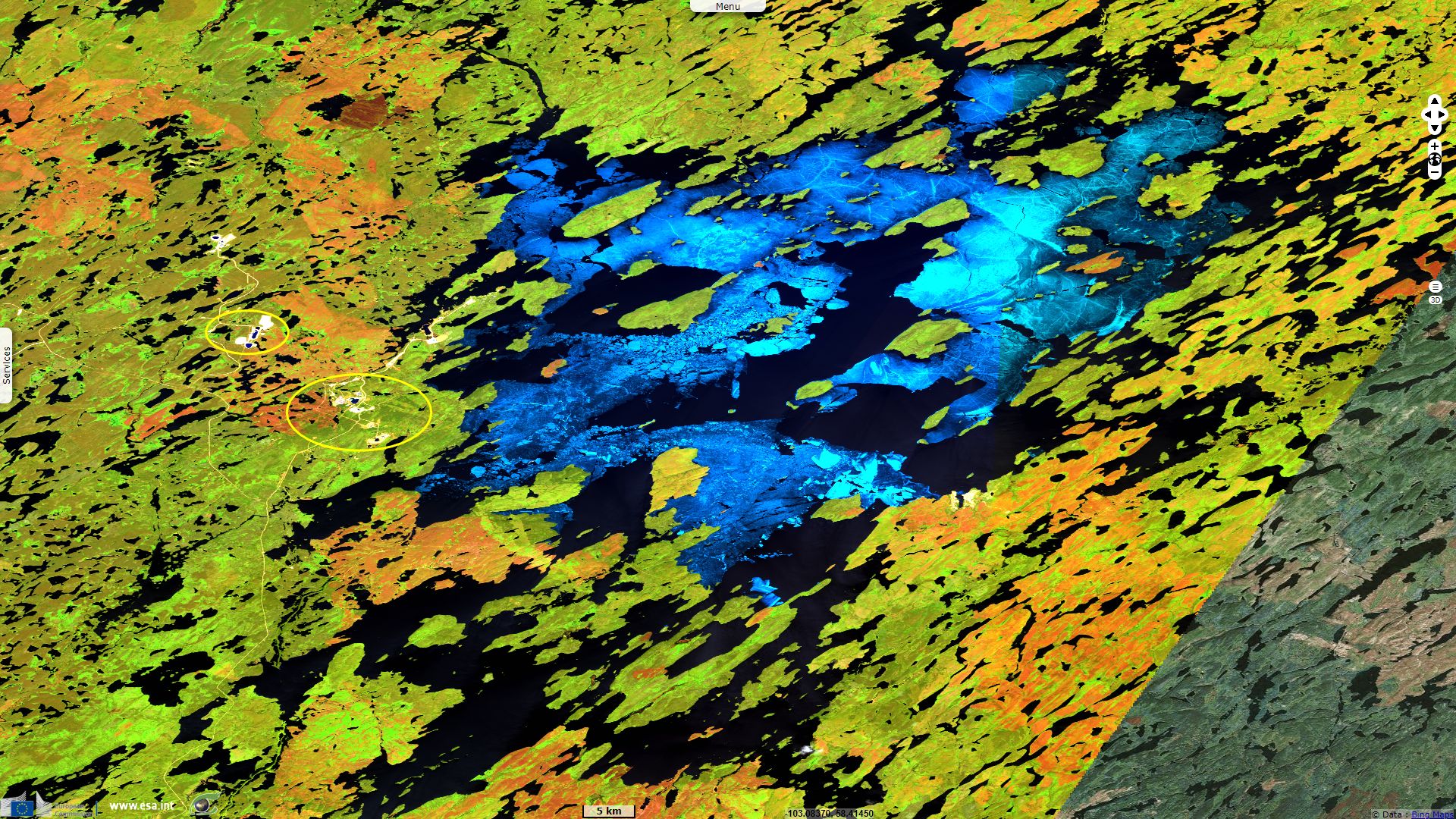
Sentinel-1 CSAR IW acquired on 05 June 2015 at 00:34:07 UTC
...
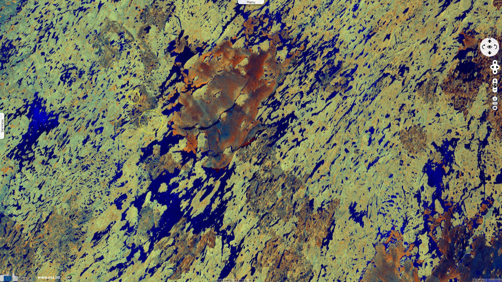
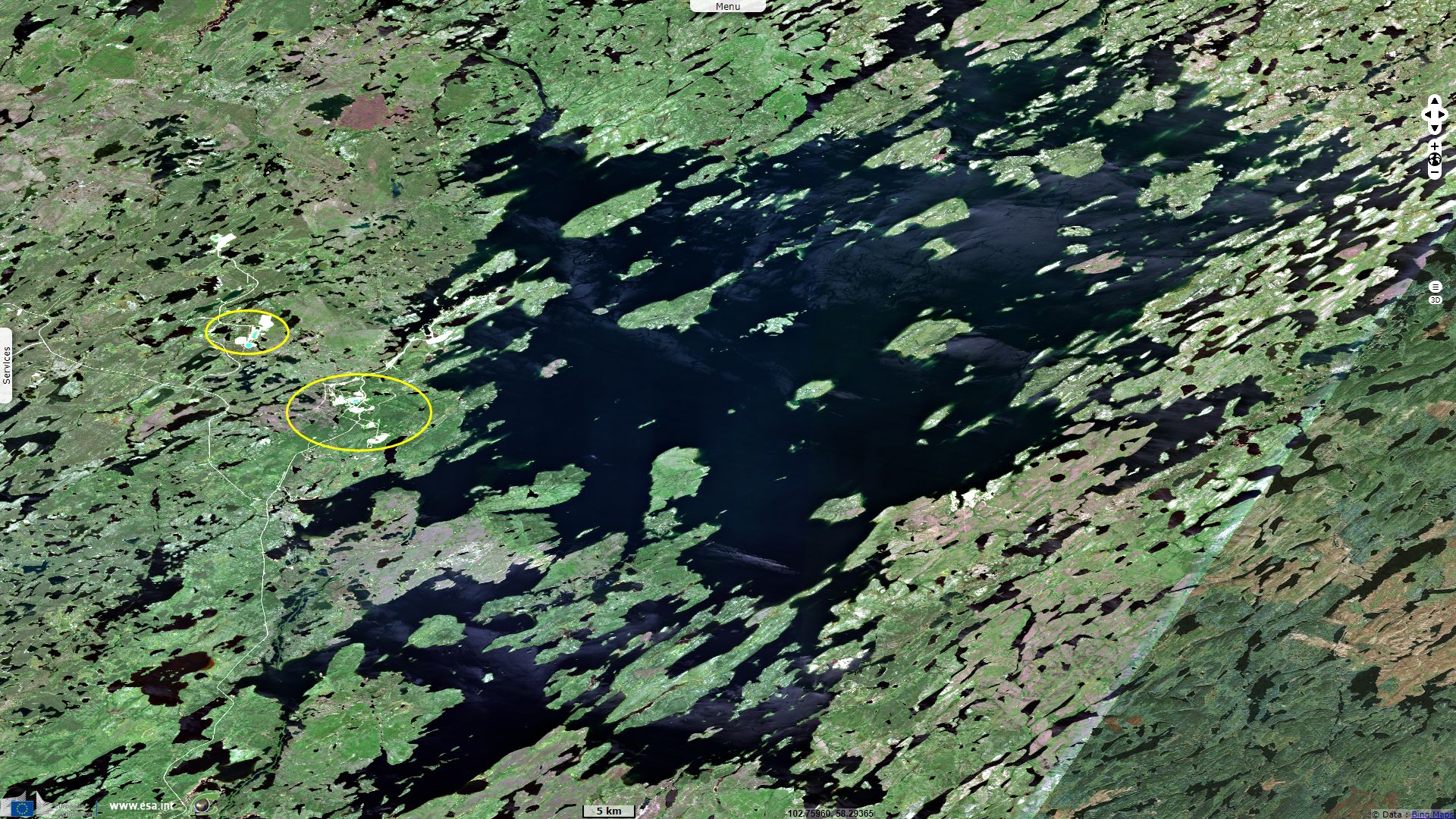
Sentinel-2 MSI acquired on 05 July 2019 at 18:19:29 UTC
...
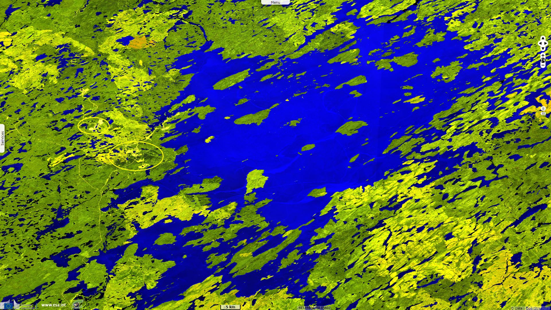
Sentinel-2 MSI acquired on 05 July 2019 at 18:19:29 UTC
Keyword(s): Lake, hydrology, mine, pollution, urban planning, Canada.
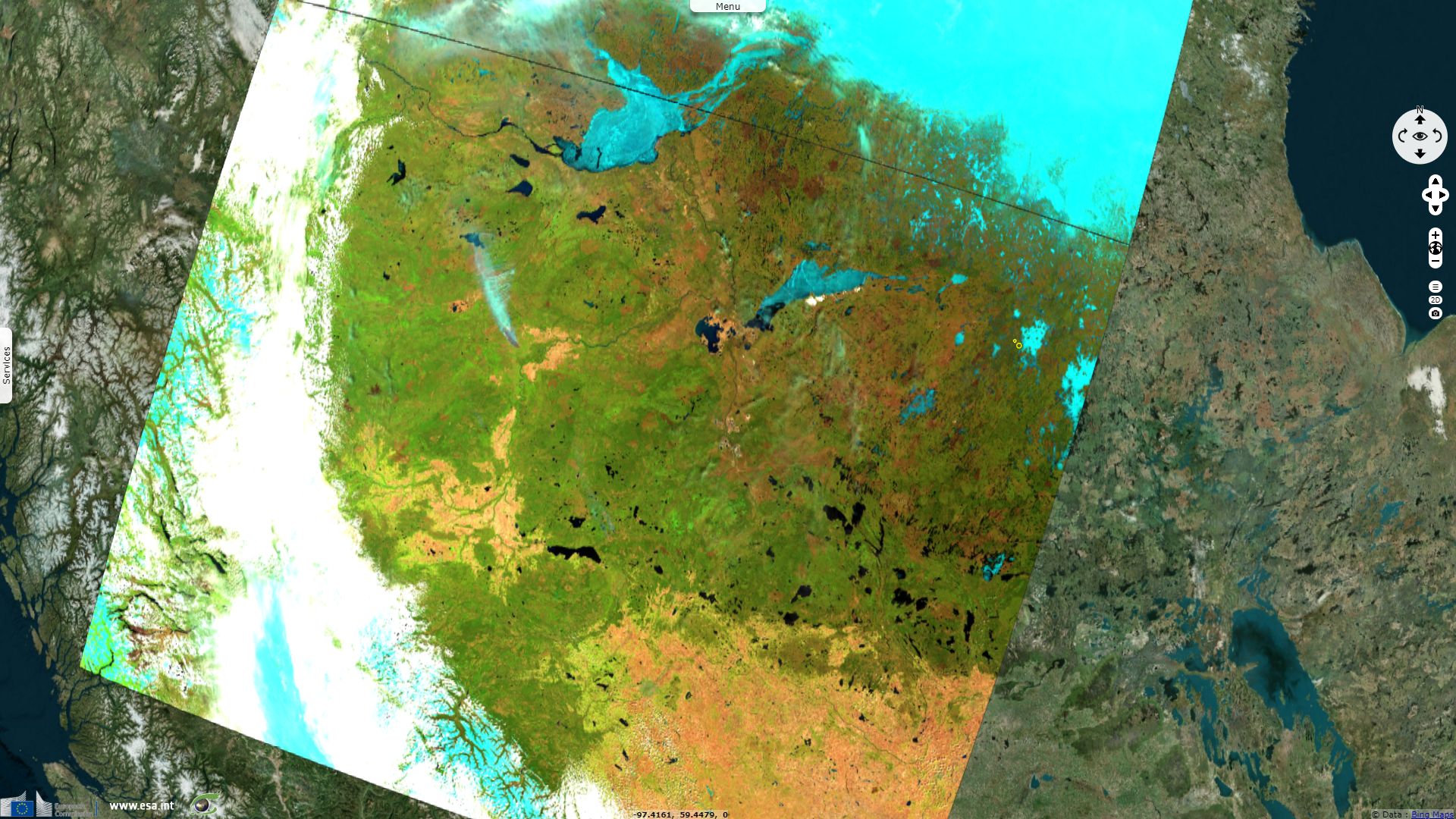
Wollaston Lake lies in the wooded Shield country of north-east Saskatchewan, Canada. The lake has an average depth of 20.6 m and a maximum depth of 71 m. Its content is estimated at 75 km³. The water level is at an altitude of 398 m and its shoreline is 1475 km. The catchment area of the lake is 23 310 km² large. The lake is frozen between November and June.
To the north-west, about 10% of the lake's water drains via the Fond Du Lac River into Lake Athabasca and the Mackenzie River system which ultimately drains into the Arctic Ocean; to the north-east it drains via the Cochrane River into Reindeer Lake and the Churchill River system into Hudson Bay. Discovered by Peter Fidler about 1800, it was used by fur traders as a link between the 2 watersheds. According to the encyclopedia of Saskatchewan: "this unusual drainage pattern was described by David Thompson in 1796 as 'perhaps without parallel in the world.'"

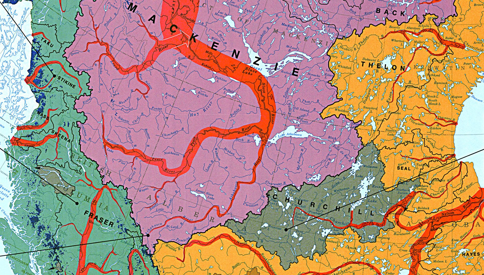
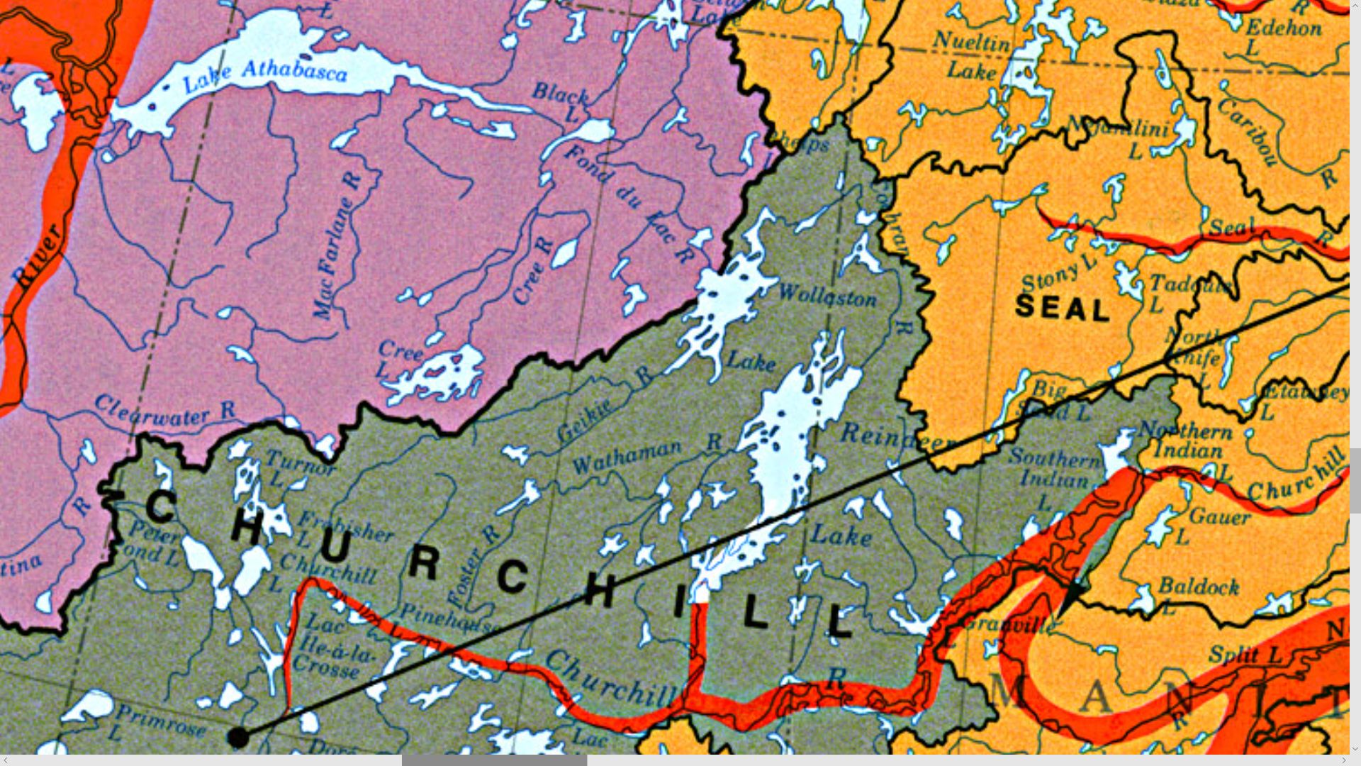
Left: Main river systems of Canada between Hudson Bay and the Pacific Ocean - Source: The national atlas of Canada, 5th edition
Right: Zoom on the continental divide straddling on Wollaston Lake.
Cameco (Canadian Mining and Energy Corporation) describe the few nearby settlements: "The hamlet of Wollaston Lake and Hatchet Lake First Nation (HLFN) are situated in the Athabasca Basin region on the southeastern shore of Wollaston Lake, the largest bifurcation lake in the world, draining naturally in two directions. The lake is known in Dene as “Axe” Lake, and the community is called “The Post” to outlying dwellers of the lake. Access to the hamlet is by ice road in the winter and by barge during the open water season. Year round access is provided by two airline companies that operate scheduled flights to and from the surrounding communities and southern Saskatchewan. There is a desire for a year-round road to connect the community to the south."
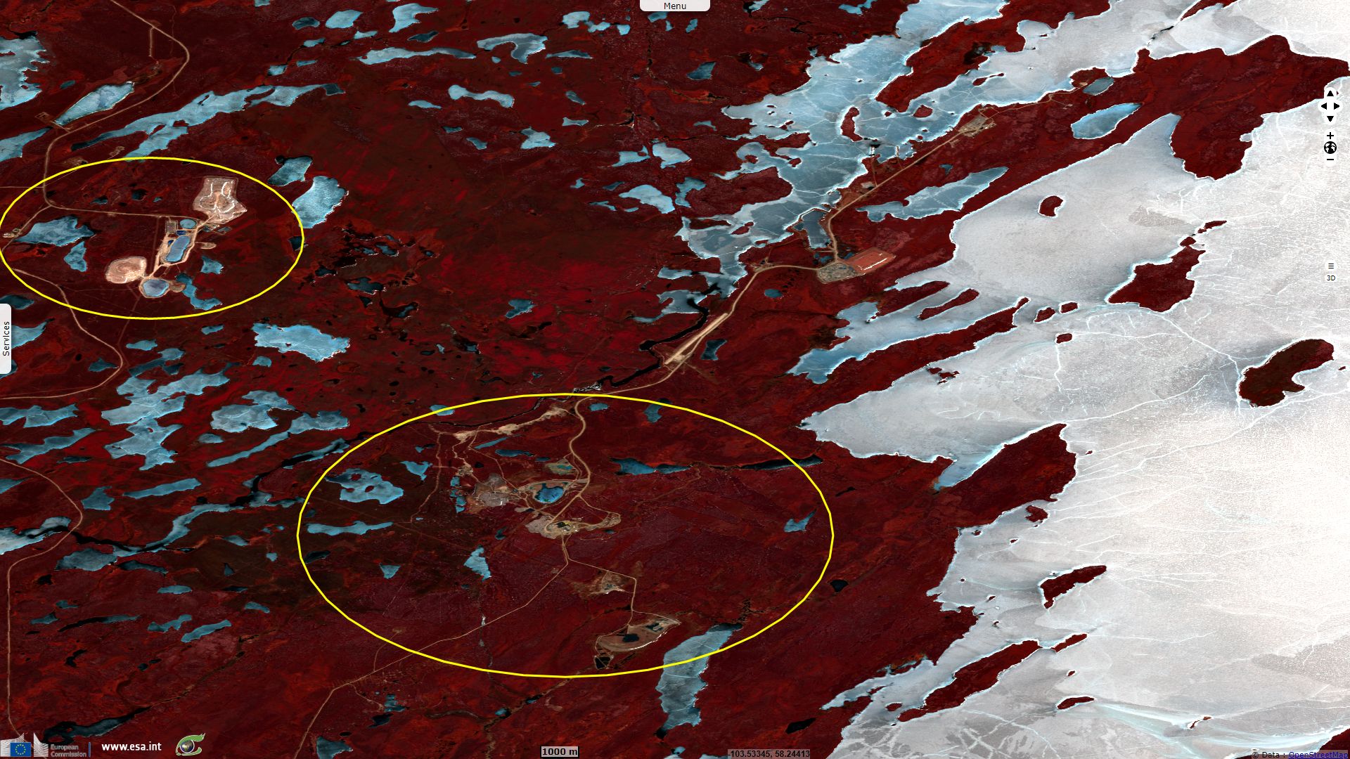
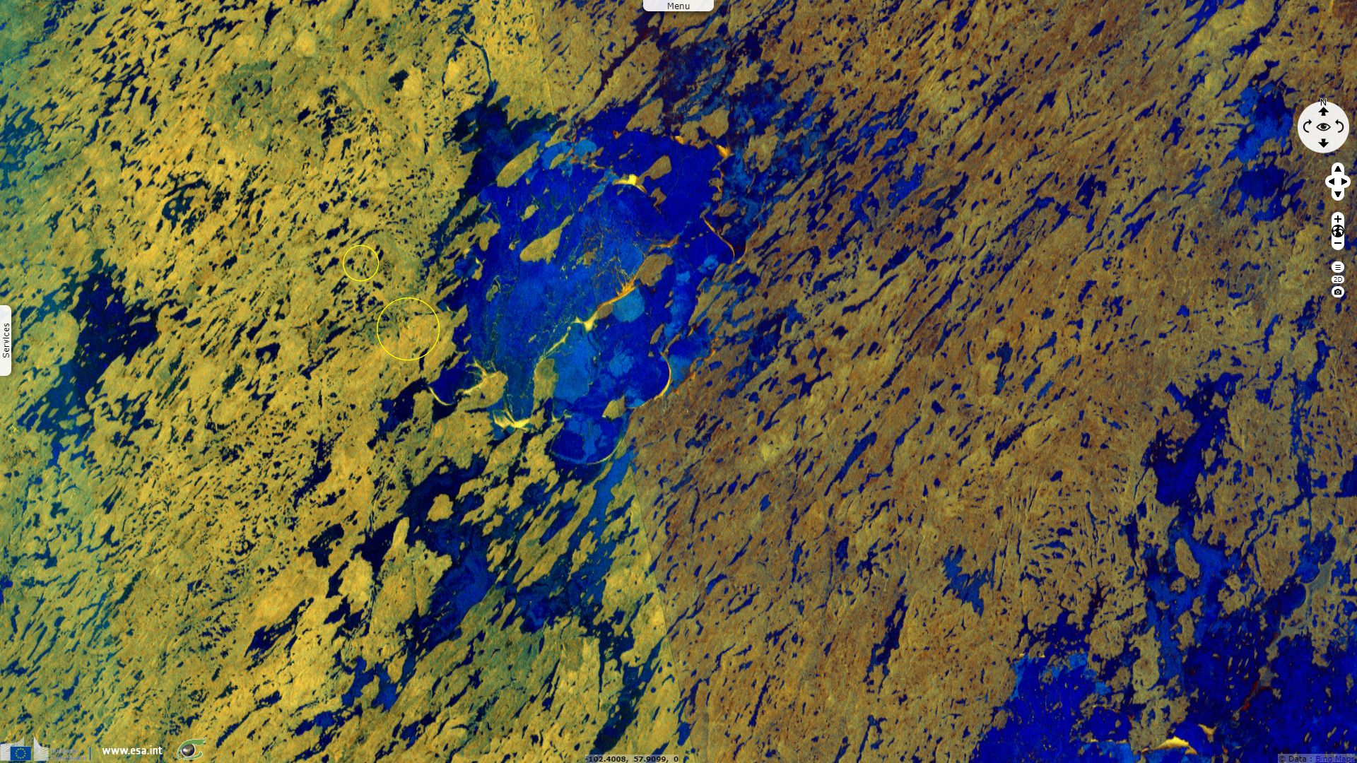
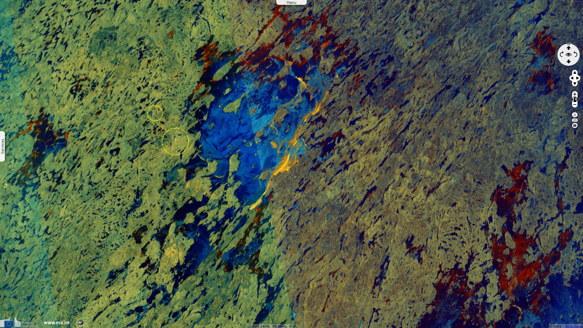
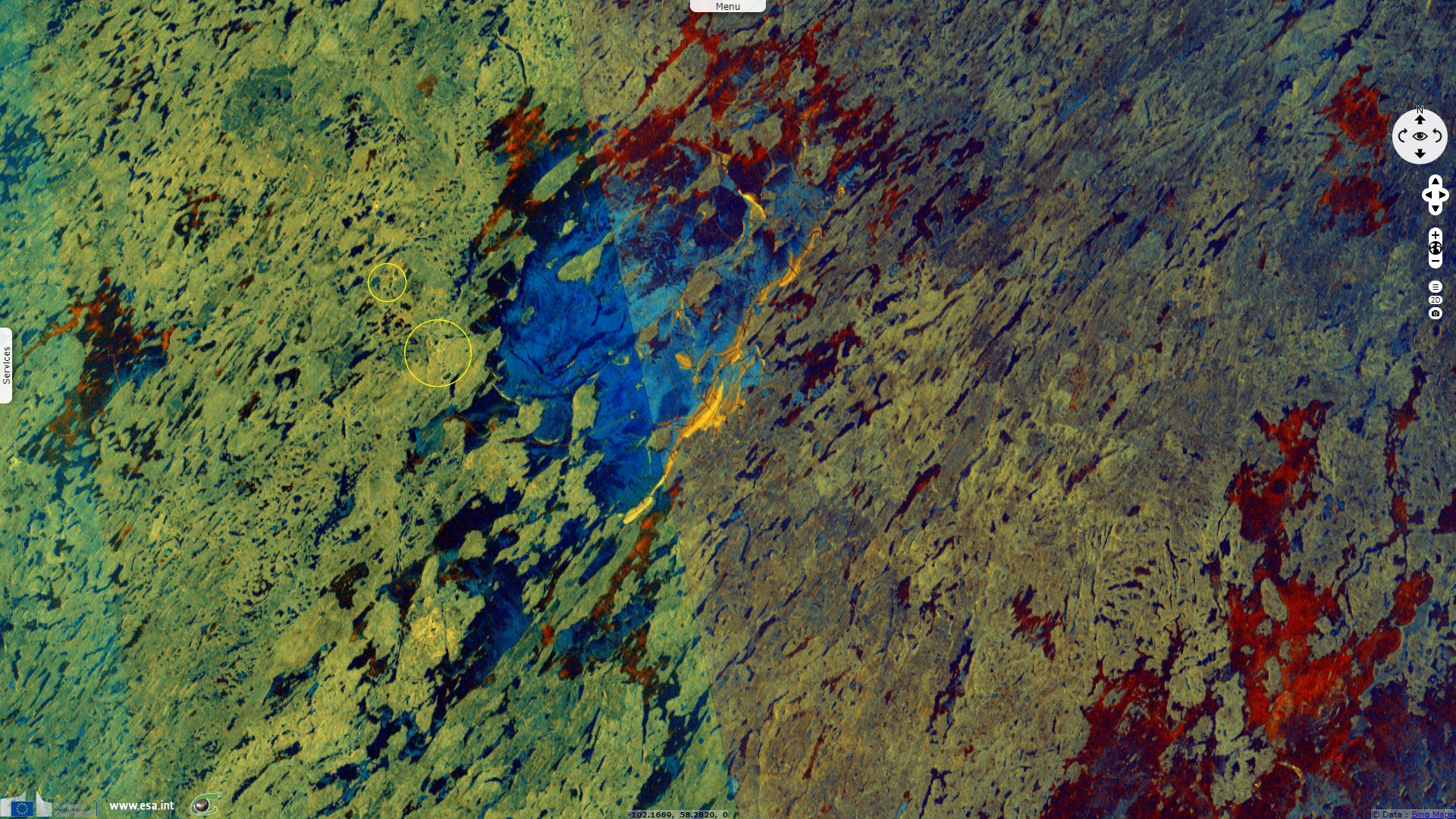
Uranium is mined at Wollaston Lake and at the headwaters of the Geikie River, a tributary of Wollaston Lake. Orano (Areva) released a news item about the McClean Lake uranium mine located next to the lake: "The Orano operated McClean Lake mill is a unique facility – it is the most technologically advanced mill in the world for the processing of high-grade uranium ore without dilution. The McClean Lake mill opened in 1999 and underwent a period of care and maintenance from 2010 to 2014. In October, 2014, coinciding with our celebration of 50 years in Canada, the McClean Lake restart began with the processing of all ore from the newly opened Cigar Lake mine located 80 kilometres away. Since its original commissioning, the mill has achieved a production of over 68 million pounds of uranium concentrate. In 2016 alone, the mill processed a record 17.3 million pounds."
Athabasca Working Group Environmental Monitoring Program released a report in 2003: "The AWG program tests the environment near each community in the Athabasca region of northern Saskatchewan for contaminants that could come from active uranium mining and milling operations. The goal of this community-based program is for community members to decide what and where to sample in the environment and to assist in all sample collections. The AWG program began in 2000 and this pamphlet presents the results of the 2003 environmental testing completed near the community of Wollaston Lake.
Contaminants from uranium mines would mainly enter the water, but small amounts may also be spread through the air. Therefore, the AWG program samples lakes and rivers, as well as plants, wildlife, and air quality near each community. This is the same type of sampling that is done near each mine site to test the environment close to the mines."
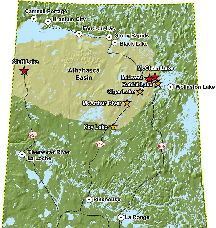
Cities, uranium mines and mills in Athabasca basin - Source: Orano (Areva)
The report hopefully concludes: "Treated effluent from the Rabbit Lake mine is released into Hidden Bay and, therefore, it is not surprising that the water and sediment samples from Hidden Bay contained a higher level of uranium than samples from the other stations in Wollaston Lake. All key parameter levels in fish, plants, and wildlife were low and gave no indication that they would not be safe to eat with respect to these parameters. Radon levels at one of the air monitoring stations measured higher during the summer months, but overall the radon levels followed a recognized seasonal pattern. The information collected in 2003 does not highlight any major environmental concerns near the community of Wollaston Lake caused by operational uranium mining and milling projects."
The views expressed herein can in no way be taken to reflect the official opinion of the European Space Agency or the European Union.
Contains modified Copernicus Sentinel data 2026, processed by VisioTerra.
Contains modified Copernicus Sentinel data 2026, processed by VisioTerra.
| More on European Commission space: |  |
 |
 |
||||
| More on ESA: | |
|
|
S-1 website | S-2 website | S-3 website | |
| More on Copernicus program: | |
|
|
Scihub portal | Cophub portal | Inthub portal | Colhub portal |
| More on VisioTerra: | |
|
|
Sentinel Vision Portal | Envisat+ERS portal | Swarm+GOCE portal | CryoSat portal |