Birth of a volcanic isle in a remote archipelago, Japan
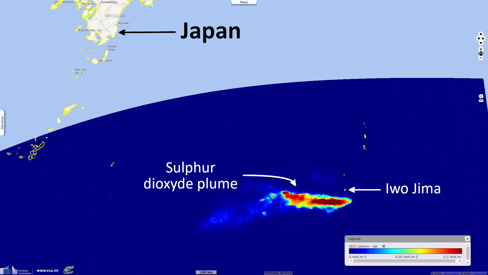
Sentinel-5P TROPOMI SO2 acquired on 13 August 2021 at 04:11:30 UTC
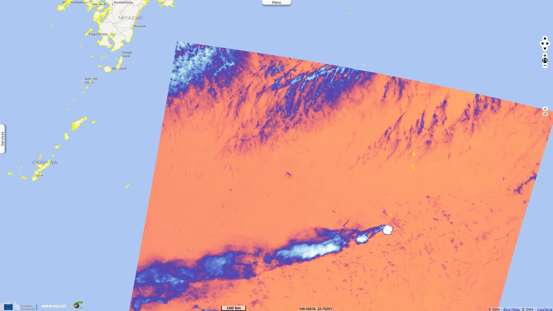
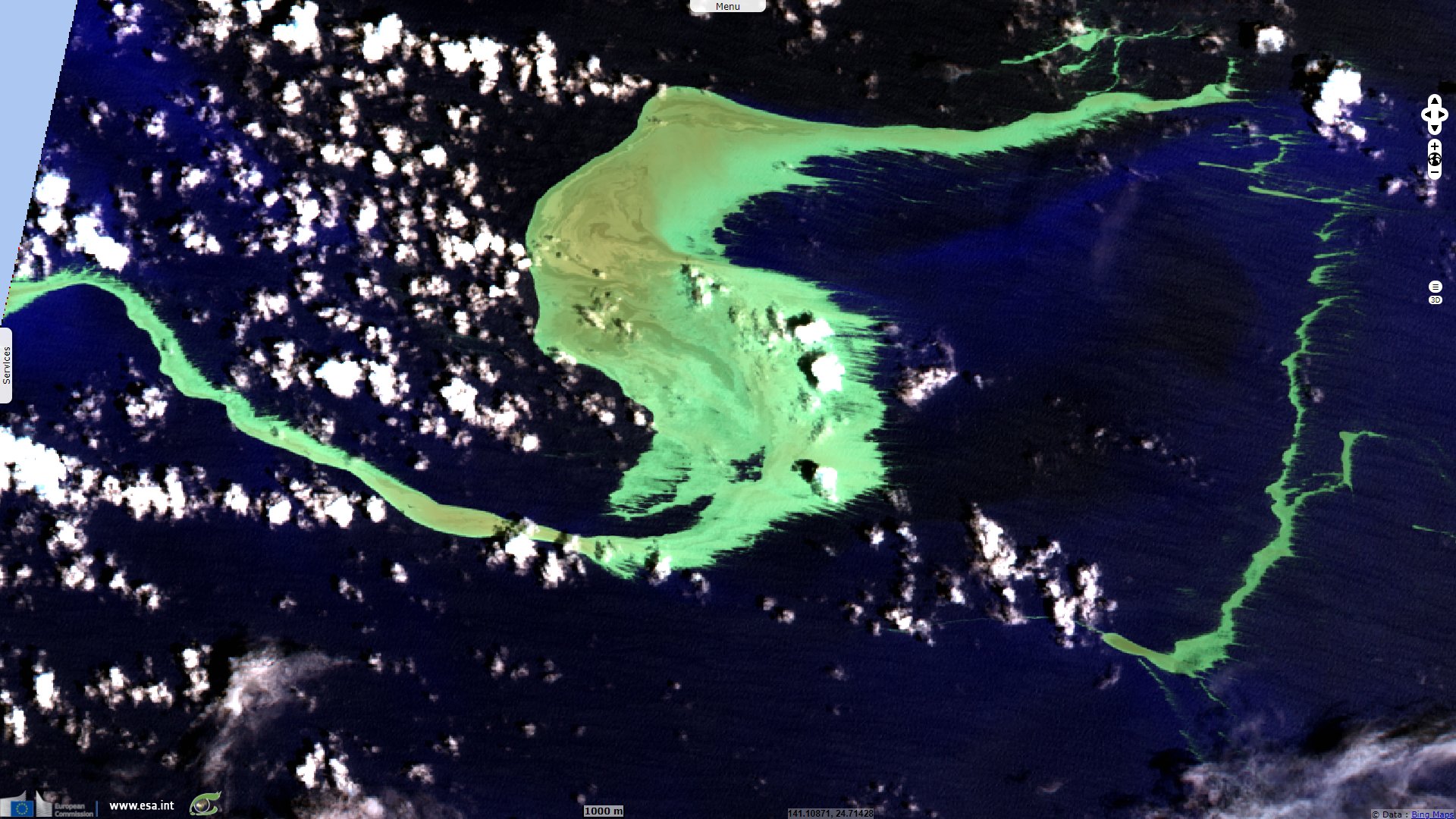
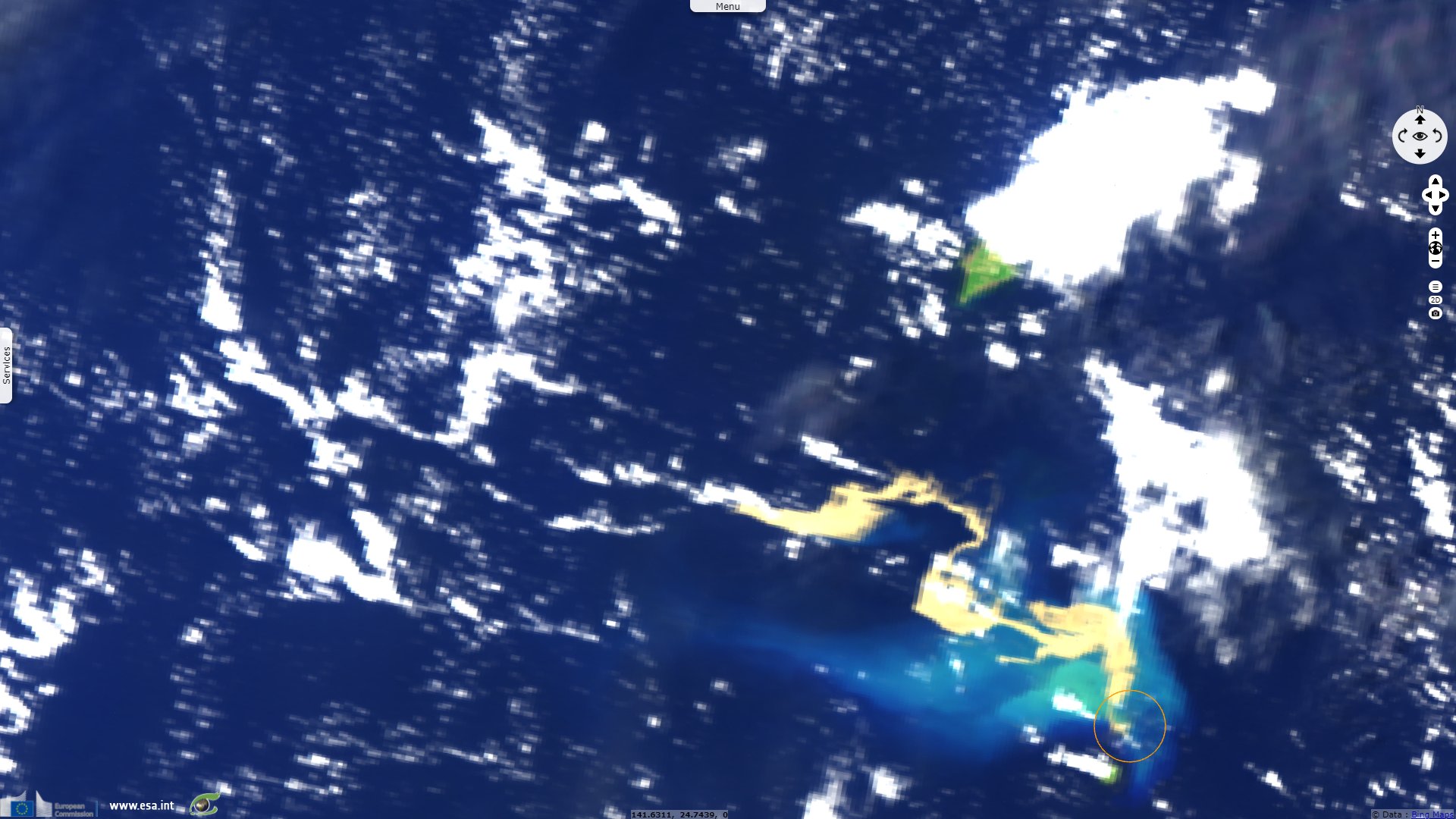
Sentinel-3 OLCI FR & SLSTR RBT acquired on 14 August 2021 at 00:48:46 UTC
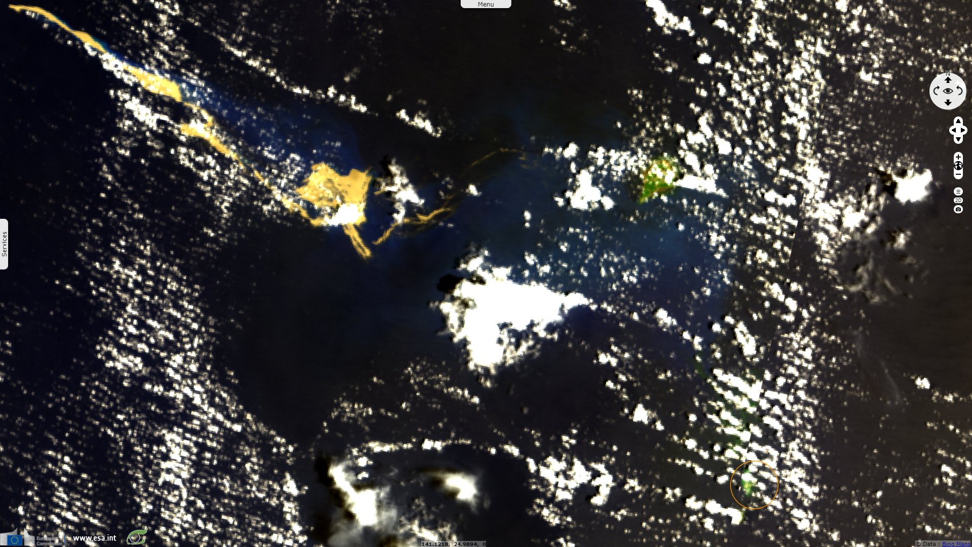
Landsat8 OLI-TIRS acquired on 17 August 2021 at 01:00:21 UTC
...
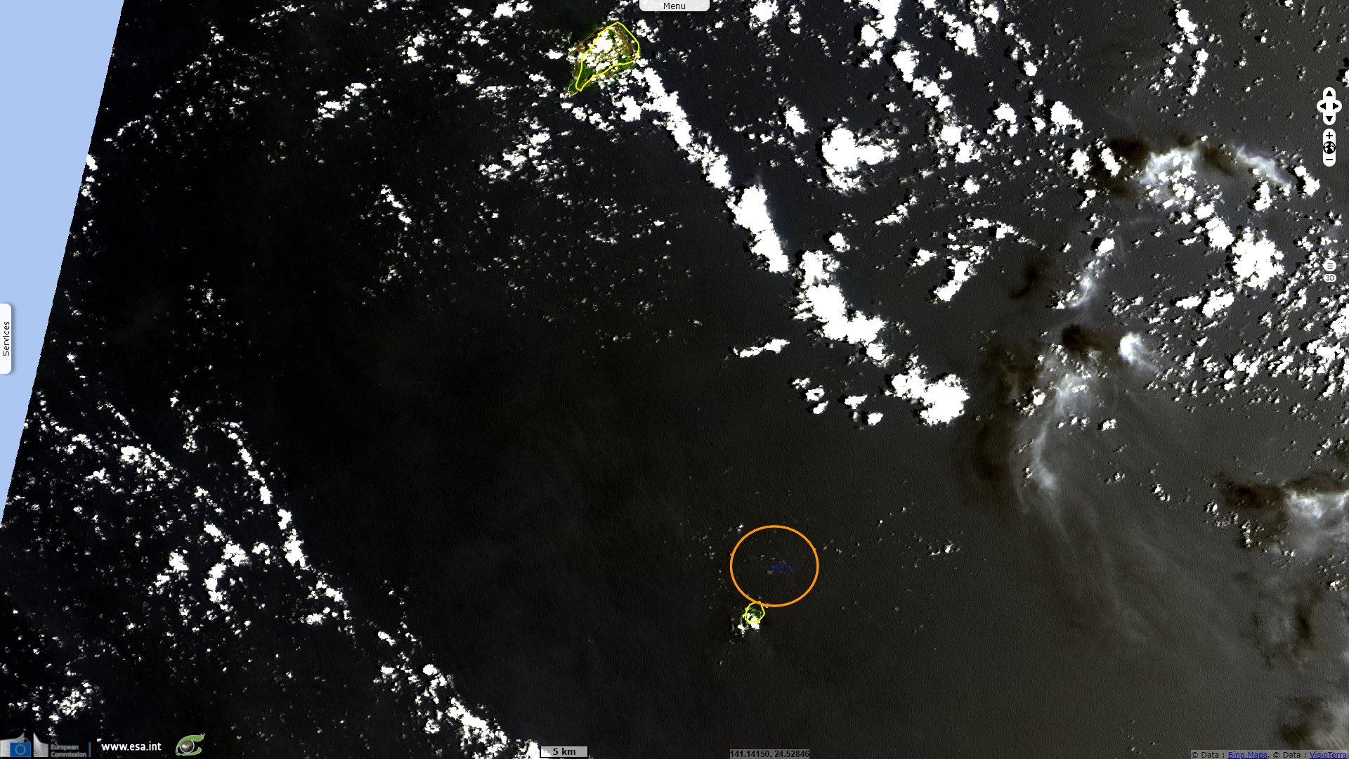
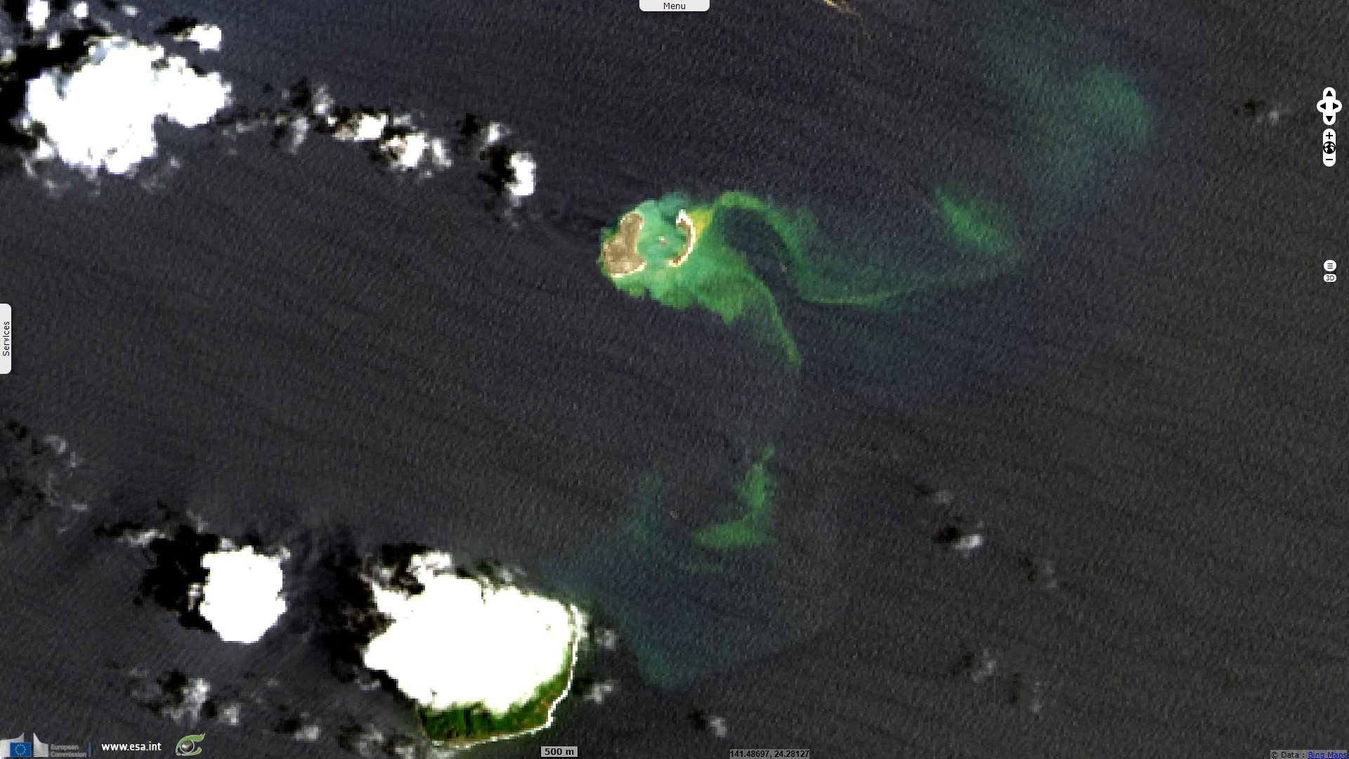
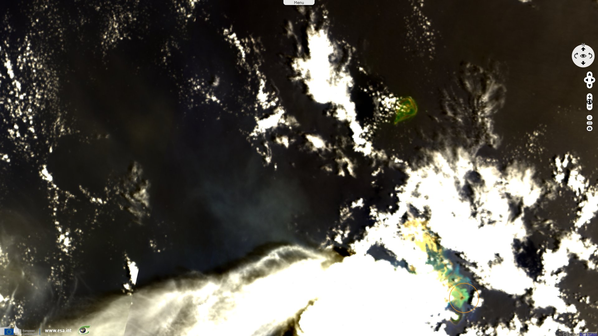
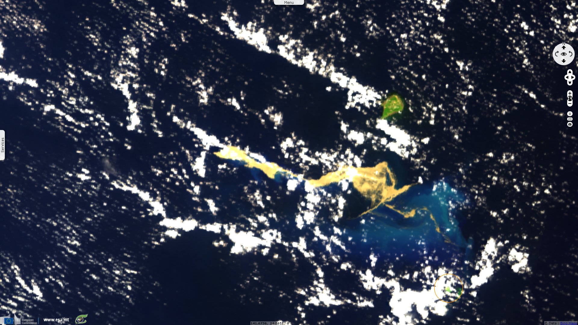
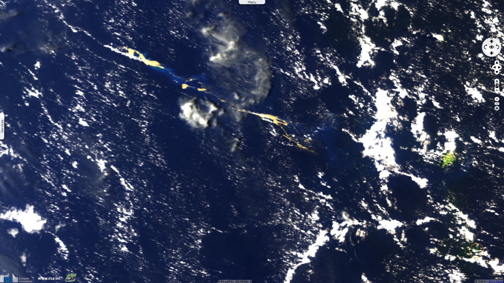
Sentinel-3 OLCI FR acquired on 23 August 2021 at 00:54:23 UTC
Sentinel-3 OLCI FR & SLSTR RBT acquired on 14 August 2021 at 00:48:46 UTC
Landsat8 OLI-TIRS acquired on 17 August 2021 at 01:00:21 UTC
...
Sentinel-3 OLCI FR acquired on 23 August 2021 at 00:54:23 UTC
Keyword(s): Island, volcanic arc, submarine eruption, water colour, bathymetry, Philippine Sea, Pacific Ring of Fire
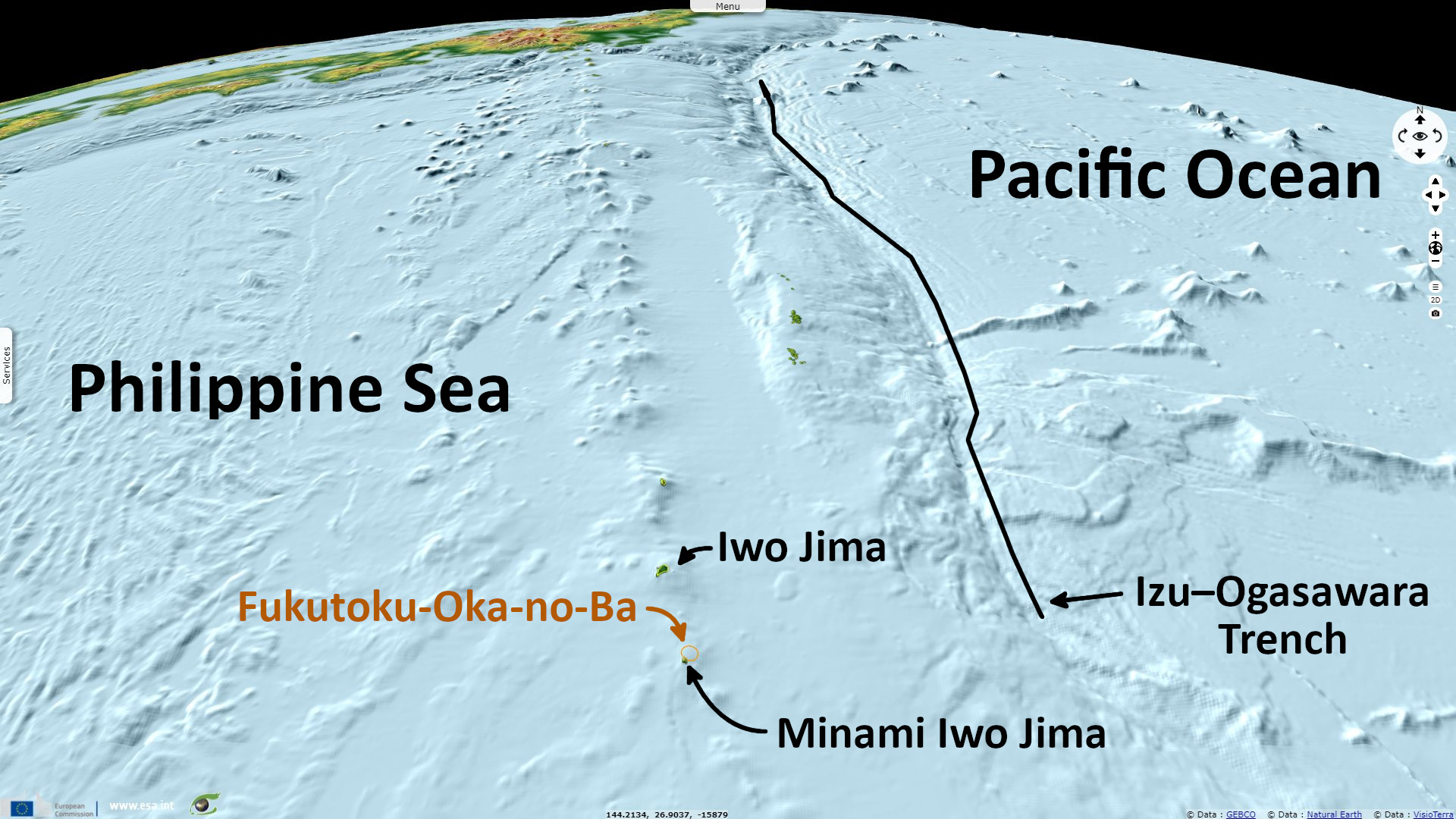
The Bonin and Volcano islands are the central portion of the Izu–Bonin–Mariana Arc, an island arc created by the subduction of the Pacific Plate under the Philippine Sea Plate that stretches 2800 km. They are bordered by the Izu–Ogasawara Trench which is 9780 metres at its deepest. The 'new' island, Fukutoku-Oka-no-Ba, is located between the sadly famed Iwo Jima (Sulphur Island), an inhabitated 20.60 km² island up to 166 metres high, and the much closer uninhabitated Minami Iwo Jima (South Sulphur Island) which is 3.54 km² large and 916 metres high.
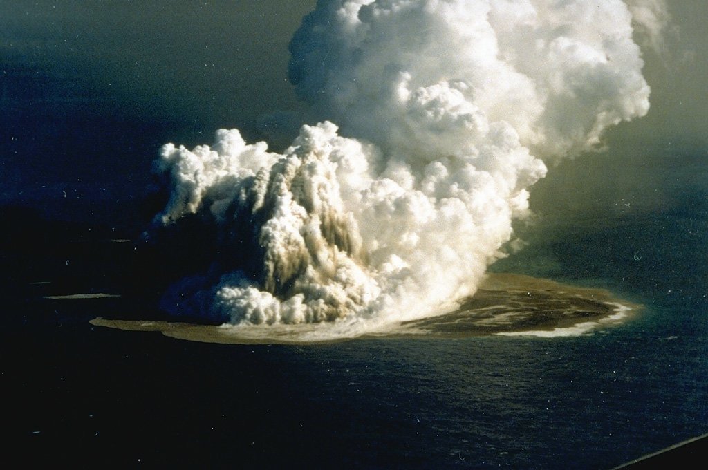
The Smithsonian Institution relayed an eruption had happened in this location: "Japan Meteorological Agency (JMA) reported that a large eruption at Fukutoku-Oka-no-Ba commenced around 06:20 on 13 August based on satellite data. Ash plumes rose as high as 16 km a.s.l. and drifted W. The eruption was also confirmed during an overflight later that day. Video showed Surtseyan explosions ejecting black material above the ocean’s surface, and ash plumes drifted W. Ash plumes identified in satellite images rose 12.2-16 km a.s.l. during 13-15 August; the height of the plume decreased afterwards though the eruption intermittently continued.
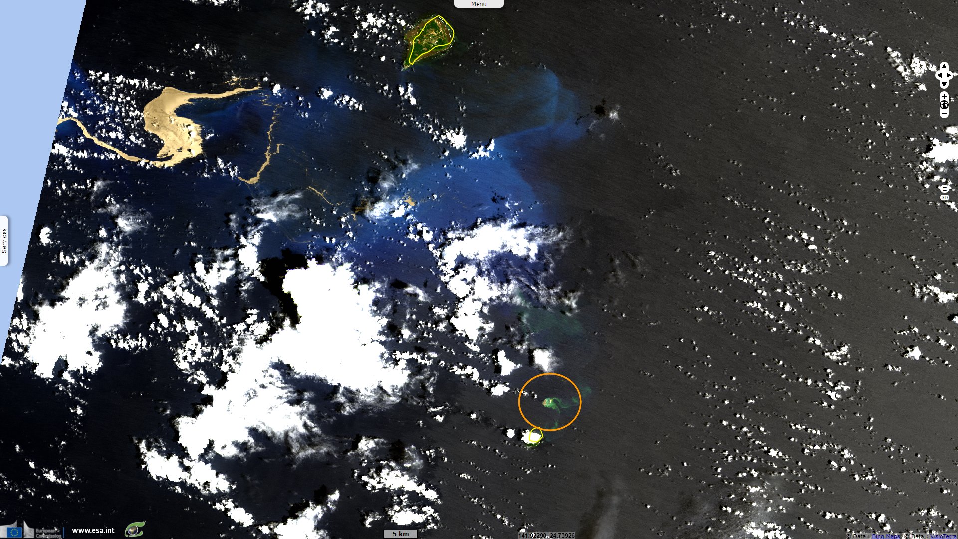
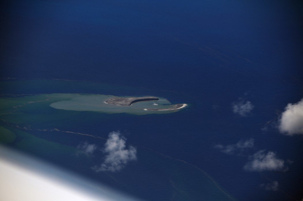
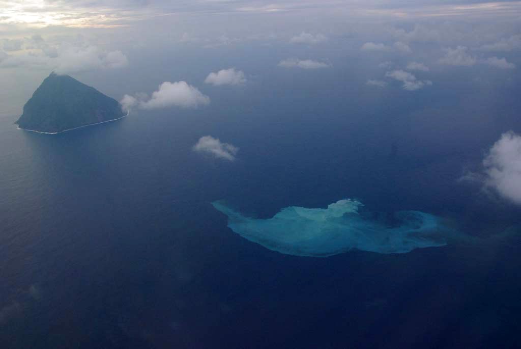
"The Japan Coast Guard observed a new horseshoe-shaped island that was about 1 km in diameter during an overflight on 15 August. They also observed and photographed a notable pumice raft swirling with the currents as far as 60 km NW. JMA noted that the volcano last erupted in 2010 and frequent episodes of discolored seawater had been observed since then."
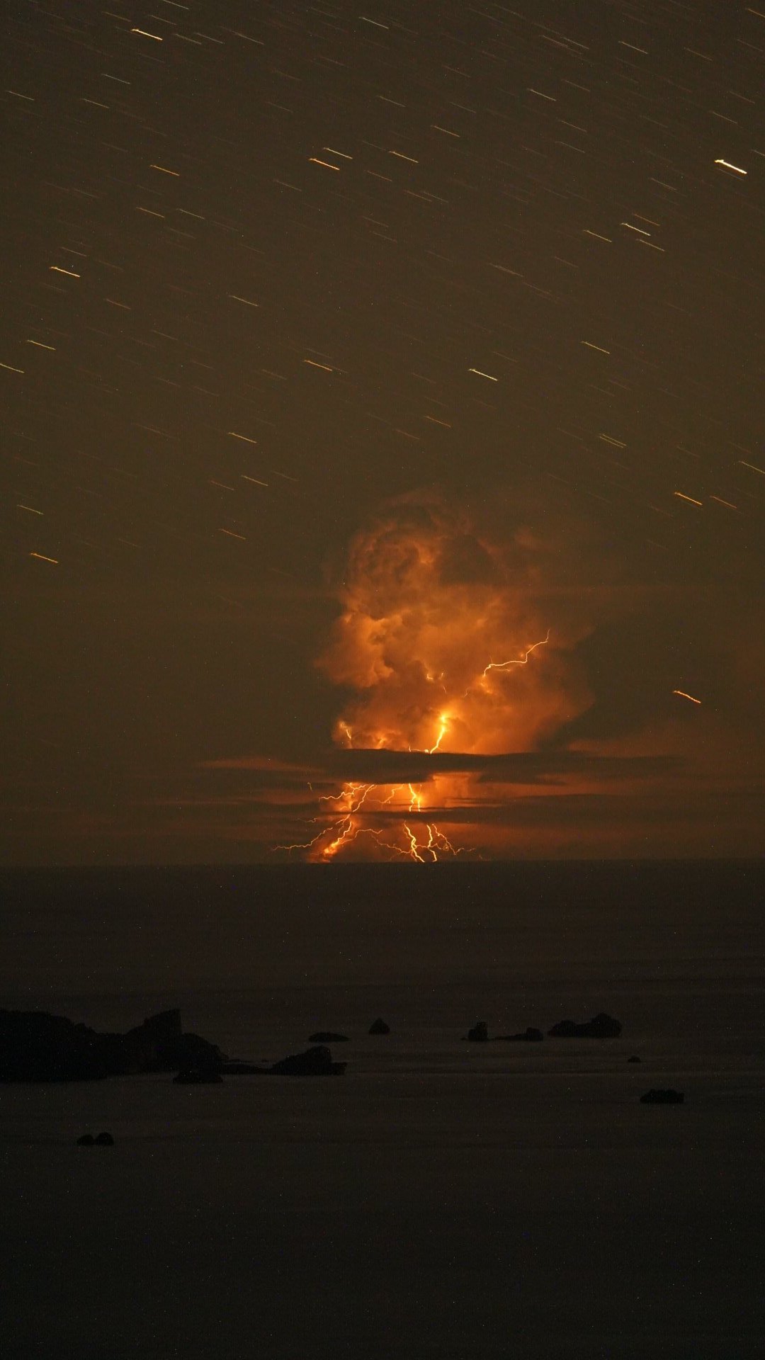
Left: Image of the eruption taken from Iwo Jima island on 13 August 2021 - Source
Right: Aerial image of the new island on 16 August 2021 - Source: Japan Coast Guard
The site volcanocafe.org dedicated to volcanoes analyzed deeply this event: "The submarine explosion had produced a tephra raft 60 km long, plus an ash cloud reaching 15 km high. Afterwards, it turned out the eruption had already been in progress for a few days before the explosion and had created new land – an island 1 kilometer across. The final explosion has created a large crater in this new island, and had reduced it to a rim."
"There have been several eruptions here in the past century. The ‘new’ island appeared after an eruption in 1905. Other confirmed eruptions occurred in 1914, 1973, 1974, 1986, 1987, 1992, 2005 and 2010. They were mostly small, at VEI 0-2. The 1904 and 1914 eruptions are classified as VEI 3, the same as the recent explosion. The 1986 eruption also created an island: the current incarnation is the third such island in 120 years. The islands do not last long: they tend to disappear under the waves within a month or so. The Pacific ocean, and in particular its cargo of typhoons, is not friendly to intruders. There are more reports of eruptions but they are unconfirmed, and they may be fumarole activity discolouring the sea water. This was seen several times in the decade after the 2010 eruption."
"Fukutoku-Oka-no-Ba, seen here in 1986, is a submarine volcano located 5 km NE of Minami-Ioto island. An eruption plume rising 3-4 km above Fukutoku-Oka-no-Ba was witnessed from fishing boats on 18 January 1986. A 4-km plume was detected by radar the following day. On 20 January a new island formed (seen here to the right of the eruption plume). The island reached maximum dimensions of 400 x 600 m, with a height of 15 m. Frequent strong explosions continued on 21 January, the day of this photo, and decreased in intensity that afternoon. Explosive activity ended by the next morning, and the island eroded below sea level by 8 March." - Source: Smithsonian Institution.
"Blue-white and greenish brown discolored seawater at Fukutoku-Oka-no-Ba on 19 January 2011. The source appears to be from multiple vents. The fan shape extends about 500 m NE of the vent source. Minami-Ioto is at the upper left." - Source: Japan Maritime Self Defense Force
"The culprit lies underneath the waters, save from the Pacific fury. Fukutoku-Oka-No-Ba is a highly active undersea volcano, which has a peak some 15 to 30 meters under water. The depth varies with each eruption, but it will always stabilize at the depth to which wave erosion can reach. Over time, the waves form a plateau at some 30 meters depth. The eruptions build on this plateau – but only temporary, until the sea reclaims its property."
"This is clearly an impressive volcano, and a very active one. It is not huge. The ocean here is deep, 2 kilometers or more, but the volcano is sitting on a larger plateau which rises far above the deep sea floor. The base of the volcano is around 400 to 500 meter deep, and around 5 km in diameter. We are talking about a 5 km wide, 500 meter tall volcano with a 1-km flat top and a 500-meter rift running from the centre. Without wave erosion, we can estimate that the top would have been about 100 meter above sea level."
"This happened in the Philippine sea plate 30 milion years ago: it formed the Parece Vela Basin in the south and a little latter the Shikoku Basin in the north. But the basins eventually ran out of magma and spreading here ceased 15 million years ago. So the process repeated, and around 7 million years ago the Mariana basin began to form, closer to the front. At the moment this basin is 1000 km long and 200 km wide; it is widening by 2 to 4 cm per year. Further north no new basin has formed (so far, at least). The Philippine sea plate has a bit of clockwise rotation, and it is pulling away a bit from the Pacific plate in the southern region. This has made the whole process faster in the south. The Mariana Trough has become so pronounced that it is sometimes considered as its own micro plate, and the adjoining trench, the world famous Mariana trench, now contains the deepest surface on Earth."
"The Philippine sea plate is a mosaic of ridges and basins. The ridges are (or were) volcanic arcs. They formed in the usual way: once the subducted plate reaches a certain depth it will begin to melt. The melt percolates up and forms a chain of volcanic islands, typically 50-200 km from the plate boundary. The basin forms adjacent to the trench, in between the volcanic arc and the plate boundary. Every time a basin forms, the volcanic chain begins to move away from the plate boundary and the volcanoes become extinct. This has happened to the Kyushu-Palau Ridge which became extinct 25 million years ago, and to the West Mariana Ridge 7 million years ago."
"A new volcanic arc will form, at first widening the existing arc and later as a separate arc. The spreading centre moves away from the subduction front as the crust stretches, and once it has moved far enough that the volcanic islands form between the spreading centre and the front, they can grow in one location. This can take a few million years. The Mariana Ridge has formed such a new volcanic arc. The Izu Bonin Ridge has not yet done so."
The views expressed herein can in no way be taken to reflect the official opinion of the European Space Agency or the European Union.
Contains modified Copernicus Sentinel data 2026, processed by VisioTerra.
Contains modified Copernicus Sentinel data 2026, processed by VisioTerra.
| More on European Commission space: |  |
 |
 |
||||
| More on ESA: | |
|
|
S-1 website | S-2 website | S-3 website | |
| More on Copernicus program: | |
|
|
Scihub portal | Cophub portal | Inthub portal | Colhub portal |
| More on VisioTerra: | |
|
|
Sentinel Vision Portal | Envisat+ERS portal | Swarm+GOCE portal | CryoSat portal |