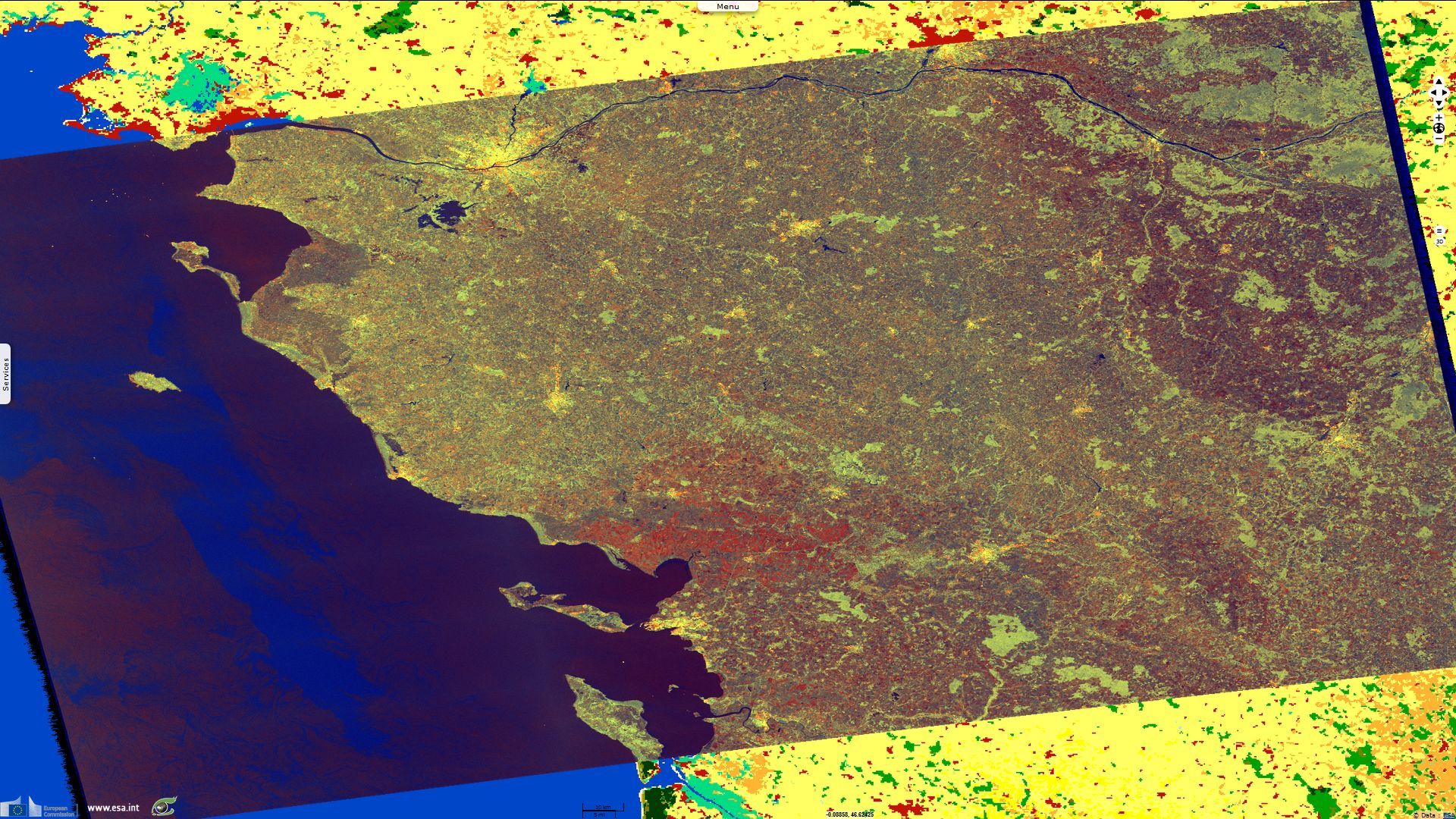
Poitevin marsh wetland
Sentinel-1 CSAR IW acquired on 12 March 2015 at 17:55:55 UTC
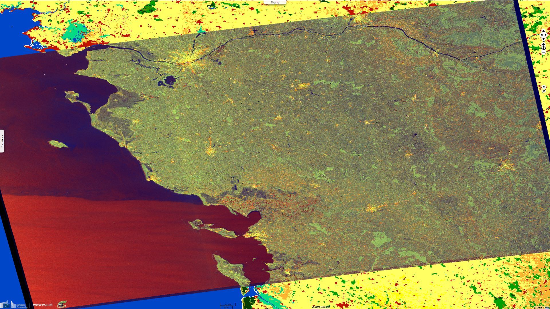
Sentinel-1 CSAR IW acquired on 30 January 2016 at 17:56:01 UTC
Sentinel-1 CSAR IW acquired on 30 January 2016 at 17:56:01 UTC
Keyword(s): land, coastal, flooding, wetland, marsh, Poitou, France
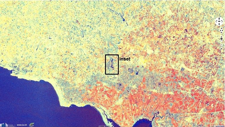
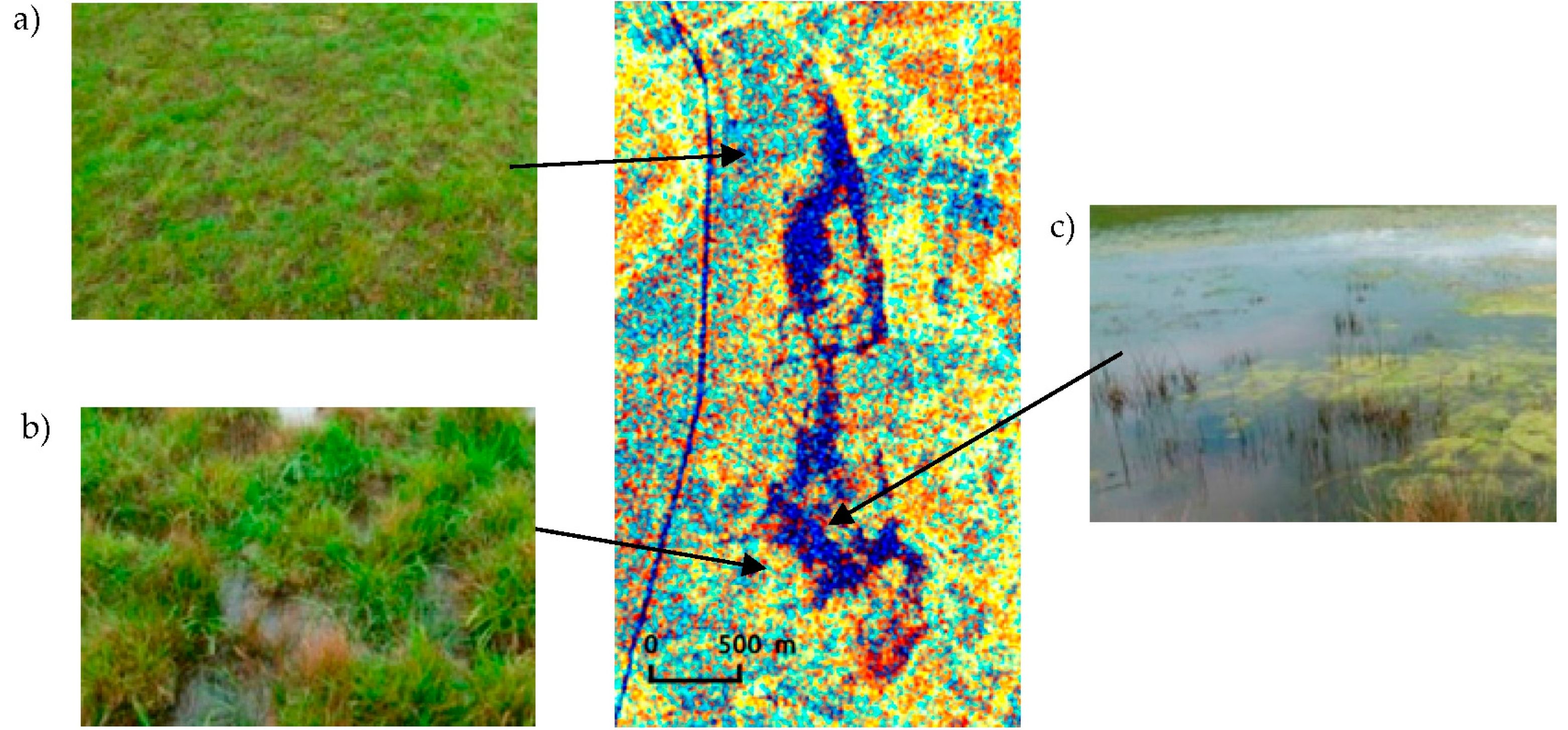
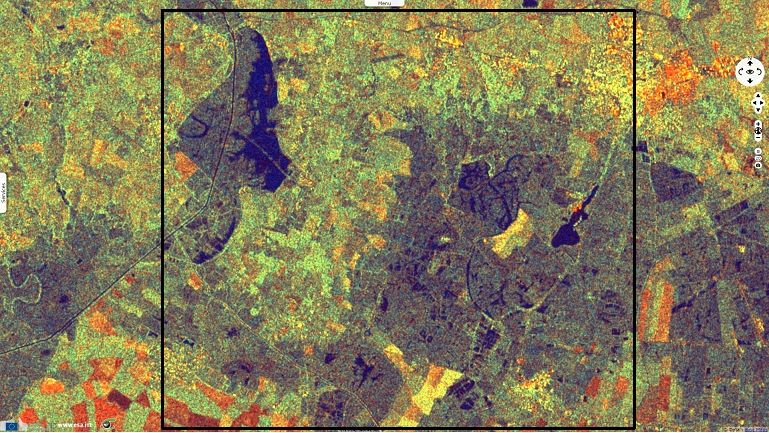
Cécile Cazals, researcher for l’Institut national de l’information géographique et forestière (IGN) in France described fig 2: “Three main tones are clearly visible: (a) cyan-dominated areas correspond to non-flooded grassland; (b) orange areas correspond to flooded vegetation; and (c) dark blue areas correspond to open water (see fig. 4).”
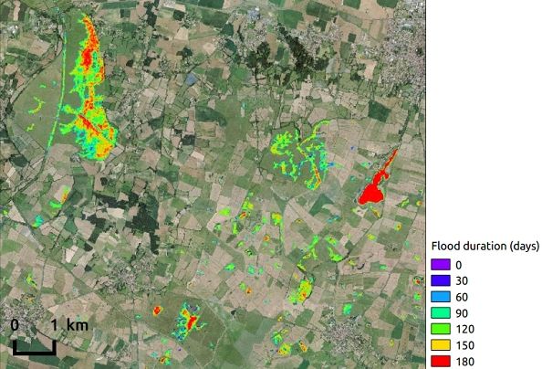
Cécile Cazals, commented: “In Europe, water levels in wetlands are widely controlled by environmental managers and farmers. However, the influence of these management practices on hydrodynamics and biodiversity remains poorly understood. Remote sensing appears to be an efficient way to monitor floods dynamics in natural environment.
Due to the specular reflexion of C-band radar wave occuring over water surfaces, all water bodies can be characterized (in dark blue in the images fig. 1 to fig. 5) by Sentinel-1. Its temporal resolution of 6 days allows an accurate flood dynamic monitoring, deriving several indicators like floods duration, drying period or spatial coverage of wetland. Theses indicators are essential to a better water levels management, improve our knowledge of wetland and preserve biodiversity expression.”
The views expressed herein can in no way be taken to reflect the official opinion of the European Space Agency or the European Union.
Contains modified Copernicus Sentinel data 2026, processed by VisioTerra.
Contains modified Copernicus Sentinel data 2026, processed by VisioTerra.
| More on European Commission space: |  |
 |
 |
||||
| More on ESA: | |
|
|
S-1 website | S-2 website | S-3 website | |
| More on Copernicus program: | |
|
|
Scihub portal | Cophub portal | Inthub portal | Colhub portal |
| More on VisioTerra: | |
|
|
Sentinel Vision Portal | Envisat+ERS portal | Swarm+GOCE portal | CryoSat portal |