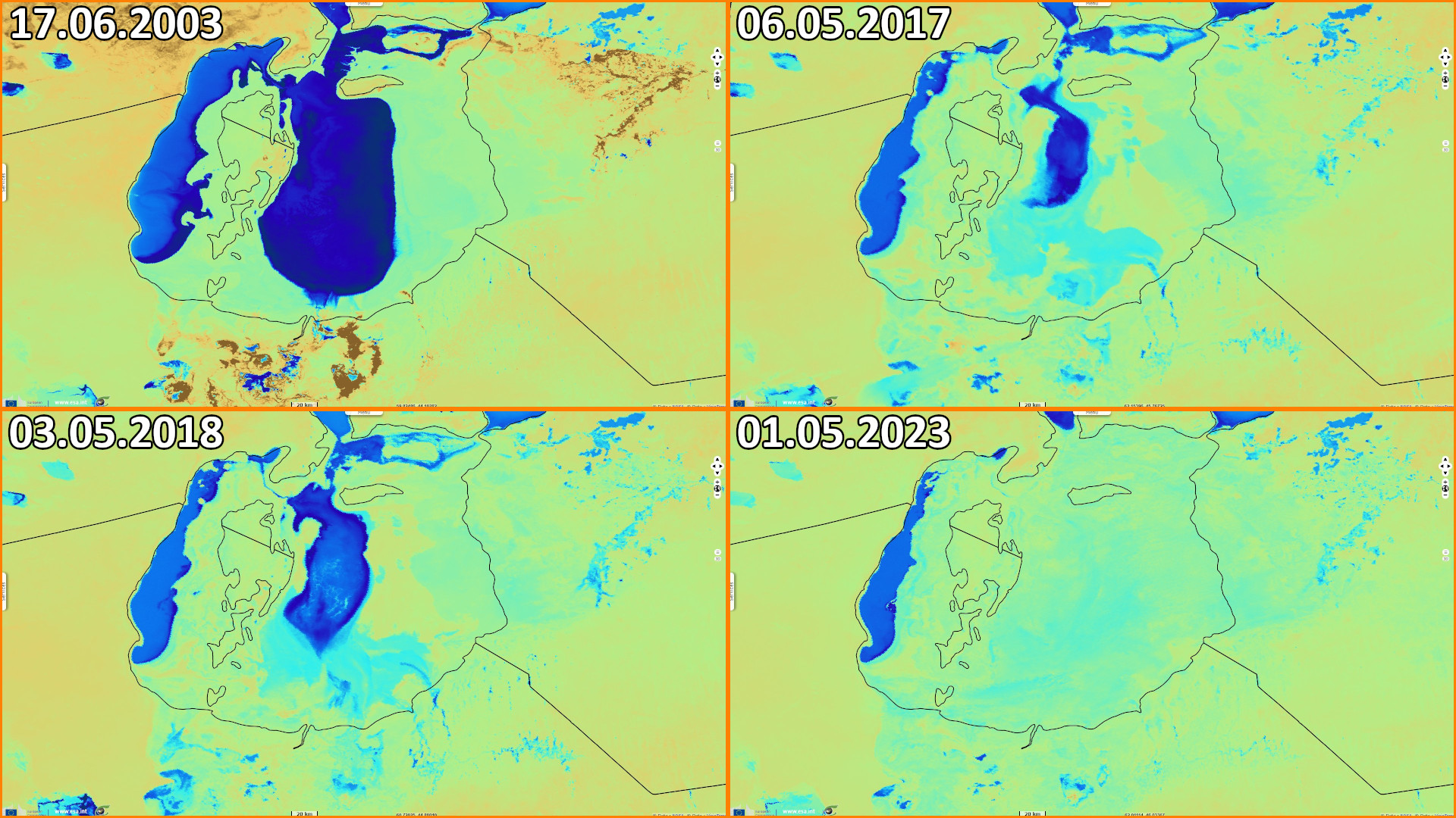
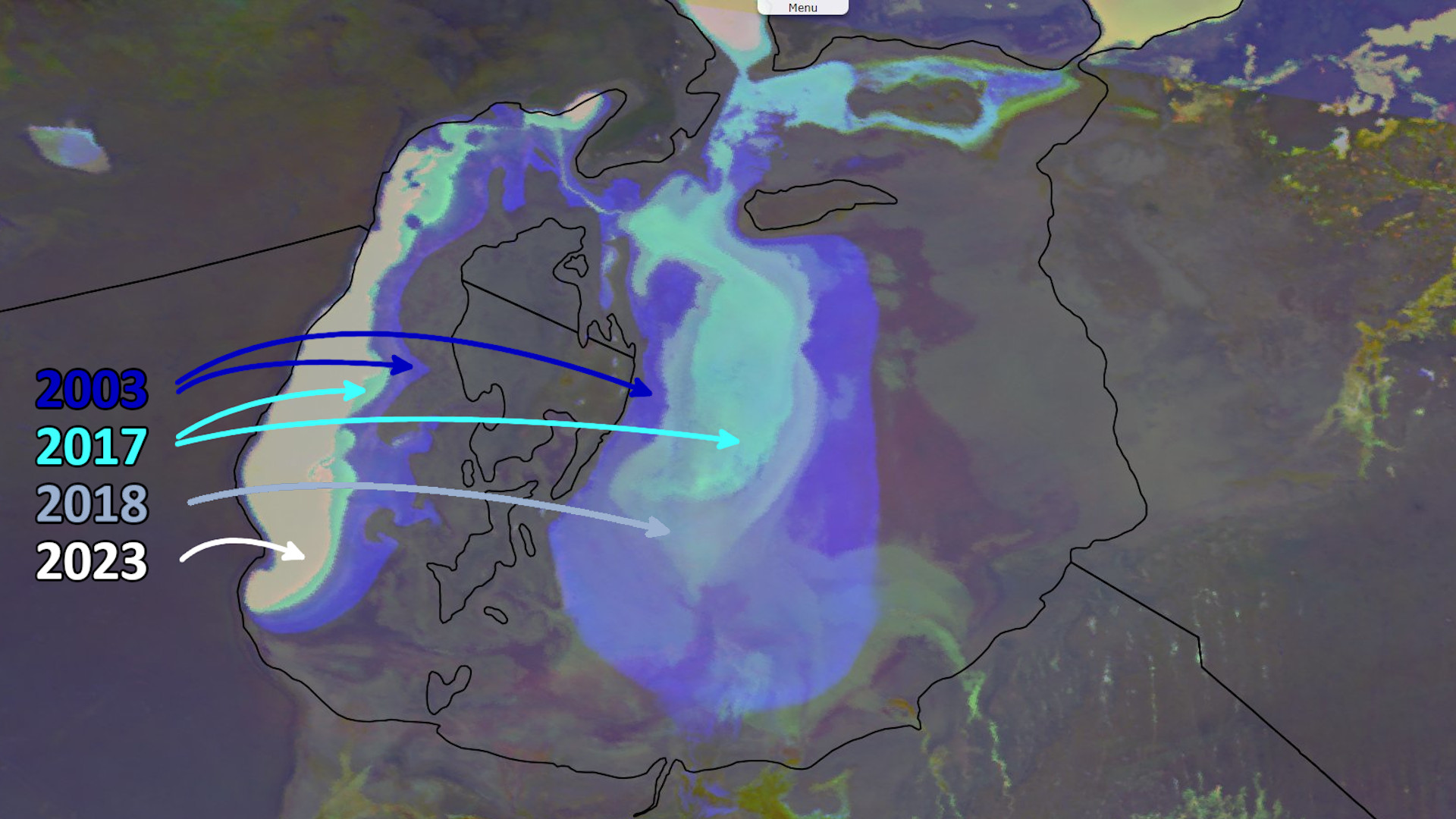
20 years of regression of the Aral Sea from ENVISAT MERIS to Sentinel-3 SLSTR
Sentinel-3 SLSTR RBT acquired on 06 May 2017 at 05:54:47 UTC
Sentinel-3 SLSTR RBT acquired on 03 May 2018 at 06:09:54 UTC
Sentinel-3 SLSTR RBT acquired on 01 May 2023 at 06:21:19 UTC
Sentinel-3 SLSTR RBT acquired on 03 May 2018 at 06:09:54 UTC
Sentinel-3 SLSTR RBT acquired on 01 May 2023 at 06:21:19 UTC
Keyword(s): Land, water, hydrology, irrigated agriculture, fishing, biodiversity, endorheic basin, soil degradation, desertification, Uzbekistan, Kazakhstan.
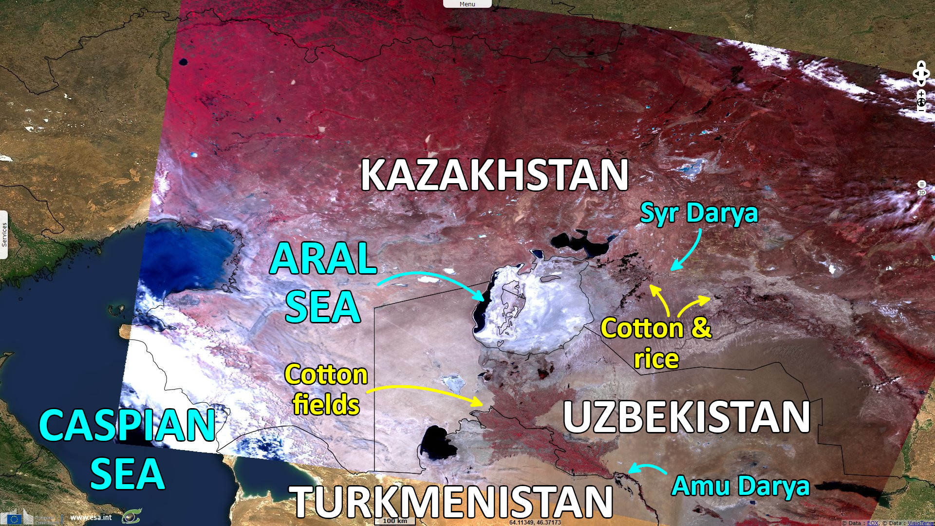
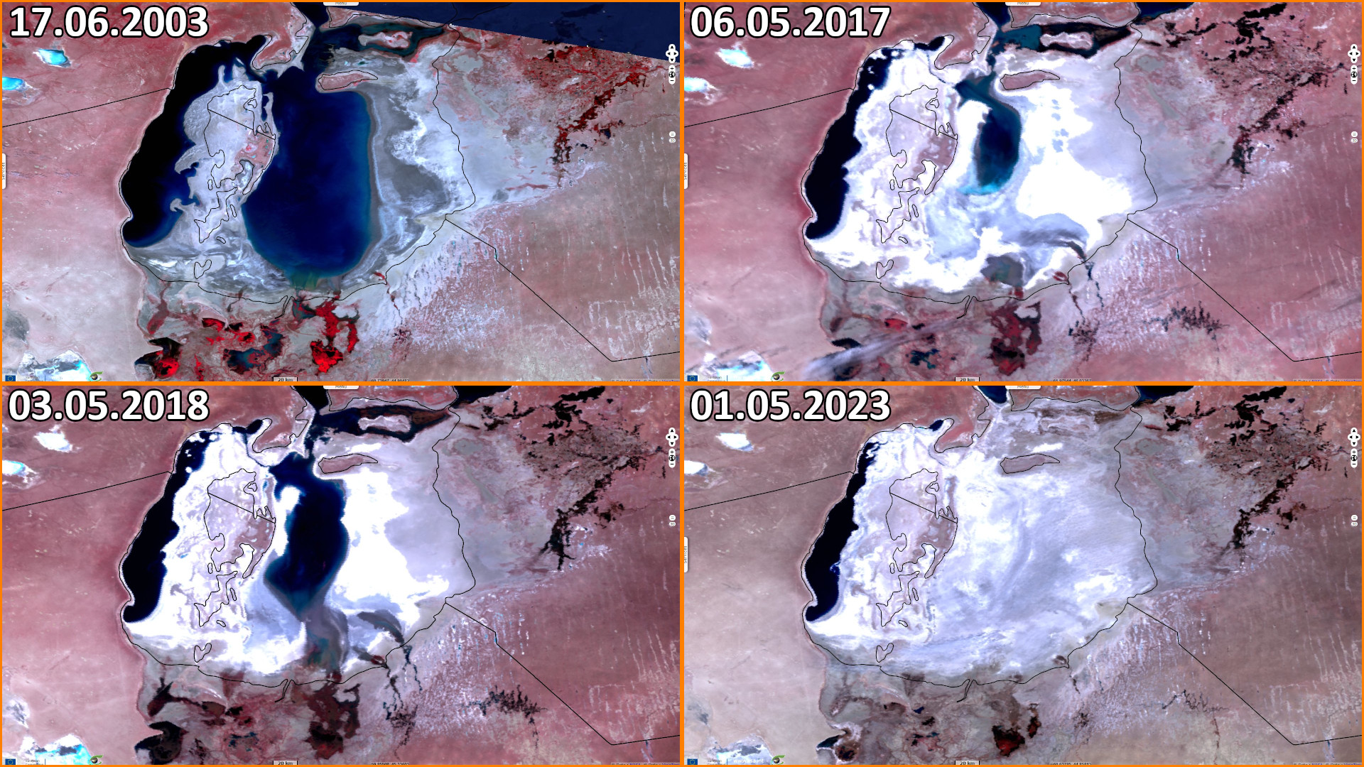
River inflows were diverted to produce water-hungry monocultures of cotton and rice crops, causing the depletion of the Aral Sea from 67 000 km² to 7000 km²
The enormous Soviet irrigation system was massively wasteful, crop rotation was not used, and huge quantities of pesticides and fertilizer were applied.
The runoff from the fields washed these chemicals into the shrinking sea. The increasing amount into smaller water created severe pollution and health problems. This desertification resulted in wind-borne toxic dust that spread quite widely. As wildlife disappeared, so did the fishing industry.
The views expressed herein can in no way be taken to reflect the official opinion of the European Space Agency or the European Union.
Contains modified Copernicus Sentinel data 2026, processed by VisioTerra.
Contains modified Copernicus Sentinel data 2026, processed by VisioTerra.
| More on European Commission space: |  |
 |
 |
||||
| More on ESA: | |
|
|
S-1 website | S-2 website | S-3 website | |
| More on Copernicus program: | |
|
|
Scihub portal | Cophub portal | Inthub portal | Colhub portal |
| More on VisioTerra: | |
|
|
Sentinel Vision Portal | Envisat+ERS portal | Swarm+GOCE portal | CryoSat portal |