Land cover in Palestinian territories
Sentinel-2 MSI acquired on 20 August 2015 at 08:20:06 UTC
Sentinel-2 MSI acquired on 18 October 2017 at 08:20:11 UTC
Sentinel-2 MSI acquired on 18 October 2017 at 08:20:11 UTC
Keyword(s): Land, urban, agriculture, frontiers, wall, refugees, Palestine, Israel, Jordan, Egypt
Yasser Arafat proclaimed Palestinian Declaration of Independence on 15 November 1988. It was recognized by the majority of the United Nations but some states did not, which of its neighbour Israel. As a result people of both nations still claim the same territory and live next to each other with a lot of tensions. It can partly be told by analyzing the landscape using remote sensing images.
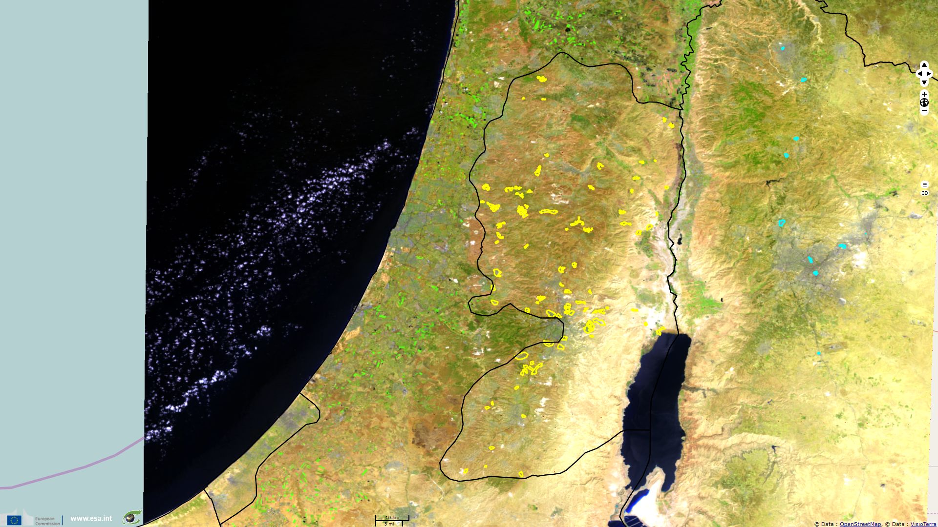
On this colour composite, sea appears dark blue, vegetated areas show in green, bare soils in yellow and cities in indigo. Some Israeli settlements have been outlined on this image, based on United Nations Office for the Coordination of Humanitarian Affairs (UN OCHA). Official Palestinian refugee camp in Jordan have been outlined in cyan based on United Nations Relief and Works Agency for Palestine Refugees (UNRWA).
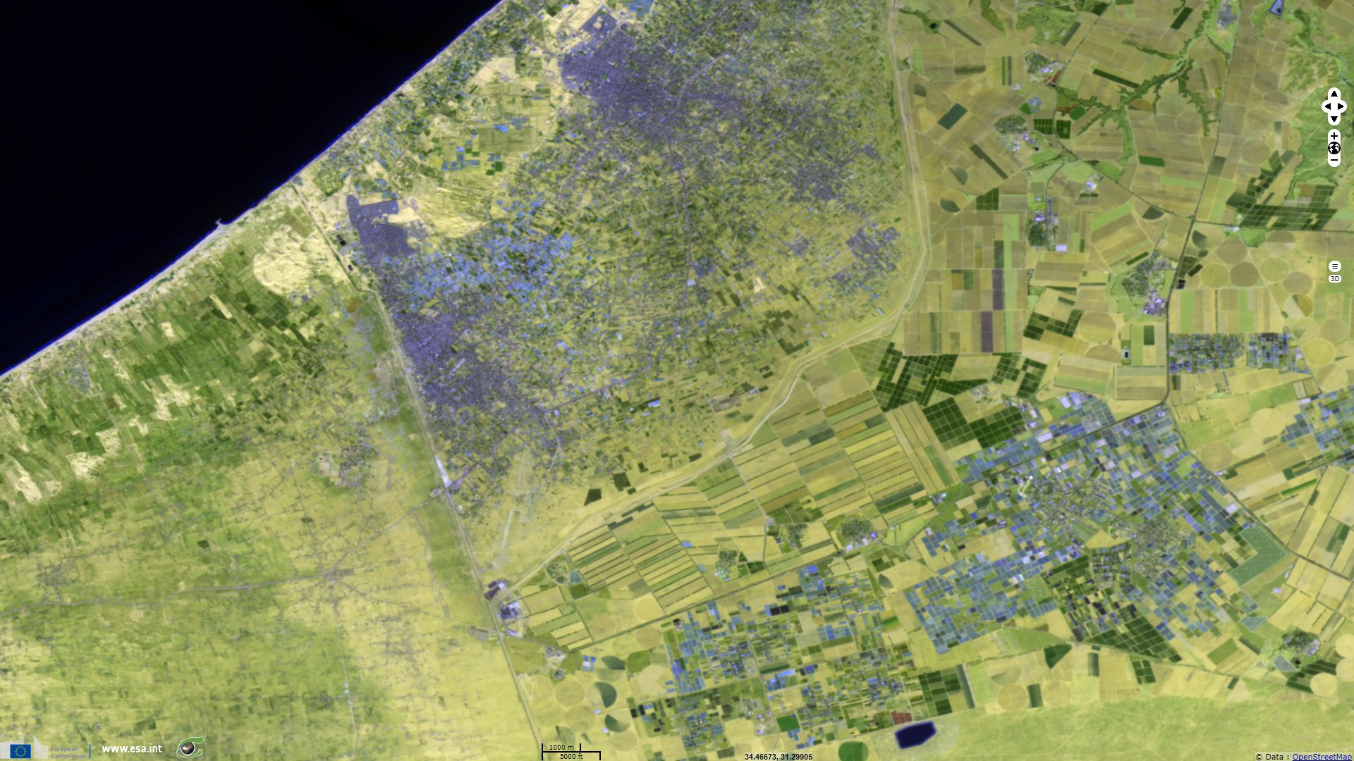
On this close up on the southern part of Gaza Strip, frontiers with Egypt (on a NNW-SSE axis) and with Israel (on a ENE-SWS axis) are clearly wisible. Water sensitive band 11 eases discriminating between bare sand (pale yellow) from cropland in geometric patterns shades of green. The Israeli side mostly encompasses large fields except at the south-east of the image where the Negev desert is left natural. On the Egyptian side, cropland are present along the coastline while at south one can see villages and sparce vegetation. Finally, Gaza Strip appears extremely urbanised, the cropland appears more dry than that of its neighbours.
This image shows a large difference in land cover and human density: Egyptian North Sinai gouvernorate counts 15 hab/km² which off less than 40% rural, Israeli Eshkol Regional Council counts 17 hab/km² (12800 inhabitants in 735.52 km²), while Gaza Strip density exceeds 5000 hab/km² with its population rising from 0.24 to 1.9 million between 1950 and 2017 according to the US census bureau.
UN OCHA estimates 2.97 millions Palestinians live the the West Bank. Fences separate Palestinian territories in several parts that can be crossed only through checkpoints. In 2017, 2/3 of the planned 710km barrier had been built, separating Israeli settlements from Palestinian cities. The difference in urban planning and architecture is easily seen using Sentinel-2 images. Furthermore, the barriers show in lighter colour linear features separating people of each side. UN OCHA wrote "587,000 Israeli settlers live in 150 settlements and 100 settlement outposts in the West Bank, including East Jerusalem, in contravention of international law". As shown in these images fast urbanisation undergoes on both sides of the fences, partly due to fast population growth.
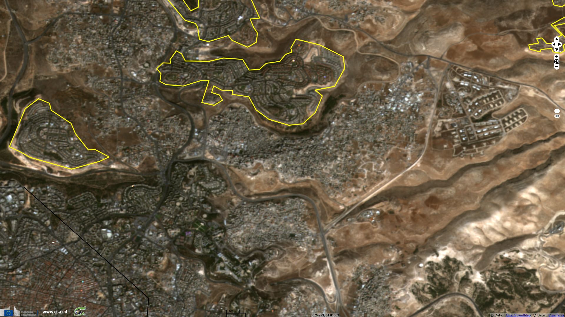
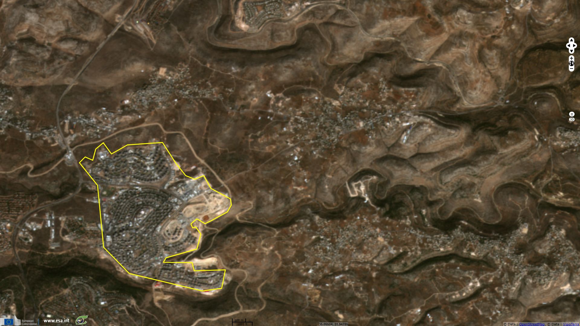
Accoding to the CIA factbook, "approximately 201,200 Israeli settlers live in East Jerusalem (2014)". They are separated from Palestinian by a barrier that isolates some Palestinian cities and villages from the rest of the Palestinian territories.

Barriers around East-Jerusalem, from the 2007 United Nations report, the Humanitarian Impact on the West Bank Barrier on Palestinian Communities
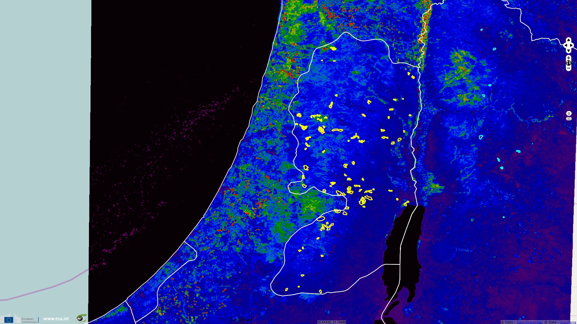
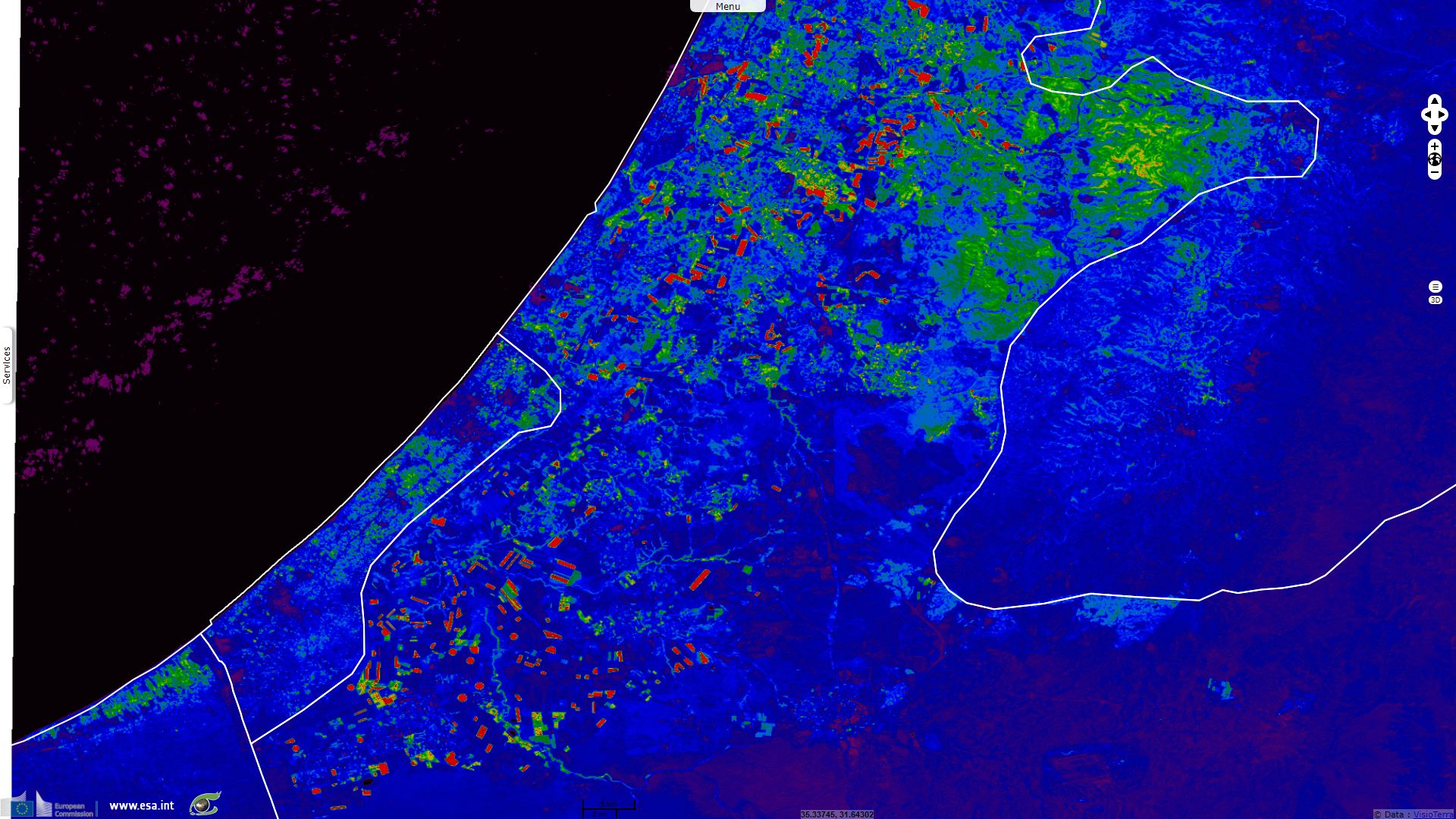
People living in the Palestinian territories lack the productive cropland of their Egyptian, Jordanian and even further, of their Israelian neighbours as shown by the lower NDVI values on this Sentinel-2 image on which a rainbow colour map was applied.
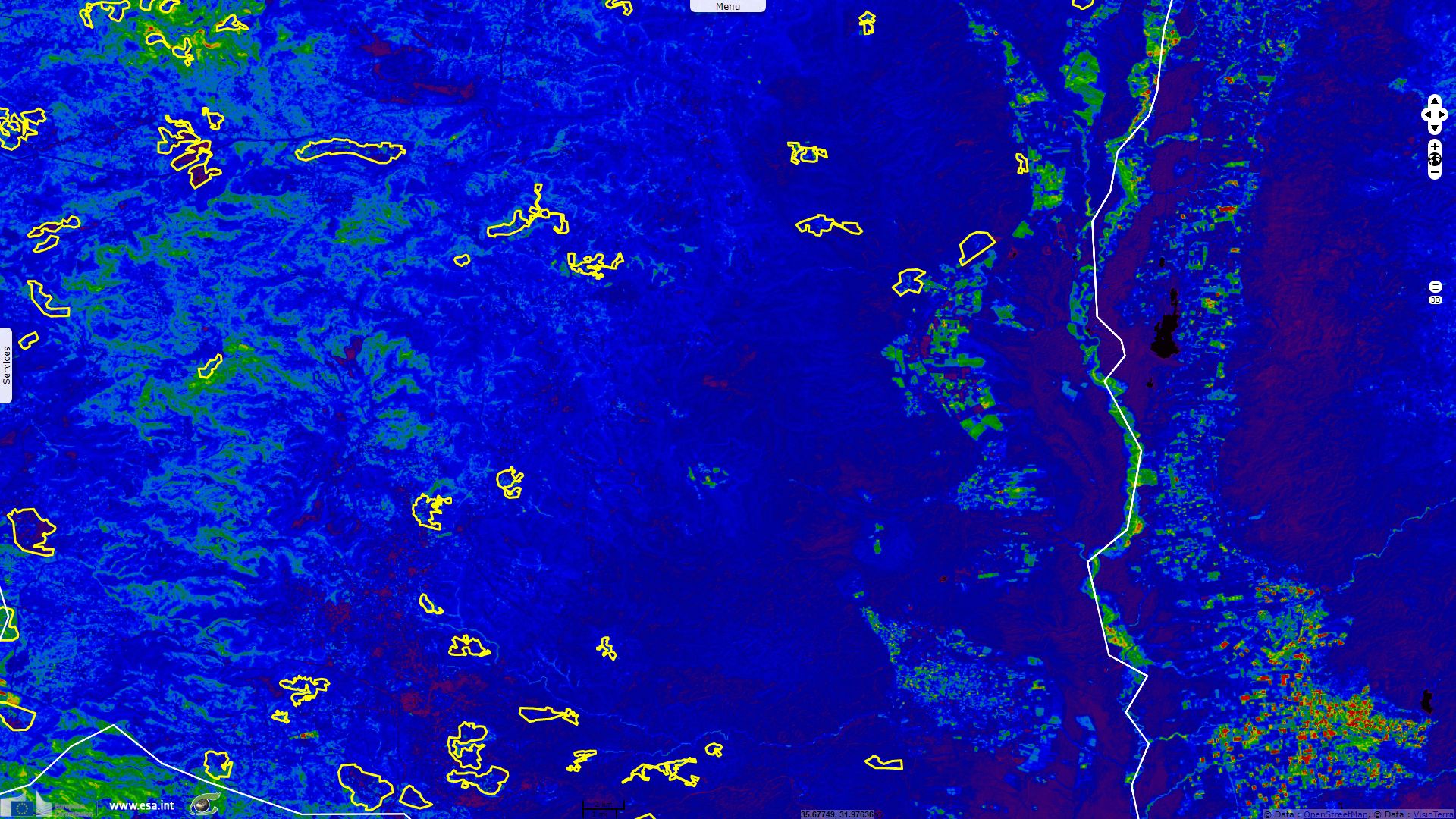
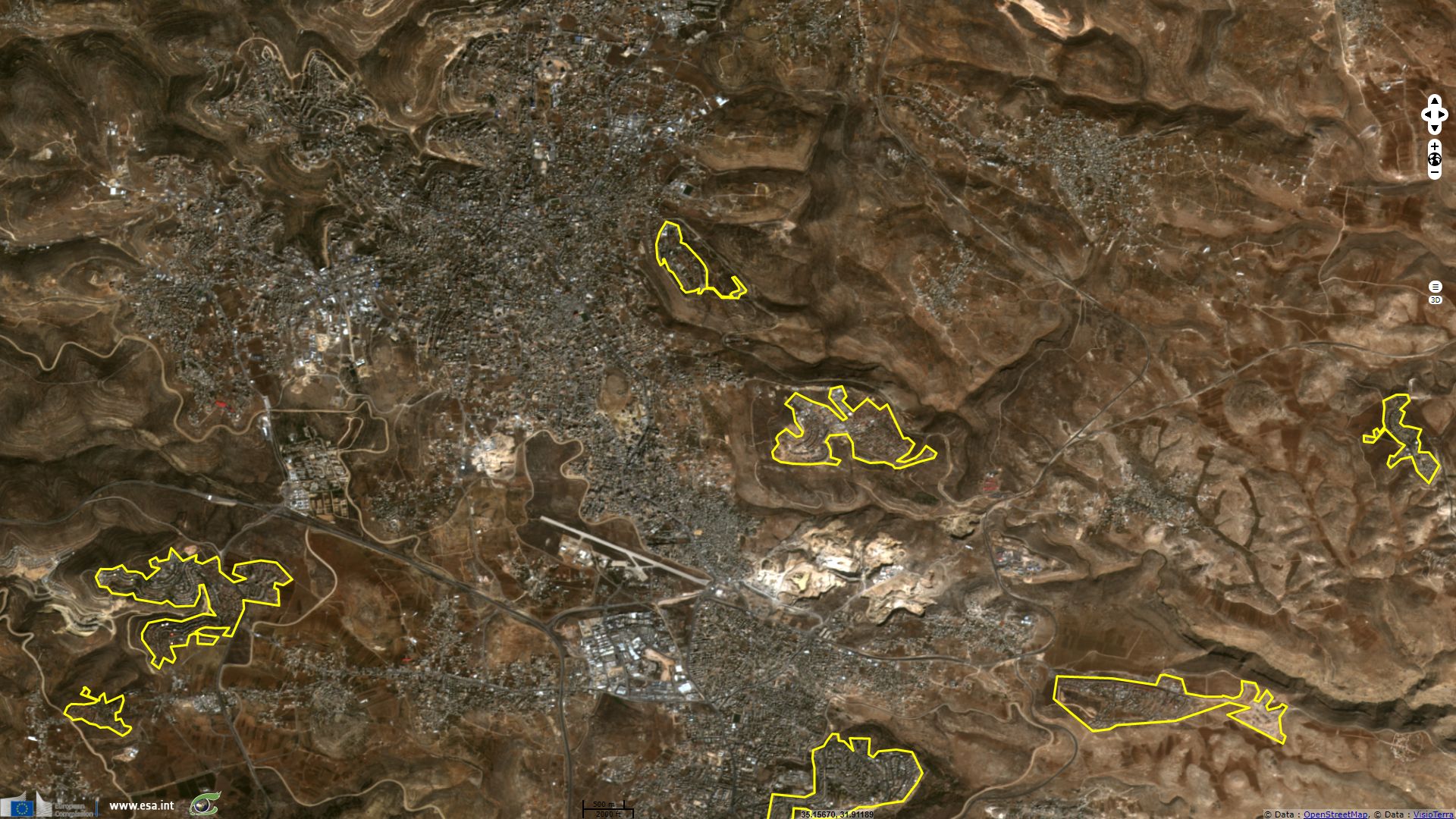
On this image showing NDVI index using a rainbow colour table, roads show as dark linear features, river beds as lighter linear features, cities and villages as violet patches. Cities and villages that are contoured are some of the Israelian settlements in West Bank.
UNRWA estimates there are "2,175,491 registered Palestine refugees" in Jordan, adding "Most Palestine refugees in Jordan, but not all, have full citizenship. There are ten recognized Palestine refugee camps throughout the country, which accommodate nearly 370,000 Palestine refugees, or 18 per cent of the country total. Jordan hosts the largest number of Palestine refugees of all of the UNWRA fields.
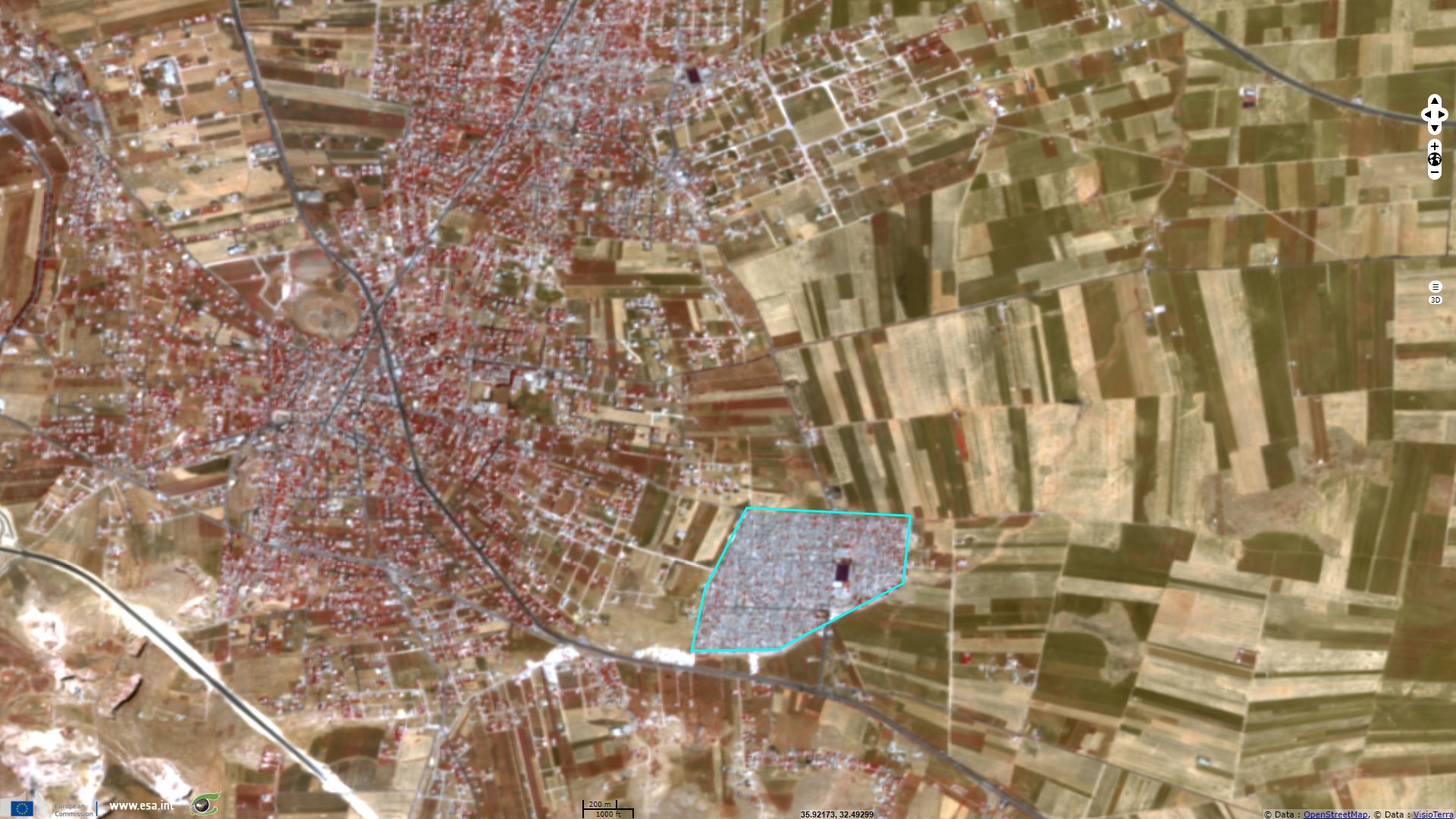
Nearly ten thousand Palestine refugees from Syria (PRS) have sought assistance from UNRWA in Jordan. The majority of them are believed to suffer from abject poverty and live in a precarious legal status. UNRWA is working to accommodate PRS children in its schools and to provide relief and health care to those in need." Based the statistics given in this UNRWA report, one can estimate the average population density within the ten official refugee camp between 60000 and 65000 hab/km². Al Husn city lies 80 km north of Amman, it hosts 33000 inhabitants plus 51000 refugees. UNWRA describes this camp as: "Husn camp, known locally as Martyr Azmi el-Mufti camp, was one of the six "emergency" camps set up in 1968 for 12,500 Palestine refugees and displaced people who left the West Bank and Gaza Strip as a result of the 1967 Arab-Israeli war. The inhabitants were initially accommodated in tents, in an area of 0.77 square kilometres. UNRWA originally planned to provide stronger tents to withstand the harsh winters, but between 1969 and 1971 built 2,990 prefabricated shelters instead. Over the years, many of the refugees have replaced these with more durable structures.". This images brings into light the urban organisation within this camp and the very high population density as this camp alone hosts half more population than the rest of the city. It is also materialized by the lack of vegetation (which shows in red) compared to Al Husn urban centre.
Nearly ten thousand Palestine refugees from Syria (PRS) have sought assistance from UNRWA in Jordan. The majority of them are believed to suffer from abject poverty and live in a precarious legal status. UNRWA is working to accommodate PRS children in its schools and to provide relief and health care to those in need." Based the statistics given in this UNRWA report, one can estimate the average population density within the ten official refugee camp between 60000 and 65000 hab/km². Al Husn city lies 80 km north of Amman, it hosts 33000 inhabitants plus 51000 refugees. UNWRA describes this camp as: "Husn camp, known locally as Martyr Azmi el-Mufti camp, was one of the six "emergency" camps set up in 1968 for 12,500 Palestine refugees and displaced people who left the West Bank and Gaza Strip as a result of the 1967 Arab-Israeli war. The inhabitants were initially accommodated in tents, in an area of 0.77 square kilometres. UNRWA originally planned to provide stronger tents to withstand the harsh winters, but between 1969 and 1971 built 2,990 prefabricated shelters instead. Over the years, many of the refugees have replaced these with more durable structures.". This images brings into light the urban organisation within this camp and the very high population density as this camp alone hosts half more population than the rest of the city. It is also materialized by the lack of vegetation (which shows in red) compared to Al Husn urban centre.
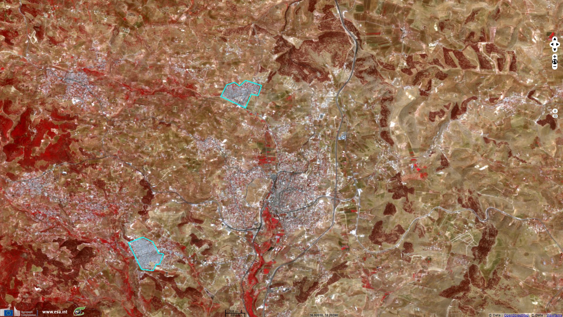
50km north of Amman, Jerash and its population of 51000 inhabitants hosts two refugee camps: Souf camp (around 31000 inhabitants) and Jerash camp (around 58000 inhabitants). Of the first, writes: "Souf camp was one of the six "emergency" camps set up for Palestine refugees and displaced people who left the West Bank and Gaza Strip during the 1967 Arab-Israeli war. The camp covers an area of 0.5 square kilometres and is near the famous Roman ruins of Jerash, 50km north of Amman.
The camp was abandoned in October 1967 because of the harsh weather conditions and heavy rainfall, and its inhabitants were accommodated in a tented camp in the Jordan valley. This temporary camp was abandoned in 1968 after an escalation in military operations in the area, and the refugees and displaced persons returned to Souf. UNRWA's plans for providing more durable tents to withstand the harsh winters were dropped in favour of constructing 1,650 prefabricated shelters.".
Of Jerash camp, located South-East of Jerash, UNRWA gives the following description: "Jerash camp was set up as an "emergency" camp in 1968 for 11,500 Palestine refugees and displaced persons who left the Gaza Strip as a result of the 1967 Arab-Israeli war. It is known locally as Gaza camp. The camp covers an area of 0.75 square kilometres and is situated 5km from the famous Roman ruins of Jerash. After 1967 UNRWA quickly set up facilities for food aid, sanitation, health services and education.
In order to withstand the harsh winters, the original 1,500 tents were replaced with prefabricated shelters. Between 1968 and 1971, 2,000 shelters were built with support from emergency donations. Over the years, many of the camp’s inhabitants have replaced the prefabs with more durable concrete shelters.". Until Palestine and Israel agree on their fate, there is little chance these two million refugees can leave these camps.
In order to withstand the harsh winters, the original 1,500 tents were replaced with prefabricated shelters. Between 1968 and 1971, 2,000 shelters were built with support from emergency donations. Over the years, many of the camp’s inhabitants have replaced the prefabs with more durable concrete shelters.". Until Palestine and Israel agree on their fate, there is little chance these two million refugees can leave these camps.
The views expressed herein can in no way be taken to reflect the official opinion of the European Space Agency or the European Union.
Contains modified Copernicus Sentinel data 2026, processed by VisioTerra.
Contains modified Copernicus Sentinel data 2026, processed by VisioTerra.
| More on European Commission space: |  |
 |
 |
||||
| More on ESA: | |
|
|
S-1 website | S-2 website | S-3 website | |
| More on Copernicus program: | |
|
|
Scihub portal | Cophub portal | Inthub portal | Colhub portal |
| More on VisioTerra: | |
|
|
Sentinel Vision Portal | Envisat+ERS portal | Swarm+GOCE portal | CryoSat portal |