Record-breaking wildfires devastate USA Pacific Coast
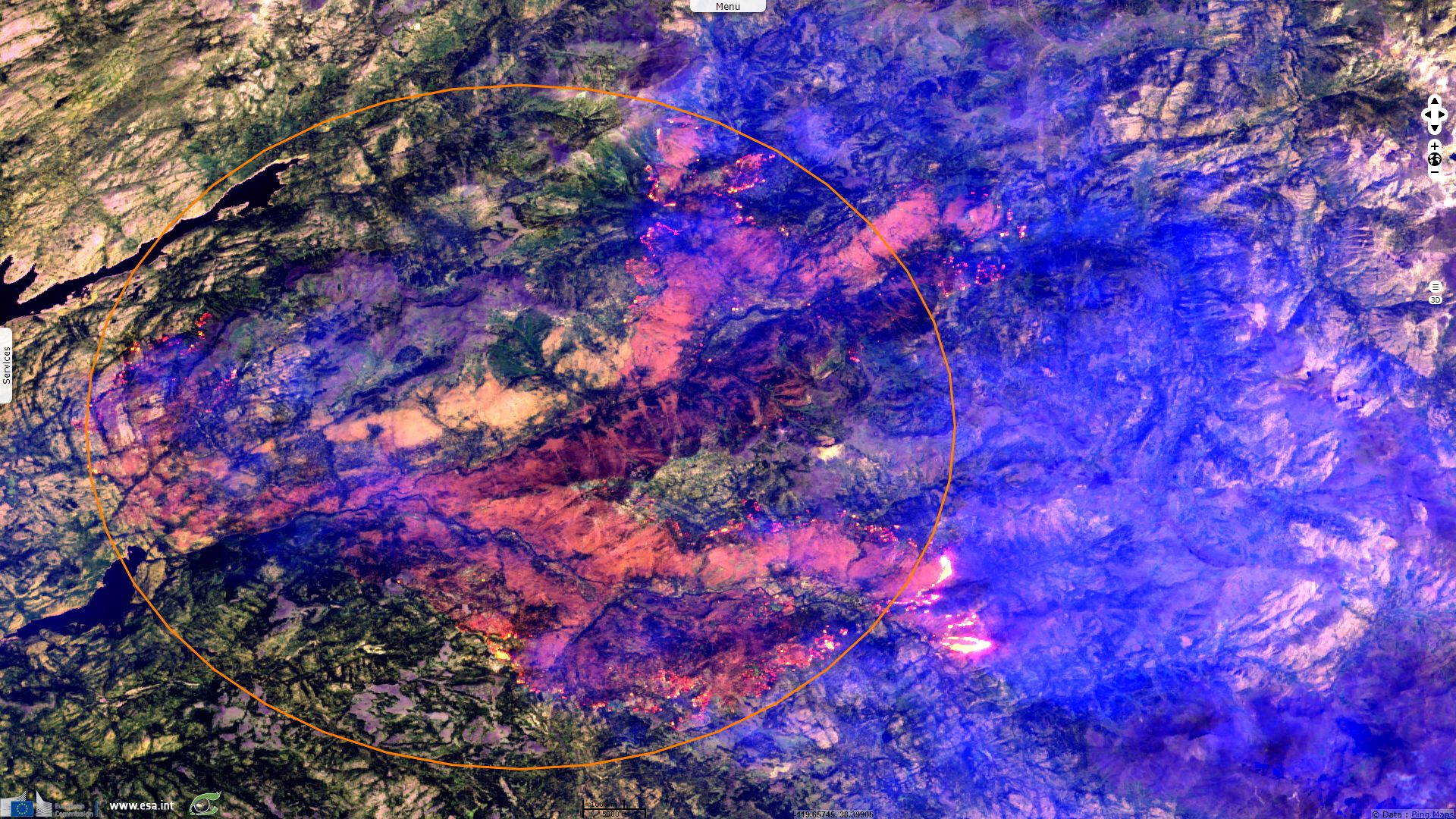
Sentinel-3 OLCI FR acquired on 03 July 2018 from 18:15:22 to 18:18:22 UTC
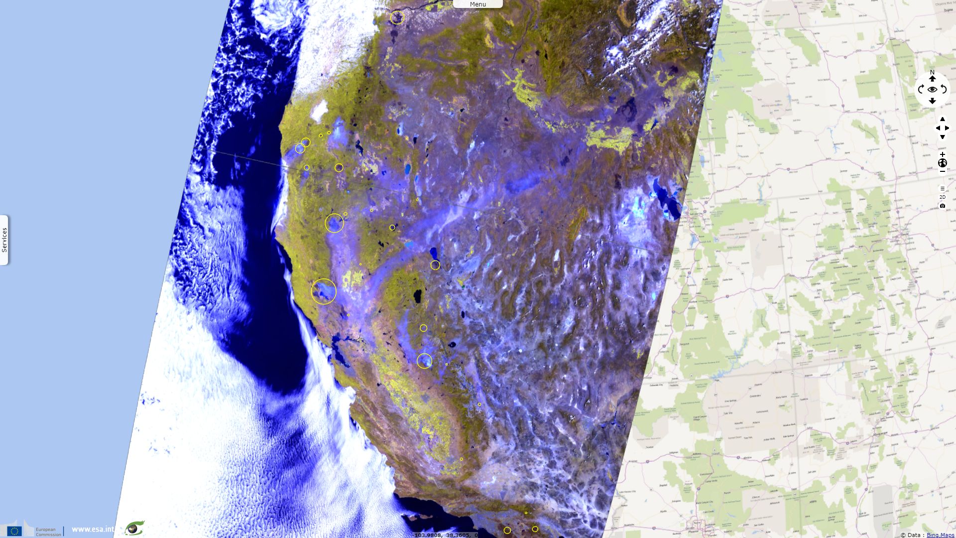
Sentinel-2 MSI acquired on 09 July 2018 at 18:50:19 UTC
...
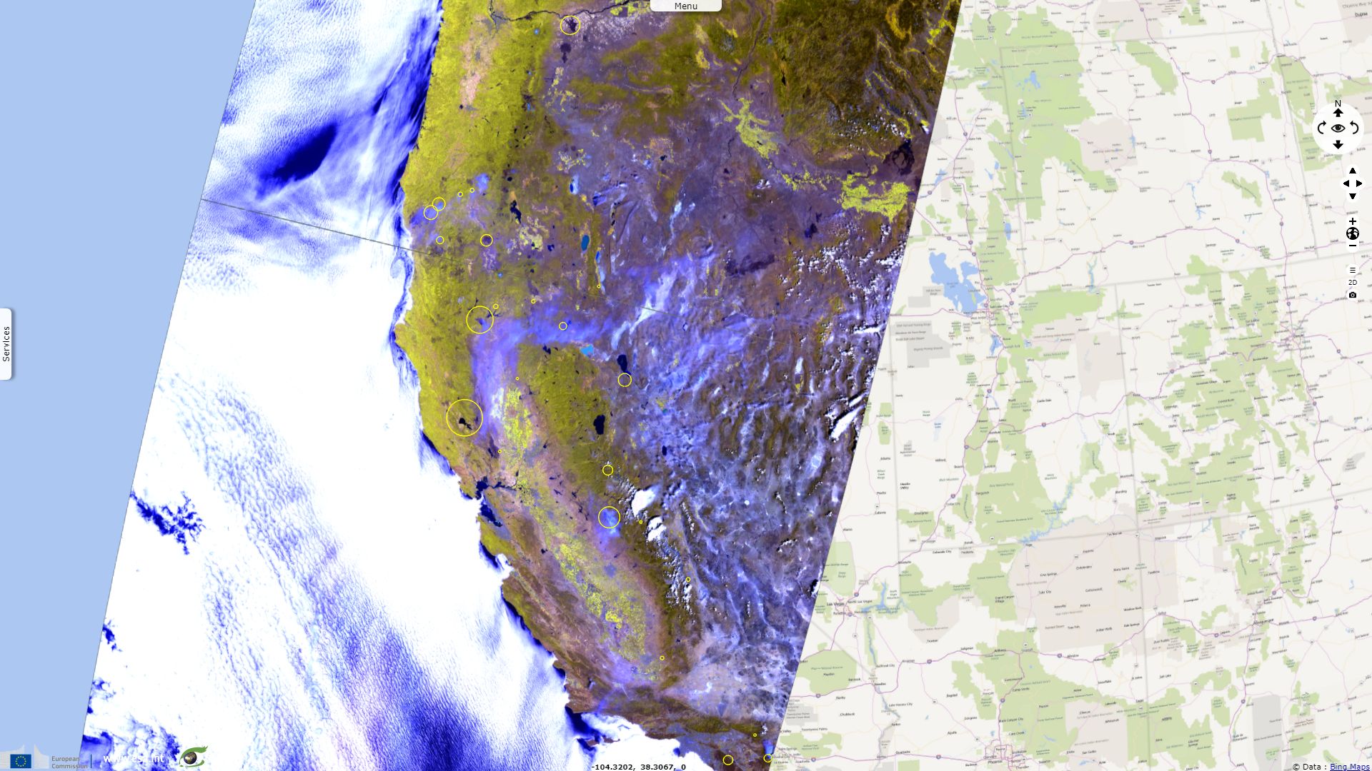
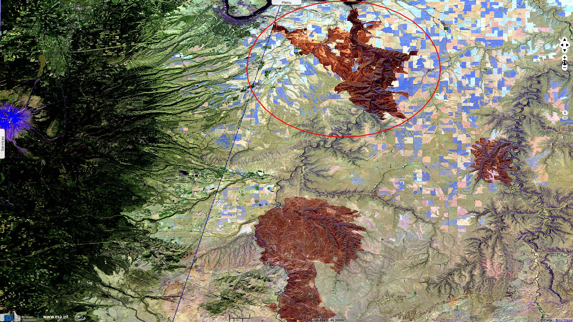
Sentinel-3 OLCI FR acquired on 11 August 2018 from 18:01:09 to 18:07:09 UTC
Sentinel-2 MSI acquired on 13 August 2018 at 18:49:21 UTC
Sentinel-2 MSI acquired on 09 July 2018 at 18:50:19 UTC
...
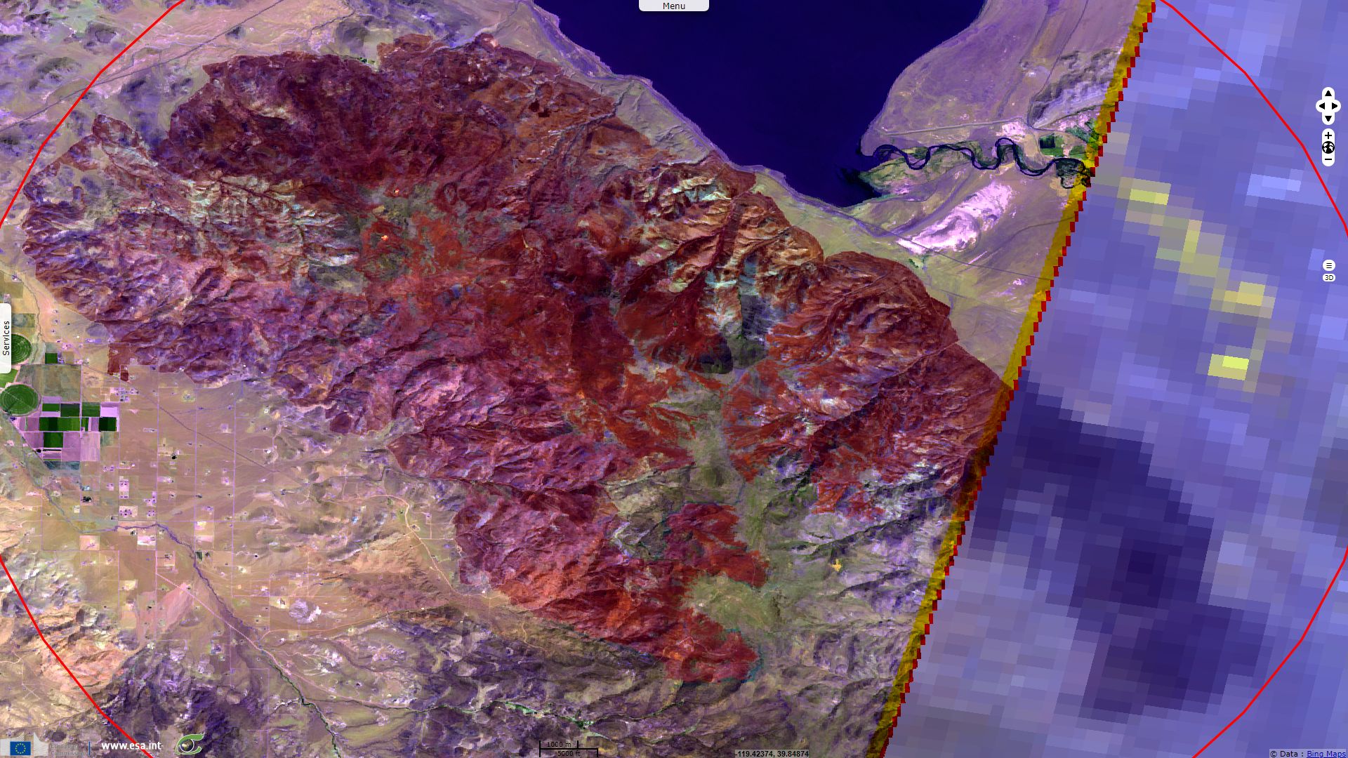
Sentinel-3 OLCI FR acquired on 11 August 2018 from 18:01:09 to 18:07:09 UTC
Sentinel-2 MSI acquired on 13 August 2018 at 18:49:21 UTC
Keyword(s): Land, disaster monitoring, emergency, forestry, atmosphere, climate, National Park, California, United States
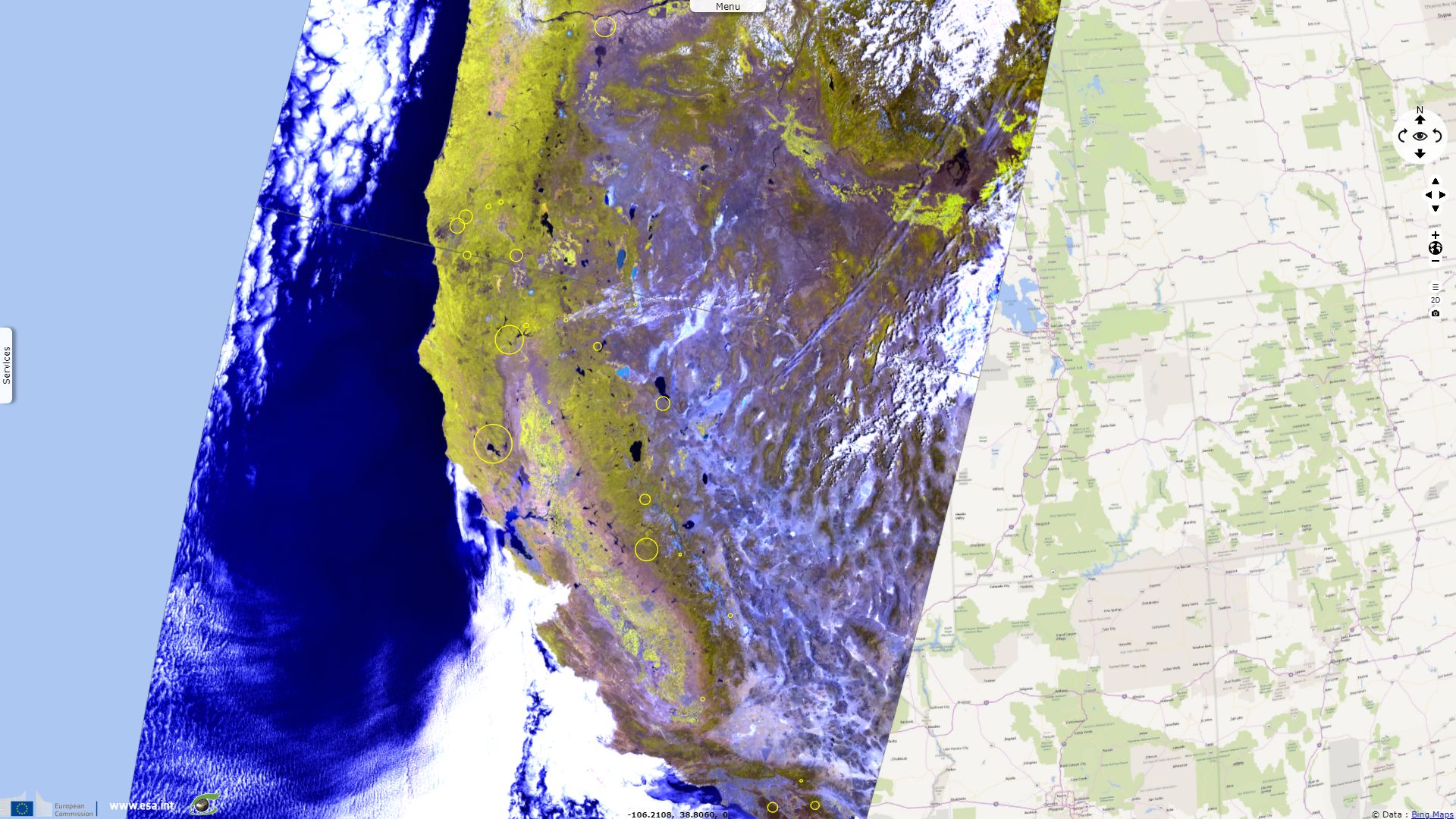
Several large wildfires have been raging across the Pacific Coast this summer. Hitting mostly California, these nightly fiery lights have given its nickname, the Golden State, a new meaning to many of its inhabitants.
As it was the case with Portugal Fire spotlighted previously, most fires that spread on wide areas develop on rugged terrain (so common along the Pacific Coast of USA) that makes firefighters intervention a lot harder. Furthermore, like in Portugal, eucalyptus have been planted in California. This invasive fire-prone specie can similarly develop in the absence of its native predators and worsen wildfires.
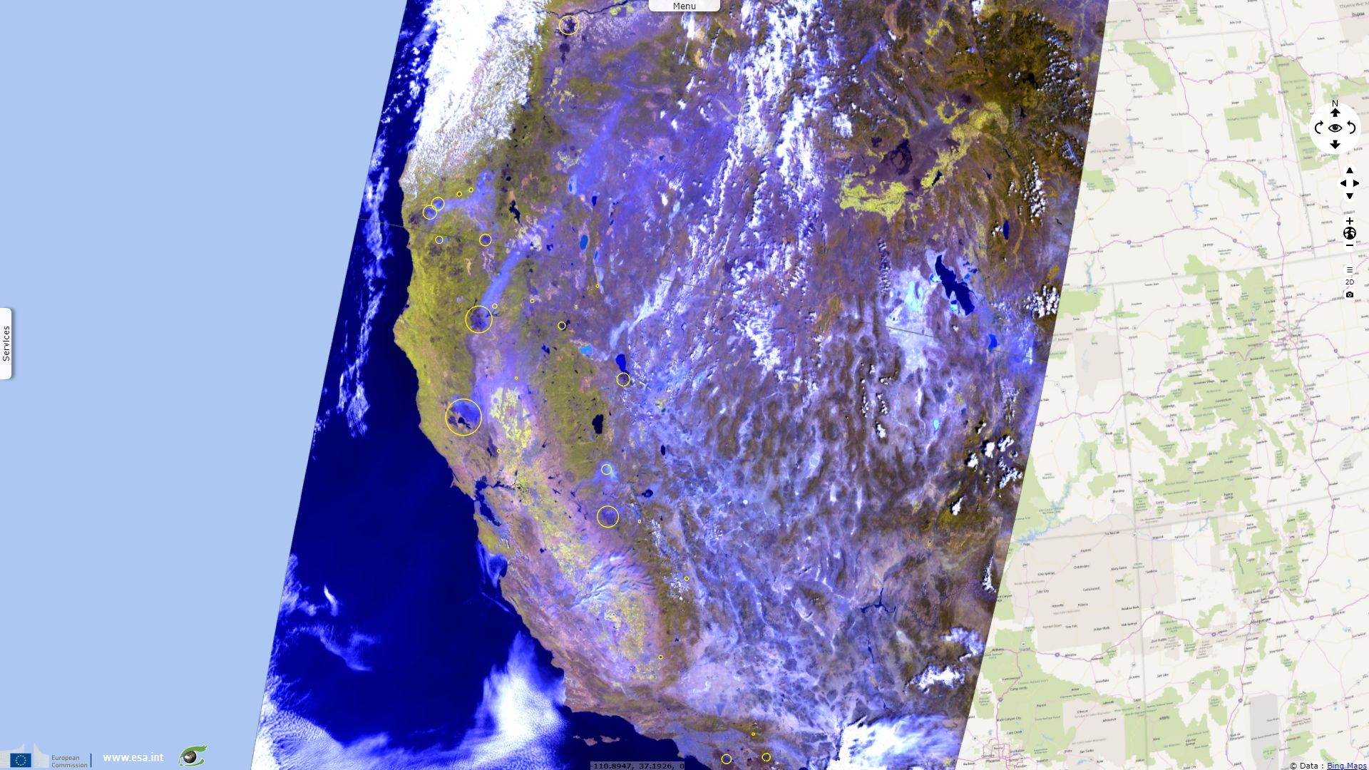
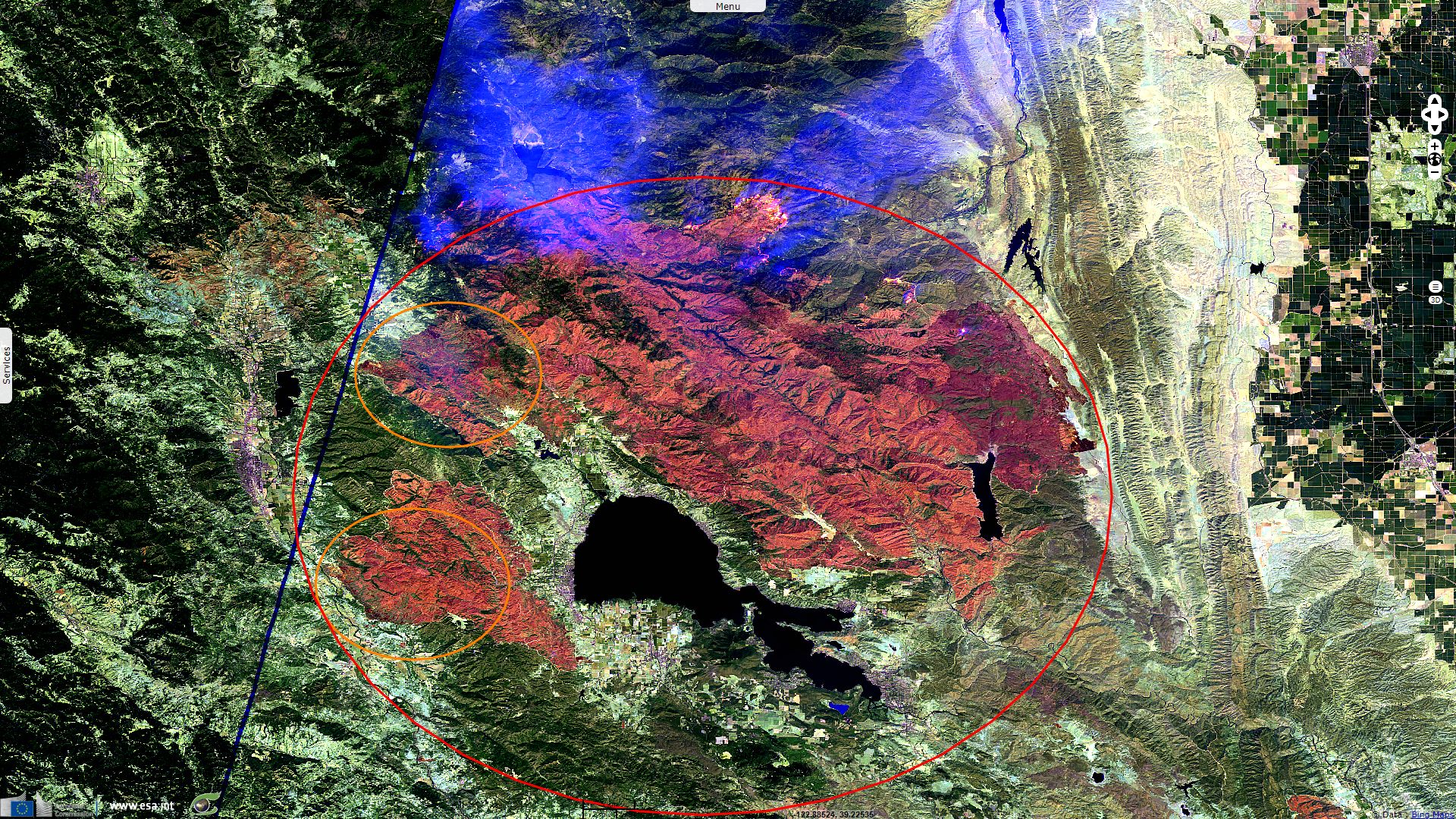
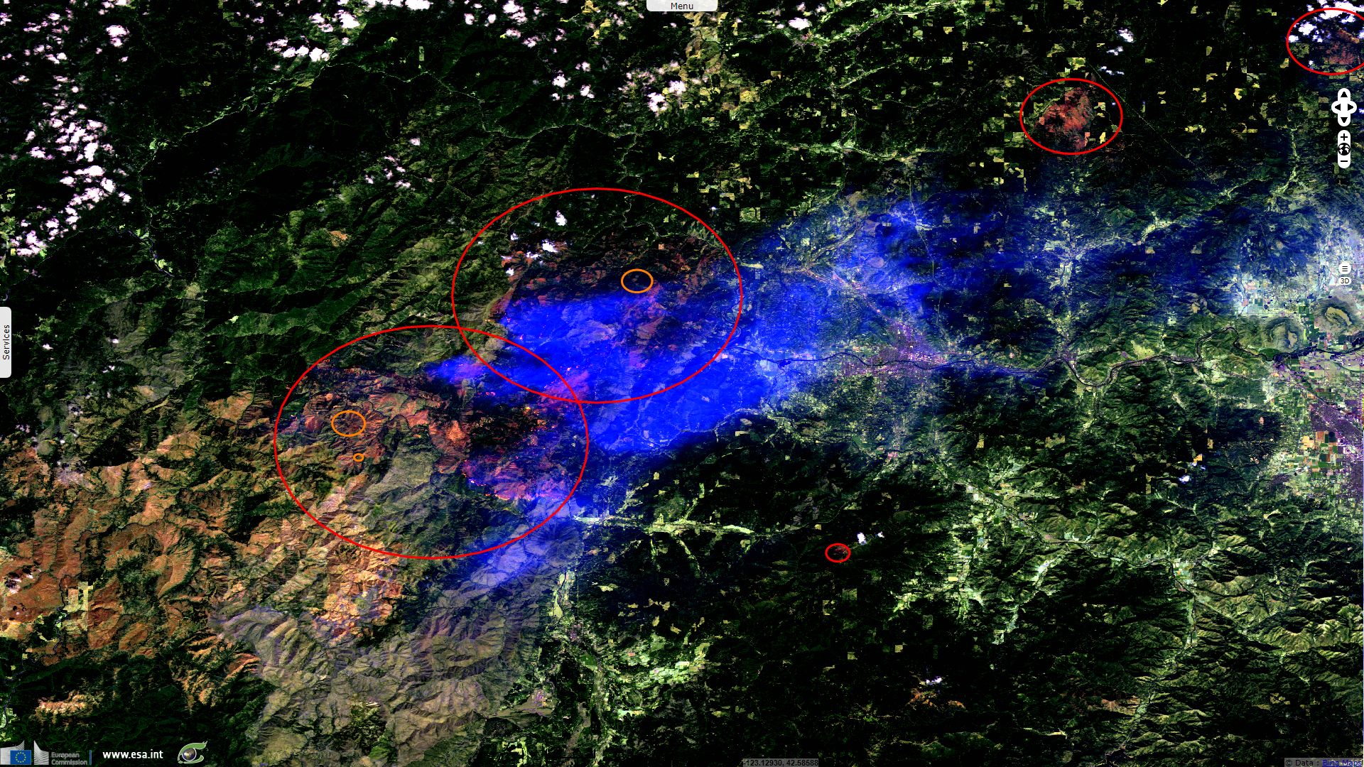
Ranch fire and River fire both started the 27.07.2018 few kilometres apart and later spread in the same direction. With high heat, low humidity and gusty wind, the condition were favourable to their extension while rugged terrain made their containment difficult. Firefighters stopped the merging just 3km before the junction occurred. Together, they form the Mendocino Complex Fire that burned 1500km² so far, which of 200km² can be attributed to the now contained River fire, while the massive Ranch Fire is only 72% contained. This make of Mendocino Complex fire the largest wildfire recorded in modern California, surpassing the previously record-breaking Thomas wildfire.
3600 & 3100 firefighter, 21 & 20 helicopters, 91 & 79 water tenders, 63 & 76 bulldozers have been mobilised to fight respectively Ranch & River fires. As Mendocino Complex fire spread in a low density area, it only damaged 265 structures and killed one firefighter.
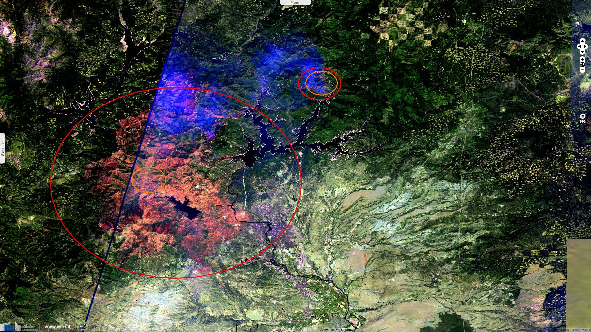
Despite its smaller 870km² burnt, Carr fire unfortunately killed 8 people and destroyed 1599 structures, making it the sixth most destructive fire ever recorded in California. Up to 3600 firefighters, 12 helicopters and 35 bulldozers have been mobilised to fight it, it is 72% contained at the moment. Note that Hirz fire is visible at north-east of Carr Fire since the 11.08.2018
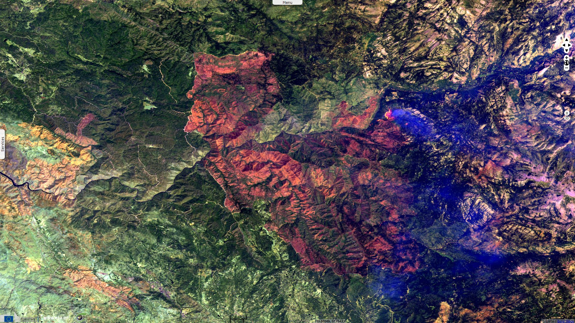
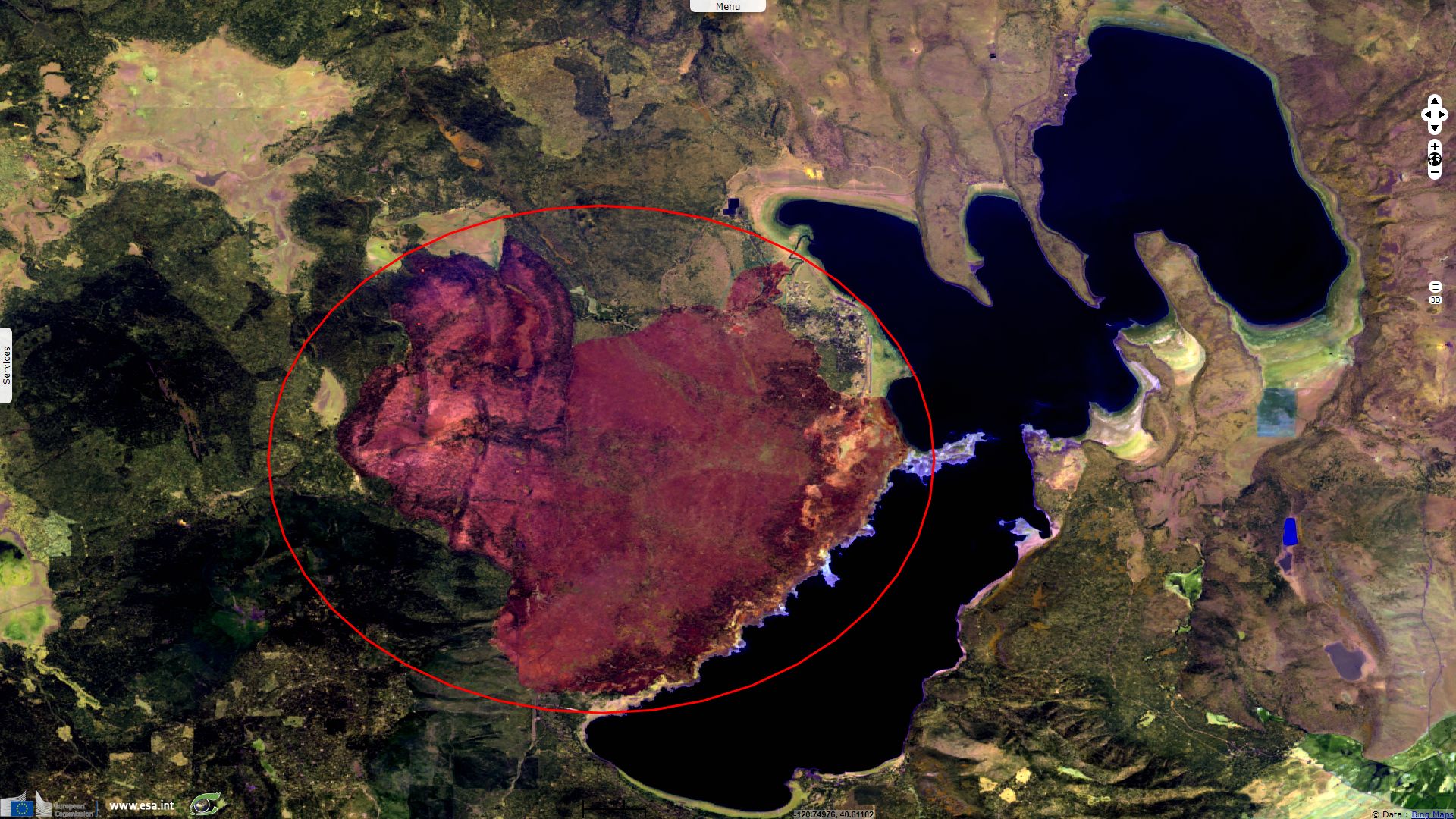
Ferguson Fire is another large wildfire that has been raging since July. It scorched 392km², partly in Yosemite National park, forcing its closure since the 25th of July.
These wildfires were powerful enough to generate unusual meteorological events known as fire storms, Cumulonimbus flammagenitus and fire tornado. The first, the firestorm, is described by Wikipedia as being: "created as a result of the stack effect as the heat of the original fire draws in more and more of the surrounding air. This draft can be quickly increased if a low-level jet stream exists over or near the fire. As the updraft mushrooms, strong inwardly-directed gusty winds develop around the fire, supplying it with additional air. This would seem to prevent the firestorm from spreading on the wind, but the tremendous turbulence created may also cause the strong surface inflow winds to change direction erratically."
Higher in the atmosphere, the pyrocumulus clouds is described as: "A flammagenitus cloud is produced by the intense heating of the air from the surface. The intense heat induces convection, which causes the air mass to rise to a point of stability, usually in the presence of moisture. Phenomena such as volcanic eruptions and forest fires can induce formation of this cloud, by mechanisms similar to those that form homogenitus. The presence of a low-level jet stream can enhance its formation. Condensation of ambient moisture (moisture already present in the atmosphere), as well as moisture evaporated from burnt vegetation occurs readily on particles of ash. Flammageniti contain severe turbulence, manifesting as strong gusts at the surface, which can exacerbate a large conflagration."
The most powerful among those can produce pyrocumulonimbus (or pyrocumulonimbus): "Firestorms will produce hot buoyant smoke clouds of primarily water vapor that will form condensation clouds as it enters the cooler upper atmosphere". NASA writes more about this class of clouds able to set off further fires: "Pyrocumulonimbus is the fire-breathing dragon of clouds. A cumulonimbus without the "pyre" part is imposing enough -- a massive, anvil-shaped tower of power reaching five miles (8 km) high, hurling thunderbolts, wind and rain. Add smoke and fire to the mix and you have pyrocumulonimbus, an explosive storm cloud actually created by the smoke and heat from fire, and which can ravage tens of thousands of acres. And in the process, "pyroCb" storms funnel their smoke like a chimney into Earth's stratosphere, with lingering ill effects."

A pyrocumulus cloud created by the Thomas Fire looms over Santa Barbara. - Source: Greg Vitalich
Finally, Wikipedia tells of another extreme event that can be triggered by the most powerful wildfires, the fire fornado (or firenado, fire twister, fire vortex...): "A firestorm may also develop into a mesocyclone and induce true tornadoes/fire whirls. The greater draft of a firestorm draws in greater quantities of oxygen, which significantly increases combustion, thereby also substantially increasing the production of heat. The intense heat of a firestorm manifests largely as radiated heat (infrared radiation), which may ignite flammable material at a distance ahead of the fire itself. This also serves to expand the area and the intensity of the firestorm. Violent, erratic wind drafts suck movables into the fire and as is observed with all intense conflagrations, radiated heat from the fire can melt asphalt, some metals, and glass, and turn street tarmac into flammable hot liquid. The very high temperatures ignite anything that might possibly burn, until the firestorm runs low on fuel."
The left video shows a fire vortex on the night of July 26, the night the Carr Fire spread to Redding - Source Rob Anderson for CNN Weather.
The right video a fire tornado caused by Carr Fire near Redding, it has been acquired by Jeremiah Caudill the 02.08.2018
On a positive note, while many wildfires are still active, wind speed seems to have weakened during the last two weeks, decreasing the number and daily spread of these wildfires.
The views expressed herein can in no way be taken to reflect the official opinion of the European Space Agency or the European Union.
Contains modified Copernicus Sentinel data 2026, processed by VisioTerra.
Contains modified Copernicus Sentinel data 2026, processed by VisioTerra.
| More on European Commission space: |  |
 |
 |
||||
| More on ESA: | |
|
|
S-1 website | S-2 website | S-3 website | |
| More on Copernicus program: | |
|
|
Scihub portal | Cophub portal | Inthub portal | Colhub portal |
| More on VisioTerra: | |
|
|
Sentinel Vision Portal | Envisat+ERS portal | Swarm+GOCE portal | CryoSat portal |