Land use in Scotland
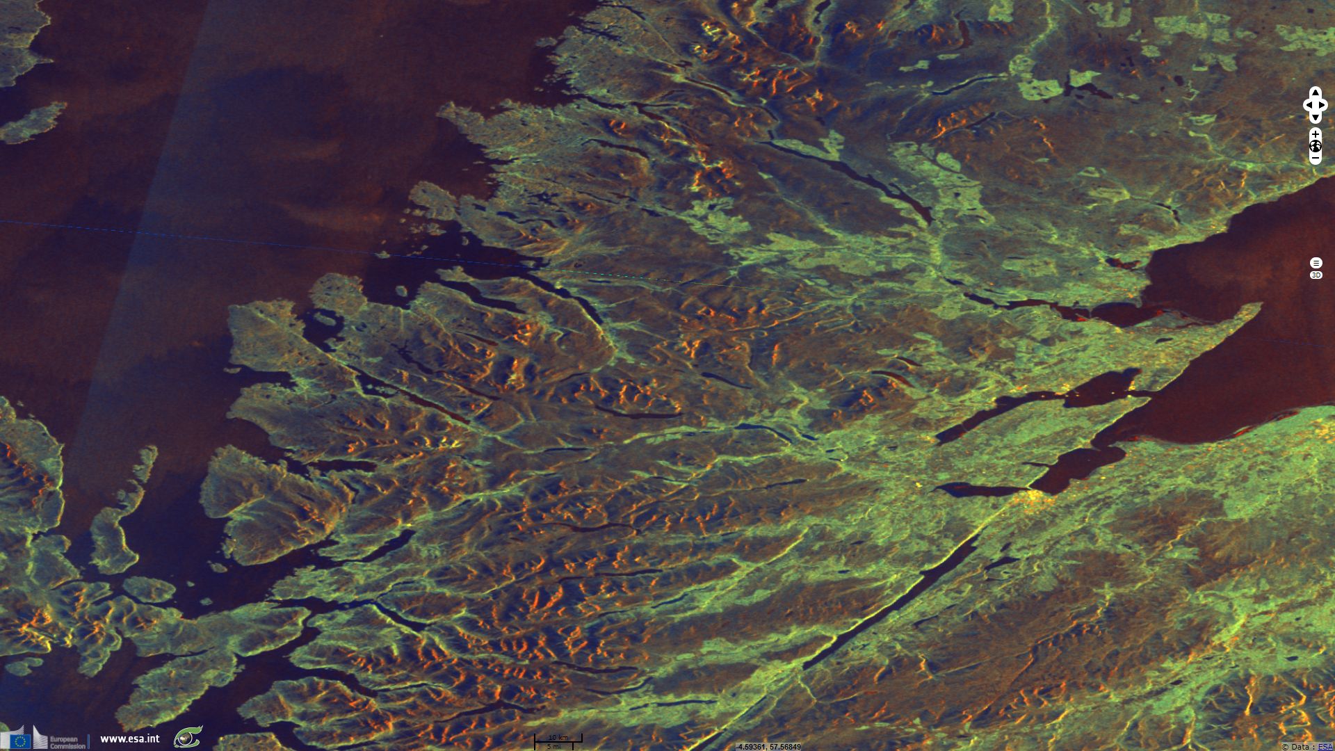
Sentinel-1 CSAR EW acquired on 11 January 2015 from 17:58:23 to 17:59:27 UTC
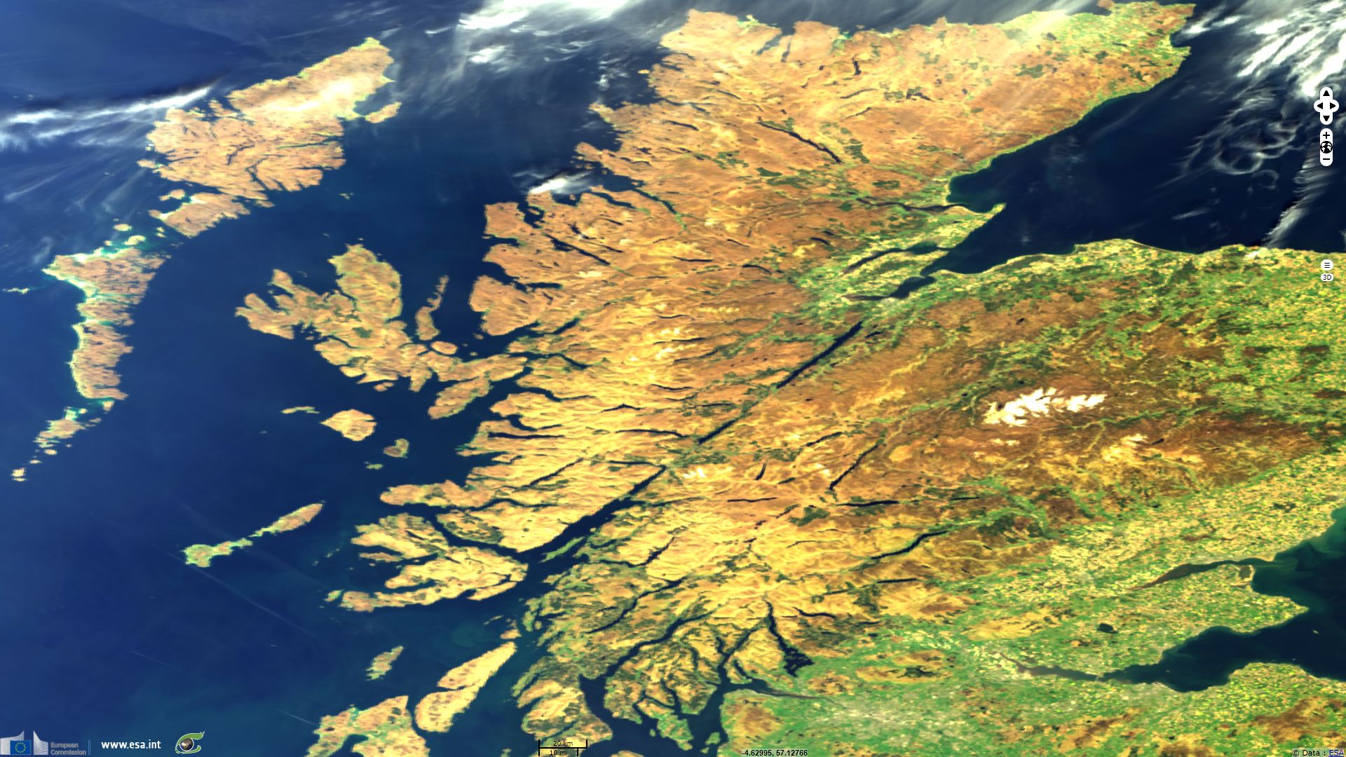
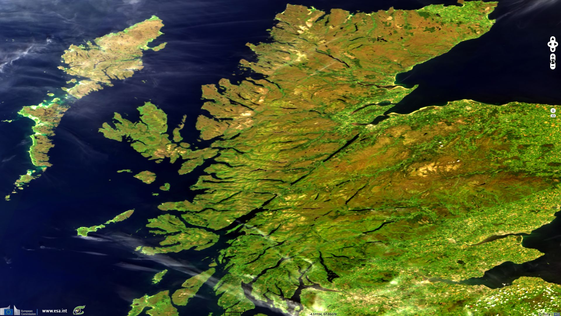
Sentinel-2 MSI acquired on 09 May 2016 at 11:54:33 UTC
...
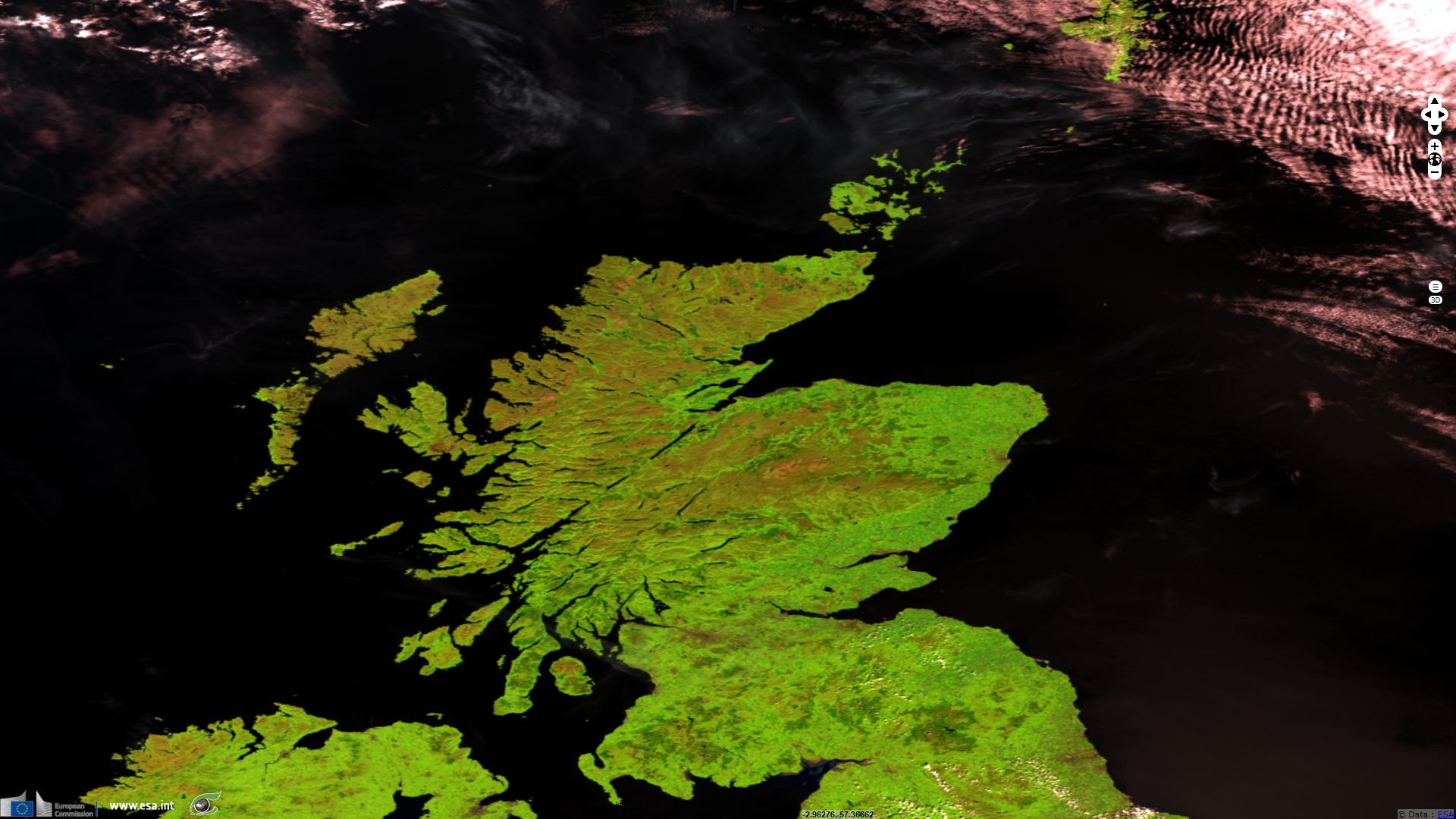
Sentinel-3 SLSTR RBT acquired on 18 July 2017 at 11:02:14 UTC
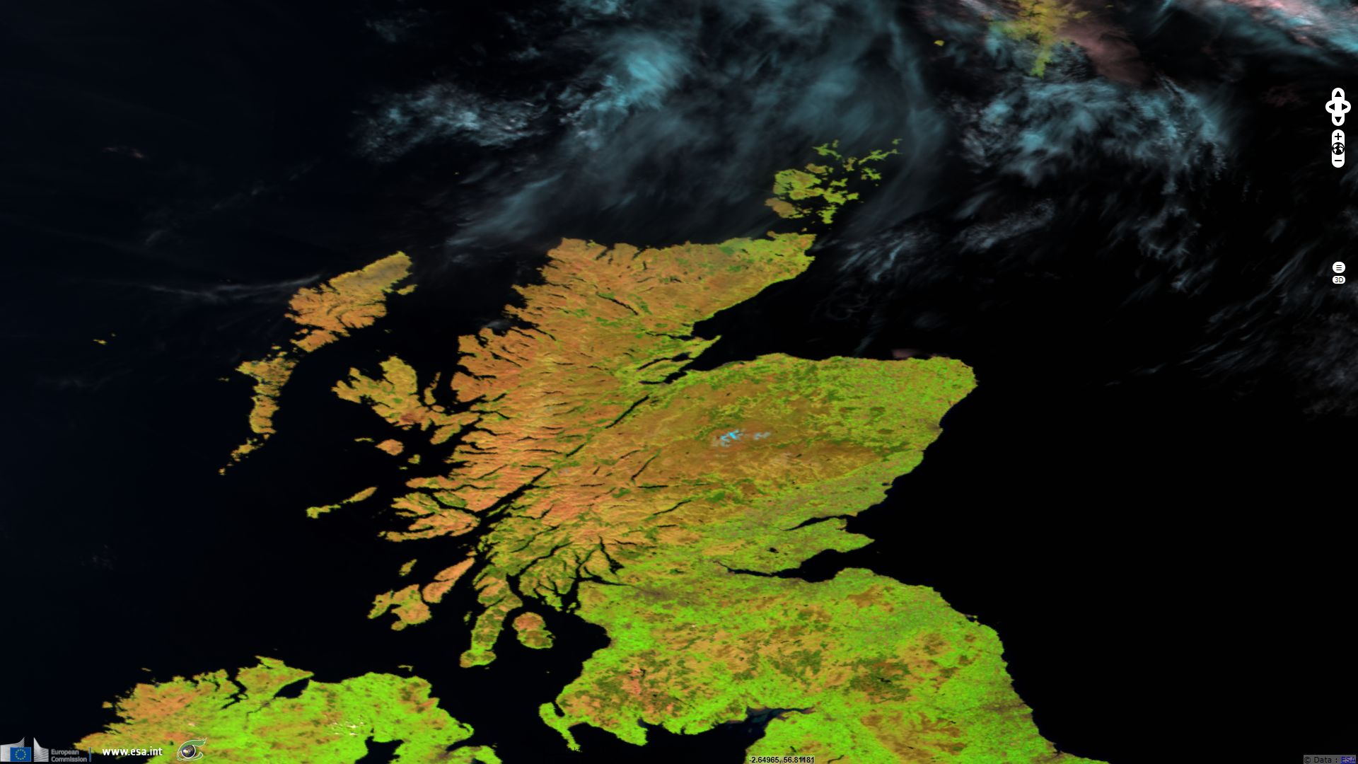
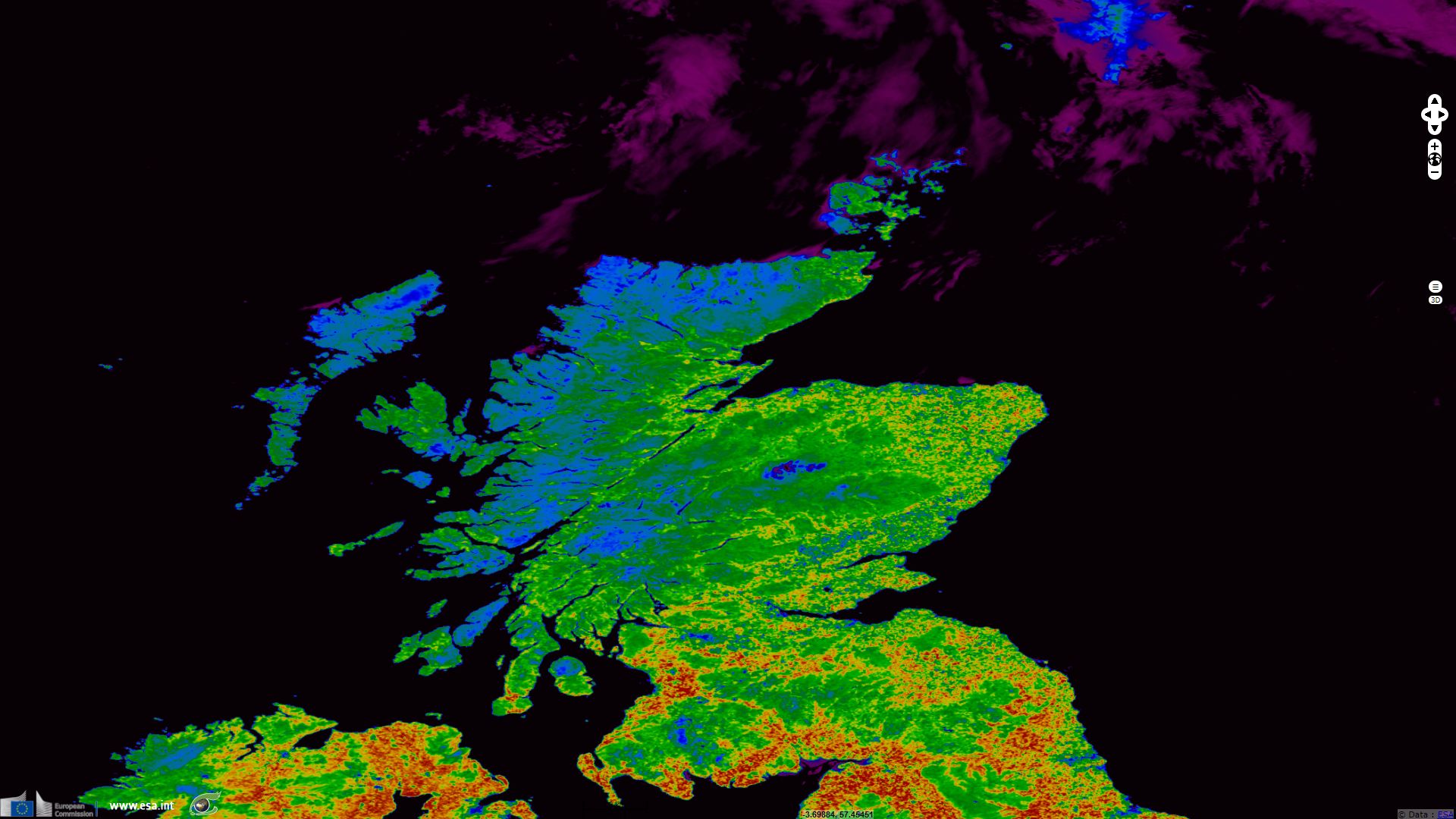
Sentinel-3 OLCI FR acquired on 18 July 2017 at 11:02:14 UTC
Sentinel-2 MSI acquired on 09 May 2016 at 11:54:33 UTC
...
Sentinel-3 SLSTR RBT acquired on 18 July 2017 at 11:02:14 UTC
Sentinel-3 OLCI FR acquired on 18 July 2017 at 11:02:14 UTC
Keyword(s): land, coastal, hydrology, mountain, agriculture, land use, orogeny, erosion, fjord, lake, Scotland, United Kingdom
On 30 November, Scotland celebrates Saint Andrew's Day. This story aims to show how some aspect of Scotland geography such as its topography and its climate contributed to shape its land use.
As part of the formation of the supercontinent Pangaea, Iapetus Ocean closed following a subduction process. The continents and terranes of Laurentia, Baltica and Avalonia collided, provoking the caledonian orogeny responsible for formation of mountain ranges in what is today Ireland, Great Britain, Scandinavia, Svalbard and eastern Greenland.

Proposed reconstruction of Euramerica paleocontinent - source.
Scotland is believed to have been entirely covered by an ice sheet during the last glacial period. Located between 55°N and 60°N latitude, Scottish hills under 1000m high can still be regularly covered in snow while some snow patches may survive the summer.

Topographic map of Scotland by Steve Drury.
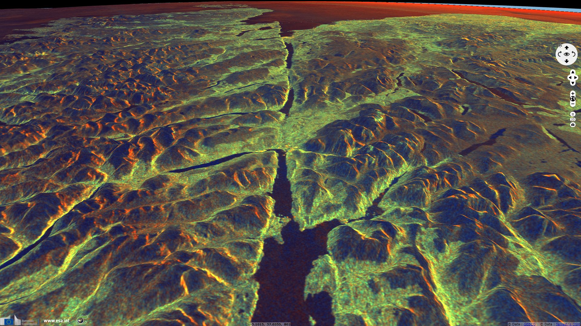
The Great Glen Fault is a long SW-NE oriented strike-slip fault, testimony of the collision of Laurentia and Avalonia which sutured the northern and southern part of Ireland and Scotland. The Iapetus Suture bisects the Scottish Highlands into the Grampian Mountains to the southeast and the Northwest Highlands to the northwest. It forms a straight line from Beauly Firth to the Firth of Lorne, passing through Loch Linnhe, Loch Lochy, Loch Oich and Loch Ness to do so.
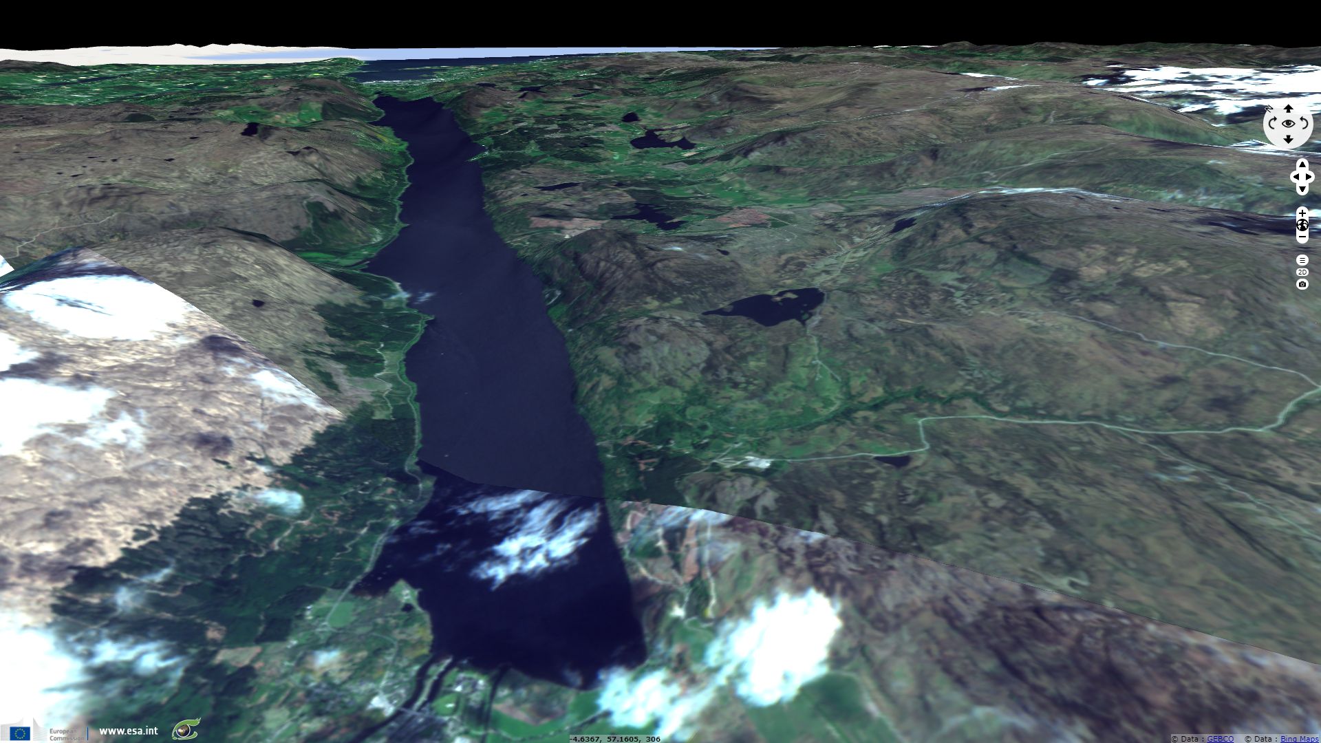
The Caledonian canal was built to take advantage of this natural features, joining Inverness to Fort William, the two biggest cities in Scotland's Highlands; Loch Ness forms its longest section.
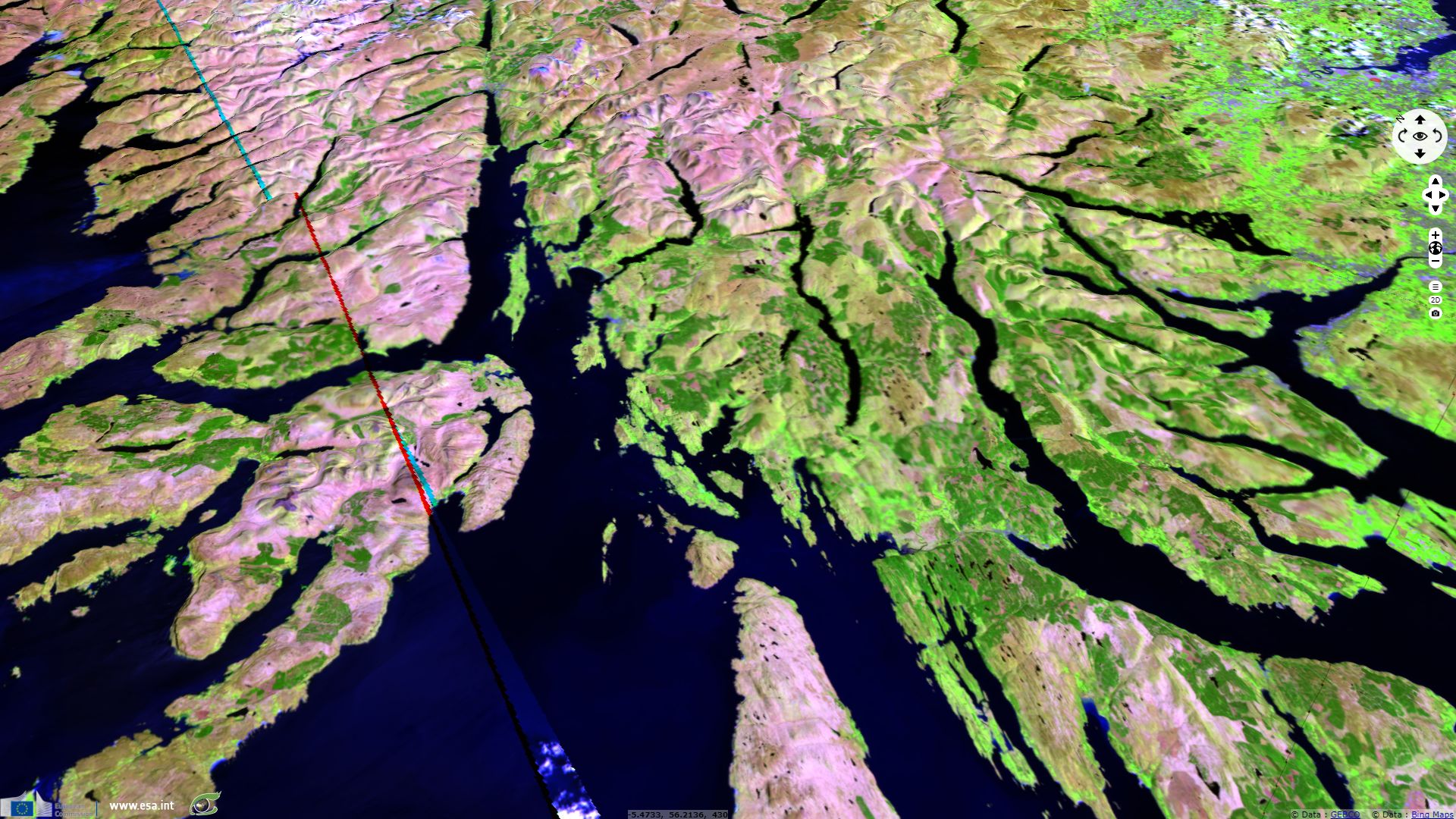
Mountains from the caledonian orogeny were once much higher. Hundreds of million years of erosion have abrased and polished their surface, leaving rounded high hills where sharp mountains once stood. The main agent of this erosion is water. Not only does liquid water dig through softer material but ice carves rock crevices and glaciers act as sandpaper applied with tremendous strength. This gave birth to glacial lakes (freshwater lochs) and to fjords (firths and saltwater lochs) that characterize Scotland. At several locations in Scotland, Irish Sea and North Sea seem to be connected by fjords and lakes if not for narrow strips of land.
The British Met Office described the precipitations in Scotland: "There is a general misconception that the whole of Scotland experiences high rainfall. In fact, rainfall in Scotland varies widely, with a distribution closely related to the topography, ranging from over 3,000 mm per year in the western Highlands (comparable with rainfall over the mountains of the English Lake District and Snowdonia in Wales) to under 800 mm per year near the east coast (comparable with the Midlands of England). (Note that rainfall also includes snow, which is melted and measured as rainfall.)"

Annual average rainfall in the United Kingdom by the Met Office
As shown above, pushed by prevailed winds, precipitations fall preferably on Scotland's western coast. In times when ice covered the Highlands, it implies glaciers were more active carving the western part of Scotland and thus explains why this coast is a lot more rugged than the eastern one. Unsurprisingly,
most cities are located near these water bodies which acts as a waterway and a fishing resource rather than in altitude where the climate is more extreme and the access more difficult
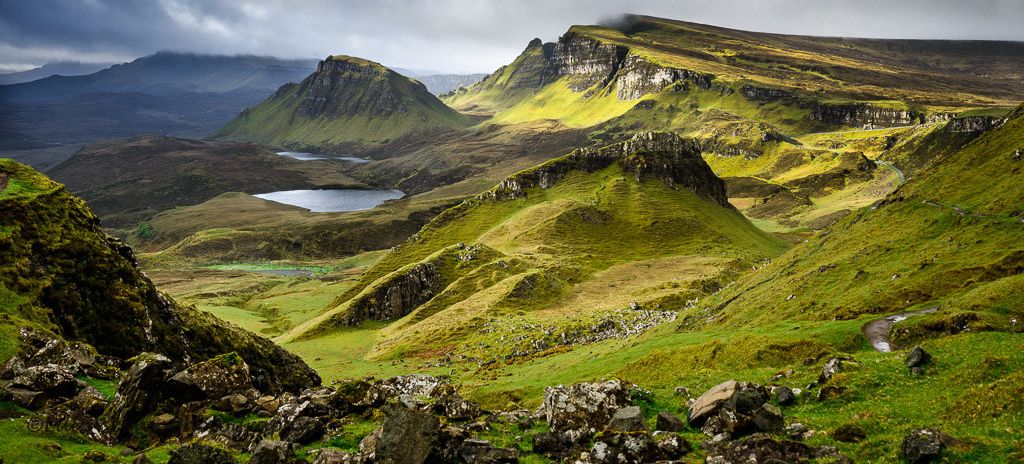
Eroded landscape in Quiraing, Isle of Skye by Luis Ascenso
Another cause of erosion is the wind. Being the westernmost European land at this latitude, Highlands are particularly exposed.
Niall Stuart, chief executive of Scottish Renewables, estimates: "Scotland has 25 per cent of Europe’s wind energy and tidal energy, as well as 10 per cent of the continent’s wave energy.". The Met Office exposes the Scottish context: "Since many of the major Atlantic depressions pass close to or over Scotland, the frequency of strong winds and gales is higher than in other parts of the United Kingdom. Over low ground, the windiest areas are the Western Isles, the north-west coast and Orkney and Shetland with over 30 days with gales per year in some places. A day of gale is defined as a day on which the mean wind speed at the standard measuring height of 10 m above ground attains a value of 34 knots (39 miles per hour, 17.2 metres per second) or more over any period of 10 minutes during the 24 hours.".

30-year (1961-90) average number of days with gales for selected stations by the Met Office
Note most cities are located on the East coast and all major cities are located in the prevailing wind shadow and rain shadow of some elevation. The population density reaches 98 hab/km² in the Lowlands as against 9.1 hab/km² according to the Scottish Highland Council
Little forested area remains in Scotland, no more than 15% now. Michael B. Usher commented in a report for the Scottish Biodiversity Group: "By 8,000 years ago, between 60 per cent and 70 per cent of the land of Scotland was wooded, with a tree line that extended in the Eastern Highlands to about 850 m above sea level. By 5,000 years ago the combination of a wetter climate and the impact of man’s activities as farmer and grazier had started the process of deforestation that created the moorlands and bogs. There will always be disagreement about the extent to which climate or human activity accelerated the development of the great peat bogs of the north-west Highlands at the expense of the forests. It is clear, however, that for the most part the moorlands of the Highlands and the Southern Uplands are kept open by land management practices. As such they are artefacts and a part of what we have come to call the cultural landscape.".
Scots pine, national tree of Scotland, is a common component of the taiga or boreal forest / taiga but it has become rare. Michael B. Usher added: "Mostly the tree line is lower (not more than 500 m above sea level). In parts of the West Highlands and Northern Isles. Beneath the tree line, there may be a zone in which, because of exposure and climate, trees such as Scots pine, juniper, rowan and willows can only grow in a low, twisted, shrubby form. Unfortunately, this natural montane scrub zone is almost absent from Scotland’s hills as a result of burning and grazing by hill sheep and deer.".
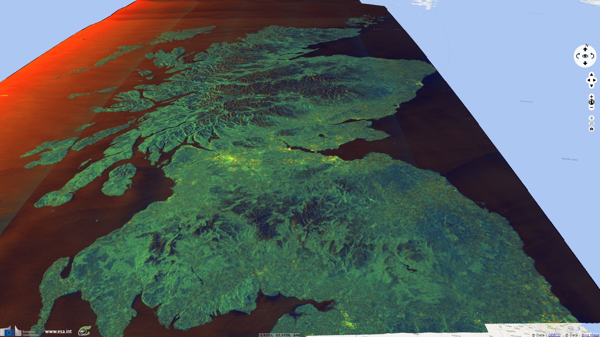
As shown in the Sentinel-3 image above and in the photograph below, there is almost no dwarf-trees transition between forested areas (dark green) and the grassland (brown). The grassland is used for cattle raising which plays a major role in Highland's agriculture. At higher altitude, lichens and moss dominate the bald hill summits (beige).

About two thirds of Scottish land is devoted to cattle raising in the form of pastoral farming while cropland represent less than 10%. Most arable and flat land is located in Lowlands and on the North Sea coast. They lie in the precipitations rain shadow and benefit from more sunshine hours than land located the the Highland valleys or hillsides.
The views expressed herein can in no way be taken to reflect the official opinion of the European Space Agency or the European Union.
Contains modified Copernicus Sentinel data 2026, processed by VisioTerra.
Contains modified Copernicus Sentinel data 2026, processed by VisioTerra.
| More on European Commission space: |  |
 |
 |
||||
| More on ESA: | |
|
|
S-1 website | S-2 website | S-3 website | |
| More on Copernicus program: | |
|
|
Scihub portal | Cophub portal | Inthub portal | Colhub portal |
| More on VisioTerra: | |
|
|
Sentinel Vision Portal | Envisat+ERS portal | Swarm+GOCE portal | CryoSat portal |