A landslide causes a glacier failure at the top of India
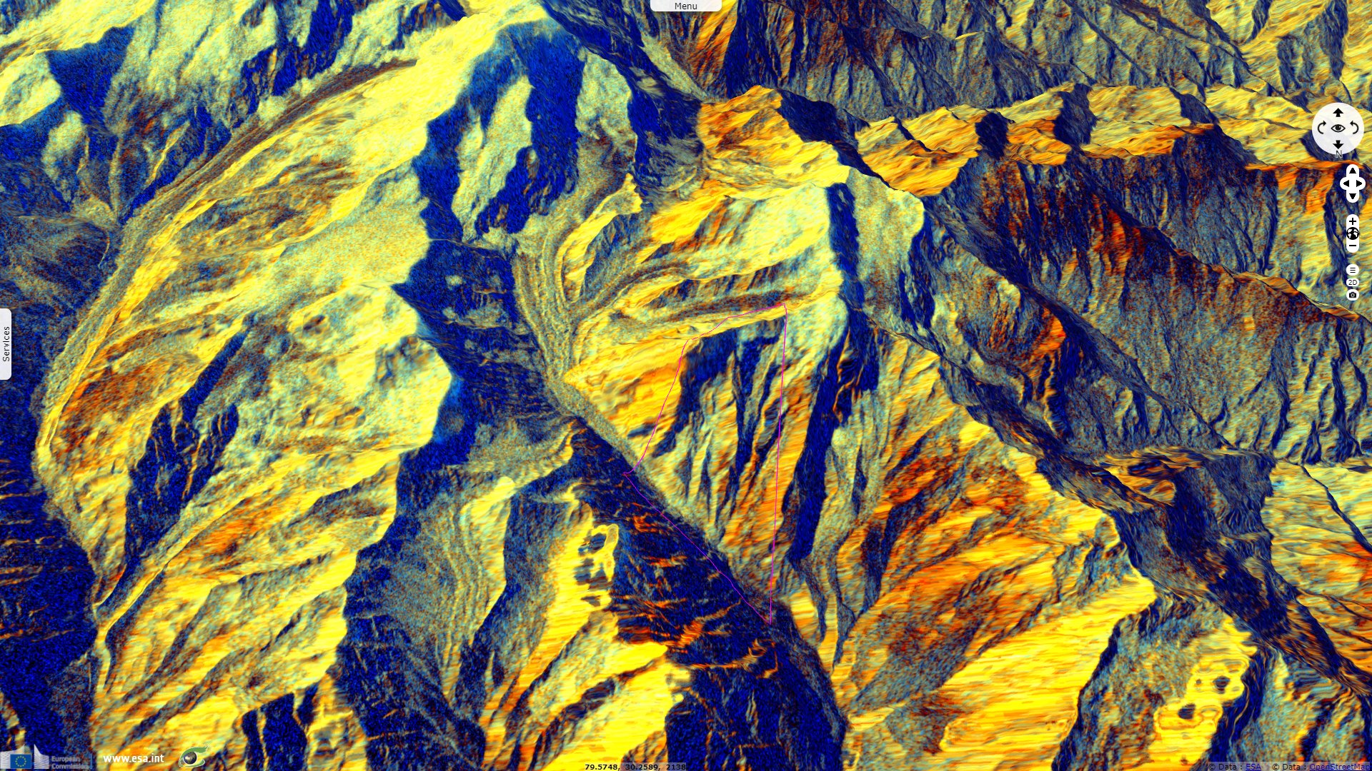
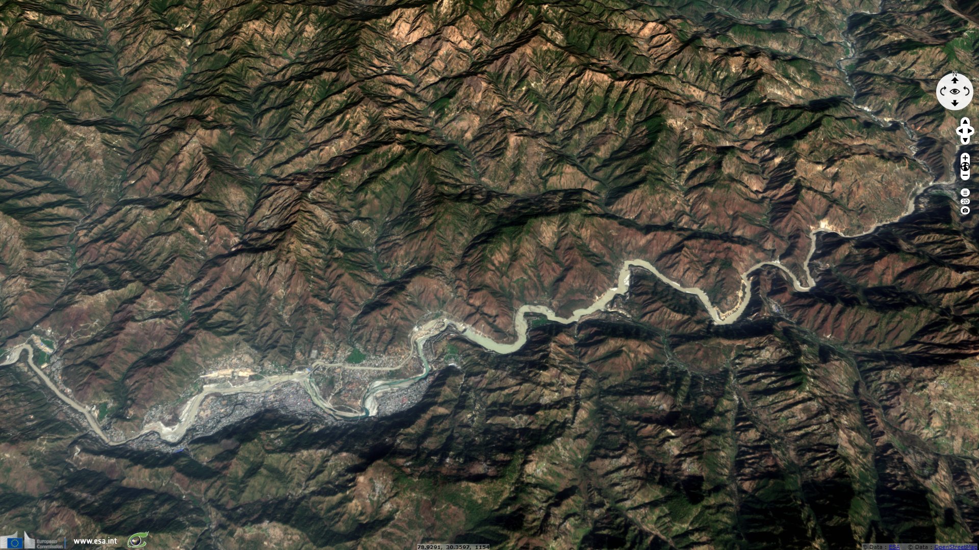
Sentinel-1 CSAR IW acquired on 06 January 2021 at 00:43:43 UTC
...
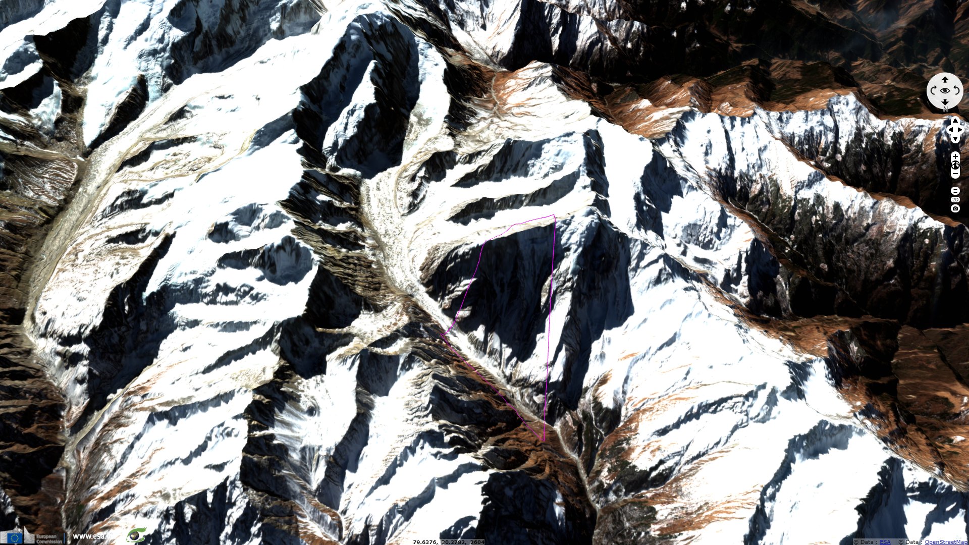
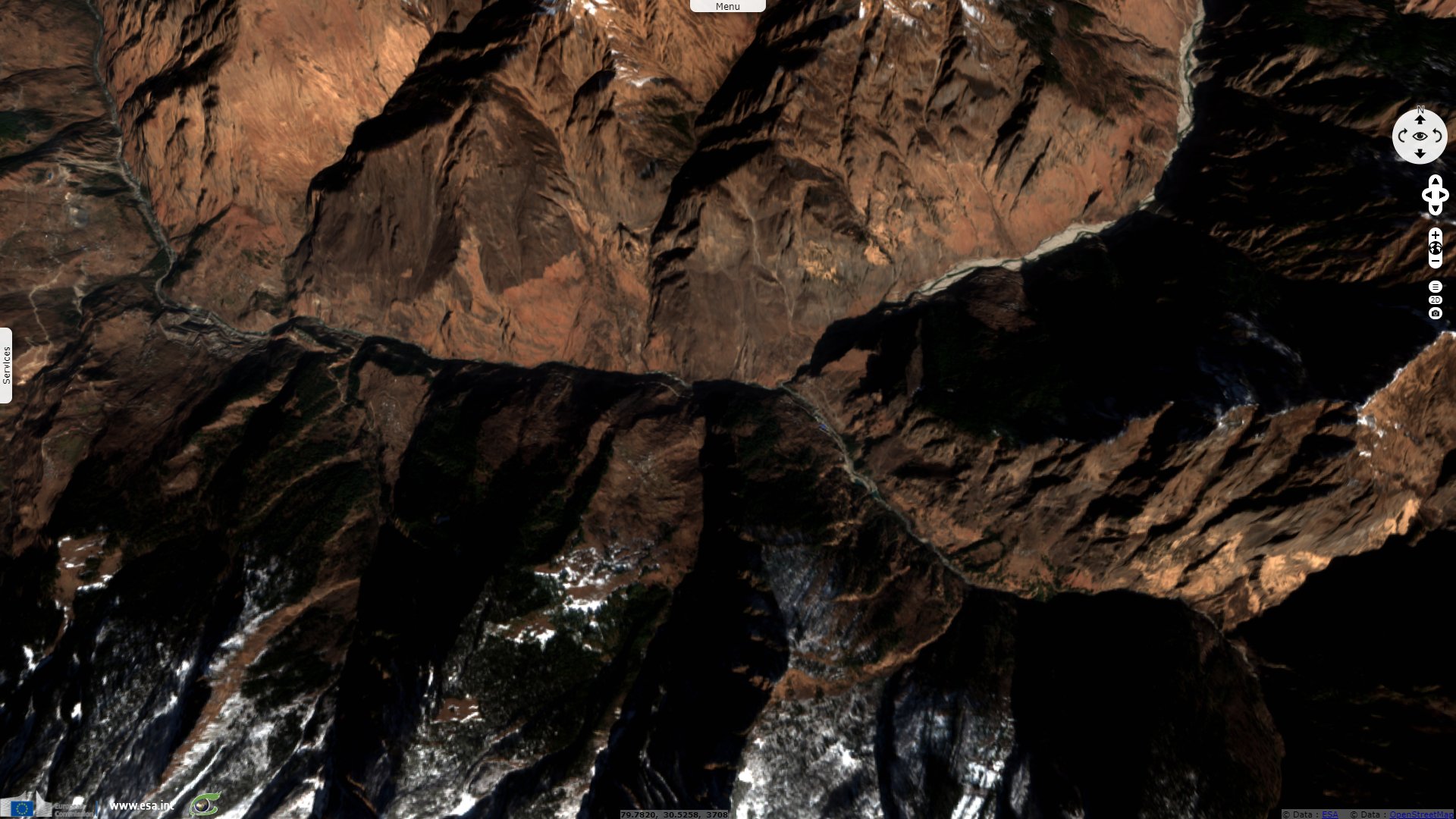
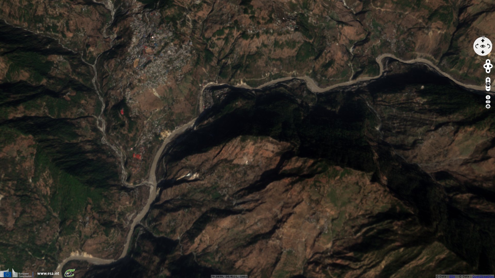
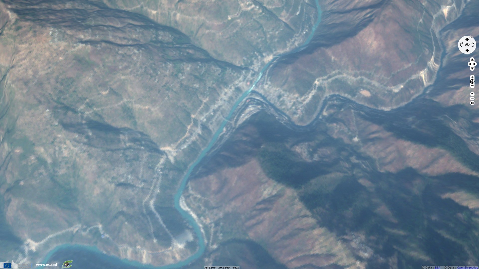
Sentinel-2 MSI acquired on 31 January 2021 at 05:20:39 UTC
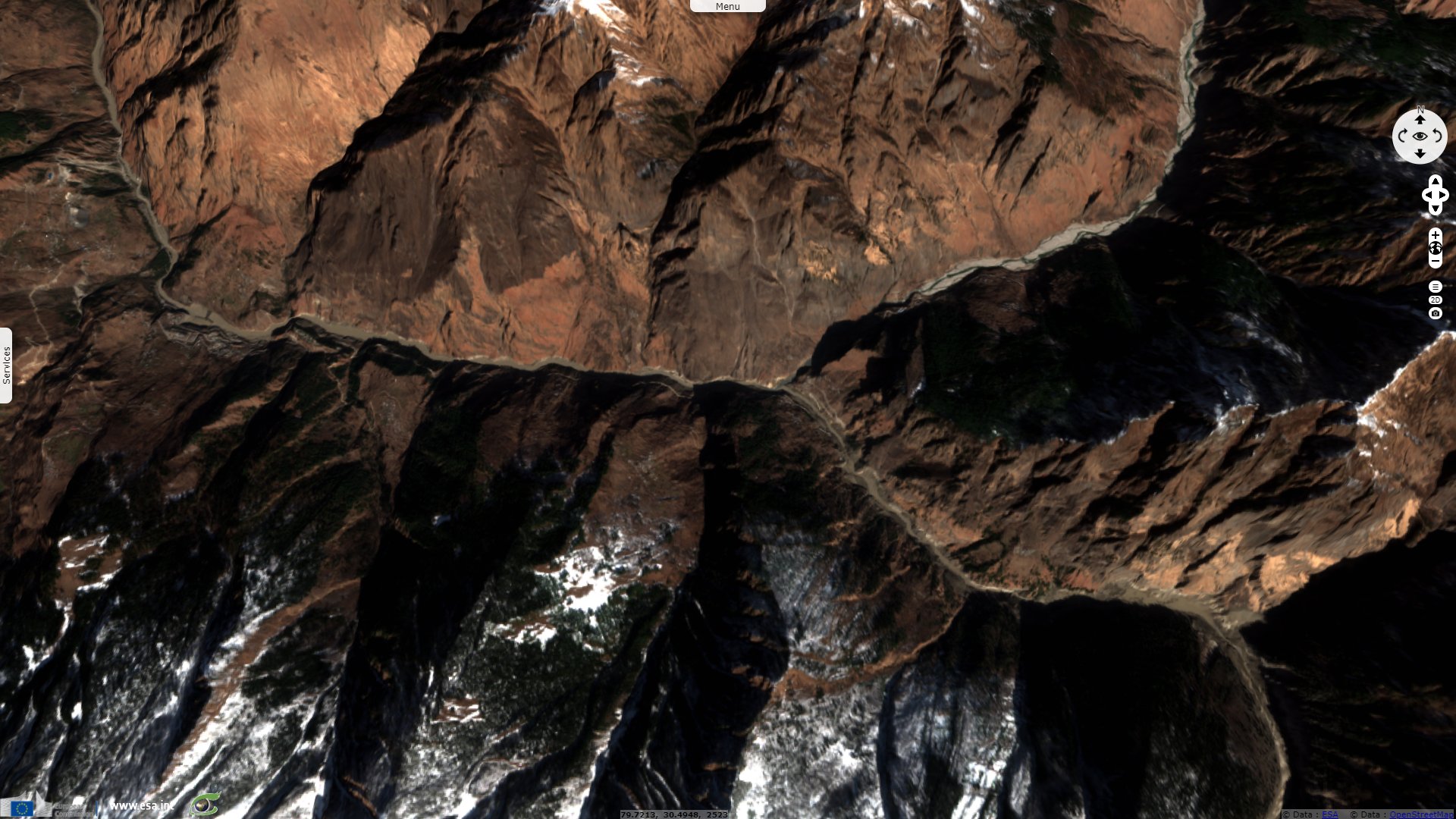
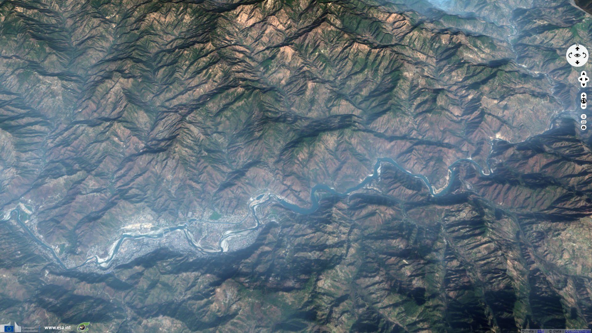
Sentinel-2 MSI acquired on 10 February 2021 at 05:19:39 UTC
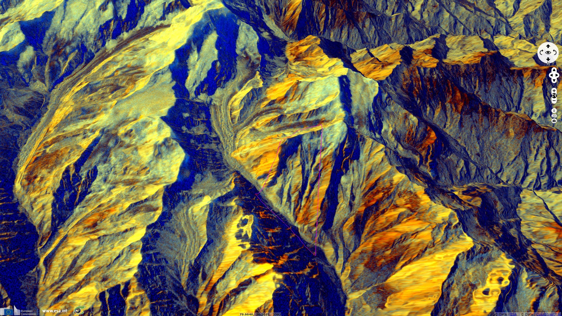
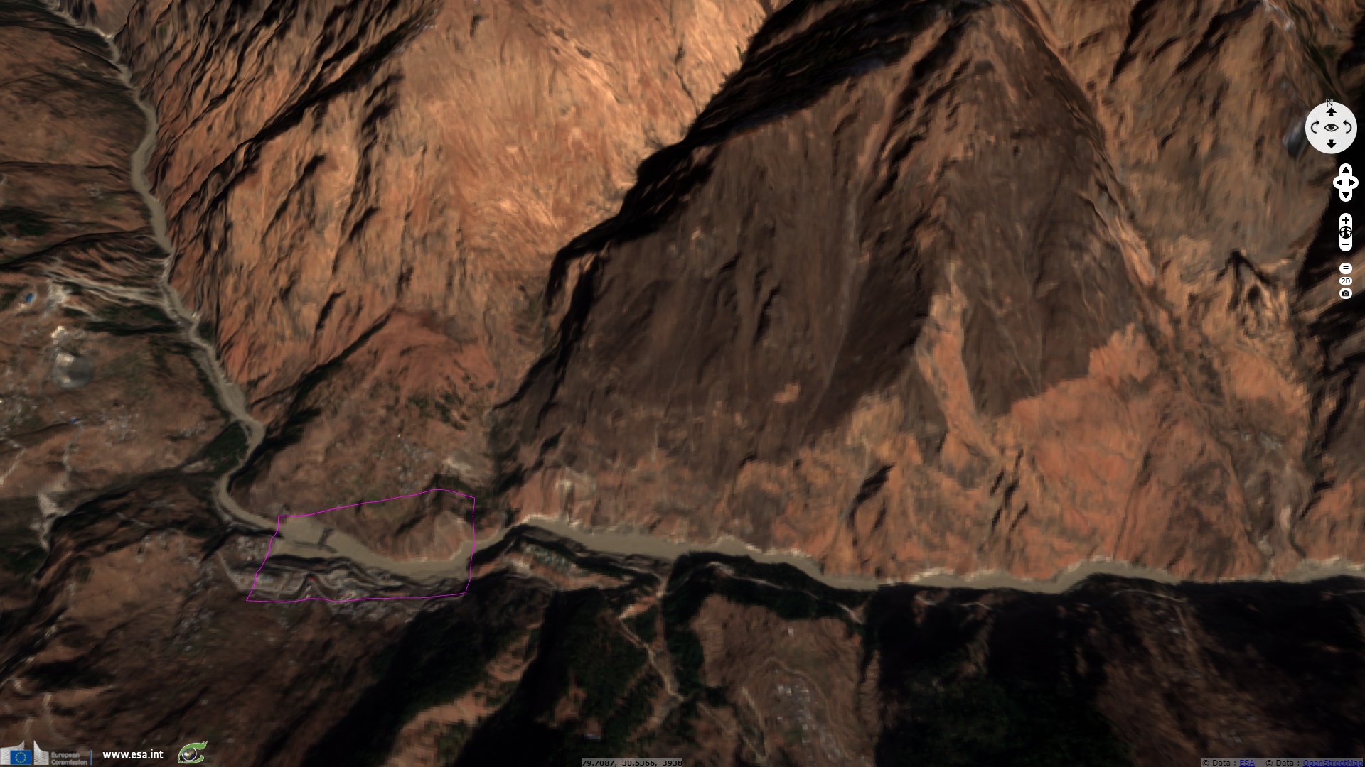
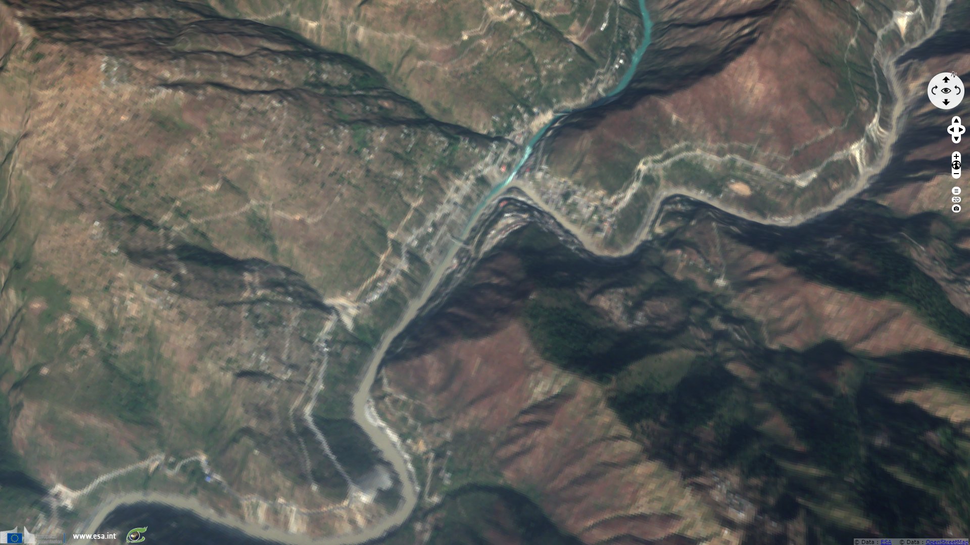
Sentinel-1 CSAR IW acquired on 11 February 2021 at 00:43:42 UTC
Keyword(s): Natural disaster, landslide, flood, dam, climate change, erosion, glacier, water colour, India, Himalaya
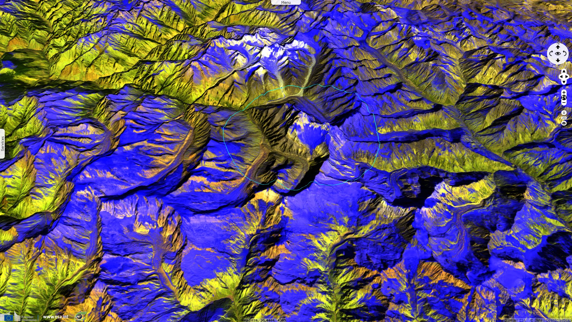
The Disaster Charter has been activated following a large landslide which triggered an avalanche and then a flooding event: "Part of Nanda Devi glacier broke off in Uttarakhand's Chamoli district on 7 February, triggering an avalance that struck the Rishiganga Hydroeletric Dam. The collision at the dam and influx of water caused a surge of flood water along the Dhauliganga river. Dozens of villages along the river have been evacuated, and rescue operations are underway to free people trapped at the dam or elsewhere in the flood's path, but more than a hundred people have been confirmed lost with their current status unknown."
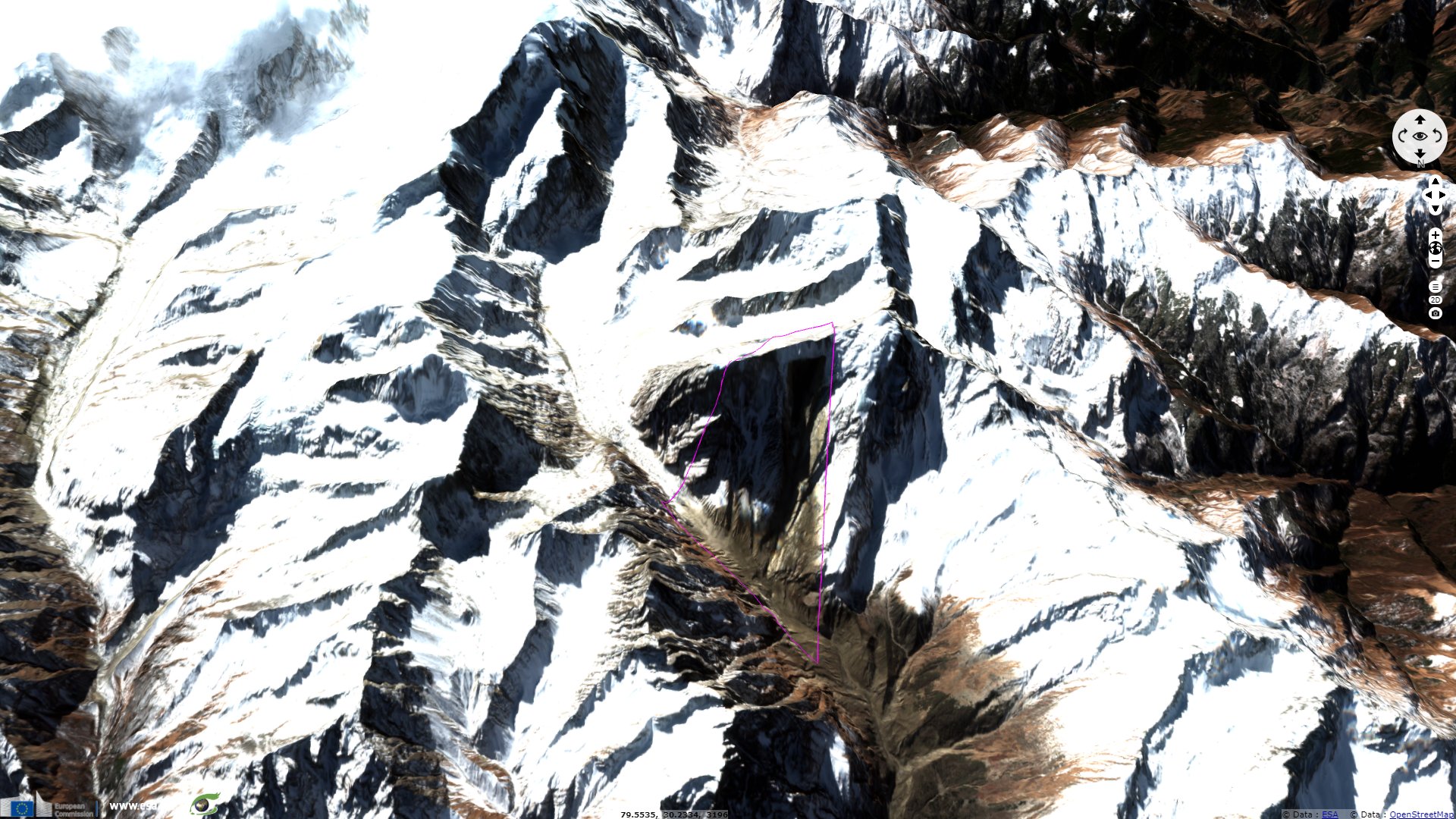
Dave Petley, Pro-Vice-Chancellor at the University of Sheffield wrote for the Landslide blog: "For orientation, the valley floor is to the north, and the block that has dropped off is about 550 m wide. This is a very steep slope, so the block is very large indeed. My interpretation is that this is a wedge failure – note the inclined surfaces on the east and west side, although the basal shear plane may be another, slope parallel, joint. The block has dropped out of this wedge-shaped source, and fallen almost vertically about 1800 metres."
In another article, he added: "There appears to have been a deeply troubled scheme even before the landslide. Descriptions of this project indicate that the expected completion date was in 2012, but at the time of the landslide it was still under construction. Problems seen to be associated with very difficult geological conditions, leading to slow progress in the tunnelling operations, including significant groundwater ingress. In 2014 there were reports of at least three occasions in which the Tunnel Boring Machine had become trapped."
"the problems with this scheme are now much more serious. Aside from the damage to the infrastructure, which looks to be extremely severe (see the satellite images in an article in India Today), there will be a need to assess properly the likelihood of another event of this type in the life of the dam. In a warming climate this cannot be precluded."
According to Professor Petley, the block of rock with some ice: "It will have instantly fragmented to generate a huge rock and ice avalanche, which travelled down the glacier. This would have been extremely fast and very energetic. On the way it generated a vast quantity of dust, which is smeared on the valley side to the west of the valley. Down valley (to the north) the rock avalanche was able to entrain a vast amount of water and sediment."
"It seems likely that much of this material was the remains of previous landslides and some glacial material. The rock avalanche will have generated a huge amount of heat and will have induced fragmentation. The ice will have been entrained into the flow, crushed and melted, allowing the landslide to transition to a debris flow. The volume will have continued to increase as the landslide rushed to the north. The movement of the landslide was so rapid that the debris flow pushed water from the river ahead of it before incorporating it."
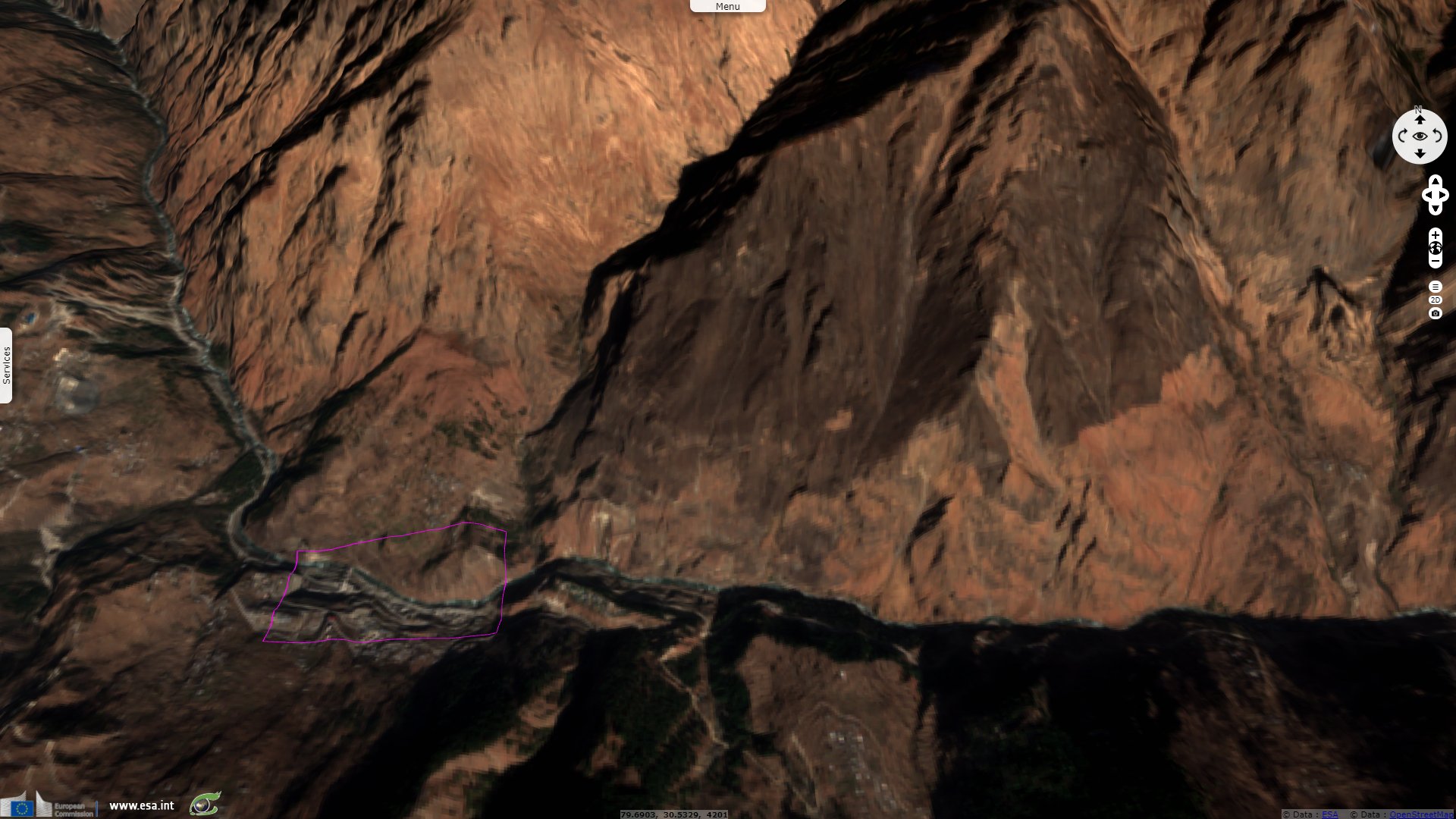
India Today published the following toll: "Twenty-six bodies have been recovered and 171 are still missing after the glacier burst in Uttarakhand’s Chamoli district, as per DGP Ashok Kumar. This comes even as multiple agencies joined hands to rescue at least 30 workers trapped in a 250-metre tunnel at Tapovan. Rescue efforts in the affected areas near Joshimath, gained momentum with teams of the Army, Indo-Tibetan Border Police (ITBP), National Disaster Response Force (NDRF) and State Disaster Response Force (SDRF) coordinating to rescue 30-35 people feared trapped in a tunnel at the Tapovan-Vishnugad project. Officials said 27 people were rescued alive. Of these, 12 were saved from the smaller of the two tunnels at the Tapovan-Vishnugad project site and 15 from the Rishiganga site."

The views expressed herein can in no way be taken to reflect the official opinion of the European Space Agency or the European Union.
Contains modified Copernicus Sentinel data 2026, processed by VisioTerra.
Contains modified Copernicus Sentinel data 2026, processed by VisioTerra.
| More on European Commission space: |  |
 |
 |
||||
| More on ESA: | |
|
|
S-1 website | S-2 website | S-3 website | |
| More on Copernicus program: | |
|
|
Scihub portal | Cophub portal | Inthub portal | Colhub portal |
| More on VisioTerra: | |
|
|
Sentinel Vision Portal | Envisat+ERS portal | Swarm+GOCE portal | CryoSat portal |