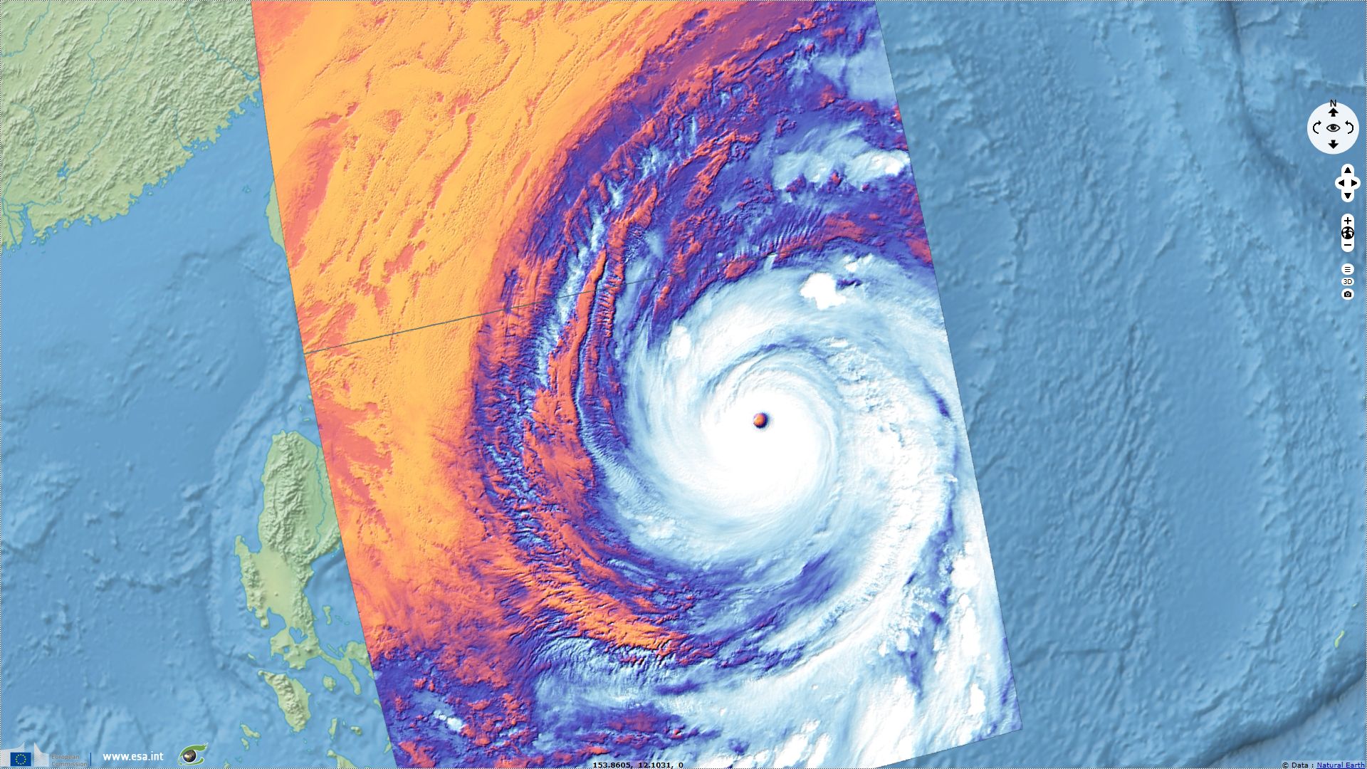
Typhoon Kong-Rey follows Trami over Ryukyu Islands
Sentinel-3 SLSTR RBT acquired on 30 September 2018 from 12:29:03 to 12:35:03 UTC
Sentinel-3 SLSTR RBT acquired on 01 October 2018 from 00:57:58 to 01:00:58 UTC
...
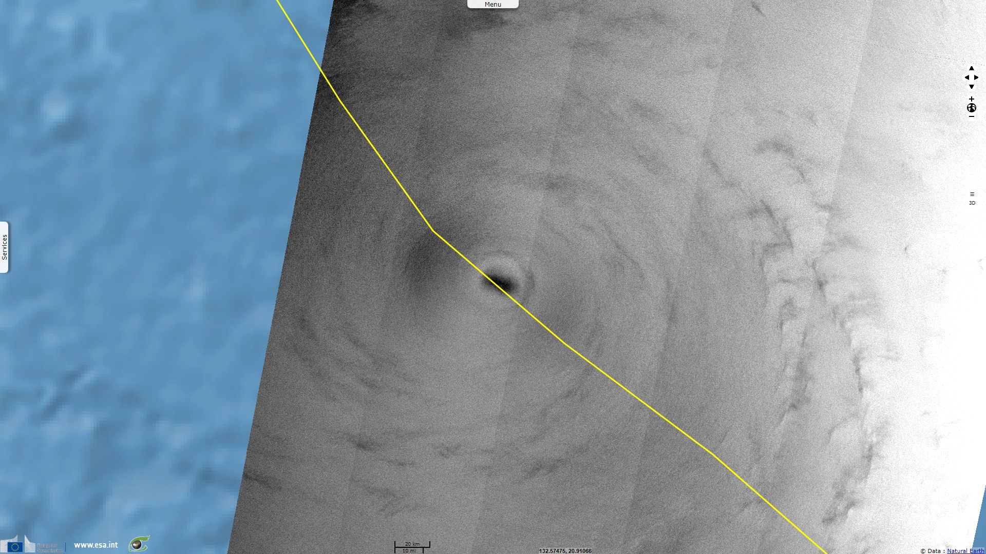
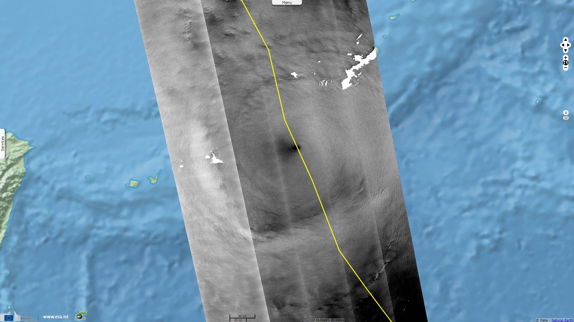
Sentinel-1 CSAR EW acquired on 04 October 2018 from 09:35:11 to 09:36:11 UTC
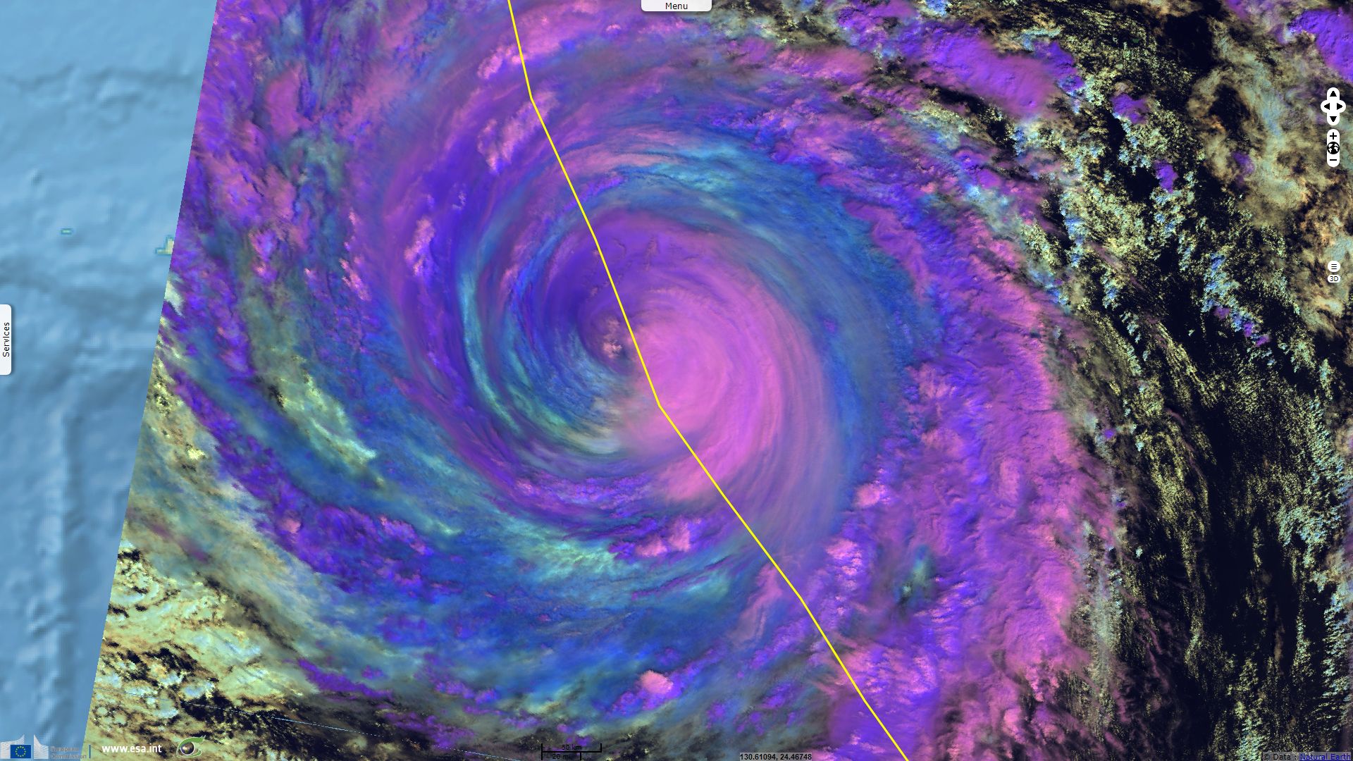
Sentinel-3 SLSTR RBT acquired on 05 October 2018 from 13:46:08 to 13:49:08 UTC
Sentinel-3 SLSTR RBT acquired on 01 October 2018 from 00:57:58 to 01:00:58 UTC
...
Sentinel-1 CSAR EW acquired on 04 October 2018 from 09:35:11 to 09:36:11 UTC
Sentinel-3 SLSTR RBT acquired on 05 October 2018 from 13:46:08 to 13:49:08 UTC
Keyword(s): Emergency, natural disaster, atmosphere, storm, climate, wind, rain, cyclone, hurricane, Japan, South Korea
The views expressed herein can in no way be taken to reflect the official opinion of the European Space Agency or the European Union.
Contains modified Copernicus Sentinel data 2026, processed by VisioTerra.
Contains modified Copernicus Sentinel data 2026, processed by VisioTerra.
| More on European Commission space: |  |
 |
 |
||||
| More on ESA: | |
|
|
S-1 website | S-2 website | S-3 website | |
| More on Copernicus program: | |
|
|
Scihub portal | Cophub portal | Inthub portal | Colhub portal |
| More on VisioTerra: | |
|
|
Sentinel Vision Portal | Envisat+ERS portal | Swarm+GOCE portal | CryoSat portal |