A landslide in Elliot Creek causes a tsunami-like wave, Canada
Sentinel-2 MSI acquired on 10 September 2020 at 19:20:01 UTC
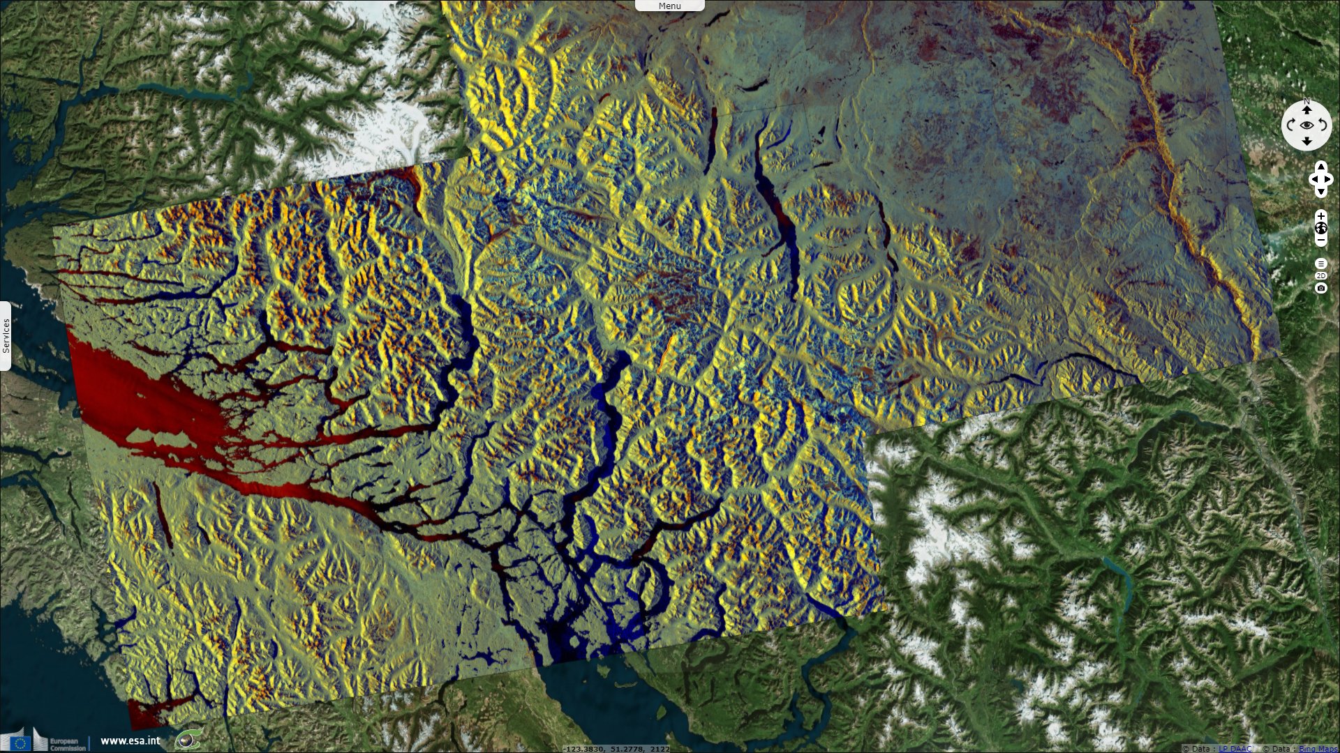
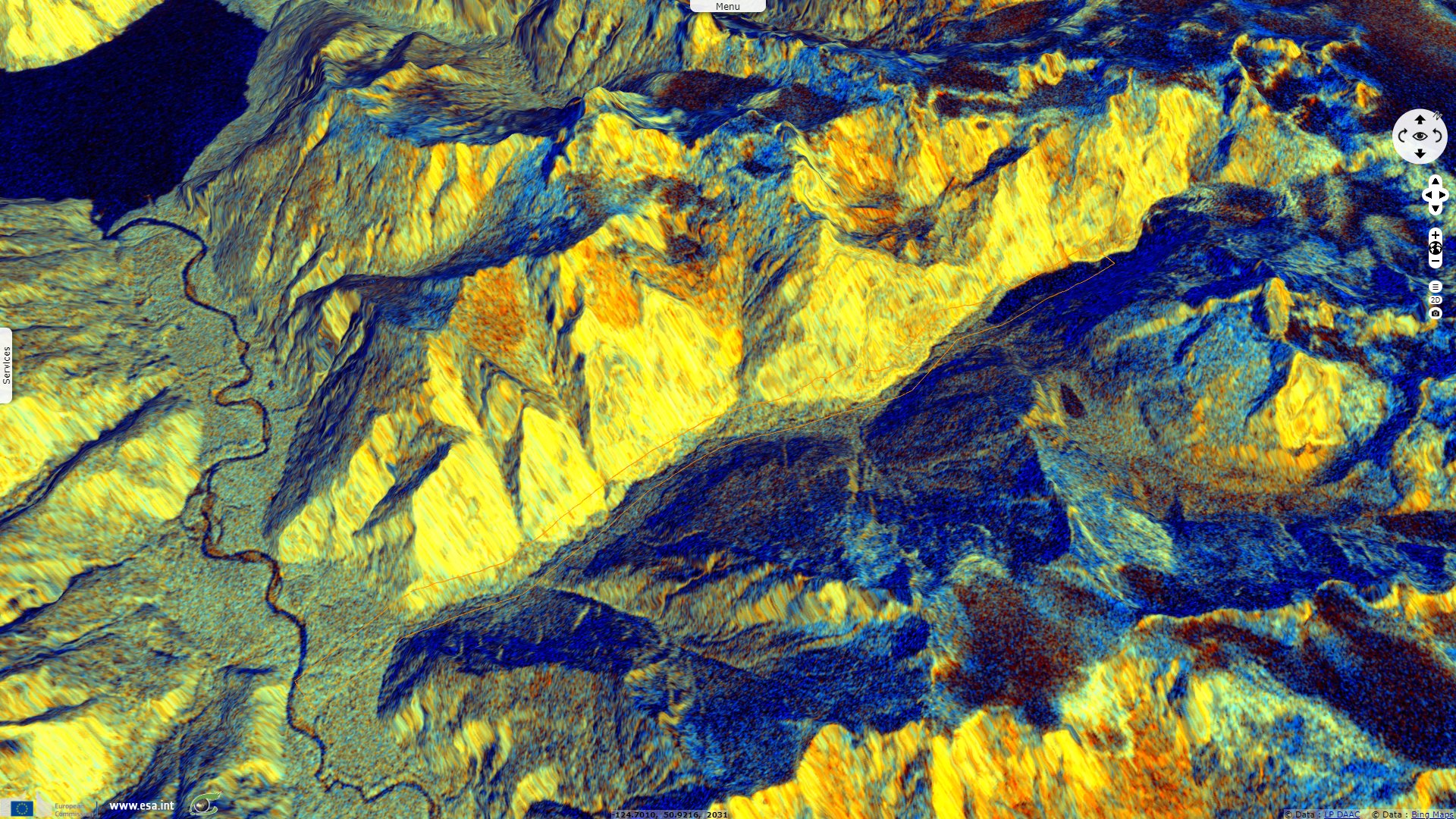
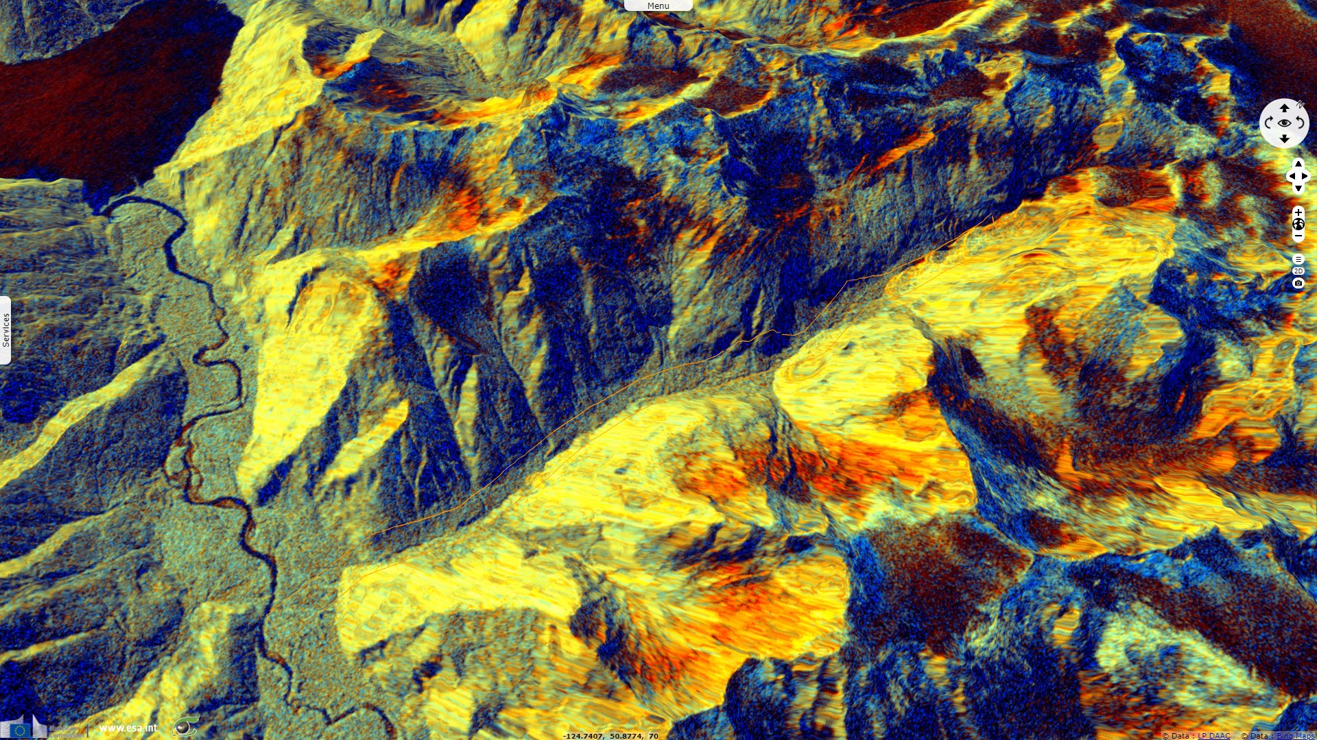
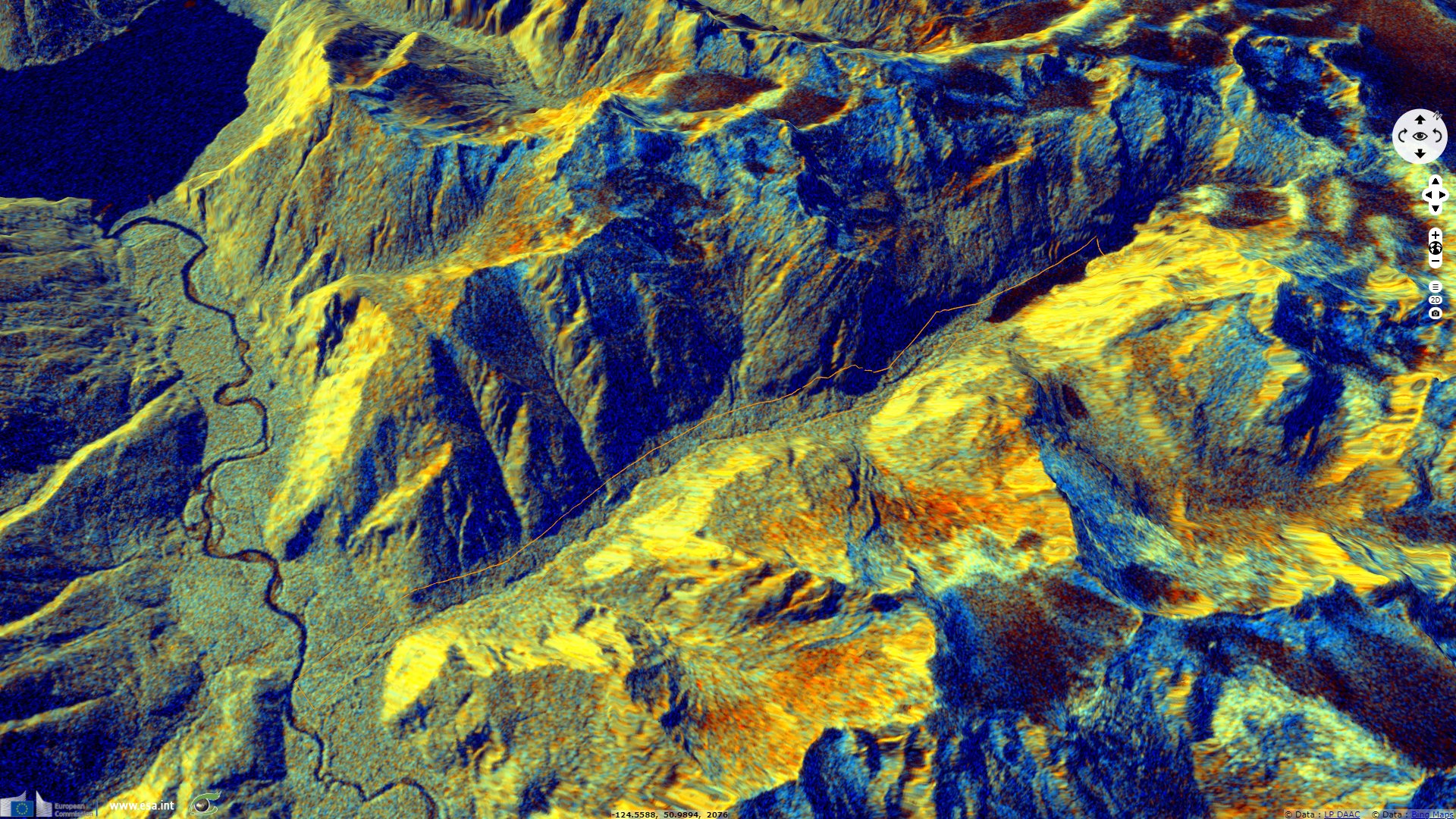
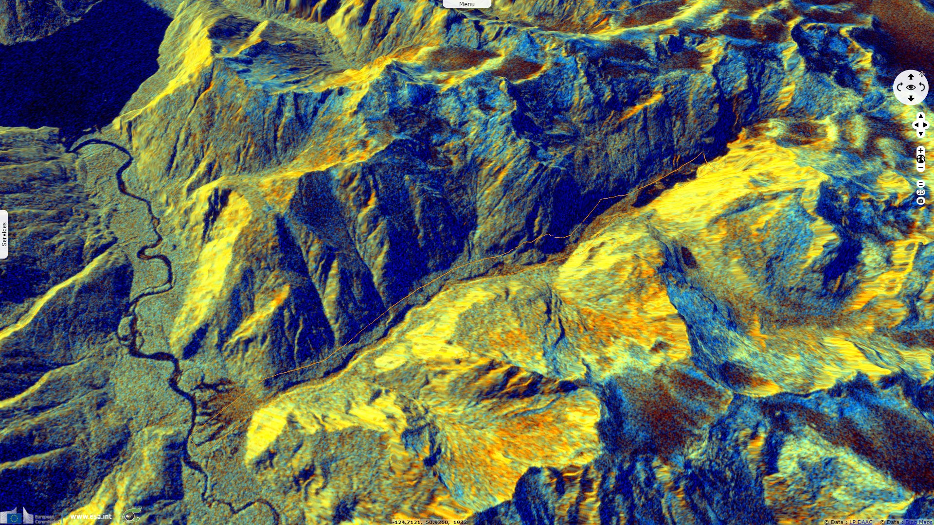
Sentinel-1 CSAR IW acquired on 26 November 2020 at 14:28:25 UTC
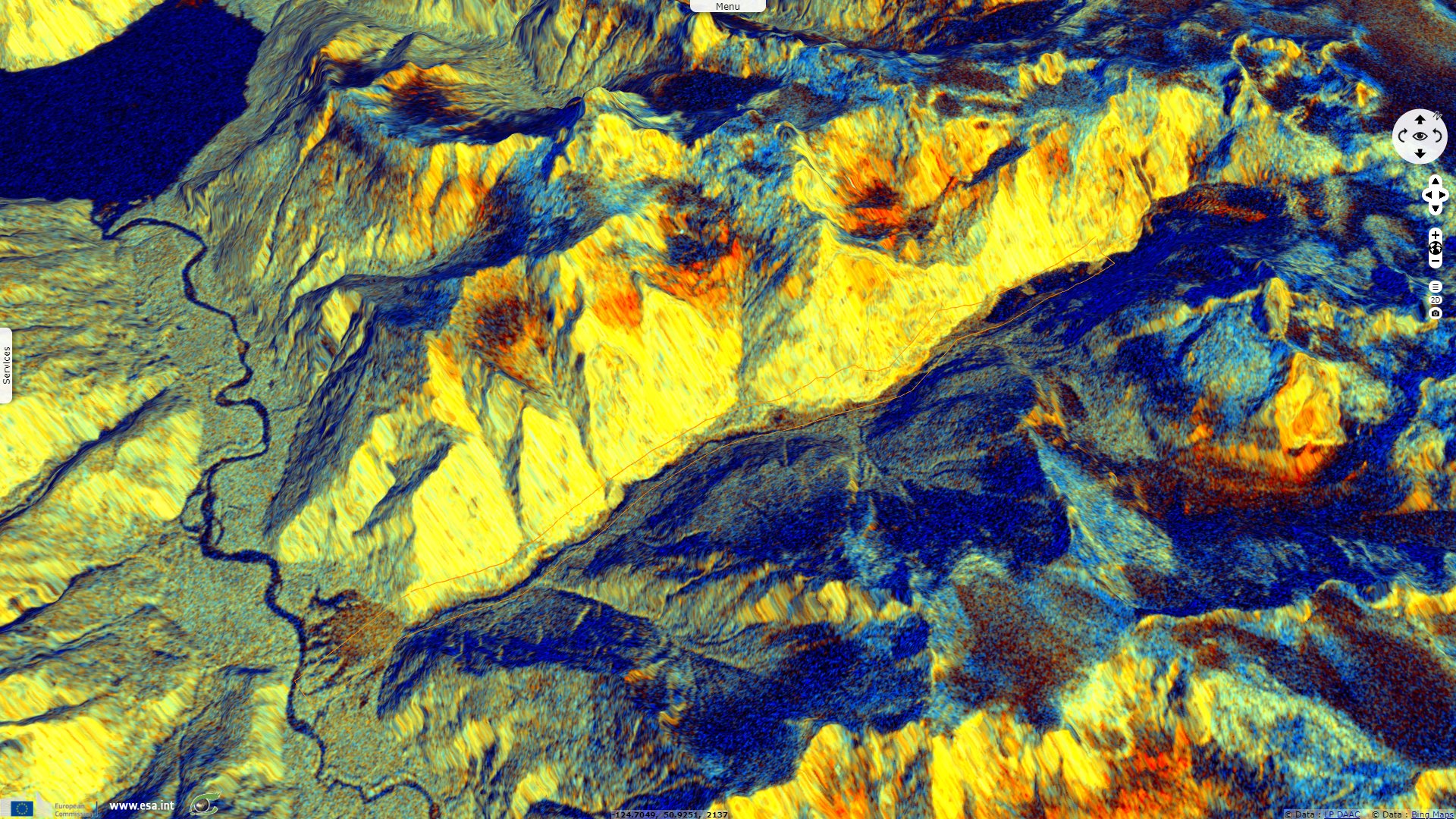
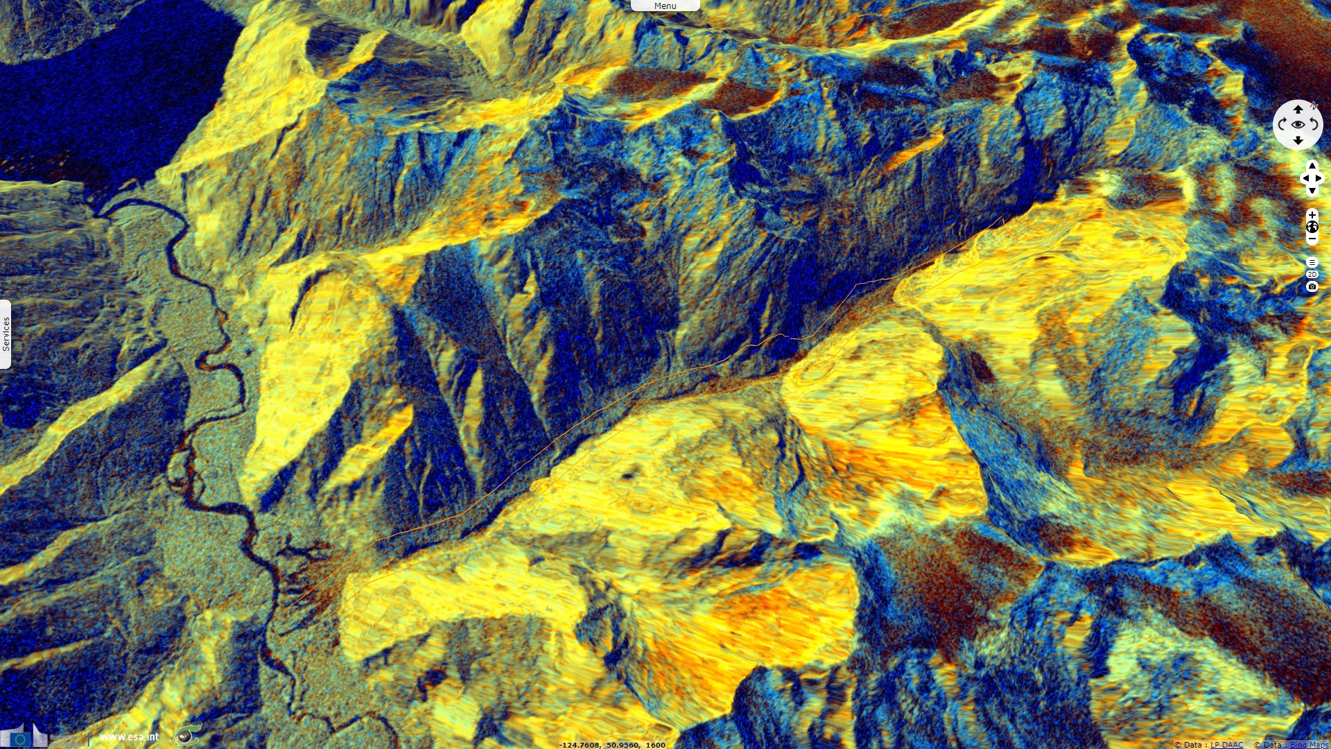
Sentinel-1 CSAR IW acquired on 30 November 2020 at 02:02:43 UTC
...
Sentinel-1 CSAR IW acquired on 08 December 2020 at 14:28:25 UTC
Sentinel-1 CSAR IW acquired on 26 November 2020 at 14:28:25 UTC
Sentinel-1 CSAR IW acquired on 30 November 2020 at 02:02:43 UTC
...
Sentinel-1 CSAR IW acquired on 08 December 2020 at 14:28:25 UTC
Keyword(s): Geohazard, landslide, river, lake, glacier, icefield, cryosphere, global warming, climate change, fjord, Canada
On December 22nd 2020, Rochelle Baker wrote a detailed press article about the large landslide that caused a powerful tsunami-like wave in Eliott Creek, British Columbia, Canada. It relates: "Environmental impacts from millions of tonnes of earth and water sluicing down a valley and spilling into the ocean are just beginning to be understood, say scientists studying a massive landslide in the Bute Inlet watershed. Climate change set the stage for the slide that occurred on the morning of Nov. 28, according to Brent Ward, a geologist at Simon Fraser University."
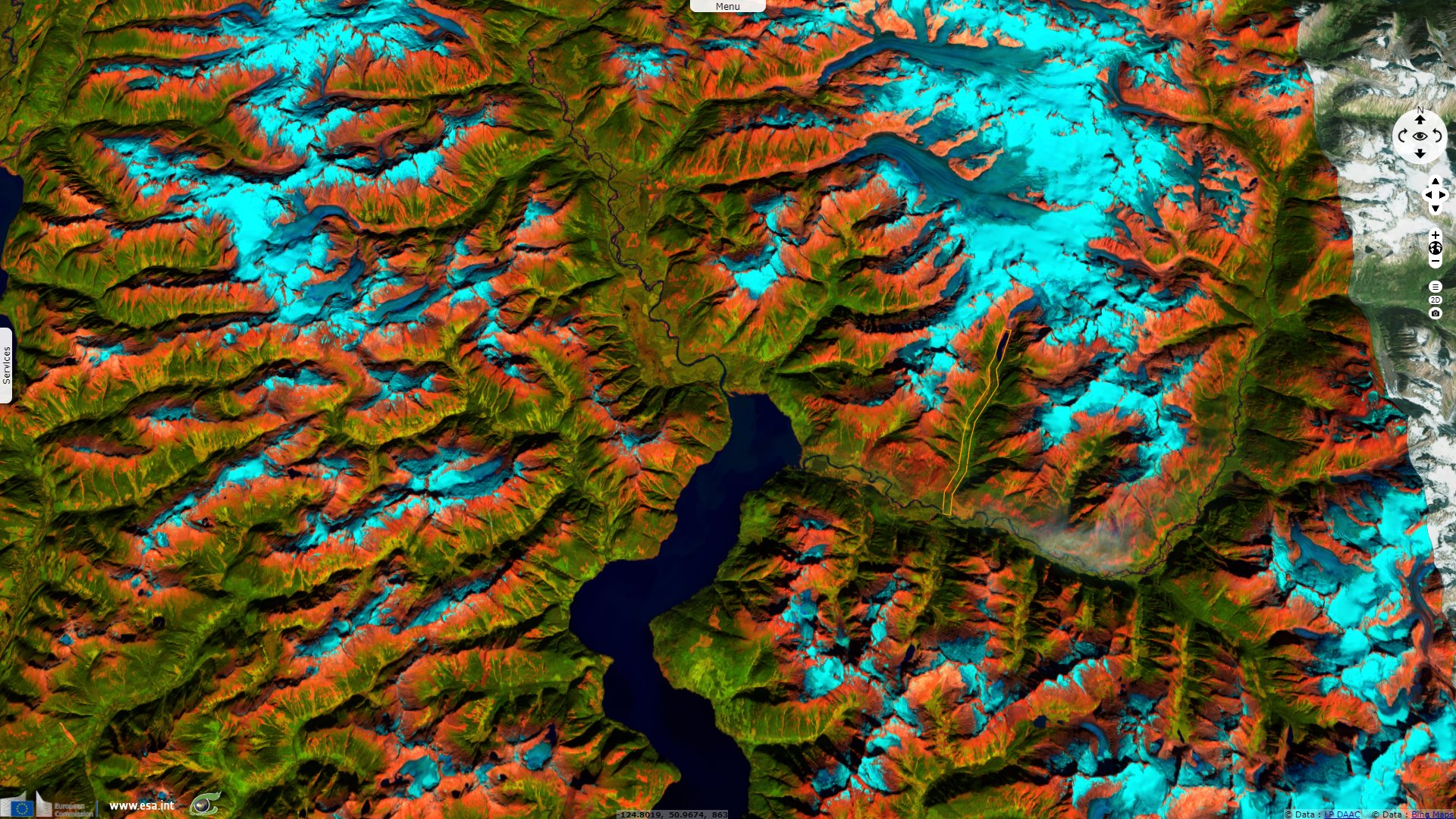
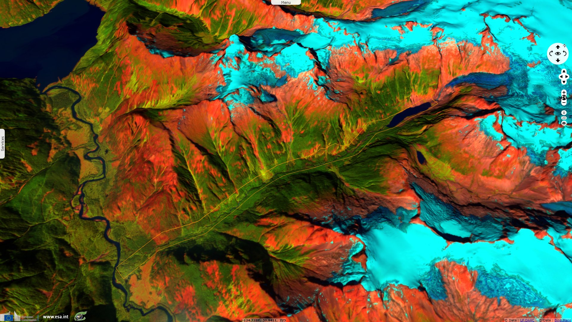
"A retreating glacier northeast of the head of Bute Inlet left a mountain slope above Elliot Creek unstable, said Ward, who is also co-director for SFU’s Centre for Natural Hazards Research. A section of the mountain — normally secured by the glacier and located above an older slide — came loose, plunging six to seven million cubic metres of rock and earth into a glacial lake at the head of the creek, Ward said."
"A displacement wave likely 100 metres high resulted — sending a wall of water down the length of the lake and creek, carving out channels for about 15 kilometres along the valley bottom and taking a raft of trees, rocks and earth with it. All the debris and water fanned out when it collided with the Southgate River valley, which, in turn, continued to drain into Bute Inlet, Ward said. Most of the slide’s devastation was the result of the wave pushing out of the lake, which grew at the bottom of the mountain as the glacier melted, Ward said."
"'Because of climate change and the fact the glacier pulled back, a lake formed there,' he said, adding if the landslide had occurred in the past, it would have just fallen onto the glacier and stayed put. 'We probably wouldn't have even noticed it, but because of the lake, it triggered this big wave, and it's had a huge effect on the fishery and wildlife in the area,' Ward said."
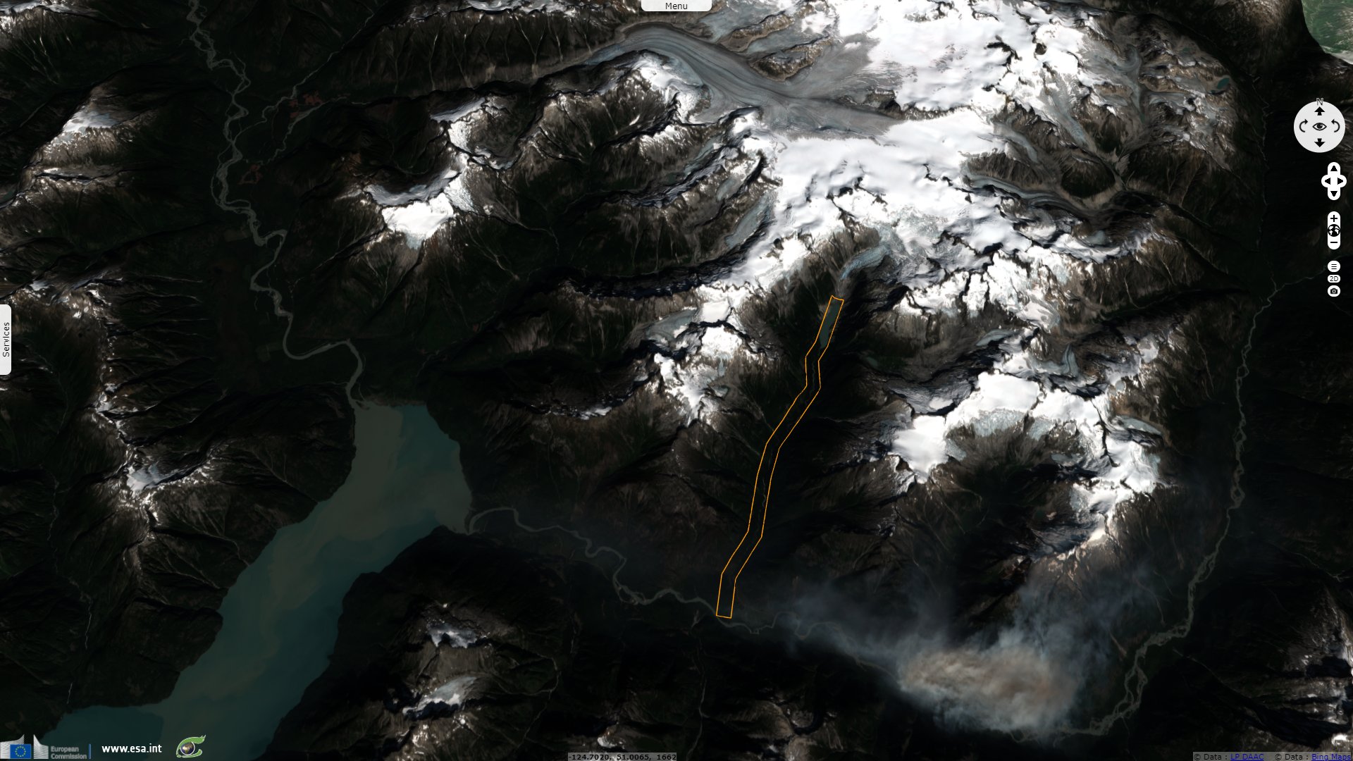
Pilot Bastian Fleury, with 49 North Helicopters based in Campbell River, was one of the first to investigate why trees and logs were floating down the nearby Bute Inlet. He got "footage of the slide’s devastation from the air. Fleury returned to the area again last Thursday to get images of where the slide originated close to the glacier."
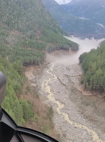
Still from one of the 49 North Helicopters videos. Left: track of the Bute Inlet landslide. Right: lower part of the Bute Inlet landslide, at the mouth of the valley there is extensive deposition of sediment. Source: Pilot Bastian Fleury
"Jennifer Jackson, an oceanography researcher with the Hakai Institute, said the glacial slide had an immediate and dramatic cooling effect on deeper water in Bute Inlet. Over 70 years, Bute Inlet’s deep-water temperature rose by 1.2 C, said Jackson, whose research involves monitoring impacts of climate change in B.C.’s fjords. But the landslide was so massive, it immediately caused half a degree of cooling in deep water below 350 metres, Jackson said."
"The turbidity current caused by the slide travelled as far as 65 kilometres from the mouth of the Southgate River down the inlet and was an incredible 400 metres thick, Jackson said. 'Normal turbidity currents in Bute Inlet would be about 25 metres thick,' she said. However, it’s clear retreating glaciers were a factor in the landslide, which should raise concern for any coastal communities that could be at increased risk of natural disasters triggered by climate change, Jackson said."
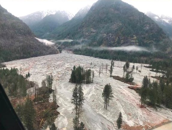
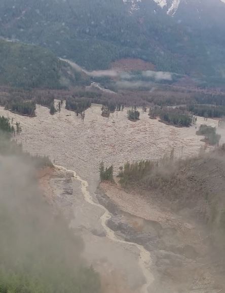
Still from one of the 49 North Helicopters videos. Glacial lake outburst flood, at Elliot Creek just east of the head of Bute Inlet, part of glacier failed and hit lake. Source: Pilot Bastian Fleury
Yvette Brend, journalist for Canadian Broadcasting Corporation (CBC), gives estimates of the landslide for CBC: "On Nov. 28, an estimated 7.7-million cubic metres of debris flowed oceanward, carried in a thick mud slurry the consistency of wet cement. Scientists say the force of the event was equivalent to a magnitude 4.9 earthquake — and was about one-sixth the size of one of Canada's biggest landslides in 1965 near Hope B.C."
In another article, she reported about the cause: "Daniel Shugar, an associate professor in the department of geoscience at the University of Calgary said: 'It's quite an interesting hazards cascade or sort of domino series of events. One landslide triggered a displacement wave — like a tsunami in the lake — which cut down through the moraine [a debris accumulation] that was damming that lake to cause this outburst flood and then this turbidity current in the ocean.' Shugar suspects heavy rain caused the initial slide on the slope that had shown instability before. The sudden burst of water from the lake created a knock-on effect propelling millions of cubic metres of mud and debris and scouring out Elliot Creek into more of a canyon."
The views expressed herein can in no way be taken to reflect the official opinion of the European Space Agency or the European Union.
Contains modified Copernicus Sentinel data 2026, processed by VisioTerra.
Contains modified Copernicus Sentinel data 2026, processed by VisioTerra.
| More on European Commission space: |  |
 |
 |
||||
| More on ESA: | |
|
|
S-1 website | S-2 website | S-3 website | |
| More on Copernicus program: | |
|
|
Scihub portal | Cophub portal | Inthub portal | Colhub portal |
| More on VisioTerra: | |
|
|
Sentinel Vision Portal | Envisat+ERS portal | Swarm+GOCE portal | CryoSat portal |