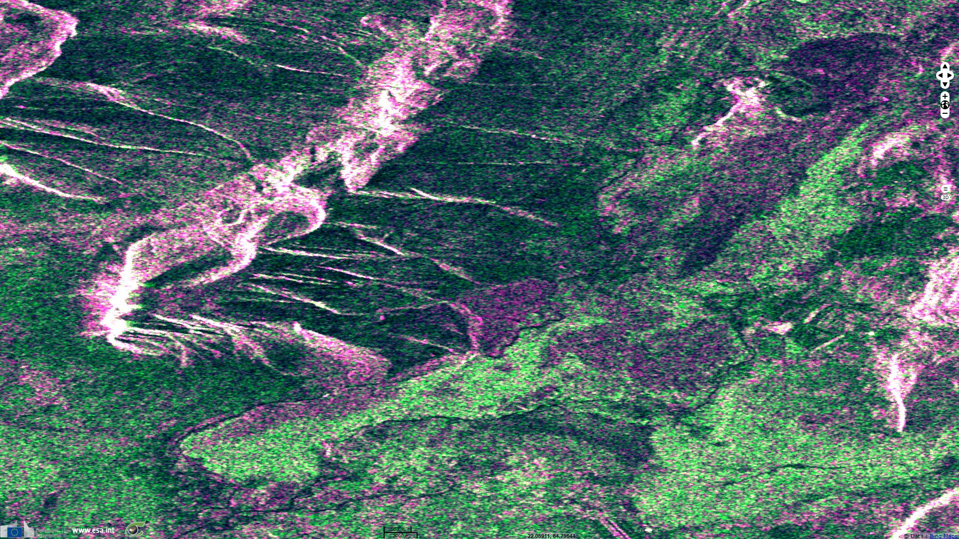
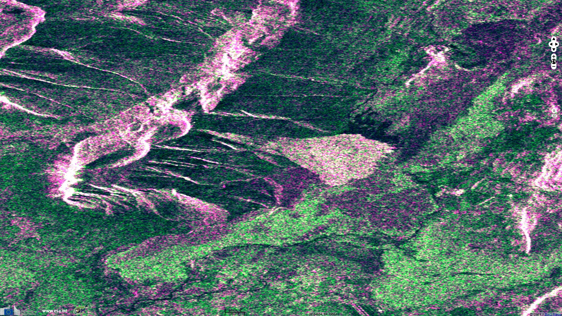
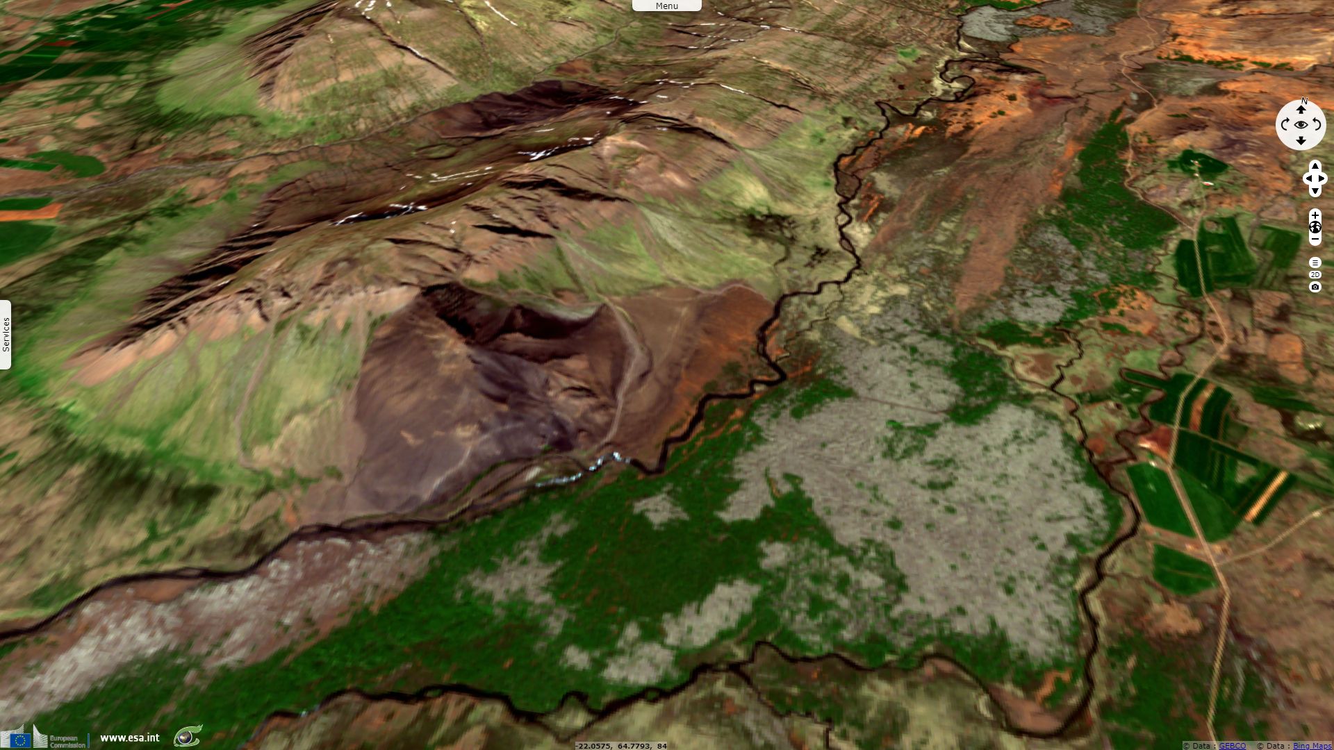
Large landslide in Fagraskógarfjall, west Iceland
Sentinel-2 MSI acquired on 20 June 2018 at 13:17:19 UTC
Sentinel-1 CSAR IW acquired on 05 July 2018 at 18:58:57 UTC
Sentinel-2 MSI acquired on 17 July 2018 at 13:12:59 UTC
Sentinel-1 CSAR IW acquired on 17 July 2018 at 18:58:58 UTC
Sentinel-1 CSAR IW acquired on 05 July 2018 at 18:58:57 UTC
Sentinel-2 MSI acquired on 17 July 2018 at 13:12:59 UTC
Sentinel-1 CSAR IW acquired on 17 July 2018 at 18:58:58 UTC
Keyword(s): Land, geohazard, landslide, mountain, dam, river, Iceland
The landslide crossed the river Hítará, damming the river and causing a lake to form above the debris tongue.
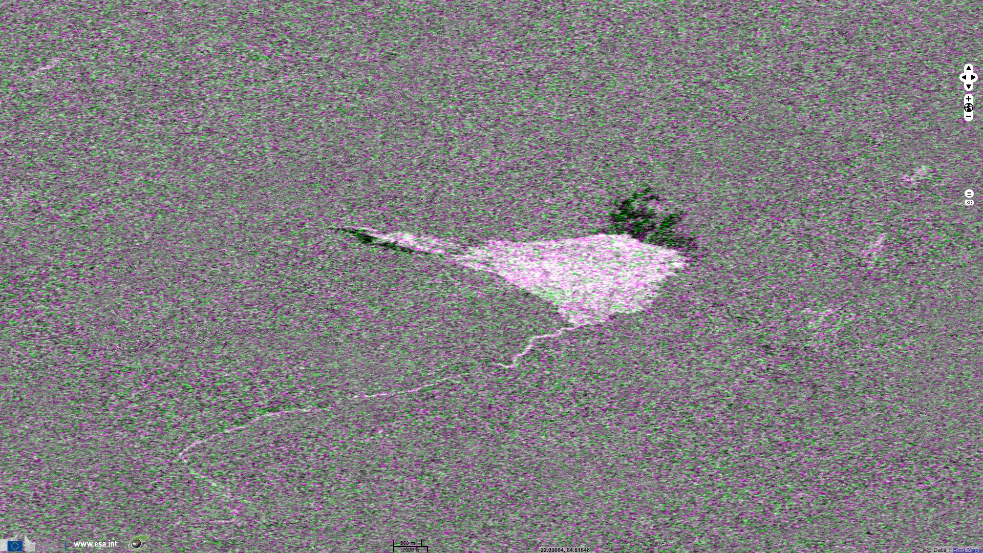
This composite using normalised difference indices between several dates highlights the debris fan in bright. Just north, the dammed river formed a lake (dark) which water now flows south east toward the Tálmi river bed (lesser dark ribbon). Downstream of the landslide, river Hítará is partly dried up which shows as a bright ribbon.
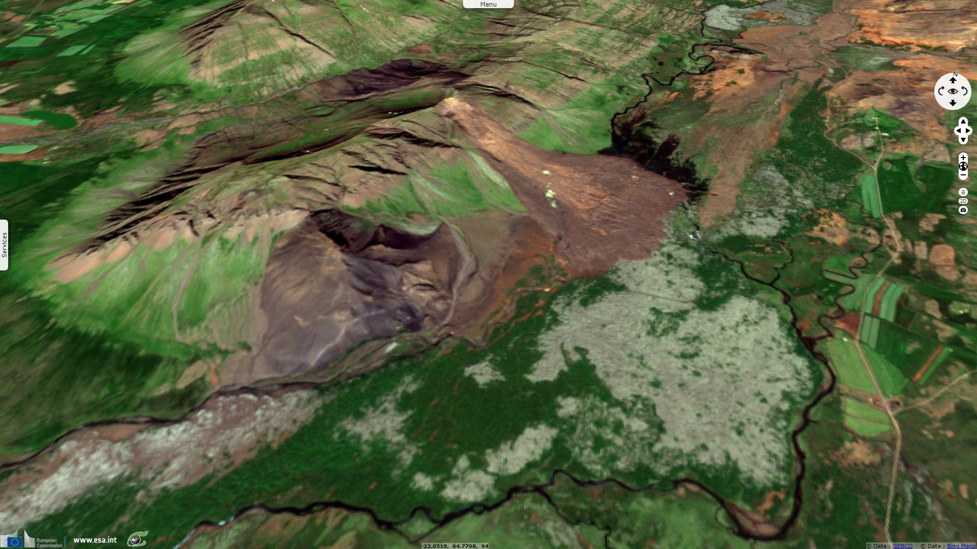
The water found a new channel east the next day into Tálmi, a riverbed that reconnects with the now smaller Hítará river a few km farther downstream.
The views expressed herein can in no way be taken to reflect the official opinion of the European Space Agency or the European Union.
Contains modified Copernicus Sentinel data 2026, processed by VisioTerra.
Contains modified Copernicus Sentinel data 2026, processed by VisioTerra.
| More on European Commission space: |  |
 |
 |
||||
| More on ESA: | |
|
|
S-1 website | S-2 website | S-3 website | |
| More on Copernicus program: | |
|
|
Scihub portal | Cophub portal | Inthub portal | Colhub portal |
| More on VisioTerra: | |
|
|
Sentinel Vision Portal | Envisat+ERS portal | Swarm+GOCE portal | CryoSat portal |