Iranian landscapes
Sentinel-2 MSI acquired on 17 May 2017 at 06:56:31 UTC
Sentinel-3 OLCI FR & SLSTR RBT acquired on 25 May 2017 from 06:05:16 to 06:08:16 UTC
Sentinel-3 OLCI FR & SLSTR RBT acquired on 31 May 2017 from 06:50:09 to 06:53:09 UTC
Sentinel-2 MSI acquired on 03 July 2017 at 06:46:21 UTC
Sentinel-2 MSI acquired on 14 December 2017 at 07:23:09 UTC
Sentinel-3 OLCI FR & SLSTR RBT acquired on 25 May 2017 from 06:05:16 to 06:08:16 UTC
Sentinel-3 OLCI FR & SLSTR RBT acquired on 31 May 2017 from 06:50:09 to 06:53:09 UTC
Sentinel-2 MSI acquired on 03 July 2017 at 06:46:21 UTC
Sentinel-2 MSI acquired on 14 December 2017 at 07:23:09 UTC
Keyword(s): Land, mountain range, basin, desert, salar, sebkha, geology, Biosphere Reserve, UNESCO World Heritage, Iran
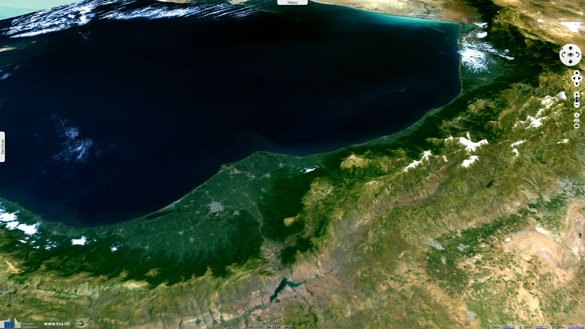
Part of the alpide belt, the Alborz mountain range runs from west to east though Northern Iran between Caucasus and Pontic mountains at west and continuing east to the Kopet Dag mountain range separating Turkmenistan from Iran.
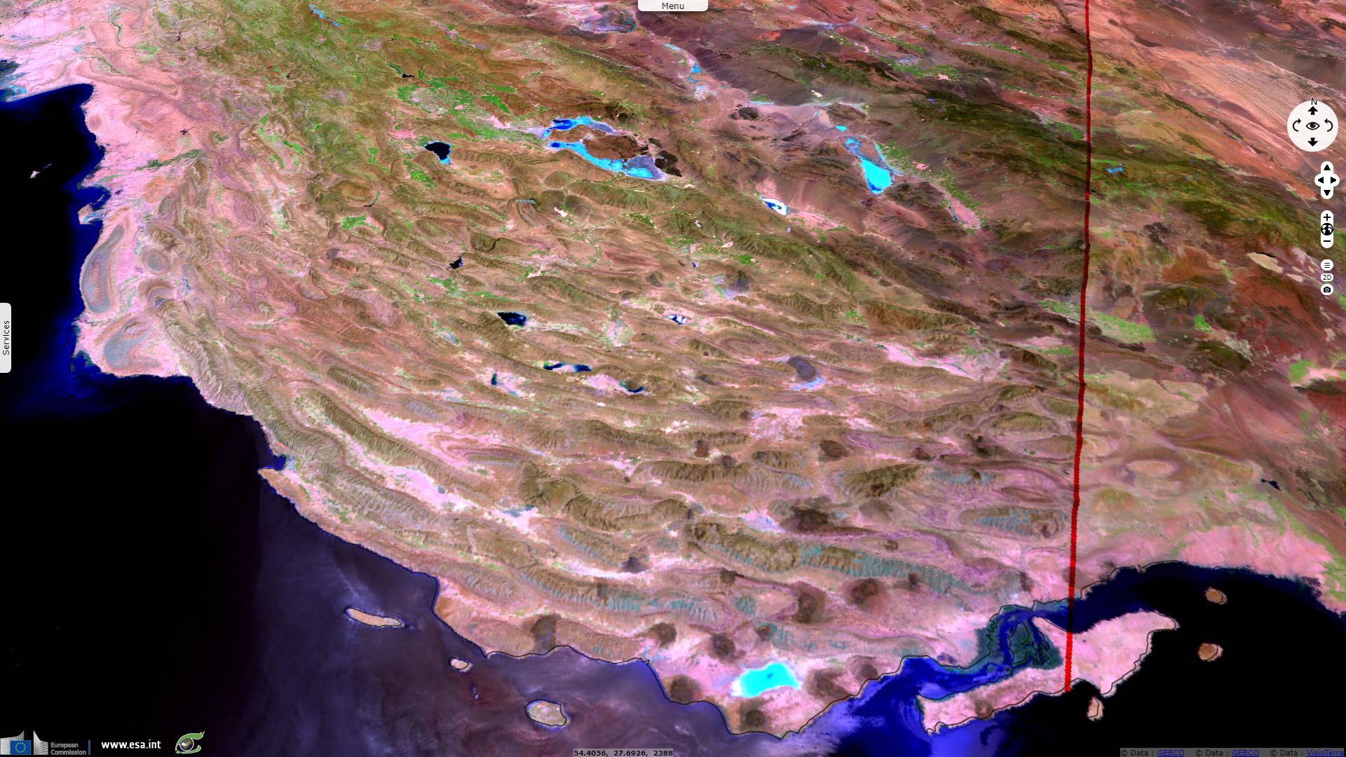
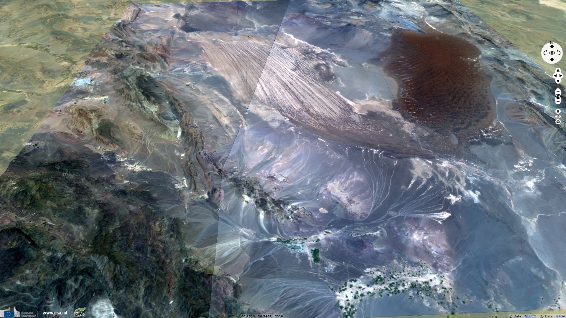
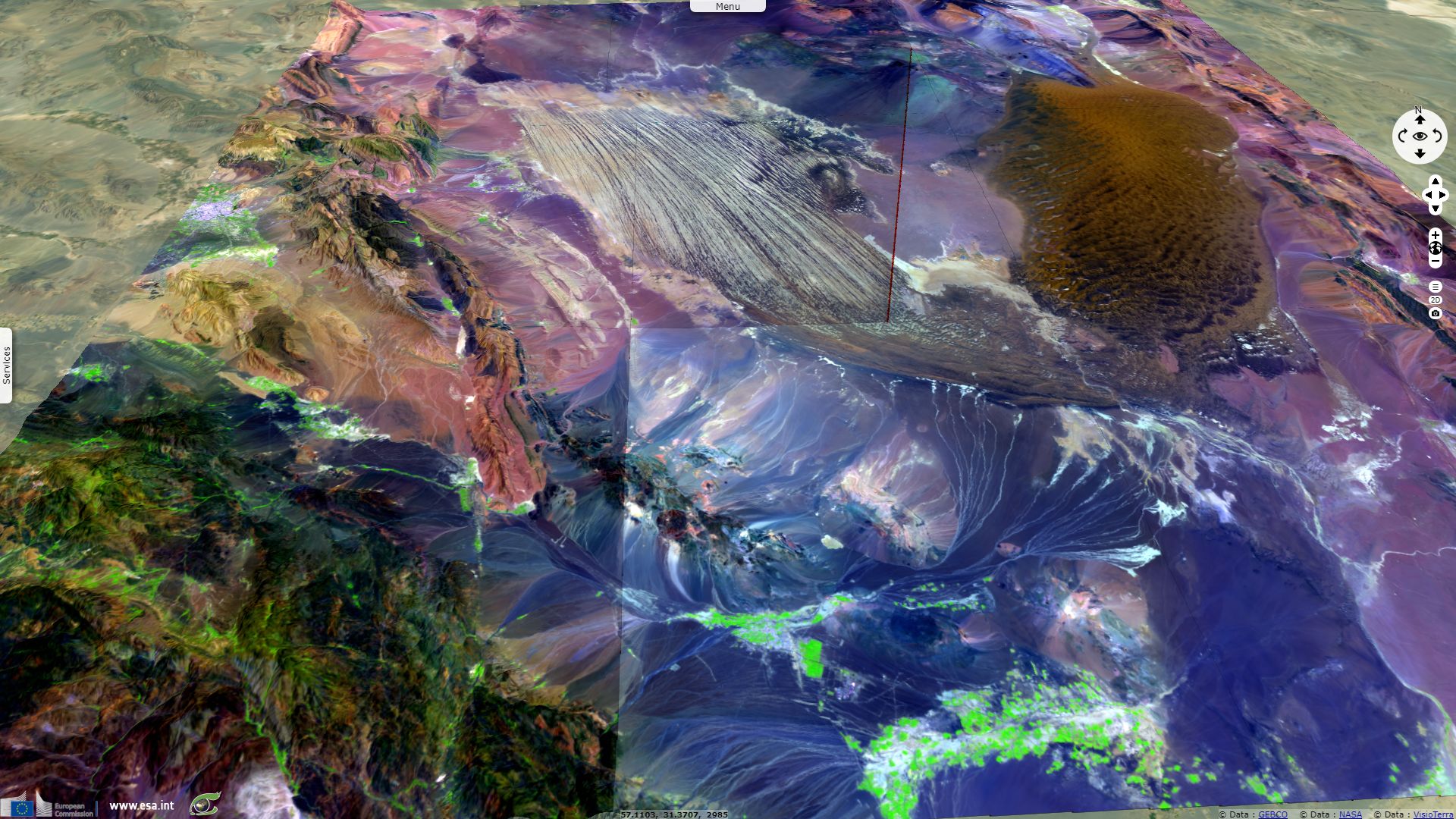
The Zagros range features landforms similar to the basin and range region west of the United States shown in SED-241.
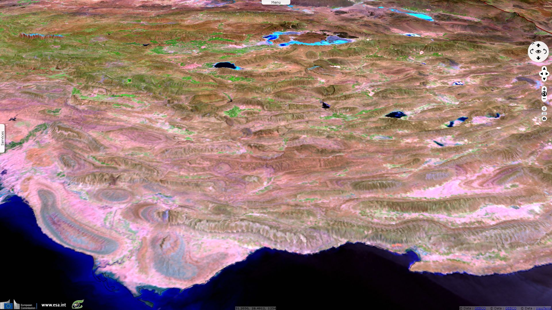
iranicaonline.org describes the Bakhtari mountains, writing: "The impressive basin-range-structure of the Baḵtīārī mountains, a result of the geological development of the Zagros system since late Cretaceous time and culminating in the orogenesis of Tertiary upfolding, is accentuated by the complicated and unique drainage system, which itself is the result of geology and topography. The Baḵtīārī mountains sensu stricto are part of the Folded Zagros and, as such, characterized by extensive north-northwest to south-southeast running ridges (anticlinal axes) and deeply incised valleys, connected with each other by numerous transverse gorges (tang). The vertical differences between some crest elevations and valley bottoms amount to more than 2,000 m; some of the narrow and extremely incised transverse gorges are more than 1,500 m deep."
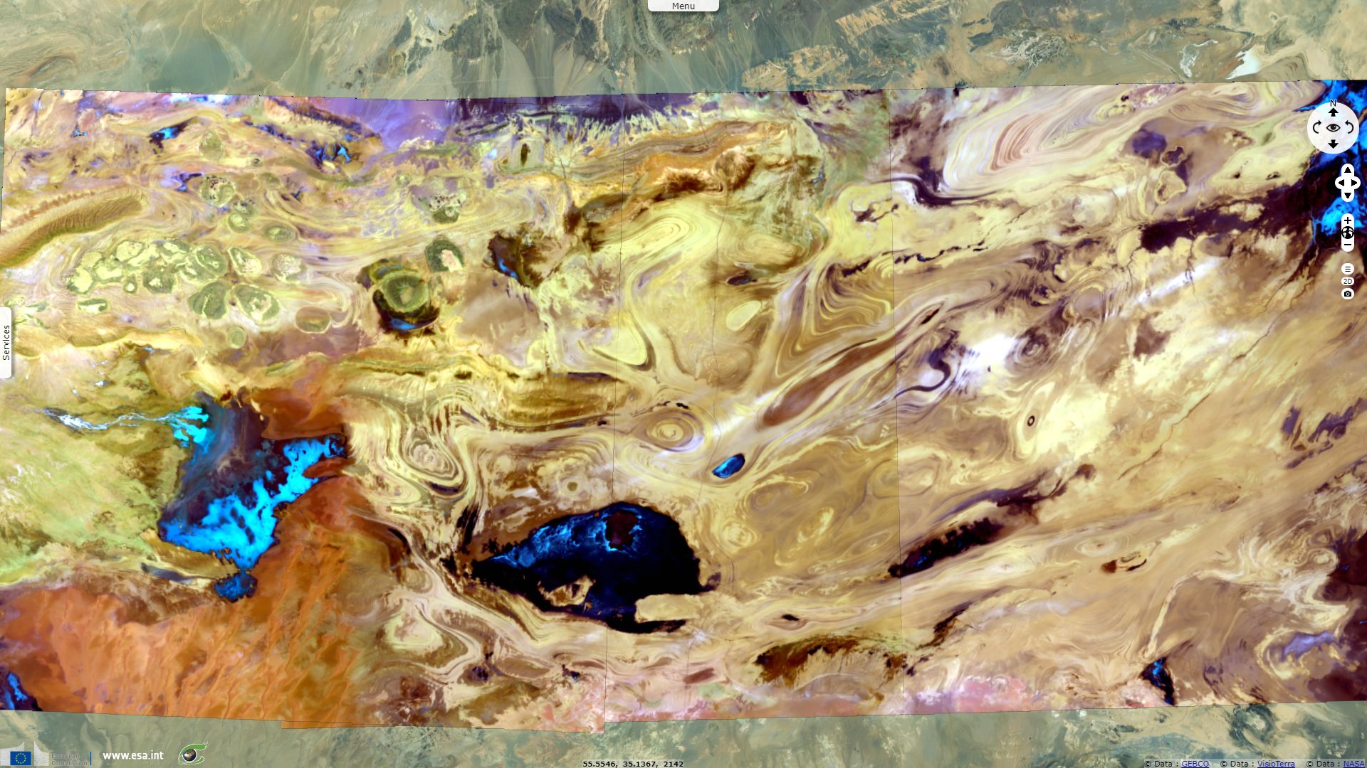
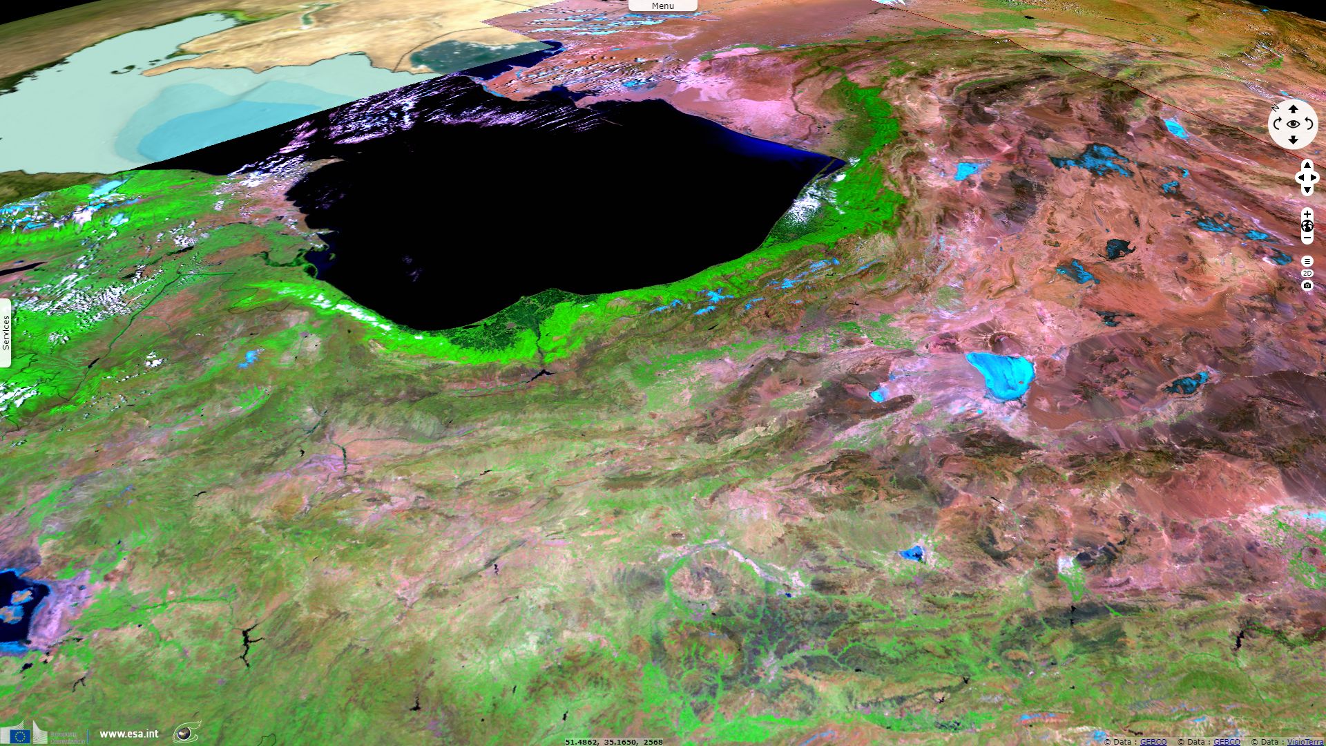
UNESCO lists Dasht-e Kavir among its biosphere reserves. Its information sheet details: "The Kavir Biosphere Reserve is located in the Anatolian Iranian Desert. The Kavir plain mainly covers flood plains and low mountain ranges. Apart from arid and semi-arid desert vegetation, steppe communities, salted and sandy lands are characteristical for the biosphere reserve."
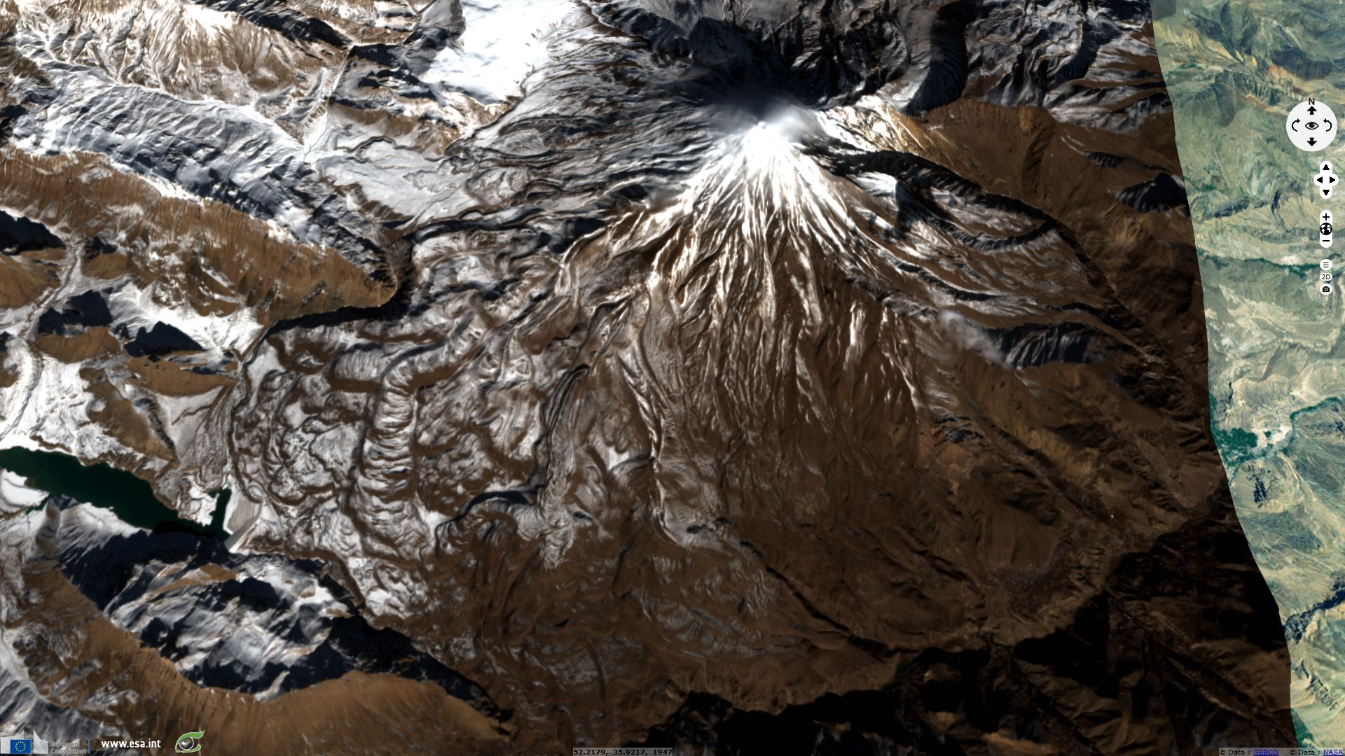
The snowcapped Damavand is striking by its 5670m height, isolated among much lower summits. Being located in the vinicity of Tehran and of the Caspian Sea makes its silhouette and steep slopes even more remarkable. The Smithonian Institution writes about it: "The Damavand stratovolcano towers dramatically 70 km to the NE above Iran's capital city of Tehran and 70 km S of the Caspian Sea. It is the highest volcano in the Middle East. A younger cone has been constructed during the past 600,000 years over an older edifice, remnants of which were previously interpreted as a caldera wall. Flank vents are rare, and activity at the dominantly trachyandesite volcano has been concentrated at the summit vent, which has produced a series of radial lava flows. Lava effusion has dominated, pyroclastic activity has been limited, and the only major explosive event produced a welded ignimbrite about 280,000 years ago. The youngest activity has consisted of the eruption of a series of lava flows from the summit vent that cover the W side of the volcano. The youngest dated lava flows were emplaced about 7000 years ago."
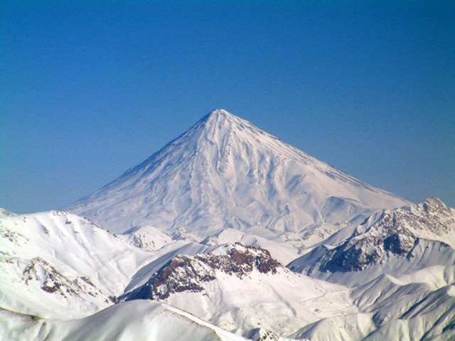
Damavand during the winter 2006 - Source: Arad Mojtahedi
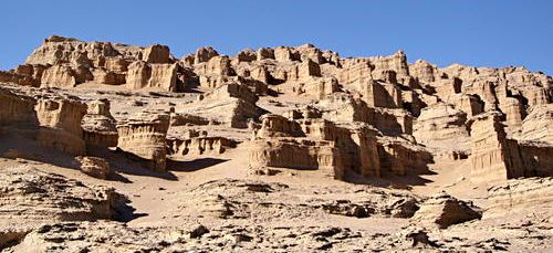
Lut Desert: Shahr-e Khialyye Lut - Source: Alireza Amrikazemi for UNESCO
A UNESCO World Heritage, the Lut Desert displays various landscapes: ergs, regs, mountains, alluvial fans, depressions, sebkhas... UNESCO summurizes this basin in central Iran the interest of this remote location: "The Lut Desert, or Dasht-e-Lut, is located in the south-east of the country. Between June and October, this arid subtropical area is swept by strong winds, which transport sediment and cause aeolian erosion on a colossal scale. Consequently, the site presents some of the most spectacular examples of aeolian yardang landforms (massive corrugated ridges). It also contains extensive stony deserts and dune fields. The property represents an exceptional example of ongoing geological processes."
The views expressed herein can in no way be taken to reflect the official opinion of the European Space Agency or the European Union.
Contains modified Copernicus Sentinel data 2026, processed by VisioTerra.
Contains modified Copernicus Sentinel data 2026, processed by VisioTerra.
| More on European Commission space: |  |
 |
 |
||||
| More on ESA: | |
|
|
S-1 website | S-2 website | S-3 website | |
| More on Copernicus program: | |
|
|
Scihub portal | Cophub portal | Inthub portal | Colhub portal |
| More on VisioTerra: | |
|
|
Sentinel Vision Portal | Envisat+ERS portal | Swarm+GOCE portal | CryoSat portal |