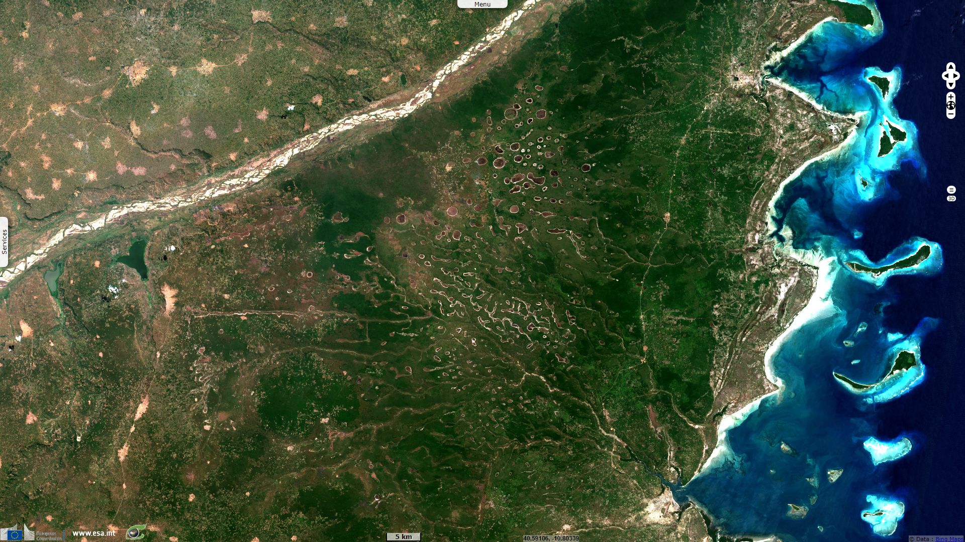
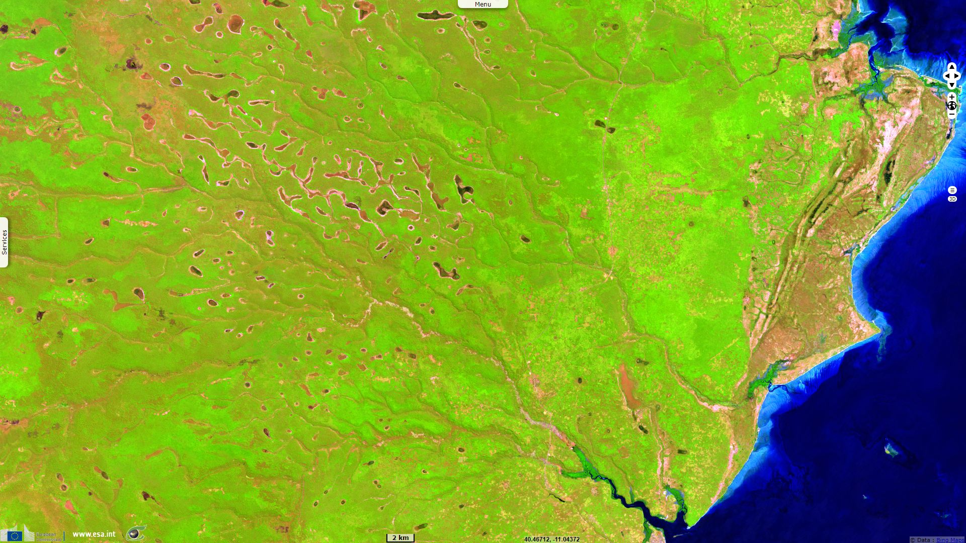
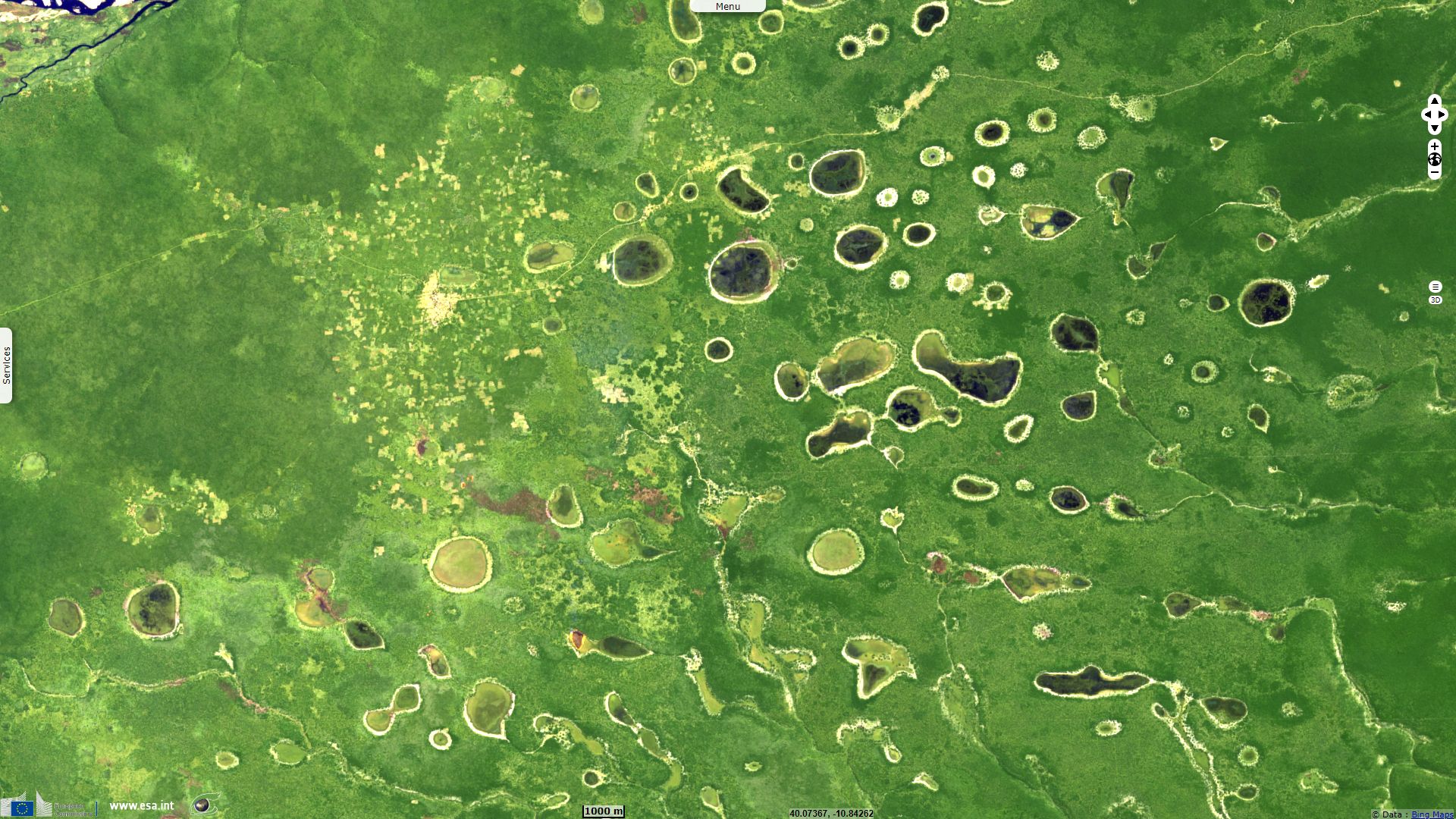
Dotted landscape in Pundanhar grass pans, Mozambique
Sentinel-2 MSI acquired on 27 July 2017 at 07:23:09 UTC
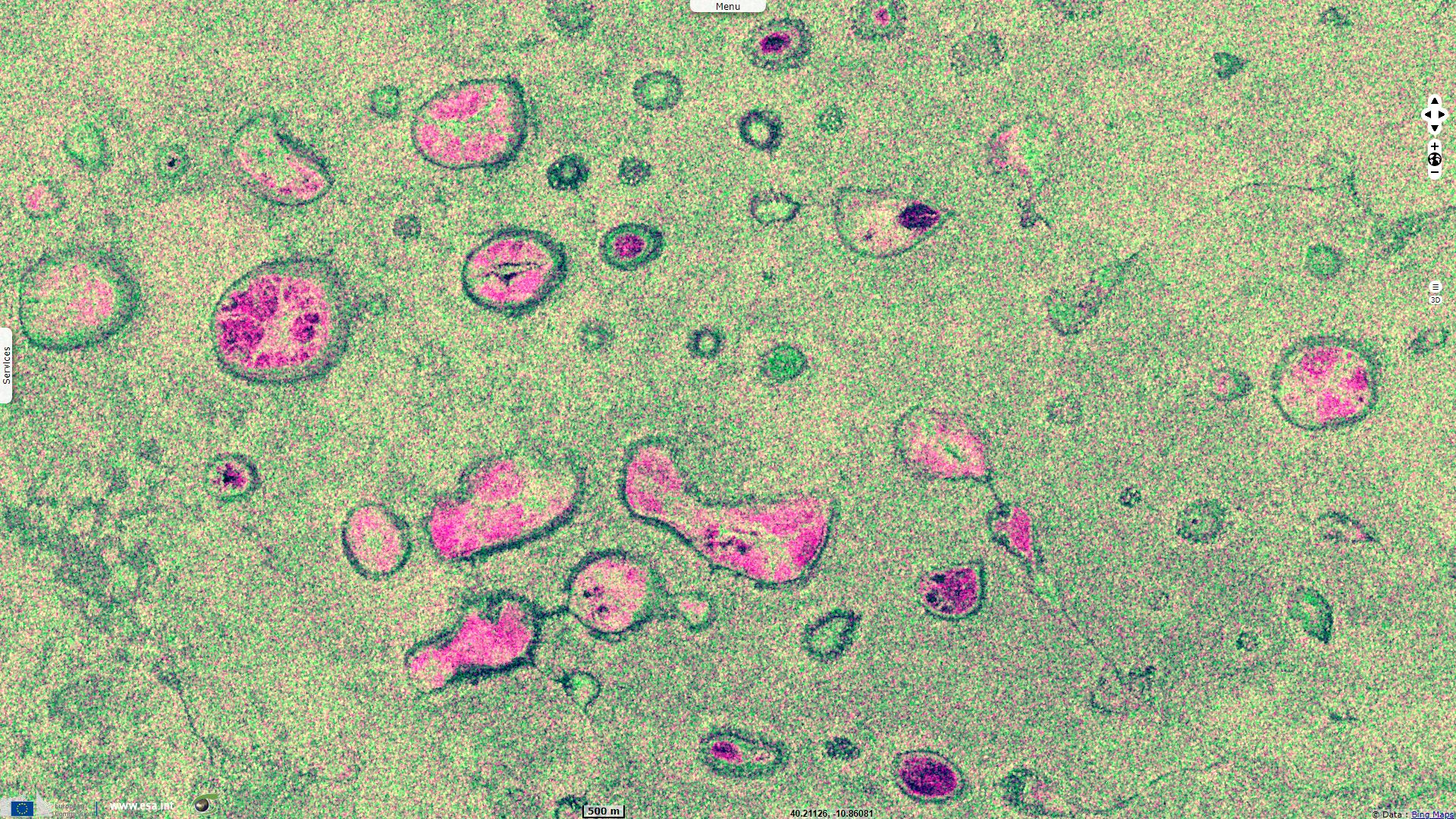
Sentinel-1 CSAR IW acquired on 03 March 2019 at 02:57:25 UTC
Sentinel-1 CSAR IW acquired on 03 March 2019 at 02:57:25 UTC
Keyword(s): Land, hydrology, savannah, pans, lakes, wildfire, bushfire, Mozambique.
Some pans are partitioned into separate agricultural plots with associated guard/shelter towers, possibly built on former termite mounds.
The views expressed herein can in no way be taken to reflect the official opinion of the European Space Agency or the European Union.
Contains modified Copernicus Sentinel data 2026, processed by VisioTerra.
Contains modified Copernicus Sentinel data 2026, processed by VisioTerra.
| More on European Commission space: |  |
 |
 |
||||
| More on ESA: | |
|
|
S-1 website | S-2 website | S-3 website | |
| More on Copernicus program: | |
|
|
Scihub portal | Cophub portal | Inthub portal | Colhub portal |
| More on VisioTerra: | |
|
|
Sentinel Vision Portal | Envisat+ERS portal | Swarm+GOCE portal | CryoSat portal |