All time highs and lost ice caps in Ellesmere, Canada
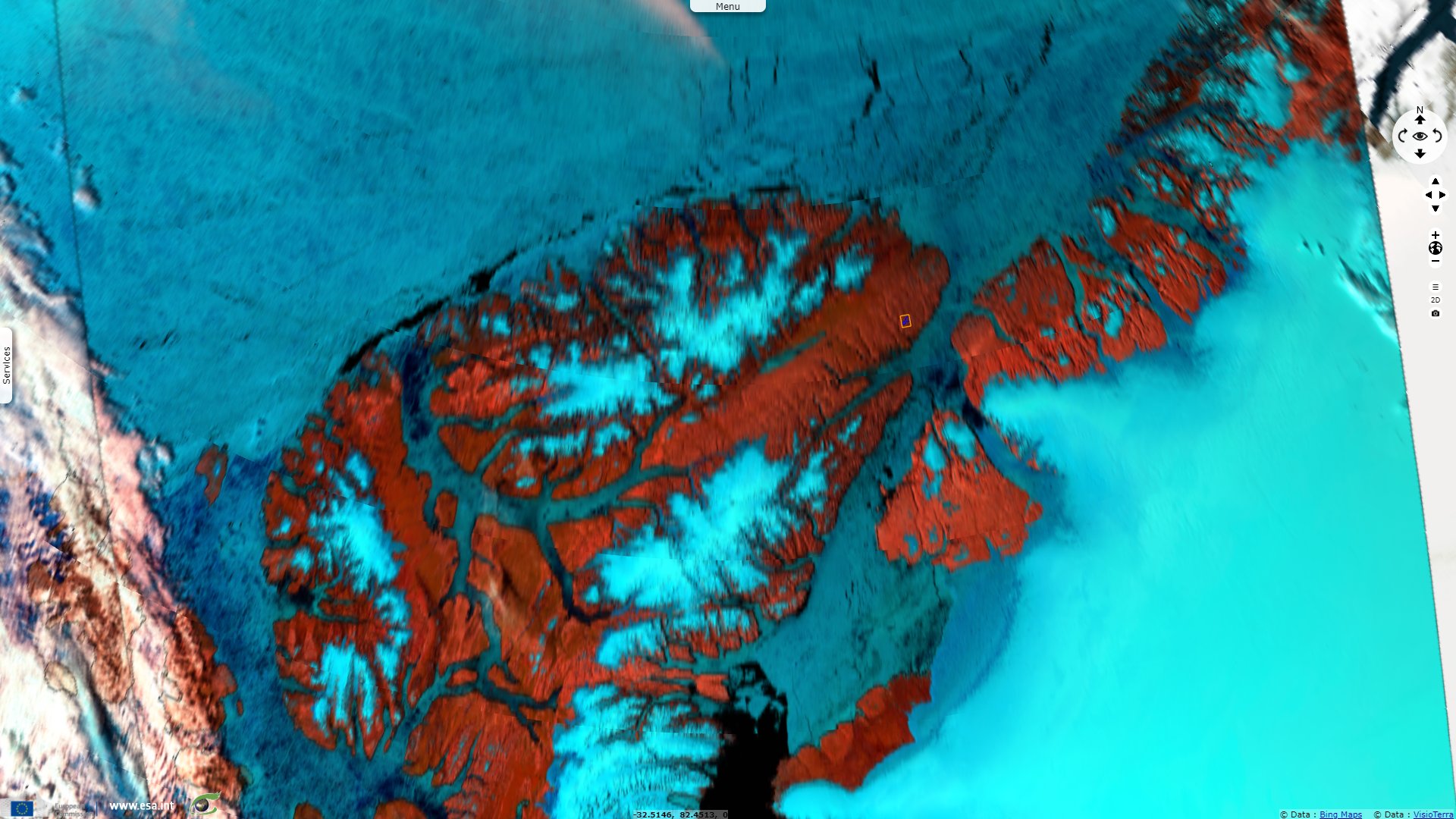
Sentinel-2 MSI acquired on 29 July 2016 at 19:39:12 UTC
Sentinel-2 MSI acquired on 31 July 2018 at 20:18:51 UTC
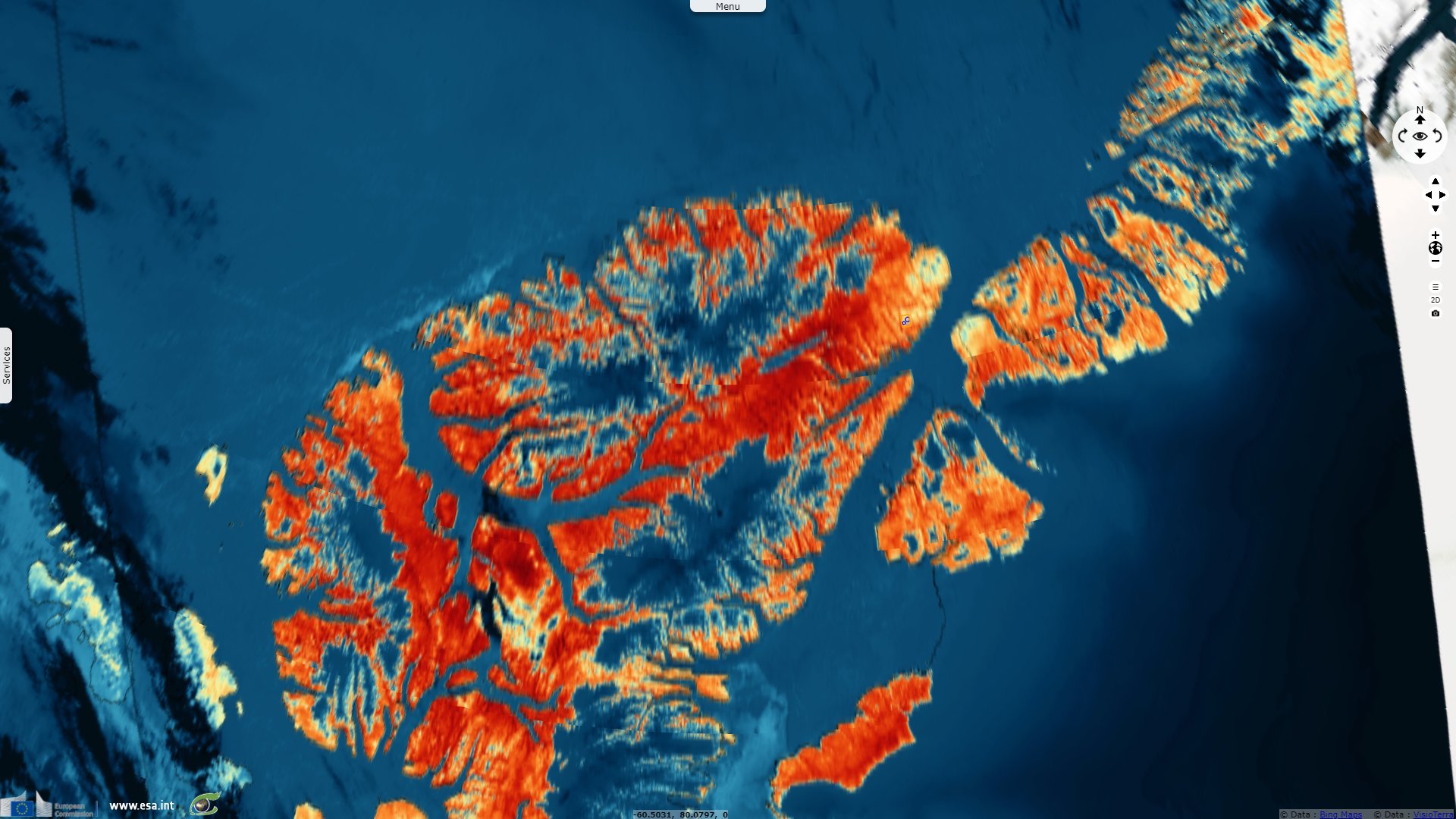
Sentinel-1 CSAR EW acquired on 28 June 2020 from 12:48:21 to 12:49:21 UTC
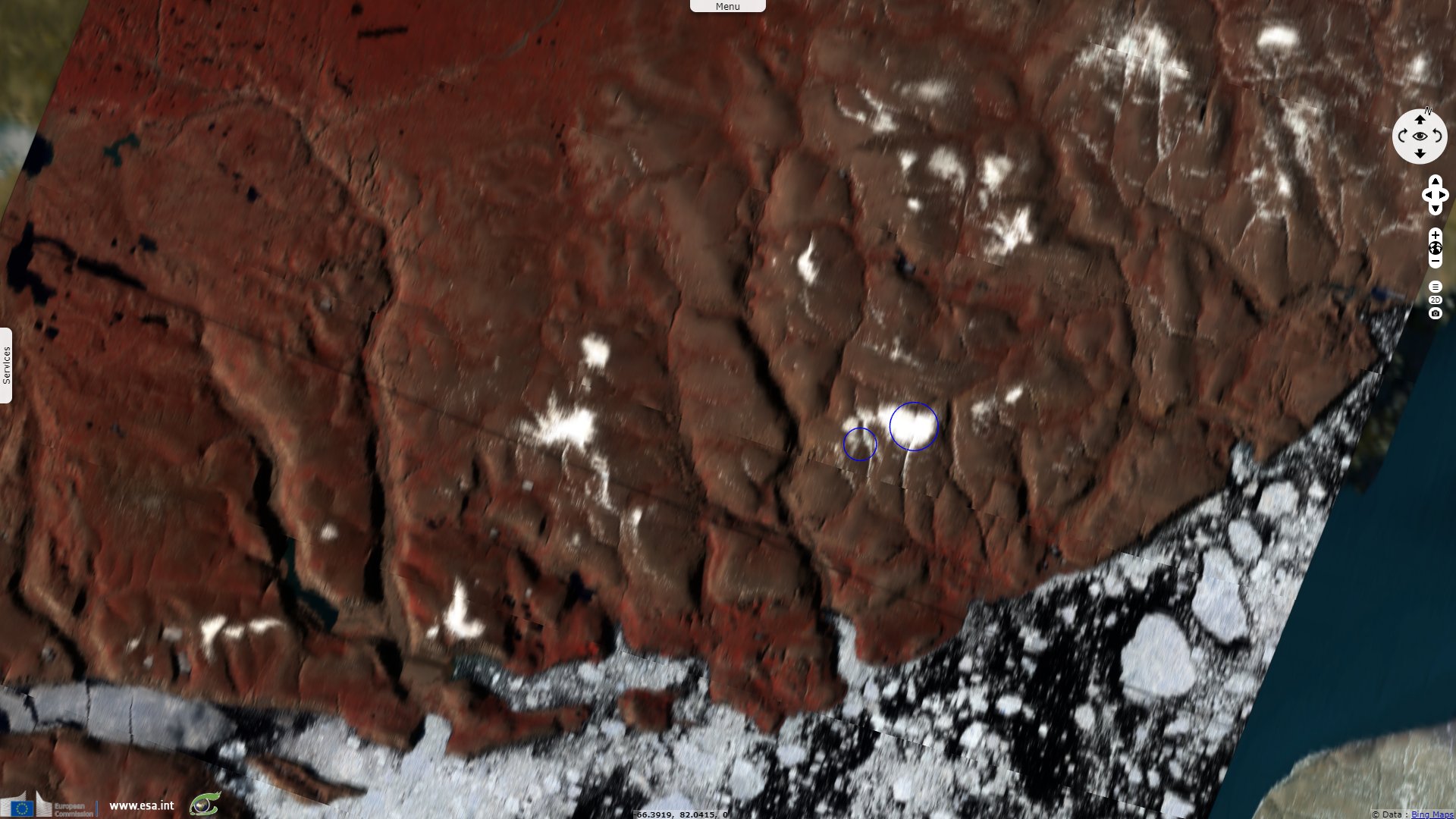
Sentinel-3 SLSTR RBT acquired on 28 June 2020 at 20:23:43 & 21:03:10 UTC
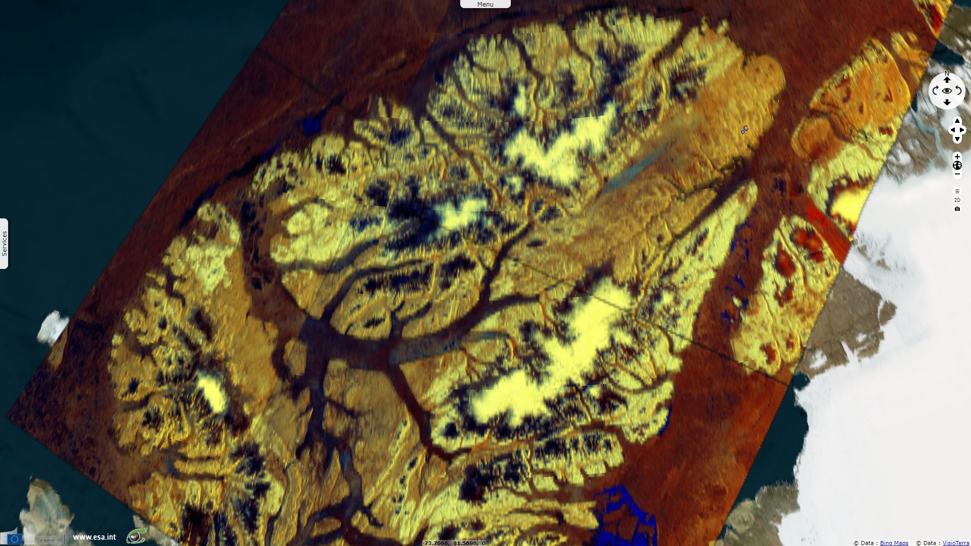
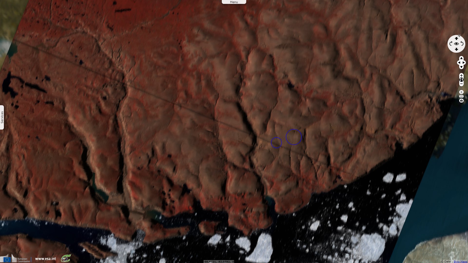
Sentinel-2 MSI acquired on 30 July 2020 at 20:19:01 UTC
Sentinel-2 MSI acquired on 31 July 2018 at 20:18:51 UTC
Sentinel-1 CSAR EW acquired on 28 June 2020 from 12:48:21 to 12:49:21 UTC
Sentinel-3 SLSTR RBT acquired on 28 June 2020 at 20:23:43 & 21:03:10 UTC
Sentinel-2 MSI acquired on 30 July 2020 at 20:19:01 UTC
Keyword(s): Polar, climate change, global warming, ice cap, sea ice, glacier, coastal, Canada, Arctic
Arctic is warming up much faster than the rest of the planet. A recent illustration was the June record of Alert was beaten on 28.06.2020 with 18.8°C as against 18.2°C on 30.06.2000 in the previous record, wrote Etienne Kapikian, previsionnist at Meteo-Franc.
The absolute record on the station (21.0°C) dates from 14.07.2019. A bit further south, Eureka also had beaten its record the previous day with 21.4°C.

Source: Etienne Kapikian, previsionnist at Meteo-France
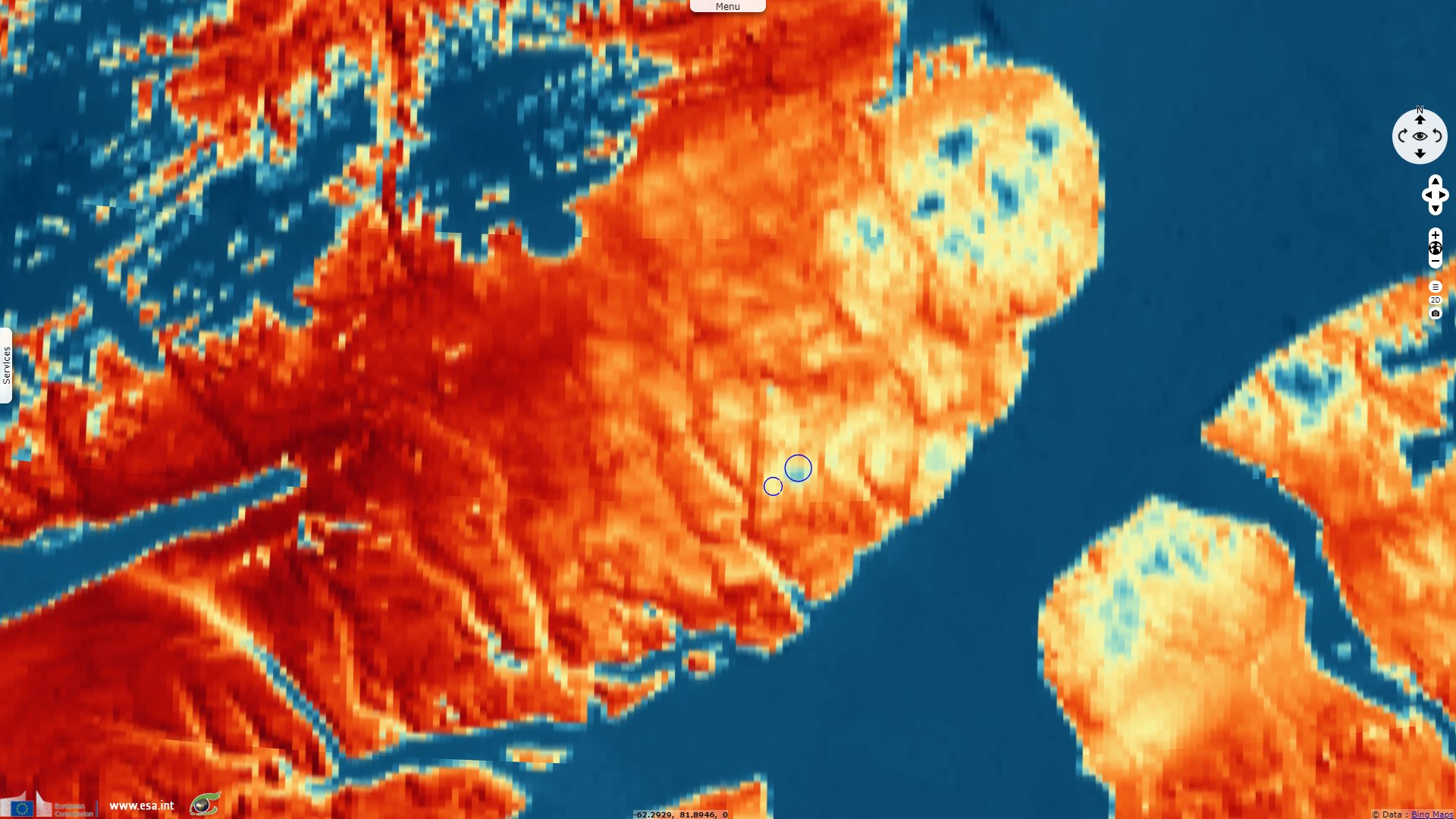
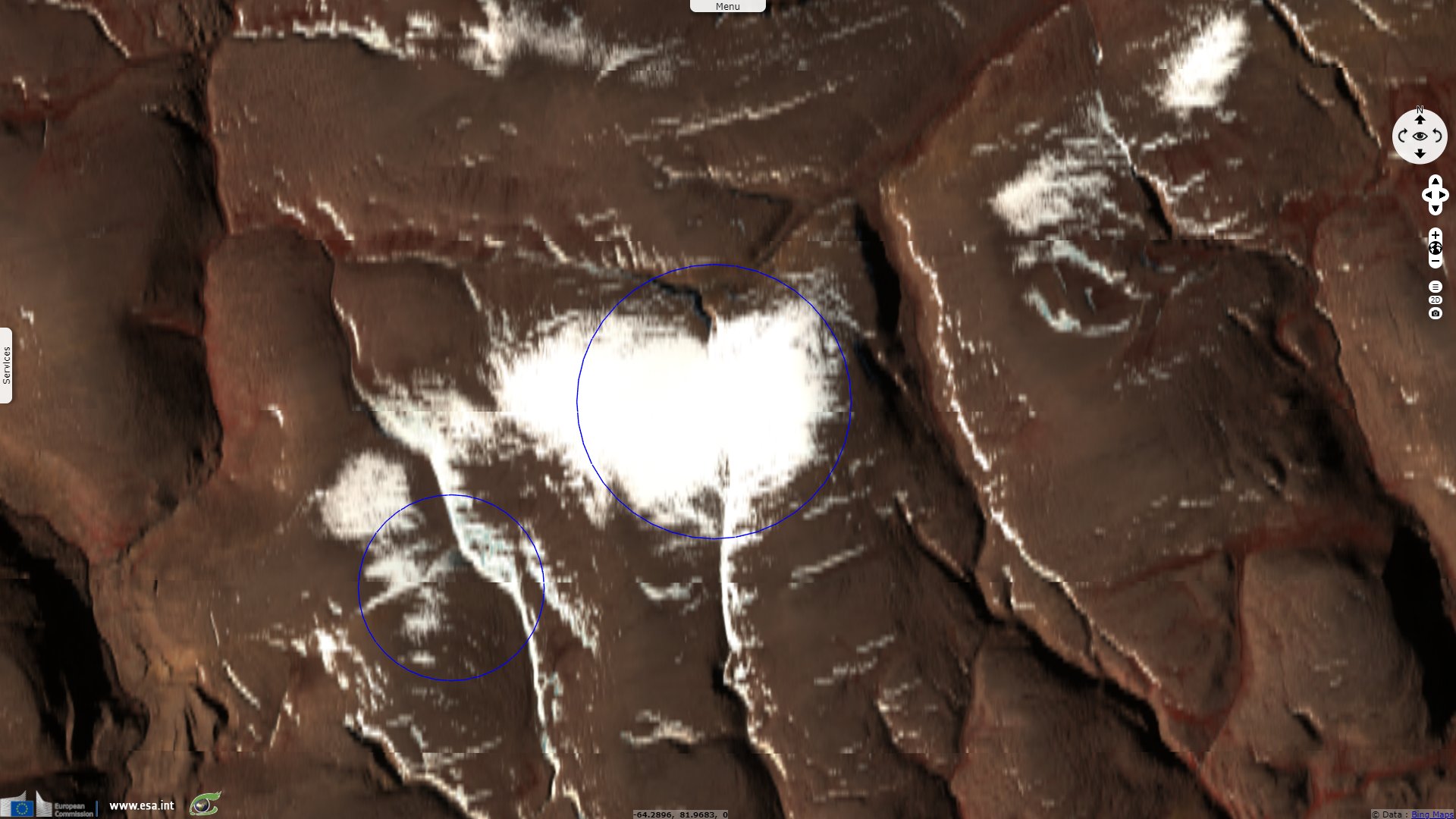
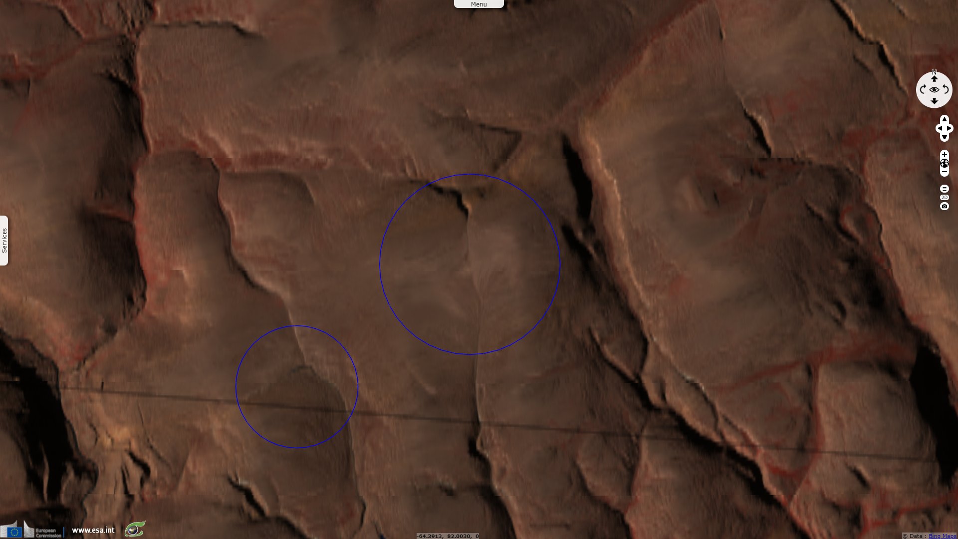
A singular exemple of the warming are the well studied ice caps near St. Patrick Bay on Ellesmere Island in Nunavut, Canada. They have been documented in particular by Mark Serreze, director of the US National Snow and Ice Data Center (NSIDC), Distinguished Professor of Geography at the University of Colorado Boulder. In 2016, Laura Naranjo reported for the NSIDC news: "As a young graduate student, Mark Serreze spent the summers of 1982 and 1983 studying two ice caps near St. Patrick Bay on Ellesmere Island in Nunavut, Canada. These ice caps have dramatically shrunk over the past fifty years and are likely to soon disappear entirely."
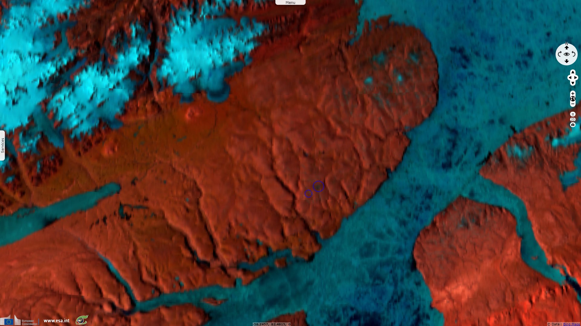
"In the 1959 photographs of the St. Patrick Bay Ice Caps, the larger, heart shaped ice cap had an area of about 7.48 square kilometers, and the smaller one about 2.93 square kilometers. Based on the measurements taken by Carsten Braun and Doug Hardy, by 2001 the larger and smaller of the two ice caps had shrunk to 62 percent and 58 percent of their 1959 areas. The last fifteen years have not been kind. Imagery processed by NSIDC scientist Bruce Raup from the NASA ASTER (Advanced Spaceborne Thermal Emission and Reflection Radiometer) satellite instrument shows as of August 2015, the larger ice cap covered only 7 percent of the area that it did in 1959, and the smaller one was down to 6 percent of its original area. They shrank noticeably even between 2014 and 2015. This large one-year change appears to have been in direct response to the especially warm summer of 2015 over northern Ellesmere Island."

"A fifty-year record shows the St. Patrick Bay ice caps receding. The orange lines show August 2015 margins from ASTER imagery; green lines show ASTER-based margins from August 2014; red lines show 2001 margins, based on GPS surveys by Carsten Braun and Doug Hardy; blue lines show 1959 margins based on aerial photography." - Source: B. Raup
"The St. Patrick Bay ice caps are not relicts of the last ice age, which peaked 15,000 to 25,000 years ago, depending on the region. Instead, the caps probably first formed several thousand years ago when the Arctic experienced a period of cooling following the Holocene Thermal Maximum, a warm interval lasting from 9,000 to 5,000 years ago. During the Little Ice Age, which spanned the sixteenth to the nineteenth centuries, the ice caps were likely several times larger than observed in 1959. They have been in an overall state of decline ever since, interrupted by periods of growth. While eventually they likely would have disappeared on their own, fossil fuel burning has contributed to a strongly warming Arctic in recent decades."
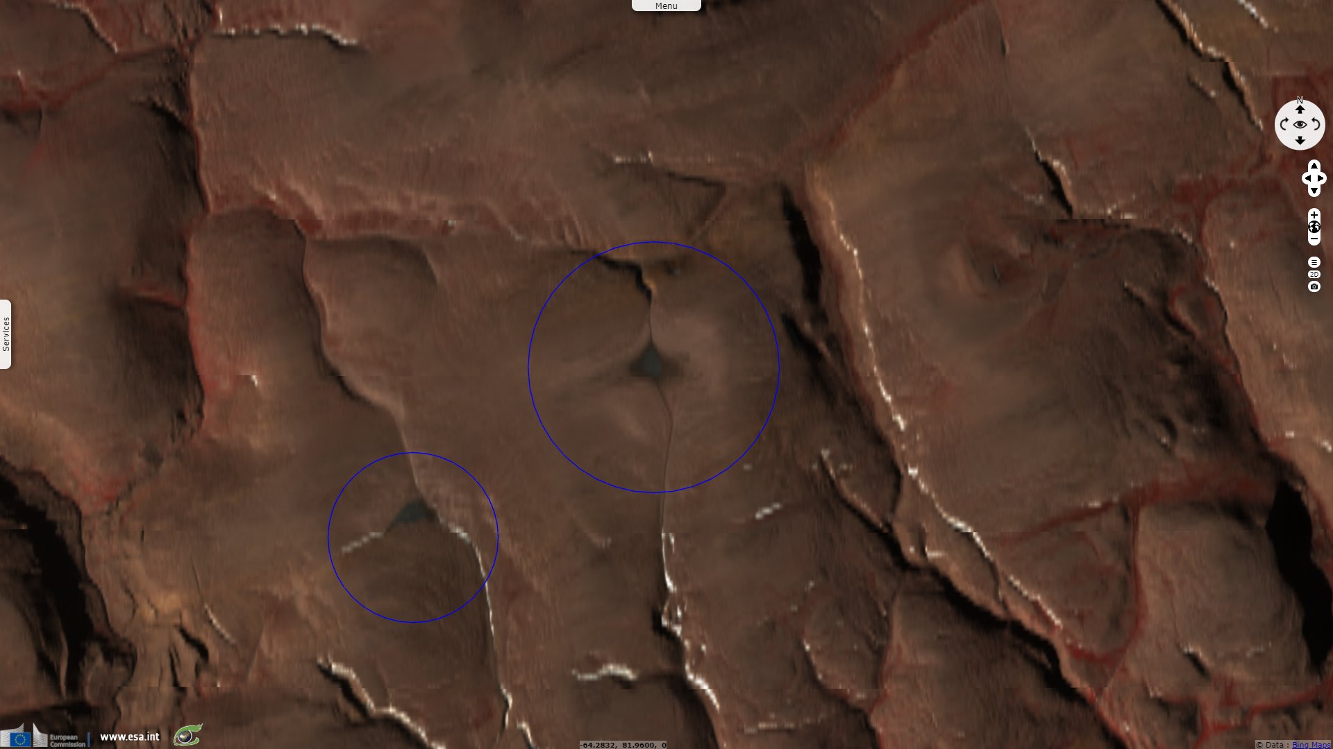
In a more recent article published on NSIDC newsroom, Mark Serreze added: "National Snow and Ice Data Center (NSIDC) scientists and colleagues predicted via a 2017 paper in The Cryosphere that the ice caps would melt out completely within the next five years, and recent images from NASA’s Advanced Spaceborne Thermal Emission and Reflection Radiometer (ASTER) have confirmed that this prediction was accurate."
"The St. Patrick Bay ice caps were one-half of a group of small ice caps on the Hazen Plateau, which formed and likely attained their maximum extents during the Little Ice Age, perhaps several centuries ago. The Murray and Simmons ice caps, which make up the second half of the Hazen Plateau ice caps, are located at a higher elevation and are therefore faring better, though scientists predict that their demise is imminent as well."
The views expressed herein can in no way be taken to reflect the official opinion of the European Space Agency or the European Union.
Contains modified Copernicus Sentinel data 2026, processed by VisioTerra.
Contains modified Copernicus Sentinel data 2026, processed by VisioTerra.
| More on European Commission space: |  |
 |
 |
||||
| More on ESA: | |
|
|
S-1 website | S-2 website | S-3 website | |
| More on Copernicus program: | |
|
|
Scihub portal | Cophub portal | Inthub portal | Colhub portal |
| More on VisioTerra: | |
|
|
Sentinel Vision Portal | Envisat+ERS portal | Swarm+GOCE portal | CryoSat portal |