Trail of flood caused by Irma in Gulf of Mexico
Sentinel-1 CSAR IW acquired on 12 July 2017 from 10:54:49 to 10:55:14 UTC
Sentinel-1 CSAR IW acquired on 29 August 2017 from 23:26:34 to 23:28:14 UTC
...
Sentinel-1 CSAR IW acquired on 10 September 2017 from 23:26:36 to 23:28:16 UTC
Sentinel-1 CSAR IW acquired on 29 August 2017 from 23:26:34 to 23:28:14 UTC
...
Sentinel-1 CSAR IW acquired on 10 September 2017 from 23:26:36 to 23:28:16 UTC
Keyword(s): Natural disaster monitoring, climate change, hurricane, cyclone, atmosphere, wind, rain, flooding, Dominican Republic, Haiti, Hispaniola, Cuba, Florida, USA, United States, Gulf of Mexico
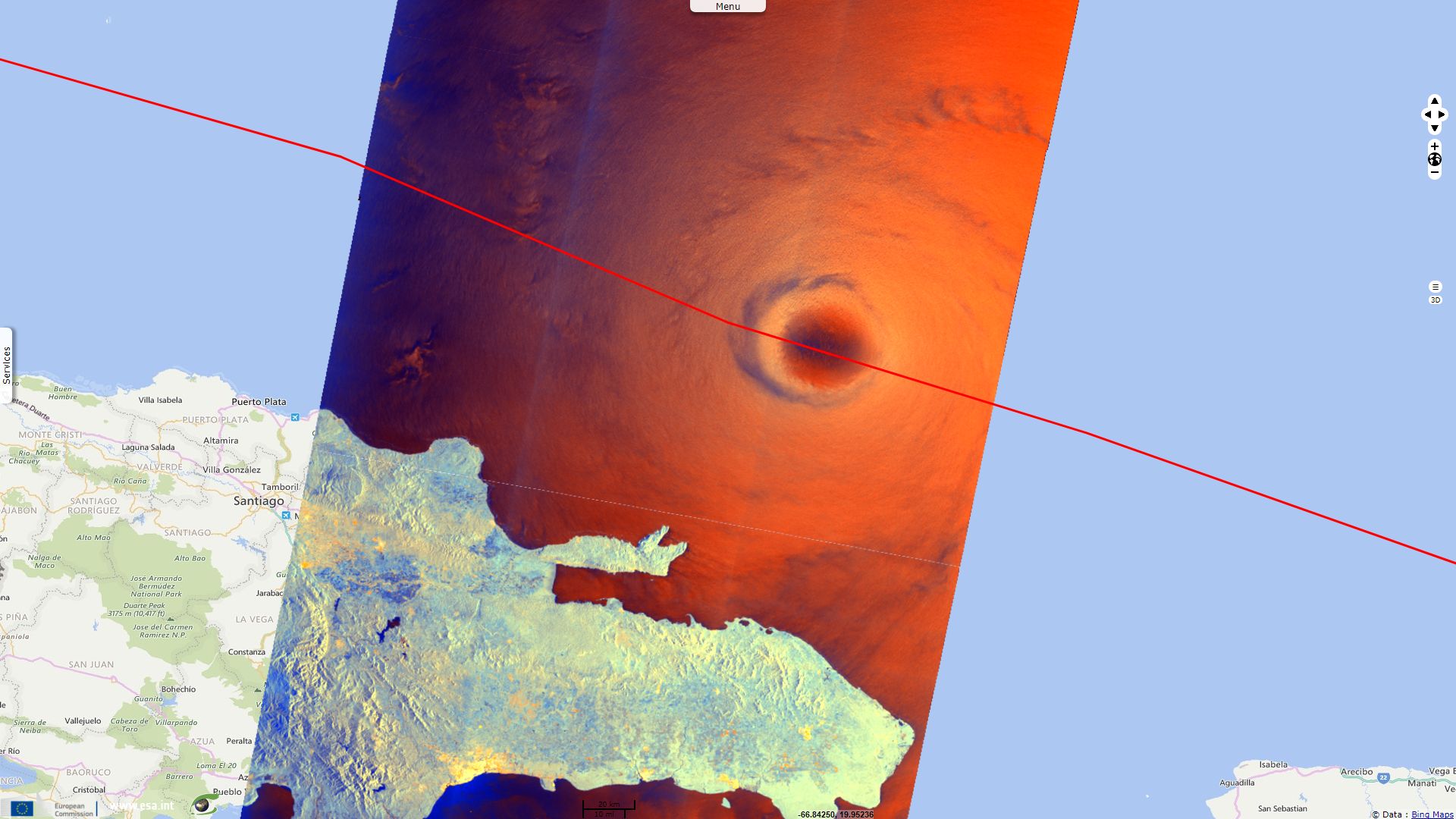
With sustained winds exceeding 300kph at its apex and remaining hundreds of kilometers wide for several days, Irma is one of the strongest hurricane ever recorded in the Atlantic ocean. Though its eye made landfall over several of the smaller Caribbean islands, causing them castrastrophic damage, extensive flooding can be more readily assessed on bigger land areas.
Bright red to orange waters show higher backscattering caused by waves that can be attributed to high wind speed. The co-polarised component (red) is more sensitive to this than the cross-polarised (green) which is why the colour leans more toward the red where the waves are high.
The blue channel corresponds to the normalized difference between cross-polarised and co-polarised bands. When there are no waves to backscatter the signal toward the satellite, such as here in the eye wall, values are about as low in both bands in which case the normalized difference is comparatively higher, hence a blue hue. This happens over areas where the wind is low (such as wind sheltered areas) or where intense rainfalls are taking place.
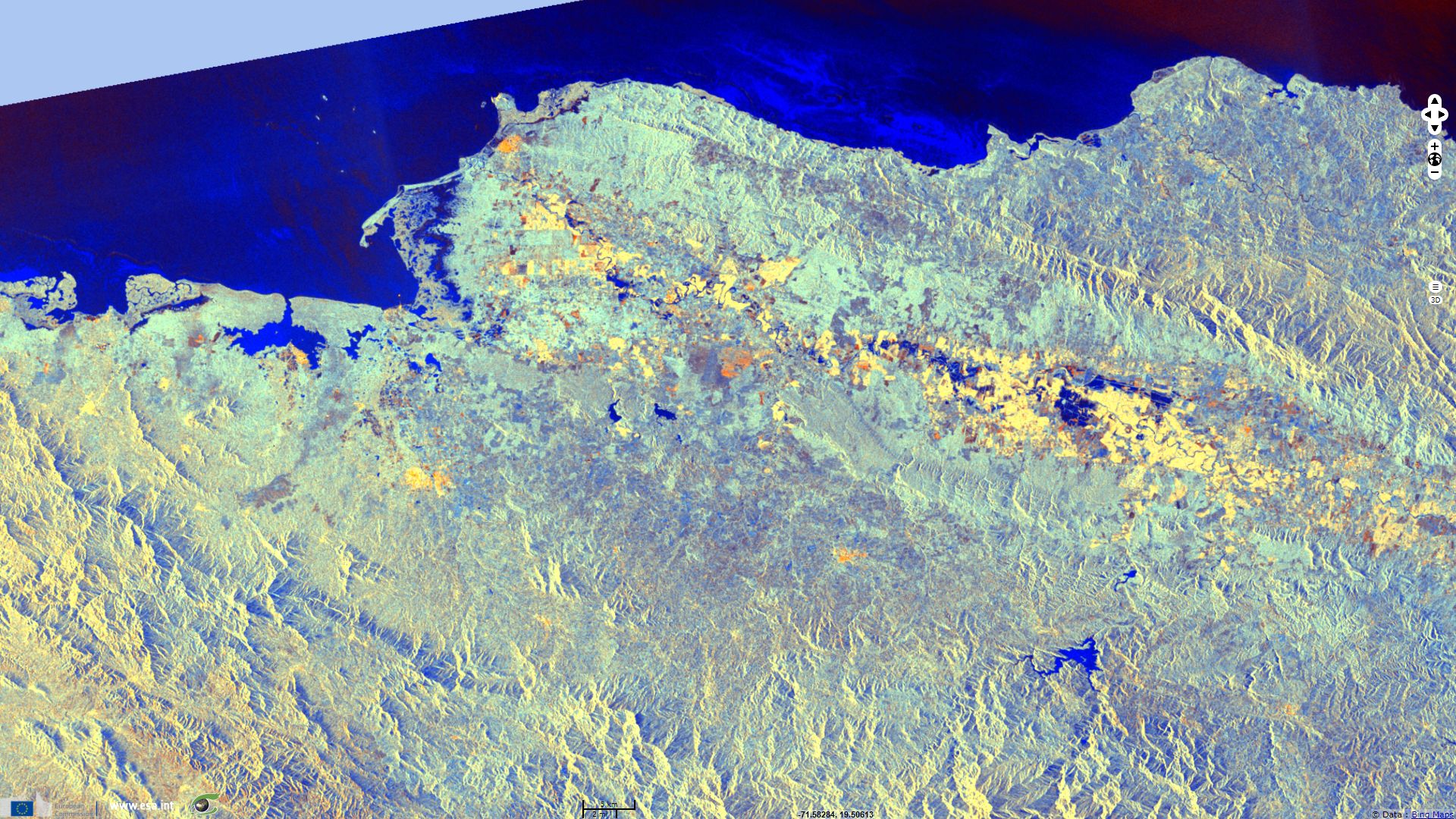
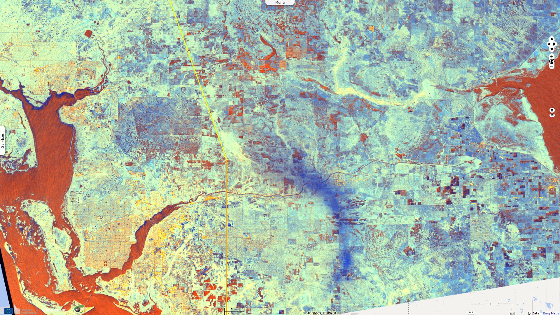
Hispaniola island was not crossed by Irma's eye but in Dominican Republic beach resorts and thousands of locals were evacuated to safety. The provinces of Monte Cristi (mostly flood plains near Yaque del Norte river) and Dajabon in Dominican Republic and Nord-Est (cities of Ferrier, Bossus and Fort Liberté) in Haiti were flooded by the precipitation as it is highlighted by comparing these images taken days before and hours after Irma's passage.
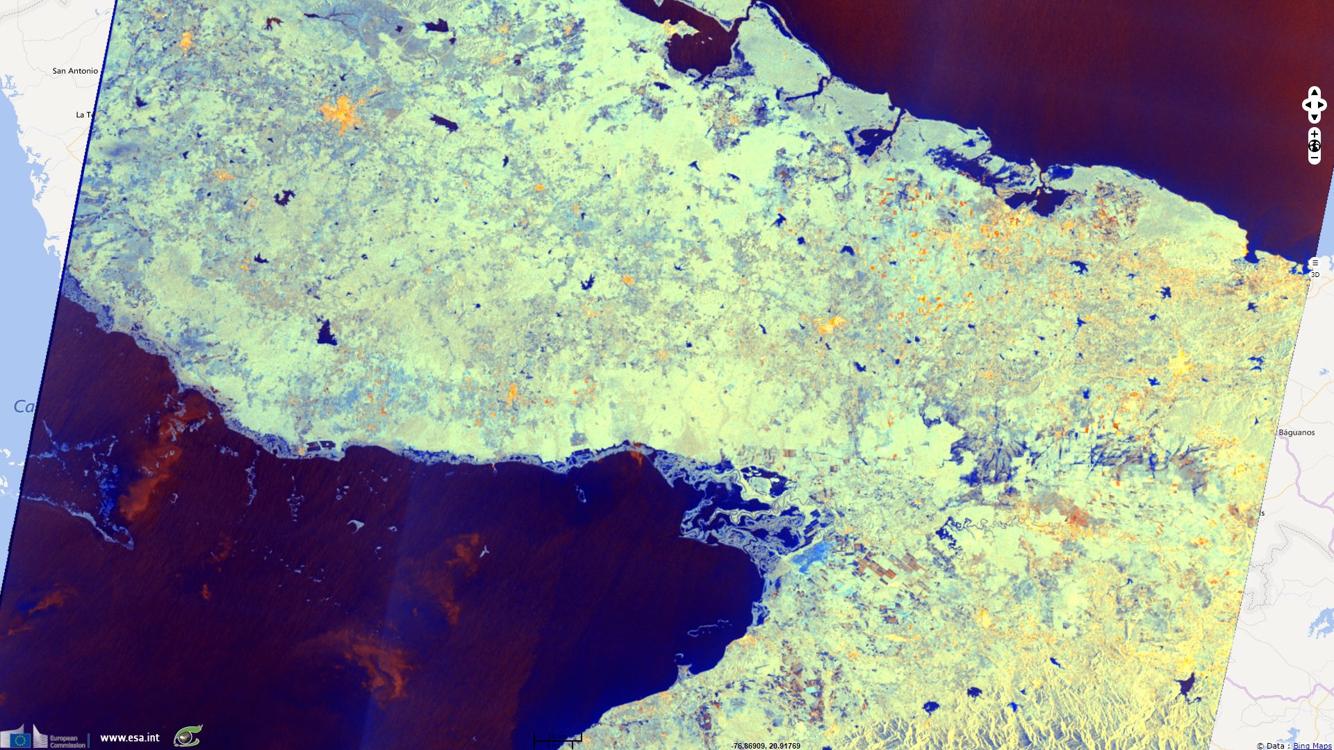
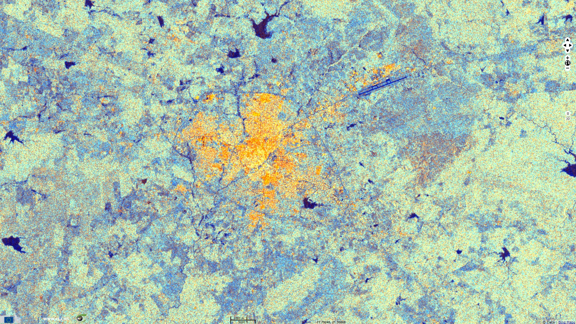
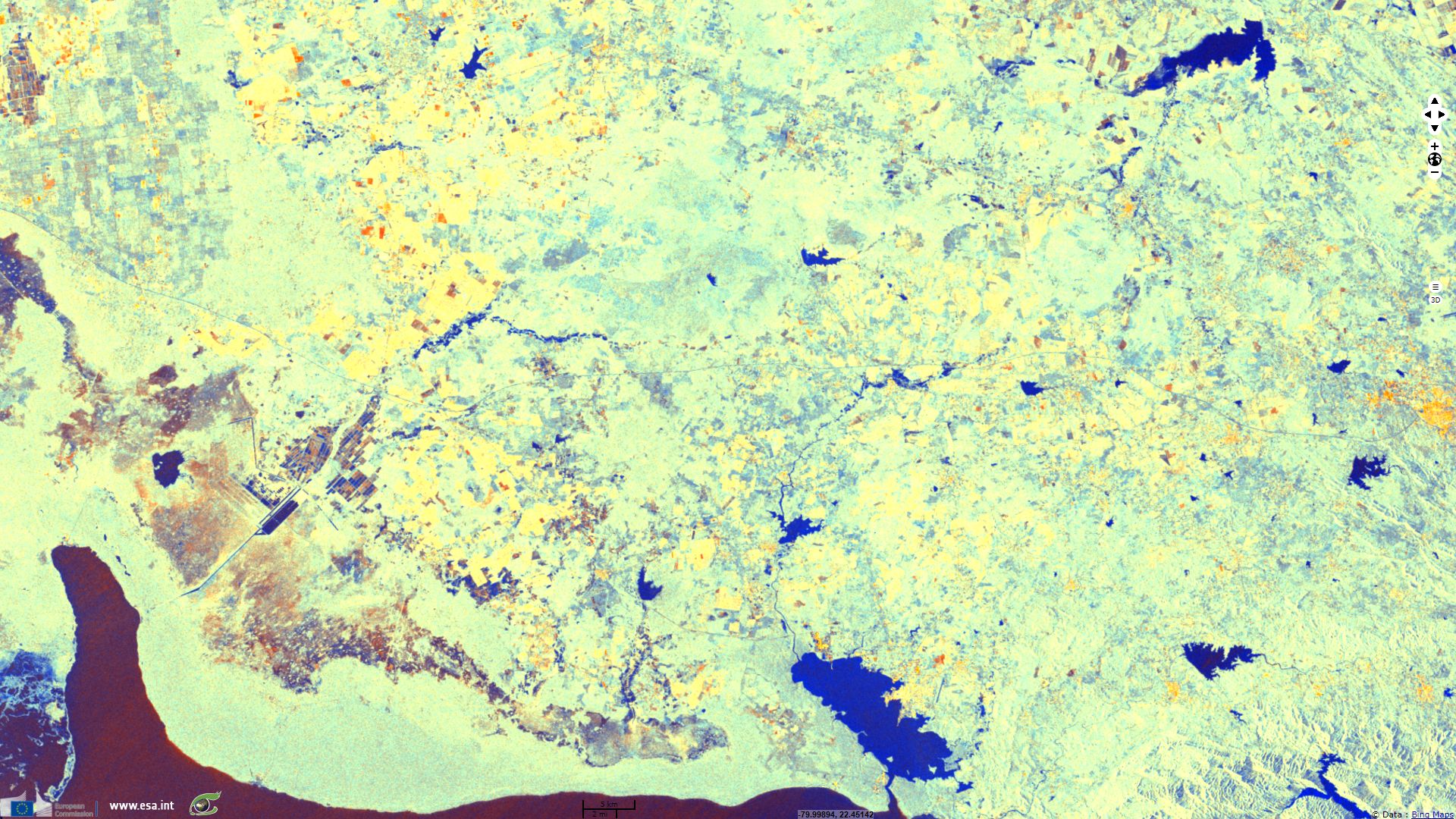
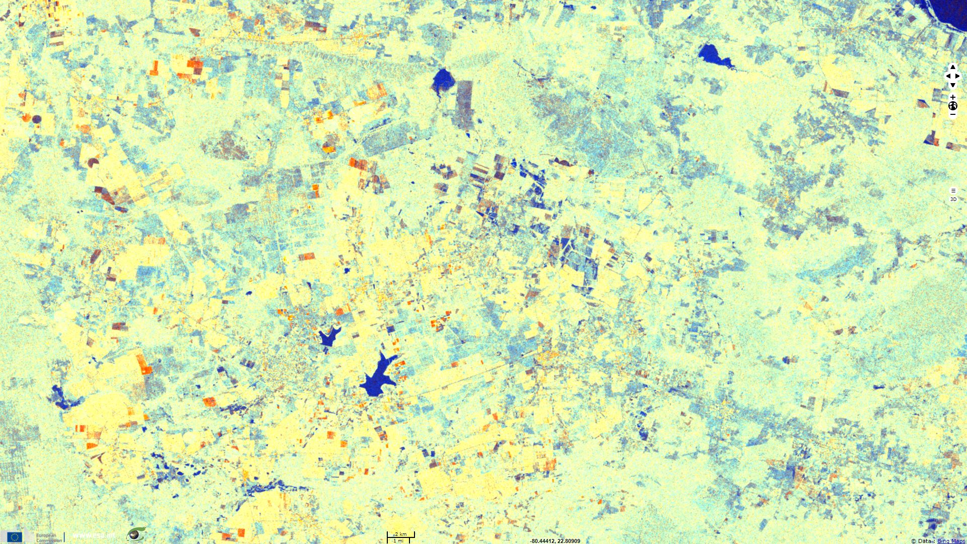
Camagüey is the third largest city in Cuba, its city centre is a UNESCO World heritage site. Located in a plain between rio Hatibonico and rio Tinima, it was vulnerable and was damaged as these rivers flooded.
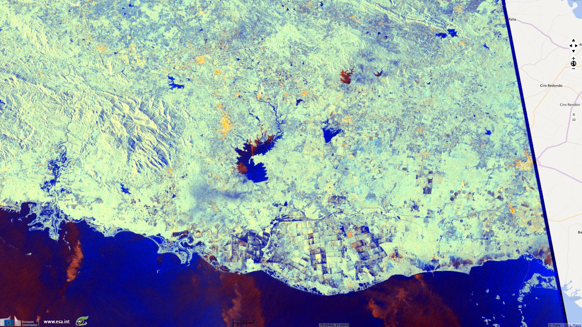
At west, Rio Agabama flooded near its outlet. In the center, Embalse Zaza and la Felicidad lakes gathered a lot of waters. Croplands located near the southern coast were drenched by excessive water.
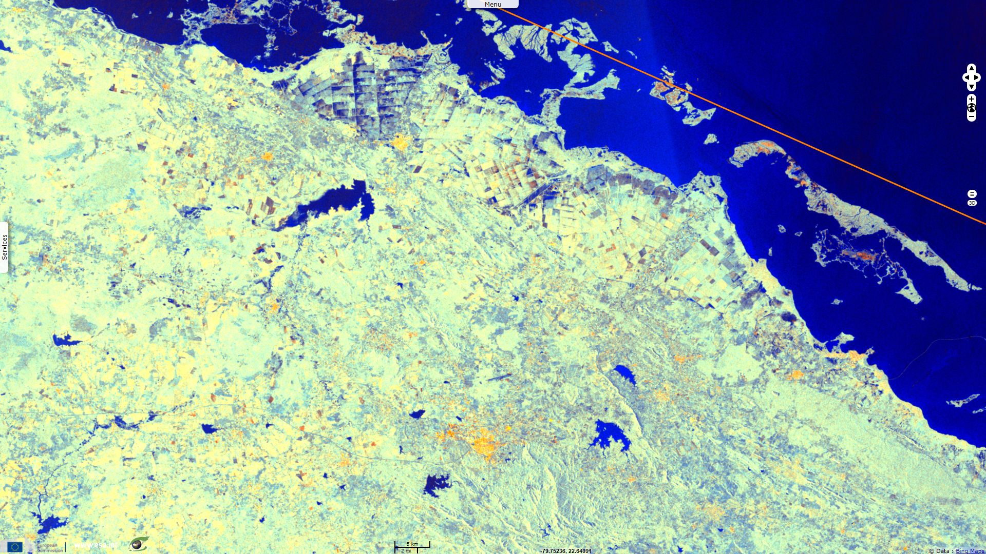
According to Cuba meteorologic services, the country was hit by 260 kph sustained winds and its northern coast was hit waves up to 7m high.
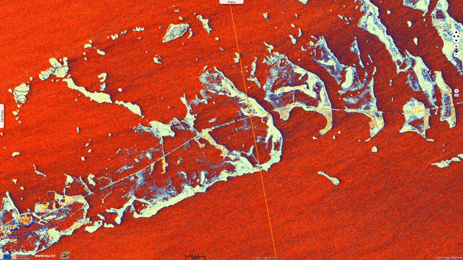
Being low lying islands located on Irma's path, the Keys in Florida were at risk from even a weakened Irma. According to the Federal Emergency Management Agency (FEMA), "At least a quarter of houses in the Keys were destroyed, [...] while 65 per cent of buildings suffered damage." Flooding can be easily identified in Key West military base, at the south west of the image, and in most of the bigger islands.
The New-York Times reminds: "Florida officials directed 6.5 million residents to leave their homes in one of the largest emergency evacuations in American history. On Saturday evening, Gov. Rick Scott of Florida warned that the state could get as much as 18 inches of rain, with the Keys getting up to 25 inches. Southwest Florida could see a storm surge of 15 feet above ground level, and entire neighborhoods stretching northward from Naples to Tampa Bay could be submerged.". Irma is estimated to have caused over 100 casualties with over fifty people killed in mainland US and 15 million Americans suffered outages during the storm.
The views expressed herein can in no way be taken to reflect the official opinion of the European Space Agency or the European Union.
Contains modified Copernicus Sentinel data 2026, processed by VisioTerra.
Contains modified Copernicus Sentinel data 2026, processed by VisioTerra.
| More on European Commission space: |  |
 |
 |
||||
| More on ESA: | |
|
|
S-1 website | S-2 website | S-3 website | |
| More on Copernicus program: | |
|
|
Scihub portal | Cophub portal | Inthub portal | Colhub portal |
| More on VisioTerra: | |
|
|
Sentinel Vision Portal | Envisat+ERS portal | Swarm+GOCE portal | CryoSat portal |