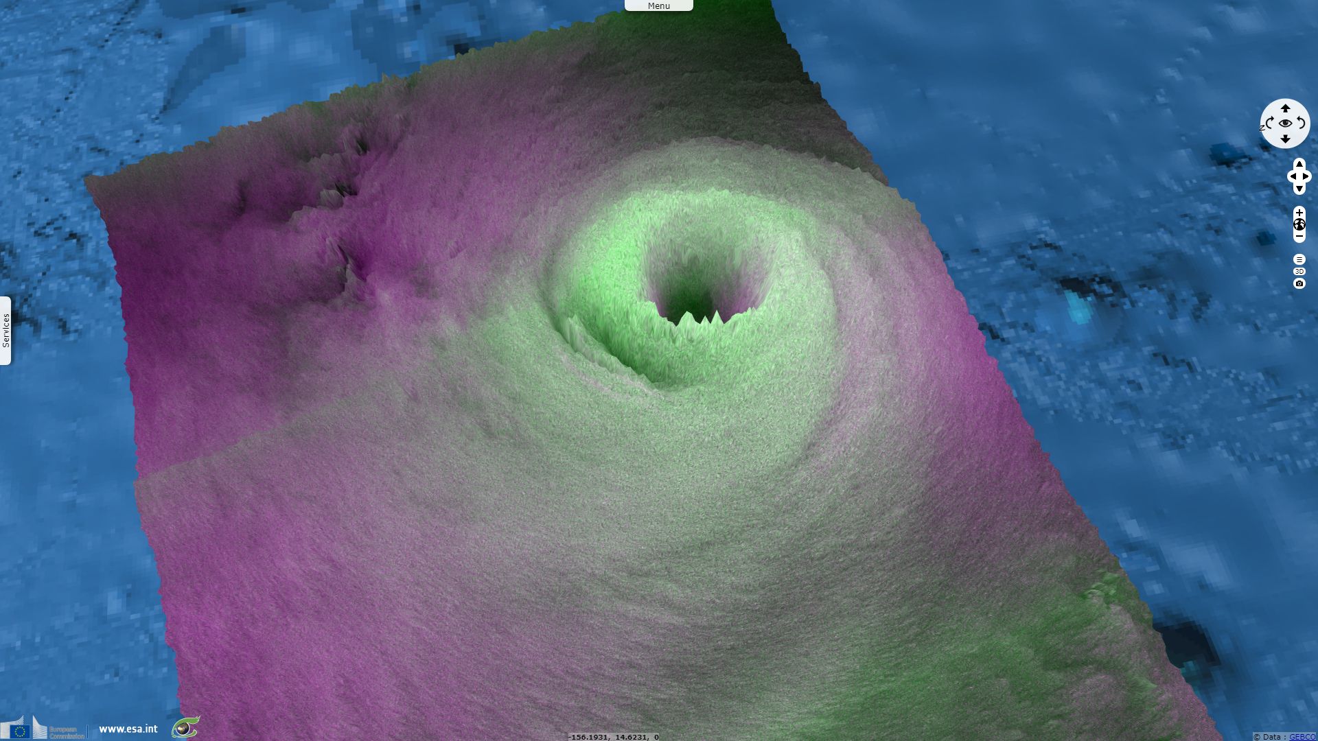
Looking in the eye of Cyclone Lane as it nears Hawaii
Sentinel-3 SRAL LAND acquired on 21 August 2018 at 07:38:11 UTC
Sentinel-3 SLSTR RBT acquired on 21 August 2018 from 08:03:25 to 08:06:25 UTC
Sentinel-3 SRAL LAND acquired on 21 August 2018 at 20:15:35 UTC
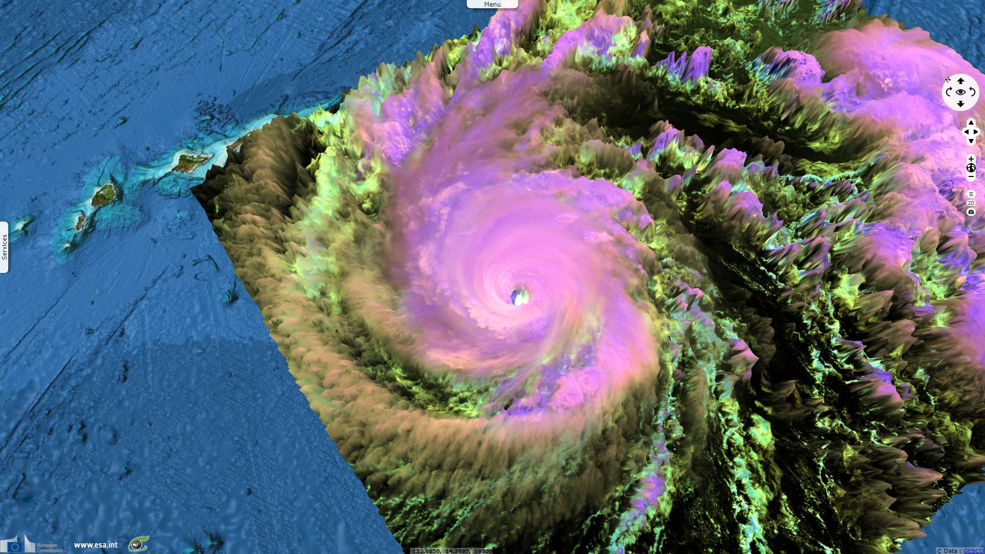
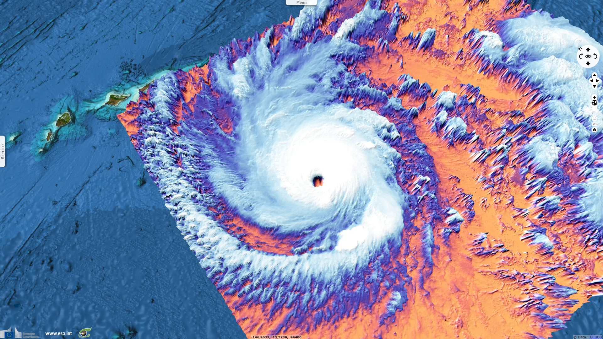
Sentinel-3 SLSTR RBT acquired on 22 August 2018 at 20:09:09 UTC
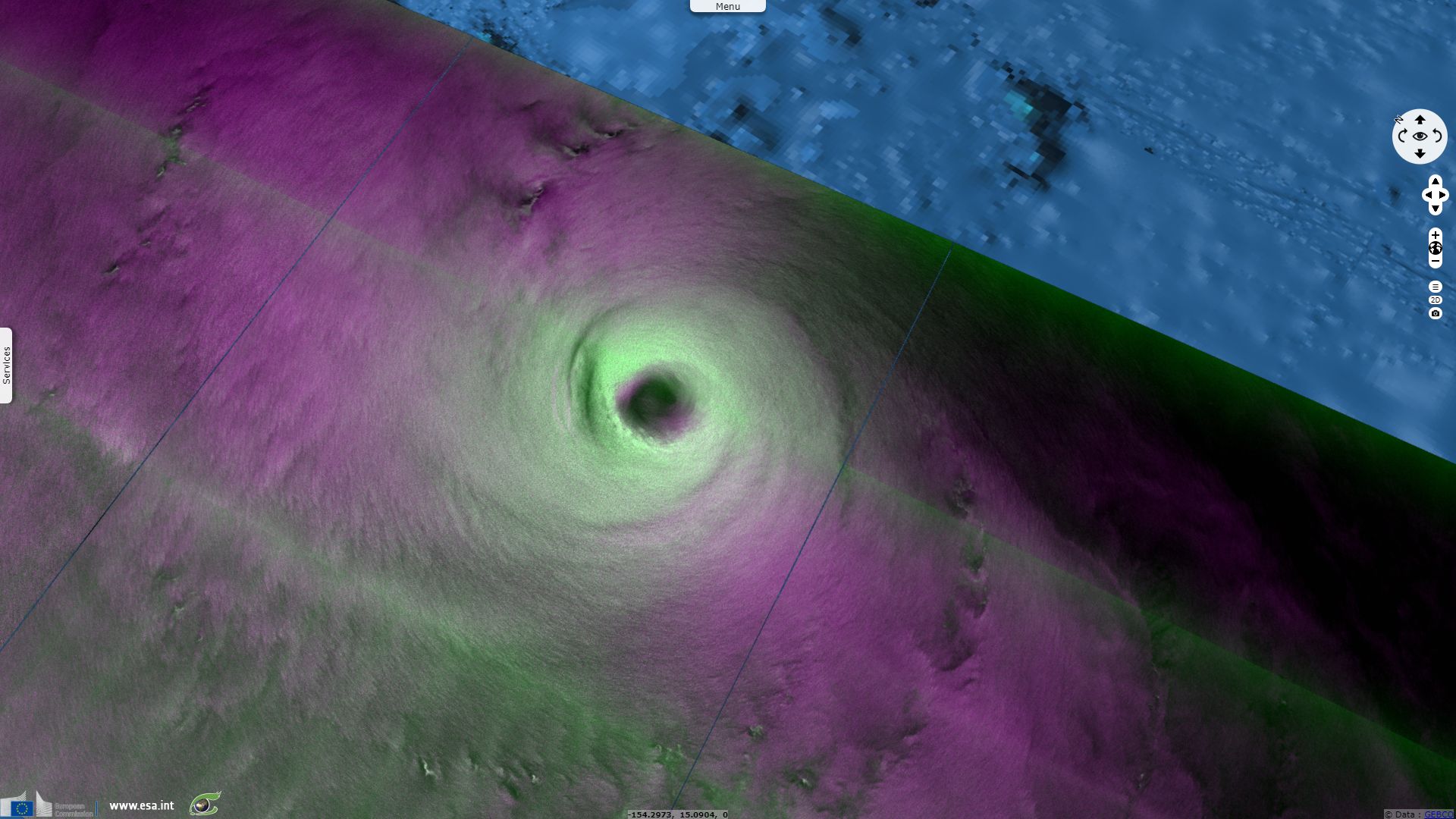
Sentinel-1 CSAR IW acquired on 23 August 2018 from 04:37:33 to 04:38:23 UTC
Sentinel-3 SLSTR RBT acquired on 21 August 2018 from 08:03:25 to 08:06:25 UTC
Sentinel-3 SRAL LAND acquired on 21 August 2018 at 20:15:35 UTC
Sentinel-3 SLSTR RBT acquired on 22 August 2018 at 20:09:09 UTC
Sentinel-1 CSAR IW acquired on 23 August 2018 from 04:37:33 to 04:38:23 UTC
Keyword(s): Emergency, natural disaster, atmosphere, climate change, wind, hurricane, Hawaii, United States, USA
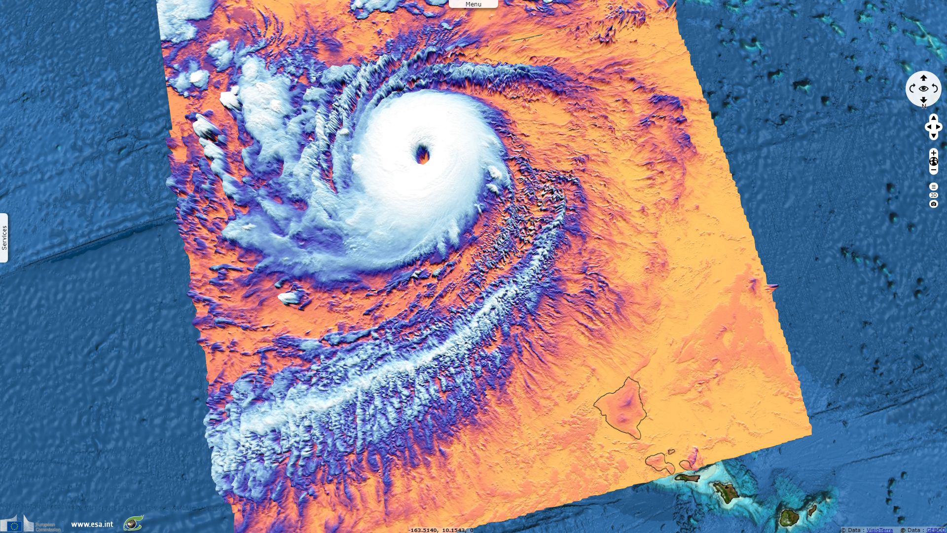
Hurricane Lane may be the most powerful to hit Hawaii since recorded meteorology started. It reached 240kph sustained winds & 935hPa pressure
The views expressed herein can in no way be taken to reflect the official opinion of the European Space Agency or the European Union.
Contains modified Copernicus Sentinel data 2026, processed by VisioTerra.
Contains modified Copernicus Sentinel data 2026, processed by VisioTerra.
| More on European Commission space: |  |
 |
 |
||||
| More on ESA: | |
|
|
S-1 website | S-2 website | S-3 website | |
| More on Copernicus program: | |
|
|
Scihub portal | Cophub portal | Inthub portal | Colhub portal |
| More on VisioTerra: | |
|
|
Sentinel Vision Portal | Envisat+ERS portal | Swarm+GOCE portal | CryoSat portal |