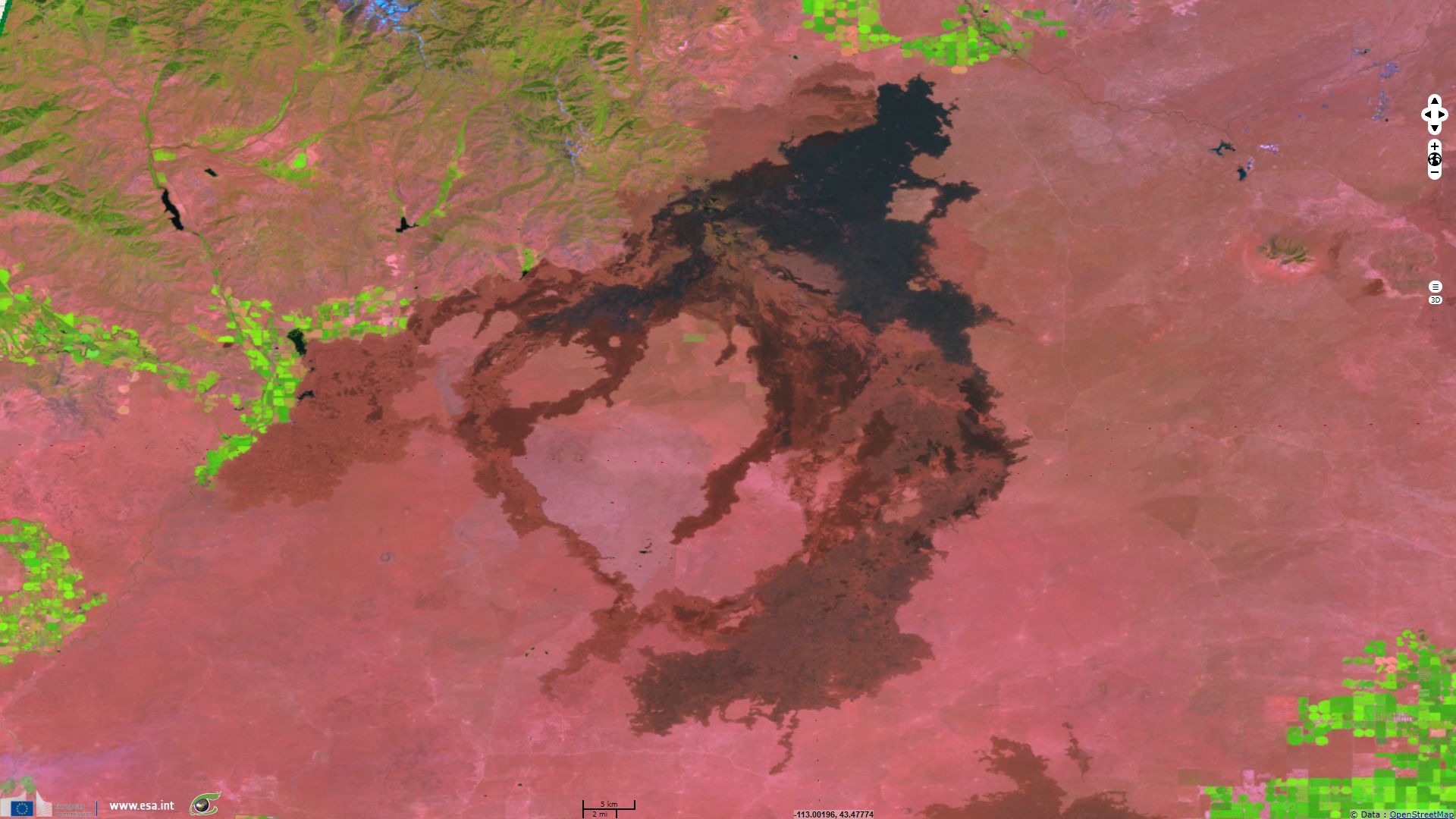
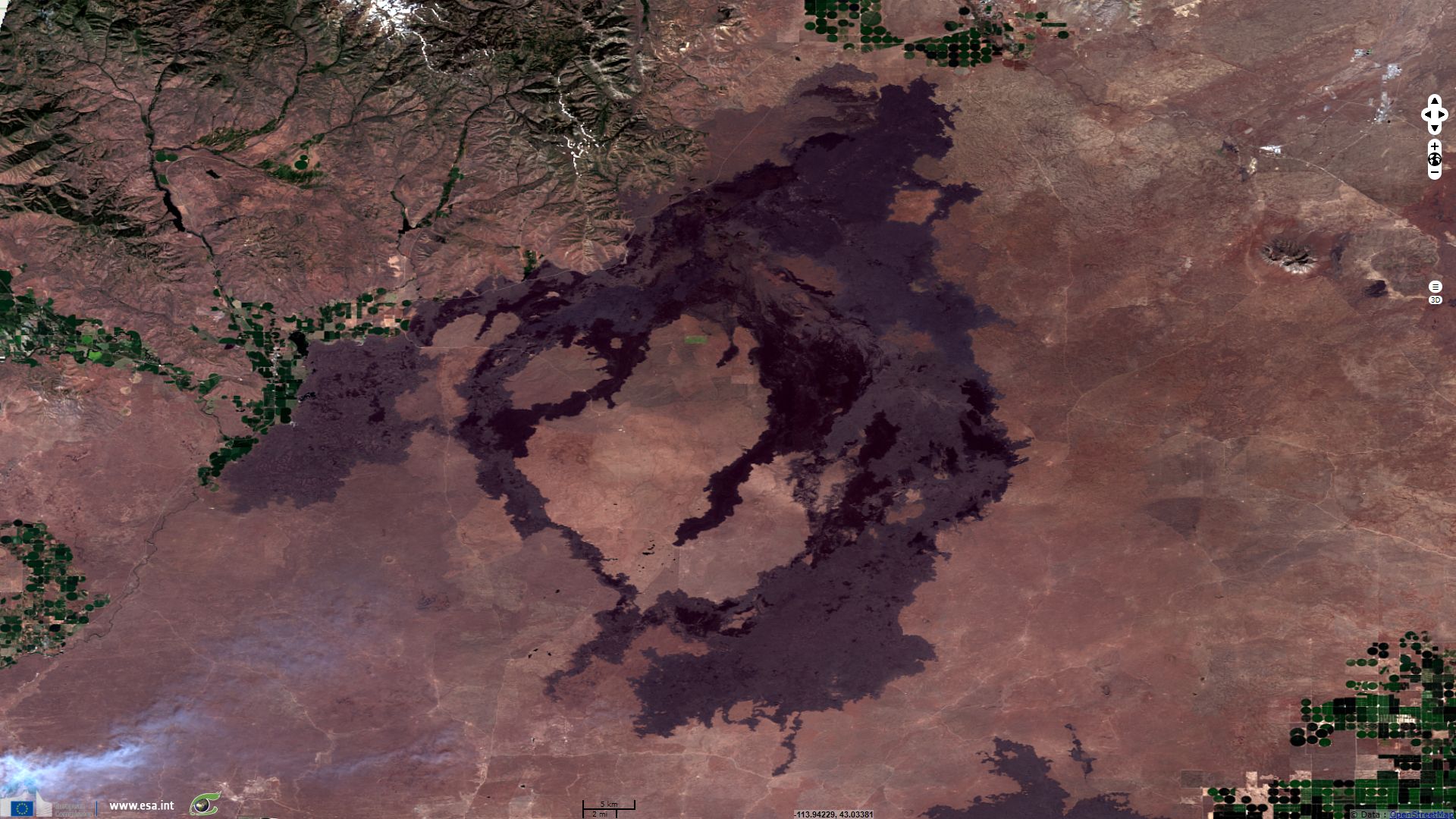
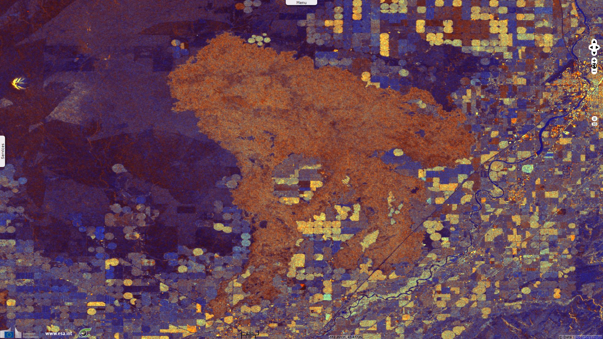
Lunar & hellish landscape amidst crop circles - Great Rift system in Eastern Snake River Plain
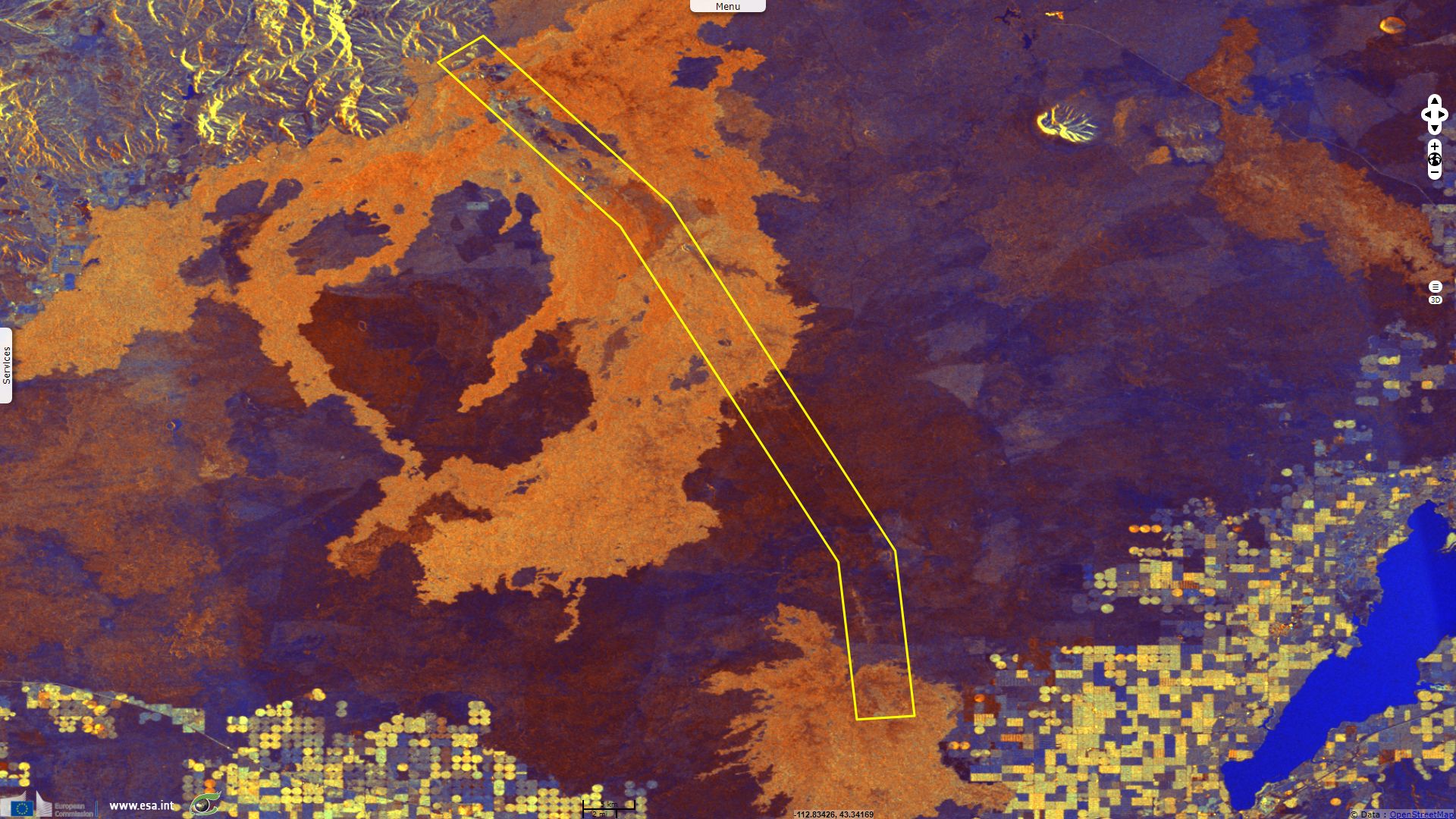
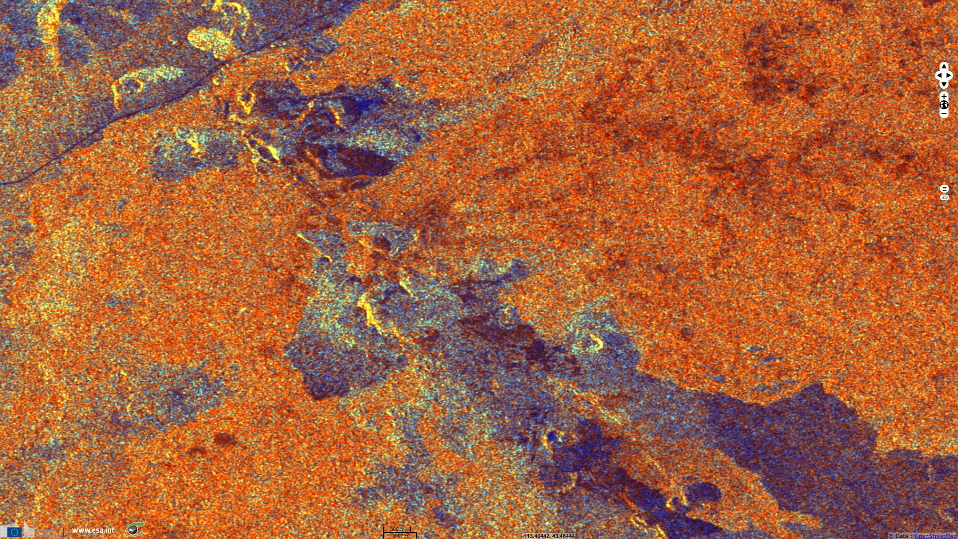
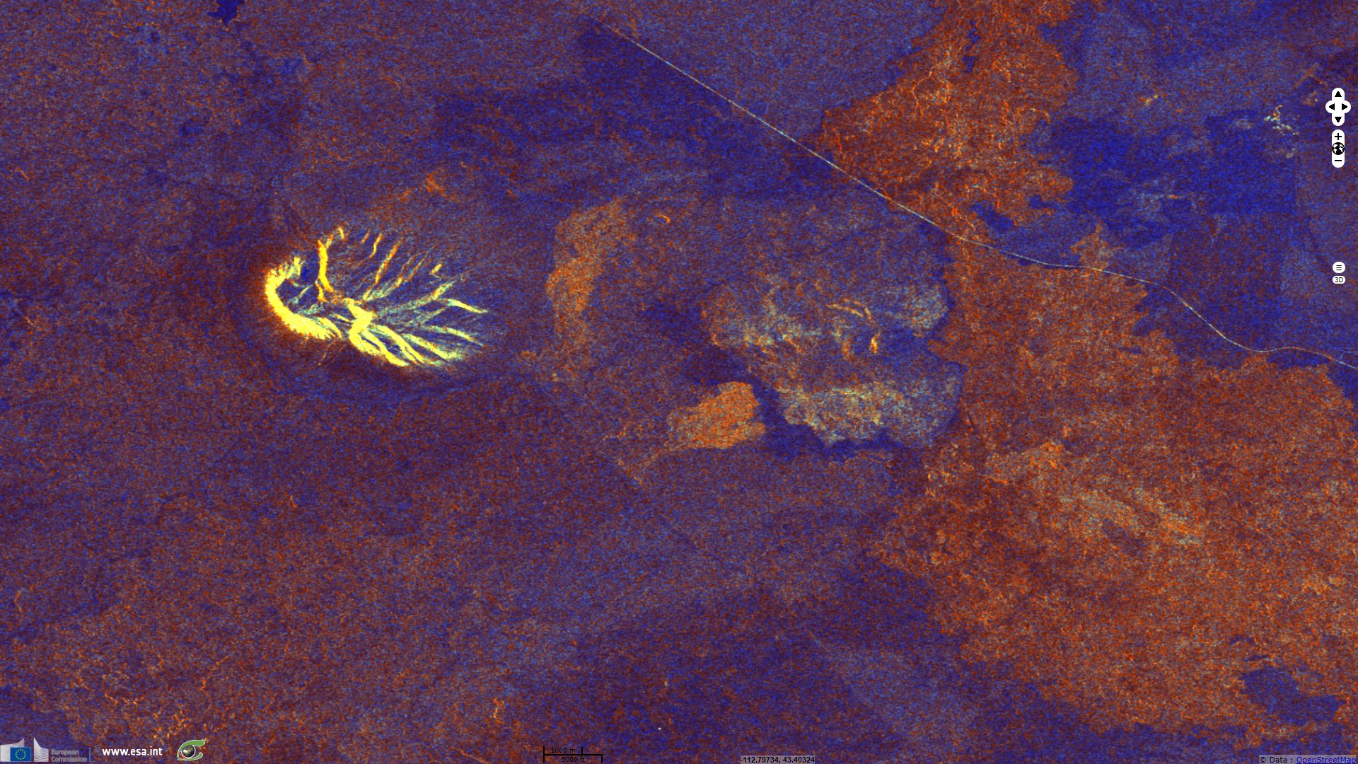
Sentinel-1 CSAR IW acquired on 05 July 2017 at 01:27:11 UTC
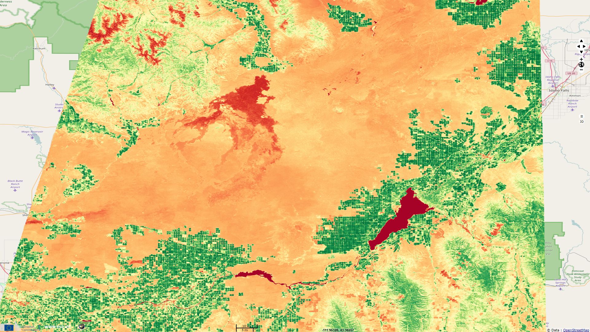
Sentinel-2 MSI acquired on 10 July 2017 at 18:19:21 UTC
Sentinel-2 MSI acquired on 10 July 2017 at 18:19:21 UTC
Keyword(s): Land, geology, agriculture, rift, fault, lava field, cinder cone, volcanoes, United States
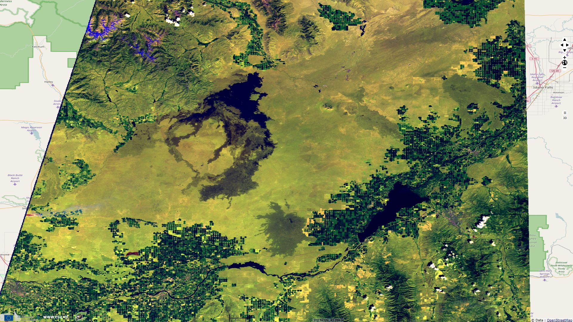
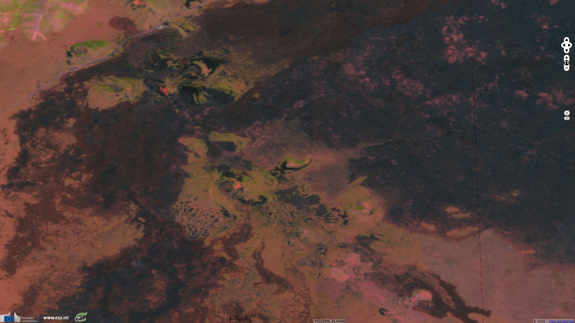
In the Eastern Snake River Plain, Idaho, USA, lies a series of lava field located near the Great Rift system. On the Craters of the Moon Website, the U.S. National Park Service introduces the area: "The Great Rift volcanic rift zone is a zone of cracks running approximately northwest to southeast across almost the entire eastern part of the Snake River Plain. The Great Rift is an example of basaltic fissure eruption. This type of volcanic activity is characterized by extrusion of lavas from fissures or vents, lava pours from cracks which opened along weak spots in the earth's crust. It is relatively quiet in comparison with highly explosive eruptions such as the 1980 Mount Saint Helens eruption. Less explosive lava flows in sheets and rivers. The lava moving beneath the congealing crust sometimes tugs the surface into folds resembling coils of rope. This type of lava is called pahoehoe, which means "ropy" in Hawaiian. Cooler, thicker aa lava inched along, twisting and shattering into tumbled masses of jagged rocks."
The Idaho Museum of Natural History supplements the description: "The youngest fissure flows on the Snake River Plain are located at Kings Bowl and the Craters of the Moon National Monument. Craters of the Moon covers 1500km² whereas Kings Bowl covers about 2.5km². Flow thickness is generally less than 1.5m although ponding or lava lakes may cause thicker layers. Point source eruptions along a fissure are common. For example, spatter cones and cinder cones at Craters of the Moon are examples of point source eruptions."
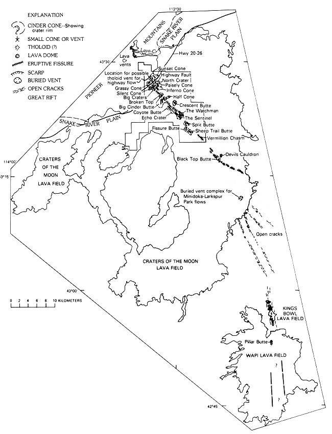
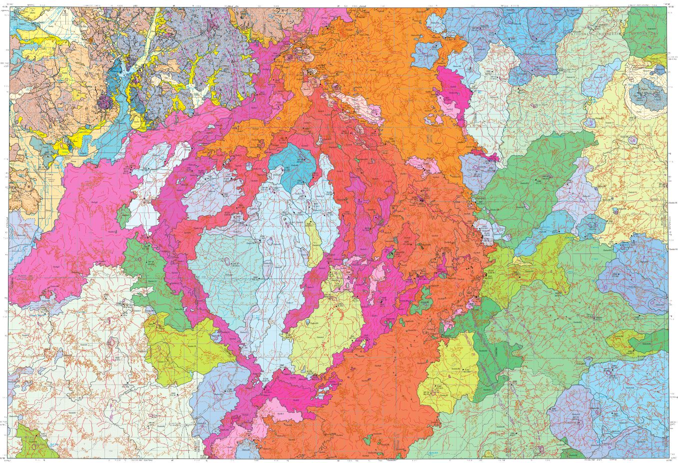
Detailed map of the Great Rift system - source: Idaho Museum of Natural History
According to the Idaho Museum of Natural History: "One explanation for the existence of the Snake River Plain and the Craters of the Moon lava field is called the mantle plume theory. This theory states that beneath the crust of the Snake River Plain lies a "hot spot" or localized heat source. Periodically, this hot spot consists of a "plume" of molten rock (magma) which rises buoyantly to the surface of the earth. The hot spot does not move but rather remains in a fixed position. What does move is the crust of the earth; as the North American plate slides southwestward over the hot spot. As the plate moves over the hot spot volcanic eruptions occur creating a string of volcanic activity on the surface.
Initially these eruptions are very violent and produce a lava known as rhyolite. Huge calderas of up to 50km in diameter are formed when these devastating eruptions take place. Later a more fluid lava known as basalt flows onto the surface and covers the rhyolitic flows. Yellowstone National Park, the area where the hot spot is believed to be located at this time, is the place where catastrophic rhyolitic eruptions last occurred 600,000 years ago. Craters of the Moon represents the second stage of the eruptions where fluid basaltic lava covered the landscape as recently as 2000 years ago."
Describing the landscape of the Craters of the Moon National Monument, the Idaho State Office of the U.S. Bureau of Land Management stated: "The monument is a geologic wonder cast in a wild and remote landscape. The Great Rift is the source of a remarkably preserved volcanic landscape with an array of exceptional features in a small area. Almost all the features of basaltic volcanism are visible at the monument. Where the Great Rift intersects the earth's surface, there is an array of lava cones, eruptive fissures, fresh-appearing lava flows, noneruptive fissures, and shield volcanoes. Craters, lava tubes, deep cracks, and vast lava fields form a strangely beautiful volcanic sea on central Idaho's Snake River Plain. Expanding gases in the lava ejected bubbly rocks hundreds of feet into the air. In some cases these cinders showered the ground to form cones.
Some of the lava flowed around areas of higher ground, forming isolated islands of vegetation called "kipukas". Today, these kipukas provide a window on the vegetation communities of the past. They contain some of the last pristine vegetation in the Snake River Plain, including 700-year-old juniper trees and relic stands of sagebrush and native bunchgrass."
The past and future of the Craters of the Moon National Monument is then raised by the Idaho Museum of Natural History: "Of the more than 60 lava flows of the Craters of the Moon lava field, 20 have been dated: their ages were found to range from about 15,000 years before present to about 2,100 years before present. The flows were laid down in eight distinct eruptive periods that recurred on an average of every 2,000 years, traveling as far as 70km from their vents. With each successive series of eruptions, older volcanic formations were buried, and new ones were superimposed on their surfaces. The barren black lava flows were emitted during the most recent eruptions. On the basis of recent eruptive history, the Craters rift set is due for another eruption within the next thousand years, perhaps as soon as within 200 years."
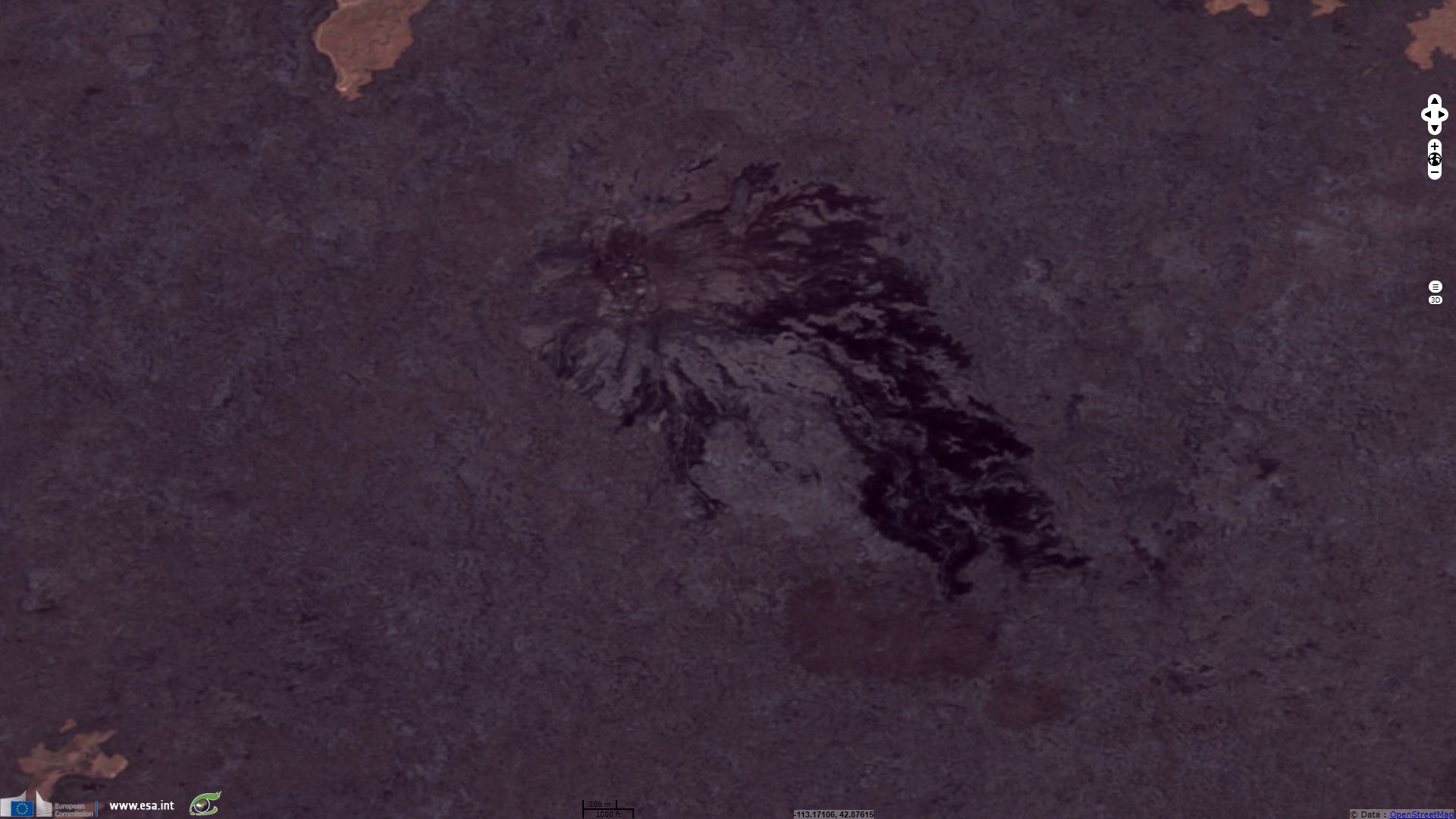
"The Wapi Lava Field is located at the southern end of the Great Rift System. The Wapi lava field is a broad shield volcano that produced about 6 km3 of fluid lava flows now covering approximately 670km². The cone consists of many aa and pahoehoe flows which are replete with lava tubes and channels" according to Idaho Museum of Natural History. They add: "It is characterized by features such as lava toes, collapse depressions, flow ridges and pressure ridges. The Wapi lavas have a carbon 14 date of 2,270 years, almost simultaneously with the King's Bowl lava field. Many of the low shields have pit craters at the summit and many craters show evidence of collapse. Shields tend to be aligned along rifts or fissures."
The Smithsonian Institution complements: "The small King's Bowl rift immediately to the north was also formed at about the same time along a central eruptive fissure flanked by two parallel non-eruptive fissures. This eruption produced a phreatic explosion that created Kings Bowl, an 80m-long, 30m-deep explosion crater. The vent area lies along the Great Rift of the Craters of the Moon and consists of five major and a half dozen minor vents covering an area of 0.5 km2. The largest of the vents contains several pit craters that truncate lava lakes that filled the crater. Pillar Butte, a mass of layered lava flows and agglutinates, forms the high point of the lava shield. The Split Butte maar to the west is partially overlapped by flows of the Wapi lava field."
Idaho Museum of Natural History wrote "Big Southern Butte, Middle Butte and East Butte are three large buttes which can be seen rising above the eastern Snake River Plain. Middle Butte appears to be an uplifted block of basalt. Although no rhyolite is exposed at the surface, the butte was probably formed by a silicic intrusion forcing the basalt upwards into the form of a butte. Big Southern Butte and East Butte are rhyolite domes. East Butte has been dated at 600,000 years, whereas Big Southern Butte has been dated at 300,000 years.
The butte was formed by two coalesced cumulo domes of rhyolite that uplifted a 350 foot section of basalt. The basalt section now covers most of the northern side of the butte. The dome on the southeastern side was developed by internal expansion (endogenous growth). Rupture of the crust at the surface caused breccia to form. Obsidian, pumice and flow-banded rhyolite are important components. Once part of a continuous flow on the surface of the Snake River Plain, the large basalt block was pushed up and tilted by intrusion of the rhyolite. The basalt block now dips about 45 degrees to the northeast. This block consists of 15 to 20 individual flow units."

Big Southern Butte - source: website of Butte County Idaho
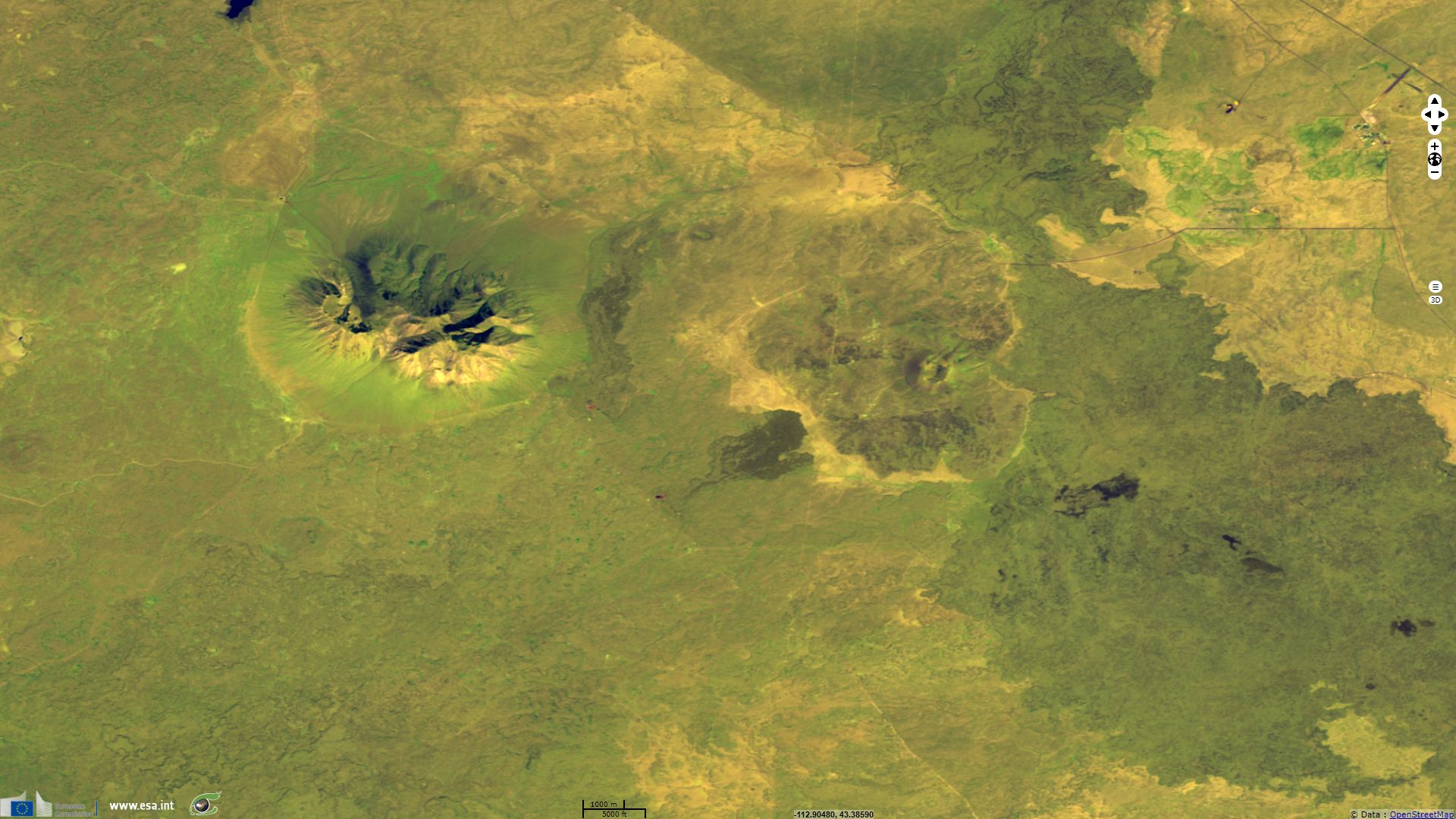
R. Greeley described Big Southern Butte as "the highest cone within the monument - it has a total volume of 0.2 km3, and rises 760m above the plain. It has no summit crater. Many bombs are found on the cone, including cow dung, breadcrust, and spindle types. The rims of five or six older volcanoes are visible around its base. Several flows issued from Big Cinder Butte. The youngest originated from a fissure on the north side of the cone and is a "Blue Dragon" - type pahoehoe flow. This type of flow is characterized by a shining iridescent surface."
According to the U.S. Department of the Interior bureau of land management, "The Hell's Half Acre Lava Trail traverses the desert ecosystem of the Snake River Plain through rough terrain, unusual scenery, and contorted landscapes created from multiple lava flows. Most of the calderas left behind by the violent eruptions of the Yellowstone hotspot have been buried by many less violent, Hawaii-type lava flows associated with the stretching of the basin and range. The Hell's Half Acre lava flow is the most recent one in eastern Idaho and erupted about 4,100 years ago across 320 km²." In his article Mafic Volcanism and Environmental Geology of the Eastern Snake River Plain, Idaho, Scott S. Hughes sums up: "Hells Half Acre basaltic lava field exemplifies monogenetic Holocene shield eruptions and inflationary lava flow emplacement on the eastern Snake River Plain."

Hells Half Acre - source: Lee Siebert for the Smithsonian Institution
The views expressed herein can in no way be taken to reflect the official opinion of the European Space Agency or the European Union.
Contains modified Copernicus Sentinel data 2026, processed by VisioTerra.
Contains modified Copernicus Sentinel data 2026, processed by VisioTerra.
| More on European Commission space: |  |
 |
 |
||||
| More on ESA: | |
|
|
S-1 website | S-2 website | S-3 website | |
| More on Copernicus program: | |
|
|
Scihub portal | Cophub portal | Inthub portal | Colhub portal |
| More on VisioTerra: | |
|
|
Sentinel Vision Portal | Envisat+ERS portal | Swarm+GOCE portal | CryoSat portal |