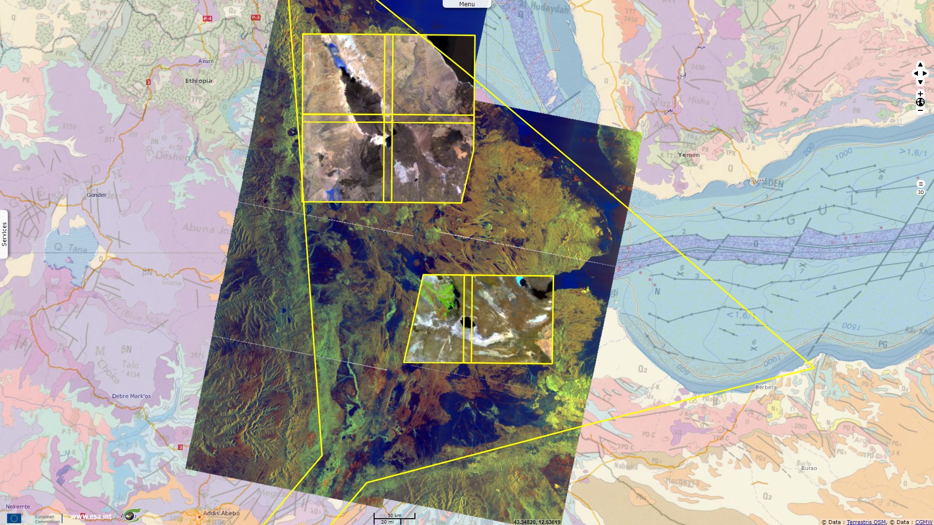
Afar Triangle featured by Sentinels
Sentinel-2 MSI acquired on 25 June 2017 at 07:26:11 UTC
Sentinel-1 CSAR IW acquired on 28 June 2017 from 02:59:45 to 03:00:35 UTC
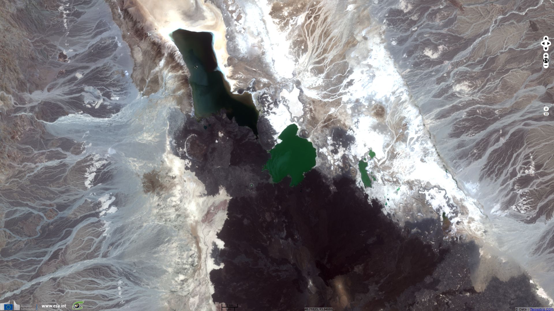
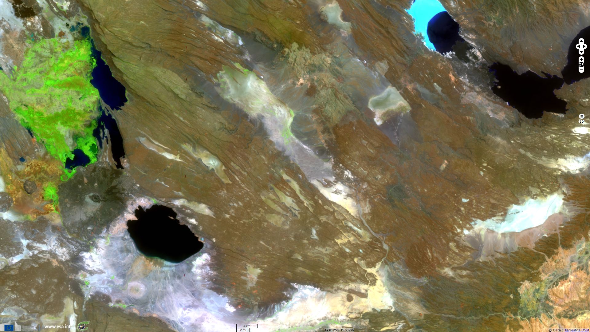
Sentinel-2 MSI acquired on 28 June 2017 at 07:52:11 UTC
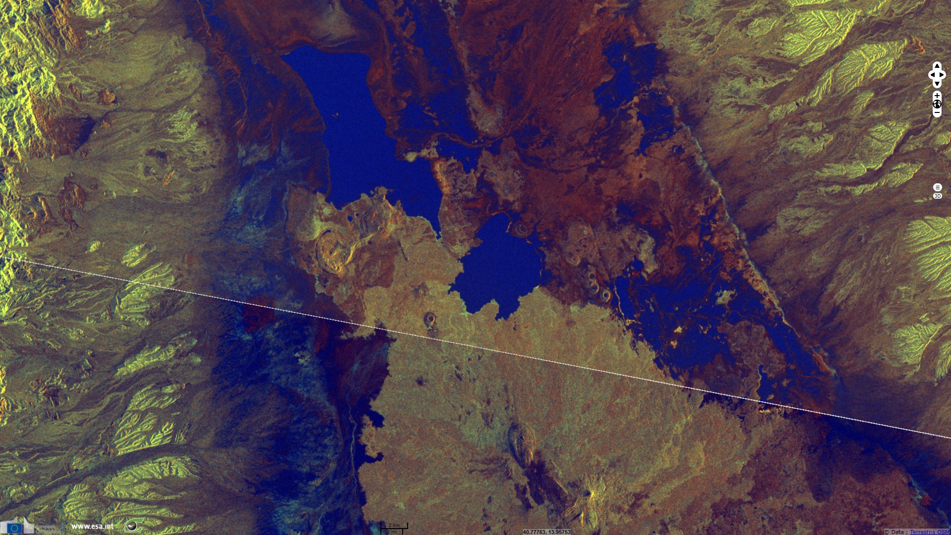
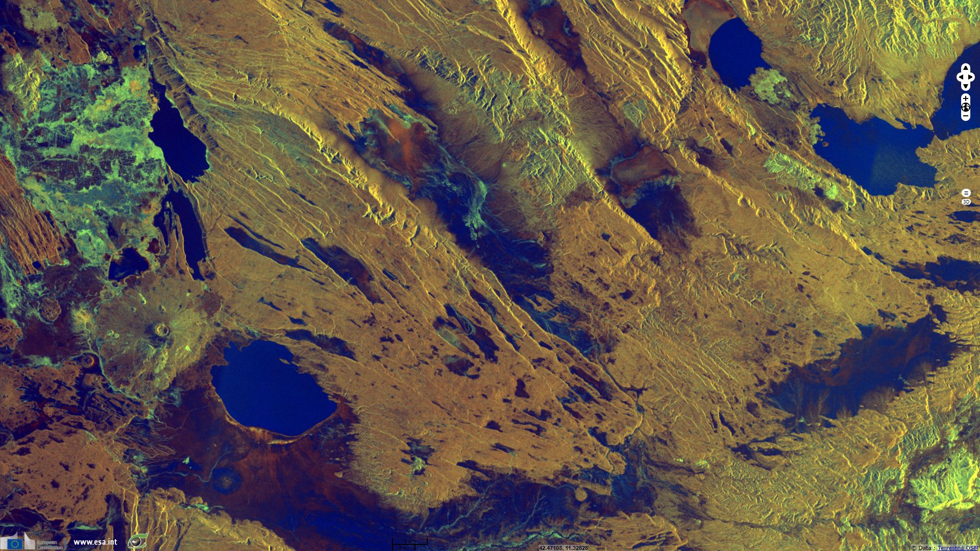
Sentinel-1 CSAR IW acquired on 03 July 2017 from 03:07:29 to 03:08:44 UTC
Sentinel-1 CSAR IW acquired on 28 June 2017 from 02:59:45 to 03:00:35 UTC
Sentinel-2 MSI acquired on 28 June 2017 at 07:52:11 UTC
Sentinel-1 CSAR IW acquired on 03 July 2017 from 03:07:29 to 03:08:44 UTC
Keyword(s): land, rifting, volcanism, hydrothermal activity, eruption, magmatism, lava flow, salt flats, mining, lakes, Afar Triangle, Danakil depression, Djibouti, Erithrea, Ethiopia
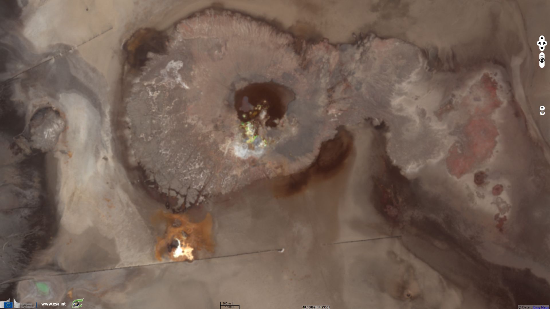
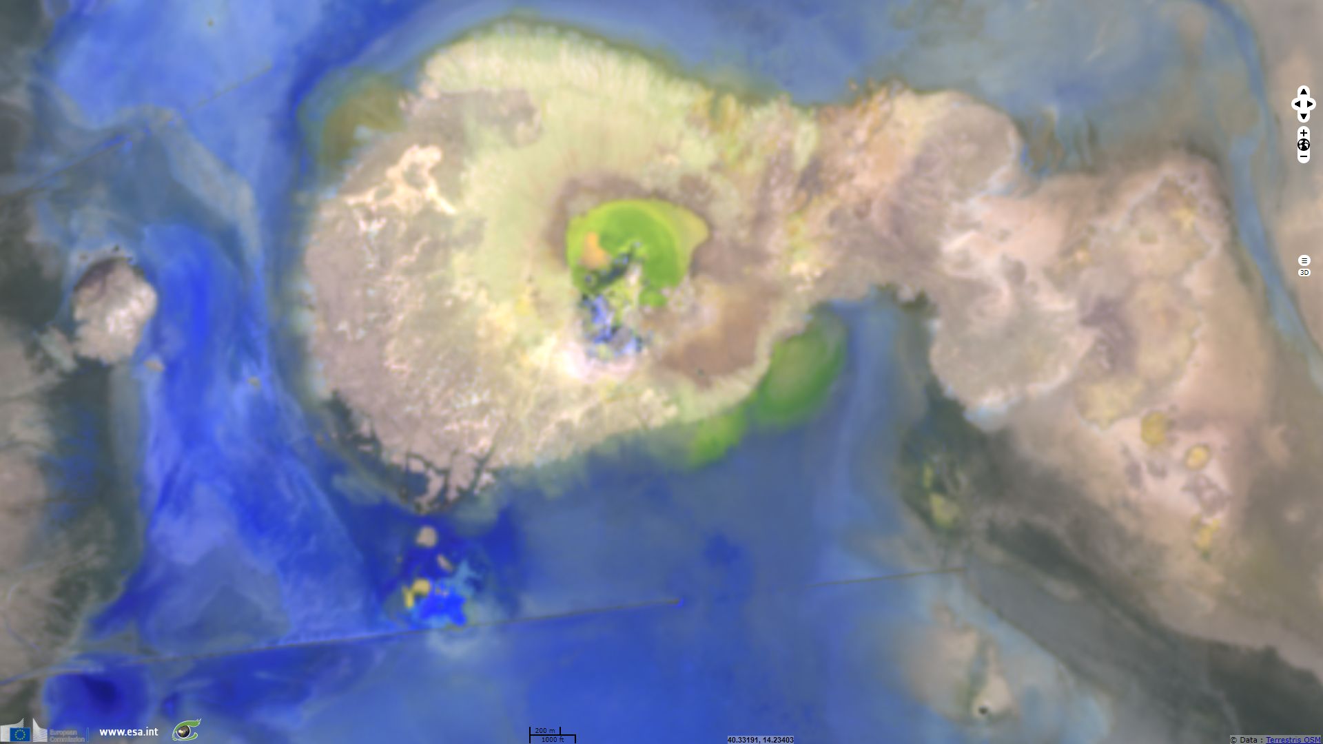
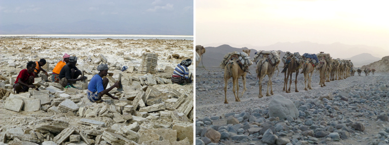
Near Salt Canyon, Dallol is located in a maar 120m below sea level while its summit tops at -48m. Its is reknowned for its colourful acidic pools bordered by evaporatite and geyserites, sulfur, potash, salt deposits and other mineral concretion.
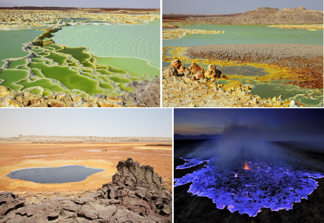
In Exploring for Geothermal Sites in Northern and Central Afar (Ethiopia), Jacques Varet described the Dallol geothermal site:
"The Dallol site is located in the middle of the vast Dagad Salt Plain. It is a former potash mining site (Holwerda and Hutchinson, 1966; ELMICO, 1984) and also a tourist destination due to the multi-coloured salt concretions that have developed as a result of spectacular hydrothermal activity. Hot water and fumaroles (the temperature of which may reach 120 °C) deposit sodium, potassium and magnesium chloride as well as elemental sulfurs, creating a wide range of colors at the emission sites, from black and green under reduced conditions, to yellow, red and brown after oxidation (Figure 5). Springs and fumaroles are clearly aligned along NNW trending fissures, certainly linked to the opening of fissures on the rift axis."
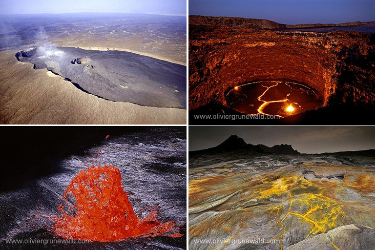
On their page dedicated to Erta Ale, Oregon State University notes "Oppenheimer and Francis (1998) looked at the implications of long-lived lava lakes. They believe that Erta Ale's lava lake has been active since at least 1906 (making it one of the longest known historic eruptions). Large amounts of heat are released by the volcano but the amount of lava that erupts is relatively small. Oppenheimer and Francis speculated that a higher magma density (caused by the cooling of the lava in the lake) inhibits eruptions. They proposed that most of the magma accumulates in the underlying crust in the form of dikes and sills. Since the Afar region is under extension, conditions are favorable for the injection of dikes and sills."
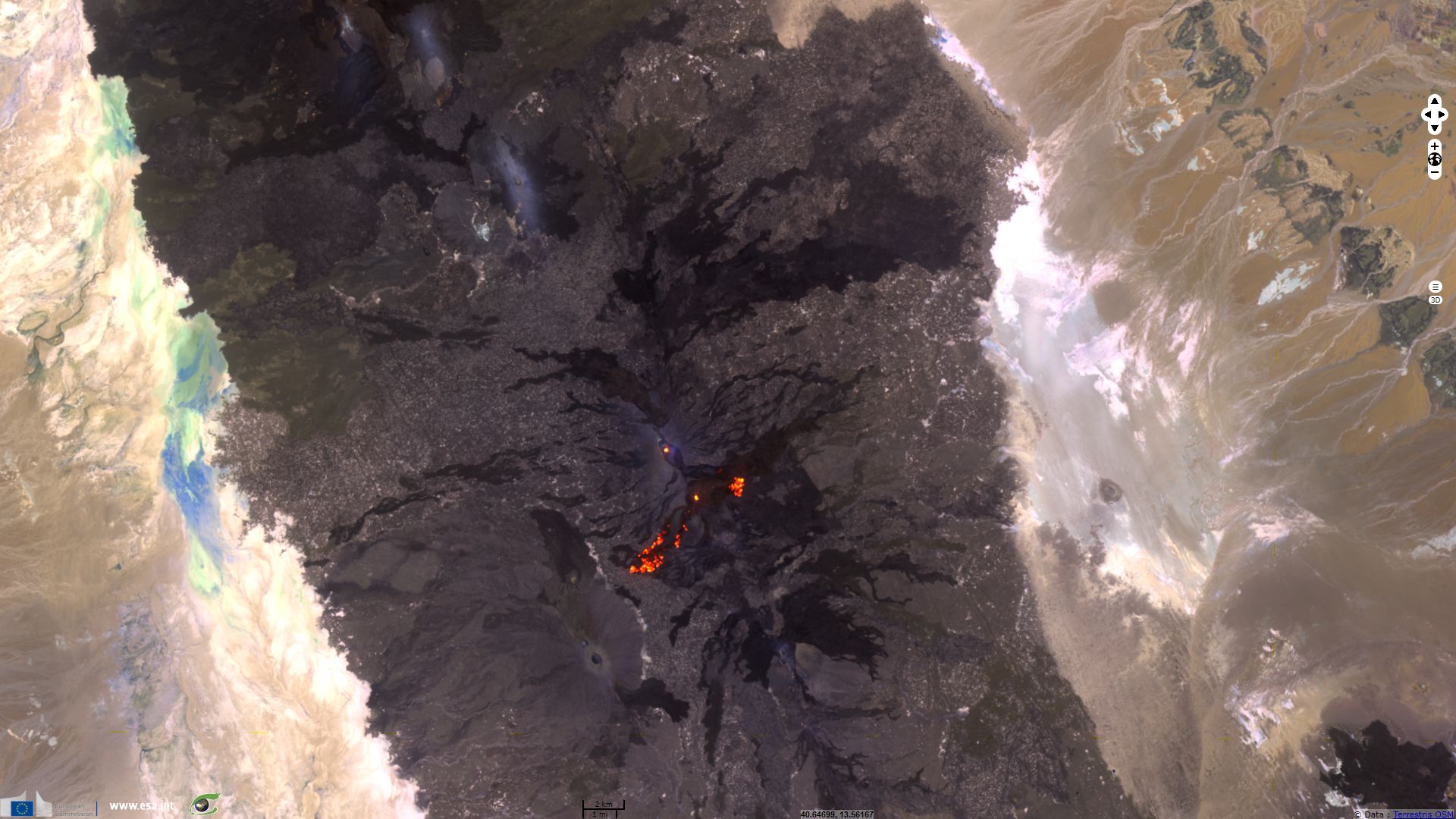
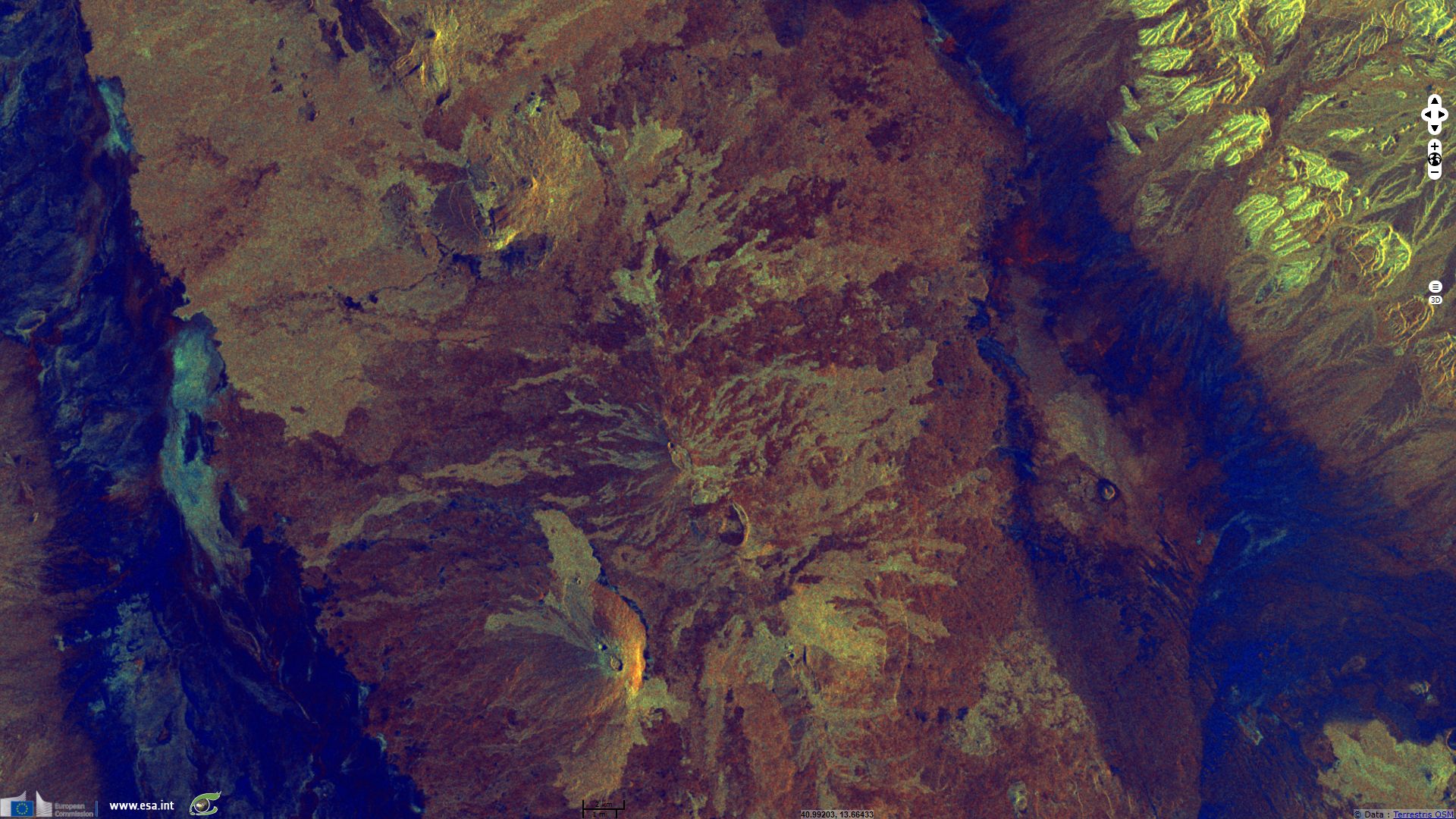
Erta Ale configuration is likely to change soon again, a report added on volcanodiscovery.com informs that "The new flank eruption continued to be active throughout the first half of 2017 and greatly intensified in early June when overflowing of the ca 200 m diameter lava lake created new pahoehoe lava flows both in northeasterly and southwesterly direction. Enku Mulugetu writes: 'Satellite images confirm that there has been a continuous outpour of lava from the new fissure eruption which seems to be building a new shield with different active vents from where pahoehoe lava flows, but not much fountaining or degassing occurs.'"
The Afar Triangle or Afar Triple Junction also called Afar depression is the region where the Red Sea Rift, the Aden Ridge and the East African Rift converge.
The magma convection under these rifts cause three continental plates, the Somalian, Arabian and African plates to move away from each other, enlarging the Gulf of Aden and the Red Sea.
In the East African Rift Valley, magma plumes weaken the spread lithosphere, causing thinning and crust failures that are materialized by the succession of grabens and horsts. As this pre-oceanic basin structure matures, the Afar depression lakes and basins should connect with the sea and spread further into the rift valley, it could then evolve like the Red Sea and then into an ocean.
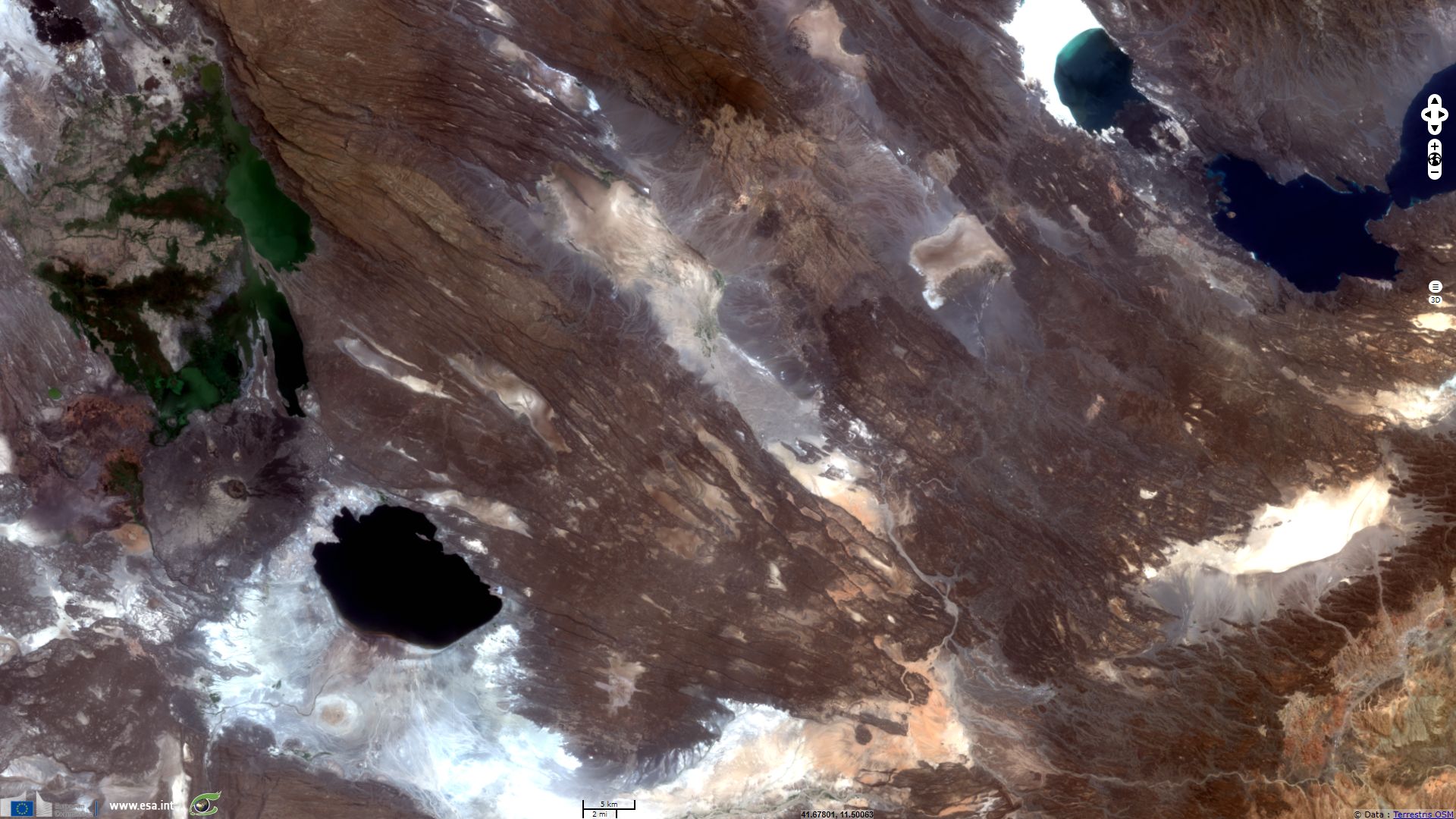
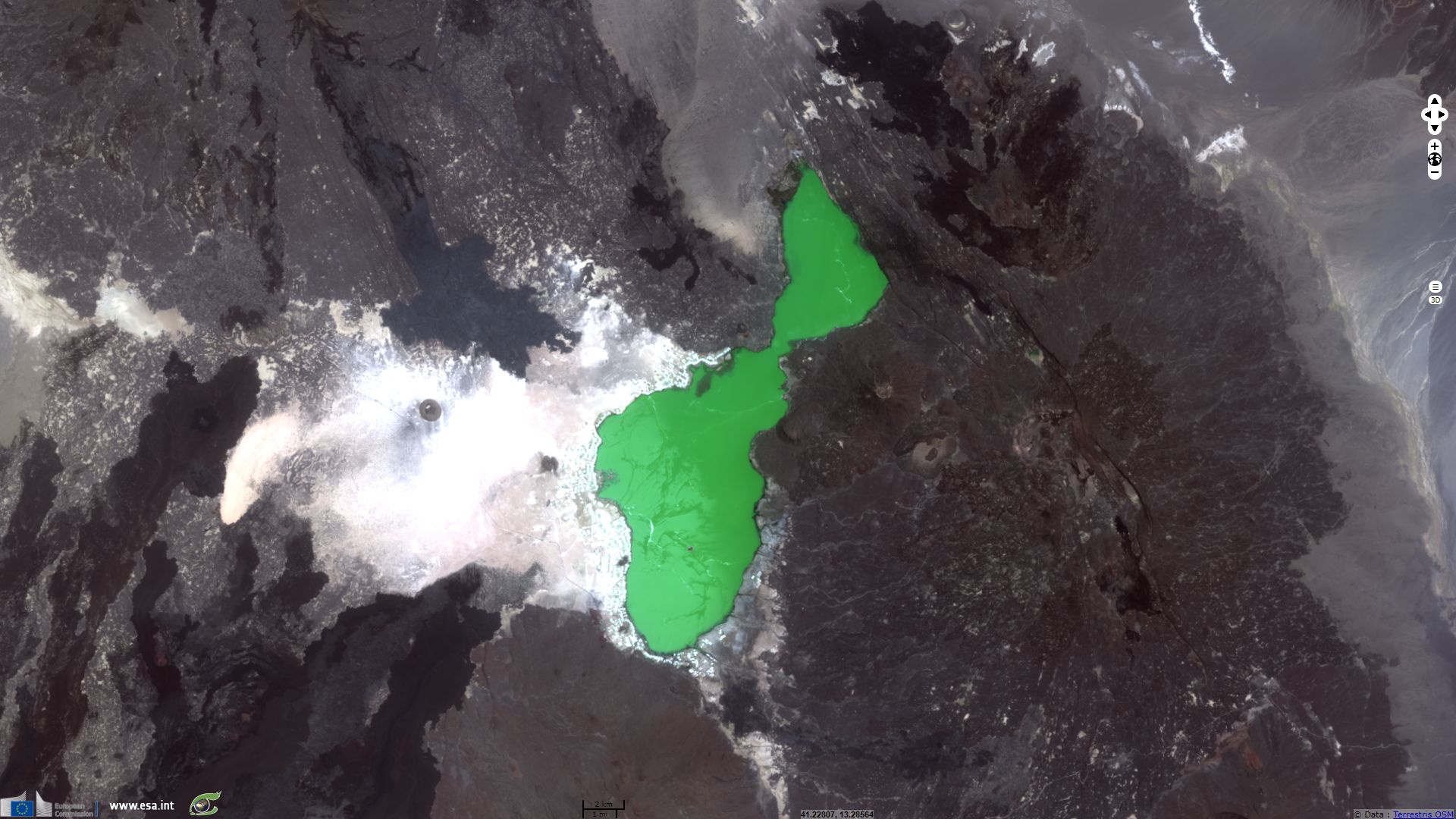
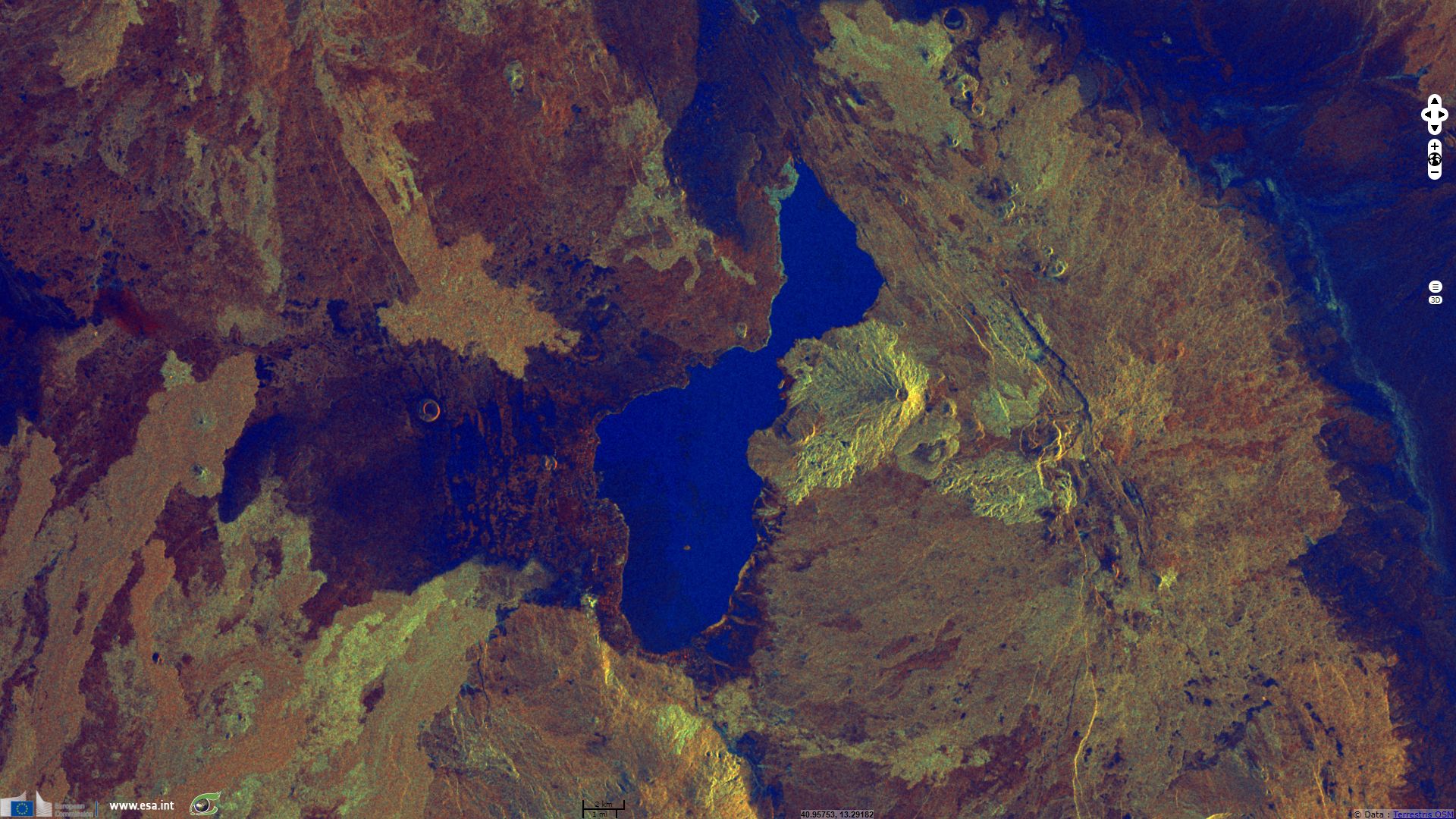
Lake Abbe is located on the South-West of the image below. R. H. Hugues described it in his 1992 book, A directory of African wetlands, "It is situated on the floor of a basin which once contained a much larger lake. It is 37m deep, endorheic, and is fed principally by the Awash River, which with its tributaries drains a major part of the eastern slopes of the Ethiopian Highlands. Since 1954 an increasing volume of water has been removed from the upper Awash for irrigation and by 1984 the lake surface had shrunk to two thirds of what it was in the late 1940s. This shrinkage is evidenced by extensive flats now covering some 11500 ha to the south west of the lake. A small part of these flats extends into Djibouti."
Visible on the North-East of this image, Lake Assal is the lowest point in Africa with -155m level. It is 10km away from being connected to the Indian Ocean via Ghoubbet-el-Kharab cove and then the Gulf of Aden. Located over a 60m salt crust, Lake Assal salinity is tenfold that of mean sea water (more than that of the Dead Sea), it is considered World's largest salt reserve. Temperatures near Lake Assal reach 52°C in summer and decrease to 34°C during winter. This hot and arid climate combined with magmatic and mineral soil make Afar depression an extreme environment for life.
The views expressed herein can in no way be taken to reflect the official opinion of the European Space Agency or the European Union.
Contains modified Copernicus Sentinel data 2026, processed by VisioTerra.
Contains modified Copernicus Sentinel data 2026, processed by VisioTerra.
| More on European Commission space: |  |
 |
 |
||||
| More on ESA: | |
|
|
S-1 website | S-2 website | S-3 website | |
| More on Copernicus program: | |
|
|
Scihub portal | Cophub portal | Inthub portal | Colhub portal |
| More on VisioTerra: | |
|
|
Sentinel Vision Portal | Envisat+ERS portal | Swarm+GOCE portal | CryoSat portal |