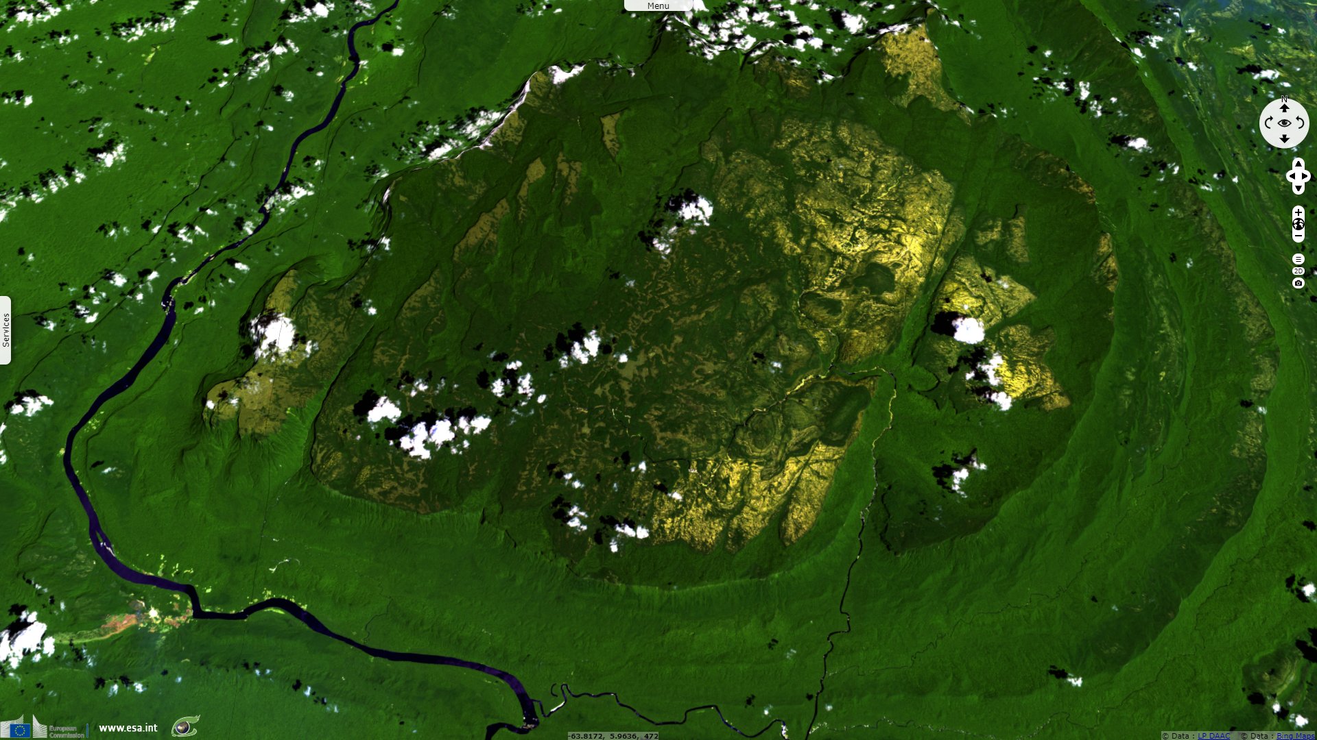
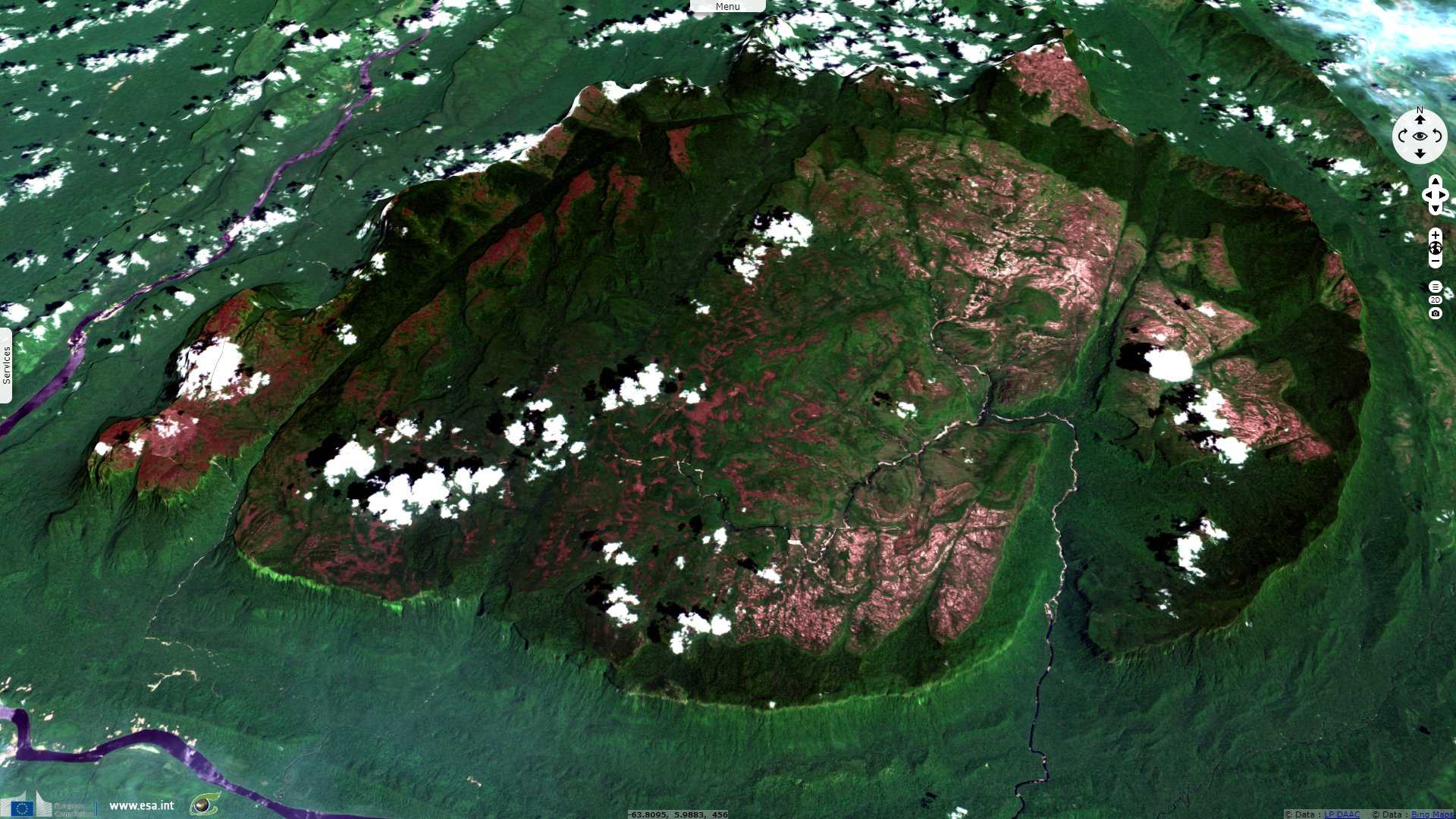
Cerro Guaiquinima, Venezuela
Sentinel-1 CSAR IW acquired on 19 August 2018 at 10:00:43 UTC
Sentinel-1 CSAR IW acquired on 24 August 2018 at 22:32:16 UTC
Sentinel-1 CSAR IW acquired on 05 September 2018 at 22:32:17 UTC
Sentinel-1 CSAR IW acquired on 17 September 2018 at 22:32:17 UTC
Sentinel-2 MSI acquired on 26 February 2019 at 14:47:29 UTC
Sentinel-1 CSAR IW acquired on 24 August 2018 at 22:32:16 UTC
Sentinel-1 CSAR IW acquired on 05 September 2018 at 22:32:17 UTC
Sentinel-1 CSAR IW acquired on 17 September 2018 at 22:32:17 UTC
Sentinel-2 MSI acquired on 26 February 2019 at 14:47:29 UTC
Keyword(s): Mountain range, plateau, tableland, rainforest, biodiversity, national park, land, erosion, craton, Guiana shield
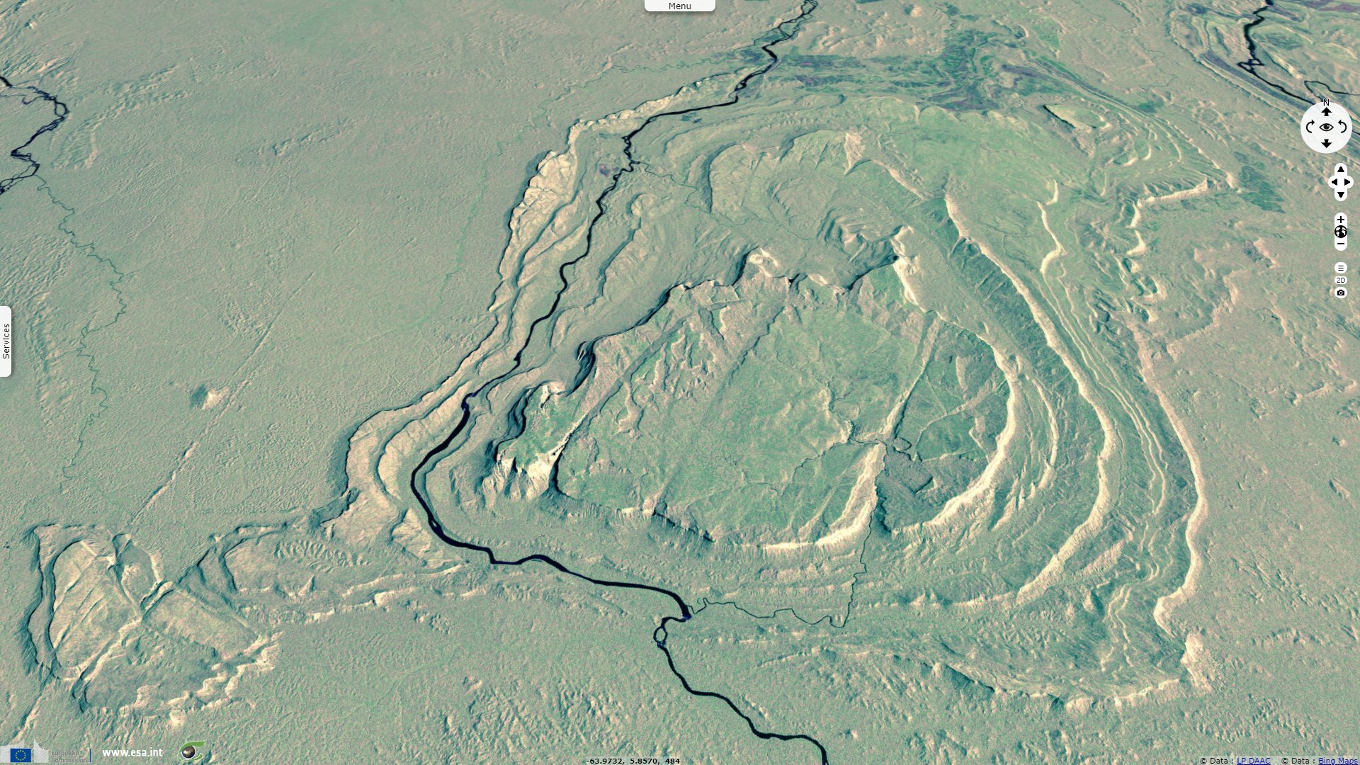
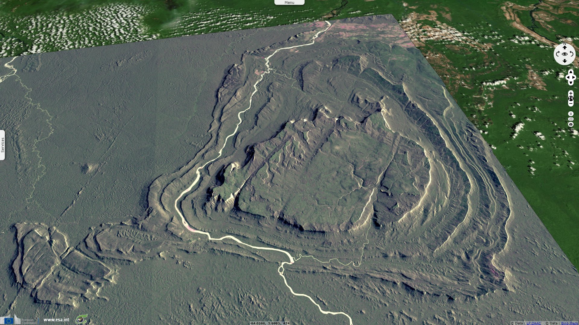
Located in the Guiana Highlands, Cerro Guaiquinima is one of the largest isolated sandstone mesas of the Pantepui region, with an estimated summit area of 1096 km².
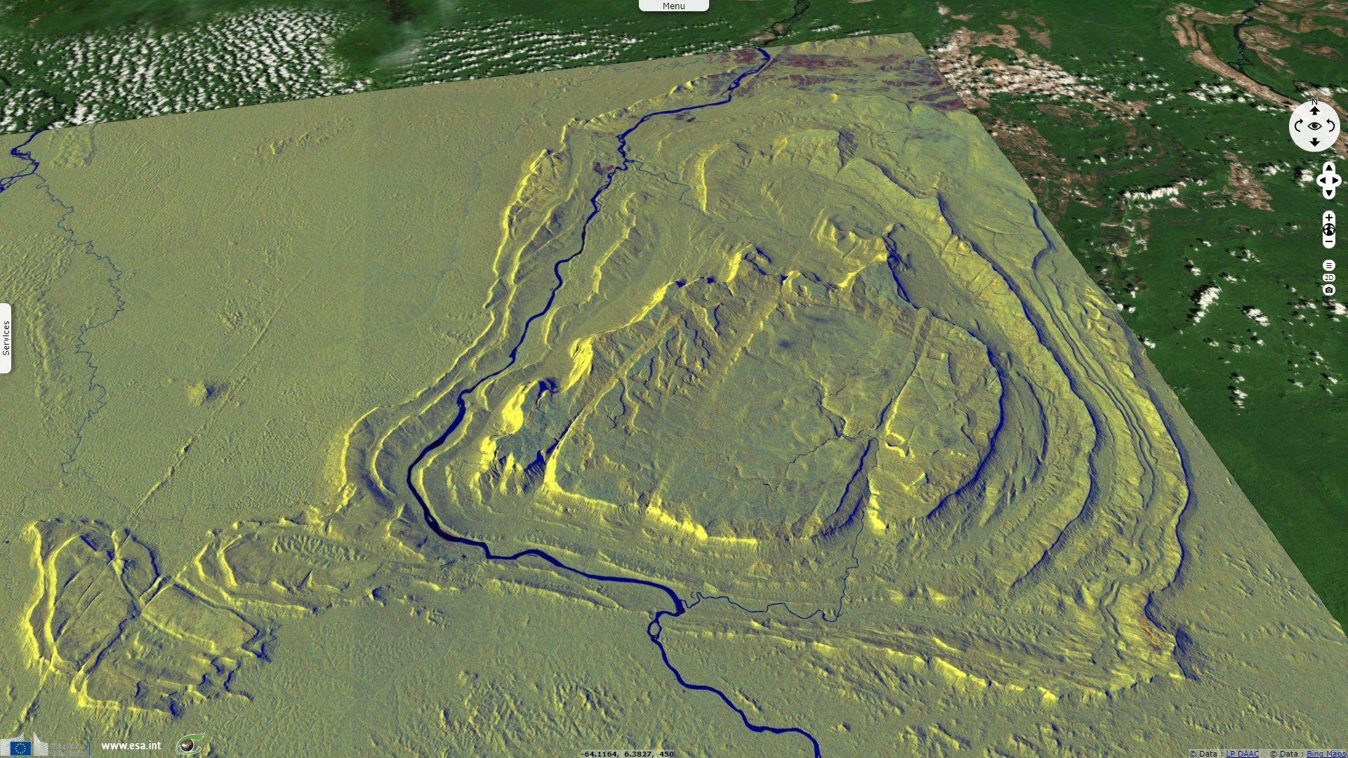
This mountainous plateau lies in the Jaua-Sarisariñama National Park, at the southern tip of the Bolivar state in Venezuela. At an average height of 1413 m above sea level, this tepuy is one of the highest mountains in Bolívar.
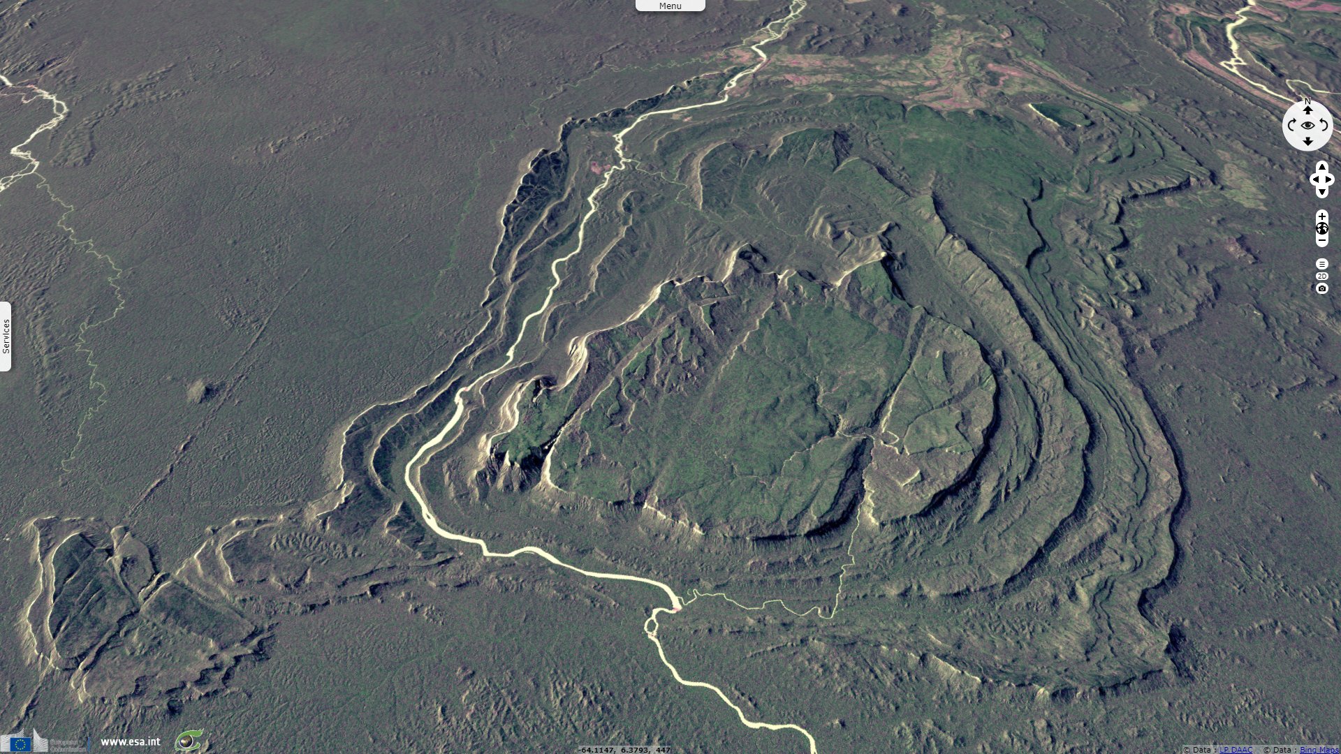
It has very high precipitation values, which allows a dense vegetation with a high proportion of high forest at its top. It houses species with great ecological value, endemic to the Guayana region. Surrounded by 1000m high cliffs, it is a refuge for over 100 bird species.
The views expressed herein can in no way be taken to reflect the official opinion of the European Space Agency or the European Union.
Contains modified Copernicus Sentinel data 2026, processed by VisioTerra.
Contains modified Copernicus Sentinel data 2026, processed by VisioTerra.
| More on European Commission space: |  |
 |
 |
||||
| More on ESA: | |
|
|
S-1 website | S-2 website | S-3 website | |
| More on Copernicus program: | |
|
|
Scihub portal | Cophub portal | Inthub portal | Colhub portal |
| More on VisioTerra: | |
|
|
Sentinel Vision Portal | Envisat+ERS portal | Swarm+GOCE portal | CryoSat portal |