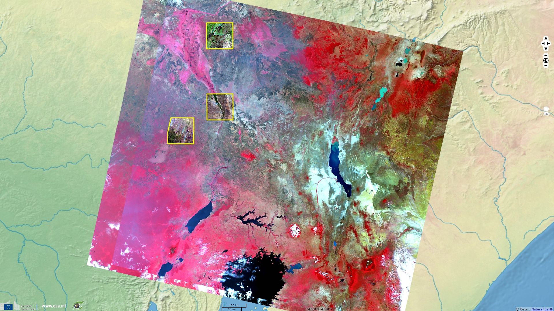
Fires and deforestation in South Sudan
Sentinel-2 MSI acquired from 29 December 2016 to the 18 January 2017
Sentinel-3 OLCI FR acquired from 03 January 2017 to the 07 January 2017
Sentinel-3 OLCI FR acquired from 03 January 2017 to the 07 January 2017
Keyword(s): Bush fire, smoke, agriculture, animal husbandry, shifting cultivation, South Sudan, Africa
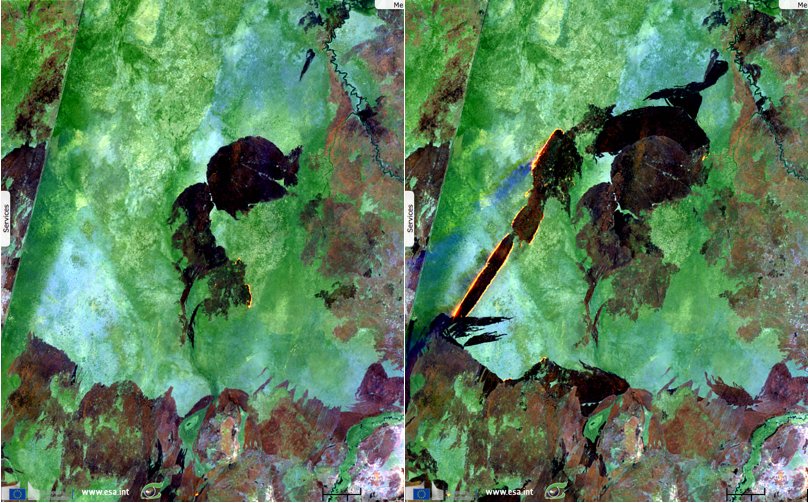
These images were taken at only 10 days interval, they highlight the rapid progress of deforestation in South Sudan. The brown and black colours show the burnt parts, the orange colour correspond to fires (smoke appears in blue on the second image) and the green colour represent the healthy forest and bush.
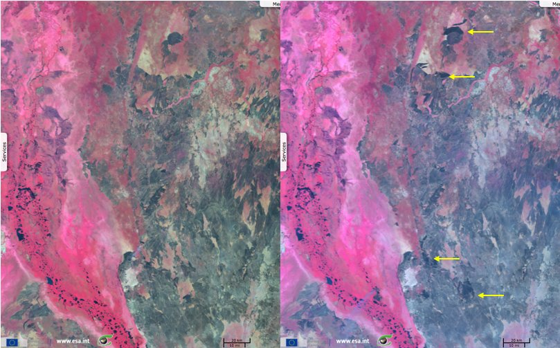
These images were taken at 4 days interval, they show the loss of vegetation in South Sudan on a larger scale. The vegetation colour composite highlight the healthy vegetation (red to pink) that contrast with the burnt vegetation (grey to black).
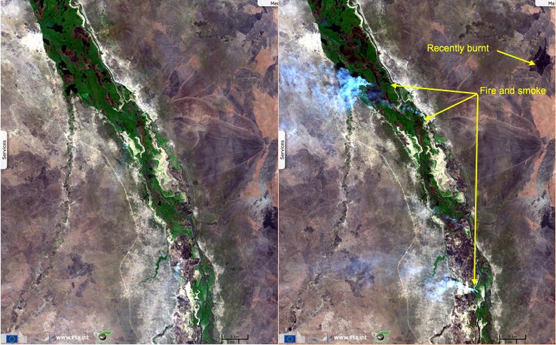
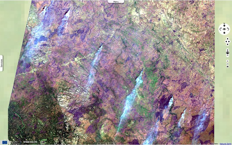
This natural colour image contains at least six bush fires over a 100 km line. The smoke is easily recognized in white, the burnt parts are in violet and the vegetation in green.
According to the UNEP’s South Sudan Program Manager, Arshad Khan, « Forests cover almost 1/3 of the land area of South Sudan and deforestation is a big issue of the country. The main causes of deforestation are: fuel wood, charcoal production, turning the forest land into agricultural land and residential areas, and timber.Similarly, burning of forests and grassland is another issue in certain parts of South Sudan. Pastoralists burn the dry grassland before the raining season to grow fresh grass for their livestock. During this process, they also burn forest. »
Unfortunately, « not much information or data is available on where the deforestation and forest fires are taking place and how big this issue is. », and that is where satellite images can help.
UNEP has been active in South Sudan since 2009 and help the country to put environmental issues on the agenda thanks to his very good relationship with the Ministry of Environment & Forestry, academia, NGOs and research organisations. Today, UNEP maintains its focus on environmental management through three major areas: Environmental governance, Community management of natural forests and Solid waste management.
As we can see on these Sentinel images, there is a very high rate of deforestation in South Sudan.
The views expressed herein can in no way be taken to reflect the official opinion of the European Space Agency or the European Union.
Contains modified Copernicus Sentinel data 2026, processed by VisioTerra.
Contains modified Copernicus Sentinel data 2026, processed by VisioTerra.
| More on European Commission space: |  |
 |
 |
||||
| More on ESA: | |
|
|
S-1 website | S-2 website | S-3 website | |
| More on Copernicus program: | |
|
|
Scihub portal | Cophub portal | Inthub portal | Colhub portal |
| More on VisioTerra: | |
|
|
Sentinel Vision Portal | Envisat+ERS portal | Swarm+GOCE portal | CryoSat portal |