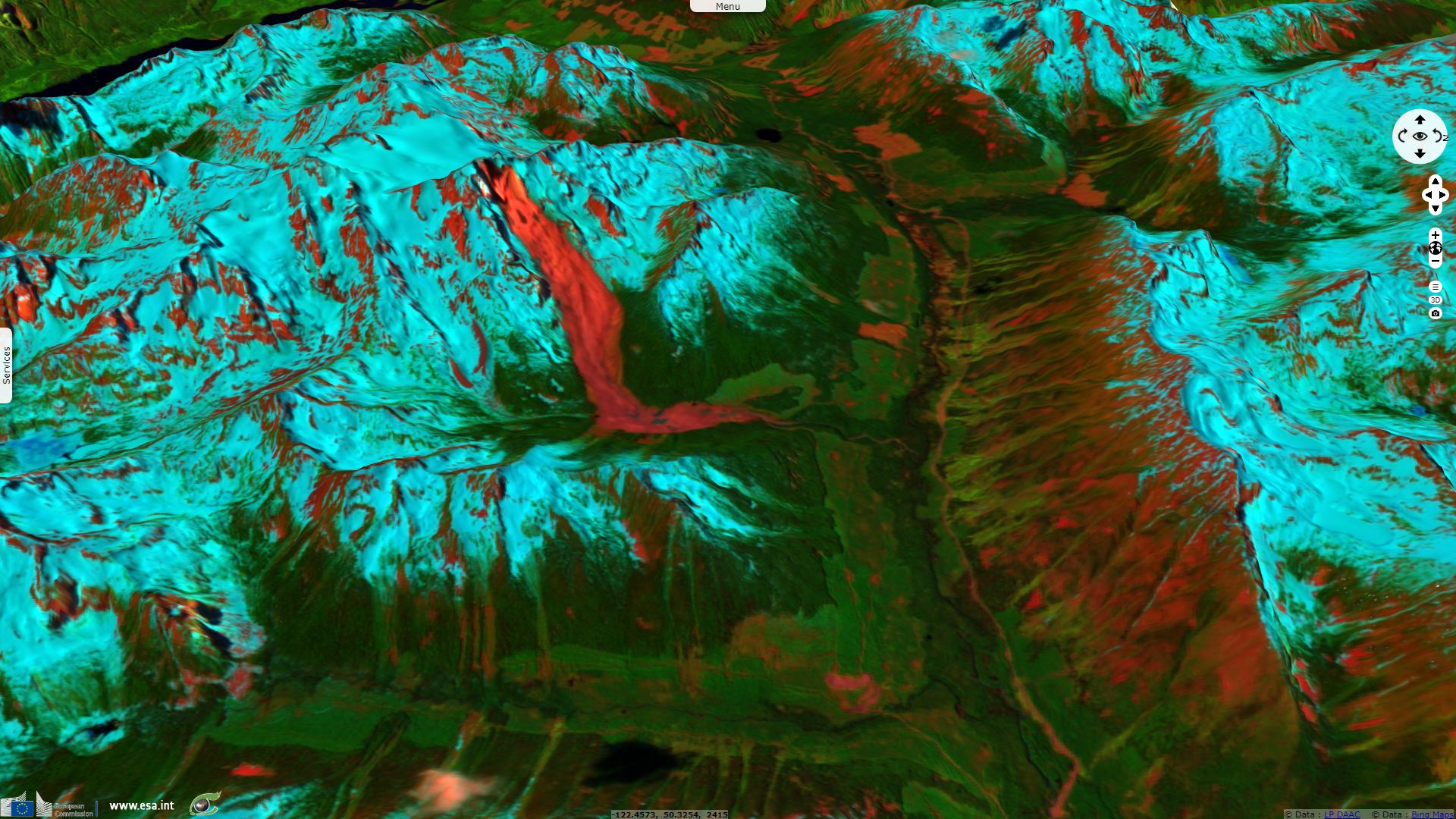
Two-step large rock avalanche in the Pacific Range
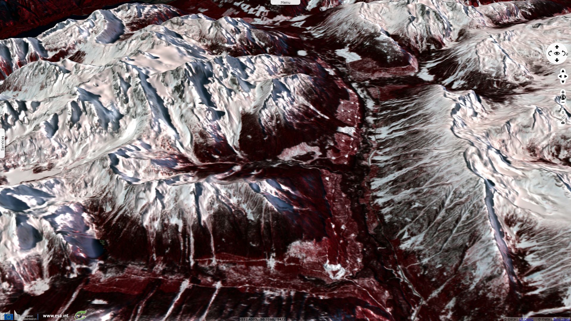
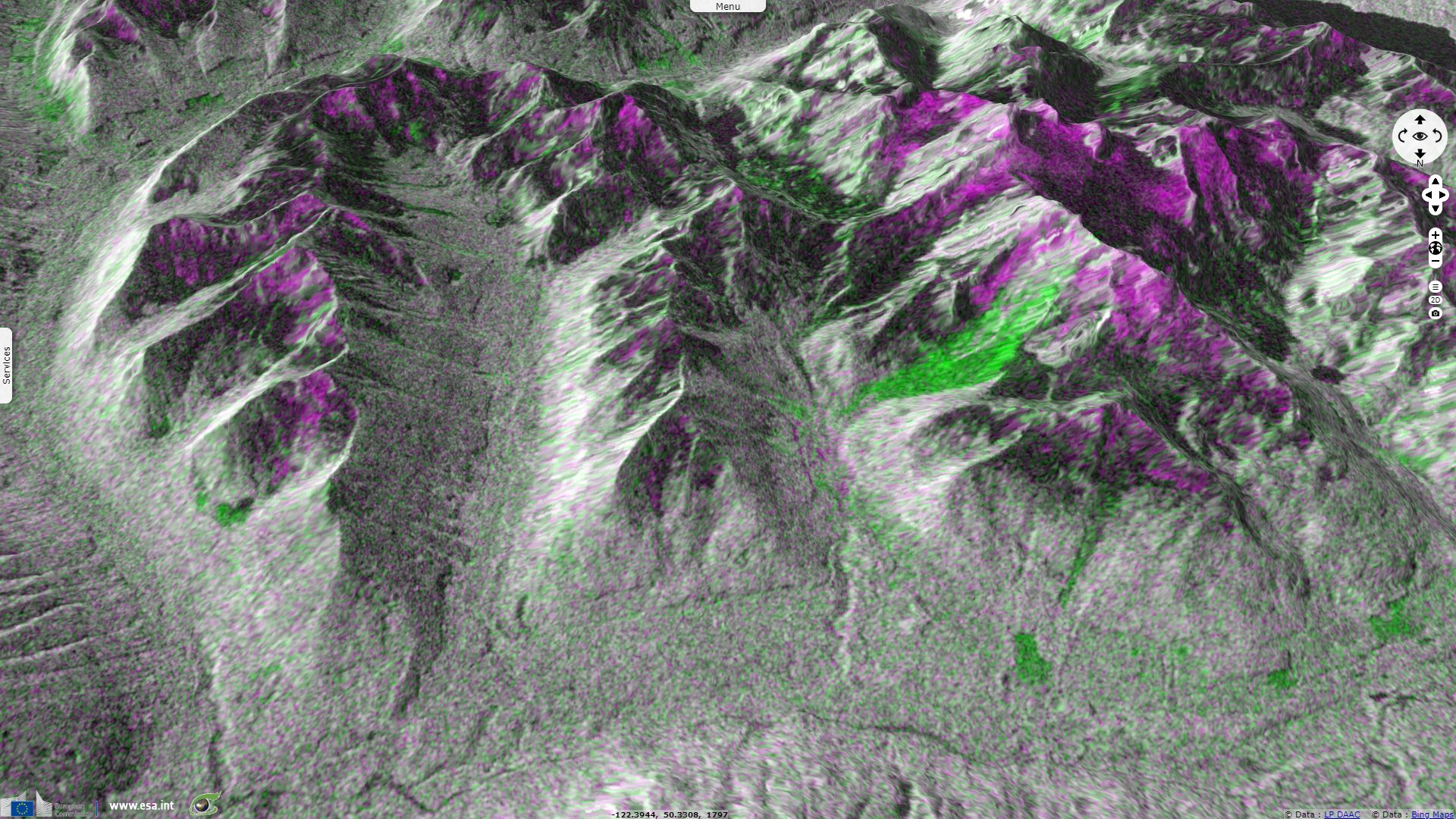
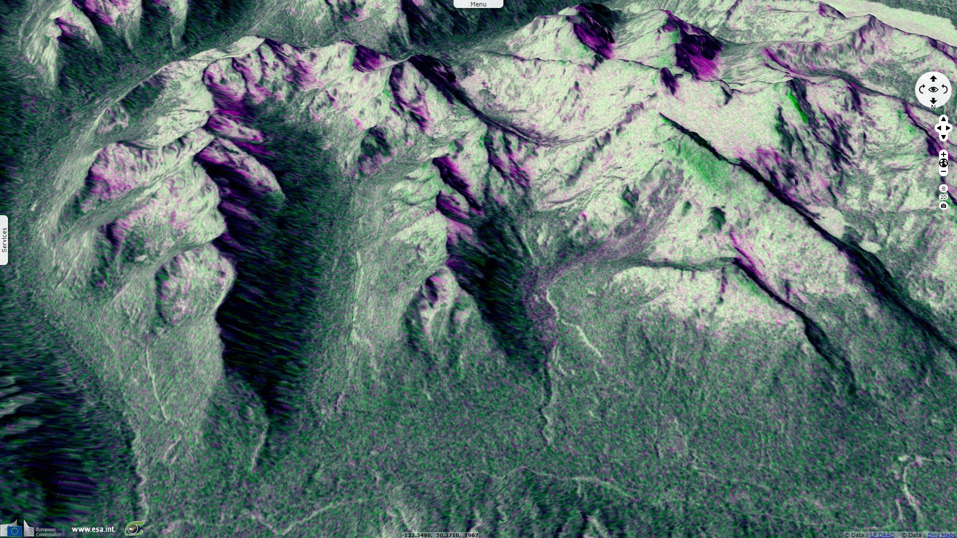
Sentinel-1 CSAR IW acquired on 04 May 2019 at 02:02:04 UTC
...
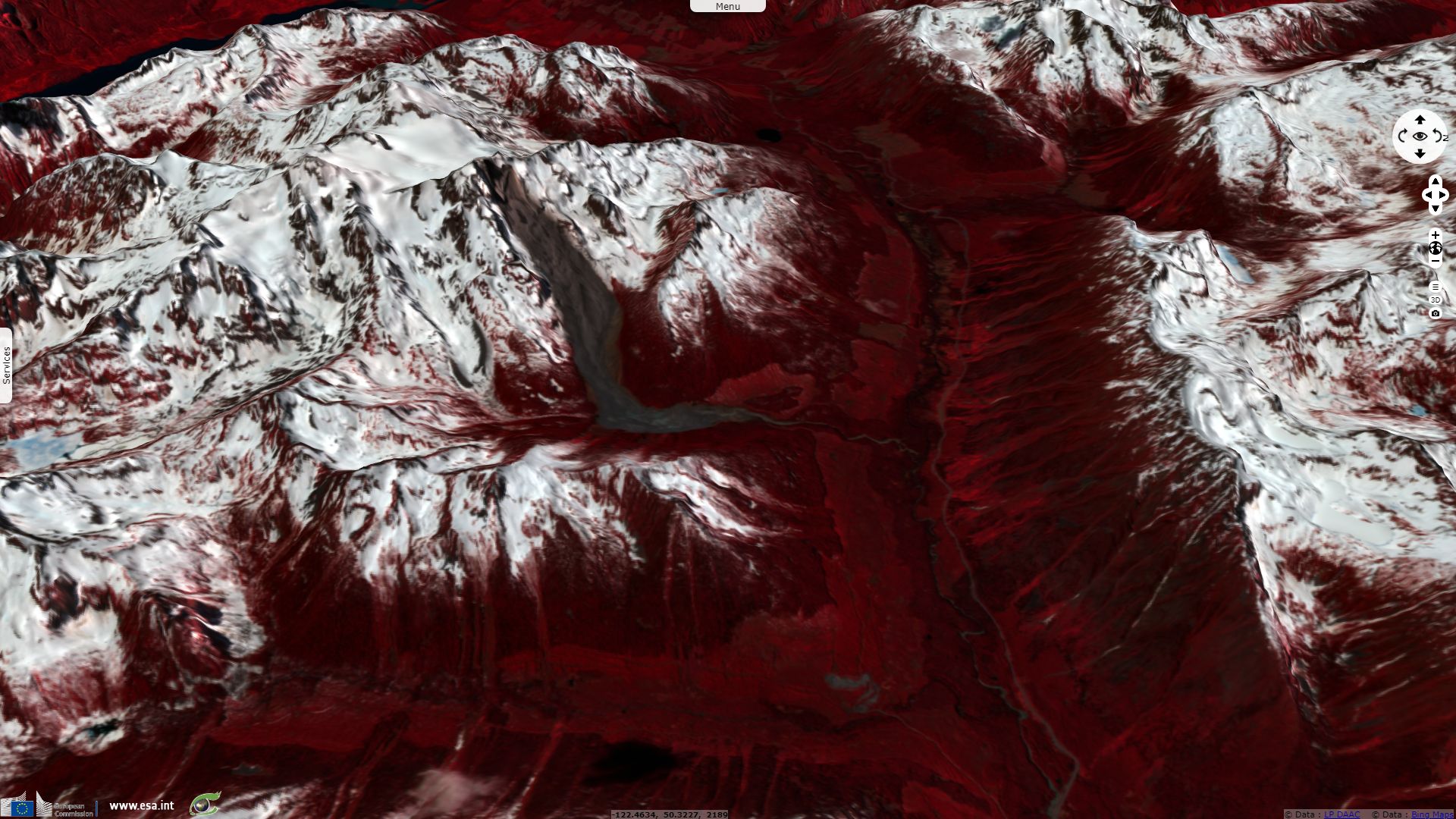
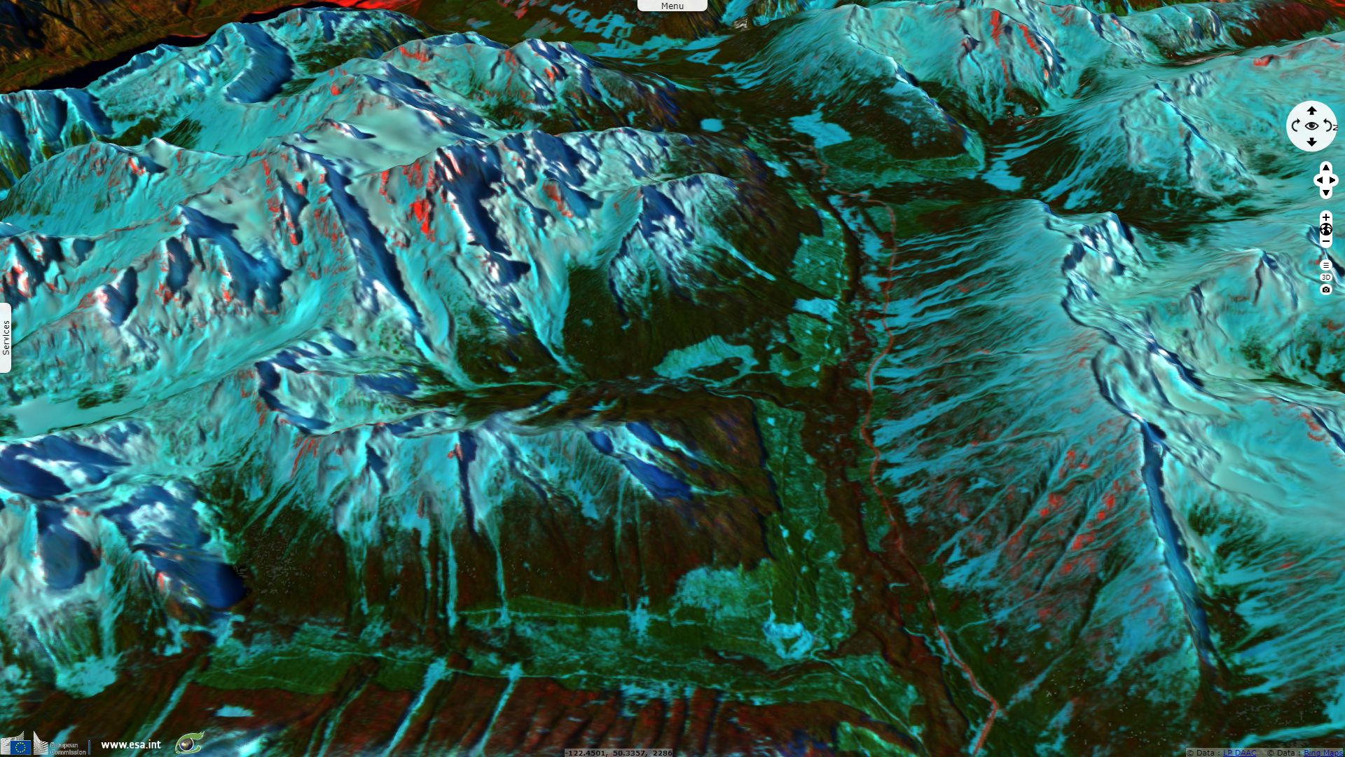
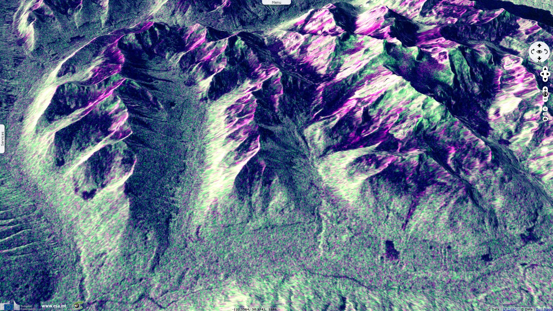
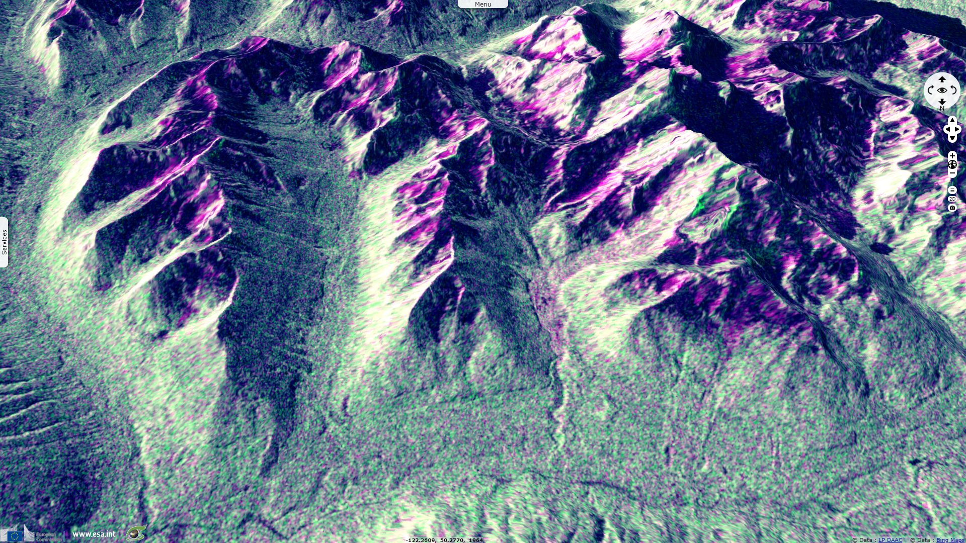
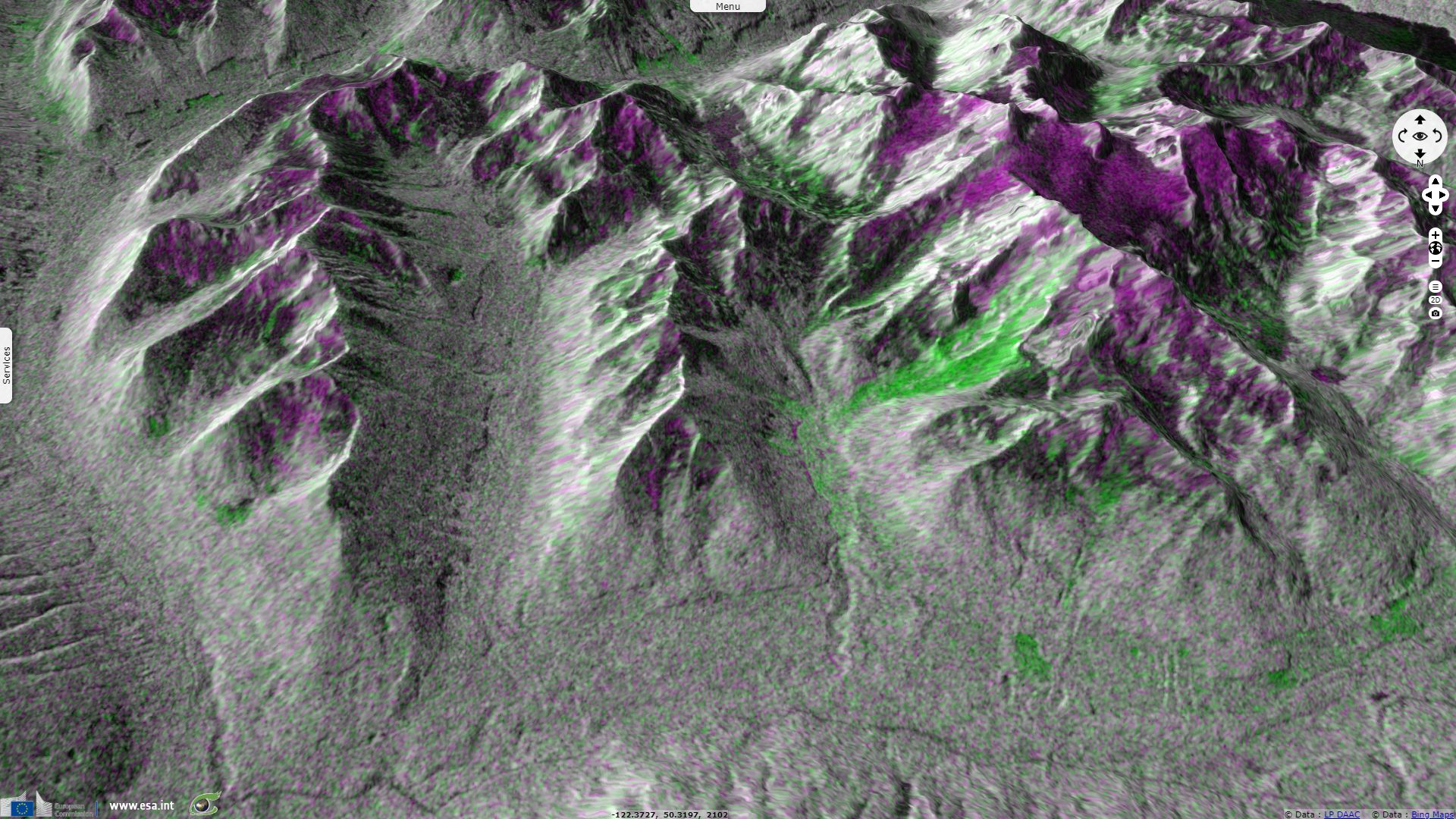
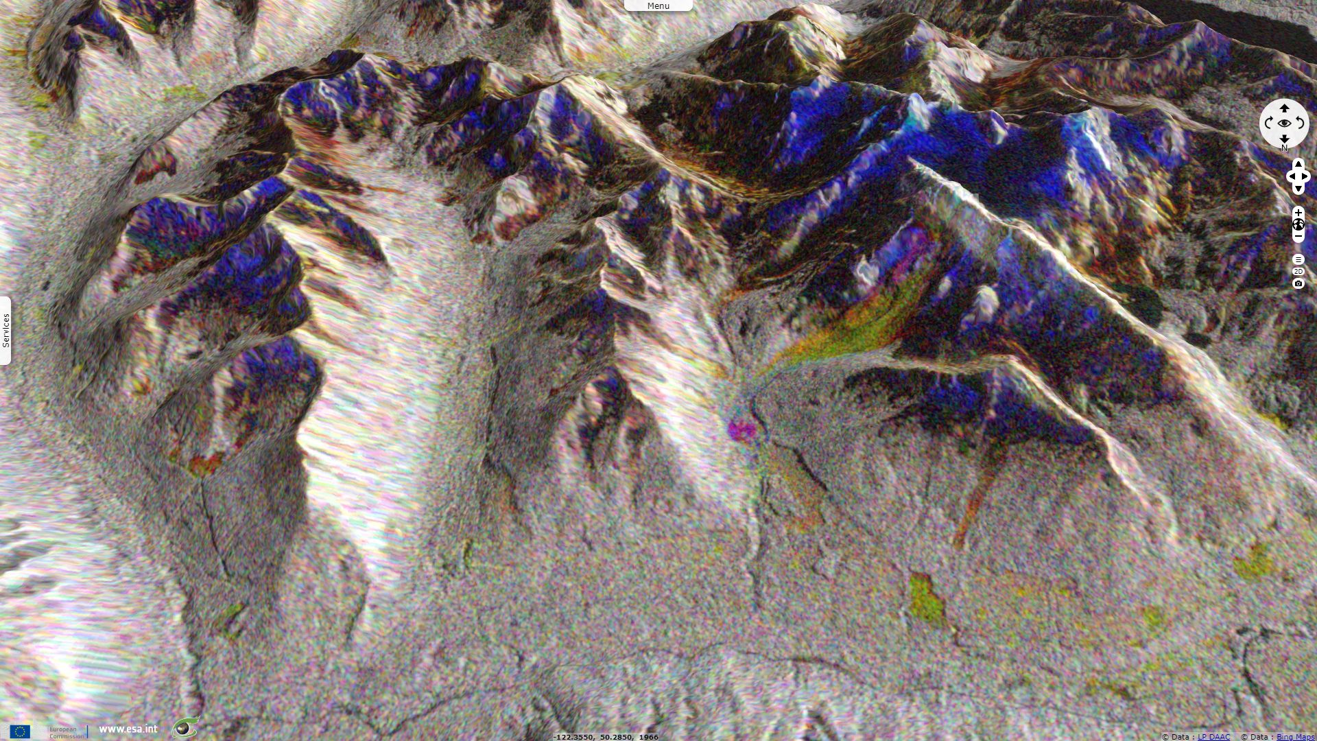
Sentinel-1 CSAR IW acquired on 16 May 2019 at 02:02:04 UTC
Sentinel-2 MSI L2A acquired on 26 May 2019 at 19:09:21 UTC
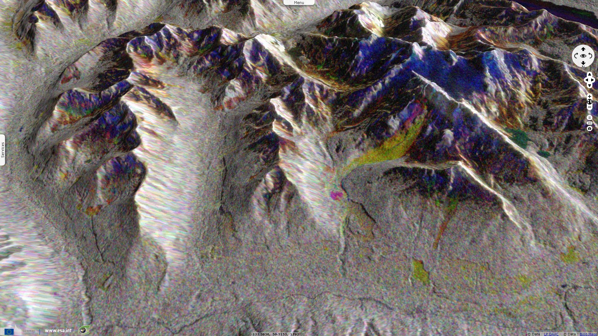
Sentinel-1 CSAR IW acquired on 28 May 2019 at 02:02:05 UTC
...
Sentinel-1 CSAR IW acquired on 16 May 2019 at 02:02:04 UTC
Sentinel-2 MSI L2A acquired on 26 May 2019 at 19:09:21 UTC
Sentinel-1 CSAR IW acquired on 28 May 2019 at 02:02:05 UTC
Keyword(s): Geohazard, geology, mountain, subduction, climate change, landslide, snow, ice melt, glacier, Canada.
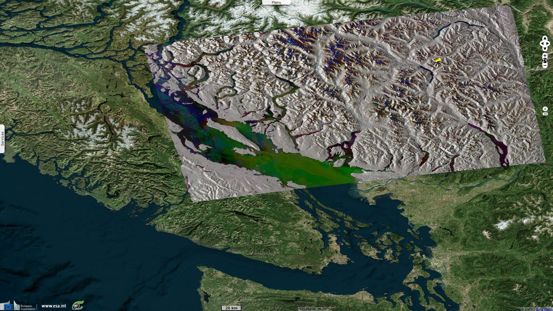
Following a large landslide in British Colombia, Ash Kelly reported for CityNews Vancouver: "No one was hurt when tonnes of rock, dirt, ice and trees came down into Cerise Creek on the back side of Joffre Peak north of Pemberton at 7:41 [14:41 UT] Monday [9th May] morning." "The extremely popular Joffre Lakes trail is on the other side of the mountain and was not impacted."
On his Twitter account, Dr. Drew Brayshaw estimated the initial failure area was ~25 000 m² (~200 m high, ~150 m wide) while the avalanche runout distance is ~4.2 km
Natural Resources Canada earthquake seismologist John Cassidy confirms on his Twitter account that earthquake instruments likely noticed the event:
"There is a signal at seismic stations near Whistler and Lillooet at ~14:41 UT (or 7:41 a.m. local time today). This signal is consistent with a landslide signal (timing and appearance). These seismometers are <50 km from the Joffre Peak site."
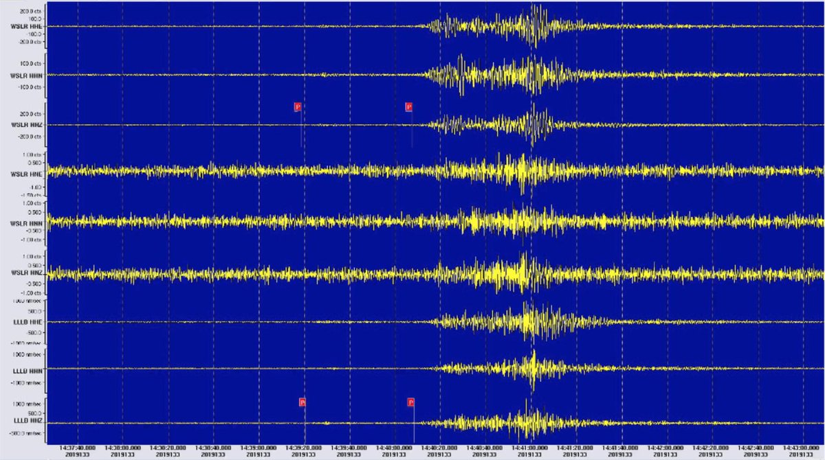
Source: John Cassidy via Twitter
Dave Petley, the Pro-Vice-Chancellor for Research and Innovation at the University of Sheffield in the United Kingdom offers a explanationin his blog decicated to such events: "Again we see a large rock avalanche in a high mountain area in the spring time, so it is logical to think that this might have been associated with melting ice in the rock mass. Interestingly, British Columbia has been experiencing unusually high temperatures – on Thursday last week [9th May] a number of temperature records were broken, with temperatures in some locations reaching 30°C. British Columbia experiences frequent large landslides – notable events include the 2012 Johnsons Landing landslide and the dramatic 2010 Meager Creek rock avalanche."
Two days later, Dave Petley reported: "a second, probably even larger, rock avalanche occurred on Joffre Peak in British Columbia in Canada. This event appears to have been a collapse of second major section of the steep side of the mountain, following the major event on Sunday." "The image does appear to suggest that this failure event is larger than the original last Sunday. The collapse was picked up on the regional seismic network. A tweet by John Cassidy indicates that it was detected by the seismic stations at Whistler, Lillooet, and Hope, with the event happening at a little after 9 pm on 16th May 2019." "It is likely that this landslide will have had a significant runout, but the timing of the landslide means that as yet there is no available data on this at the time of writing."

A graphic depicts the two points on Joffre Peak where rockslides occurred this week - Source: Steve Jones.
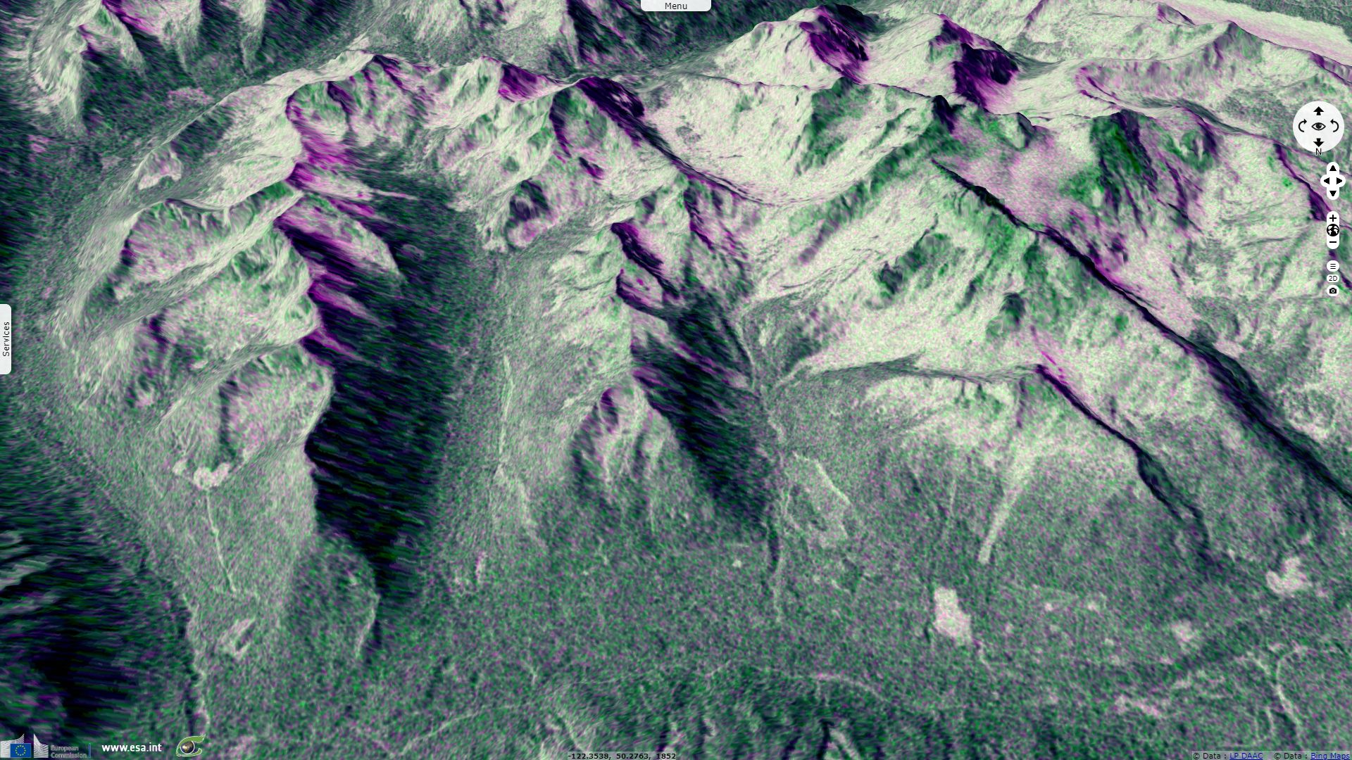
In an article written May 22, CBC News warns it is probably not over:
"In aerial photos taken on Saturday, geologist Drew Brayshaw says a crack about 20 to 30 metres long can be seen adjacent to the left of the second slide. This means a slab of unstable rock remains hanging there waiting to fall, he added. 'Whether that means it's gonna slide now, or it might be a week, a month, a year, but it's definitely lost stability,' Brayshaw said. 'I think it's more likely than not that there will be another slide there.' Brayshaw, a geologist and environmental consultant in Chilliwack, says the next slide could be as big as the first."
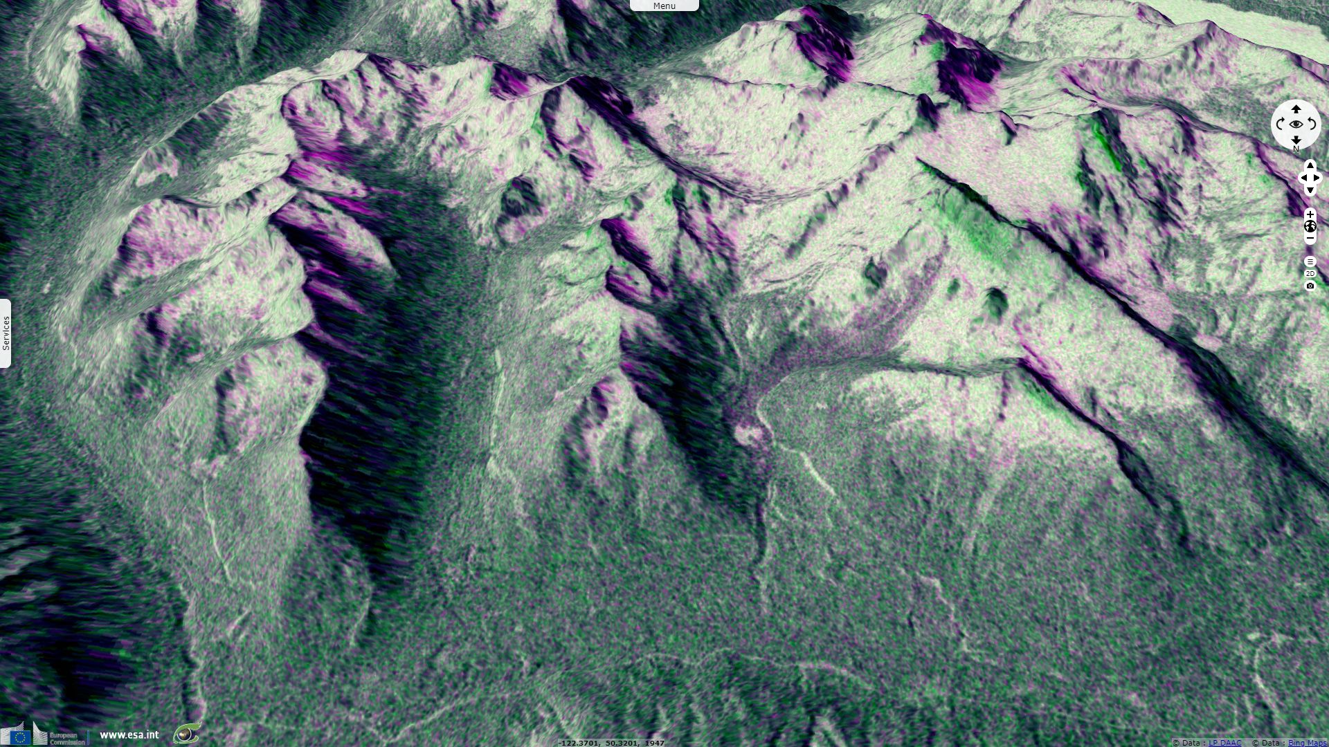
"Alpine permafrost helps to hold rocks in place, but rocks become more susceptible to landslides when it melts, said Brent Ward, co-director for the Centre for Natural Hazards Research at Simon Fraser University. That melted snow accumulates in fractures in the rock, triggering landslides, he said."
"Some research shows the frequency of large slides is increasing due to climate change, Brayshaw said. Landslides like these happen about once a year in the Coastal Range and usually in areas where there are no people, he added. The two landslides last week at Joffre Peak washed away several backcountry ski routes, like the Twisting Couloir and Central Couloir."
The views expressed herein can in no way be taken to reflect the official opinion of the European Space Agency or the European Union.
Contains modified Copernicus Sentinel data 2026, processed by VisioTerra.
Contains modified Copernicus Sentinel data 2026, processed by VisioTerra.
| More on European Commission space: |  |
 |
 |
||||
| More on ESA: | |
|
|
S-1 website | S-2 website | S-3 website | |
| More on Copernicus program: | |
|
|
Scihub portal | Cophub portal | Inthub portal | Colhub portal |
| More on VisioTerra: | |
|
|
Sentinel Vision Portal | Envisat+ERS portal | Swarm+GOCE portal | CryoSat portal |