Record low ice cover in the Arctic at the end of July 2020
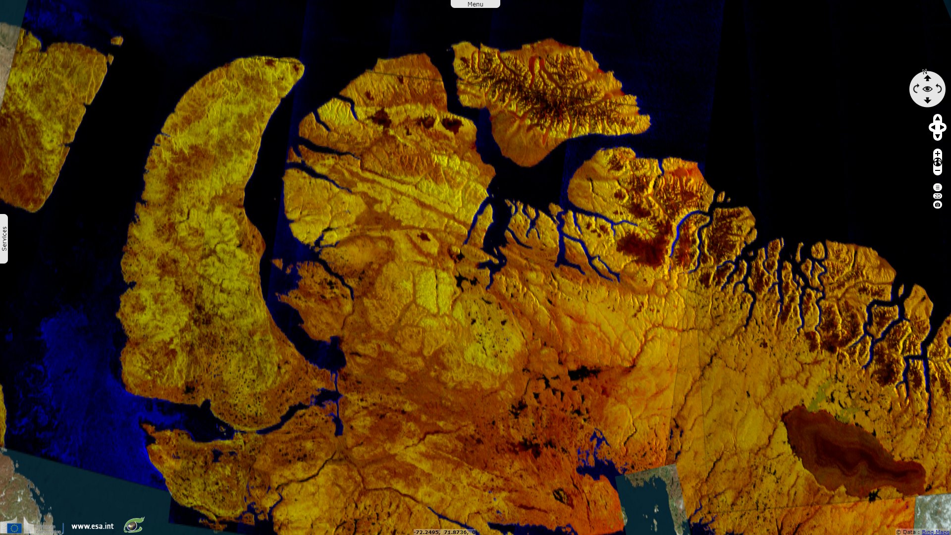
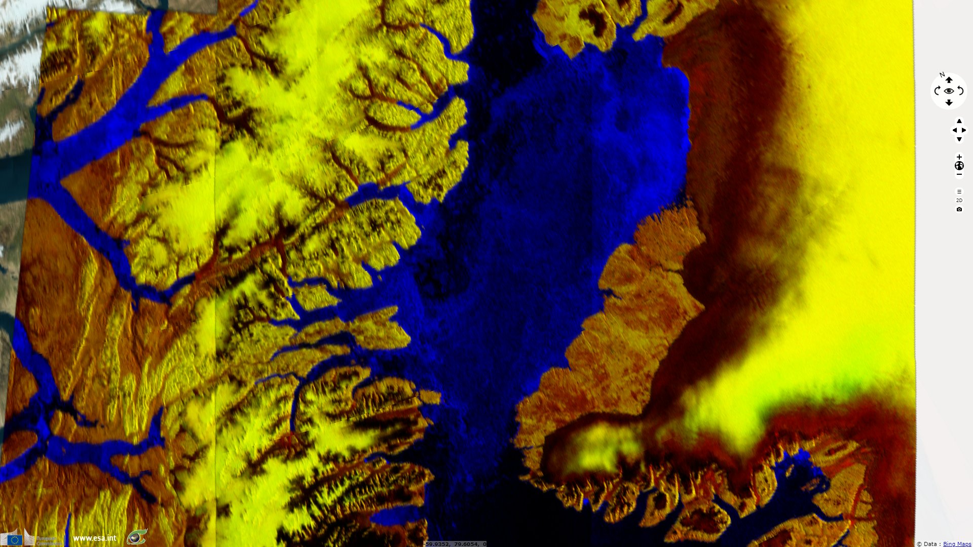
Sentinel-1 CSAR IW acquired on 29 July 2018 from 00:12:42 to 12:35:33 UTC
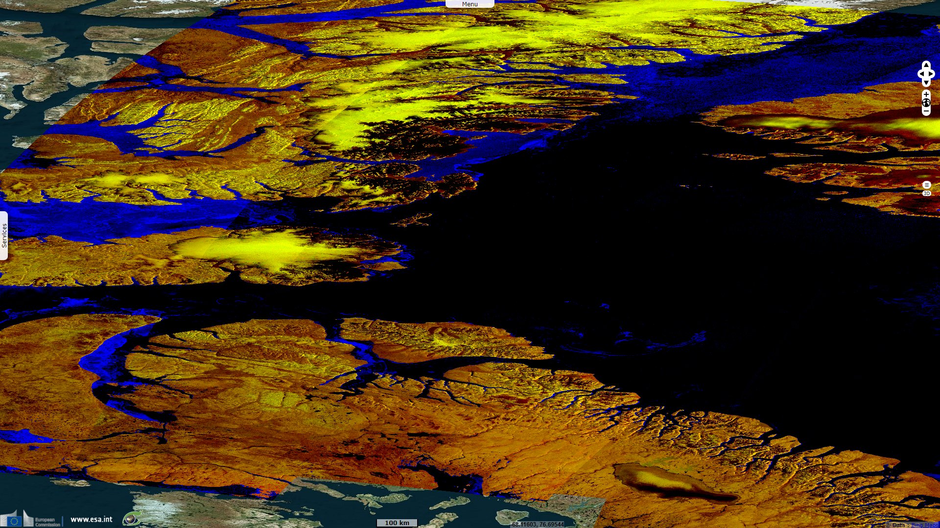
Sentinel-1 CSAR EW acquired on 01 August 2018 from 11:20:59 to 12:10:11 UTC
...
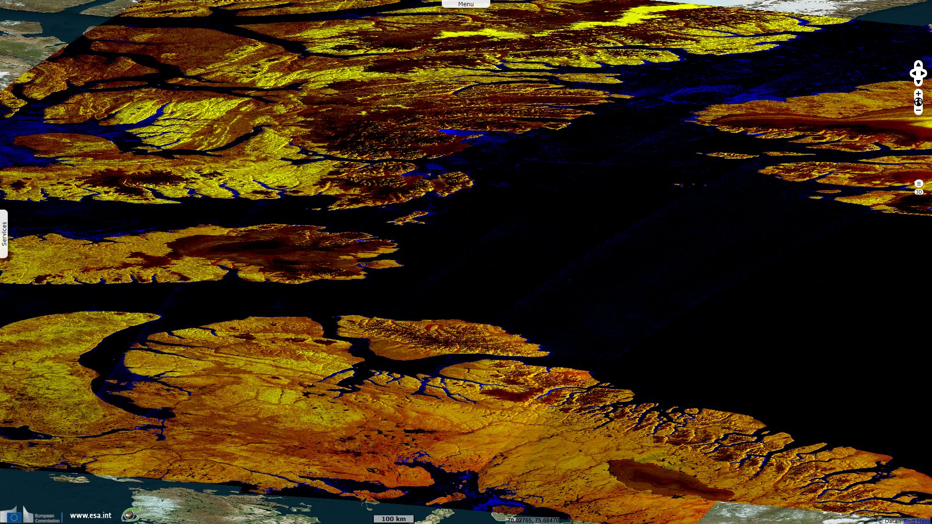
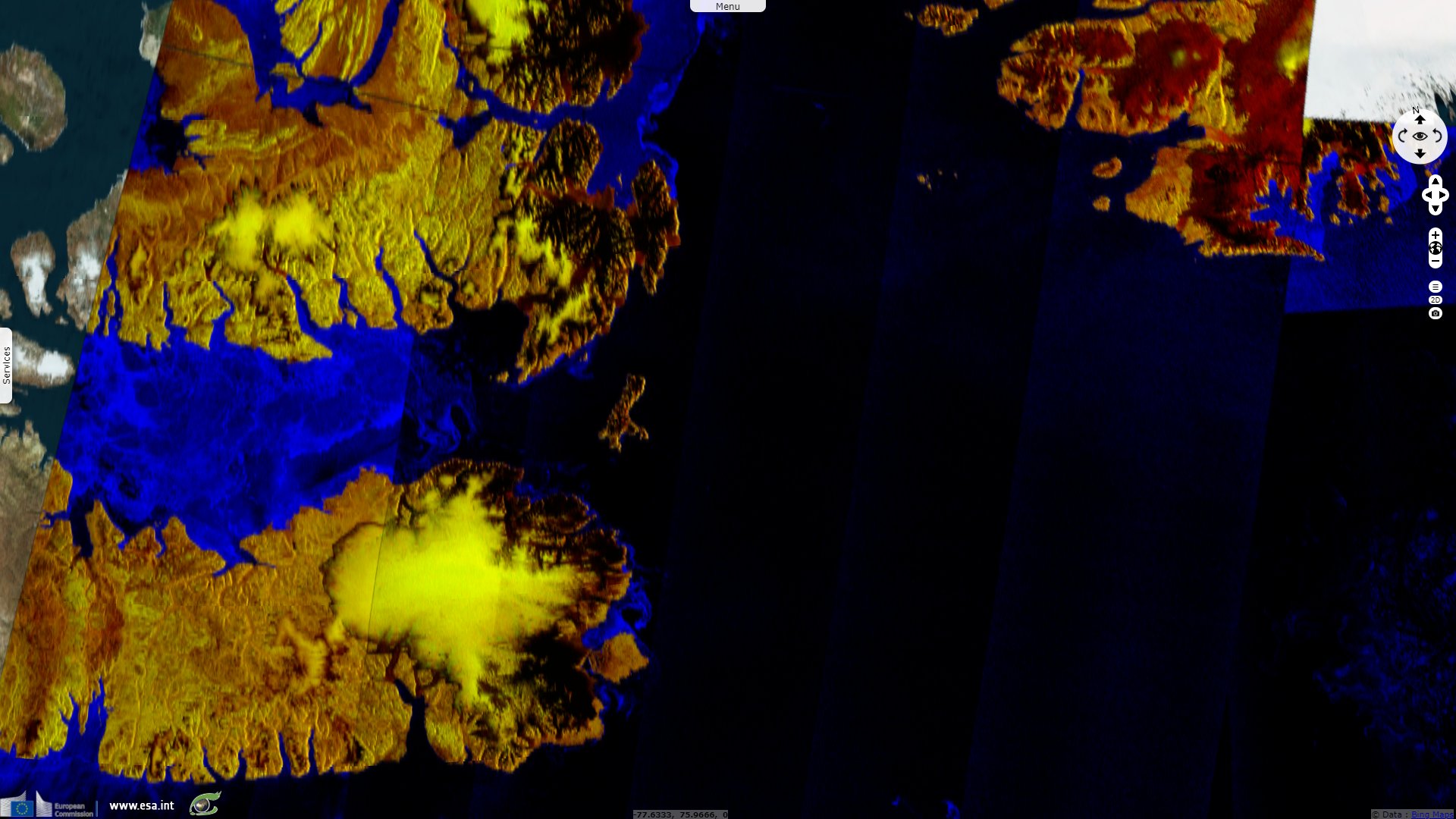
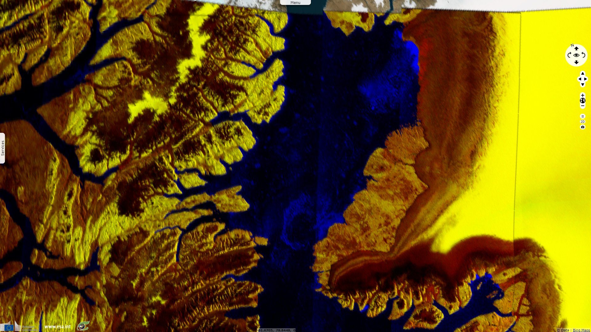
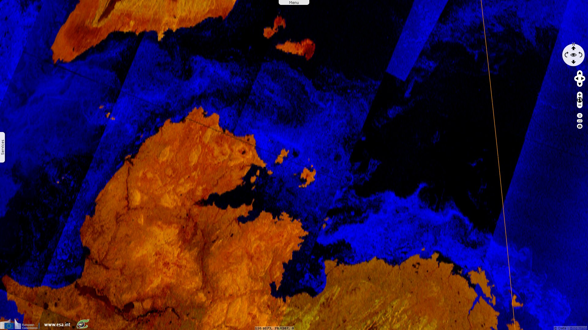
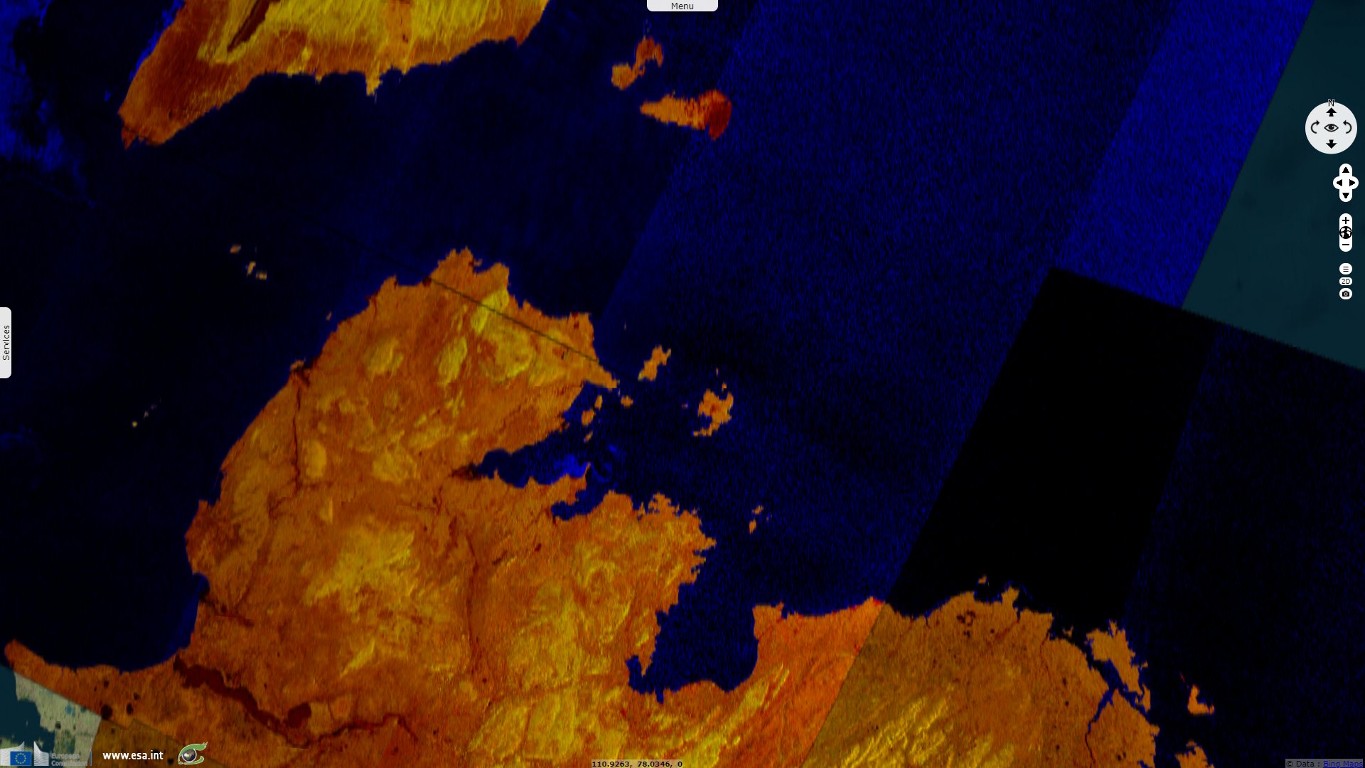
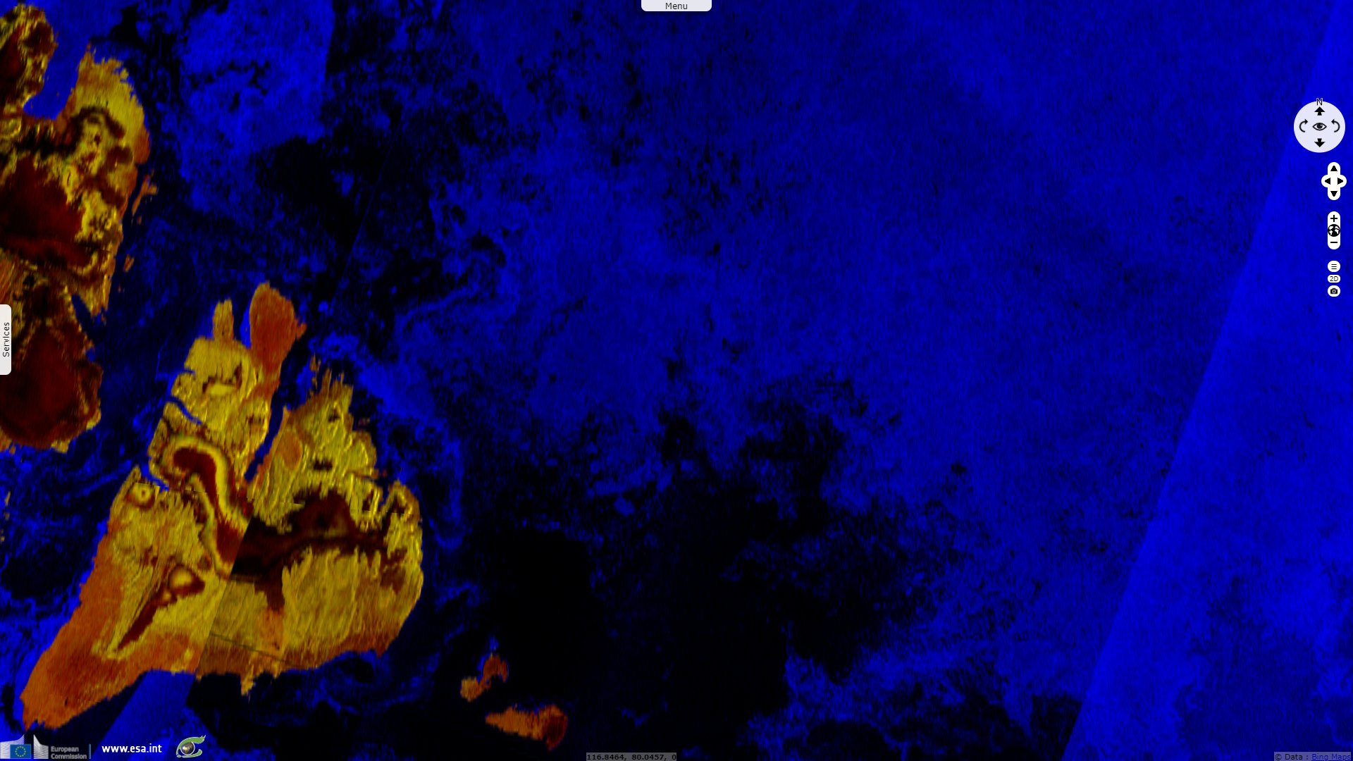
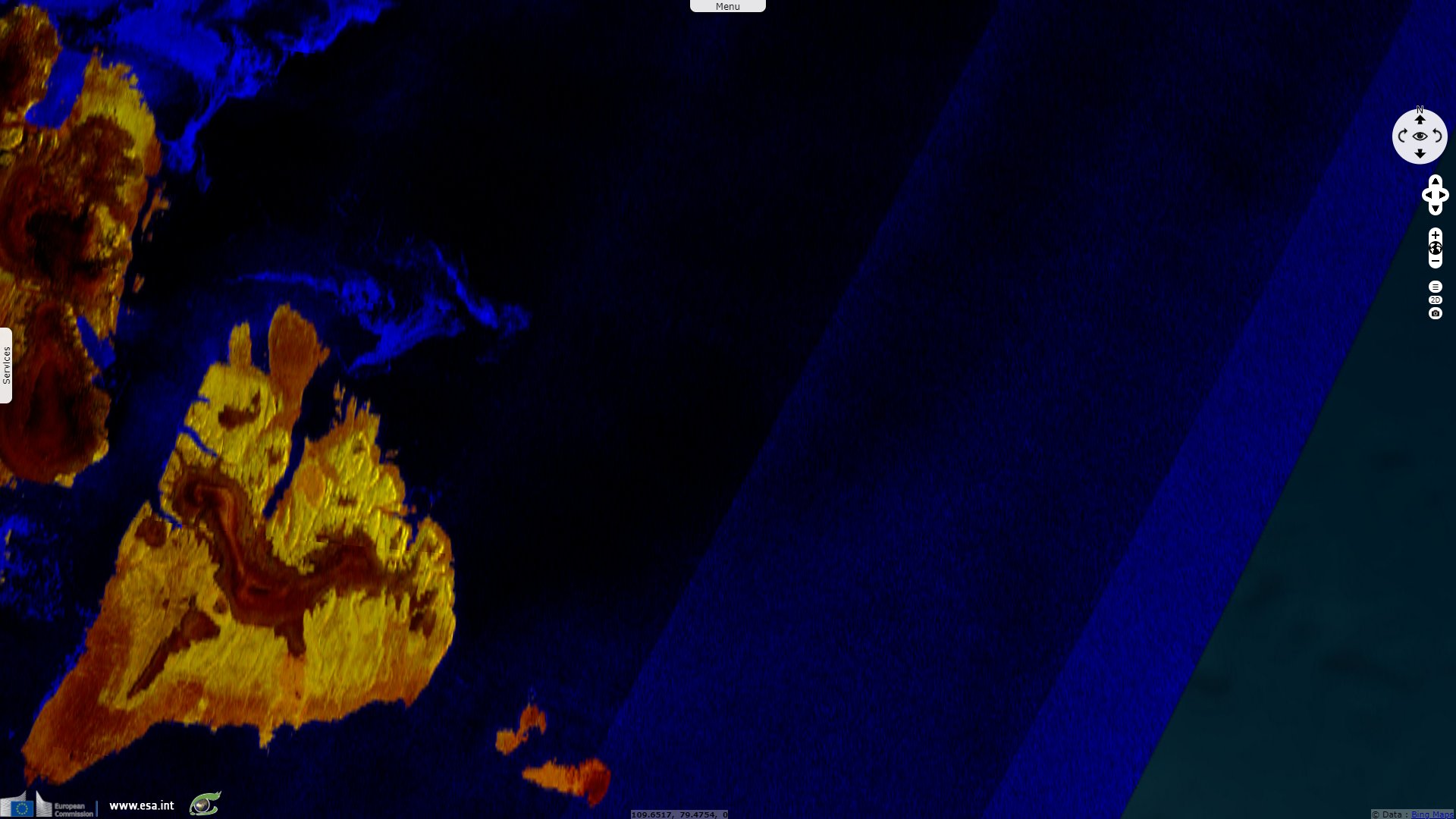
Sentinel-1 CSAR EW acquired on 29 July 2020 from 00:21:10 to 12:43:11 UTC
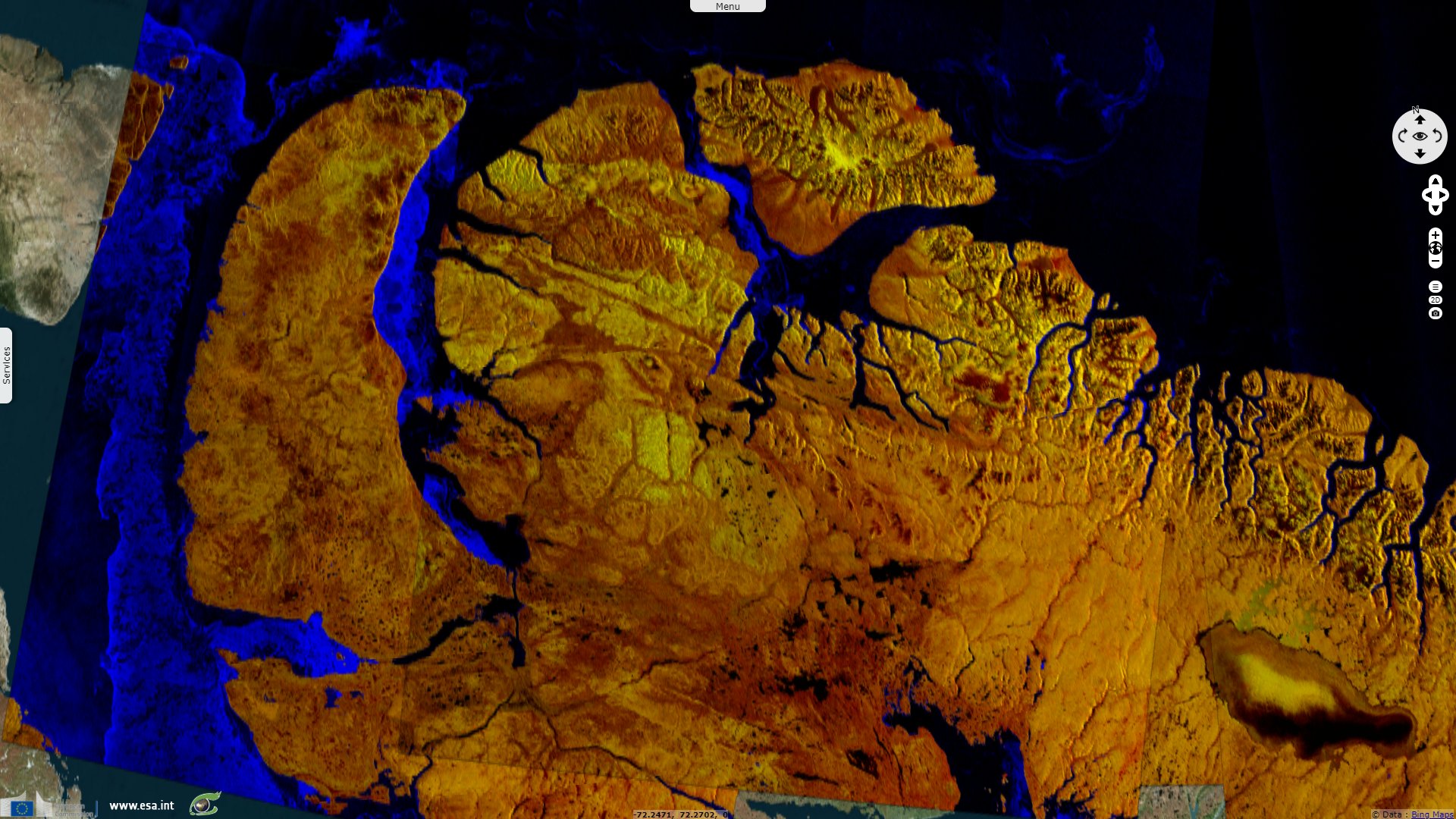
Sentinel-1 CSAR EW acquired on 01 August 2020 from 11:28:27 to 12:19:23 UTC
Sentinel-1 CSAR EW acquired on 01 August 2018 from 11:20:59 to 12:10:11 UTC
...
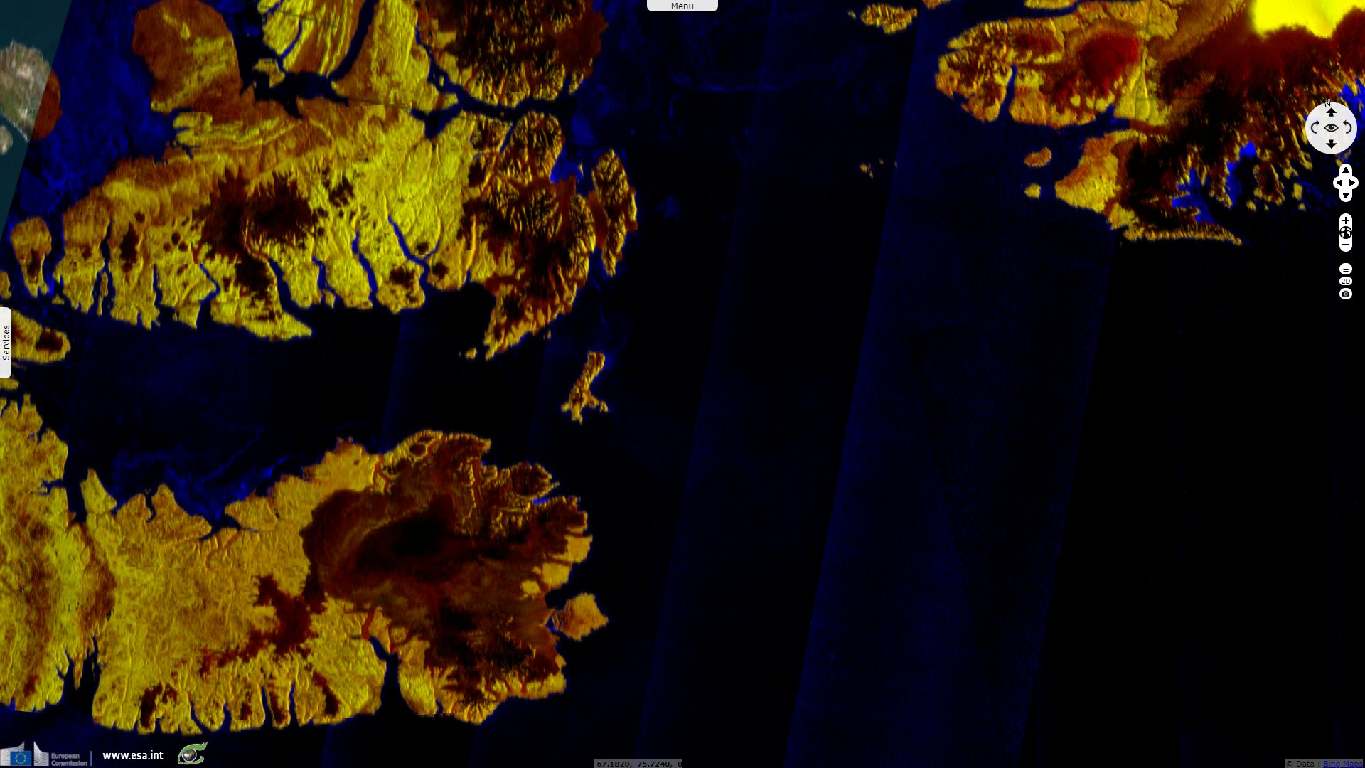
Sentinel-1 CSAR EW acquired on 29 July 2020 from 00:21:10 to 12:43:11 UTC
Sentinel-1 CSAR EW acquired on 01 August 2020 from 11:28:27 to 12:19:23 UTC
Keyword(s): Polar, climate change, global warming, ice cap, sea ice, cryosphere, glacier, coastal, Siberia, Canada, Russia, Greenland, Arctic ocean
On 07 August 2020, Hannah Paulson reported for CBC News (Canadian Broadcasting Corporation): "The High Arctic [Ellesmere] island is partially surrounded by the Tuvaijuittuq marine protected area, which translates to 'the place where the ice never melts' in Inuktitut. The area is projected to be the last portion of the Arctic Ocean to maintain year-round ice — until 2050, that is, by which time the oldest and strongest ice in the Arctic is expected to melt."
"But there are signs that the ice may become unstable earlier than predicted. Recent reports have shown that the last intact ice shelf in the Canadian Arctic has also collapsed. The Milne ice shelf, which is situated in Tuvaijuittuq is now adrift. These findings suggest that 'the Milne and other ice shelves in Canada are simply not viable any longer and will disappear in the coming decades,' said Luke Copland, glaciology research chair at the University of Ottawa, in a press release." "This may also mark a 'devastating' loss of unique, biodiverse ecosystems."
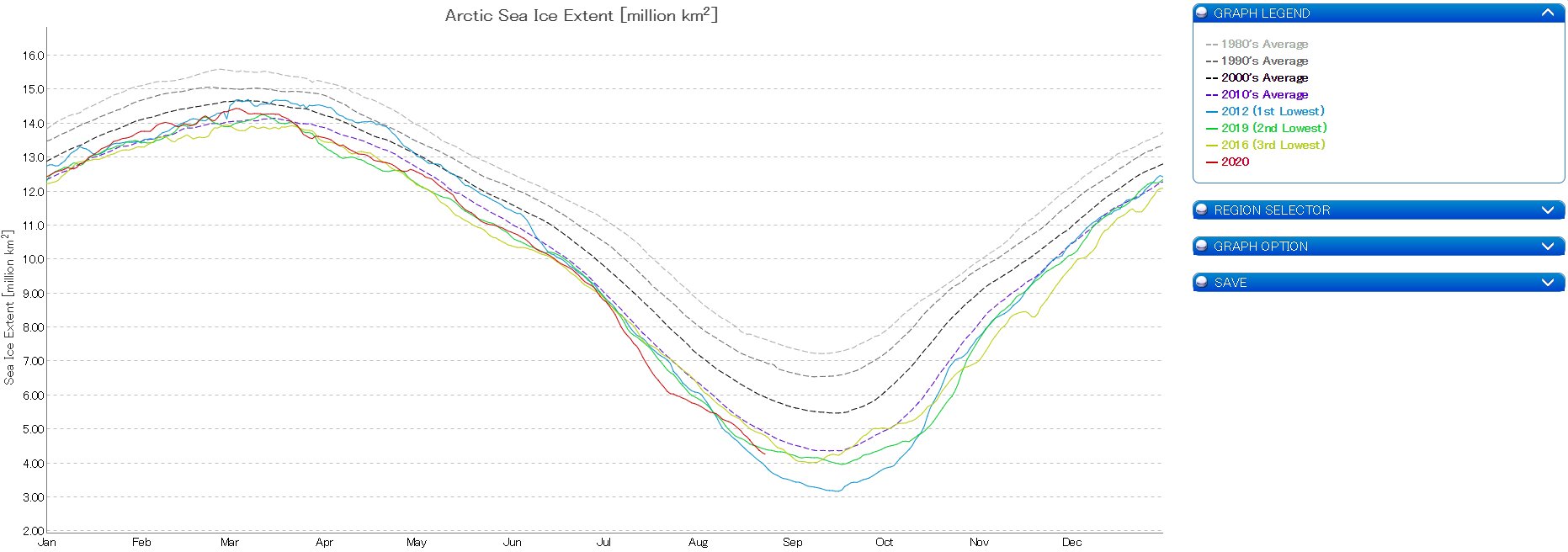
According to the US National Snow and Ice Data Center: "Sea ice extent averaged for July 2020 was 7.28 million square kilometers, the lowest extent in the satellite record for the month. This was 2.19 million square kilometers below the 1981 to 2010 July average and 310 000 square kilometers below the previous record low mark for July set in 2019."
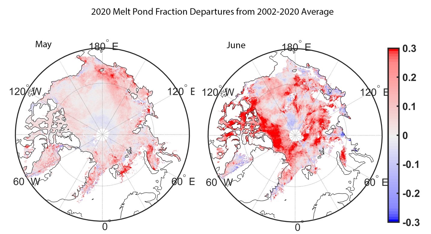
"This figure shows melt pond fractional area anomalies for May (left) and June (right). Red colors show more extensive melt ponds relative to the 2002 to 2020 average, whereas blue colors show fewer melt ponds than average." - Source: Sanggyun Lee, University College London
"Arctic sea ice extent continued to track at record low levels through the end of July, dominated by extensive open water in the East Siberian, Laptev, and Kara Seas. As of July 31, sea ice was tracking 187 000 square kilometers below 2019, which held the previous record for least amount of sea ice on that date, and 396 000 square kilometers below 2012, the year of the record low. The ice edge was further north than average everywhere except the southeastern Beaufort Sea, the Canadian Archipelago and the East Greenland Sea."
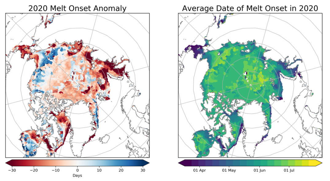
"This figure shows the melt onset anomaly (left) and mean melt onset dates (right) for 2020. Anomaly is computed relative to the 1981 to 2010 average. Melt detection is based on passive microwave brightness temperatures following the algorithm described in Markus et. al. 2009." - Source: Linette Boisvert and Jeffrey Miller, NASA Goddard Space Flight Center
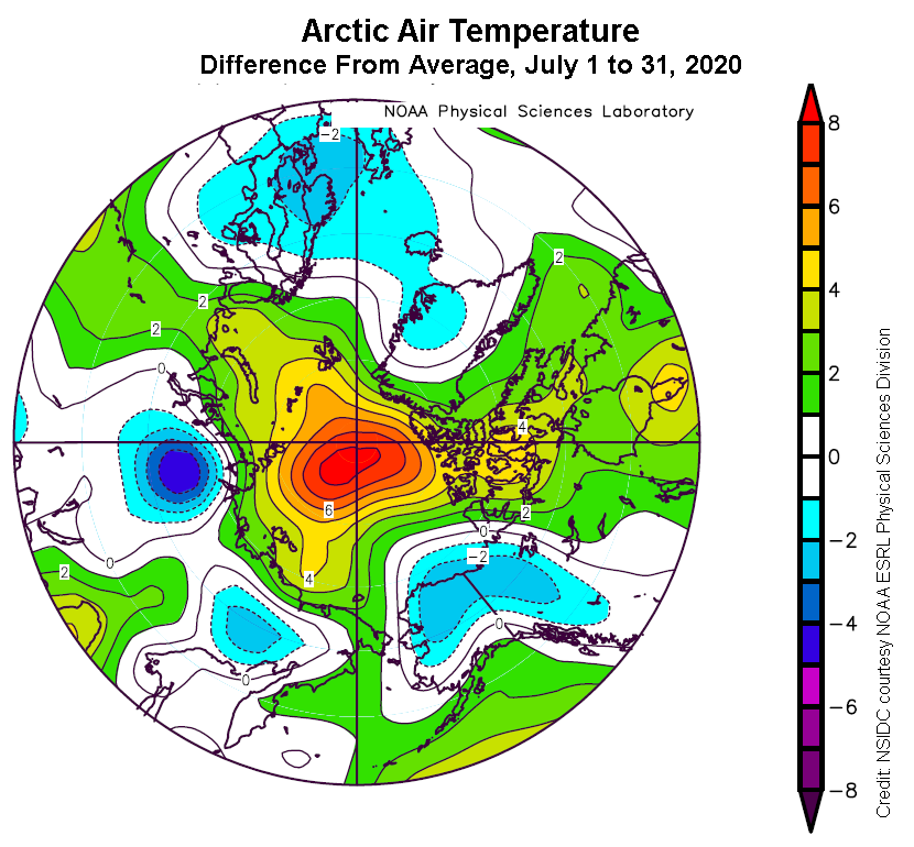
"Through the month, sea ice declined by an average of 116 000 square kilometers per day, faster than the 1981 to 2010 average of 86 800 square kilometers per day. This corresponds to a total loss of 3.59 million square kilometers of ice extent during July 2020. The average near-surface air temperatures at the 925 hPa level for July was up to 8 degrees Celsius above average over the central Arctic Ocean centered near the pole."
VIsualization Service of Horizontal scale Observations at Polar region - Source: National Institute of Polar Research, Japan
Including 2020, the linear rate of decline of July sea ice extent is 7.48 percent per decade, or 70 800 square kilometers per year. Over the 42-year satellite record, the Arctic has lost about 2.90 million square kilometers of ice in July, based on the difference in linear trend values in 2020 and 1979.
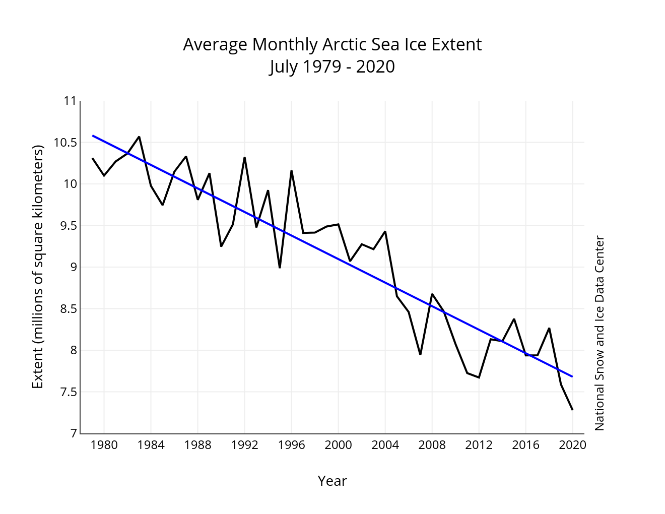
Left: "Monthly July sea ice extent for 1979 to 2020 shows a decline of 7.48 percent per decade" - Source: National Snow and Ice Data Center.
Right: "This plot shows the departure from average air temperature in the Arctic at the 925 hPa level, in degrees Celsius, from July 1 to 31, 2020. Yellows and reds indicate higher than average temperatures; blues and purples indicate lower than average temperatures." - Source: SIDC courtesy NOAA Earth System Research Laboratory Physical Sciences Division.
Until recently, ice joined the islands to Eurasia, even at its smallest extent during the late summer melt season, blocking the Northeast Passage between the Atlantic and the Pacific.
The views expressed herein can in no way be taken to reflect the official opinion of the European Space Agency or the European Union.
Contains modified Copernicus Sentinel data 2026, processed by VisioTerra.
Contains modified Copernicus Sentinel data 2026, processed by VisioTerra.
| More on European Commission space: |  |
 |
 |
||||
| More on ESA: | |
|
|
S-1 website | S-2 website | S-3 website | |
| More on Copernicus program: | |
|
|
Scihub portal | Cophub portal | Inthub portal | Colhub portal |
| More on VisioTerra: | |
|
|
Sentinel Vision Portal | Envisat+ERS portal | Swarm+GOCE portal | CryoSat portal |