SRAL tracking hurricanes
Sentinel-3 SRAL LAND acquired on 25 August 2017 at 03:35:01 UTC
Sentinel-3 SLSTR RBT acquired on 25 August 2017 at 04:06:15 UTC
...
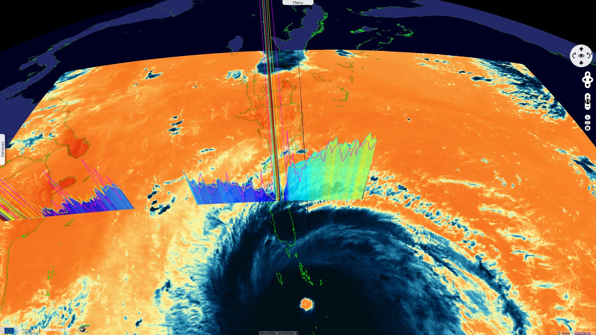
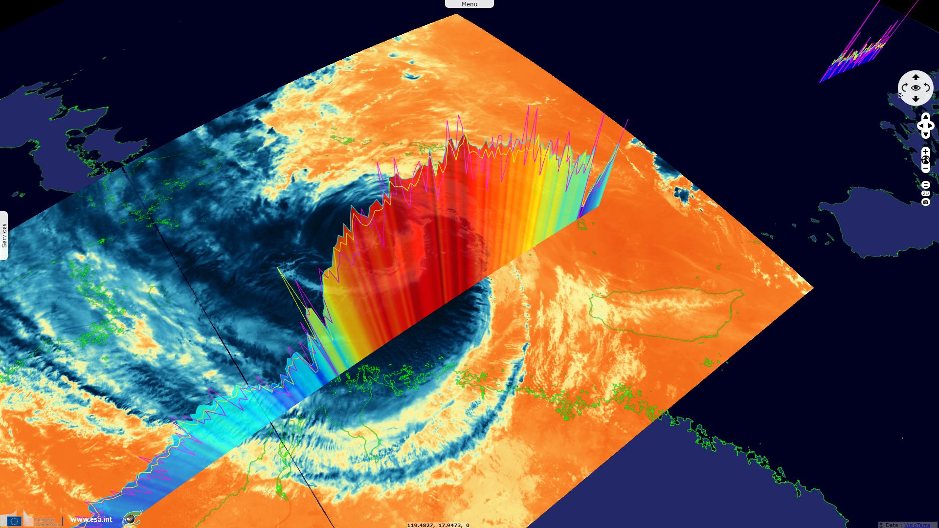
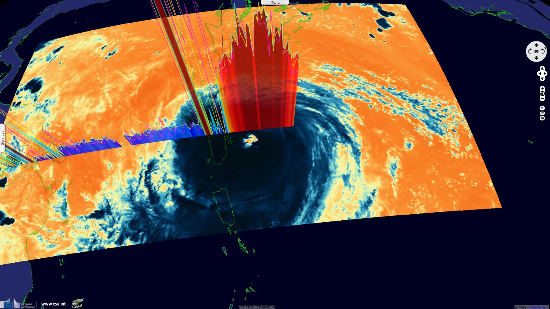
Sentinel-3 SLSTR RBT acquired on 21 September 2017 from 14:48:10 to 14:51:10 UTC
Sentinel-3 SLSTR RBT acquired on 25 August 2017 at 04:06:15 UTC
...
Sentinel-3 SLSTR RBT acquired on 21 September 2017 from 14:48:10 to 14:51:10 UTC
Keyword(s): climate, hurricane, cyclone, atmosphere, storm, significant wave height, Harvey, Irma, Talim, Maria, NW Atlantic, NW Pacific
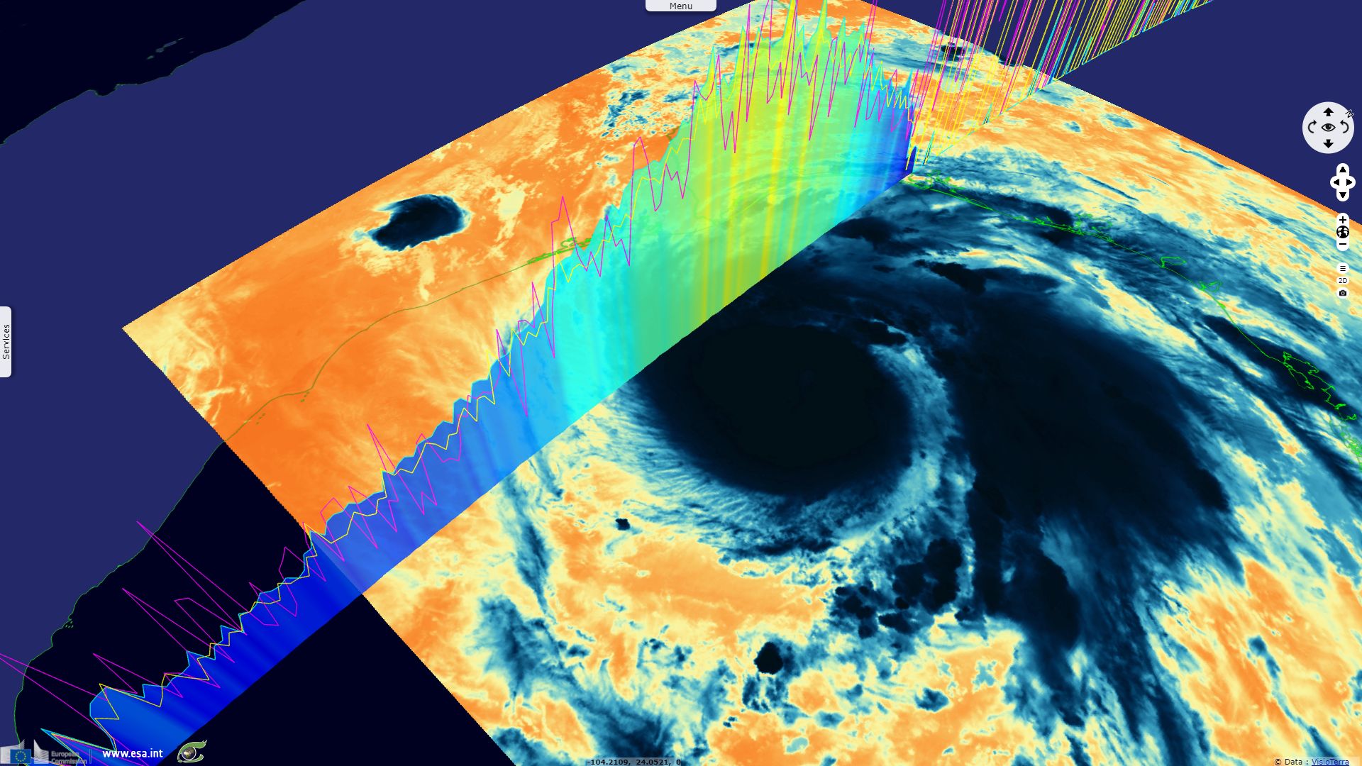
The significant wave height 1hz is shown as a yellow profile for plrm ku-band, a pink profile for c-band, a blue profile & rainbow filling for ku-band.
The views expressed herein can in no way be taken to reflect the official opinion of the European Space Agency or the European Union.
Contains modified Copernicus Sentinel data 2026, processed by VisioTerra.
Contains modified Copernicus Sentinel data 2026, processed by VisioTerra.
| More on European Commission space: |  |
 |
 |
||||
| More on ESA: | |
|
|
S-1 website | S-2 website | S-3 website | |
| More on Copernicus program: | |
|
|
Scihub portal | Cophub portal | Inthub portal | Colhub portal |
| More on VisioTerra: | |
|
|
Sentinel Vision Portal | Envisat+ERS portal | Swarm+GOCE portal | CryoSat portal |