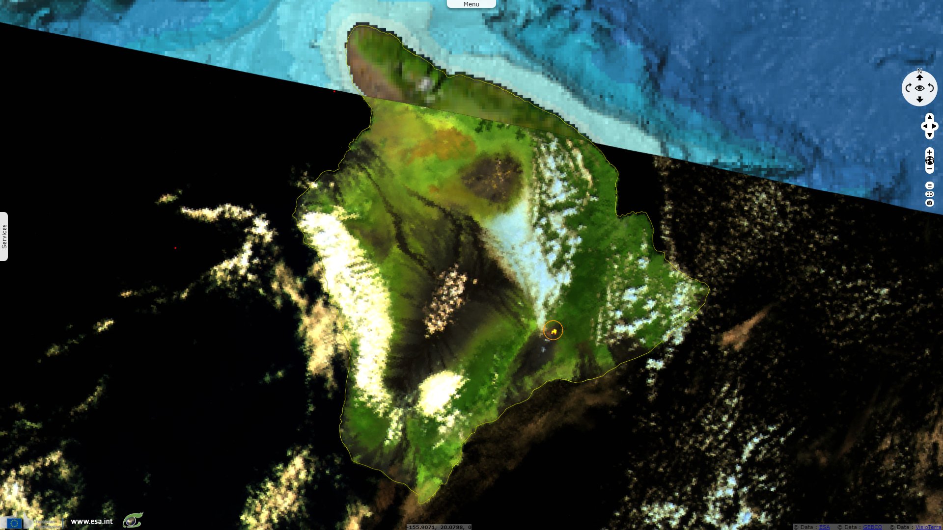
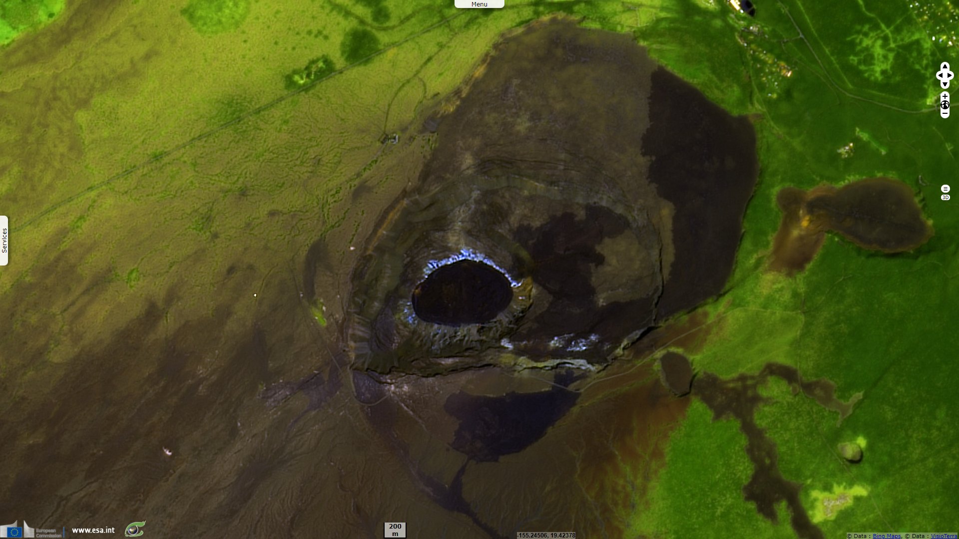
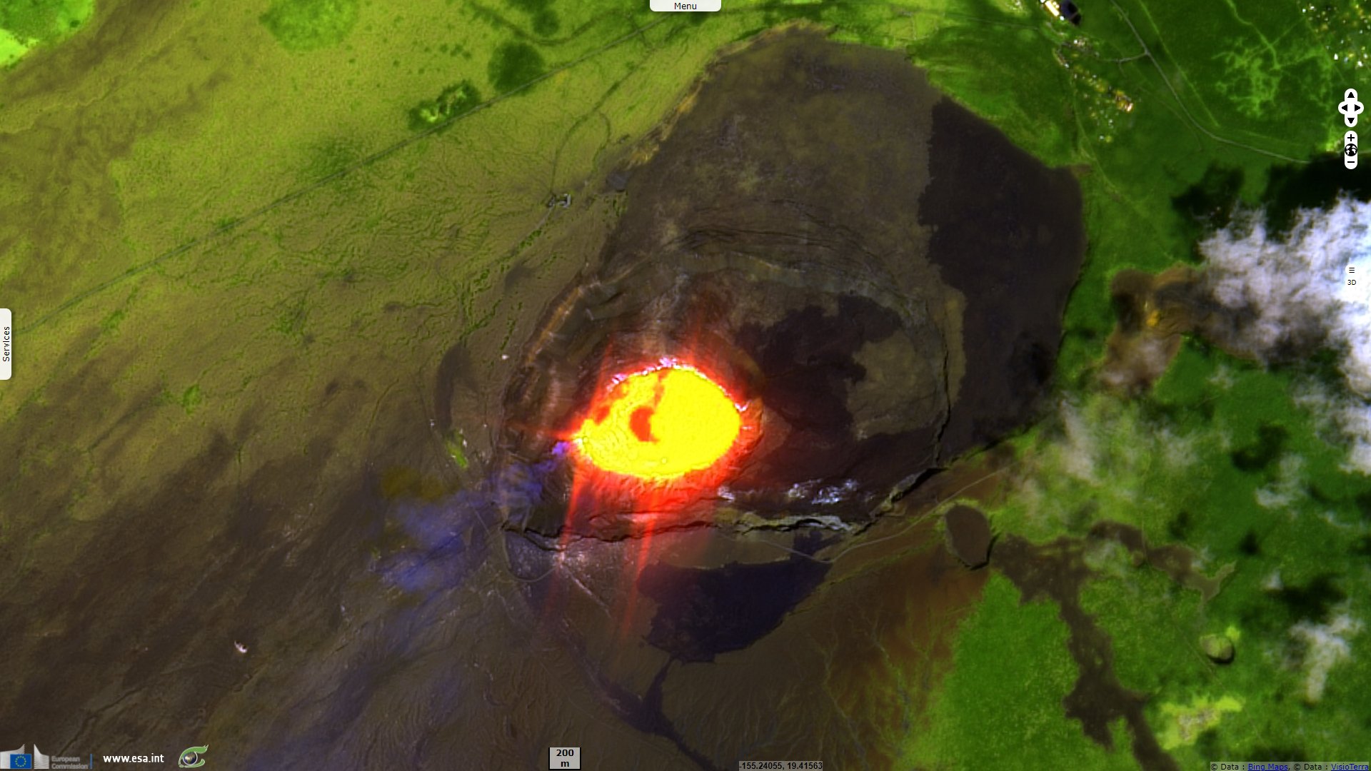
A new lava lake form in Kilauea crater, Hawaii, USA
Sentinel-3 SLSTR RBT acquired on 30 September 2021 at 20:41:50 UTC
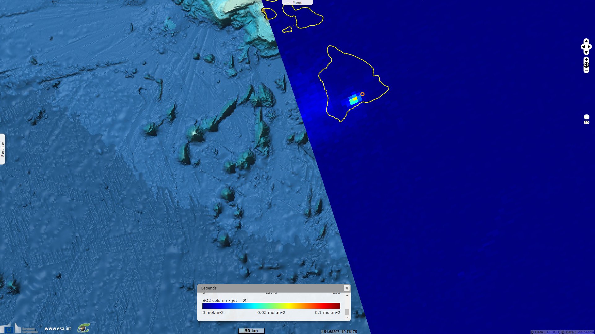
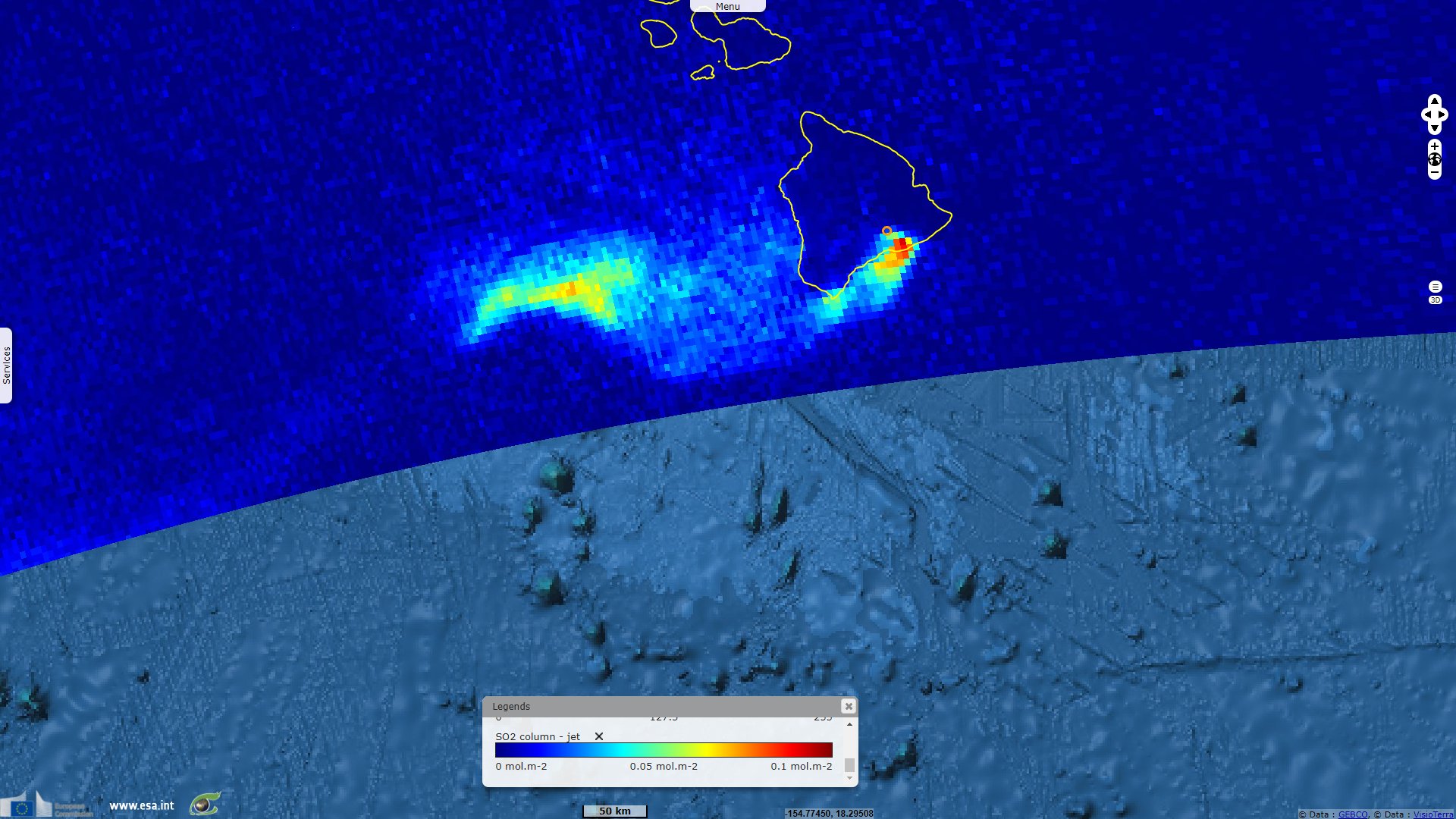
Sentinel-5P TROPOMI SO2 acquired on 30 September 2021 at 22:48:30 UTC
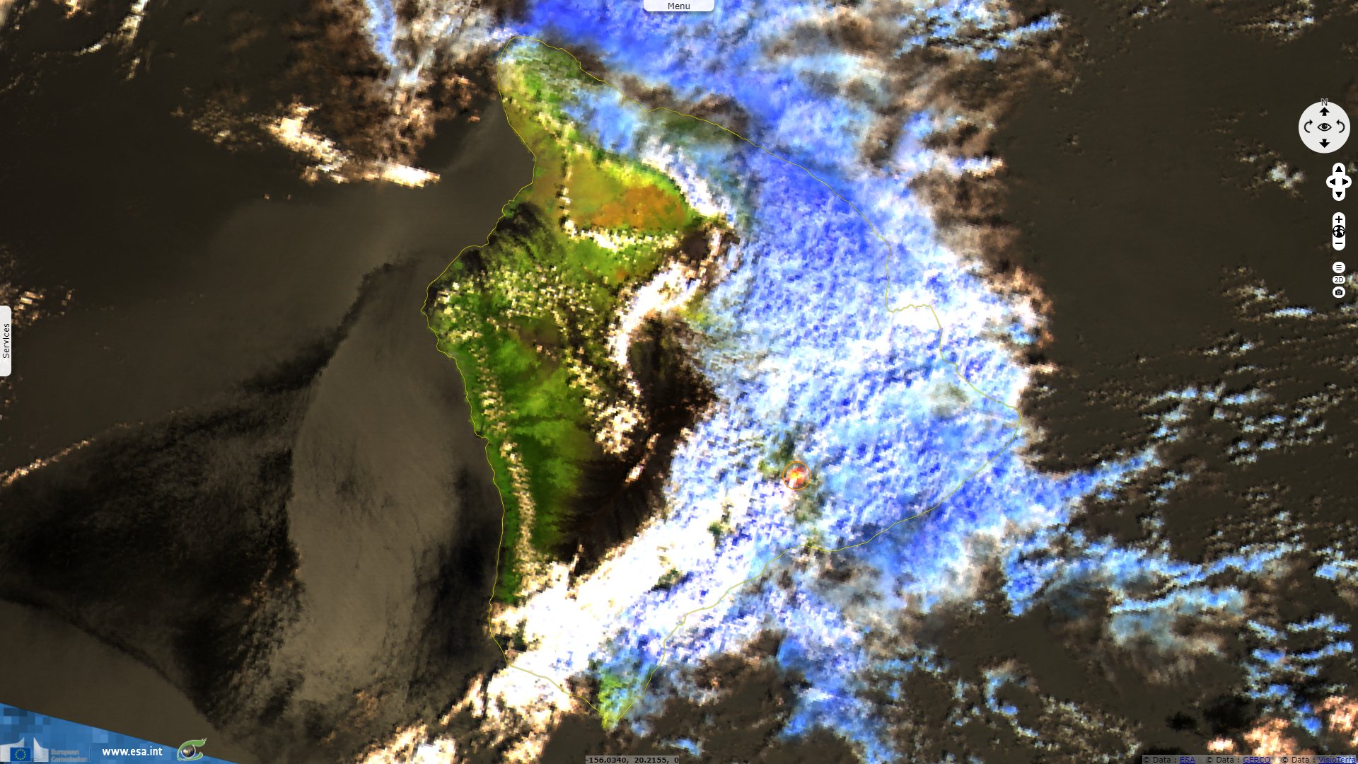
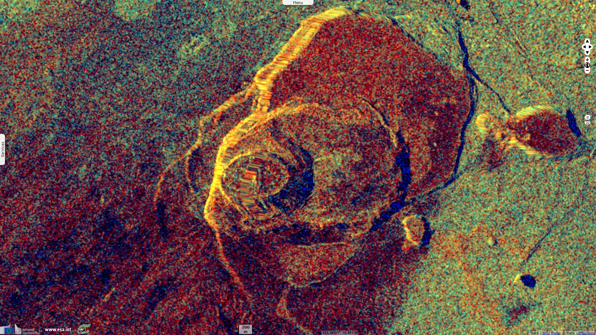
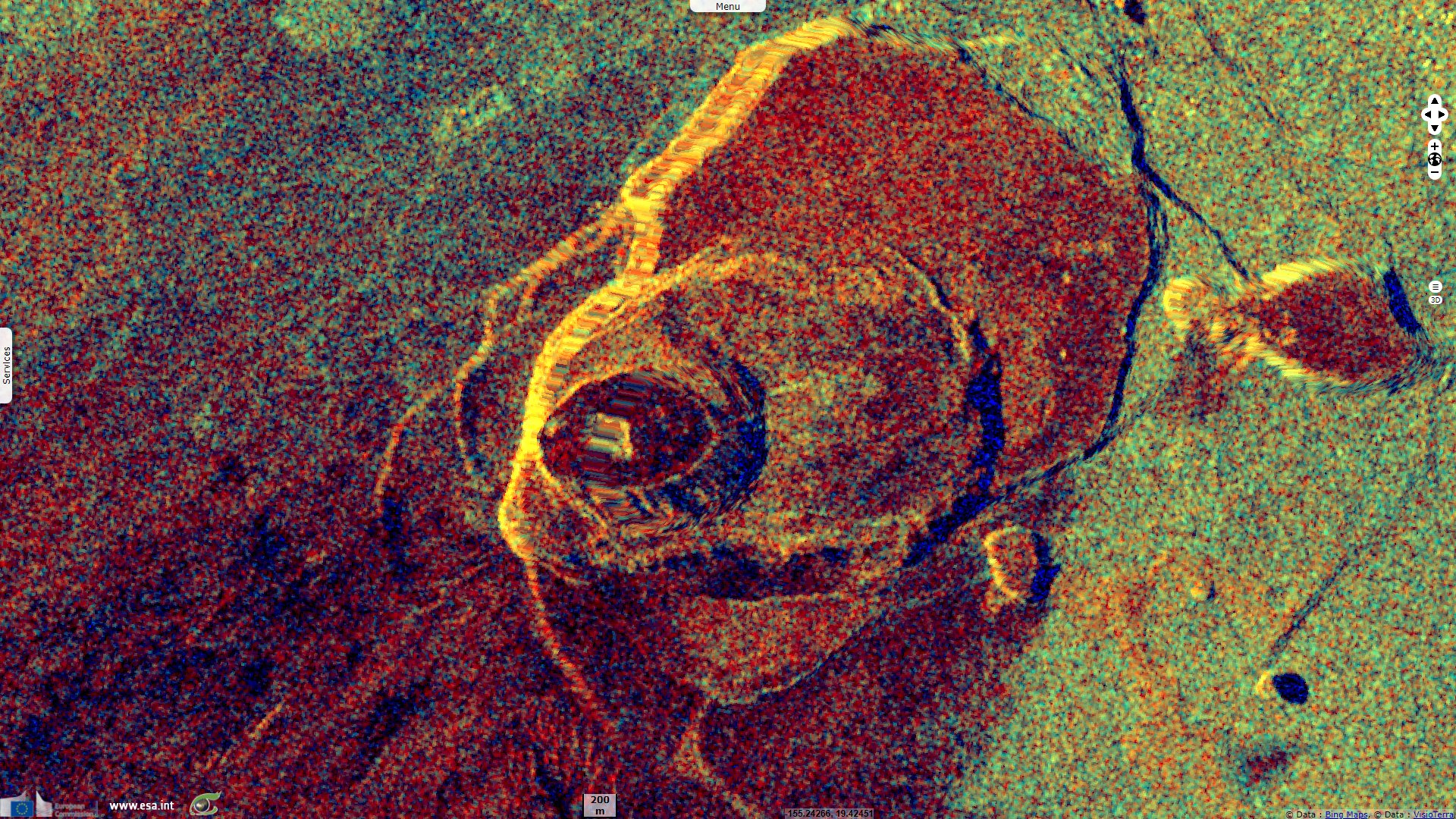
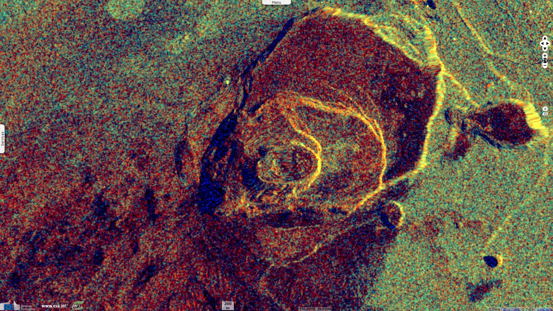
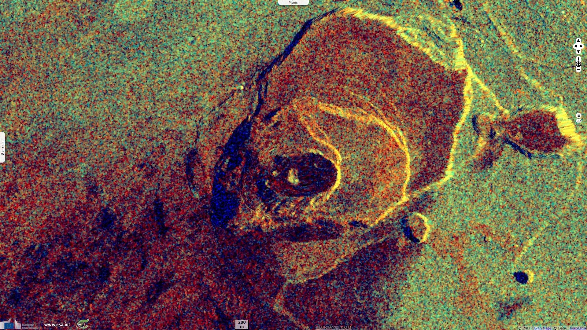
Sentinel-1 CSAR IW acquired on 01 October 2021 at 04:31:08 UTC
...
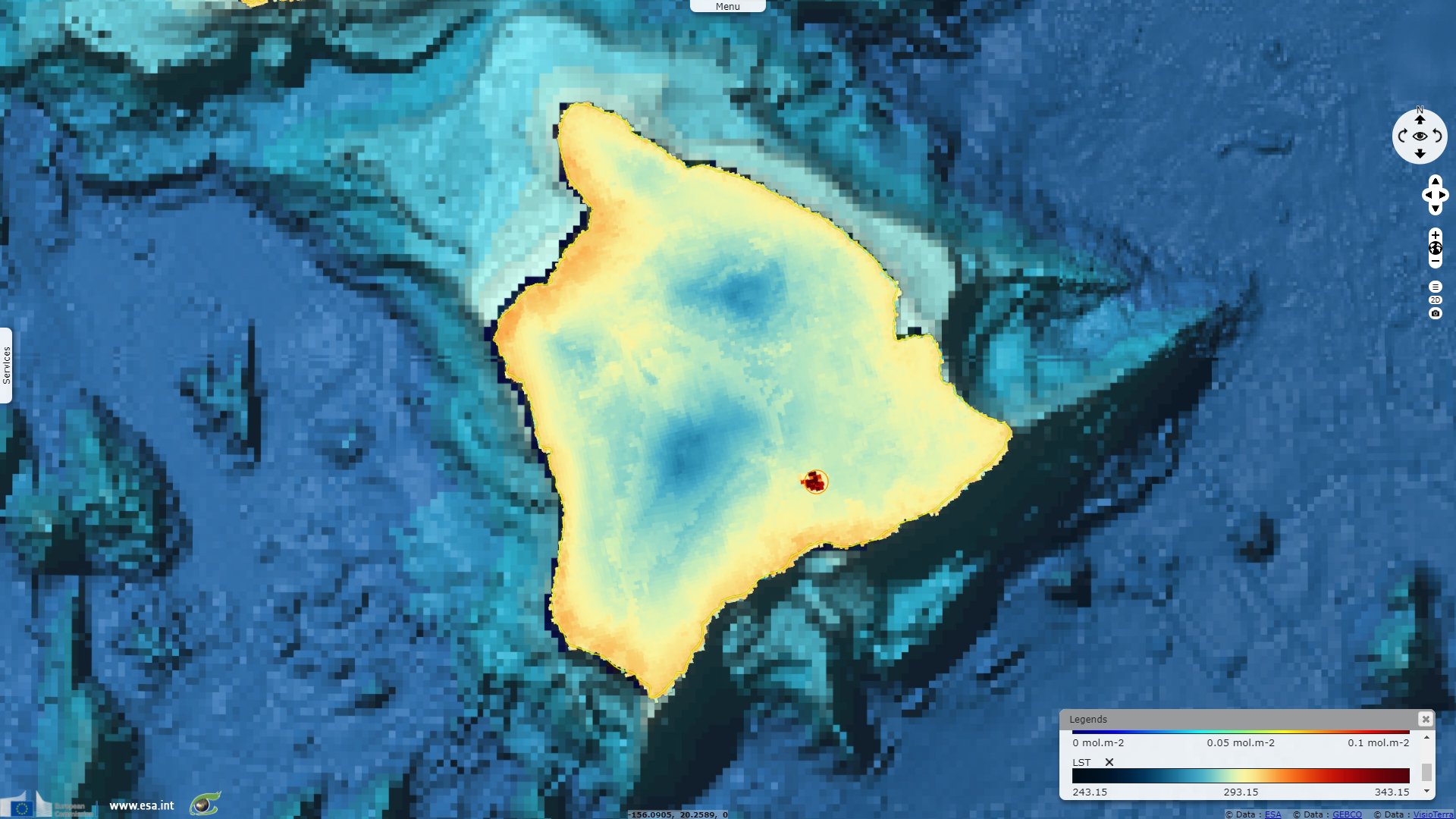
Sentinel-2 MSI acquired on 04 October 2021 at 20:59:39 UTC
Sentinel-5P TROPOMI SO2 acquired on 30 September 2021 at 22:48:30 UTC
Sentinel-1 CSAR IW acquired on 01 October 2021 at 04:31:08 UTC
...
Sentinel-2 MSI acquired on 04 October 2021 at 20:59:39 UTC
Keyword(s): Geohazard, volcano, eruption, crater, lava lake, island, Hawaii hotspot, United States, USA
The Hawaiian Volcano Observatory (HVO) announced that after several months at rest, Kīlauea volcano is erupting again. "At approximately 3:21 p.m. HST on September 29, 2021, an eruption began within Halemaʻumaʻu crater, within Kīlauea’s summit caldera in Hawai‘i Volcanoes National Park. The USGS HVO elevated Kīlauea’s volcano alert level to WARNING and its aviation color code to RED to assess the intensity of eruptive activity and identify associated hazards."
"Vigorous fountaining—with bursts up to 50–60 meters produced significant amounts of pumice, Peleʻs hair, and fragments of volcanic glass that were deposited in areas downwind along the rim and beyond Halemaʻumaʻu crater. Over the past several days, a thick layer (approximately 27 meters) of molten lava has accumulated as a lava lake at the base of the crater, partially drowning the vents resulting in subdued fountaining."
"During the same time, the amount of sulfur dioxide (SO2) emitted has dropped from 85 000 tons per day to 12 000 tons a day. Although the amount of gas and volcanic particle production has decreased since the eruption onset, they both remain significant local hazards within the plume. Concentrations of SO2 at the vents remain high (likely over 100 parts per million or ppm) and significantly elevated (5-10 ppm) at stations a few kilometers southwest of Halemaʻumaʻu."
"The eruption is currently confined to Halemaʻumaʻu crater, within Hawai‘i Volcanoes National Park. HVO does not see any indication of activity migrating elsewhere on Kīlauea volcano and expects the eruption to remain confined to the summit region."

USGS Thermal webcam images from new Kīlauea summit eruption, taken 29 September 2021 - Source: L. DeSmither
"This animated image (GIF) shows Kīlauea summit thermal webcam images from the F1cam taken between approximately 2:45 and 5:45 p.m. HST on September 29, 2021. The new Kīlauea summit eruption, which began within Halema'uma'u at approximately 3:20 p.m., is producing lava flows that have covered most of the December 2020-May 2021 lava. The solidified 'lava island' from the last eruption is visible in the center (dark blue) and the top of the west vent, which is being drowned by the lava level rise, is visible in the lower center."
"'Several fountains are emerging through the active lake surface, in addition to fountaining on the west margin of the lake. The island remains near the center of the lake, and a small portion of the western cone, active during the previous eruption earlier this year, is still exposed.' In the thermal images, warmer colors are indicative of hotter temperatures and cooler colors are indicative of colder temperatures."
According to Hawaiian Volcano Observatory: "HVO reported that the summit eruption at Kilauea continued in Halema`uma`u Crater during 6-12 October. At the beginning of the eruption, on 29 September, lava erupted from vents along the floor and from the Western wall of the crater, though by 8 October only the Western vent was active. Sulfur dioxide emissions remained high and were 5300 tonnes per day on 8 October. A 10-m-wide, horseshoe-shaped spatter rampart had formed around the Western vent and was open to the East where lava was feeding the lake. Lava fountains from the Western vent were generally 12-15 m high but decreased to 4 m during 10-11 October."
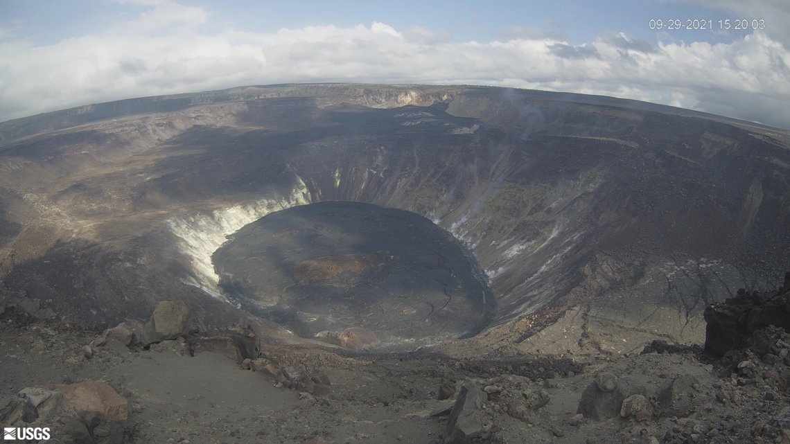
Kīlauea's summit on 29 September 2021 at 15:20 local time - Source: USGS Hawaiian Volcano Observatory KWcam.
"The total erupted volume was an estimated 15.9 million cubic meters on 8 October and the lake was as deep as 40 m on 12 October. The lava lake was not level; the Western end was 2-3 m higher than the Northern and Southern parts of the lake and 5 m higher than the Eastern end. Cooled and crusted parts of the lake’s surface overturned, or 'foundered,' in all parts of the lake, though by 11 October foundering was not observed in the East. HVO noted that the central island (or raft) of cooler material from the 2020 eruption remained above the surface as the lava lake rose, and other smaller rafts had reemerged in the East and North parts of the lake."
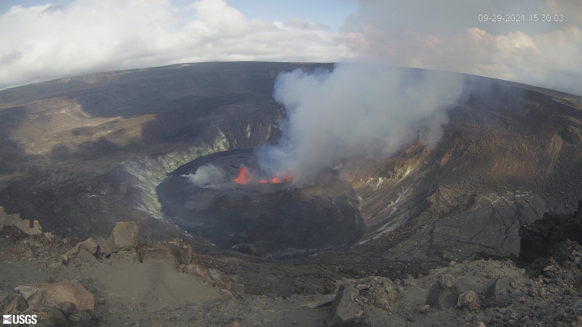
Kīlauea's summit on 29 September 2021 at 15:30 local time - Source: USGS Hawaiian Volcano Observatory KWcam.
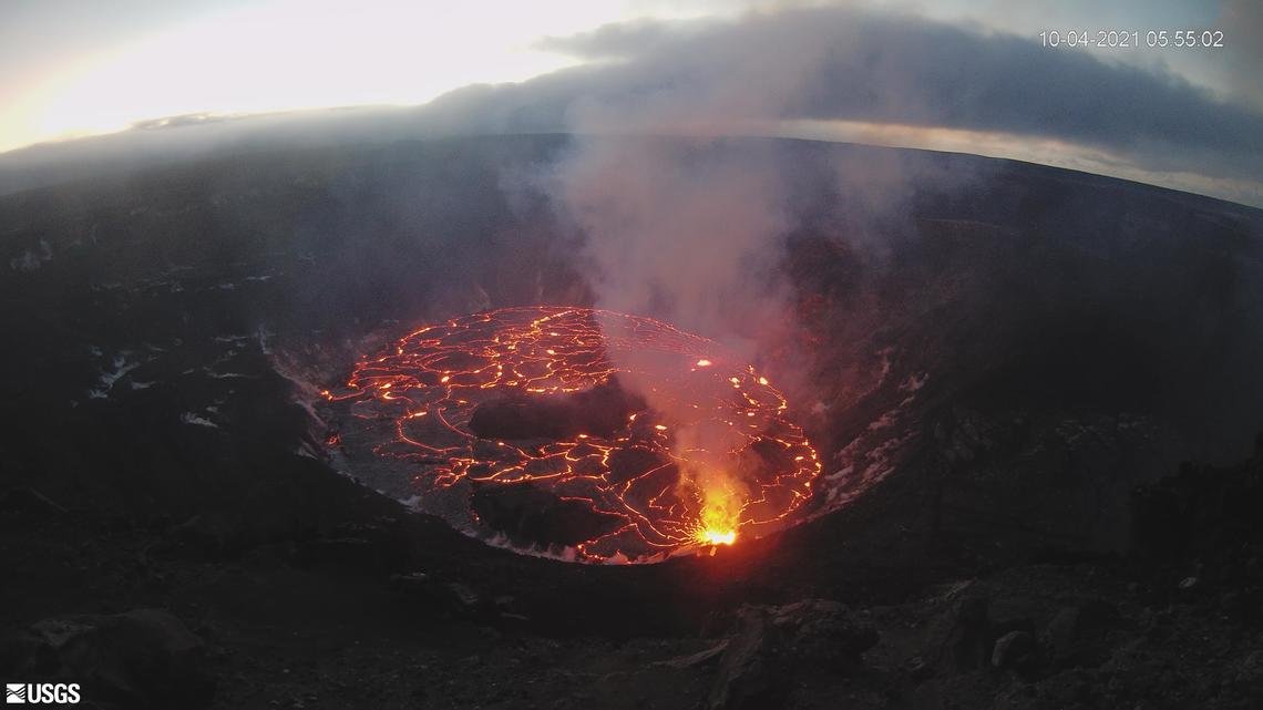
Kīlauea's summit on 04 October 2021 at 05:55 local time - Source: USGS Hawaiian Volcano Observatory KWcam.
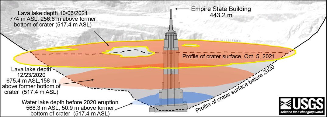
Halema‘uma‘u lava lake depth compared to Empire State Building - Source: J. Bard for the USGS.
"On September 29, 2021, fissure vents opened in Halema‘uma‘u crater. A new lava lake began to form on the one previously active from December 2020–May 2021. How much lava has filled Halema‘uma‘u crater ? If the Empire State Building, in New York City, was placed at the bottom of Halema‘uma‘u crater, we estimate the lava lake level could already be as high as the 70th floor !"
"For reference, the base of Halema‘uma‘u crater after the 2018 collapse was 517.4 m above sea level (asl). A water lake occupied the base of the crater from July 2019–December 2020, to a depth of 50.9 m (equal to an elevation of 568.3 m asl). The water lake was evaporated when an eruption began in Halema‘uma‘u crater in December 2020. That eruption created a lava lake that reached a depth of 158 m (equal to an elevation of 675.4 m asl) by December 23, 2020."
"By the end of that eruption in May 2021, the lava lake had reached a depth of 223 meters (equal to an elevation of approximately 741 meters above sea level). The eruption that began on September 29, 2021, continues to fill the bottom of Halema‘uma‘u crater and by October 6, had reached a depth of 256.6 m (equal to an elevation of 774 m asl) above the former base of the crater after it collapsed in 2018. For comparison, the height of the Empire State Building is 443.2 m."
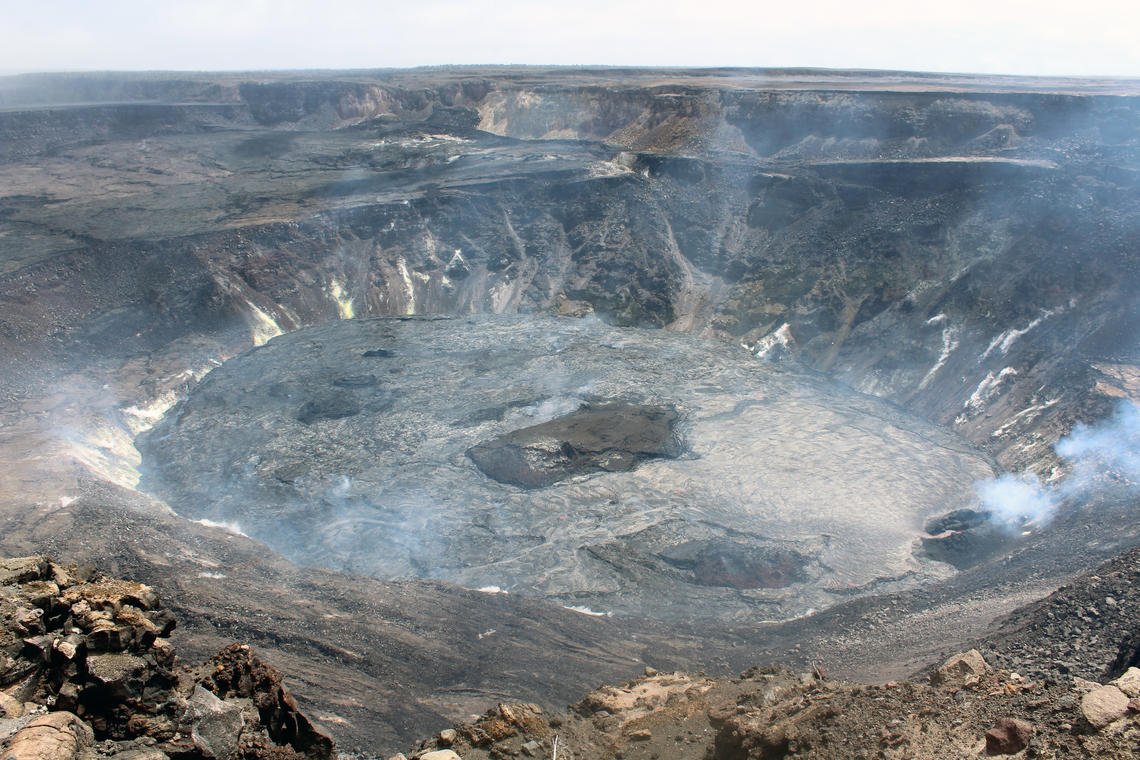
Kīlauea summit eruption on October 15, 2021 - Source: M. Zoeller for USGS
This overview photo of the Halema‘uma‘u lava lake was captured around noon on Friday, October 15, 2021, from the northwest rim of the crater. The western fissure (lower right) continues to erupt lava into the west side of the lava lake (right). The east side of the lake (left) is mostly stagnated and solidified on the surface. The lava lake measures approximately 1035 m long in the east–west direction and 745 m wide in the north–south direction."
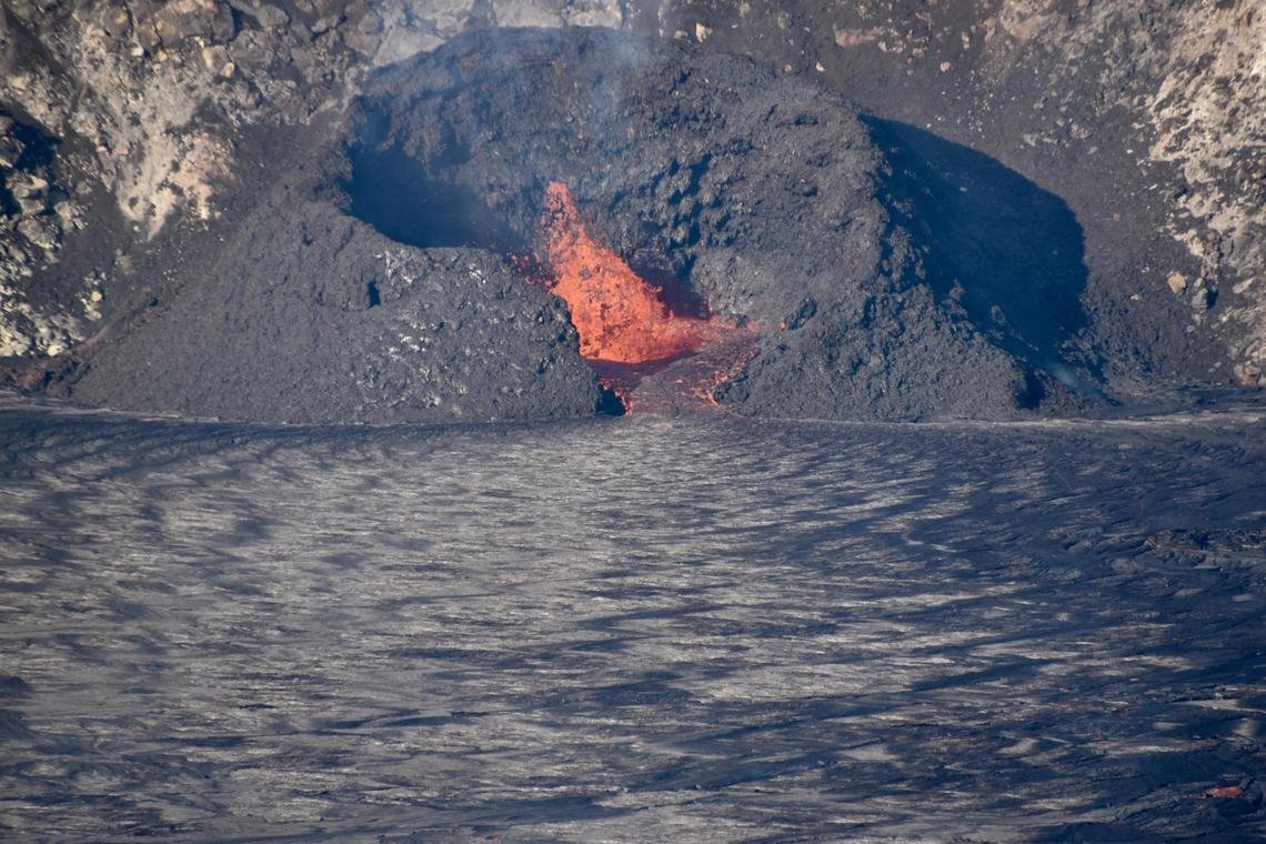
Active west vent in Halema‘uma‘u on October 15, 2021 - Source: B. Carr for USGS
"A telephoto image of the the west vent taken on the morning of October 15, during an HVO helicopter overflight of Kīlauea summit. Low lava fountaining activity continues from the vent in the western wall of Halema‘uma‘u. The lava within the surrounding spatter cone is ponded at a higher elevation than the lava lake surface (shiny silver texture in foreground).The lava flows down a short spillway through a gap in the cone, and into the lake. For scale, the maximum height of the cone above the lake surface is 25–30 meters."
The views expressed herein can in no way be taken to reflect the official opinion of the European Space Agency or the European Union.
Contains modified Copernicus Sentinel data 2026, processed by VisioTerra.
Contains modified Copernicus Sentinel data 2026, processed by VisioTerra.
| More on European Commission space: |  |
 |
 |
||||
| More on ESA: | |
|
|
S-1 website | S-2 website | S-3 website | |
| More on Copernicus program: | |
|
|
Scihub portal | Cophub portal | Inthub portal | Colhub portal |
| More on VisioTerra: | |
|
|
Sentinel Vision Portal | Envisat+ERS portal | Swarm+GOCE portal | CryoSat portal |