Applications of high resolution DEMs in remote sensing processing
Sentinel-1 CSAR IW acquired on 17 January 2019 at 08:21:09 UTC
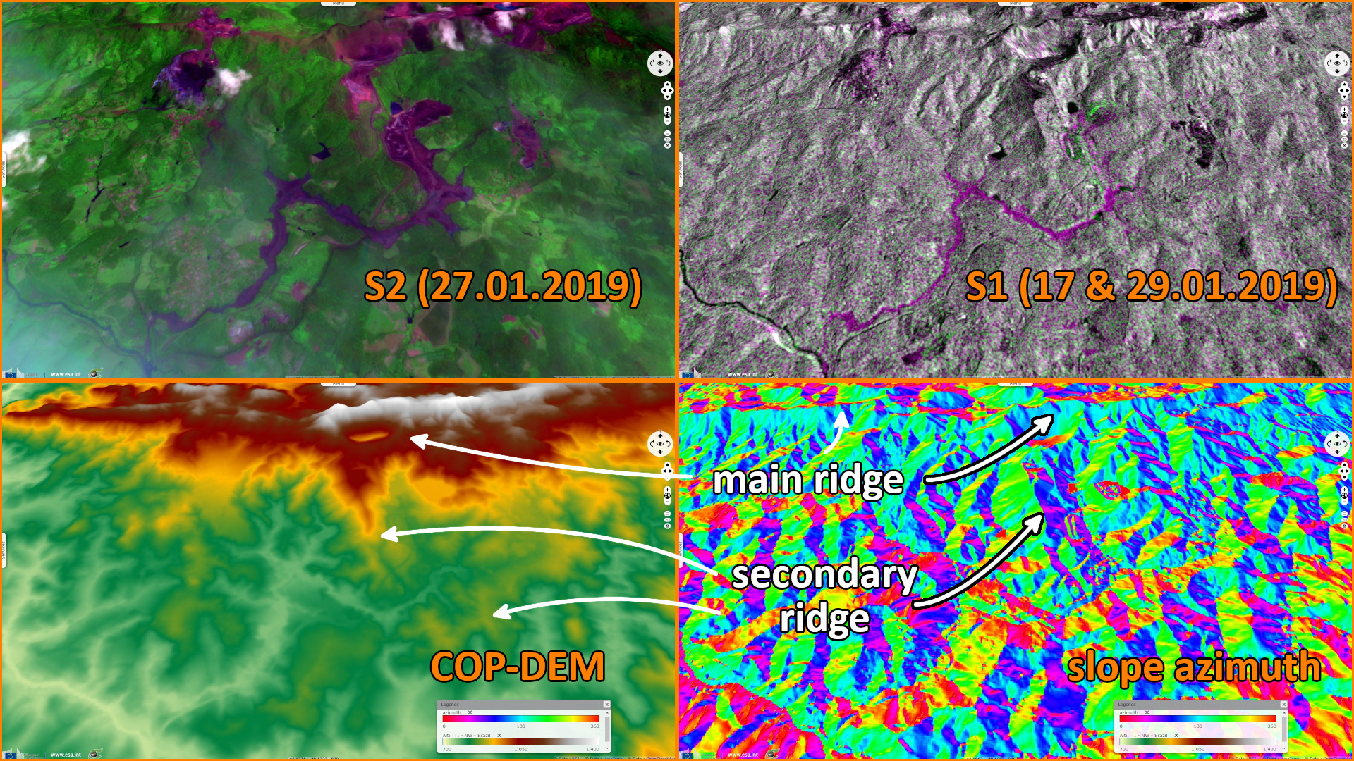
Sentinel-2 MSI acquired on 27 January 2019 at 13:12:49 UTC
Sentinel-1 CSAR IW acquired on 29 January 2019 at 08:21:09 UTC
Sentinel-1 CSAR IW acquired on 06 February 2019 at 17:15:14 UTC
Sentinel-2 MSI acquired on 21 February 2019 at 10:20:39 UTC
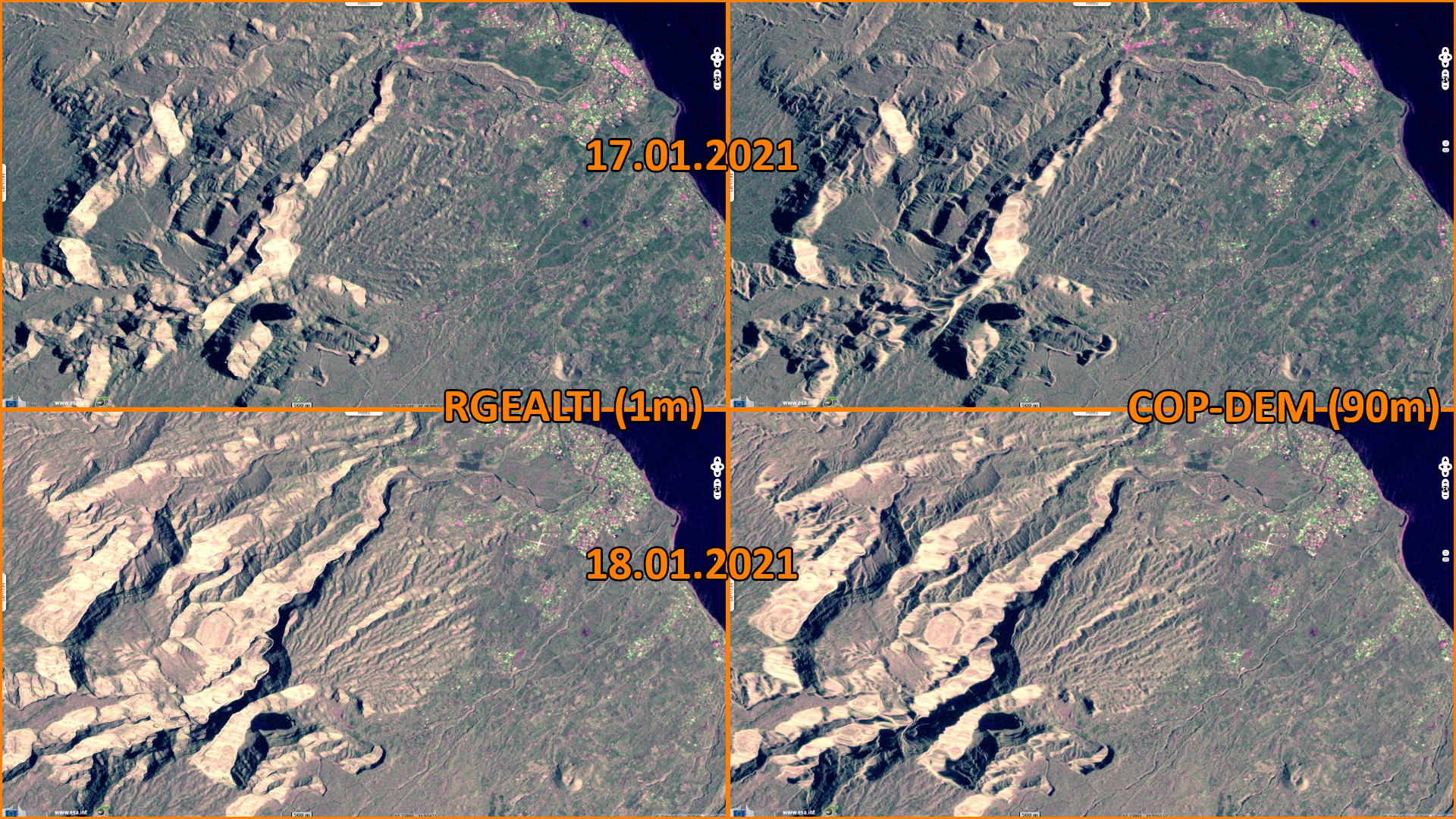
Sentinel-1 CSAR SM acquired on 17 January 2021 at 14:52:34 UTC
Sentinel-1 CSAR SM acquired on 18 January 2021 at 01:46:32 UTC
Sentinel-2 MSI acquired on 26 February 2021 at 14:17:39 UTC
Sentinel-2 MSI acquired on 31 March 2023 at 06:36:21 UTC
Sentinel-2 MSI acquired on 25 June 2023 at 10:16:01 UTC
Sentinel-2 MSI acquired on 27 January 2019 at 13:12:49 UTC
Sentinel-1 CSAR IW acquired on 29 January 2019 at 08:21:09 UTC
Sentinel-1 CSAR IW acquired on 06 February 2019 at 17:15:14 UTC
Sentinel-2 MSI acquired on 21 February 2019 at 10:20:39 UTC
Sentinel-1 CSAR SM acquired on 17 January 2021 at 14:52:34 UTC
Sentinel-1 CSAR SM acquired on 18 January 2021 at 01:46:32 UTC
Sentinel-2 MSI acquired on 26 February 2021 at 14:17:39 UTC
Sentinel-2 MSI acquired on 31 March 2023 at 06:36:21 UTC
Sentinel-2 MSI acquired on 25 June 2023 at 10:16:01 UTC
Keyword(s): Land, climate change, geohazard, open pit mine, natural resources, landslide, volcano, lava flow, emergency, geology, hydrology, river, cryosphere, mountain range, glacier, lake, snow, ice, Chile, Argentina, Switzerland, Italy, Austria, Uzbekistan, Reunion, France
"The Copernicus DEM is a Digital Surface Model (DSM) that represents the surface of the Earth including buildings, infrastructure and vegetation. The Copernicus DEM is provided in 3 different instances: EEA-10, GLO-30 and GLO-90. Data were acquired through the TanDEM-X mission between 2011 and 2015. The datasets were made available for use in 2019 and will be maintained until 2026." notes Copernicus Contributing Missions Online.
"EEA-10 covers 39 European countries including all islands of those countries plus French Overseas Departments (excluding French Overseas Territories) at a resolution of 10 metres with a surface coverage of ~6M km².
GLO-30 offers global coverage at a resolution of 30 metres. GLO-90 offers global coverage at a resolution of 90 metres. Both datasets have a surface coverage of ~149M km²."
In a document hosted on the same portal, additional information on Copernicus DEM are available: "This DEM is an edited DSM: identified water bodies are flattened and a consistent flow of rivers is ensured, shore- and coastlines and special features such as airports are edited. Implausible terrain structures are corrected as well. The Copernicus DEM is based on the WorldDEM data. The WorldDEM product is based on the radar satellite data acquired during the TanDEM-X Mission."
"The primary goal of the mission was the generation of a worldwide, consistent, and high precision Digital Surface Model (DSM) based on Synthetic Aperture Radar (SAR) interferometry. The two satellites TerraSAR-X and TanDEM-X operated as a single-pass SAR interferometer (InSAR), using the bi-static InSAR StripMap mode. At least two complete data coverages of the Earth’s surface were acquired to generate the DEM product.
The data acquisition started in December 2010 and was completed by January 2015."
Besides, https://eodatahub.com/index.php/2021/10/03/copernicus-dem-global-and-european-digital-elevation-model-cop-dem-eea-10-glo-30-and-glo-90/
"An important purpose for the Copernicus DEM will be the orthorectification and the atmospheric correction of Sentinel-2 data products, providing enhanced accuracy especially over mountainous regions. In addition, the Copernicus DEM will provide a common elevation layer for all Copernicus projects including Core Services and Contributing Missions. The homogeneous Copernicus DEM datasets will therefore ensure better consistency across the various Copernicus products and facilitate their combination over time and space.", wrote EO Data Hub.
"In order to facilitate a wide range of usages, INSPIRE-compliant metadata and numerous additional information layers are provided, such as masks containing information about water bodies, height errors and accuracy statistics. Users have also access to detailed technical documentation (Product Handbook, Validation Report) on the different products."
"The Copernicus DEM is based on the SAR-derived WorldDEM dataset provided by Airbus and acquired in close cooperation with the German Aerospace Center (DLR) by the TanDEM-X mission. WorldDEM is a standardised global and high-precision Digital Surface Model (DSM) with no regional or national border divides. It covers regions beyond 60° North and South without any missing areas, even in the heavily clouded Equatorial belt, mountainous or cliffy areas. The global WorldDEM data underwent a thorough editing and quality assurance process to ensure a homogenous quality regardless of the position on the globe."
"The Earthnet Data Assessment Project (EDAP+) continues the work of its predecessor (EDAP 2018 – 2021) and is responsible for assessing the quality and suitability of candidate missions being considered for ESA’s Earthnet Programme as Third Party Missions (TPM).", according to the portal earth.esa.int.
Performed by VisioTerra, the goal of EDAP DEM Assessment Study is described as:
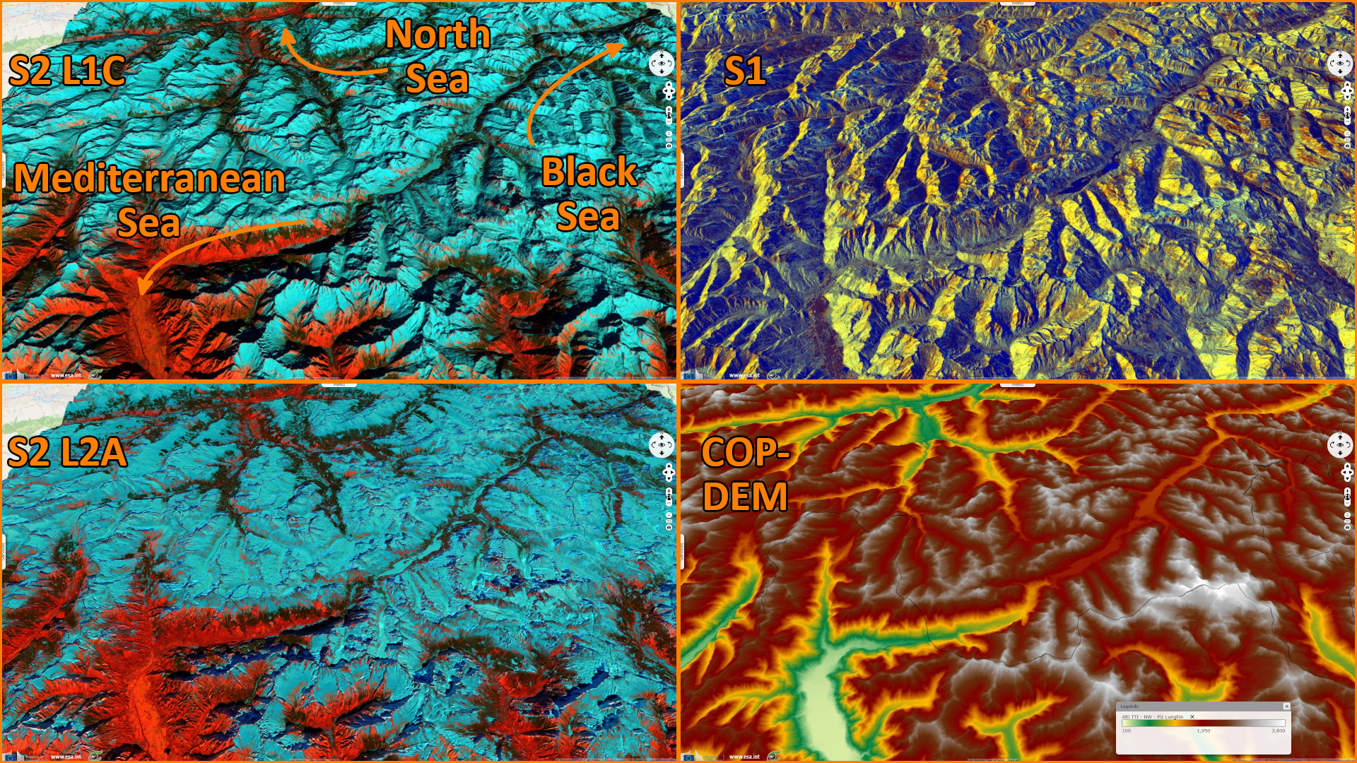
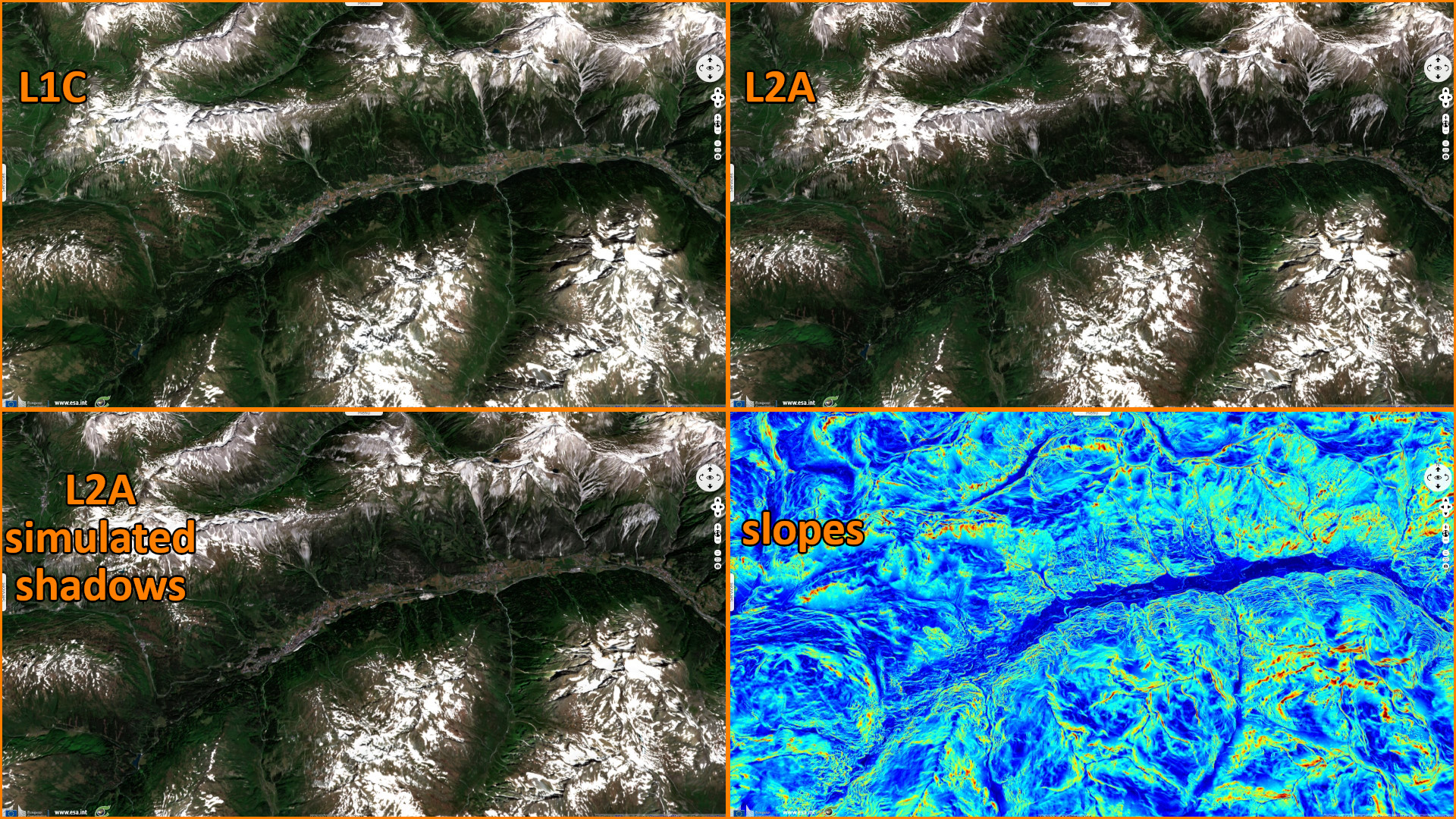
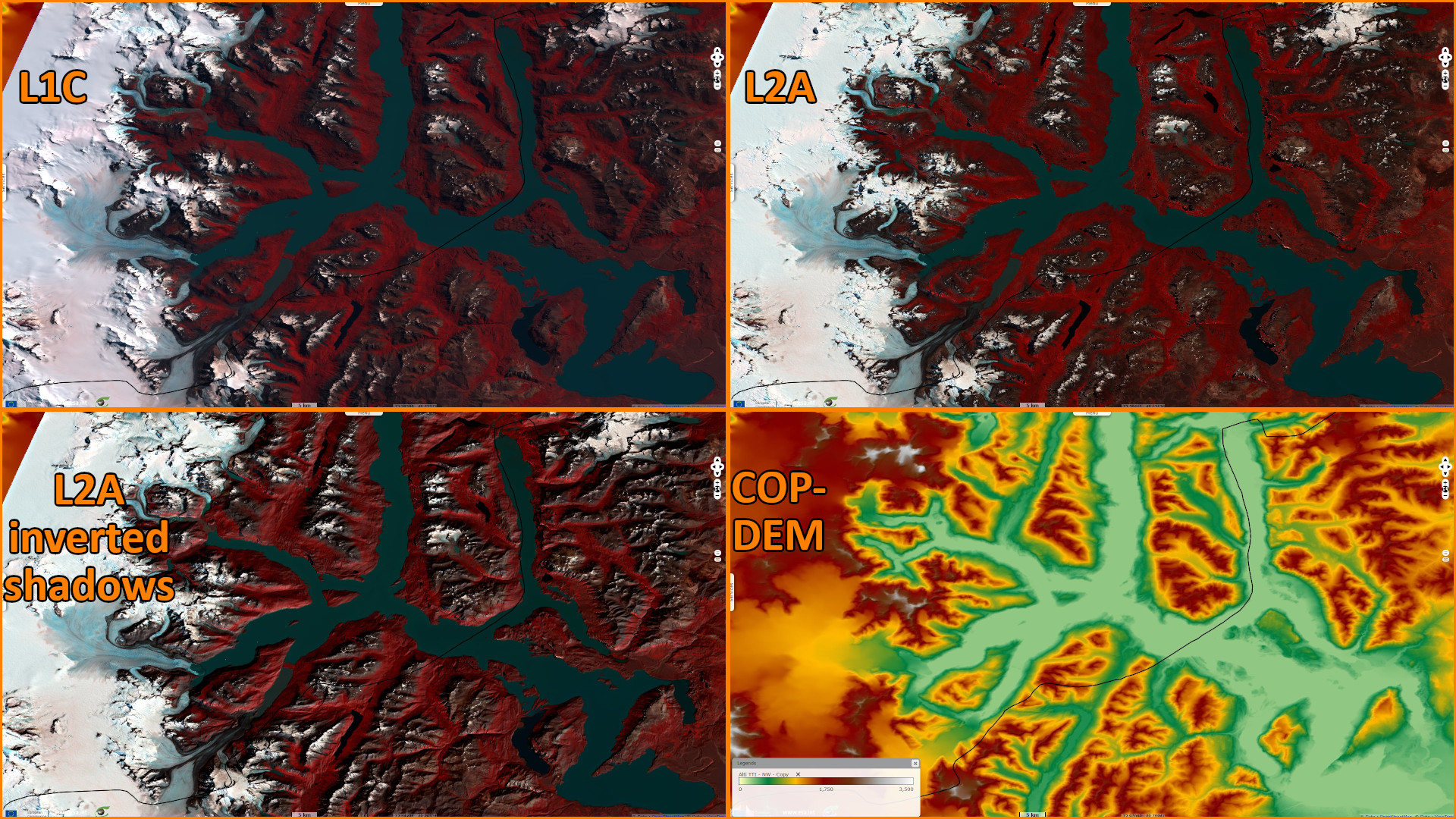
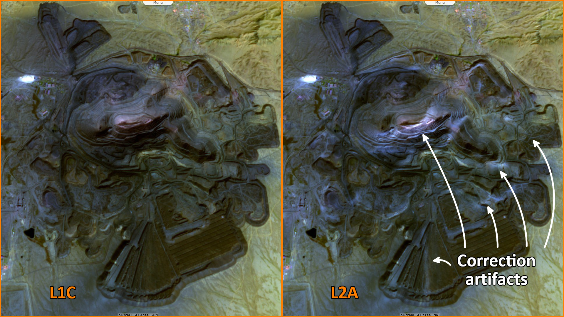
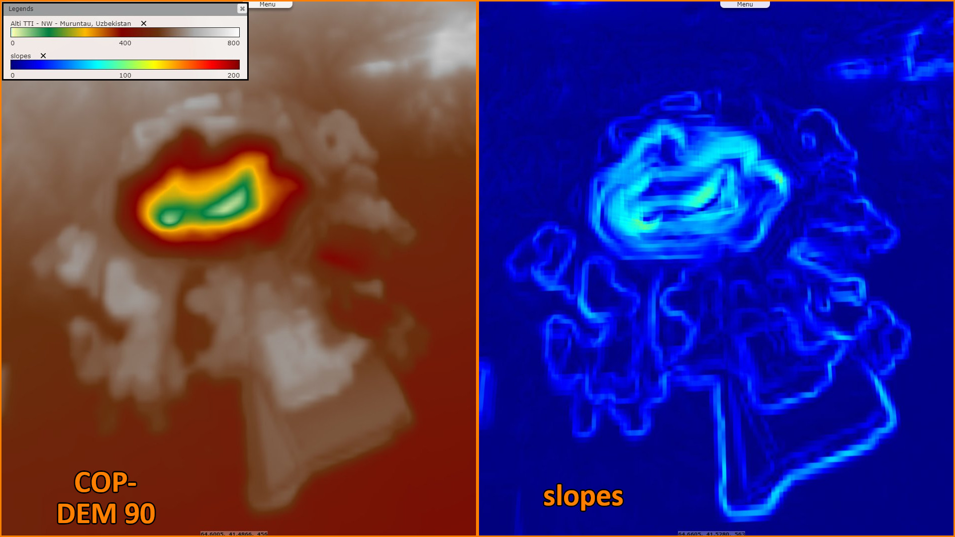
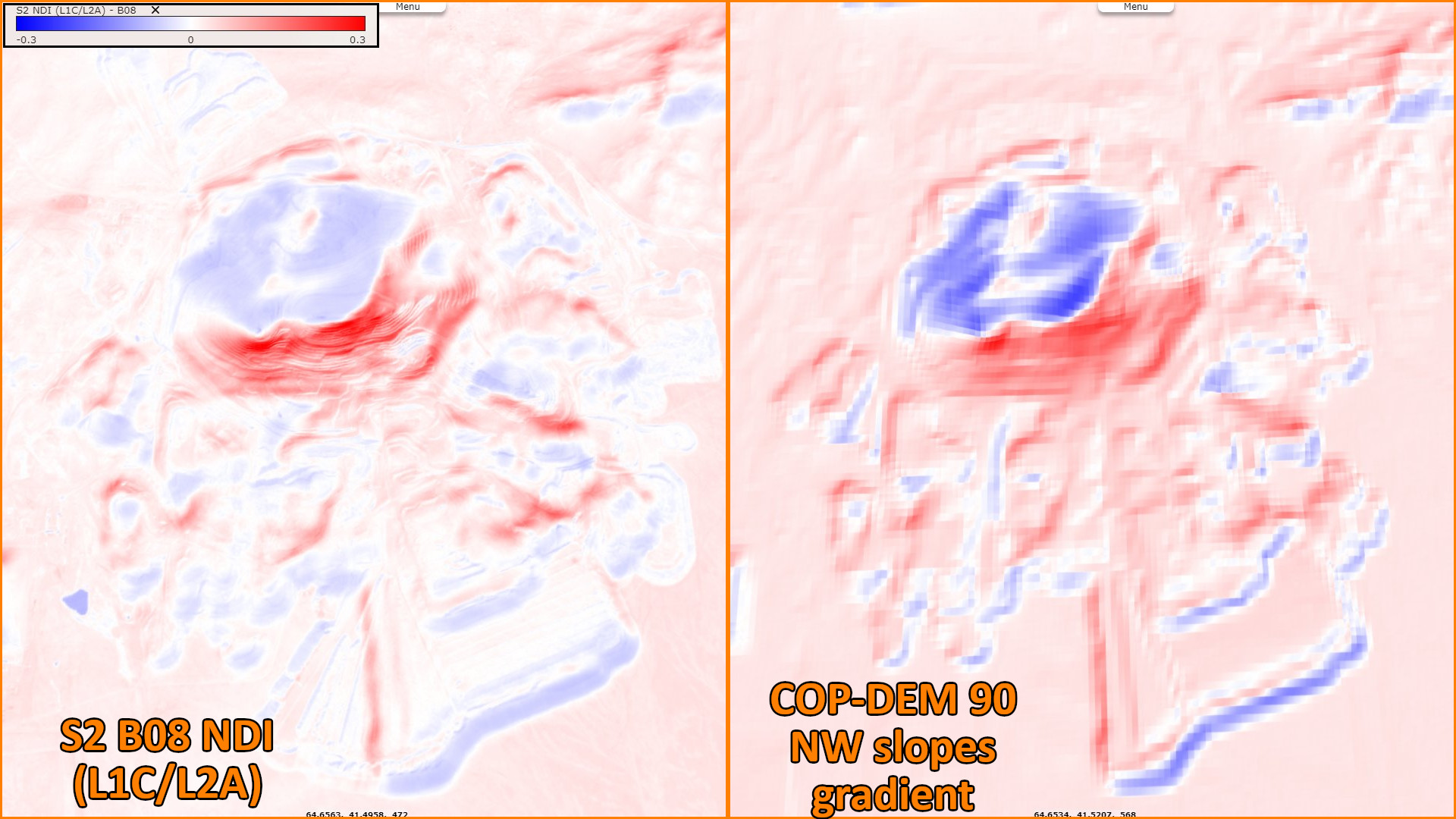
"Image data acquired by satellites are affected by systematic sensor and platform-induced geometry errors, which introduce terrain distortions when the sensor is not pointing directly at the nadir location of the sensor. In order to accurately remove the image distortions, a DEM is used to perform image orthorectification."
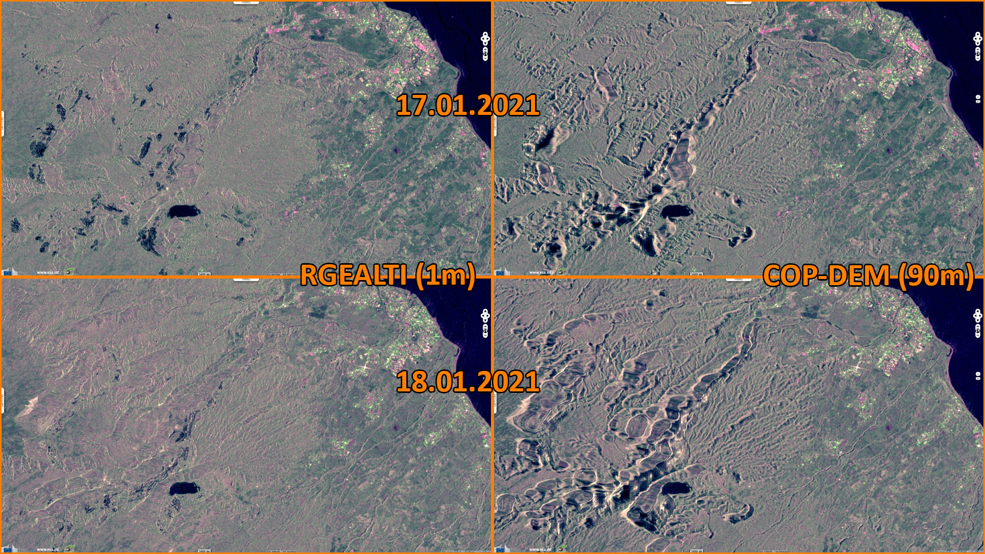
"A DEM is a dedicated catalogue that represents the relief of a surface between points of known elevation. Orthorectification is the process of removing internal and external distortions to assign more accurate coordinates to the final image. The goal of orthorectification is to create a final product whereby every pixel in the image is depicted as if it were viewed at nadir (i.e. directly overhead), removing the effects of hills, valleys, etc., on the data. However, the orthorectification process is less accurate over areas with varied relief (such as mountains), or over cities (where the bare earth representation given by DEM is very challenging to be assessed due to the presence of human artefact, such as buildings)."
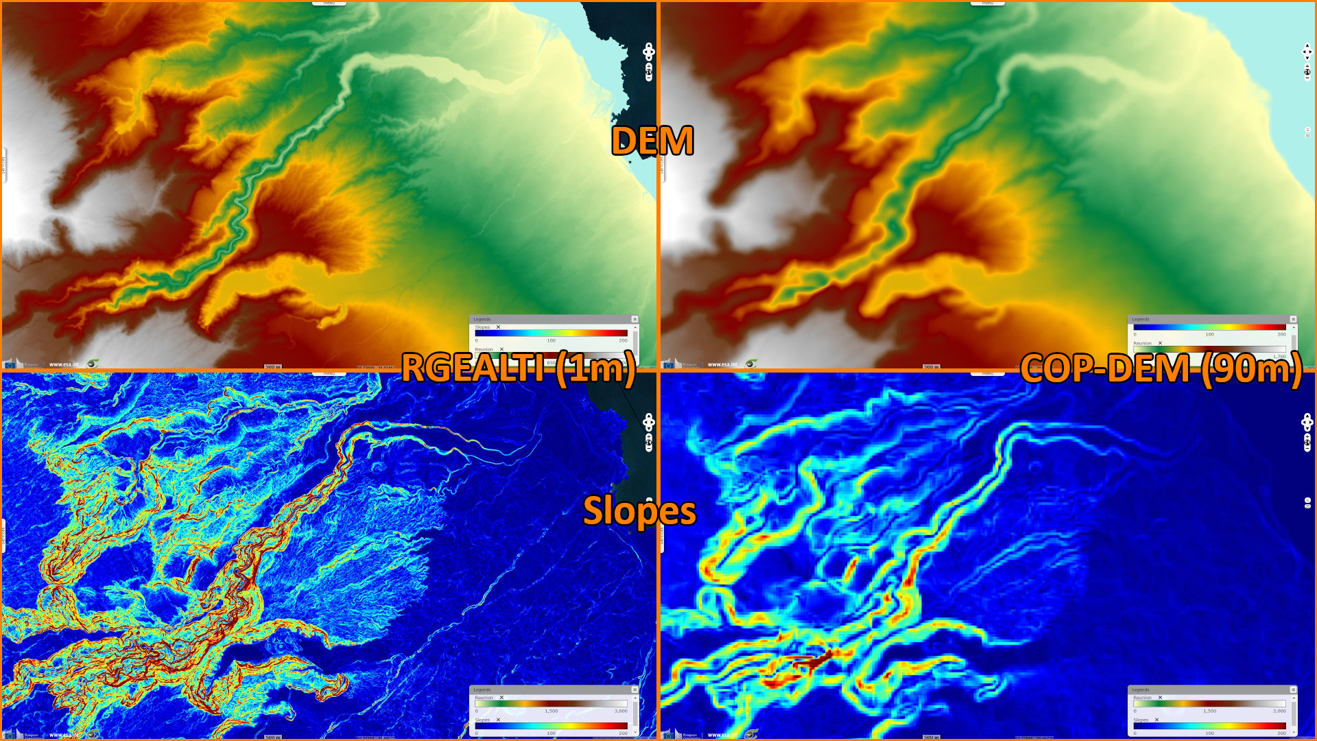
"The first step in EDAP DEM Assessment Study is to assess the quality of the global DEMs over these difficult areas, using defined areas of comparison and evaluating the quality using standard statistical parameters such as Root Mean Square Error (RMSE) or Linear Error at 90% and 95% confidence." During the "5th Sentinel-2 Validation Team Meeting" at ESRIN on April 11-13, 2022, requests were expressed to join the Copernicus DEM matching the footprint of any Sentinel-2 product (tile of approximately 100 km x 100 km geocoded in the “local UTM” CRS). After a successful one-year service, DEM4S2 will be fully integrated in the “Copernicus Open Access Hub”, this service is available at https://visioterra.org/DEM4S2/.
The views expressed herein can in no way be taken to reflect the official opinion of the European Space Agency or the European Union.
Contains modified Copernicus Sentinel data 2026, processed by VisioTerra.
Contains modified Copernicus Sentinel data 2026, processed by VisioTerra.
| More on European Commission space: |  |
 |
 |
||||
| More on ESA: | |
|
|
S-1 website | S-2 website | S-3 website | |
| More on Copernicus program: | |
|
|
Scihub portal | Cophub portal | Inthub portal | Colhub portal |
| More on VisioTerra: | |
|
|
Sentinel Vision Portal | Envisat+ERS portal | Swarm+GOCE portal | CryoSat portal |