Coastal landscapes of South-East Australia
Sentinel-3 OLCI FR acquired on 16 November 2016 at 23:42:18 UTC
Sentinel-2 MSI acquired on 17 June 2017 at 00:12:11 UTC
...
Sentinel-2 MSI acquired on 05 January 2018 at 00:02:29 UTC
Sentinel-2 MSI acquired on 17 June 2017 at 00:12:11 UTC
...
Sentinel-2 MSI acquired on 05 January 2018 at 00:02:29 UTC
Keyword(s): Coastal, water colour, bay, lagoon, sand island, beach, vegetation, rainforest, mangrove, urban, Ramsar wetland, UNESCO World Heritage, Australia
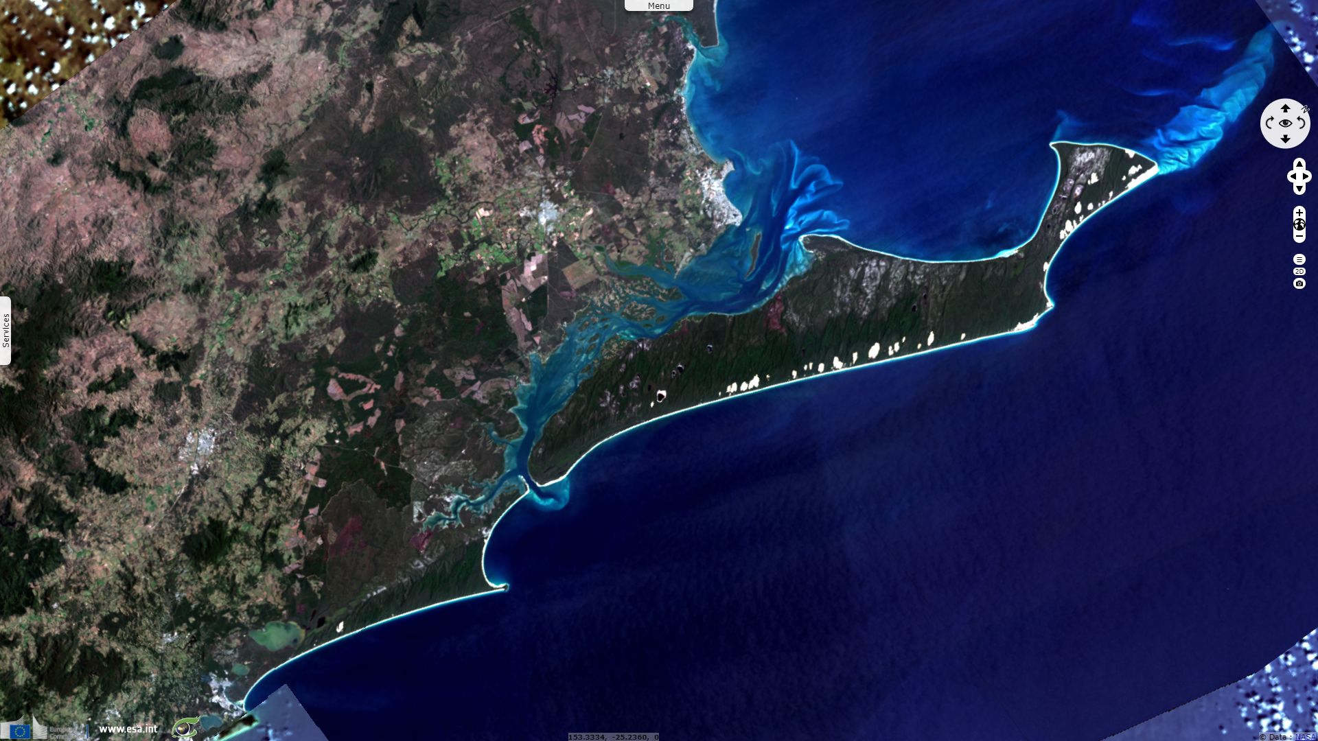
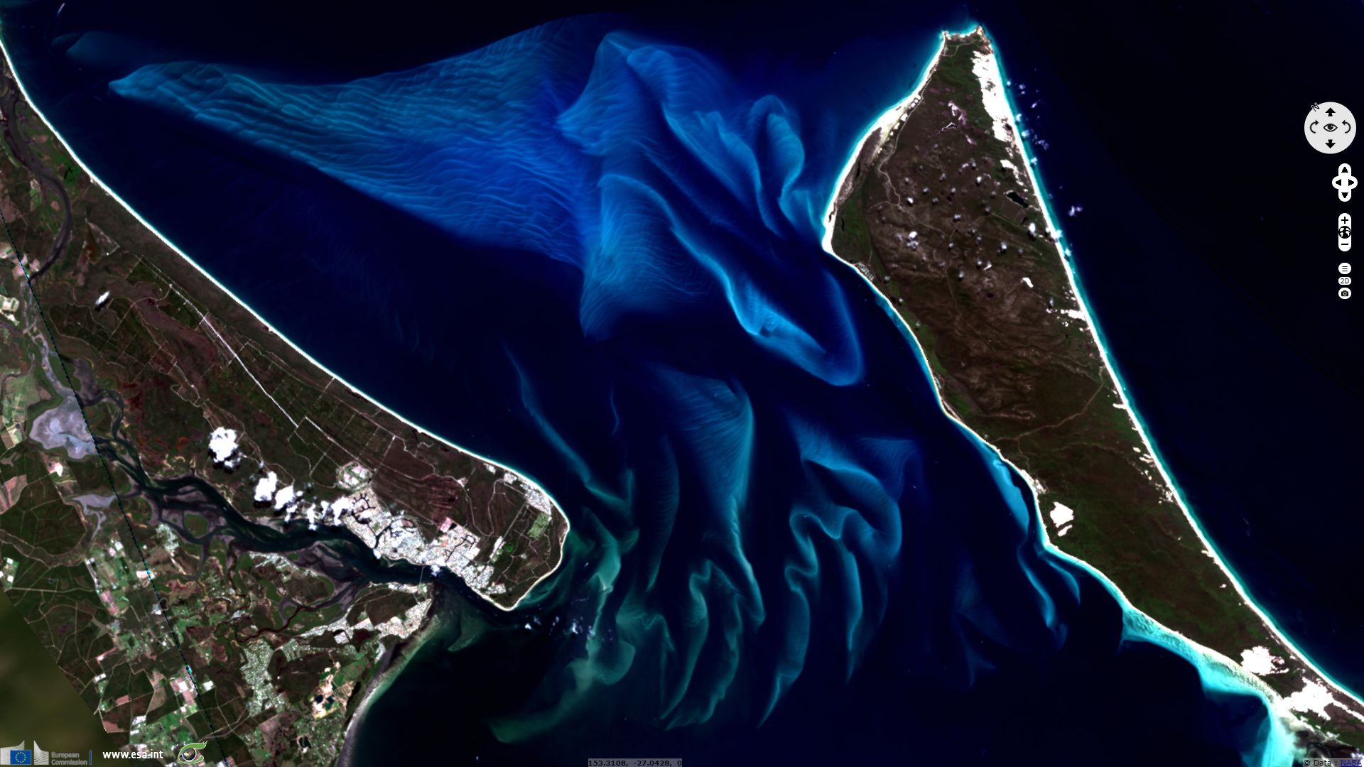
Located on the eastern coast of Australia, Fraser Island is a UNESCO World Heritage site described as "the world’s largest sand island, offering an outstanding example of ongoing biological, hydrological and geomorphological processes. The development of rainforest vegetation on coastal dune systems at the scale found on Fraser Island is unique, plus the island boasts the world’s largest unconfined aquifer on a sand island. The property has exceptional natural beauty with over 250 kilometres of clear sandy beaches with long, uninterrupted sweeps of ocean beach, strikingly coloured sand cliffs, and spectacular blowouts. Inland from the beach are majestic remnants of tall rainforest growing on sandy dunes and half of the world’s perched freshwater dune lakes."
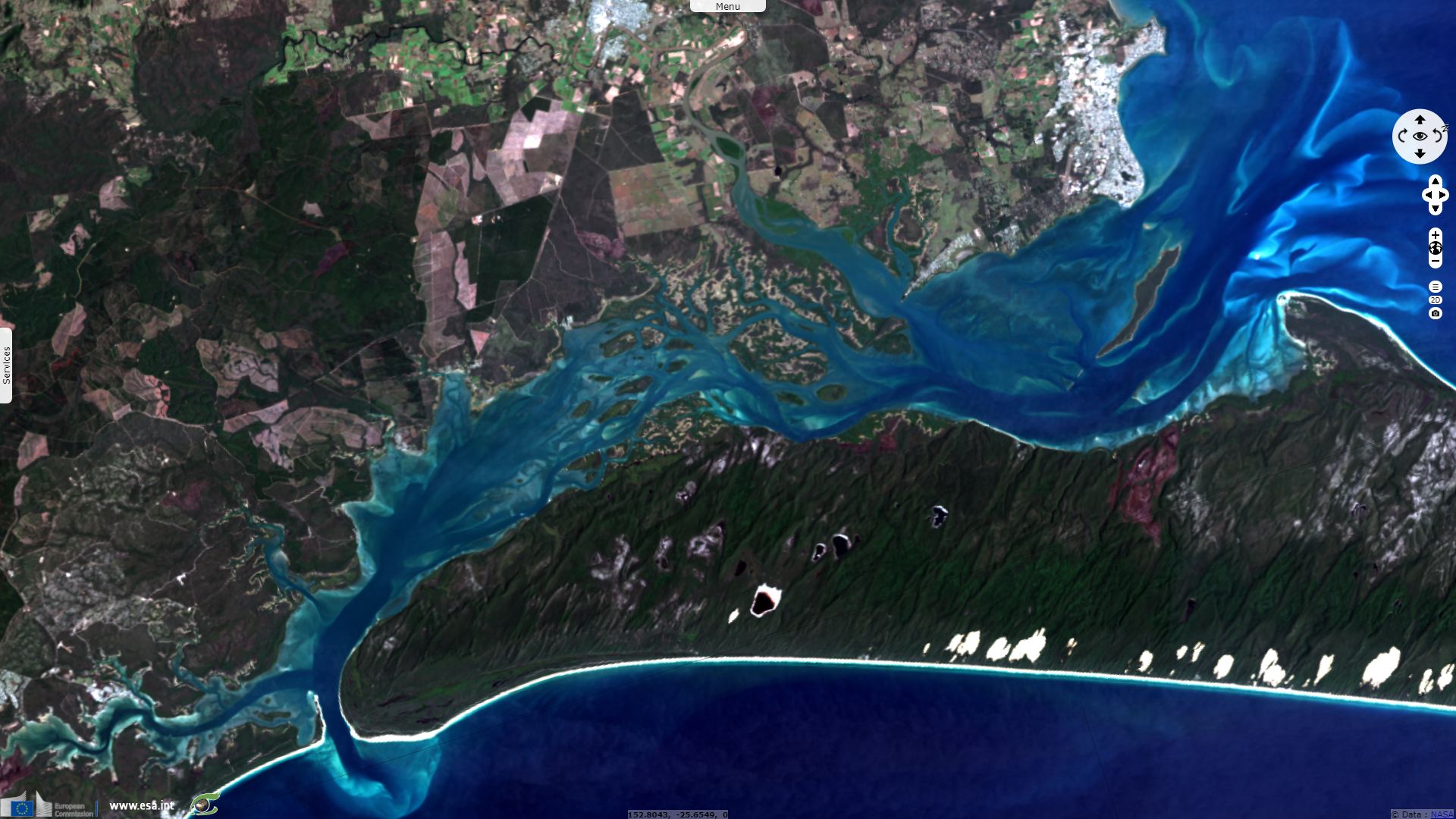
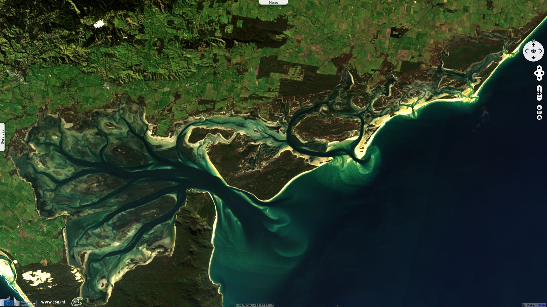
Fig.2 is zoomed on a smaller feature of fig.1 called the Great Sandy Strait. It is a wetland protected under the Ramsar convention, depicted as "a sand passage estuary between the mainland and sandy Fraser Island. The largest area of tidal swamps within the Southeast Queensland bioregion of Australia, consisting of intertidal sand and mud flats, extended seagrass beds, mangrove forests, saltflats, and saltmarshes, and often contiguous with freshwater Melaleuca wetlands and coastal wallum swamps."
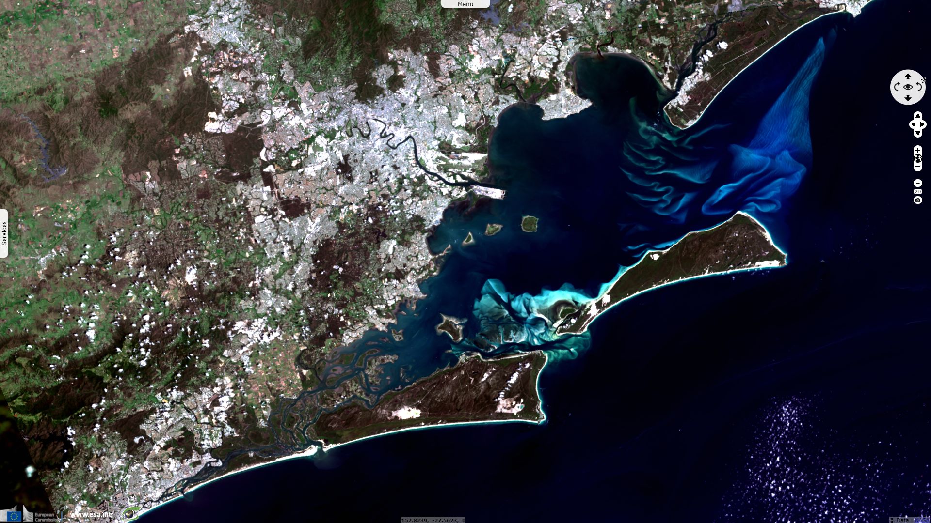
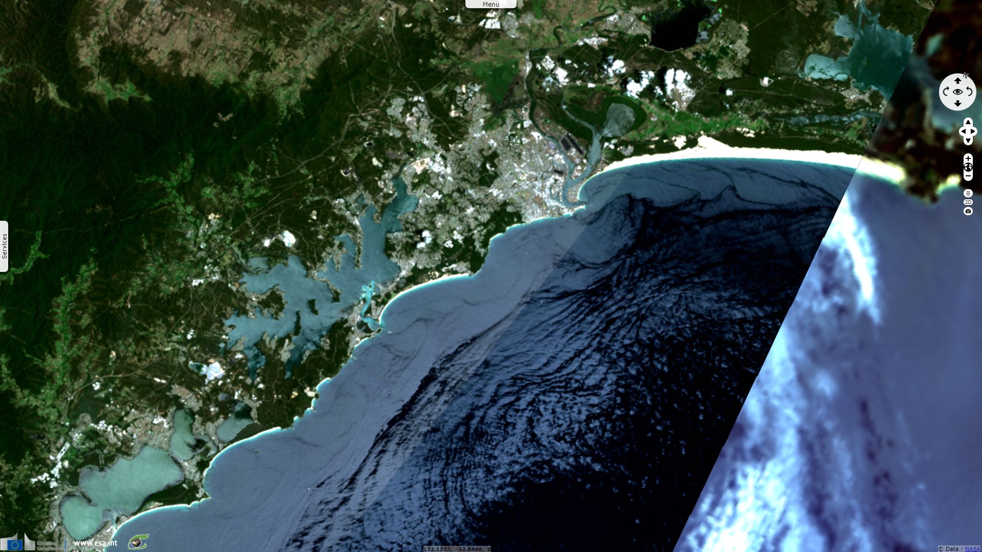
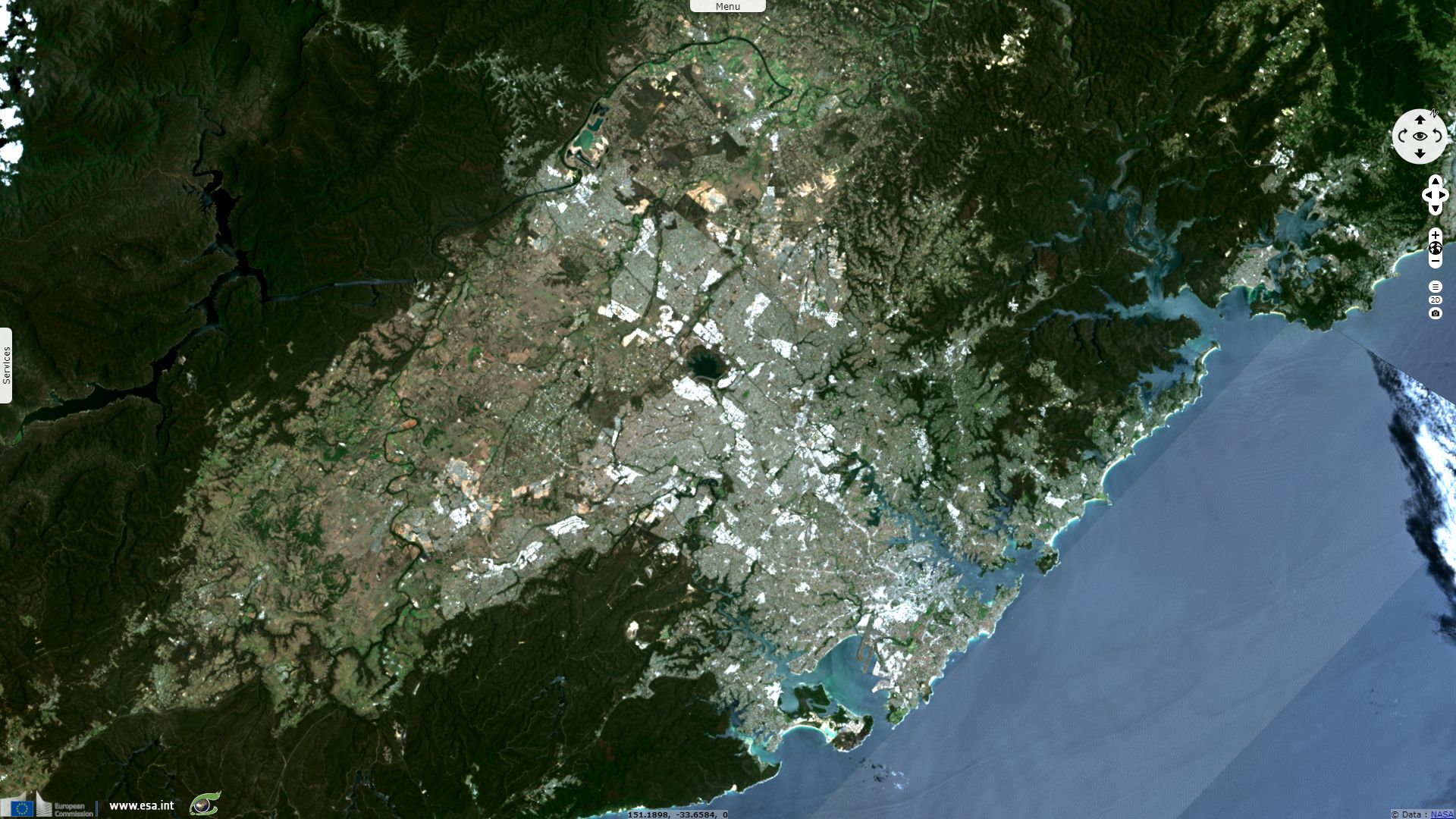
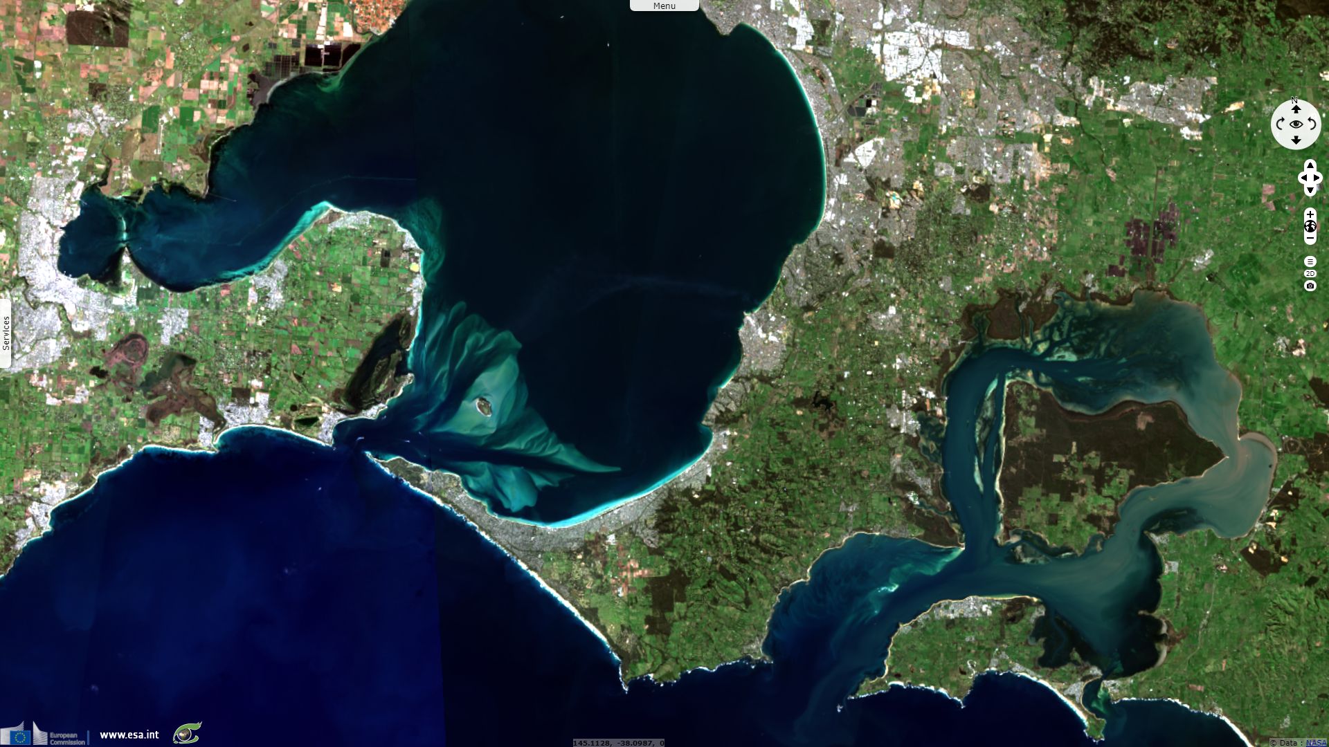
Brisbane is a coastal city populated by 2.3 million inhabitants sheltered within Moreton Bay. This bay is a wetland, it is
"Near the southern limit of reef-building corals, an estuarine basin, semi-enclosed by two of the world's largest sand islands. As one of three extensive intertidal areas of seagrass, mangroves and saltmarsh on the eastern coast, it supports an extremely high species diversity. Supported in significant numbers, several reptiles, amphibians, and mammals are rare, vulnerable or endangered. Over 50,000 migratory waterbirds are present during wintering and staging" according to the overview of this Ramsar site.
"The Kooragang Nature Reserve and the Hunter Wetlands Centre Australia two are connected by a wildlife corridor consisting of Ironbark Creek, the Hunter River, and Ash Island. The Kooragang lies within the estuarine section of the Hunter River; habitats include mangrove forest, saltmarsh, saline pastures, Casuarina forest, brackish swamps, standing open water, sandflats, beaches and rock-retaining walls and ponds. The Site is of great importance for migratory waterbirds", as noted by Ramsar which monitors its preservation.
The five million inhabitants of Sidney live between the coastal mangrove forest and the inland forest covering Blue Mountains and crossed by deep gorges.
South of Sidney lies a Nature Reserve called Towra Point, "a system of seagrass, mangrove and saltmarsh communities, marine sub-tidal aquatic beds as well as terrestrial vegetation communities. These include she-oak forest, littoral rainforest, littoral strandline and and a complex mosaic of dune sclerophyll scrub/forest. The site contains approximately half of the mangrove communities and over half of the remaining saltmarsh communities in the Sydney region.". It is "one of the few remaining areas of estuarine wetlands in that region", reminds Ramsar.
The Greater Blue Mountains are an World Heritage site that "consists of 1.03 million ha of sandstone plateaux, escarpments and gorges of eucalypt-dominated landscape just inland from Sydney, Australia’s largest city, in south-eastern Australia. Spread across eight adjacent conservation reserves, it constitutes one of the largest and most intact tracts of protected bushland in Australia" writes UNESCO.
Corner Inlet faces south-east toward Tasmania. It is "an outstanding example of the processes involved in barrier island formation, development of multiple beach ridges, lagoons and swamps, tidal creeks, deltas, and washovers. Of international importance for migratory waterbirds, the area regularly supports up to 29,000 waders, including 50% of the waders wintering in Victoria, and is important as a drought refuge" according to Ramsar.
Melbourne area borders Port Phillip Bay that leads to Bass Strait. Three Ramsar wetlands adjoin Melbourne:
- At south-east, surrounding French Island, Western Port: "a coastal embayment incorporating vast mudflats, two sites of international, geological and geomorphological significance, and nationally important expanses of relatively undisturbed, species-rich, saltmarsh vegetation. An internationally important feeding and roosting area for numerous species of summering waders."
- At south, Edithvale-Seaford Wetlands: "Two separate wetlands near Melbourne, including both freshwater and brackish lakes, both with similar morphology and ecological characteristics and both under an extensive rehabilitation and management regime by Melbourne Water. They are of exceptional significance as examples of cost-effective management of wetlands in an urban setting to provide conservation benefits, manage storm water, and encourage environmental research and education."
- At south-west, Port Phillip Bay & Bellarine Peninsula: "Six discrete areas of various wetland types, ranging from shallow, marine waters and estuaries to freshwater lakes, seasonal swamps, intertidal mudflats, and seagrass beds. Of outstanding importance to waterbirds" "Tens of thousands of ibises roost here" and "up to 65,000 migratory waders occur in summer".
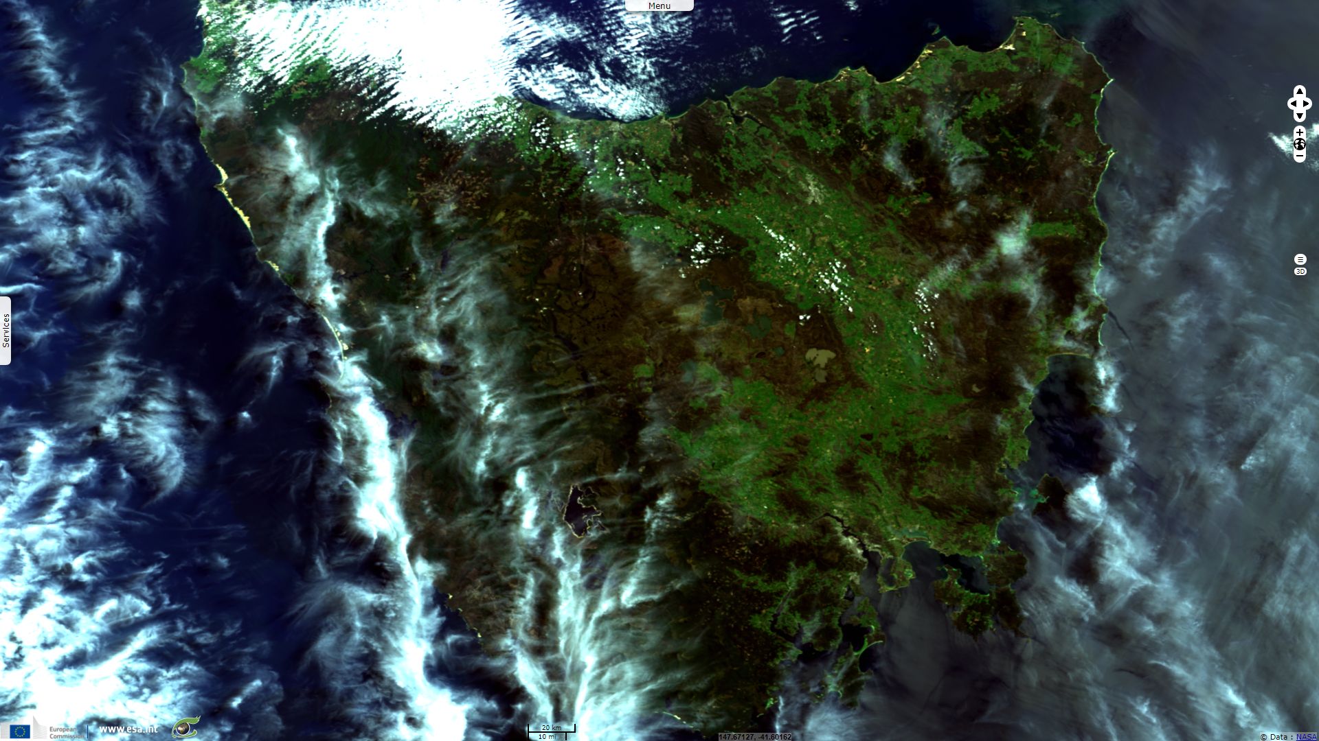
South of Bass Strait, 200km off the coast of Australian mainland, lies Tasmania island. Located at the south-west of the island, a large fraction of Tasmania is recognized as a UNESCO World Heritage site known as Tasmanian Wilderness. It is characterized by the following overview: "In a region that has been subjected to severe glaciation, these parks and reserves, with their steep gorges, covering an area of over 1 million ha, constitute one of the last expanses of temperate rainforest in the world. Remains found in limestone caves attest to the human occupation of the area for more than 20,000 years."
The views expressed herein can in no way be taken to reflect the official opinion of the European Space Agency or the European Union.
Contains modified Copernicus Sentinel data 2026, processed by VisioTerra.
Contains modified Copernicus Sentinel data 2026, processed by VisioTerra.
| More on European Commission space: |  |
 |
 |
||||
| More on ESA: | |
|
|
S-1 website | S-2 website | S-3 website | |
| More on Copernicus program: | |
|
|
Scihub portal | Cophub portal | Inthub portal | Colhub portal |
| More on VisioTerra: | |
|
|
Sentinel Vision Portal | Envisat+ERS portal | Swarm+GOCE portal | CryoSat portal |