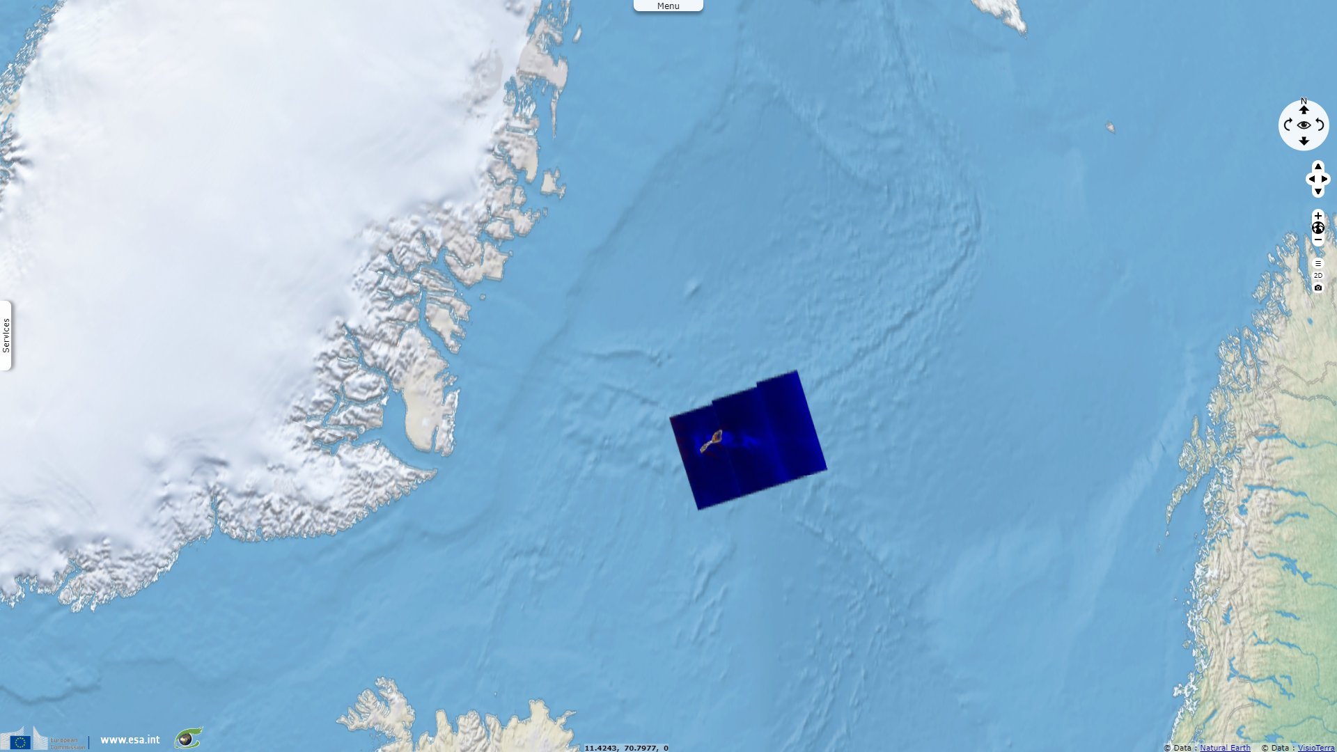
Jan Mayen, remote island on the North Atlantic ridge
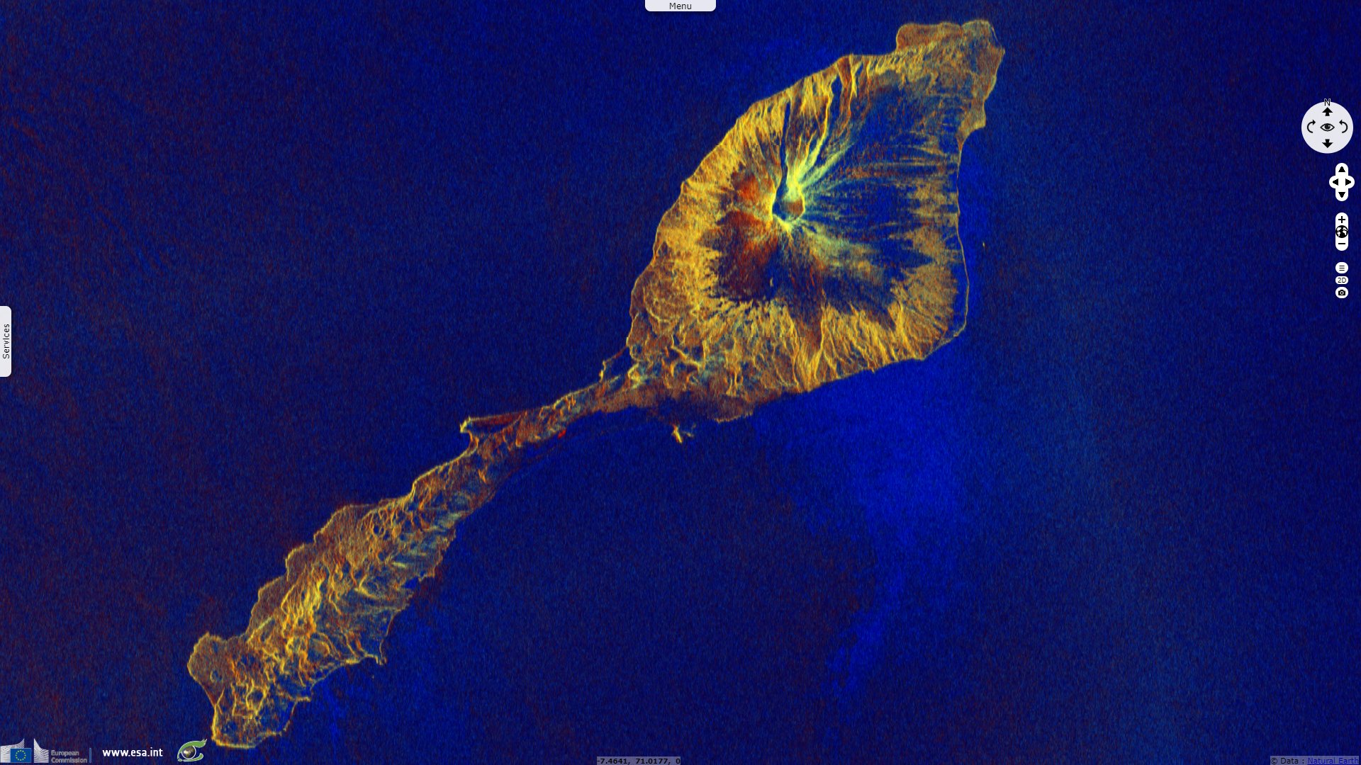
Sentinel-1 CSAR IW acquired on 21 February 2019 at 17:46:40 UTC
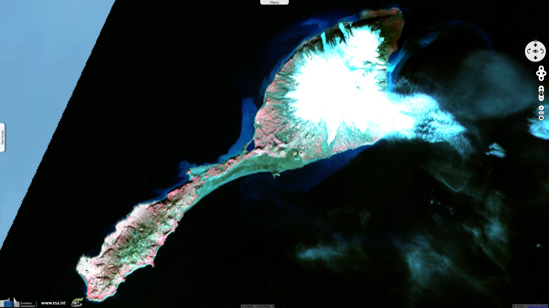
Sentinel-2 MSI acquired on 06 April 2019 at 12:31:41 UTC
...
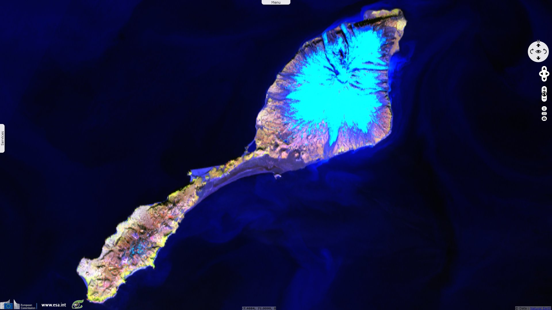
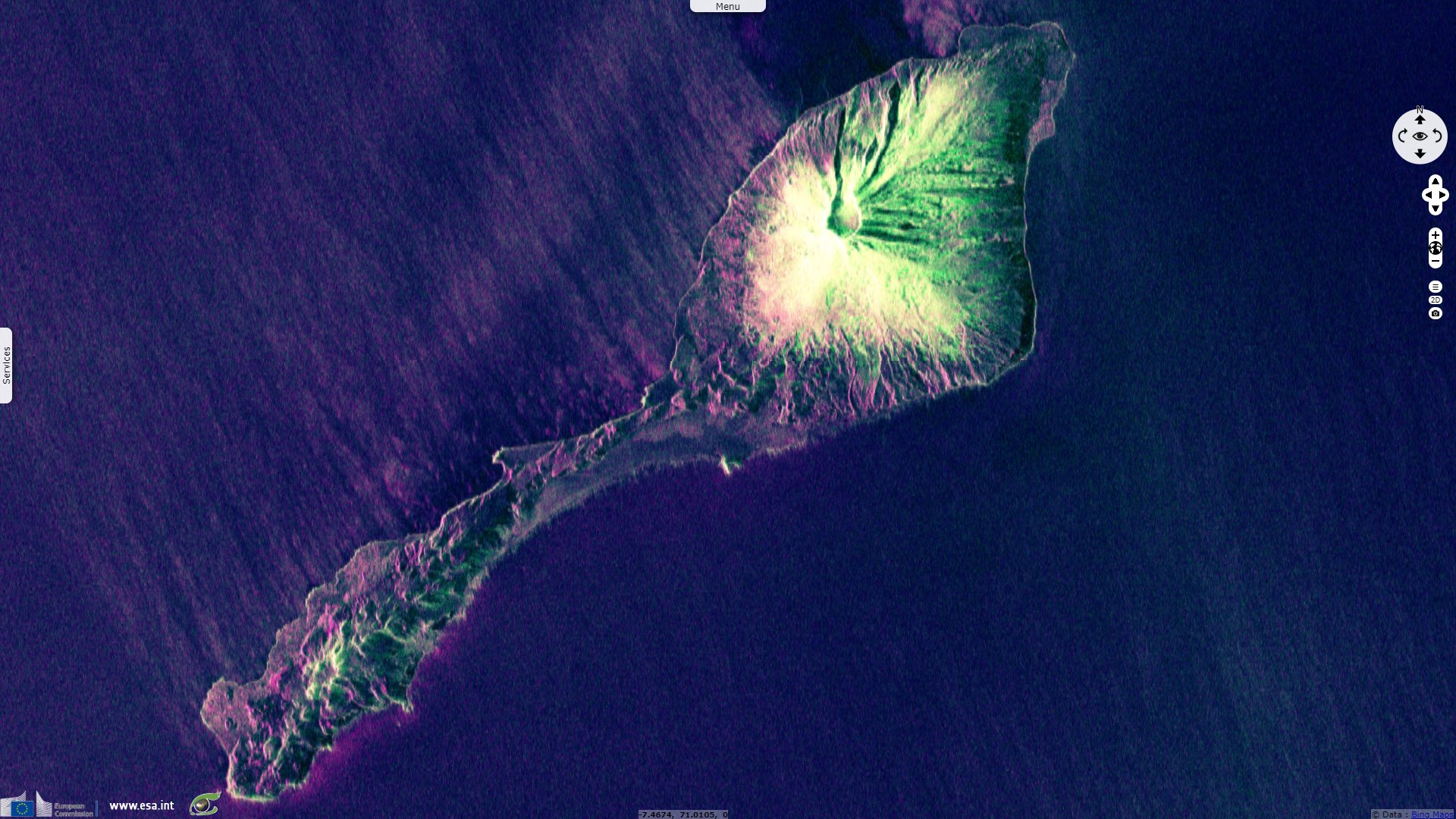
Sentinel-2 MSI acquired on 02 August 2019 at 12:41:49 UTC
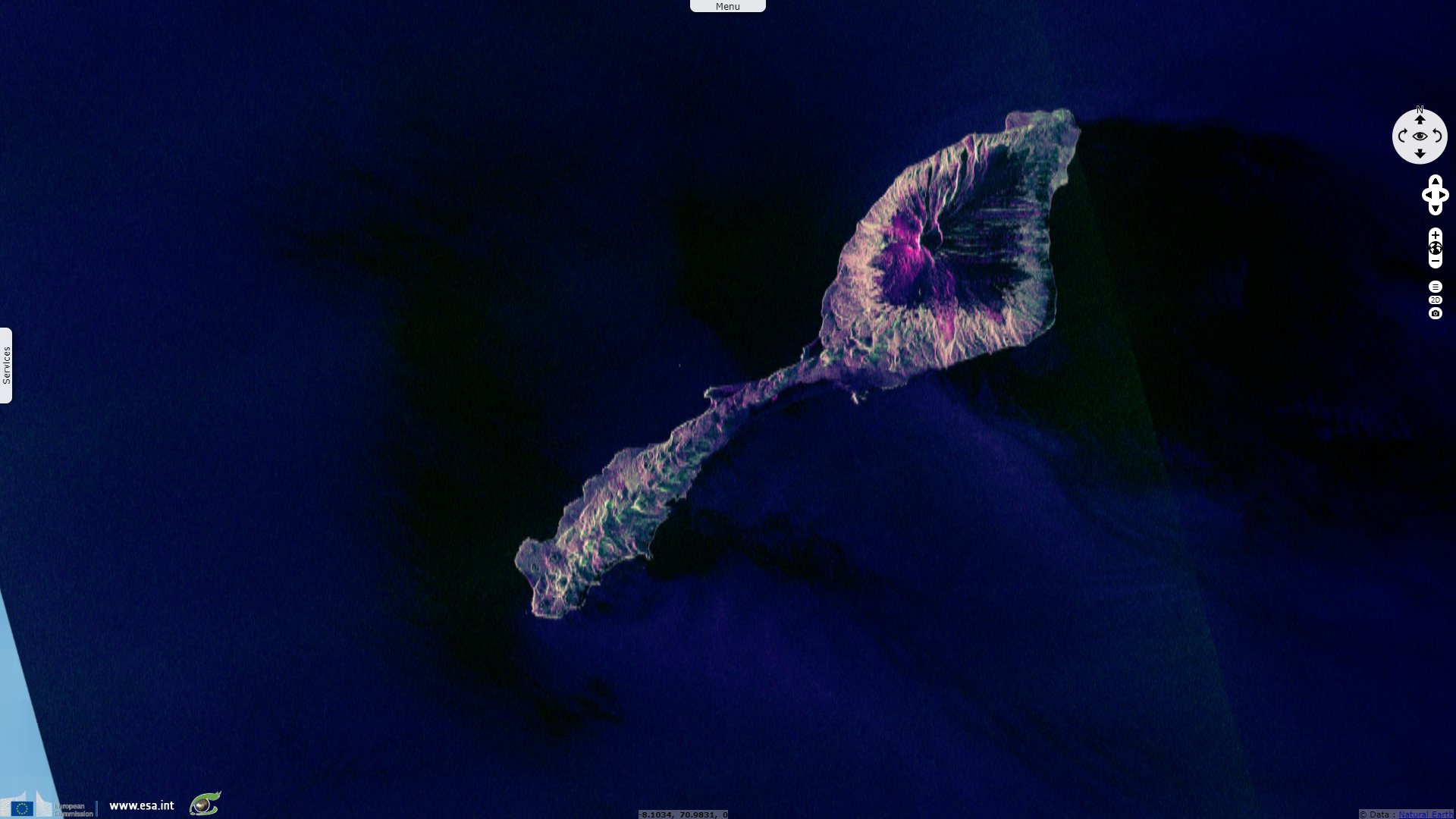
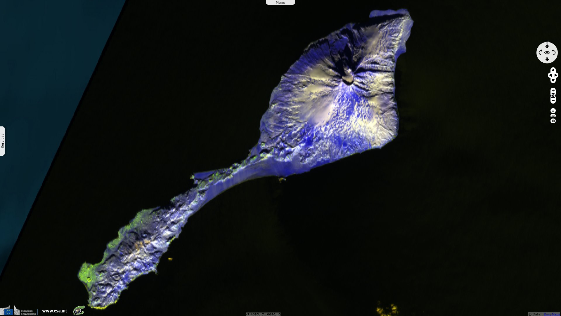
Sentinel-1 CSAR IW acquired on 02 August 2019 at 17:46:05 UTC
Sentinel-2 MSI acquired on 06 April 2019 at 12:31:41 UTC
...
Sentinel-2 MSI acquired on 02 August 2019 at 12:41:49 UTC
Sentinel-1 CSAR IW acquired on 02 August 2019 at 17:46:05 UTC
Keyword(s): Island, volcano, coastal, polar, cryosphere, glacier, water colour, Norway, Atlantic Ocean
"Jan Mayen is a volcanic island of Norwegian dominion, located in the North Atlantic Ocean, 950km west of Norway, 600km north of Iceland." The Smithonian Institution describes it as follows: "Remote Jan Mayen Island, located in the Norwegian Sea along the Jan Mayen Ridge about 650 km NE of Iceland, consists of two volcanic complexes separated by a narrow isthmus. The large Beerenberg basaltic stratovolcano (Nord-Jan) forms the NE end of the 40km-long island, which is ringed by high cliffs."
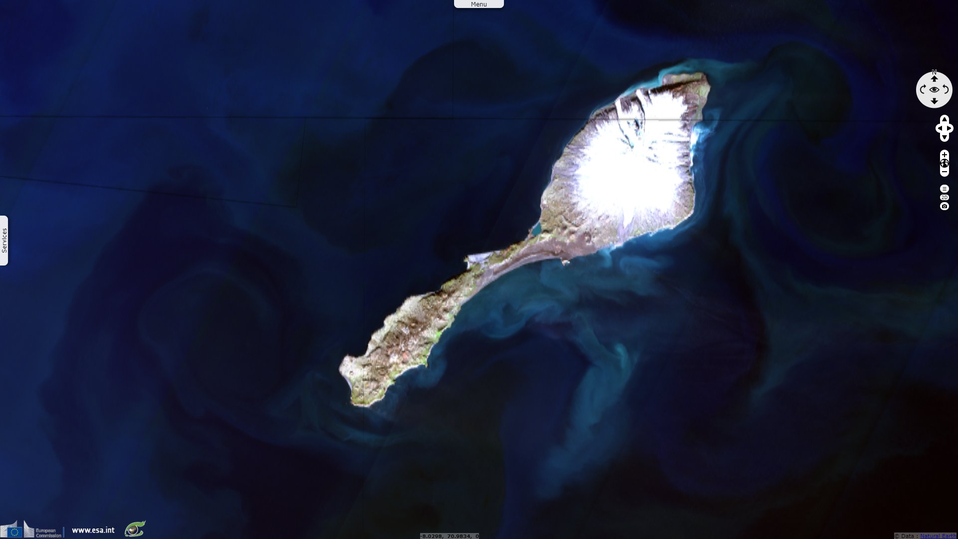
"The glacier-covered Beerenberg has a 1-km-wide summit crater and numerous cinder cones that were erupted along flank fissures. It is composed primarily of basaltic lava flows with minor amounts of tephra. Historical eruptions at Beerenberg date back to the 18th century. The Sor-Jan group of pyroclastic cones and lava domes occupies the SW tip of Jan Mayen. The Holocene Sor-Jan cinder cones, tephra rings, and trachytic lava domes were erupted from short fissures with a NE-SW trend."

"The volcanic island Jan Mayen is located along the mid-Atlantic ridge that runs through the Atlantic Ocean. The island is elevated by Jan Mayen Ridge, which is an undersea volcanic mountain range. North of Jan Mayen there is an active transform rejection zone, called the Jan Mayen rupture zone. In this zone, the mid-Atlantic ridge is offset. The volcanic activity as well as the earthquake activity on and around the island come from this location, and there is therefore a constant risk of new eruptions and earthquakes." - Published on 21.03.2020 by Mats Grimsæth, SeilNorge.
First a whaler base, it became a scientific base as soon 1921, at first limited to metorology. It became a military target during the Second World War but was partly protected from invasion and bombing by its topography and dire weather conditions. The official website of the locality adds: "Current crew is a total of 18, running the Galileo and Egnos stations, the meteorlogical station and maintaining the infrastructure - buildings, roads, airstrip, power station and so on. The view of the island is dominated by the active volcano, Beerenberg (2277m), which had its last eruption in 1985."

The station is located on Trollsletta about 1 km from the former Loran-C mast (demolished Oct-2017) and 3 km from the meteorological station. - Source.
The 2277m high Beerenberg causes the generation of Karman vortex street as explained hereafter: "Air operations at Jan Mayensfield can be challenging due to difficult weather conditions like low visibility or Karman wind. Karman wind causes sudden dramatic changes in wind direction and force. Under certain atmospheric conditions lee-waves and eddies develope a Karman vortex street in the wake of Jan Mayen."
"The Karman vortex street may extend several hundred kilometer downstream from the island. Wave lengths range from 1-15 km and the diameters of the eddies are of the order 25 km. The lee-waves and eddies are caused when airflow is diverted by Jan Mayen’s isolated conical mountain Beerenberg, 2277 m above sea level. Eddies are normally generated in situations with a shallow inversion layer intersecting the mountain below 1800 m. The period of the vortex shedding depends on wind speed and stratification and ranges from 25-100 minutes. The eddy shedding has also been recorded on the island as periodic oscillations in air pressure and shift in the wind direction."
The views expressed herein can in no way be taken to reflect the official opinion of the European Space Agency or the European Union.
Contains modified Copernicus Sentinel data 2026, processed by VisioTerra.
Contains modified Copernicus Sentinel data 2026, processed by VisioTerra.
| More on European Commission space: |  |
 |
 |
||||
| More on ESA: | |
|
|
S-1 website | S-2 website | S-3 website | |
| More on Copernicus program: | |
|
|
Scihub portal | Cophub portal | Inthub portal | Colhub portal |
| More on VisioTerra: | |
|
|
Sentinel Vision Portal | Envisat+ERS portal | Swarm+GOCE portal | CryoSat portal |