The hidden price of gold, Madre de Dios, Peru
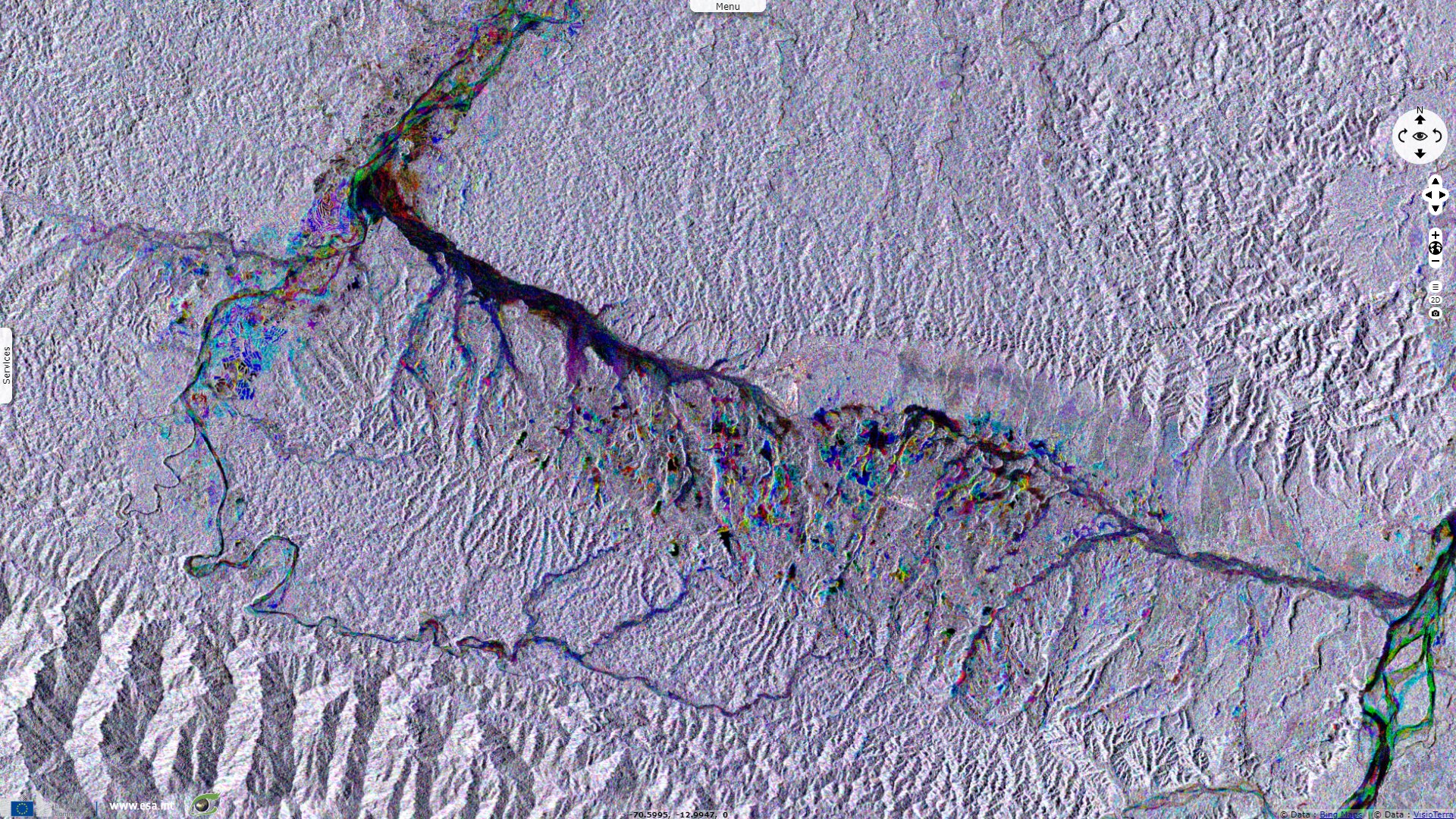
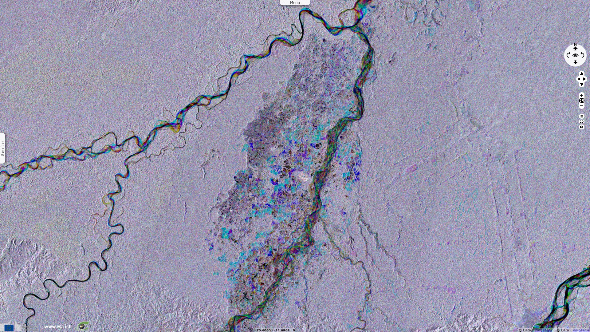
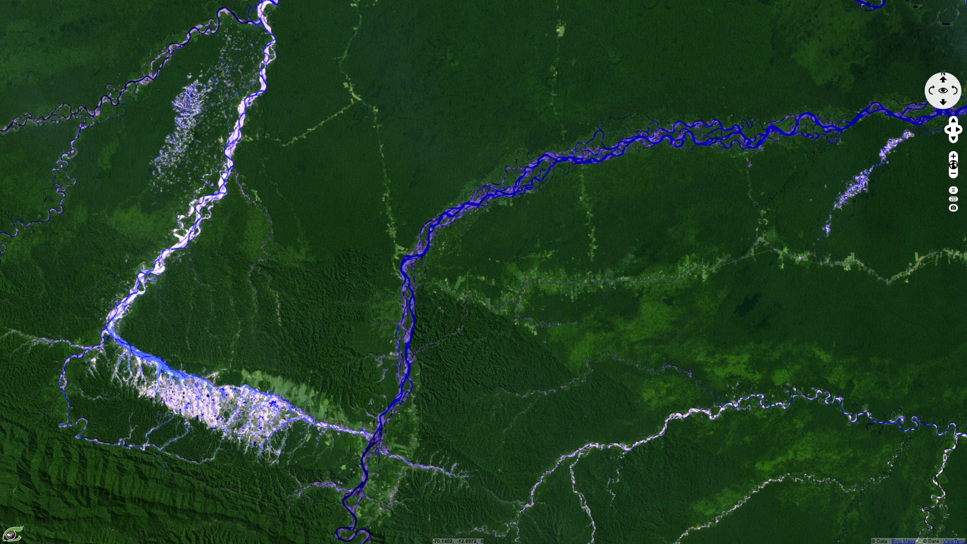
Sentinel-1 CSAR IW acquired on 18 May 2015 from 10:14:17 to 10:14:42 UTC
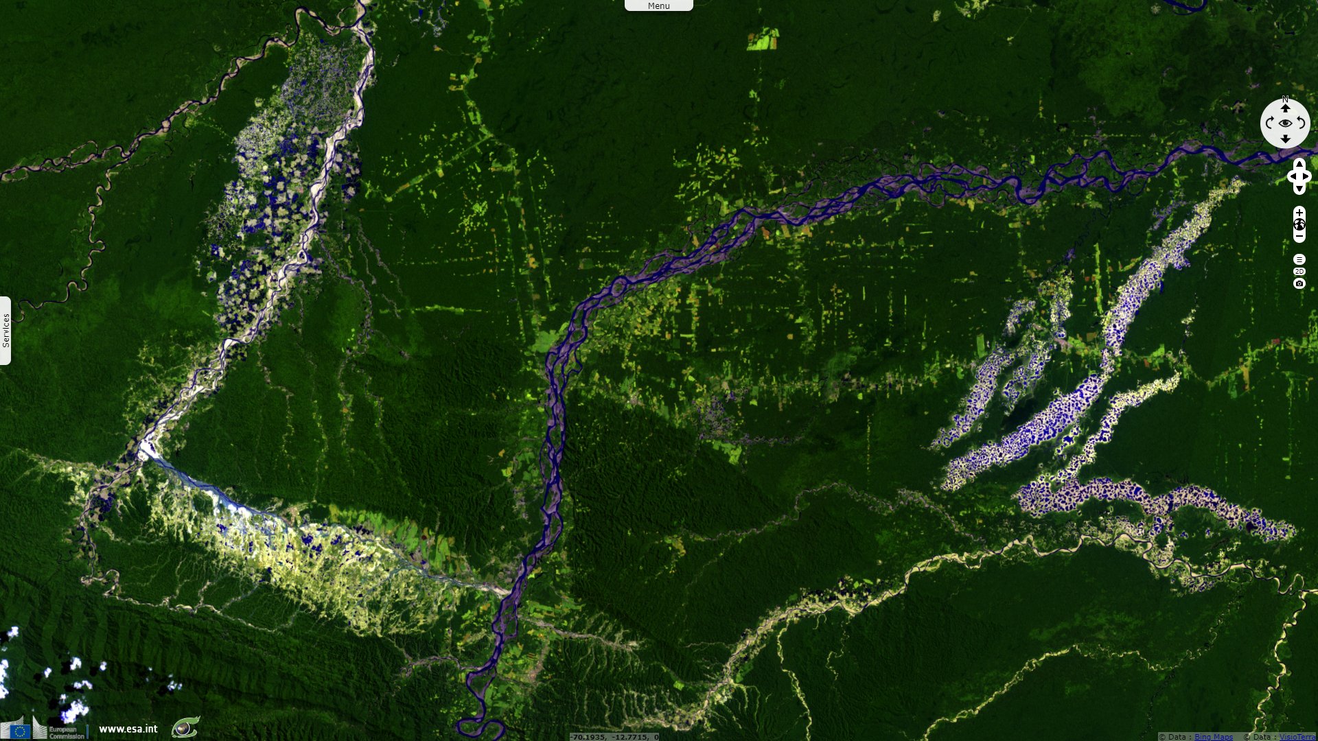
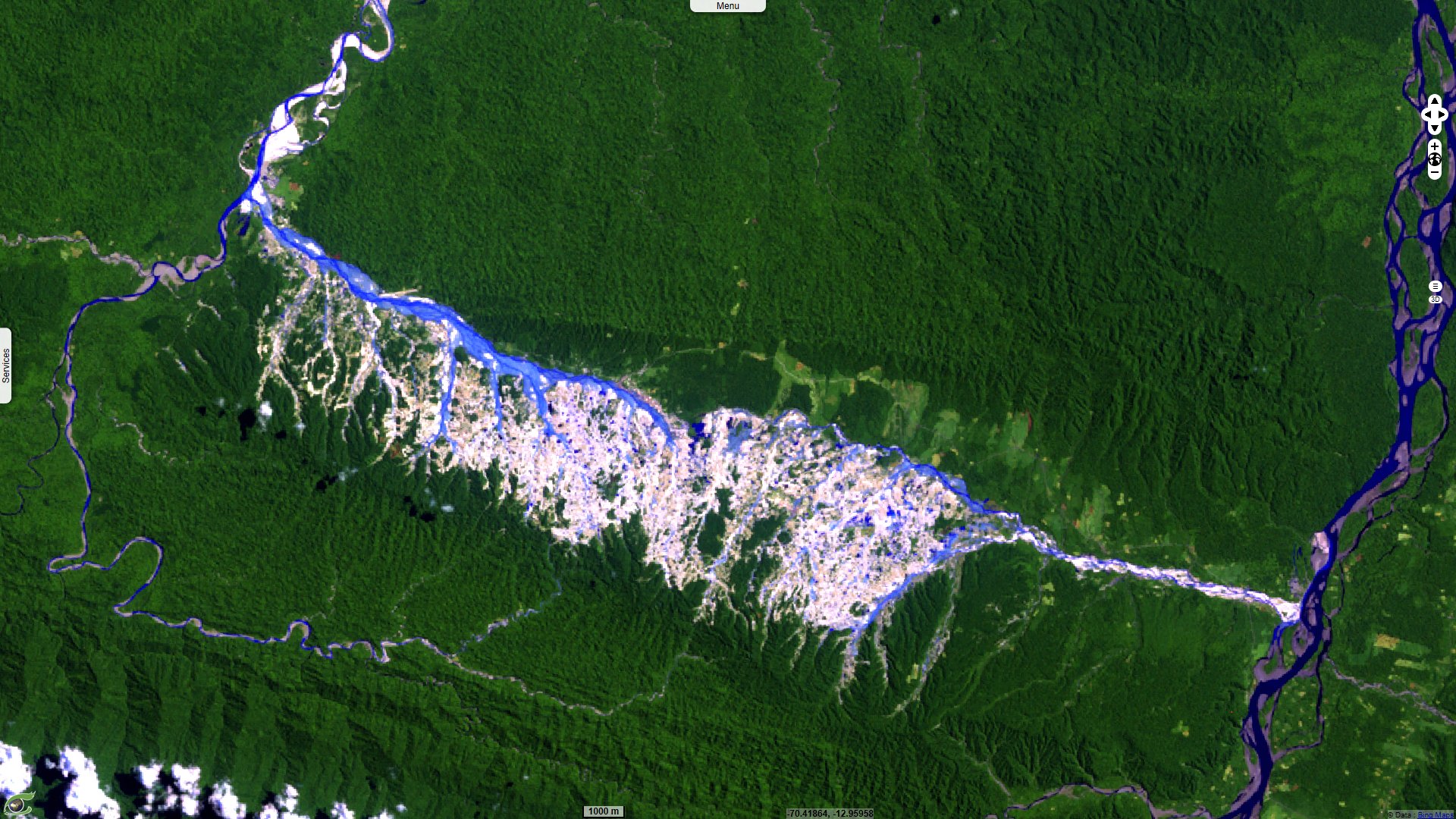
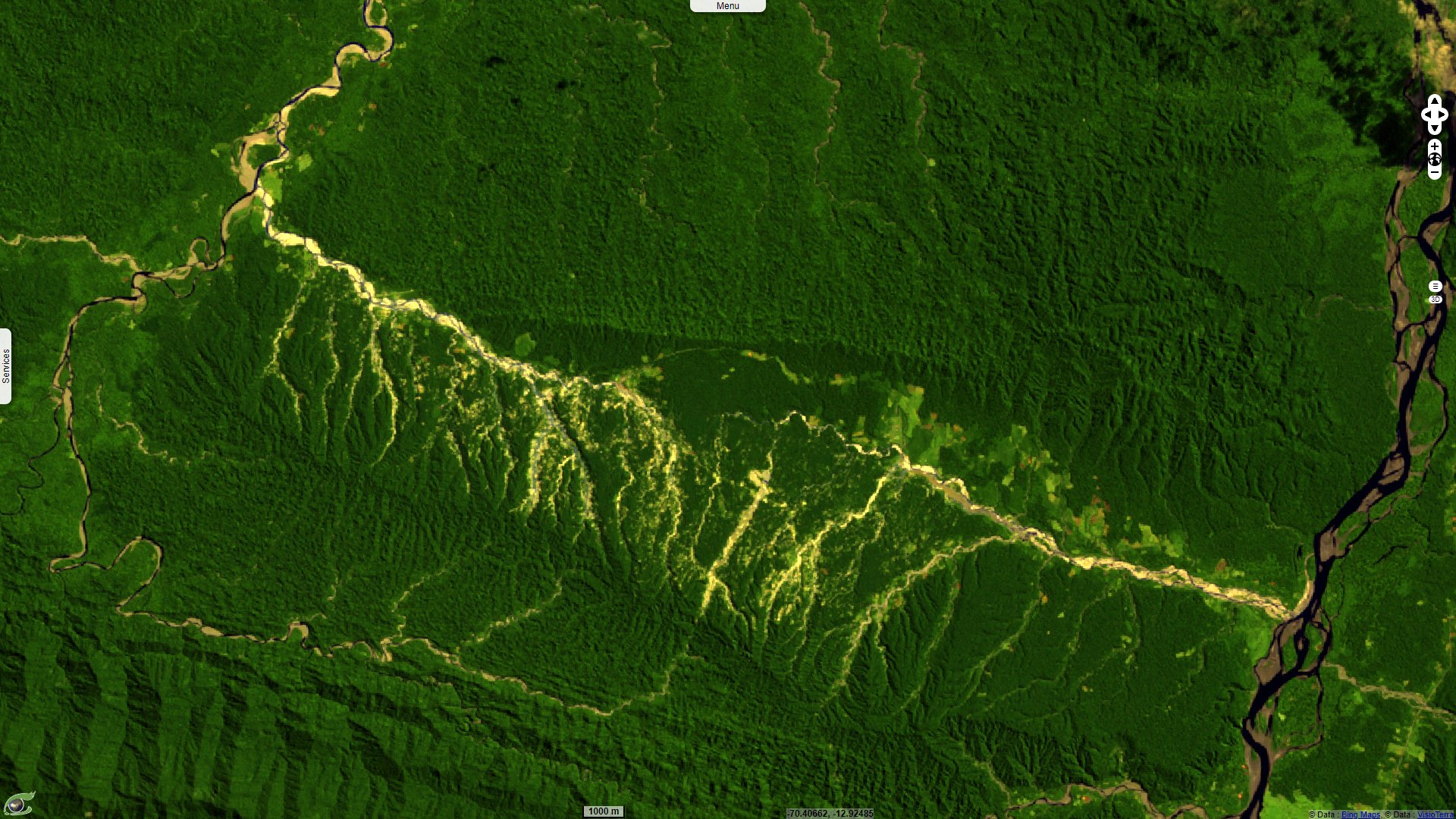
Sentinel-2 MSI acquired on 18 August 2016 at 14:57:32 UTC
...
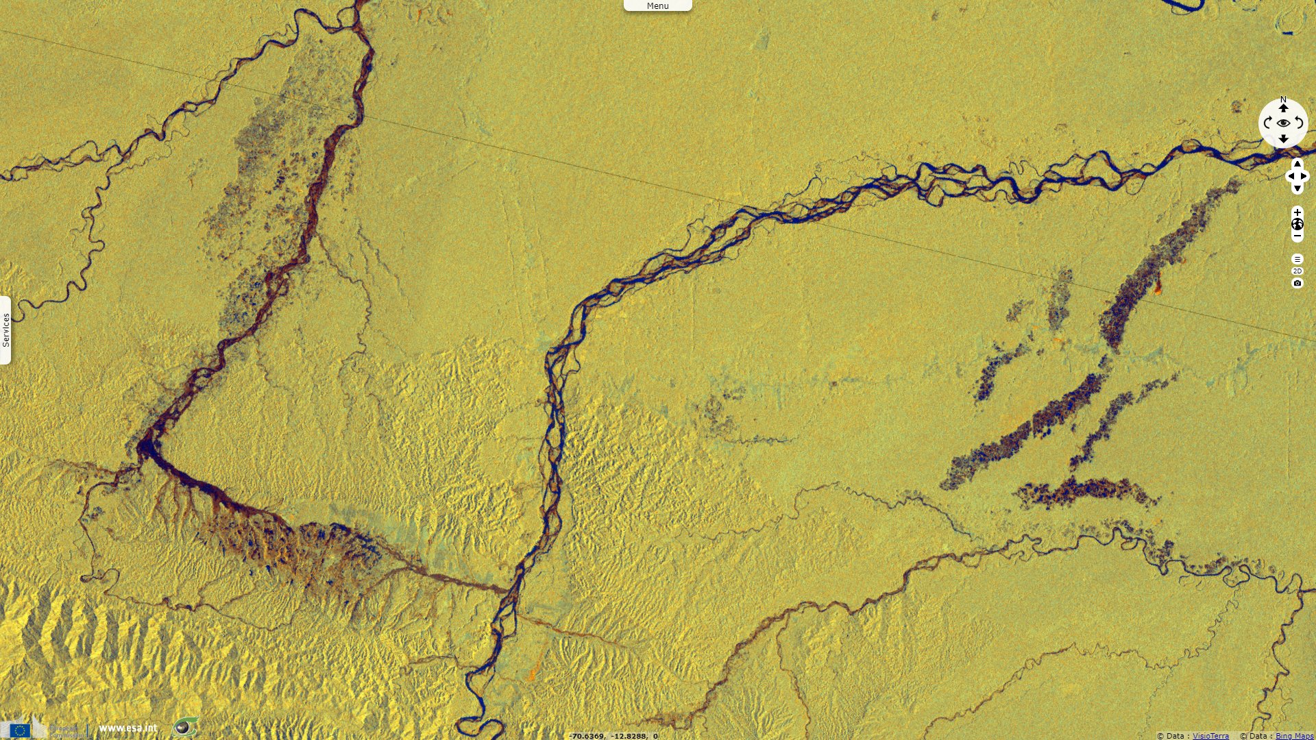
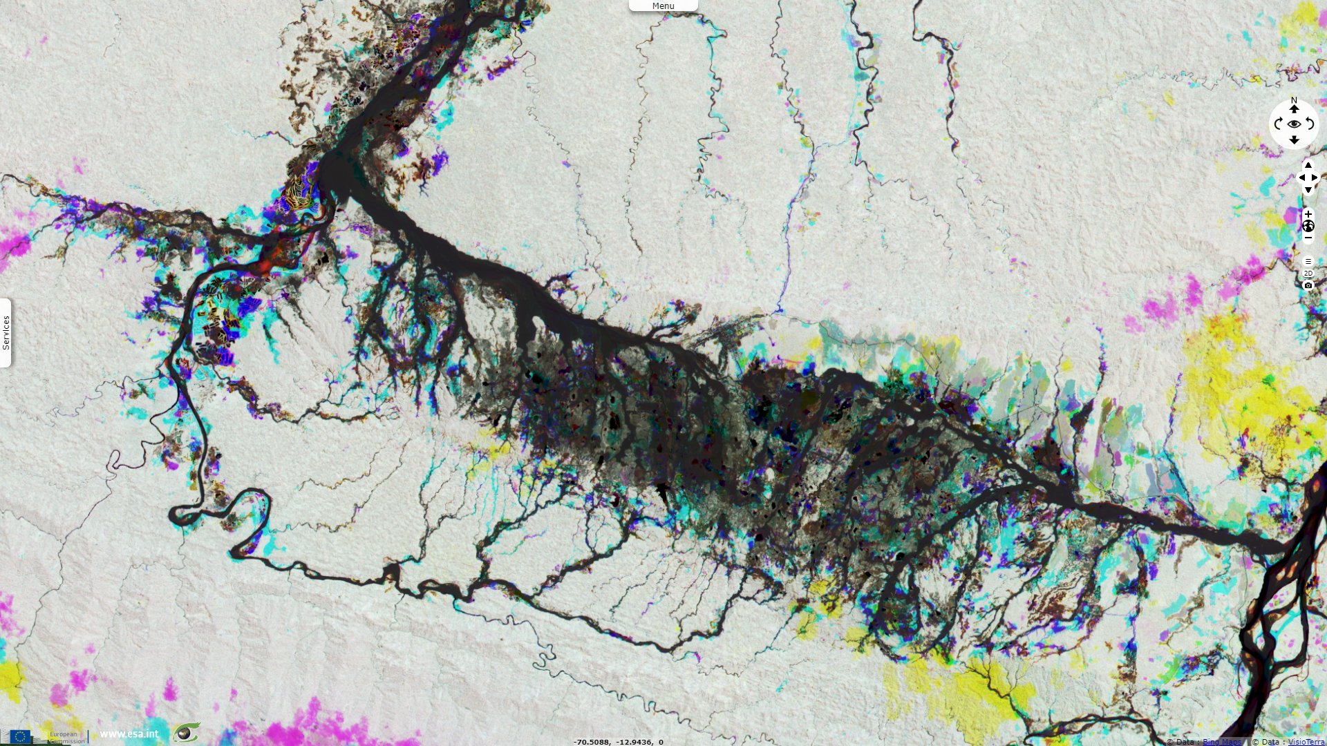
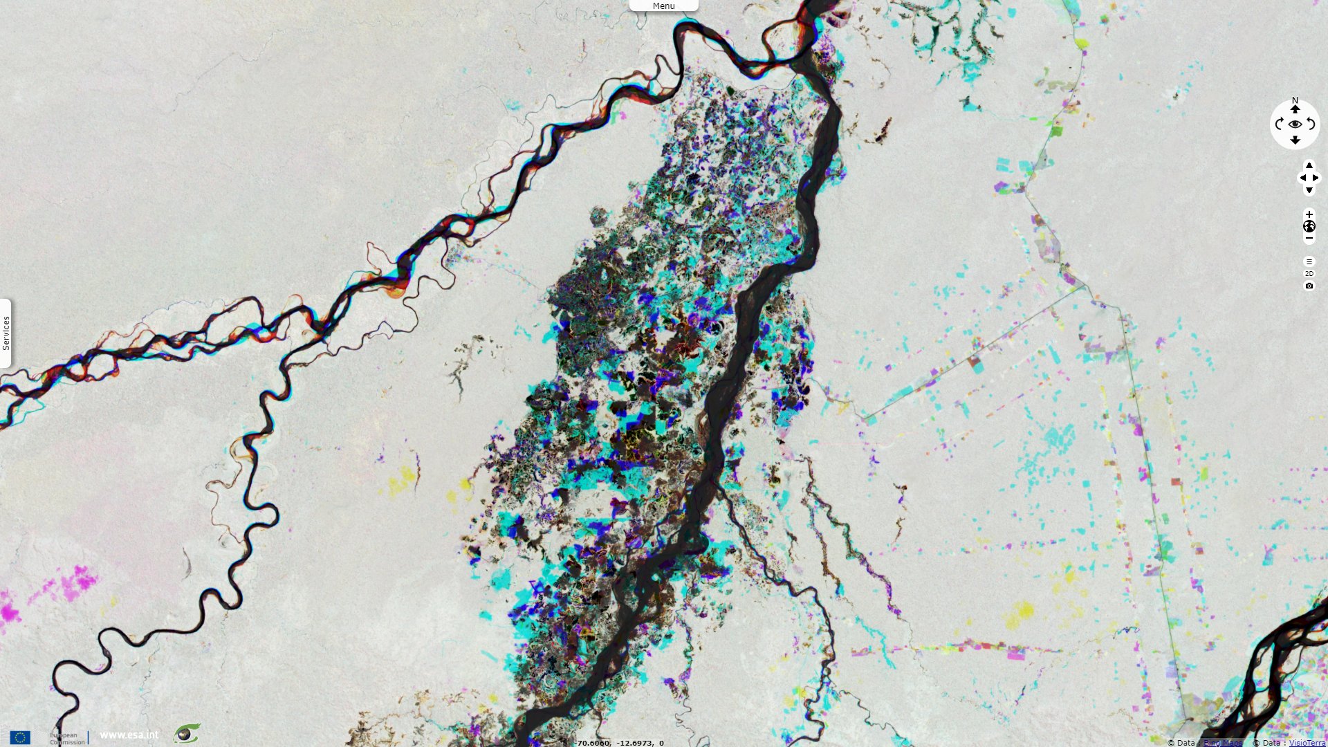
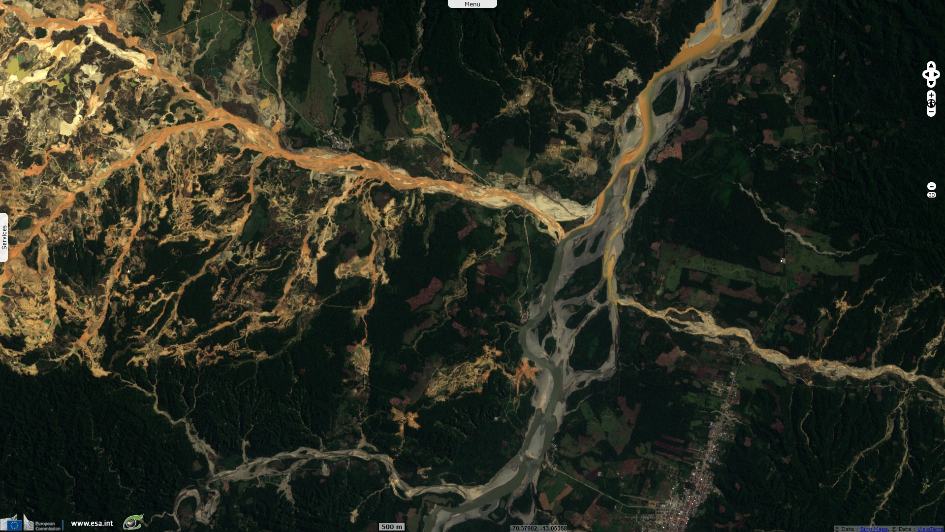
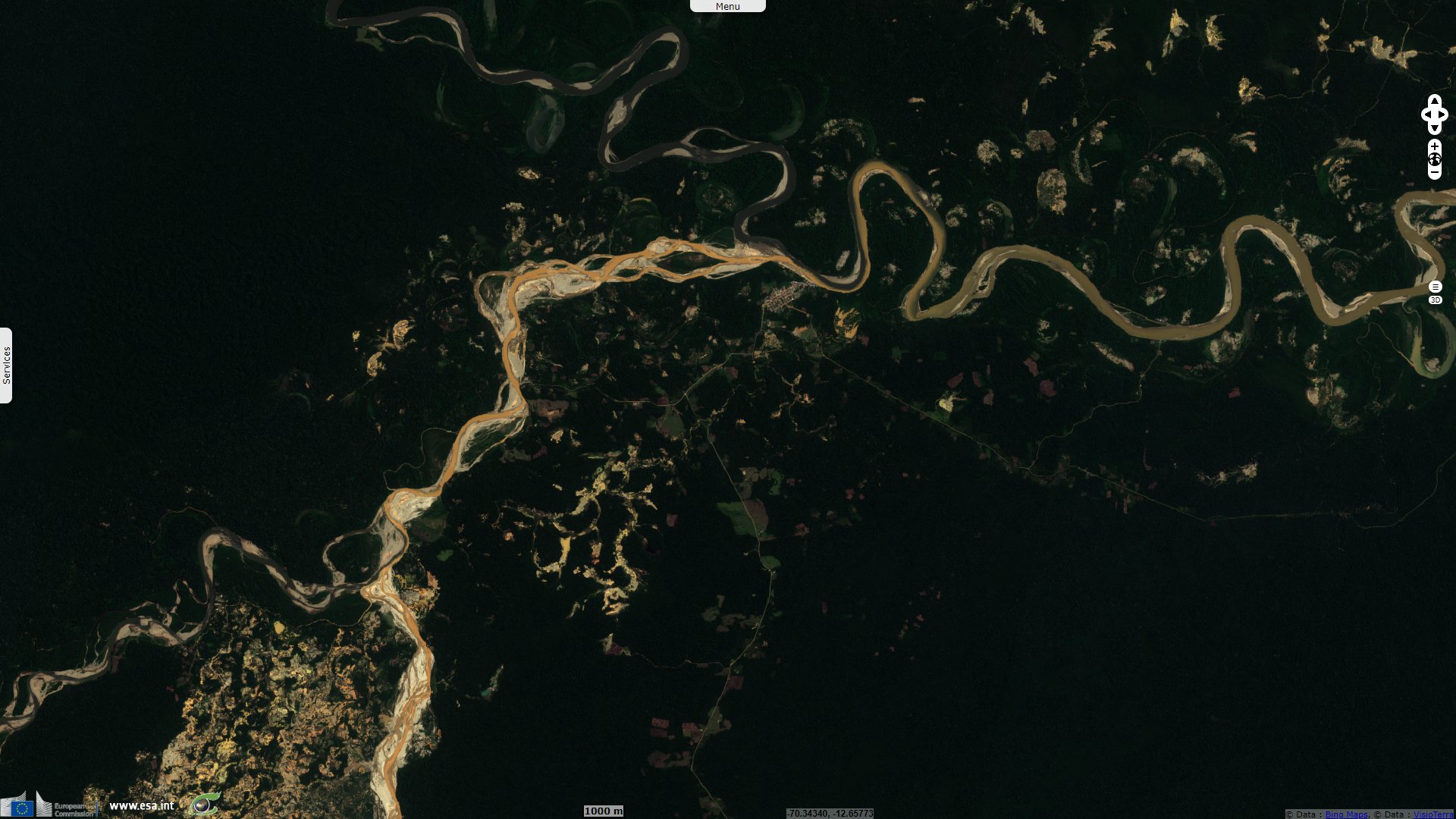
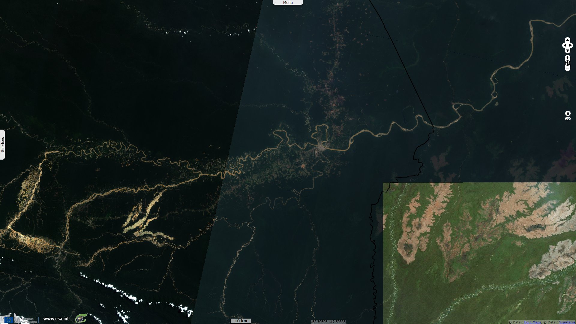
Sentinel-1 CSAR IW acquired on 22 March 2020 at 10:14:19 UTC
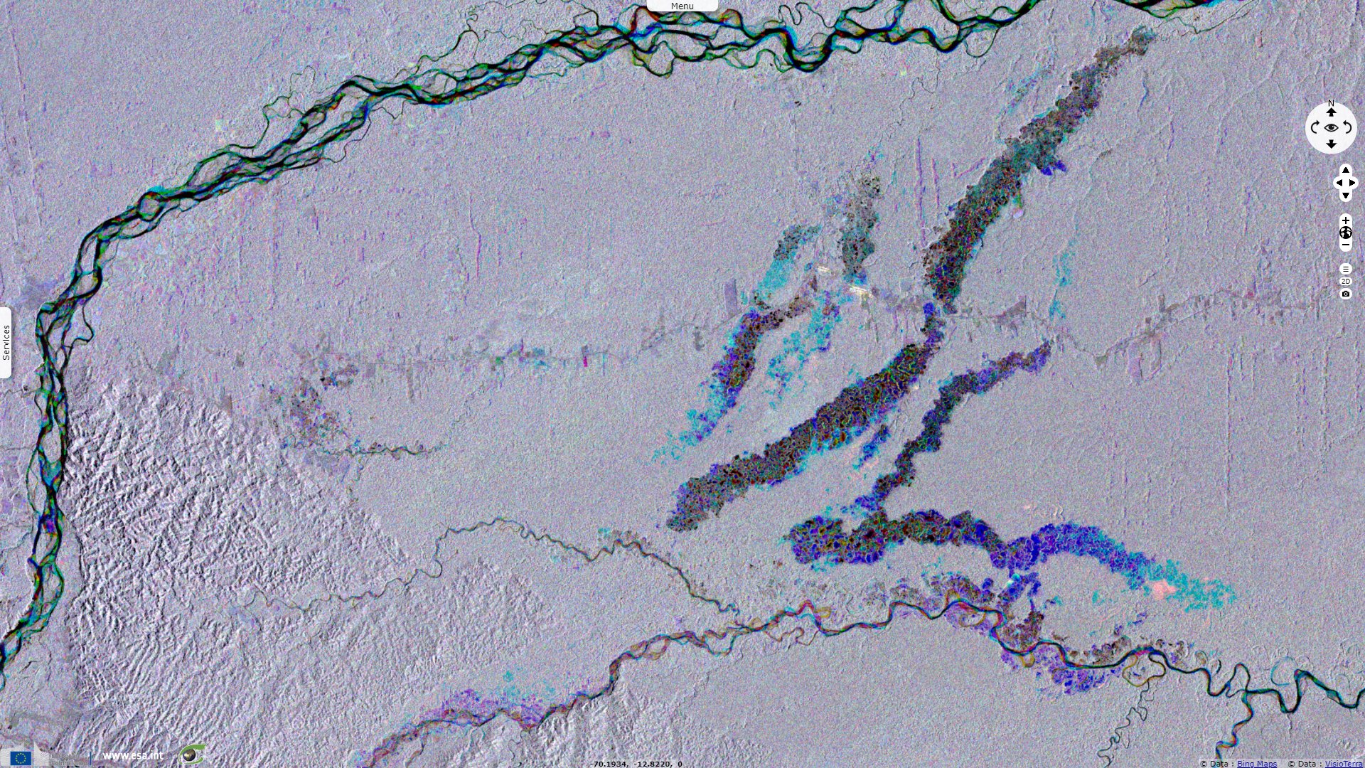
Sentinel-2 MSI acquired on 18 August 2016 at 14:57:32 UTC
...
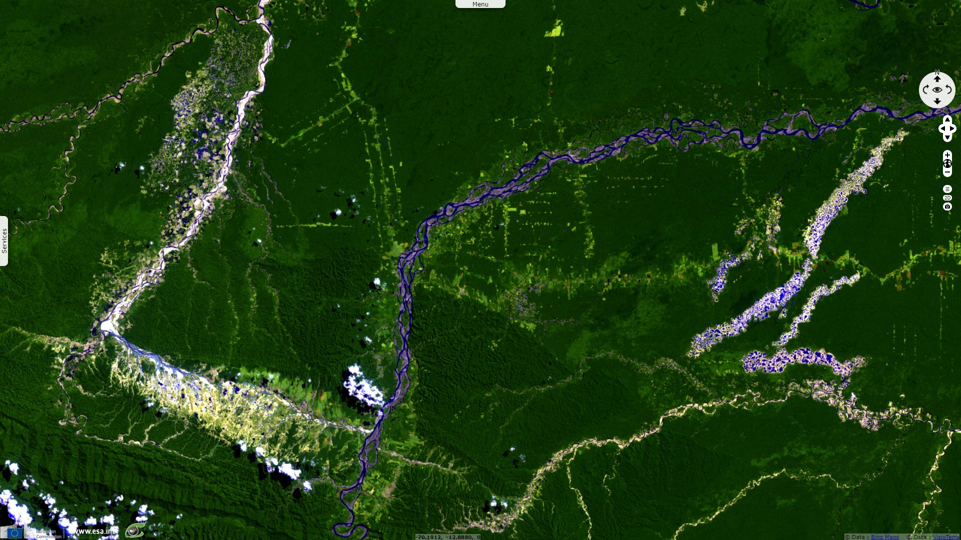
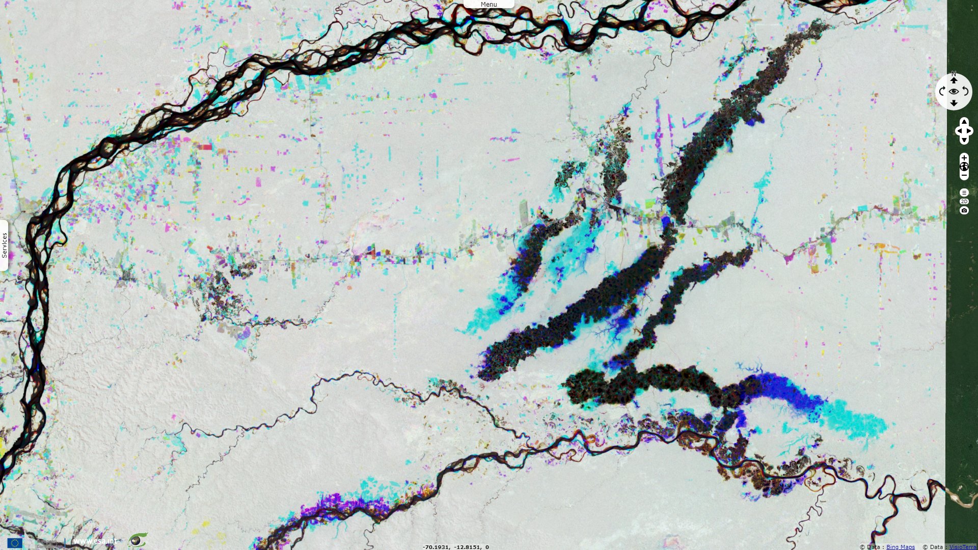
Sentinel-1 CSAR IW acquired on 22 March 2020 at 10:14:19 UTC
Keyword(s): Mine, natural resources, land, forestry, deforestation, water colour, river, pollution, biodiversity, rainforest, UNESCO World Heritage, Peru, Amazon forest.
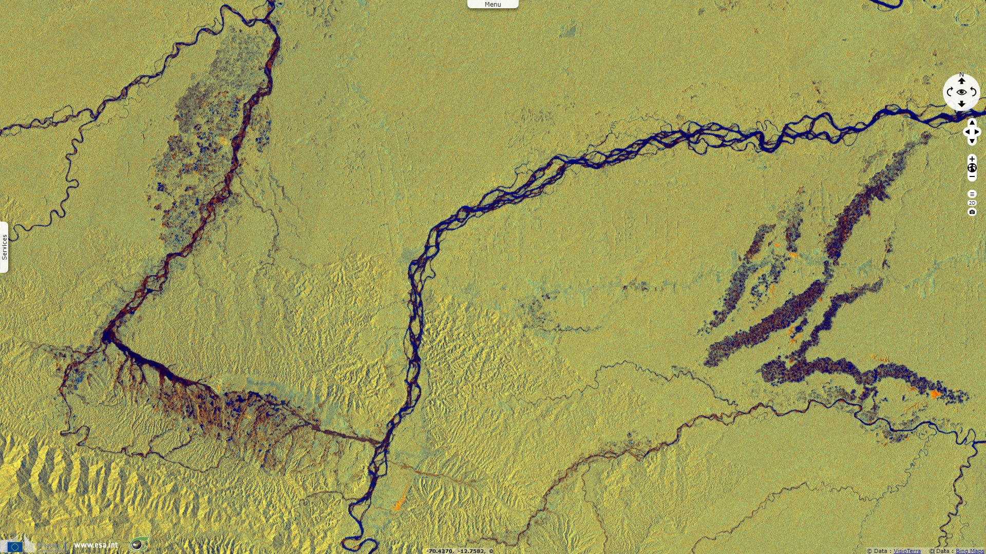
Ed Yong wrote the following in National Geographic published October 28, 2013: "The Madre de Dios region of southern Peru is rich with both life and gold, and the latter threatens the former. A recent gold rush, prompted by skyrocketing prices and enabled by a new highway, have brought tens of thousands of hopeful miners to the region. Back in 2009, scientists showed that the three big mines — Huepetuhe, Guacamayo and Delta-1 — had already claimed 15 500 hectares of forest, and were growing at a rate of 1900 more every year."
"But Greg Asner from the Carnegie Institution for Science—the same scientist who flew me over the Amazon—has found that the situation is even worse. The big mines like Guacamayo are an obvious problem, but thousands of smaller ones have sprung up in the last few years. They’re extremely hard to find or control, and Asner found that they collectively account for more than half the gold-mining in the region."
"'The Ministry of Evnironment estimates that there are 50 000 to 70 000 of these miners in the region,' says Asner. 'They’re working on groups of three to ten, so that’s a lot of mining.' Everyone was focusing on the big, gaping wounds, and ignoring the subtler infections creeping through the Amazon’s skin. The small mines look like deep pits in forest clearings, up to 10 metres deep with debris and mud at the bottom. The miners cut down a small stand of trees, dig away the top layers of soil and blast away at what remains with high-pressured water. They transfer the resulting slurry into an oil drum and add mercury. 'Someone stands in the drum and starts jumping up and down. It’s like squishing grapes,' says Asner."
"The mercury binds to any gold in the mud, which the miners filter out with a pan. The nuggets are dried and heated, releasing even more mercury into the air as a vapour. It’s no surprise that the miners often suffer from mercury poisoning, as do people who live in nearby towns or settlements, or downstream of polluted rivers. And yet, they get gold. 'Five days ago, I ran into an old Peruvian student on the river, and he told me that in some places, there’s half a kilo of gold per hectare, deep down below the forest floor,' he says."
"The mines are also expanding faster than anyone had thought—from a rate of 2 166 hectares per year before the gold price boom of 2008, to a current rate of 6 145 hectares per year. Those estimates are around 40% higher than any previous ones for the region, and they mean that gold mining is now the biggest cause of deforestation in the region, beating out logging or farming. (And that’s ignoring the fact that mining increases the odds of ranching, farming, bushmeat hunting, and environmental damage in nearby areas.)"
"Worse still, the mines are encroaching into new habitats. The big mines like Guacamayo are most found in swampy regions near the main rivers, but the smaller operations are heading deeper into the forest, and higher up the foothills of the Andes. These regions host very different communities of plants and animals, which are now being threatened. The mines are also spreading further up-river, which threatens to pollute more of the waterways with mercury."
Donovan Webster commented for Smithsonian Magazine: "The destruction is more absolute than that caused by ranching or logging, which accounts, at least for now, for vastly more rainforest loss. Not only are gold miners burning the forest, they are stripping away the surface of the earth, perhaps 1.5 metre down. At the same time, miners are contaminating rivers and streams, as mercury, used in separating gold, leaches into the watershed. Ultimately, the potent toxin, taken up by fish, enters the food chain."
"The new Peruvian gold-mining operations are expanding. 'It’s relatively easy to get a permit to explore for gold,' says the Peruvian biologist Enrique Ortiz, an authority on rainforest management. 'But once you find a suitable site for mining gold, then you have to get the actual permits. These require engineering specs, statements of environmental protection programs, plans for protection of indigenous people and for environmental remediation.' Miners circumvent this, he adds, by claiming they’re in the permitting process. Because of this evasion, Ortiz says, 'They have a claim to the land but not much responsibility to it. Most of the mines here — estimates are between 90 or 98 percent of them in Madre de Dios state — are illegal.'"
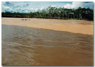
Regarding the nearby Amarakaeri park, ParksWatch adds the following: "Mining has had an enormous impact on the river, as Huaypetue mechanized operations dump sediment into the Puquri River along a stretch of several kilometers. The riverbanks are dug up by miners who have settled there. The water is cloudy and the riverbed is covered with fine sediment and sandbanks, making navigation difficult and causing flooding in the rainy season. Flooding, which is becoming increasingly common, carries sediment into other parts of the forest, covering the ground, whereupon the vegetation withers and dies. This represents a major environmental impact. In the words of the president of the community of Barranco Chico, 'miners invade, cut wood, hunt, fish and do whatever they want.'"
"Forestry is one of the main business activities in the area and is done in a very rudimentary fashion. It is selective and is aimed at the most commercially valuable species such as mahogany and cedar." "The native communities of San José del Karene, Puerto Luz and Barranco Chico suffer the impact of gold mining within their community territories. Mining affects their land as well as hunting and fishing. Migrants have settled in native territory to look for gold, forming small gold panning associations in each site."
"In the past two years alone, more than 184 square kilometers of forest have been destroyed in southern Peru, according to the analysis by the Monitoring of the Andean Amazon Project (MAAP)." According to an article written by Yvette Sierra Praeli for Mongabay on 6 March 2019.
Elie Gardner reported for Nature: "At stake are broad swathes of fertile rainforest, including that in the Tambopata National Reserve and Manu National Park, which is the largest national park in Peru and has been designated a World Heritage Site by the United Nations Educational, Scientific and Cultural Organization. 'This is the epitome of a healthy ecosystem,” says Enrique Ortiz, vice-president of the Amazon Conservation Association, based in Washington DC. “It’s the capital of biodiversity.'


Right: "The regional extent and occurrence of small and large mines throughout the southern Madre de Dios region. " - Source: Asner et al 2013.
In the scientific article Gold Mining in the Peruvian Amazon: Global Prices, Deforestation, and Mercury Imports published in Public Library of Science on April 19, 2011, Jennifer J. Swenson detailed: "From 2003 to 2009, mining in the two sites has converted ~6600 ha of primary tropical forest and wetlands, to vast expanses of ponds and tailings. In conjunction with annual rate of increase in gold prices of ~18%/yr, forest conversion to mining in these sites increased six-fold from 2003–2006 (292 ha/yr) to 2006–2009 (1915 ha/year). From 2002 to 2009 gold prices were significantly related to mercury imports (R² = 0.93, mercury Imports = 80.77 + 0.0054 e(0.0105*gold price) p=0.04. Given the past rates of gold price and mercury imports, we predict future mercury import increases of 64% for 2010 (estimated ~280 t/yr), which may nearly double by 2011 (based on 18% increase in 2011 gold price."
"The three mining sites combined (Guacamayo, Colorado-Puquiri, and Huepetuhe) totaled ~15,500 ha of mined area as of August 2009. The large mining sites farthest west lie partially inside the buffer zone <7 km from the Amarakaeri Communal Reserve and <70 km from Manu National Park Biosphere Reserve. Numerous smaller sites are scattered throughout riparian and wetland areas within the area which have the potential to grow spontaneously in the future."
Mongabay also highlighted the risk of mercury poisoning. On 4 August 2015 with an article written by Mrinalini Erkenswick Watsa: "Recent calculations by the Ministry of the environment revealed that 40.5 metric tons of mercury enters the Madre de Dios River annually, which amounts to 5.6% of the world’s mercury pollution produced by artisanal mining. This mercury then enters a range of organisms that live in the river, eventually accumulating in high levels in animals that occupy the top rungs of the food chain." And on 2 February 2015 with previous one by Jeremy Hance: "'The main message is that people likely need to avoid eating regular meals of carnivorous fish downstream from mining activities—not just a few kilometers downstream, but hundreds of kilometers downstream,' co-author William Pan"

Left: "A view shows an illegal gold mining camp during a police operation to destroy illegal machinery and equipment used by wildcat miners in Madre de Dios, Peru, February 19, 2019" - Source: Cristobal Bouroncle / Reuters.
Right: Puquiri River, note the sedimentation - Source: ParksWatch.
The views expressed herein can in no way be taken to reflect the official opinion of the European Space Agency or the European Union.
Contains modified Copernicus Sentinel data 2026, processed by VisioTerra.
Contains modified Copernicus Sentinel data 2026, processed by VisioTerra.
| More on European Commission space: |  |
 |
 |
||||
| More on ESA: | |
|
|
S-1 website | S-2 website | S-3 website | |
| More on Copernicus program: | |
|
|
Scihub portal | Cophub portal | Inthub portal | Colhub portal |
| More on VisioTerra: | |
|
|
Sentinel Vision Portal | Envisat+ERS portal | Swarm+GOCE portal | CryoSat portal |