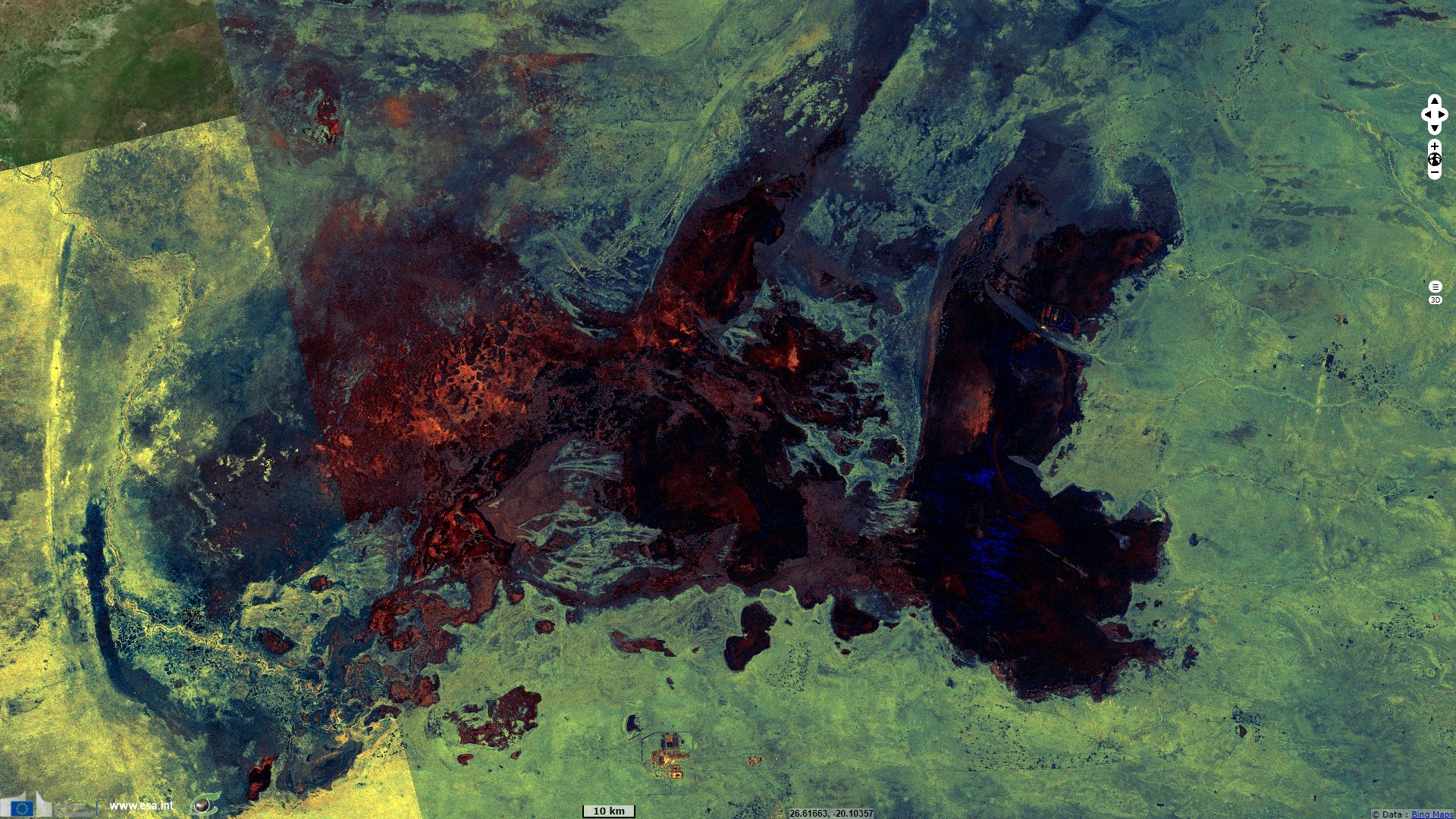
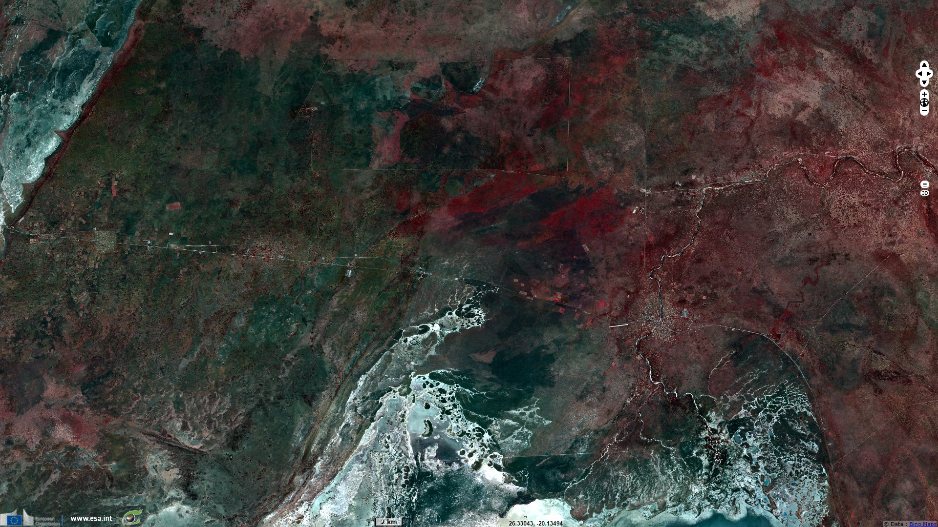
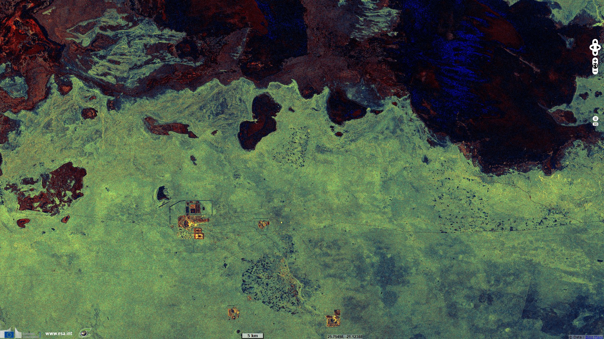
Makgadikgadi Pan, World's largest salt pans, Botswana
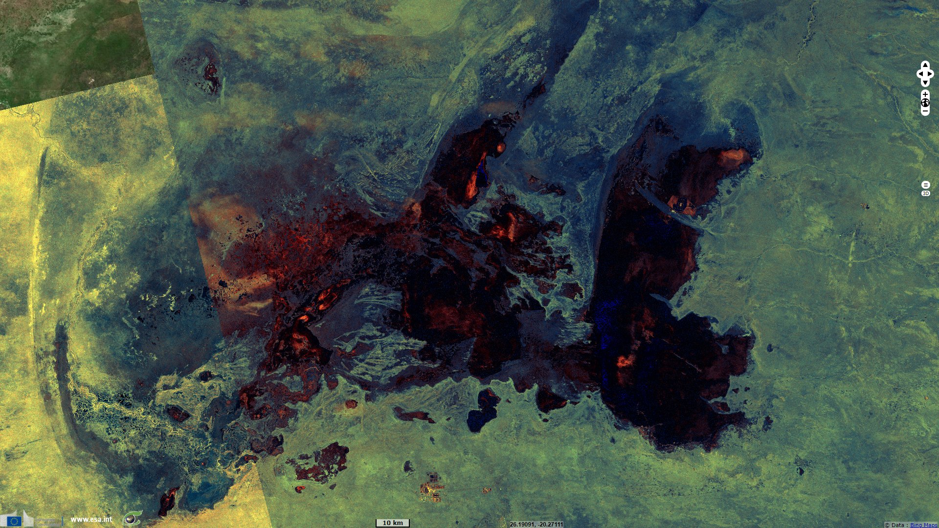
Sentinel-1 CSAR IW acquired on 14 April 2020 at 16:48:02 UTC
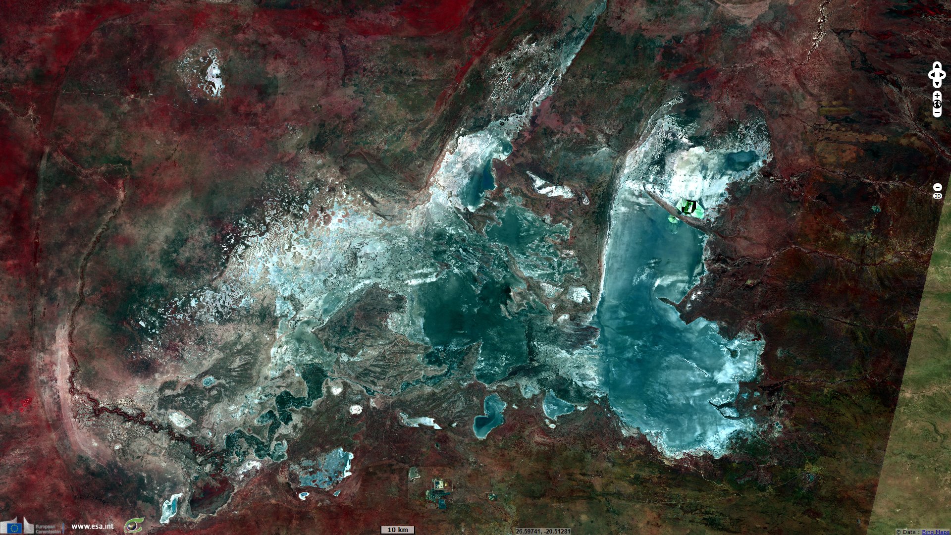
Sentinel-2 MSI acquired on 17 April 2020 at 08:05:59 UTC
...
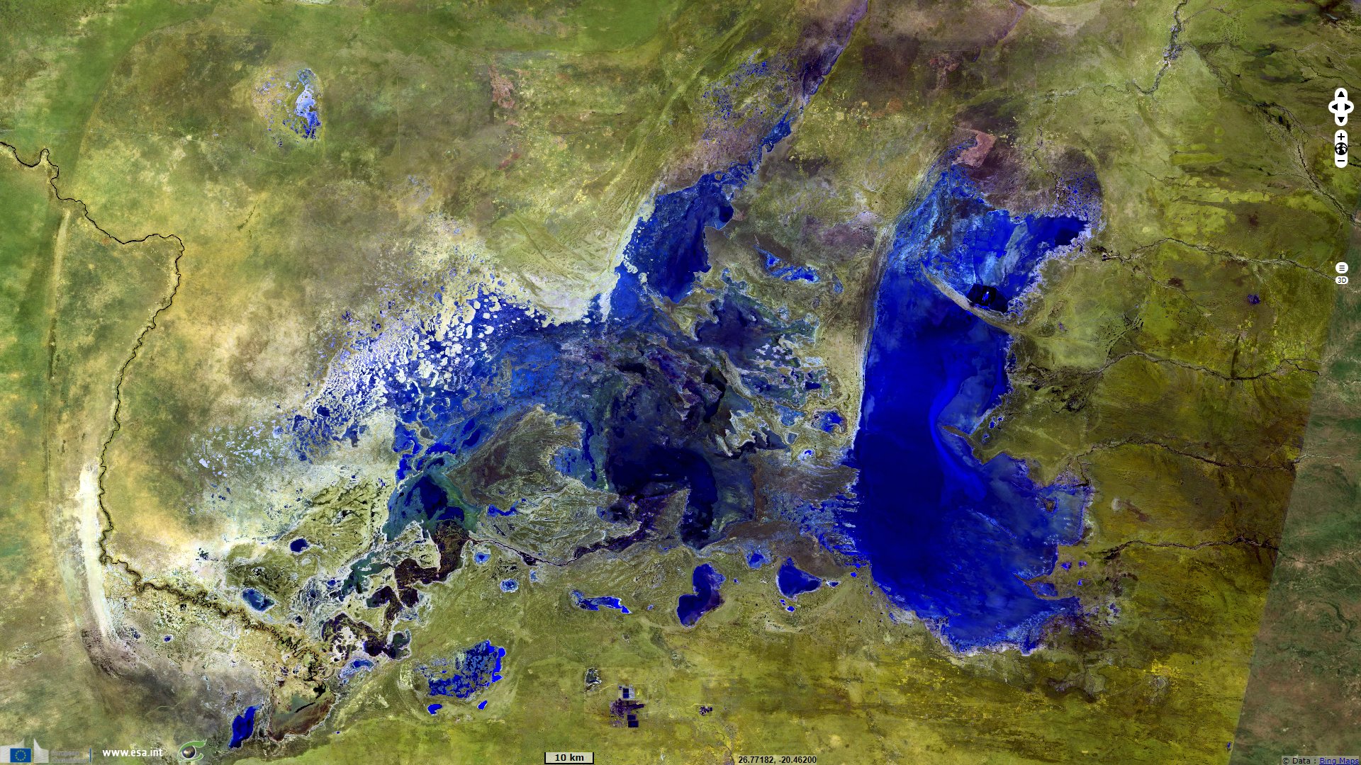
Sentinel-2 MSI acquired on 09 October 2020 at 08:08:41 UTC
Sentinel-1 CSAR IW acquired on 11 October 2020 on 16:47:46 UTC
Keyword(s): Salt lake, salt flats, land, endorheic basin, biodiversity, National Park, Kalahari Desert, Botswana
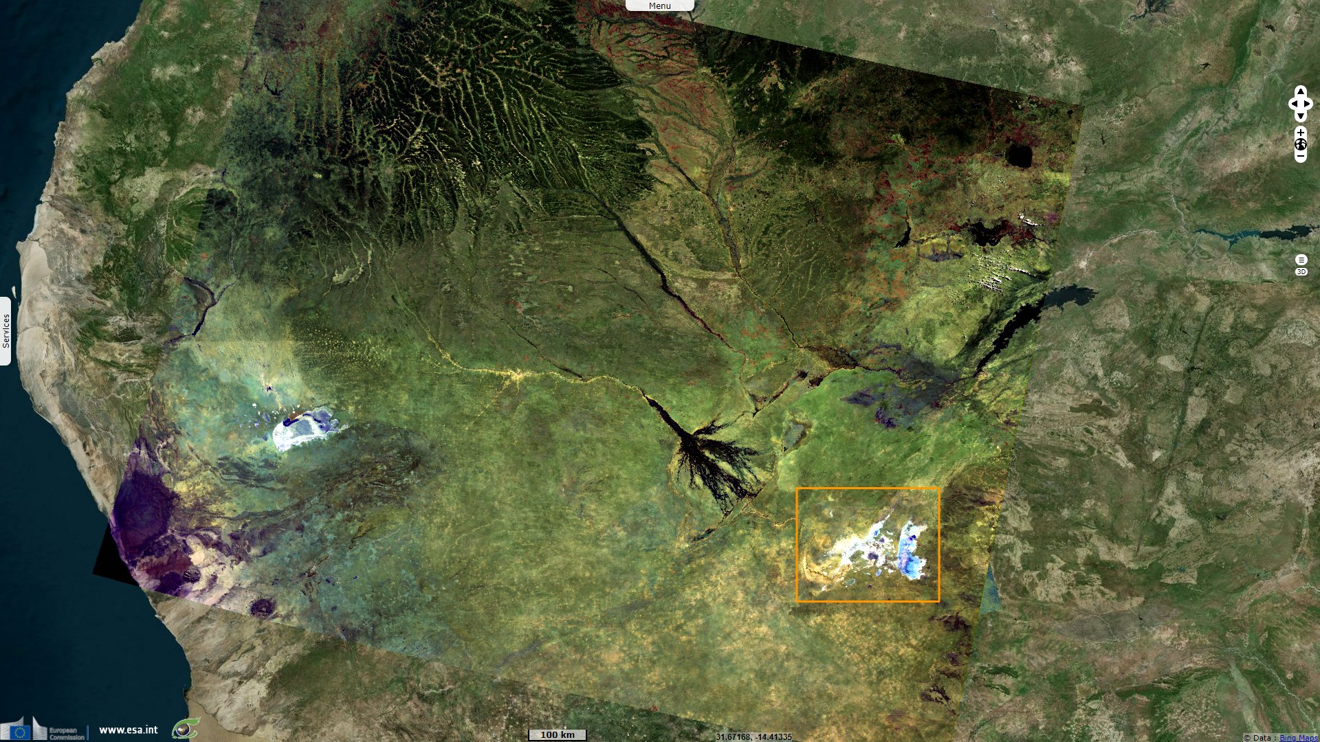
As the largest salt pans in the world, an important area for fauna and an archaeological site, Makgadikgadi Pans are on the UNESCO tentative listand it is in the process of becoming a Ramset wetland. Its UNESCO sheet describes it as follows: "Makgadikgadi Pans Landscape is located in thenorth-east of the Central Kalahari Game Reserve and south-east of the Okavango Delta. It is linked to Okavango Delta by the Boteti River andsupplied with water from Zimbabwe by the ephemeral Nata River. This makes the area the largest salt pans in the world covering an area of over30 000 km² and one of the former largest inland sea in the world."
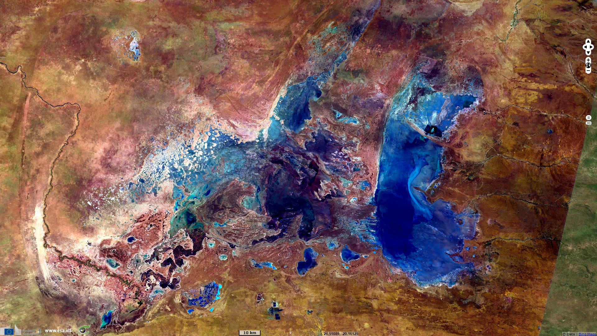
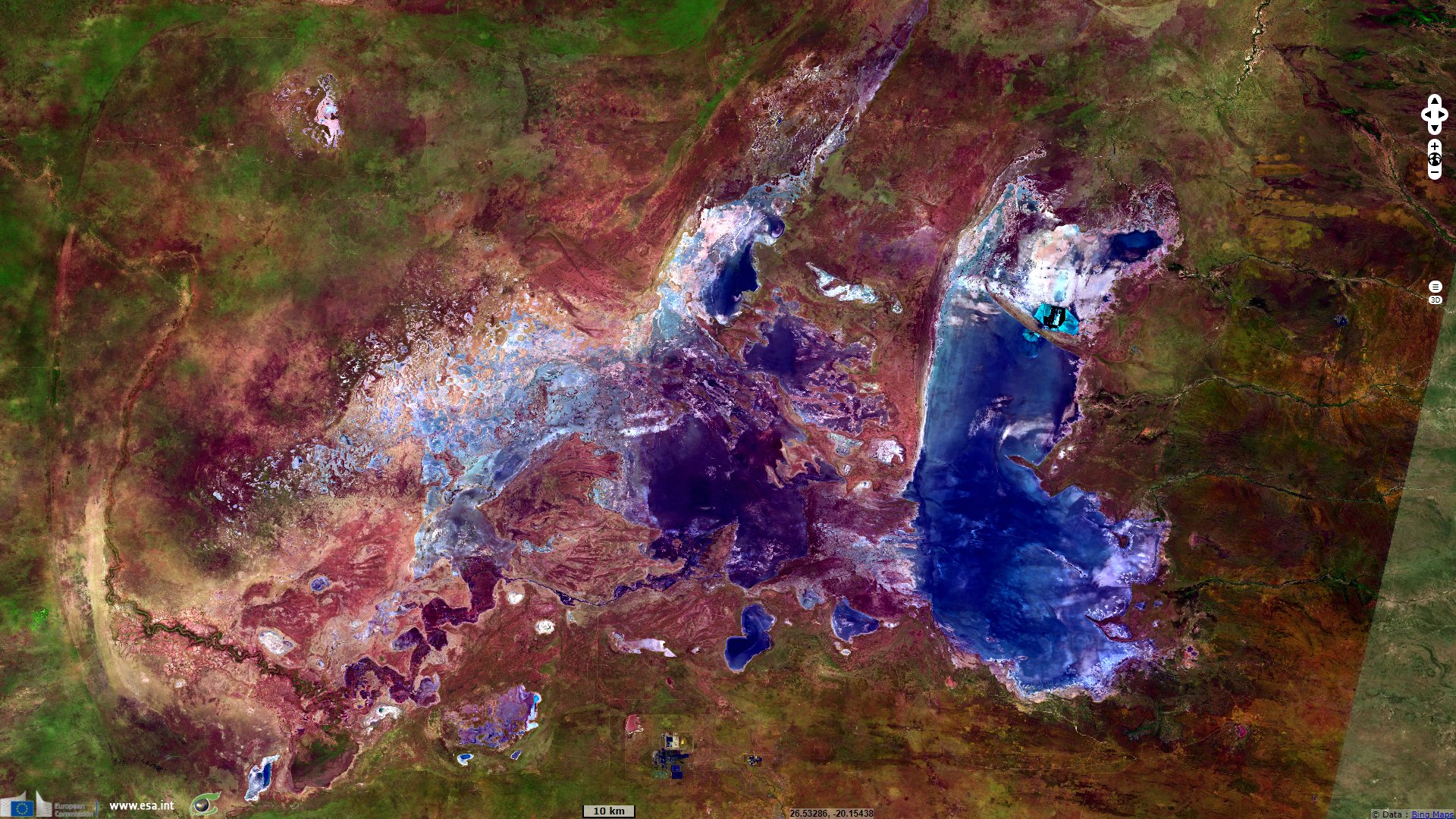
"Makgadikgadi Salt Pans are the largest salt pans in the world and display a unique expanse of landscape with fascinating natural scenic beauty. Ithas a dramatic geological and climatic history in the sense that in its initial stages of development, it was one of the largest inland sea in theworld covering over 275 000 km²."
"Makgadikgadi Salt Pans landscape is a superlative natural phenomenon that is of exceptional natural beauty with expanse of flat white bakedfeatureless surface. The Makgadikgadi Pans landscape provides a spectacular contrasting scenario during wet and dry seasons whereby one of the two major pans, Sowa, becomes flooded and turns into a sea of endless waters during wet summer season while during dry winter season thepans become white baked producing clouds of dust that travels as far as Johannesburg in South Africa."
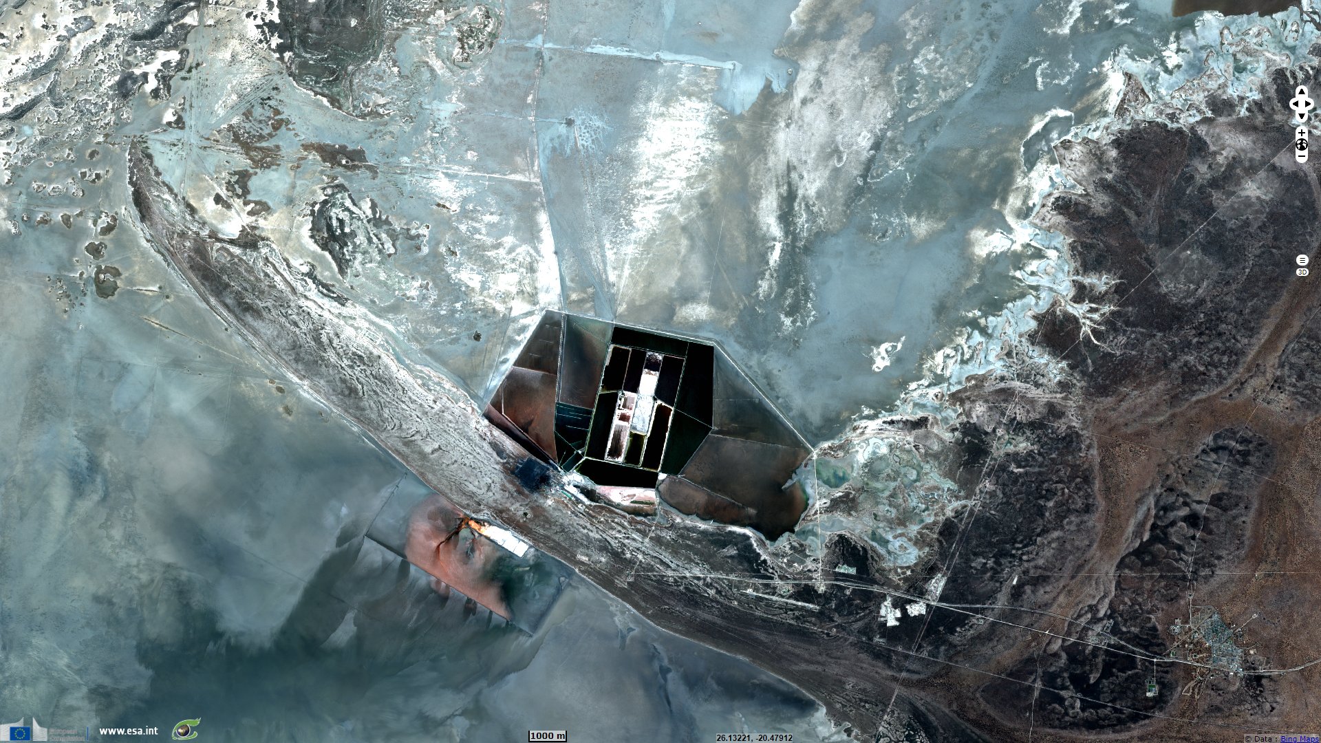
"Makgadikgadi Salt Pans present a major geologic tectonic activity that led to diversion of major inflowing rivers subsequently resulting in drying upof what used to be the greatest inland lake to the largest salt pan in the world. It also presents a record of life as evidenced by diverse fossilisedanimal foot-prints and combined fossils of macro-mammals and stone tools."
"The geology of the area consists of granite basement, flanked by the Karoo rocks, within the Kalahari Sand. The area comprises relics of paleo-climatic and ecological processes, harbours unique and threatened plant species (Hoodia, baobabs of historical importance). It is a breeding place forflamingos and major habitat for various wildlife species." according to UNESCO.
"Makgadikgadi Salt Pans contain some of the most important natural habitats for in situ conservation such as Makgadikgadi National Parks, NxaiPan National Park and particularly the Nata Bird Sanctuary which is one of the largest breeding sites of Lesser and Greater flamingo in the world."
"It is one of the most diverse in terms of ecological habitats ranging from the Lesser and Greater Flamingo breeding and feeding area to one of themost spectacular zebra-wildebeest migration on Earth as they move from Boteti River to Chobe during dry season."
"The Makgadikgadi Pans has evidence of traditional human habitation and land use dating from the Early Stone Age to the historic times. Onerecorded prehistoric settlement has one of the largest concentrations of cultural material comprising 500 individual stone wall structures and 450stone cairns."
"The Botswana Government aspires to maintain the Makgadikgadi Salt Pans in its natural form and cultural material context by continuallyreviewing management plans and encouraging research focused on conservation and management of the area. Plans are underway to formulate anintegrated management plan that will also facilitate the site to being declared a Ramsar Site. Currently a framework management plan which willinform the above stated plan is under compilation and will be completed by the end of 2010."
The views expressed herein can in no way be taken to reflect the official opinion of the European Space Agency or the European Union.
Contains modified Copernicus Sentinel data 2026, processed by VisioTerra.
Contains modified Copernicus Sentinel data 2026, processed by VisioTerra.
| More on European Commission space: |  |
 |
 |
||||
| More on ESA: | |
|
|
S-1 website | S-2 website | S-3 website | |
| More on Copernicus program: | |
|
|
Scihub portal | Cophub portal | Inthub portal | Colhub portal |
| More on VisioTerra: | |
|
|
Sentinel Vision Portal | Envisat+ERS portal | Swarm+GOCE portal | CryoSat portal |