Unusual landscapes of the Namib Desert
Sentinel-2 MSI acquired on 15 June 2018 at 09:05:49 UTC
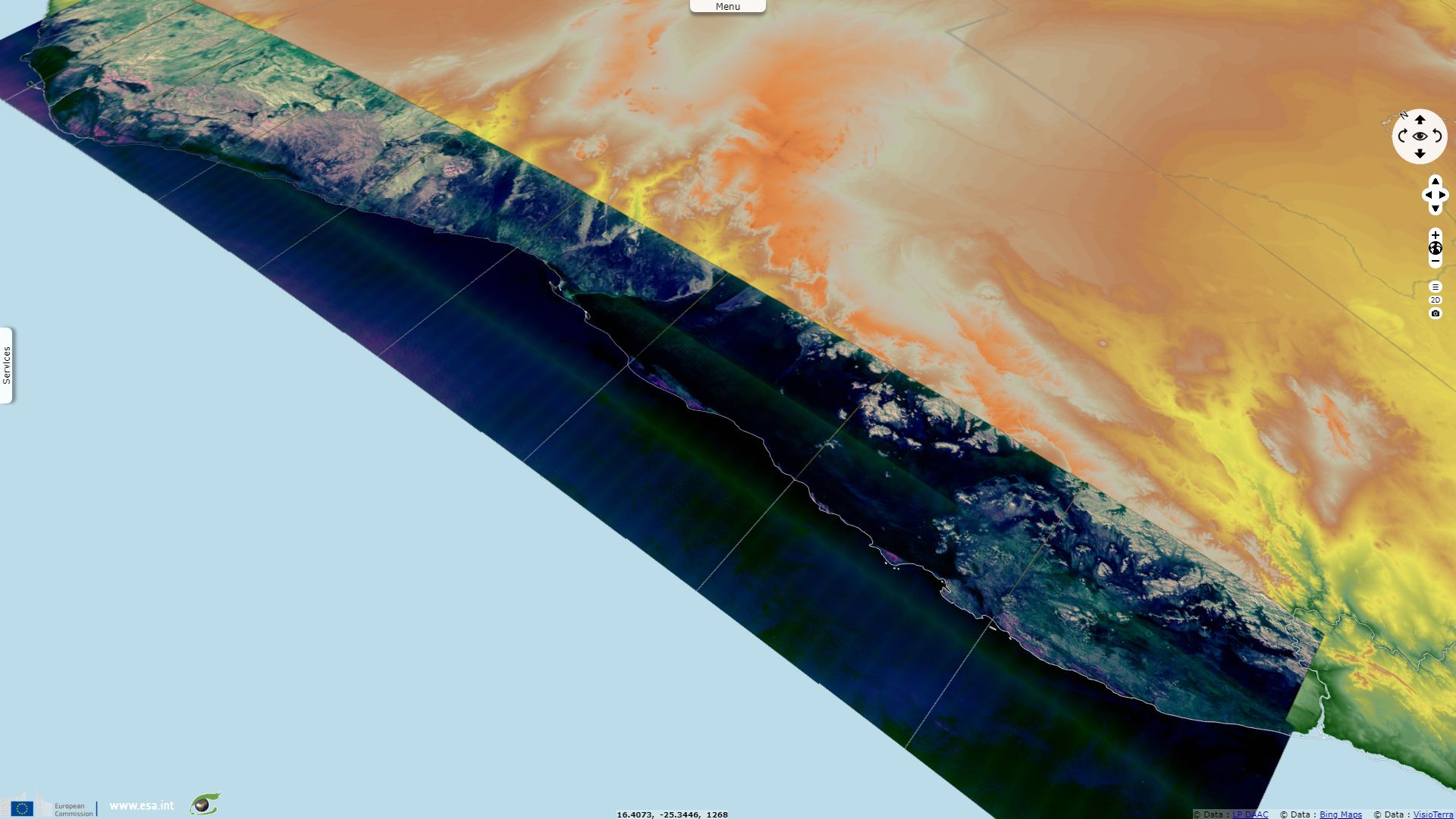
Sentinel-3 OLCI FR acquired on 03 October 2018 from 08:42:33 to 08:45:33 UTC
Sentinel-2 MSI acquired on 24 October 2018 at 08:40:19 UTC
Sentinel-2 MSI acquired on 27 October 2018 at 08:50:39 UTC
Sentinel-1 CSAR IW acquired on 28 October 2018 from 17:35:03 to 17:38:27 UTC
Sentinel-3 OLCI FR acquired on 03 October 2018 from 08:42:33 to 08:45:33 UTC
Sentinel-2 MSI acquired on 24 October 2018 at 08:40:19 UTC
Sentinel-2 MSI acquired on 27 October 2018 at 08:50:39 UTC
Sentinel-1 CSAR IW acquired on 28 October 2018 from 17:35:03 to 17:38:27 UTC
Keyword(s): Land, coastal, hydrology, desert, river, erg, sand dunes, Ramsar wetland, Namibia, Angola, South Africa, Atlantic
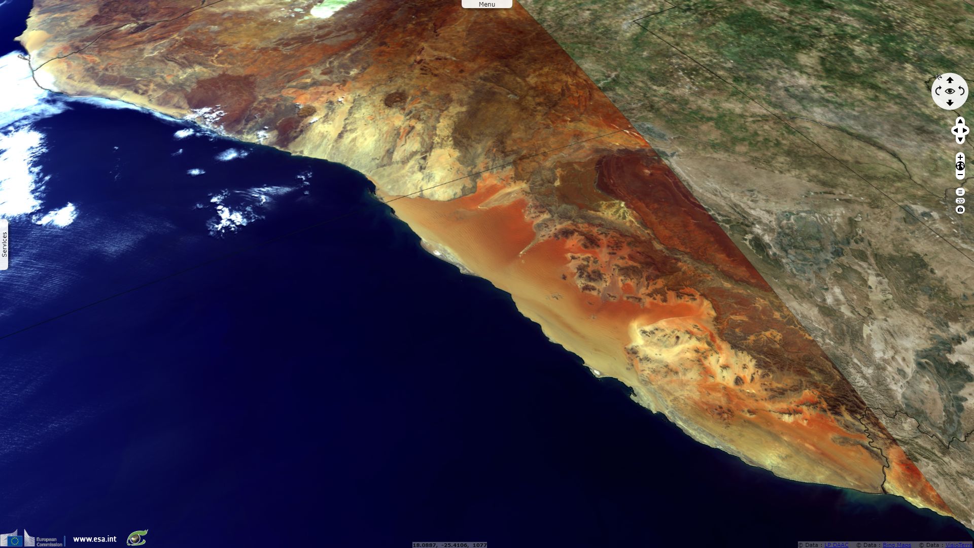
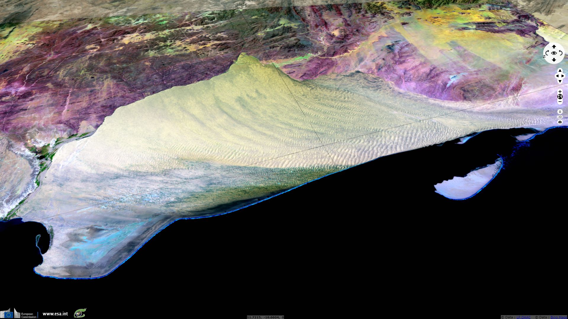
"The Namib Desert ecoregion extends along the coastal plain of western Namibia, from the Uniab River in the north to the town of Luderitz in the south. It extends inland from the Atlantic Coastline to the foot of the Namib Escarpment, a distance of between 80 and 200 km. The ecoregion can be divided into two areas: the Central Namib (from the Uniab to the Kuiseb Rivers) and the Southern Namib (from the Kuiseb River to the town of Luderitz). In the north, the Central Namib merges with the Northern Namib or Kaokoveld Desert ecoregion, and in the south it merges with the Succulent Karoo ecoregion, which extends up the west coast of South Africa."
"The most important climatic feature of the Namib Desert is its sparse and highly unpredictable annual rainfall. The annual mean ranges from 5 mm in the west to about 85 mm along its eastern limits (Lovegrove 1993). There is extraordinary variation in rainfall between years, with the driest areas of the desert having the highest variation. The low rainfall of the Namib has two causes.
- Firstly, the easterly trade winds emerging over the Indian Ocean lose most of their humidity when rising over the eastern escarpment of the Drakensberg Mountains in South Africa. On their way over the continent, they lose further moisture and reach the western escarpment of Namibia warm and dry. These air masses move down onto the low-lying Namib and produce extremely hot and dry winds.
- Secondly, the prevailing local southwesterly winds, cooled down by the Benguela current along the west coast of South Africa, produce an inland movement of cold air, which is overlain by the warmer, lighter air. This inversion prevents the convectional rise of the cool, humid air and thus no clouds are formed (von Willert et al. 1992). The cool air does, however, regularly form a stable layer of fog, which is blown inland as far as 50 km. This coastal fog is the life-blood in the Namib and is an important factor contributing to the remarkably high diversity of animal life in this extremely arid environment (Lovegrove 1993).
"Based on coastal fog, the Namib can be divided into three areas running from west to east: coastal, central, and inland. The coastal area has a mean annual rainfall of 2 to 20 mm and has thick fog on more than 180 days of the year. Air temperatures are low as a result of the cool air coming off the Benguela Current, and daily and seasonal temperature changes are minimal, with daily highs and lows differing by as little as 2° to 5°C (Barnard 1998). Up to about 50 km inland the mean annual rainfall increases from 20 mm to 50 mm. Fog, while still important to desert organisms, occurs on only about 40 days in the year. Still further inland, fog is rare, and the mean annual rainfall increases from 50 mm to a maximum of 85 mm in places. Daily and seasonal temperatures increase sharply and become highly variable, with temperatures of below 0° and above 50°C recorded at one location (von Willert et al.1992)."
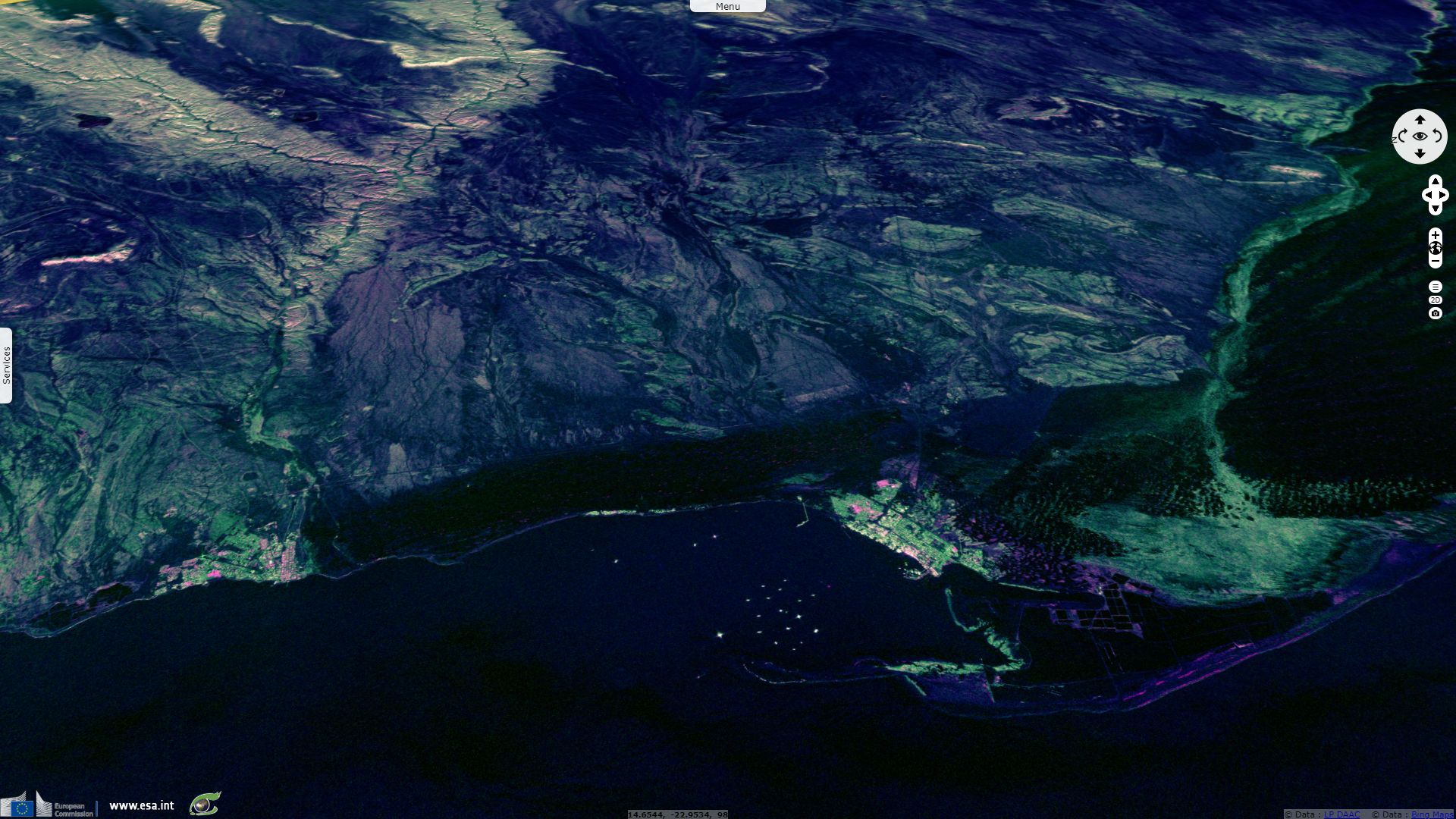
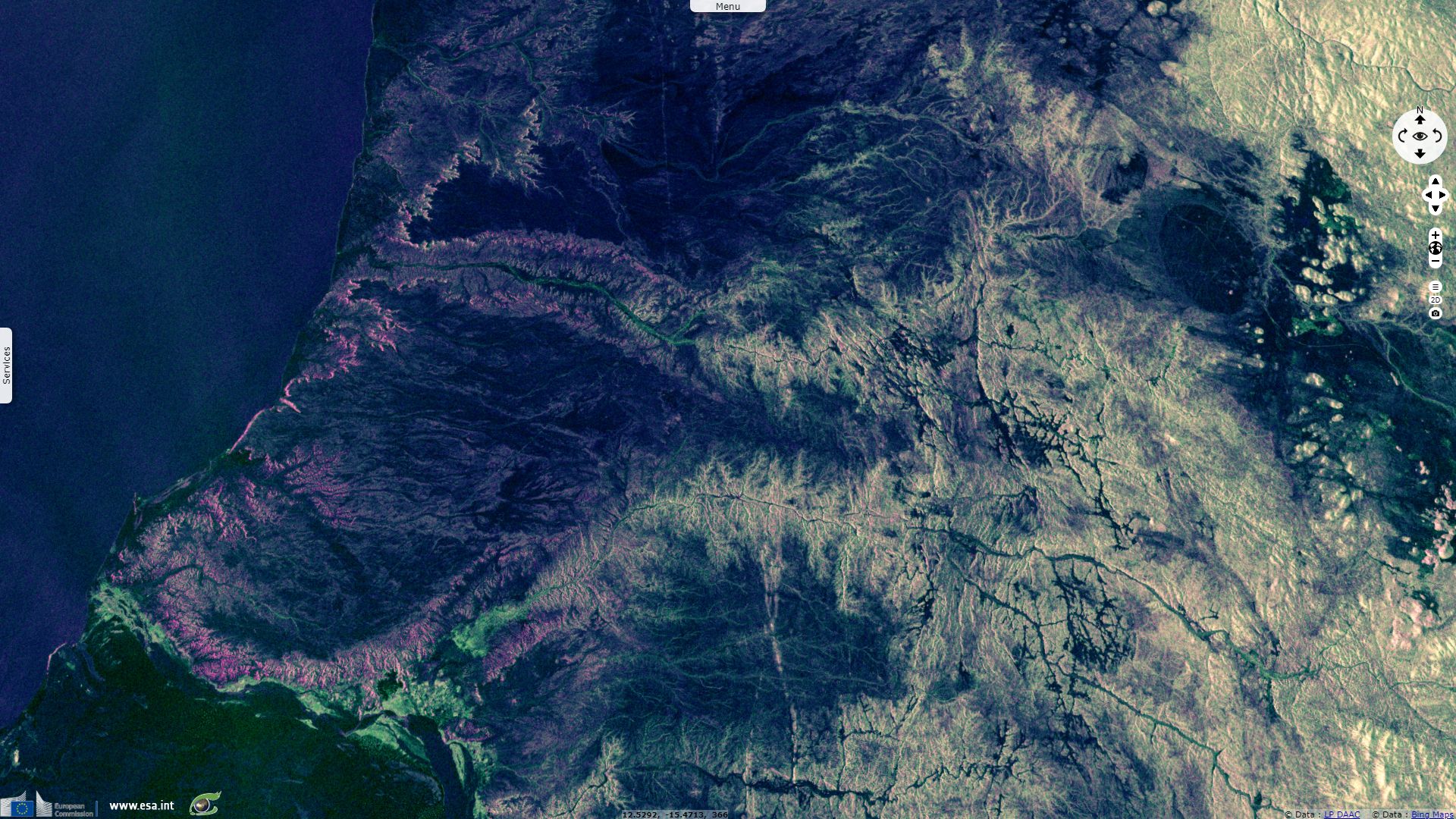
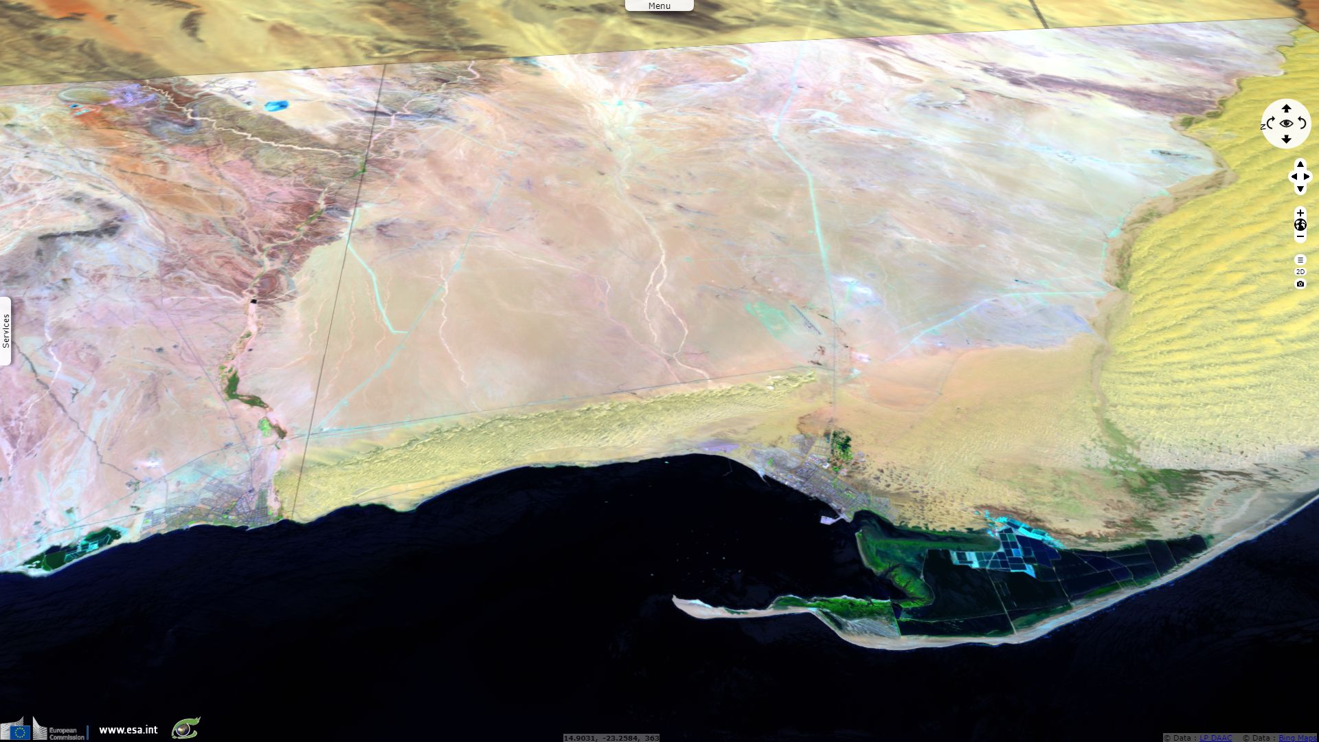
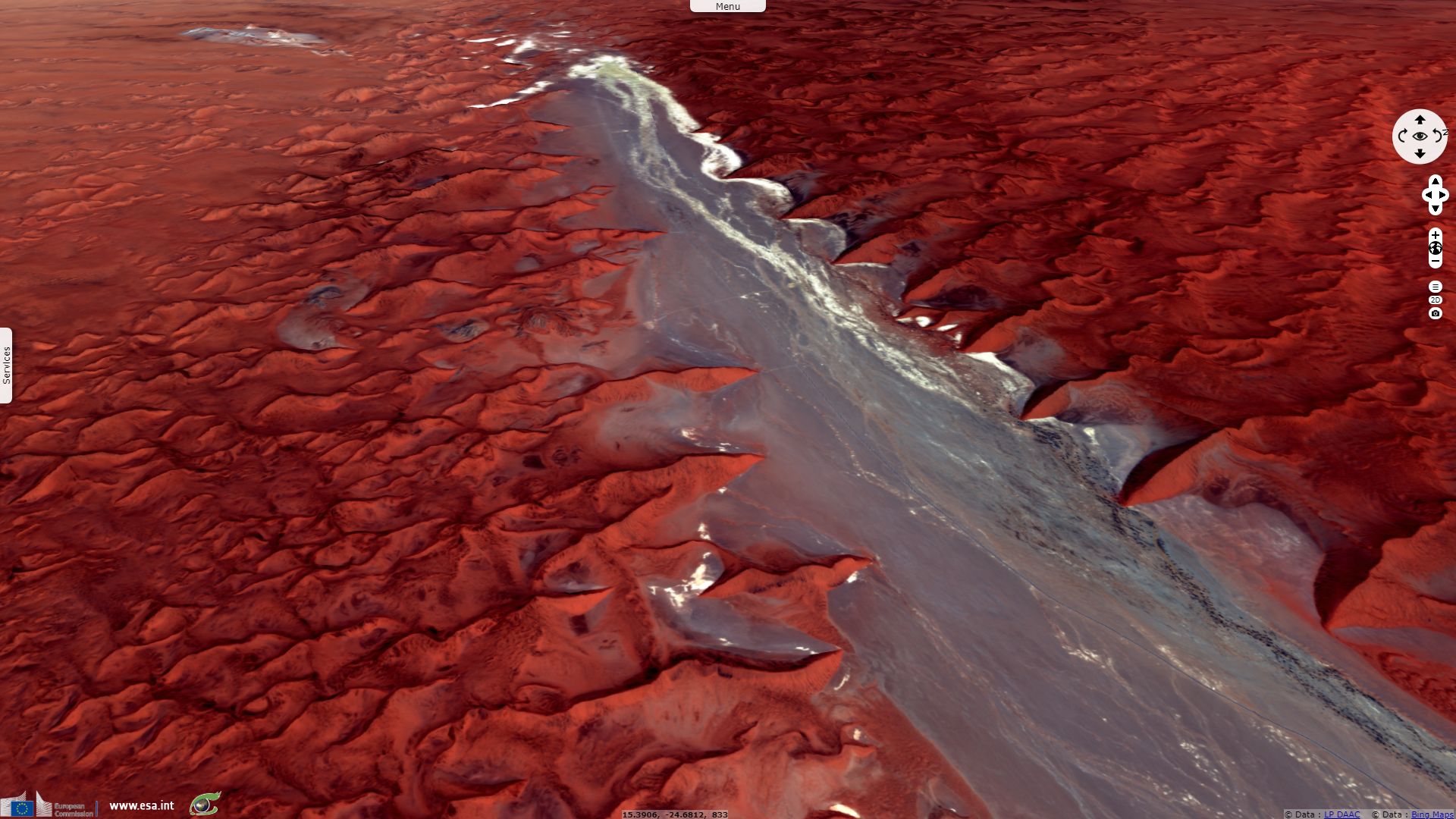
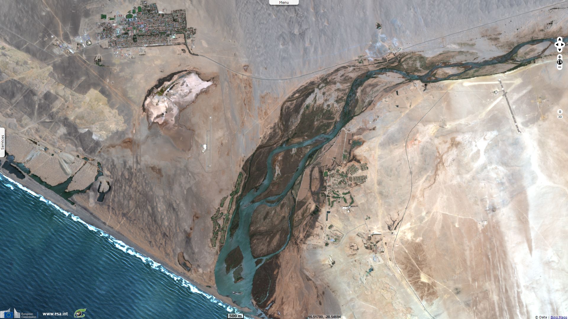
"One of the more characteristic features of the Namib Desert is its severe paucity of surface water. The Southern and Central Namib are bisected by ephemeral rivers that are normally dry and flow at irregular intervals, the most important of which is the Kuiseb River (Jacobson et al. 1995). On the rare occasions that this river does flow, its passage to the sea is blocked by sand dunes. The only temporarily flowing rivers to occasionally reach the ocean are the Swakop River and the Omaruru River (north of Swakopmund)."
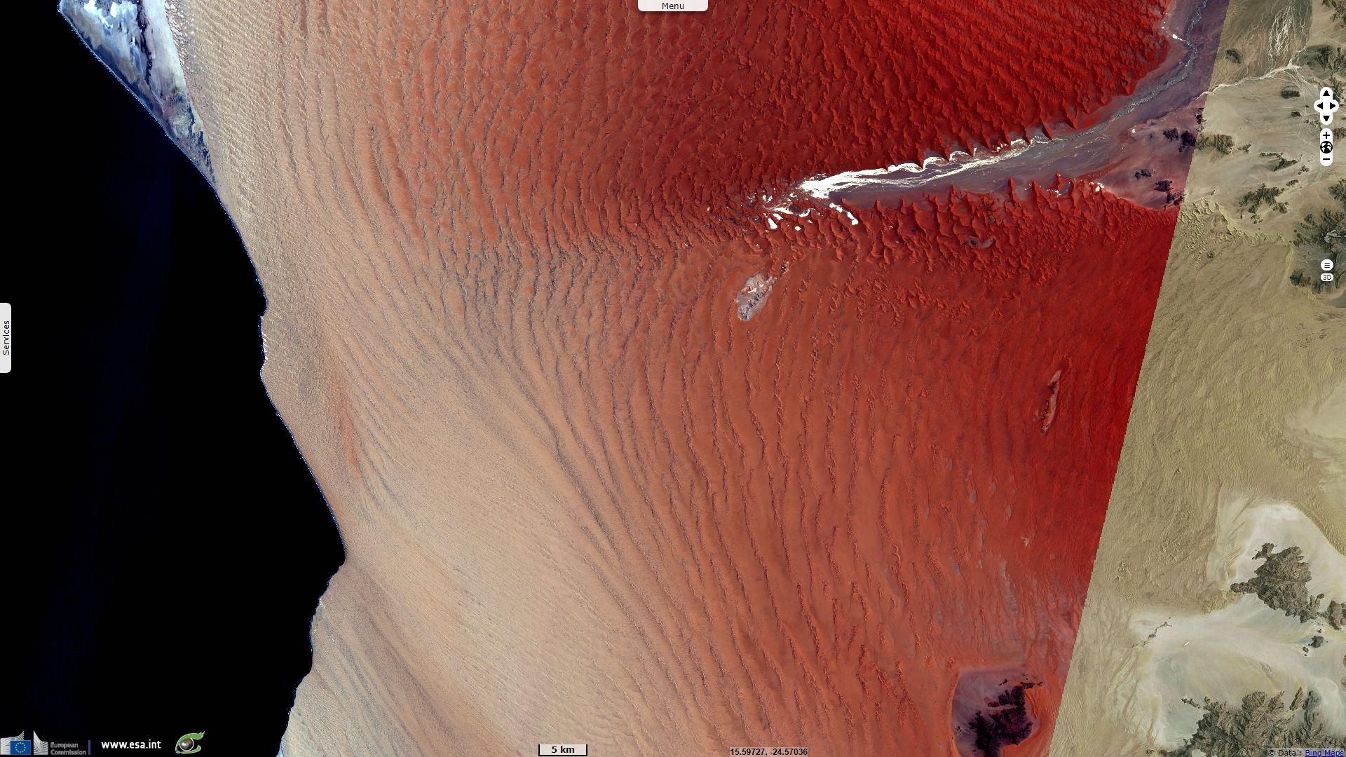
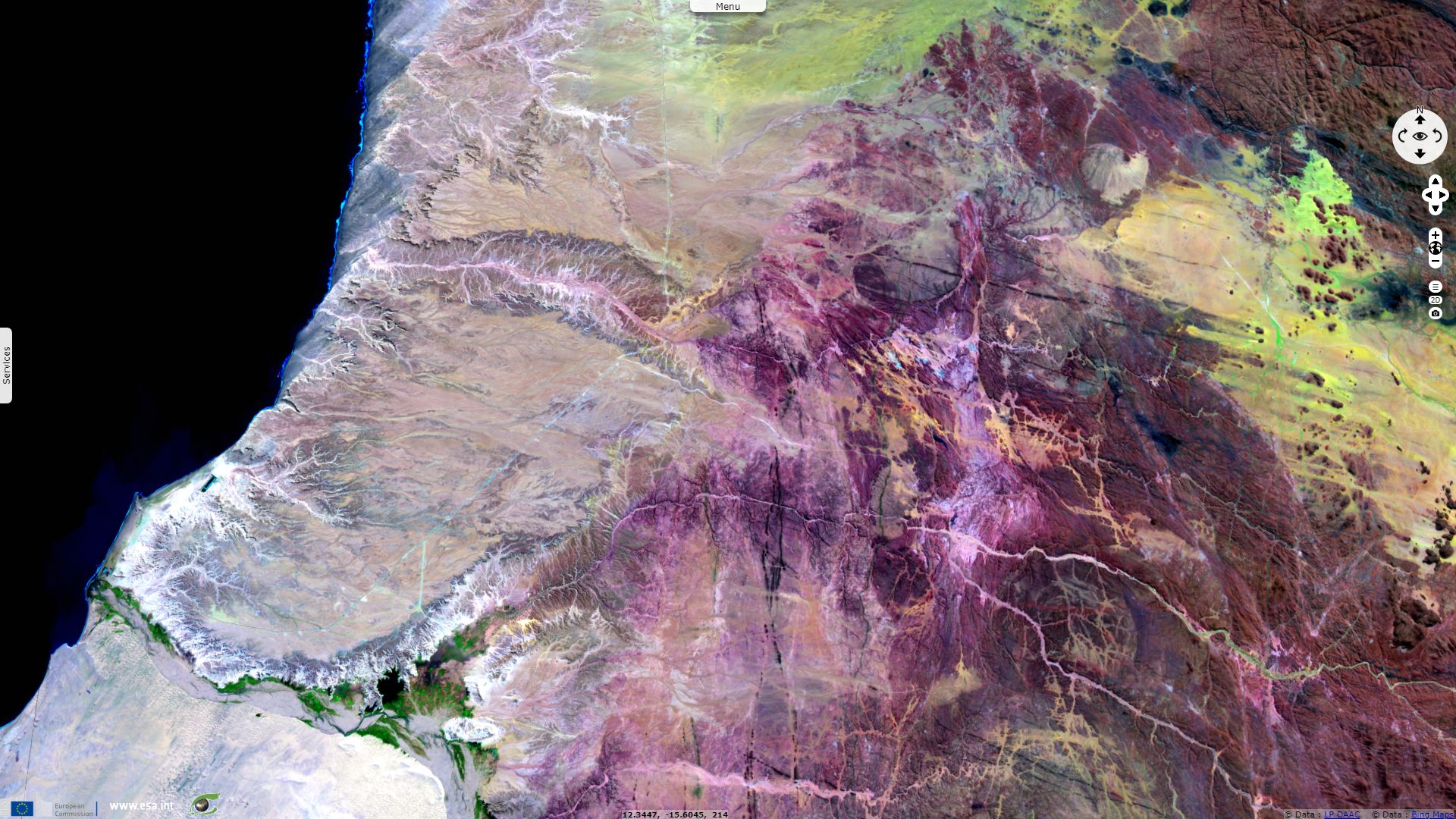
"Between Luderitz and the Kuiseb Rivers, the Southern Namib is made up of a belt of sand dunes 320 km long and about 120 km wide. These spectacular linear and crescent-shaped dunes reach elevations of 300 m. A strip of low sand hummocks of about 2 m high runs between this sea of dunes and the ocean. The dunes march northwards, driven by prevailing southerly winds, and are then brought to an abrupt halt by vegetation of the Kuiseb riverbed, which forms a wind barrier. To the north of the Kuiseb River, the dunes give way to the gravel plains of the Central Namib that are dotted with inselbergs of granite and limestone (Lovegrove 1993, Barnard 1998)."
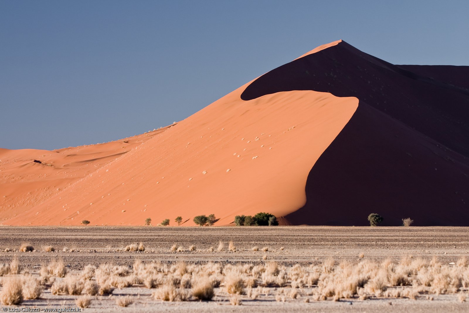
Big Daddy, the tallest dune in the Sossusvlei area - Source: Luca Galuzzi
This area is characterized by high sand dunes of vivid pink-to-orange color, an indication of a high concentration of iron in the sand and consequent oxidation processes. The oldest dunes are those of a more intense reddish color. Sossusvlei.org notes: "Big Daddy is the tallest dune in the Sossusvlei area. This magnificent dune is situated between Sossusvlei and Deadvlei and at 325 meters it dwarfs the other dunes. Should you want the ultimate bragging rights, take a lot of water and trek to the top of Big Daddy where you can look down onto Deadvlei. At 325 meters, Big Daddy may be the highest dune in the Sossusvlei area, however it is not the highest in the Namib Desert. This honour is given to Dune 7, which has been measured at 388 m. Dune 7 earned its name by being the 7th dune along the Tsauchab River."
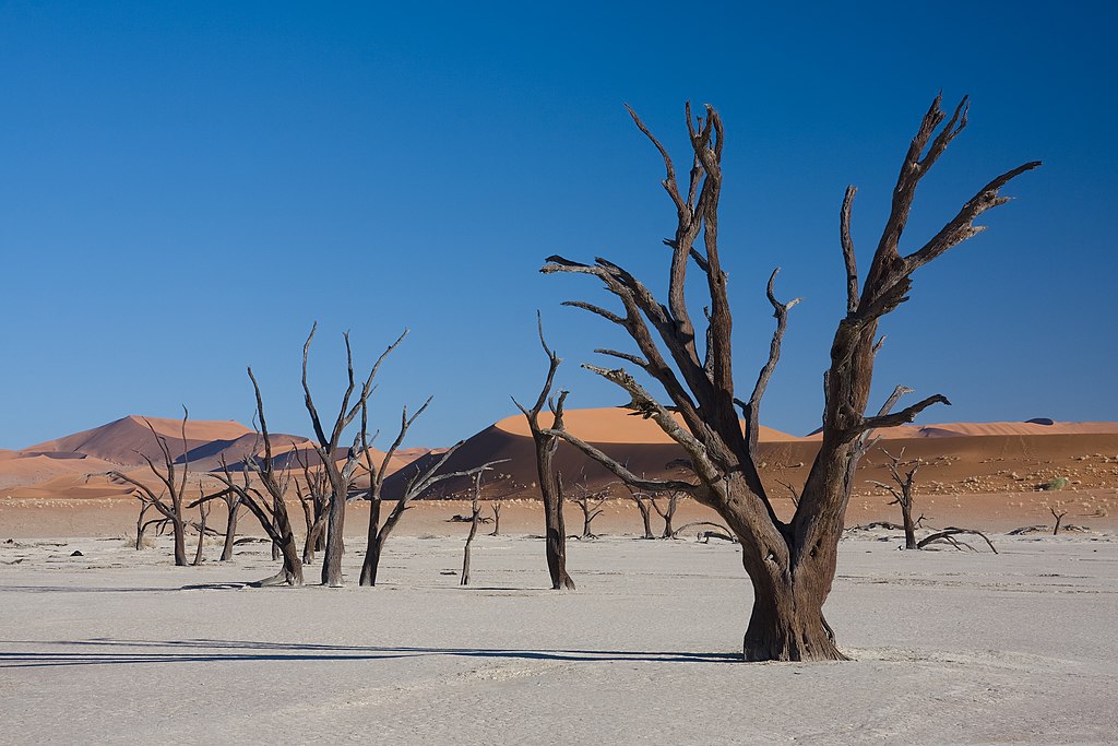
Deadvlei clay pan - Source
Sossusvlei.org describes this otherwordly scenary: "Close to Sossusvlei, Deadvlei is a clay pan characterized by dark, dead camel thorn trees contrasted against the white pan floor. The pan was formed when the Tsauchab River flooded and the abundance of water allowed camel thorn trees to grow. However, the climate changed and the sand dunes encroached on the pan, blocking the river from reaching the area. The trees are estimated to be approximately 900 years old, however they have not decomposed due to the dry climate."
"The Namib Desert is believed to be the world’s oldest desert and it has been arid for at least 55 million years (Barnard 1998). The convergence of the Benguela upwelling and the hot interior have maintained, and perhaps increased this aridity in recent times, but they did not generate the aridity. The region, isolated between the ocean and the escarpment, is considered to be a constant island of aridity surrounded by a sea of climatic change (Armstrong 1990). The arid conditions probably started with the continental split of West Gondwana 130 million to 145 million years ago when this area shifted to its present position along the Tropic of Capricorn. This lengthy dry period has had a profound influence on the region’s biodiversity. The region has remained a relatively stable center for the evolution of desert species. This has resulted in a unique array of biodiversity with high levels of endemism and numerous advanced adaptations to arid conditions."
Bordering the South Atlantic Ocean, it shows some similarities with the Atacama desert, one place even drier than the Namib desert. Both lie at a similar latitude, that of the subtropical ridges, and are located on the west coast of a southern ocean. Their aridity is caused by the descent of dry air of the Hadley Cell, cooled by a cold along the coast, Benguela Current for South-West Africa and Humboldt Current for West of South America. A mountain range on the east prevents trade winds from the east to bring precipitations and both know water mostly in the form of a dense fog.
The views expressed herein can in no way be taken to reflect the official opinion of the European Space Agency or the European Union.
Contains modified Copernicus Sentinel data 2026, processed by VisioTerra.
Contains modified Copernicus Sentinel data 2026, processed by VisioTerra.
| More on European Commission space: |  |
 |
 |
||||
| More on ESA: | |
|
|
S-1 website | S-2 website | S-3 website | |
| More on Copernicus program: | |
|
|
Scihub portal | Cophub portal | Inthub portal | Colhub portal |
| More on VisioTerra: | |
|
|
Sentinel Vision Portal | Envisat+ERS portal | Swarm+GOCE portal | CryoSat portal |