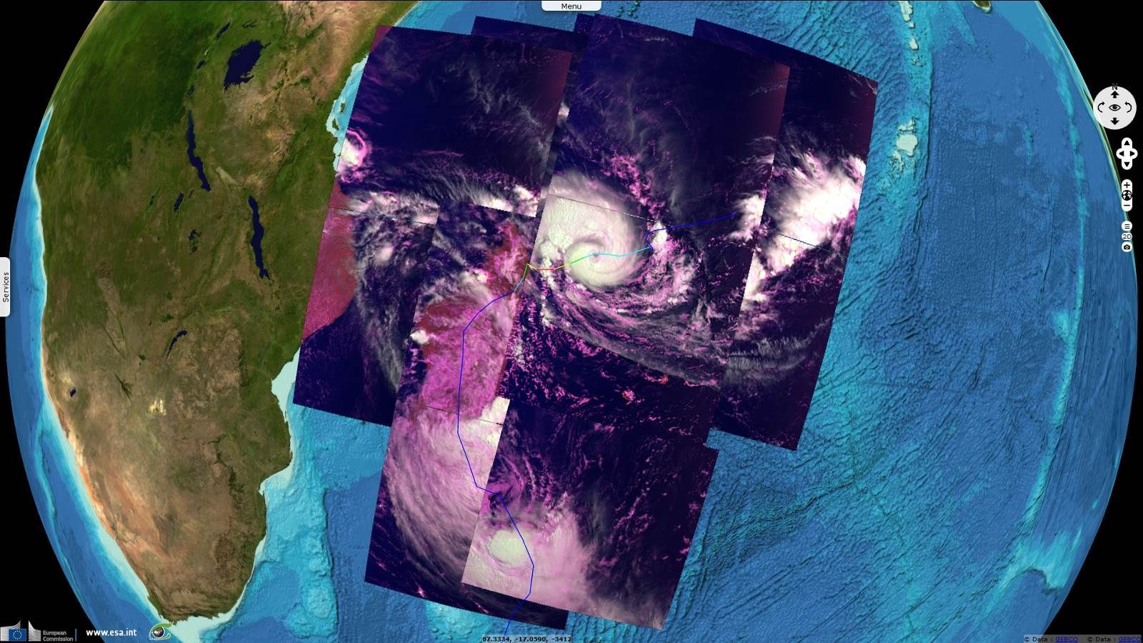
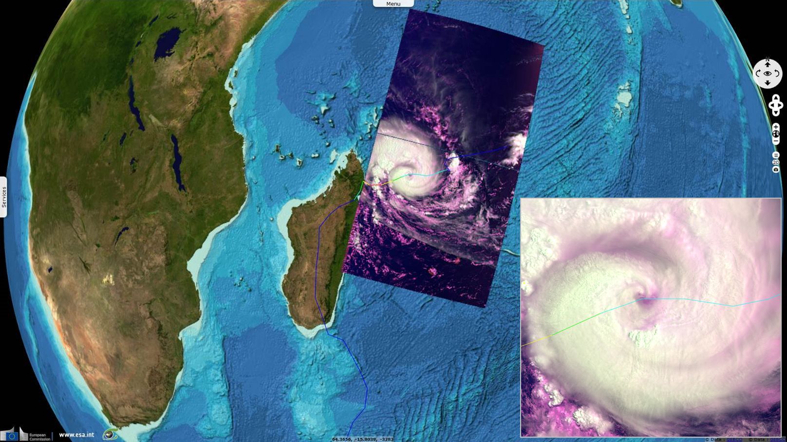
S3 tracking Enawo cyclone over Madagascar
Sentinel-3 OLCI FR acquired on 02 March 2017 at 05:54:47 UTC
...
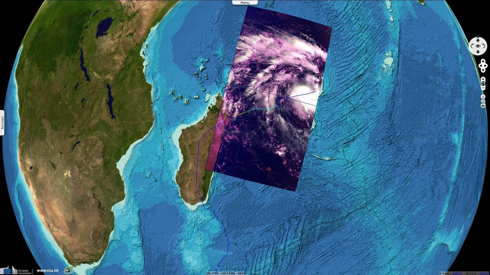
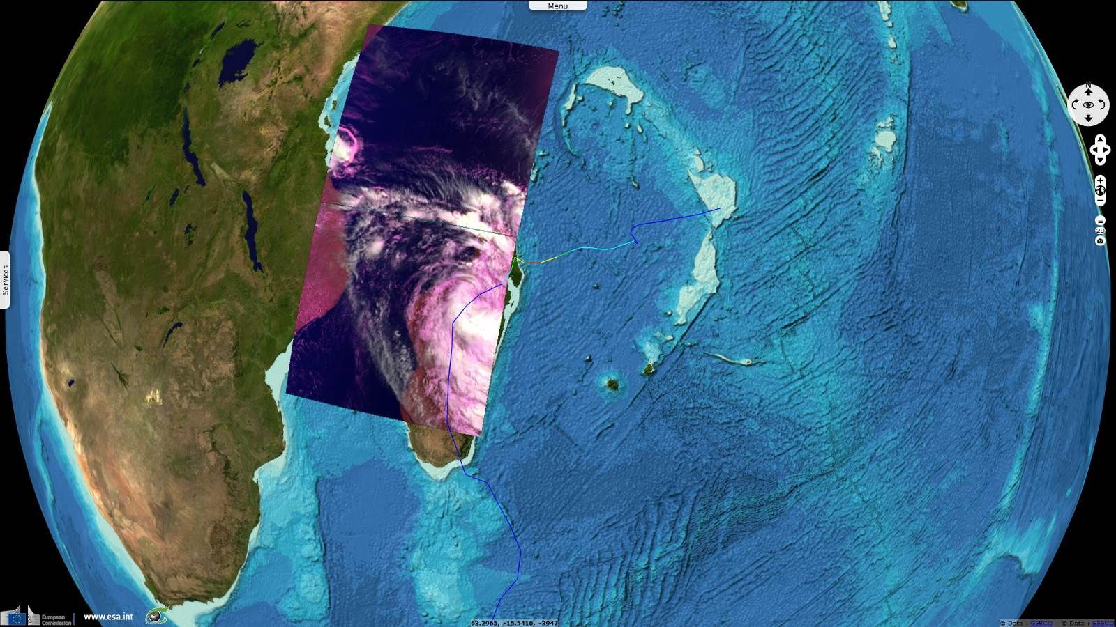
Sentinel-3 OLCI FR acquired on 10 March 2017 at 05:53:18 UTC
...
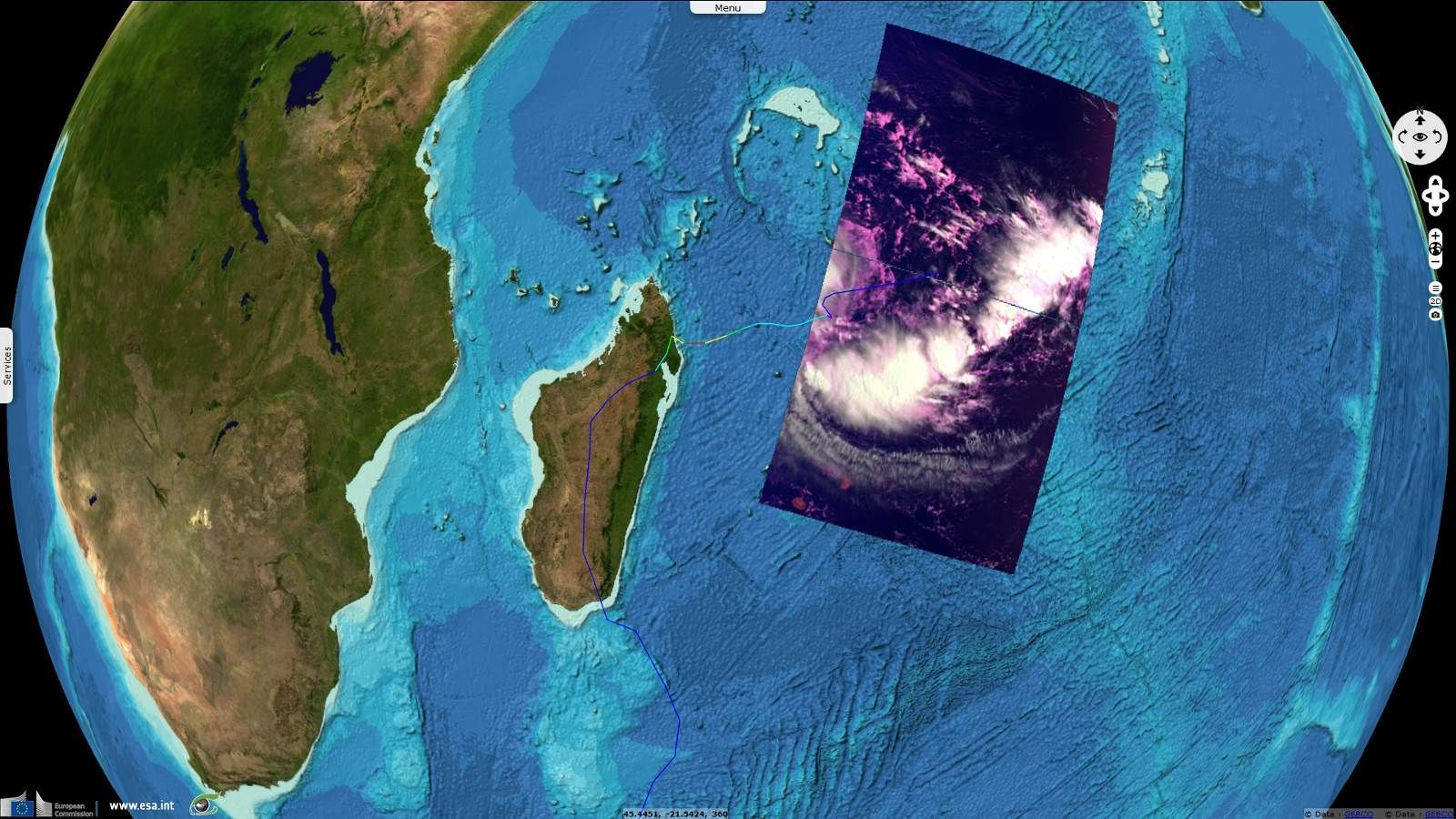
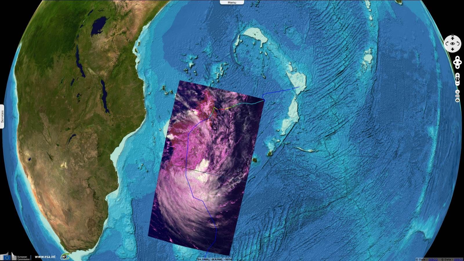
Sentinel-3 OLCI FR acquired on 10 March 2017 at 05:53:18 UTC
Keyword(s): hurricane, disaster monitoring, Madagascar
The views expressed herein can in no way be taken to reflect the official opinion of the European Space Agency or the European Union.
Contains modified Copernicus Sentinel data 2026, processed by VisioTerra.
Contains modified Copernicus Sentinel data 2026, processed by VisioTerra.
| More on European Commission space: |  |
 |
 |
||||
| More on ESA: | |
|
|
S-1 website | S-2 website | S-3 website | |
| More on Copernicus program: | |
|
|
Scihub portal | Cophub portal | Inthub portal | Colhub portal |
| More on VisioTerra: | |
|
|
Sentinel Vision Portal | Envisat+ERS portal | Swarm+GOCE portal | CryoSat portal |