Québec flooding
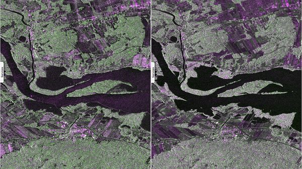
Sentinel-1 CSAR IW acquired on 06 April 2017 at 22:52:05 UTC
Sentinel-1 CSAR IW acquired on 12 May 2017 at 22:52:07 UTC
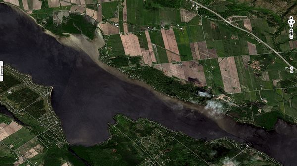
Sentinel-2 MSI acquired on 16 May 2017 at 15:49:11 UTC
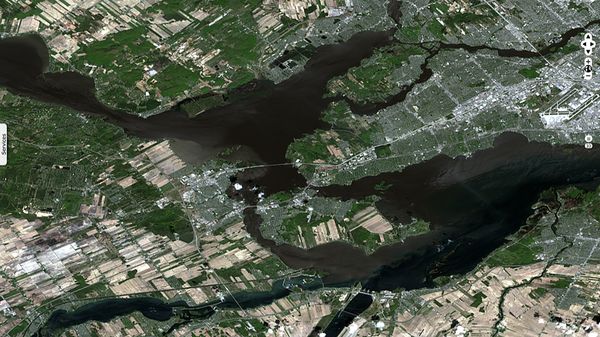
Sentinel-2 MSI acquired on 19 May 2017 at 16:10:31 UTC
Sentinel-1 CSAR IW acquired on 12 May 2017 at 22:52:07 UTC
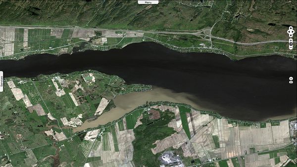
Sentinel-2 MSI acquired on 16 May 2017 at 15:49:11 UTC
Sentinel-2 MSI acquired on 19 May 2017 at 16:10:31 UTC
Keyword(s): flood, spate, water level rise, suspended sediments, plume, Ottawa river, Gatineau, Rigaud, Montréal, Quebec, Canada
The New-York Times wrote "Flooding across Quebec inundated Montreal and surrounding areas in April and May 2017.
The flooding in Montreal, which is centered on a group of islands at the confluence of the Saint Lawrence and Ottawa Rivers, began when waters breached dikes in the northern part of the city. The authorities declared a state of emergency in Montreal and other affected areas."
According to the The Canadian edition of the Huffington Post, "The Quebec town of Rigaud was under a state of emergency with about 340 homes affected by flooding due to rising water levels of the Ottawa River. Coiteux visited the flooded area, located just west of Montreal near the Ontario border, and said it's the worst flooding in the region since 1998."
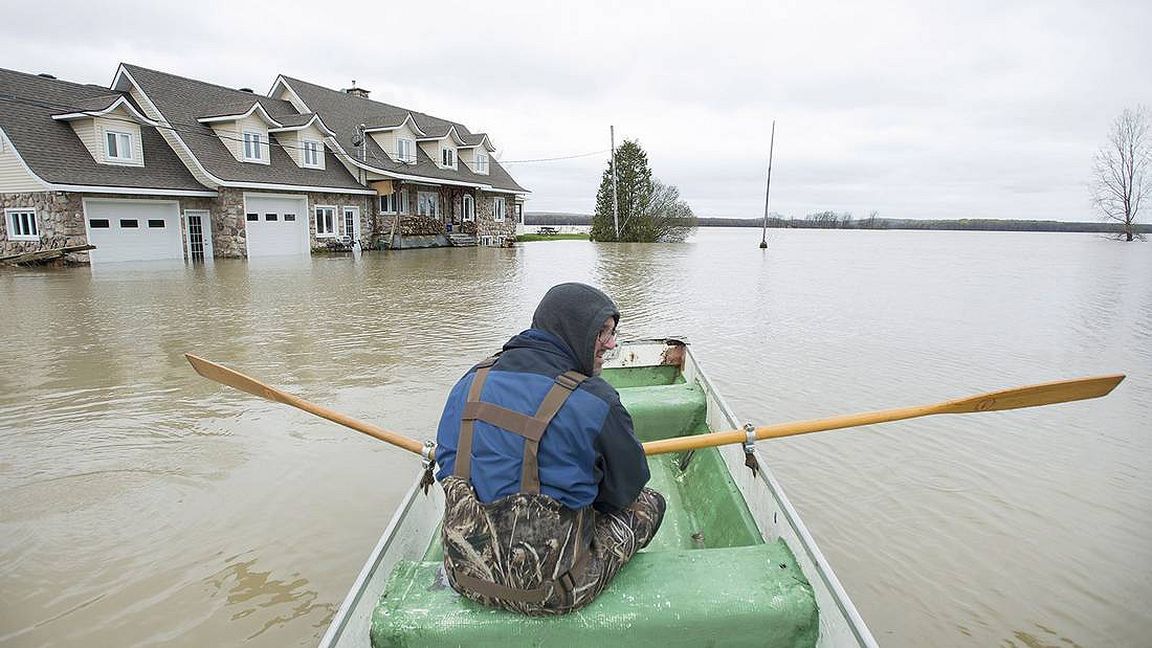
Theglobeandmail added "Quebec's deluge has been caused by a combination of melting snow and much heavier than average spring rainfall in April and May. The inundation has affected 146 Quebec communities and created more than 3,600 evacuees."
The views expressed herein can in no way be taken to reflect the official opinion of the European Space Agency or the European Union.
Contains modified Copernicus Sentinel data 2026, processed by VisioTerra.
Contains modified Copernicus Sentinel data 2026, processed by VisioTerra.
| More on European Commission space: |  |
 |
 |
||||
| More on ESA: | |
|
|
S-1 website | S-2 website | S-3 website | |
| More on Copernicus program: | |
|
|
Scihub portal | Cophub portal | Inthub portal | Colhub portal |
| More on VisioTerra: | |
|
|
Sentinel Vision Portal | Envisat+ERS portal | Swarm+GOCE portal | CryoSat portal |