Goro nickel mine, New Caledonia, France
Sentinel-2 MSI acquired on 08 July 2018 at 23:09:09 UTC
Sentinel-3 OLCI FR acquired on 17 August 2018 from 22:28:34 to 22:31:34 UTC
Sentinel-2 MSI acquired on 29 August 2018 at 23:00:21 UTC
Sentinel-2 MSI acquired on 11 August 2020 at 23:09:11 UTC
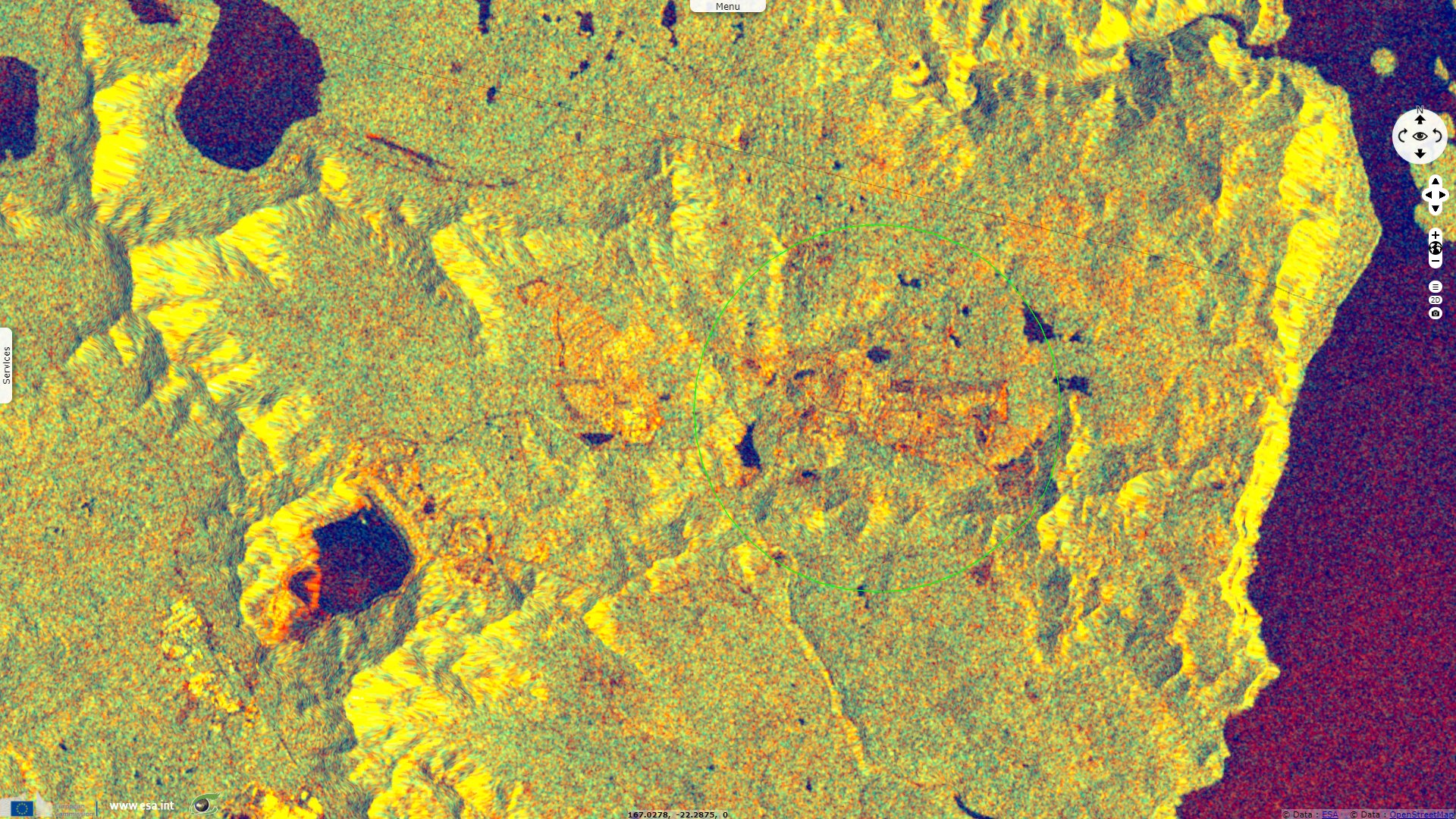
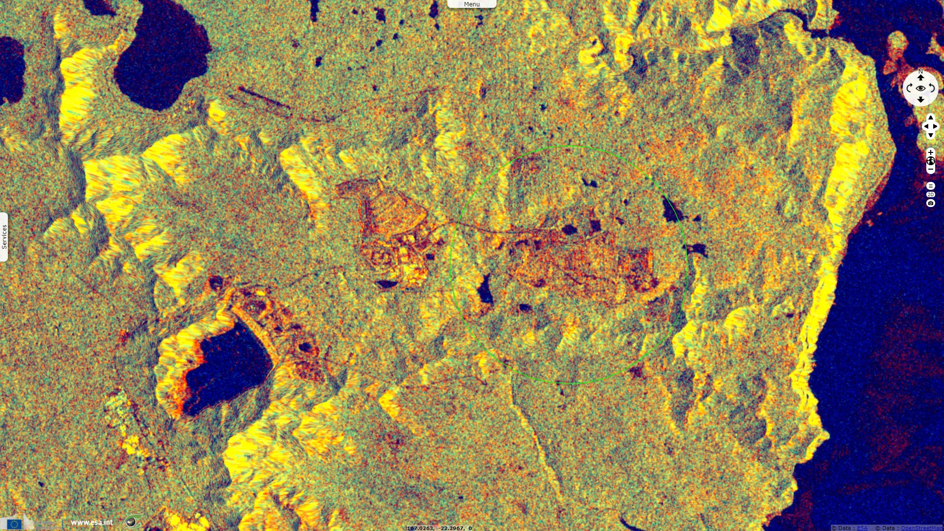
Sentinel-1 CSAR IW acquired on 29 November 2020 at 18:30:18 UTC
Keyword(s): Island, archipelago, coastal, hydrology, mine, natural ressources, New Caledonia, France
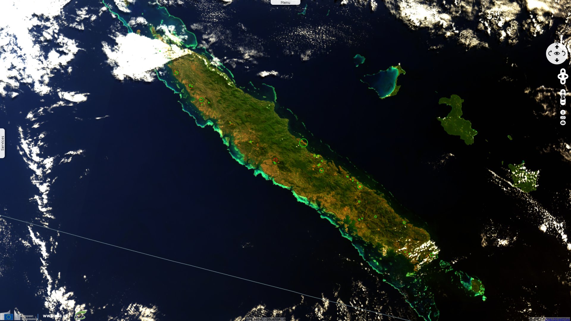
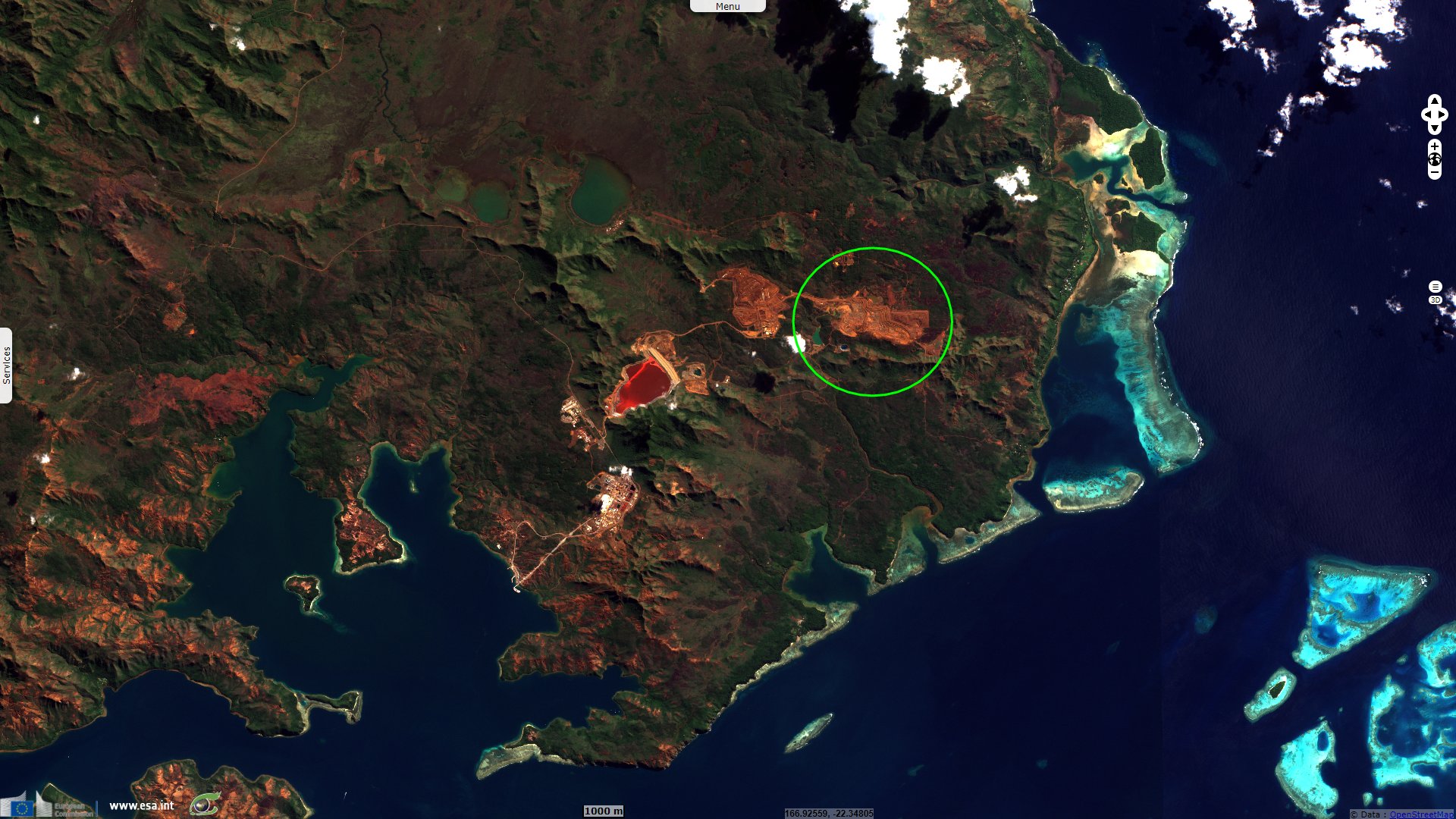
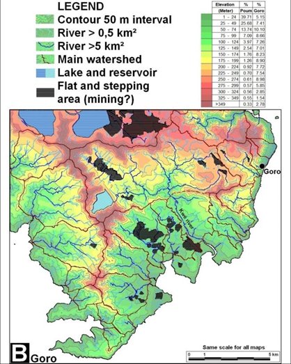
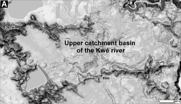
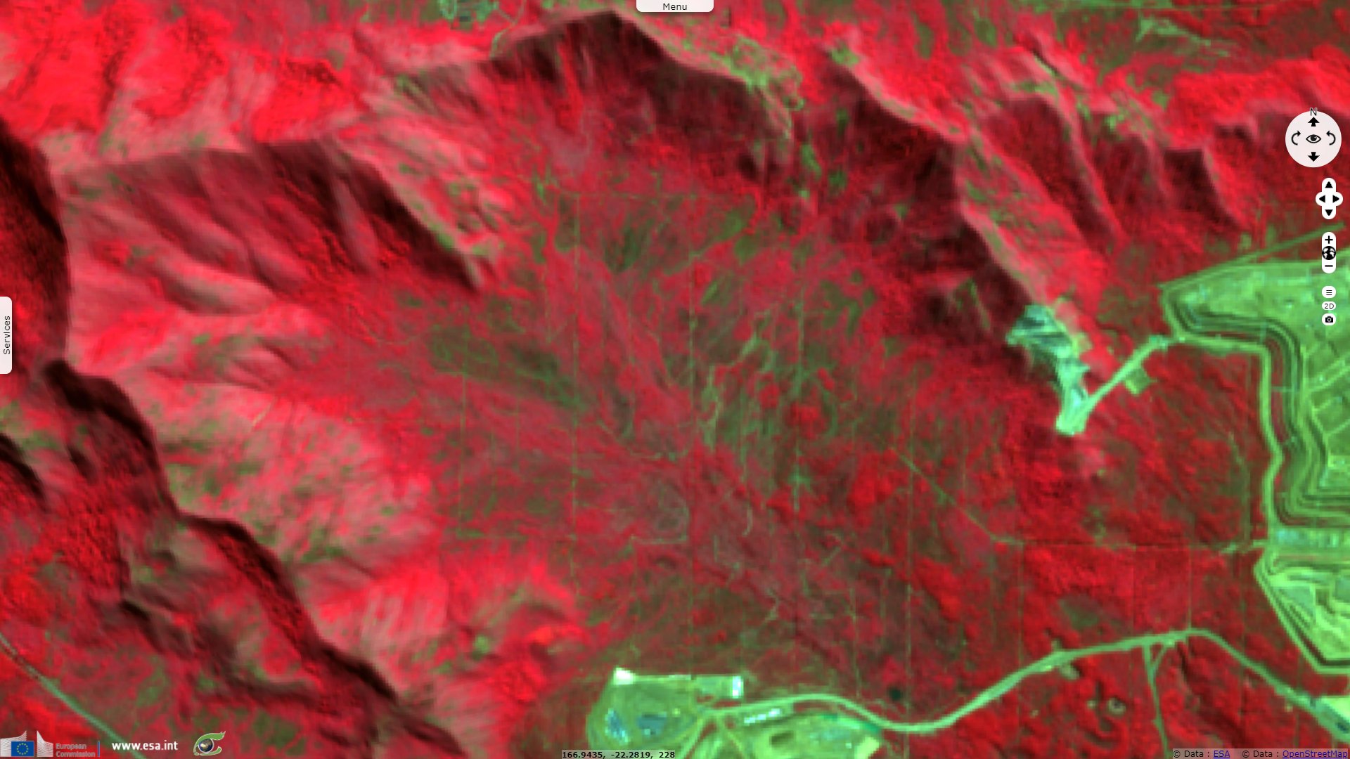
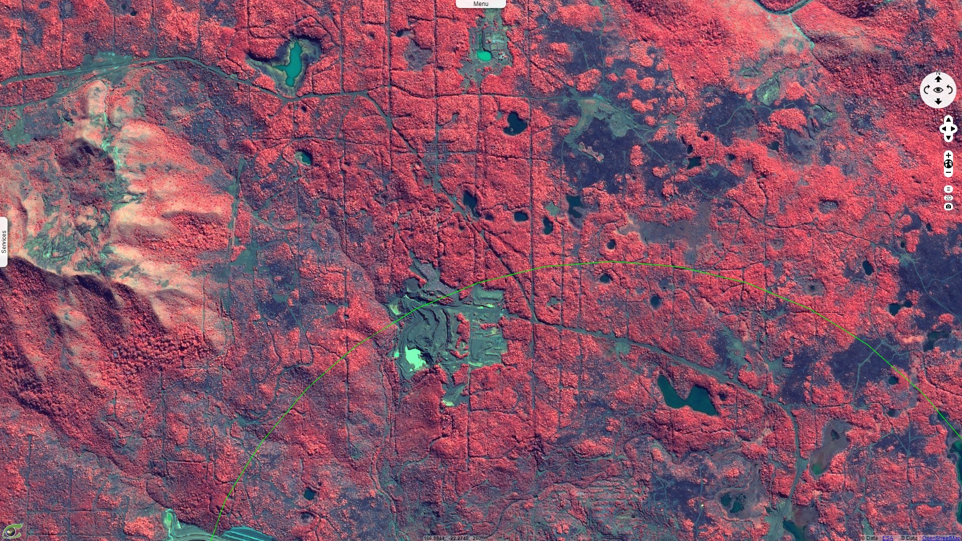
This second story relative to nickel mining sites in New Caledonia will focus on a large mining site located south-east of the island, near the city of Goro. "The present mining extraction plots are located on the upper part of the catchment basin (33.8 km²) of the Kwé river characterized by flat plateaux with few embedded valleys and fringed by steep ridges (fig 7).", writes Doctor Christian Depraetere, researcher at French National Reseach Institute for Sustainable Development (Institut de Recherche pour le Développement, IRD) and author of "Introduction à l’hydrogéomorphométrie : études des relations entre le modelé des formes de terrain et les processus hydrologiques dans des contextes insulaires."
Part-1
Part-2
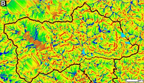
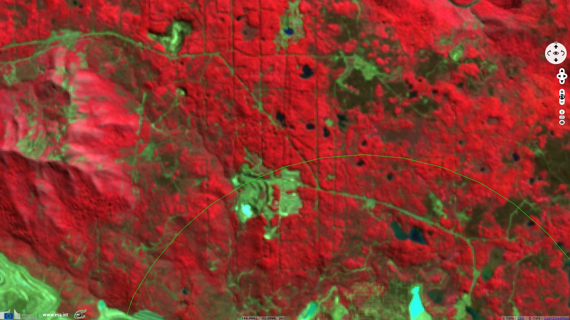
"Most of original drainage is now disturbed or completely obliterated by stripped excavations ('banquettes'), pits and embankments (fig 8)".
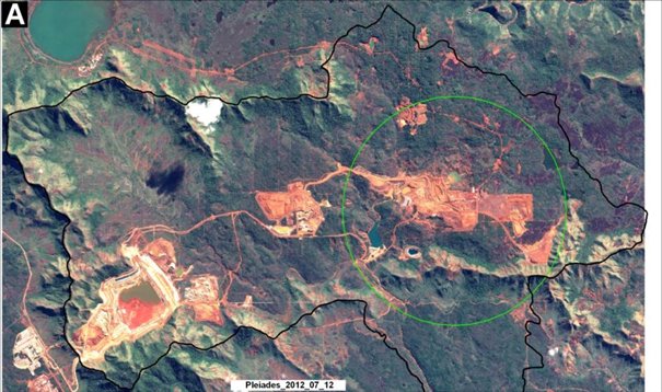
This Pleiades image has been made available by the National Centre of Technological Research (Centre National de Recherche Technologique, CNRT) "Nickel et son environnement".
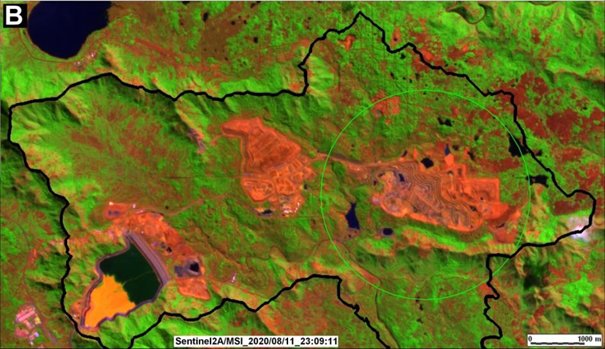
Christian Depraetere adds: "The figures 7 and 8 give an overview of the evolution in the area Goro within the upper Kwé river watershed from 2012 up to 2020: the three main excavation plots double their extension during the period and cover now about 20% of the catchment. The two phases of prospection and exploitation are clearly visible: phase 1 is based on core samplings along squaring lines of transects visible on both images and dates especially in the N-E part of the river basin."
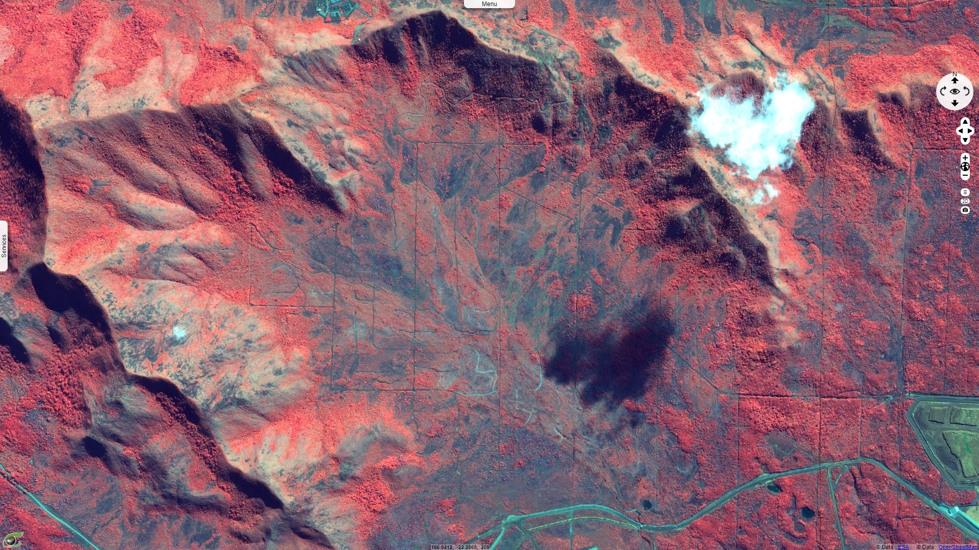
"The impacts of prospection tracks on land covers, fragmentations of forests or grasslands, soil compactions and runoff is not negligible but remain difficult to quantify regarding the hydrological budgets and solid load downstream up to the coast."
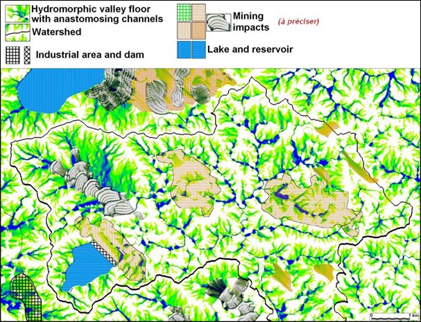
"The gridded patterns tend to avoid interference with gullies and increase of accumulation flows even on sub horizontal topography as it is the case in grassland valley floors (fig 11 & 12) or forested plateau on interfluves (fig 13 & 14)."
"The spacing between sampling lines ranges between 100 and 400 meters with few complementary transects within the meshes."
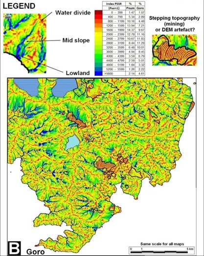
"Apart from the main extraction plots with major disturbance of the original topography, the PSSR features show step like amphitheaters landforms in the N-W valley of the Kwé catchment and outside this basin (Fig 15)."
It is to remind "the mining site of Goro complies with the terms of its authorizations to operate Installations Classified for the Protection of the Environment (ICPE), with the implementation of the Surface Water Management Operational Plan (SWMOP).
On the entire Grande-Terre, the pristine biodiversity pay a heavy toll to mining activities with about 30 000 hectares impacted. Nevertheless, themining companies in partnership with local authorities and the civil society try to mitigate the long term consequences by reforestation. For instance, the method of hydroseeding, which consists of spraying a mixture of seeds, fertilizer and substrate, gives a perspective of partial reconstitution of the milieu but it should take several centuries."
The views expressed herein can in no way be taken to reflect the official opinion of the European Space Agency or the European Union.
Contains modified Copernicus Sentinel data 2026, processed by VisioTerra.
Contains modified Copernicus Sentinel data 2026, processed by VisioTerra.
| More on European Commission space: |  |
 |
 |
||||
| More on ESA: | |
|
|
S-1 website | S-2 website | S-3 website | |
| More on Copernicus program: | |
|
|
Scihub portal | Cophub portal | Inthub portal | Colhub portal |
| More on VisioTerra: | |
|
|
Sentinel Vision Portal | Envisat+ERS portal | Swarm+GOCE portal | CryoSat portal |