Off-season cevenol storm affects South of France
Sentinel-1 CSAR IW acquired on 01 March 2022 from 17:39:01 to 17:39:26 UTC
Sentinel-2 MSI acquired on 03 March 2022 at 10:38:39 UTC
Sentinel-1 CSAR IW acquired on 12 March 2022 from 05:52:32 to 05:52:57 UTC
Sentinel-3 SLSTR RBT acquired on 12 March 2022 from 10:03:42 to 10:06:42 UTC
Sentinel-1 CSAR IW acquired on 13 March 2022 from 17:39:01 to 17:39:26 UTC
Sentinel-2 MSI acquired on 03 March 2022 at 10:38:39 UTC
Sentinel-1 CSAR IW acquired on 12 March 2022 from 05:52:32 to 05:52:57 UTC
Sentinel-3 SLSTR RBT acquired on 12 March 2022 from 10:03:42 to 10:06:42 UTC
Sentinel-1 CSAR IW acquired on 13 March 2022 from 17:39:01 to 17:39:26 UTC
Keyword(s): Natural disaster, emergency, storm, river, flooding, precipitations, rainfall, France, Mediterranean Sea
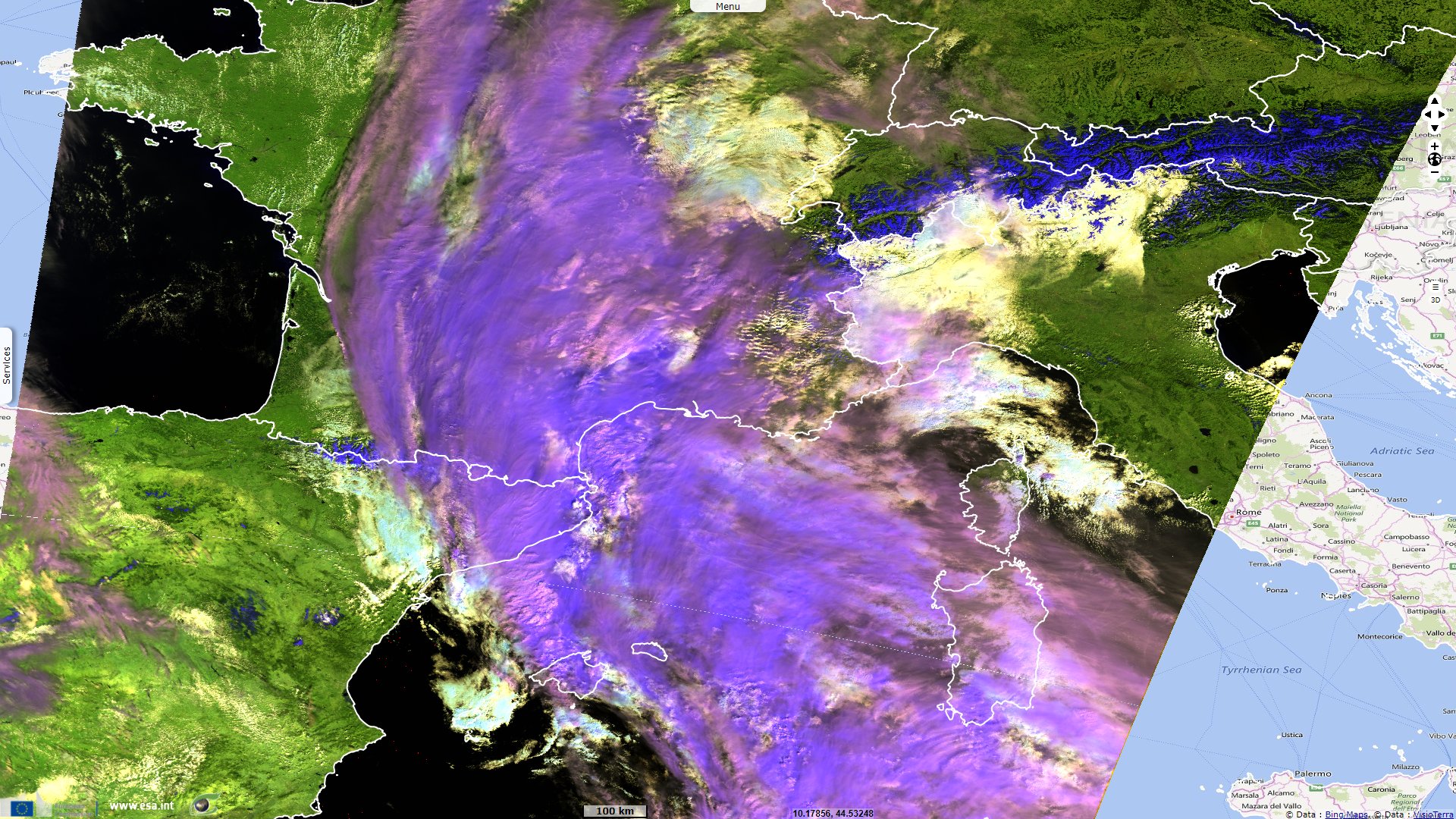
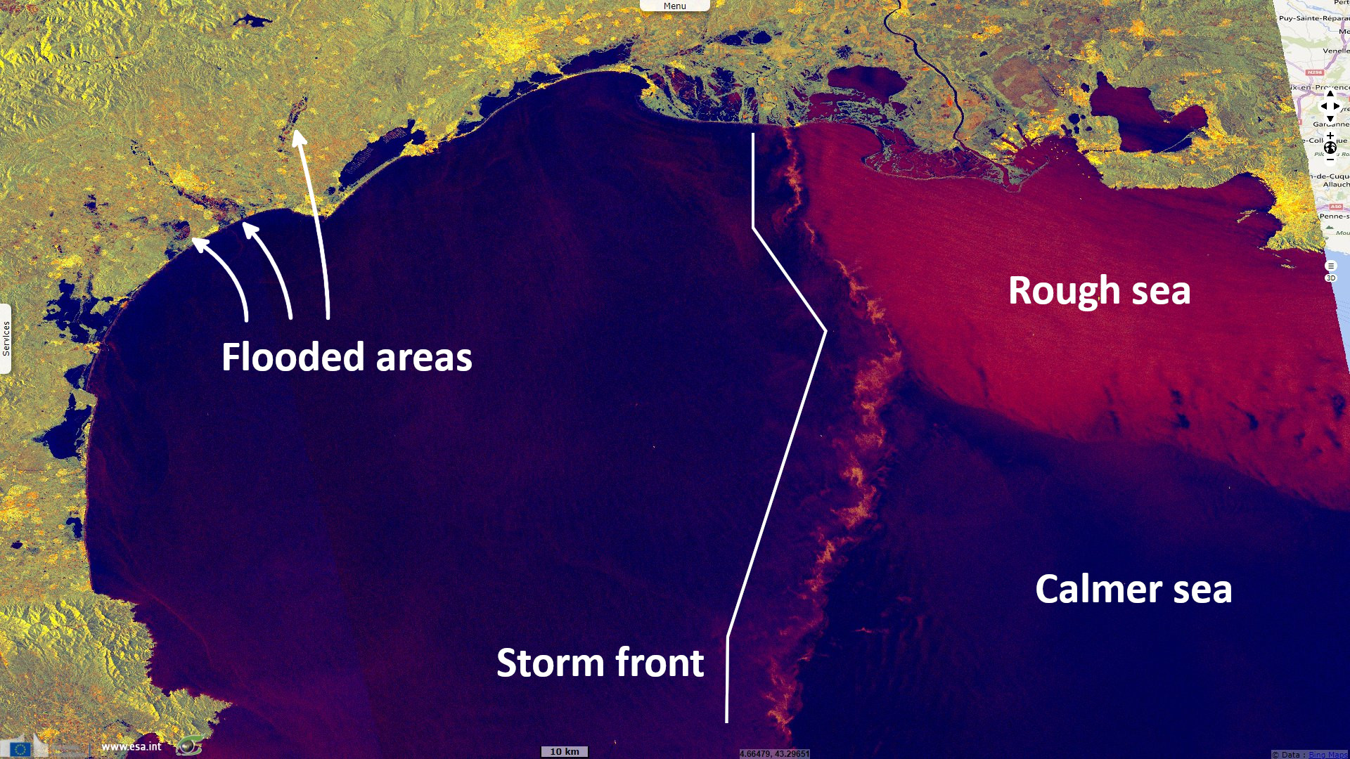
It is a record Cevenol episode for the month of March, the equivalent of 2 to 3 months of rain. A strong deterioration took place on 12-13 March over the Languedoc after several months of drought.
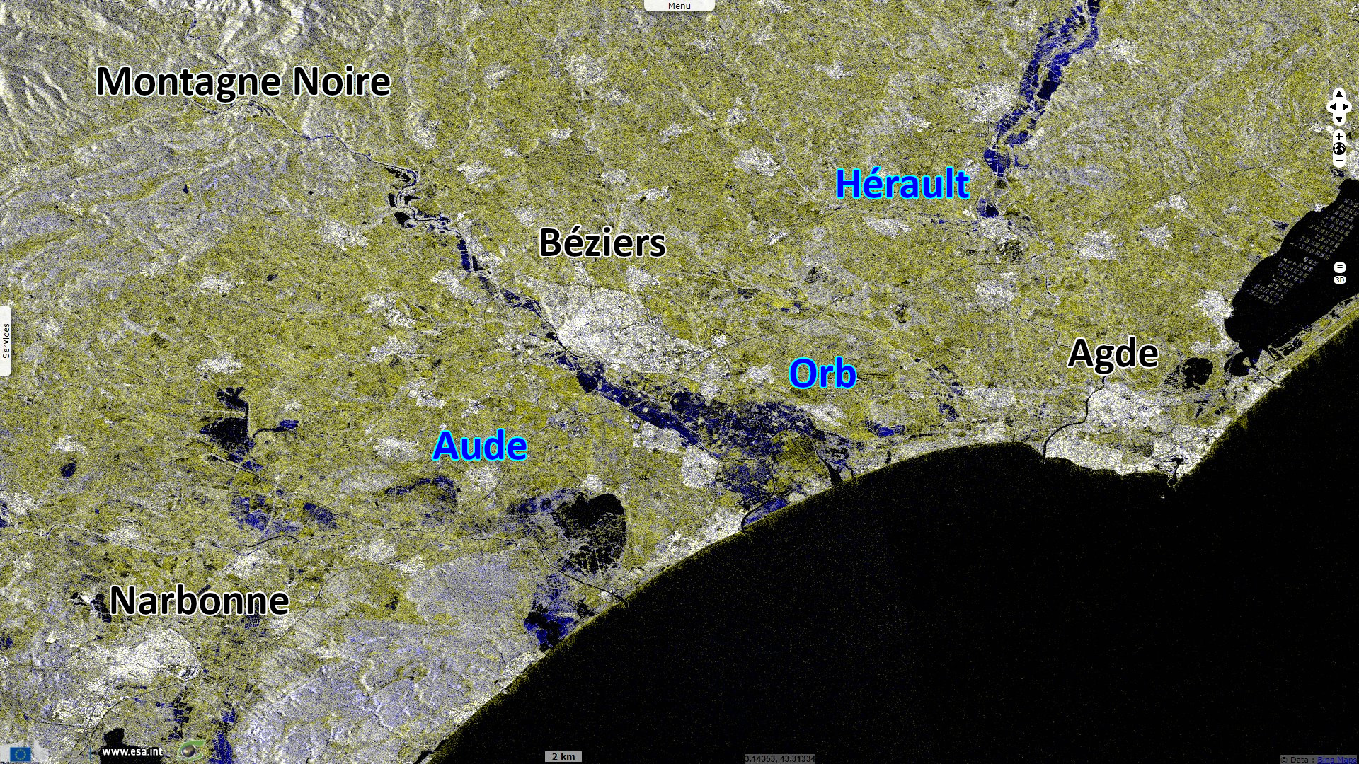
Two to three months of rain fell over the 12-13 March: 300 to 400 mm on the Montagne Noire, 100 to 200 mm from the Espinouse massif to the Cévennes and 50 to 100 mm on the Hérault coast.
On the Cevennes and the Aubrac, it fell 20 to 50 cm of heavy snow from 1300 meters of altitude.
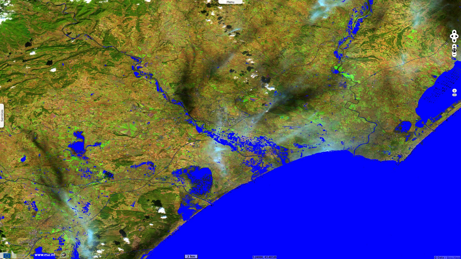
This Cevenol episode was accompanied by a sea wind with gusts between 80-90 km/h on the Hérault coast and a gust of wind in the Toulouse region up to 90 km/h.
The views expressed herein can in no way be taken to reflect the official opinion of the European Space Agency or the European Union.
Contains modified Copernicus Sentinel data 2026, processed by VisioTerra.
Contains modified Copernicus Sentinel data 2026, processed by VisioTerra.
| More on European Commission space: |  |
 |
 |
||||
| More on ESA: | |
|
|
S-1 website | S-2 website | S-3 website | |
| More on Copernicus program: | |
|
|
Scihub portal | Cophub portal | Inthub portal | Colhub portal |
| More on VisioTerra: | |
|
|
Sentinel Vision Portal | Envisat+ERS portal | Swarm+GOCE portal | CryoSat portal |