Whirlwind of colours in the eye of typhoon Khanun
Sentinel-3 SLSTR RBT acquired on 29 July 2023 from 00:37:49 to 02:21:48 UTC
...
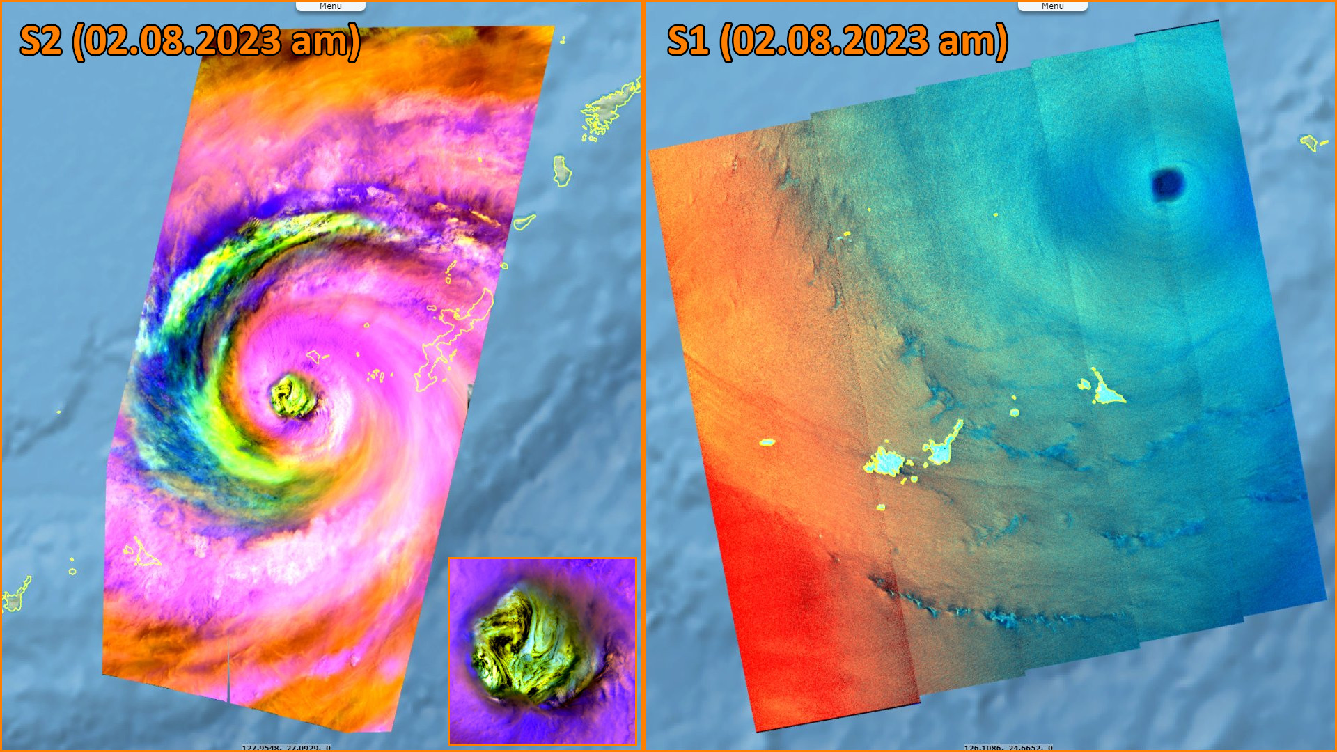
Sentinel-2 MSI acquired on 02 August 2023 at 02:06:59 UTC
Sentinel-1 CSAR EW acquired on 06 August 2023 at 09:12:56 UTC
Sentinel-3 SLSTR RBT acquired on 09 August 2023 from 12:00:42 to 13:47:41 UTC
...
Sentinel-2 MSI acquired on 02 August 2023 at 02:06:59 UTC
Sentinel-1 CSAR EW acquired on 06 August 2023 at 09:12:56 UTC
Sentinel-3 SLSTR RBT acquired on 09 August 2023 from 12:00:42 to 13:47:41 UTC
Keyword(s): Emergency, natural disaster, typhoon, cyclone, atmosphere, Japan, South Korea
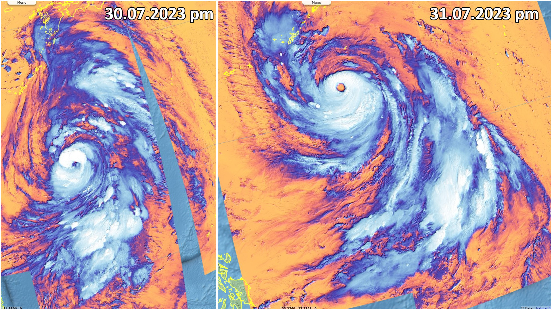
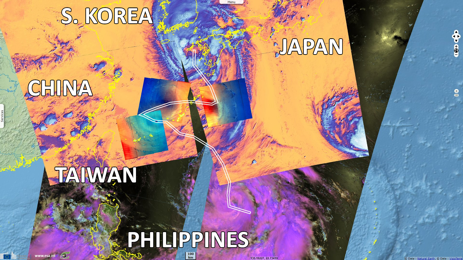
Typhoon Khanun hit Pacific Asia one week after typhoon Doksuri swept across Philippines and China. Dan Stillman reported for the Washington Post: "Typhoon Khanun was swirling above the East China Sea on Wednesday after battering Okinawa and nearby islands with more than 24 hours of huge waves, ferocious winds and severe flooding, even though the eye of the storm remained offshore. The storm, the second typhoon to affect East Asia in less than a week, left more than 30 people injured, crippled transportation."

"Hundreds of flights were canceled at Okinawa’s Naha Airport after it endured nearly 30 hours of winds gusting 100 to 160 km/h, as the storm reached Category-4 strength south of Naha, in part fueled by record-warm ocean waters. Scenes of wind-swept, torrential rain were common, with widespread flooding reported, including at the air base in Kadena. Wind gusts as high as 170 to 185 km/h were recorded, and rainfall totals were expected to reach up to 20 cm across the region."
Kathleen Magramo added for CNN: "Typhoon Khanun packed winds of 220 kilometers per hour – the equivalent of a Category-4 Atlantic hurricane – as it made its nearest pass to Japan’s southwestern Okinawa islands early Wednesday. In the past 24 hours, many locations in Okinawa have received 175 to 220 millimeters of rainfall, according to CNN Weather."
"More than 600 000 residents were ordered by the prefecture government to evacuate their homes, and strong winds took out power lines, leaving more than 200 000 households without electricity on Wednesday morning, according to the Okinawa Electric Power Company."
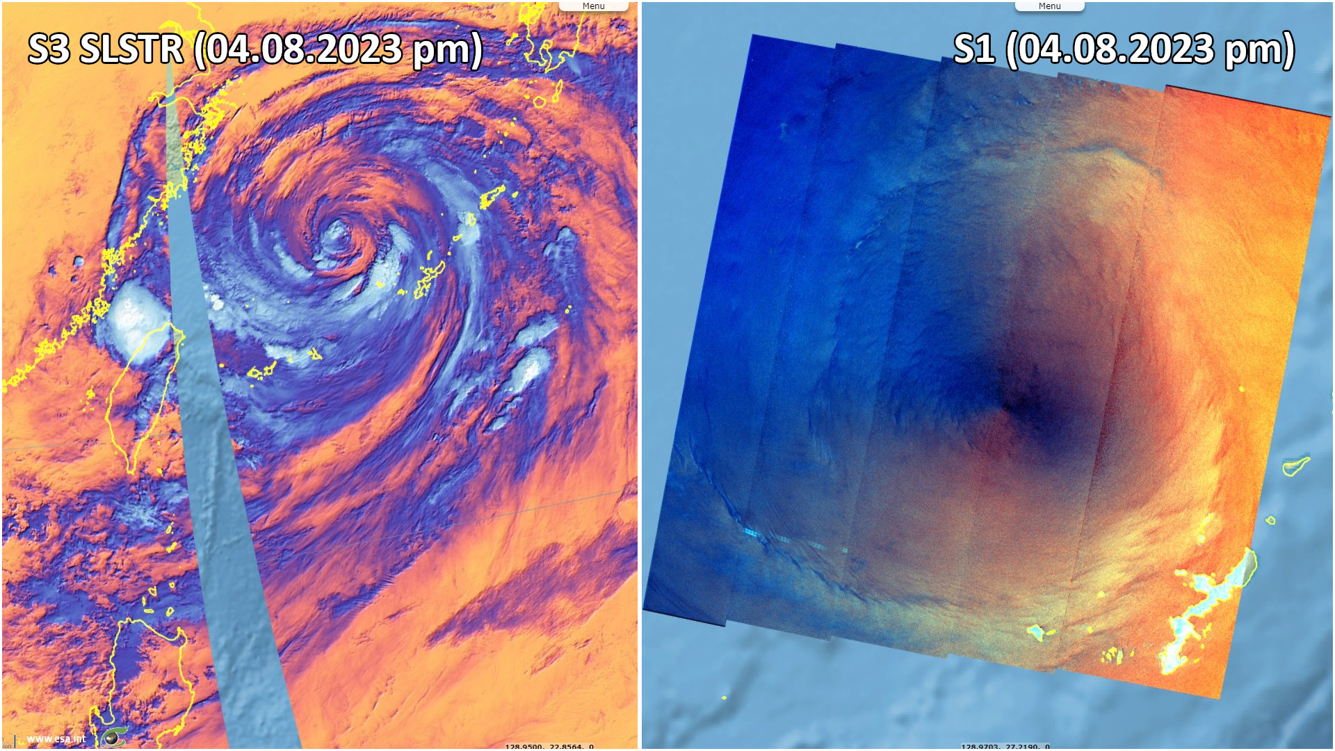
"Typhoon Khanun was approximately 210 km west of Kadena, tracking to the west-northwest over the East China Sea with estimated peak winds of 185 km/h, the equivalent of a Category-3 hurricane. The storm was exhibiting an unusual double-eyewall structure, looking like a small hurricane inside a larger hurricane, with satellite imagery showing a roughly 165 km-wide “moat” in between. Winds in both eyewalls were estimated at more than 160 km/h." completed Dan Stillman.
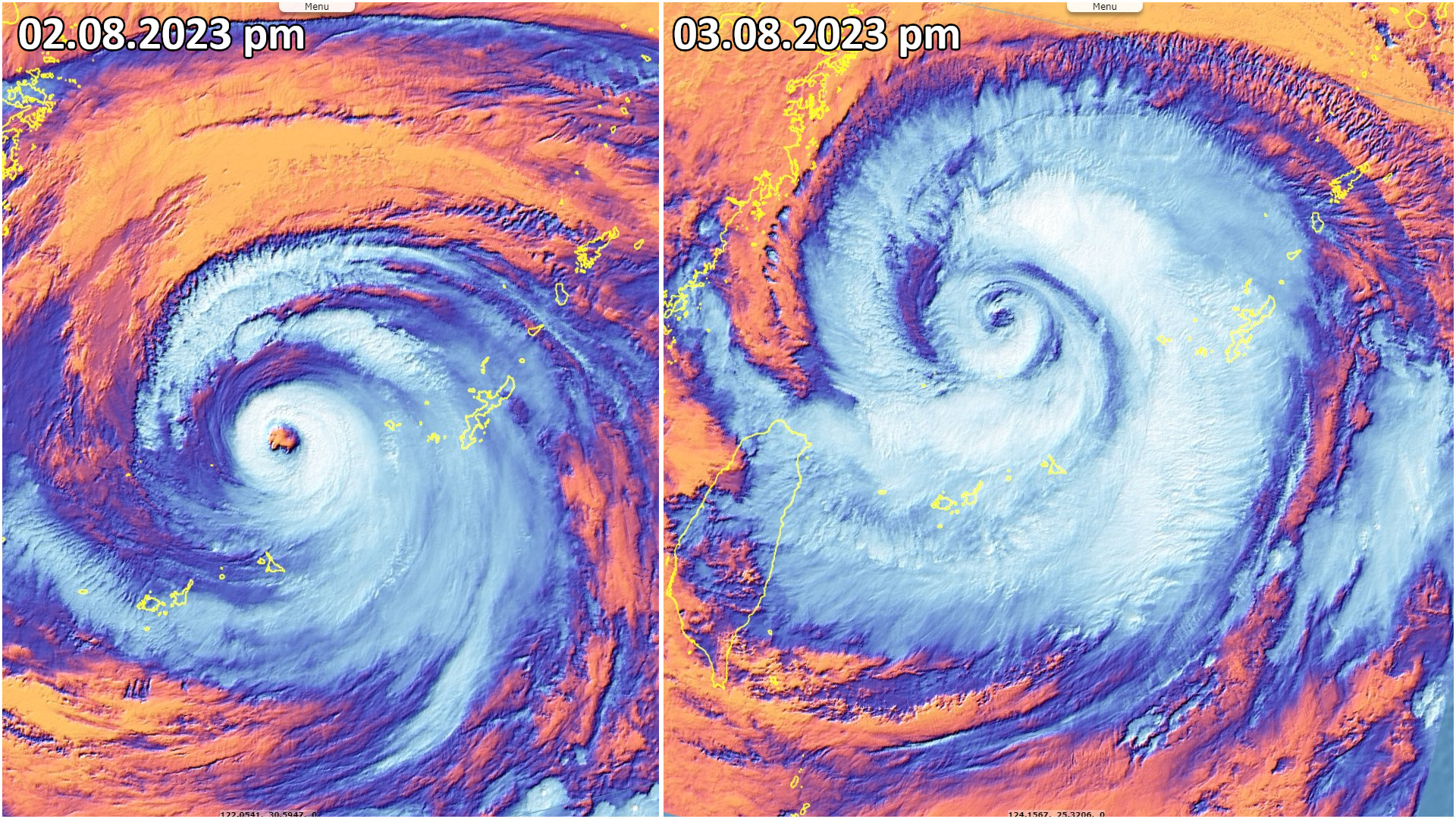
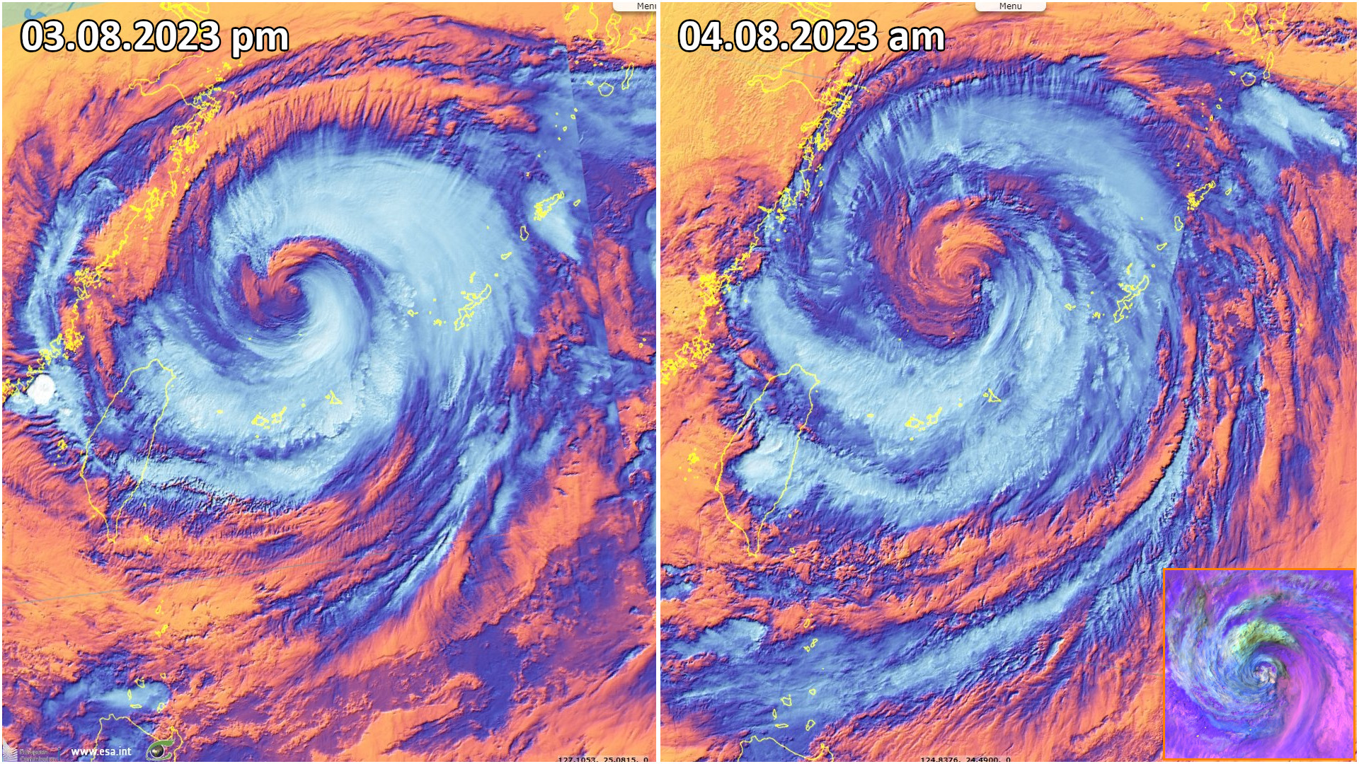
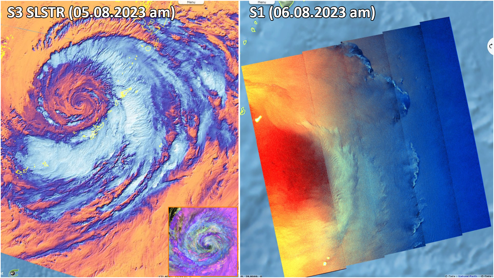
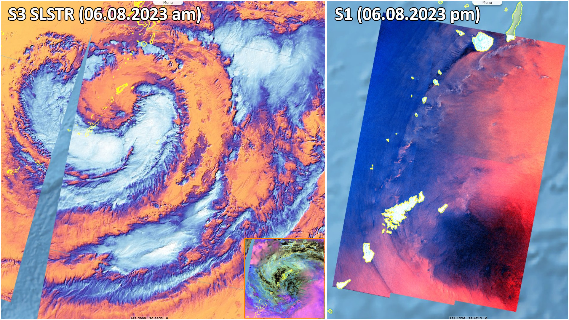
After Okinawa, the storm moved "south of Kyushu, Japan's southwestern main island some 860 km from Tokyo, after wreaking havoc in the southwestern Okinawa region. It is maintaining its strength and moving at an unusually slow 10 kph, meaning the wind and rain will linger for longer. Areas of Kyushu have already been inundated with a whole month's worth on rainfall in the previous week, the Japan Meteorological Agency (JMA) said" published Mariko Katsumura for Reuters.
"South Korea issued its highest alert as Khanun forced the cancellation of nearly 80 flights and the closure of dozens of sea routes and roads, the interior ministry said. On Tuesday, officials evacuated more than 30 000 scouts from their campsite in the southwest ahead of the typhoon, the latest snag to hit the World Scout Jamboree."

The views expressed herein can in no way be taken to reflect the official opinion of the European Space Agency or the European Union.
Contains modified Copernicus Sentinel data 2026, processed by VisioTerra.
Contains modified Copernicus Sentinel data 2026, processed by VisioTerra.
| More on European Commission space: |  |
 |
 |
||||
| More on ESA: | |
|
|
S-1 website | S-2 website | S-3 website | |
| More on Copernicus program: | |
|
|
Scihub portal | Cophub portal | Inthub portal | Colhub portal |
| More on VisioTerra: | |
|
|
Sentinel Vision Portal | Envisat+ERS portal | Swarm+GOCE portal | CryoSat portal |