Brahmaputra river floods Assam state, east of India
Sentinel-1 CSAR IW acquired on 04 June 2021 at 23:55:28 UTC
...
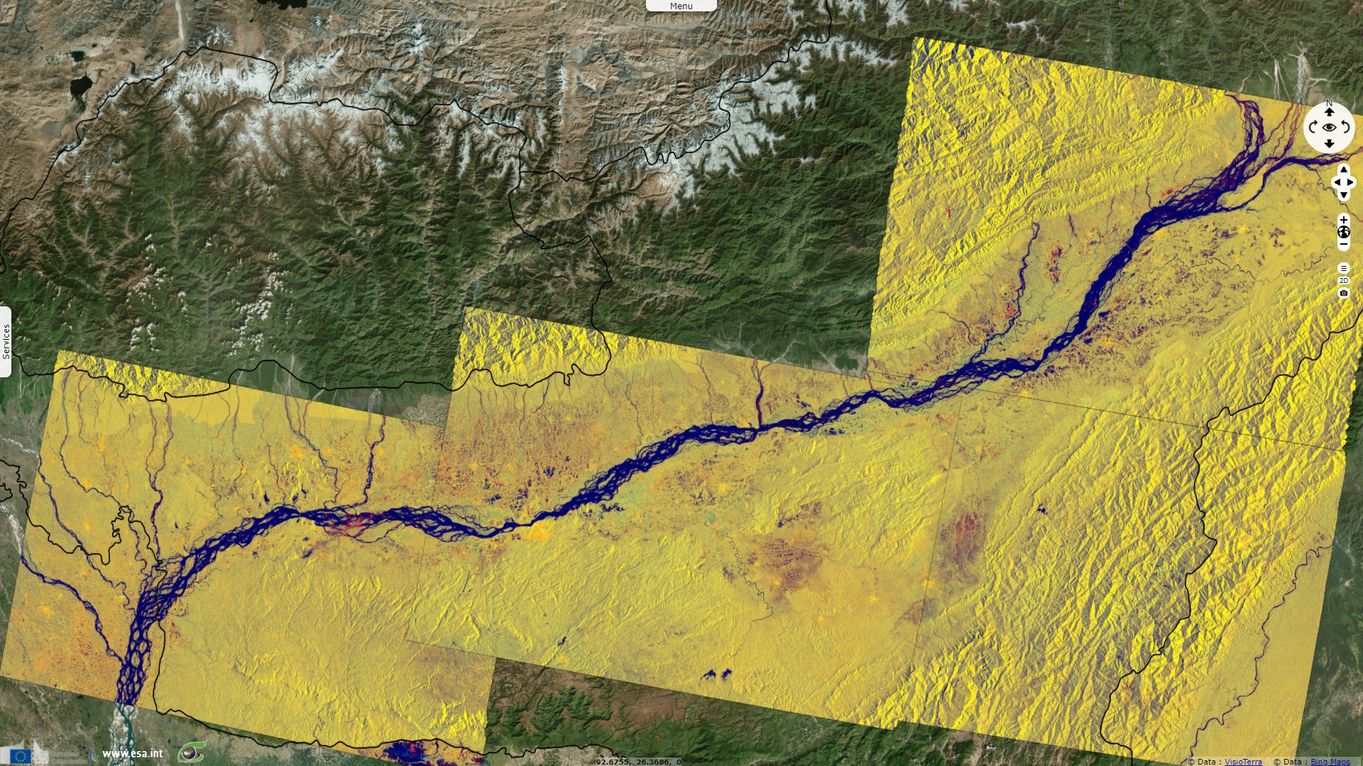
Sentinel-1 CSAR IW acquired on 27 August 2021 at 23:55:33 UTC
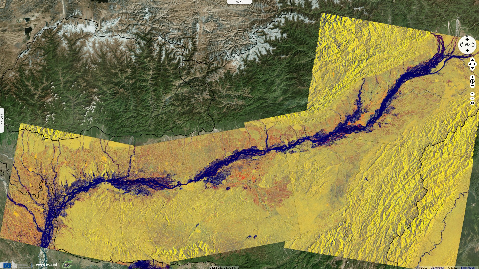
Sentinel-1 CSAR IW acquired on 29 August 2021 from 23:38:42 to 23:39:07 UTC
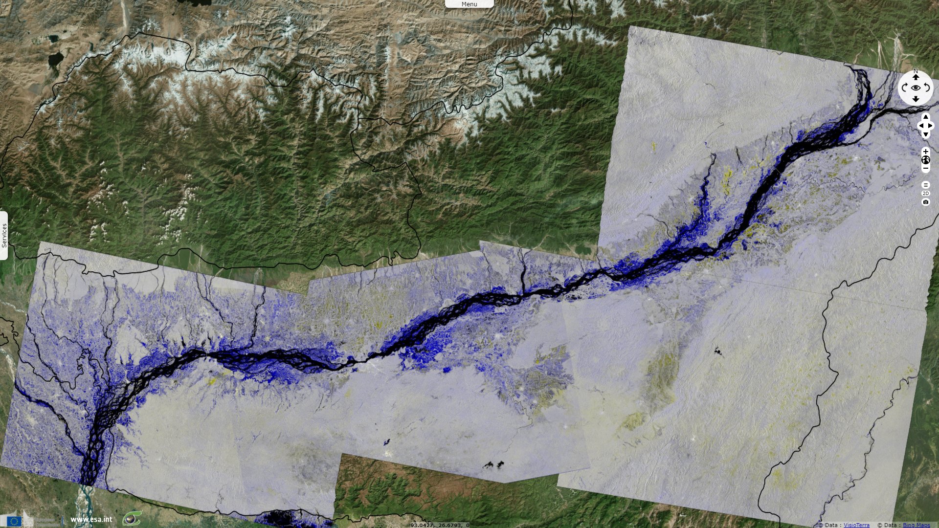
Sentinel-1 CSAR IW acquired on 01 September 2021 at 11:57:08 UTC
...
Sentinel-1 CSAR IW acquired on 27 August 2021 at 23:55:33 UTC
Sentinel-1 CSAR IW acquired on 29 August 2021 from 23:38:42 to 23:39:07 UTC
Sentinel-1 CSAR IW acquired on 01 September 2021 at 11:57:08 UTC
Keyword(s): Emergency, precipitations, natural disaster, river, hydrology, urban planning, India
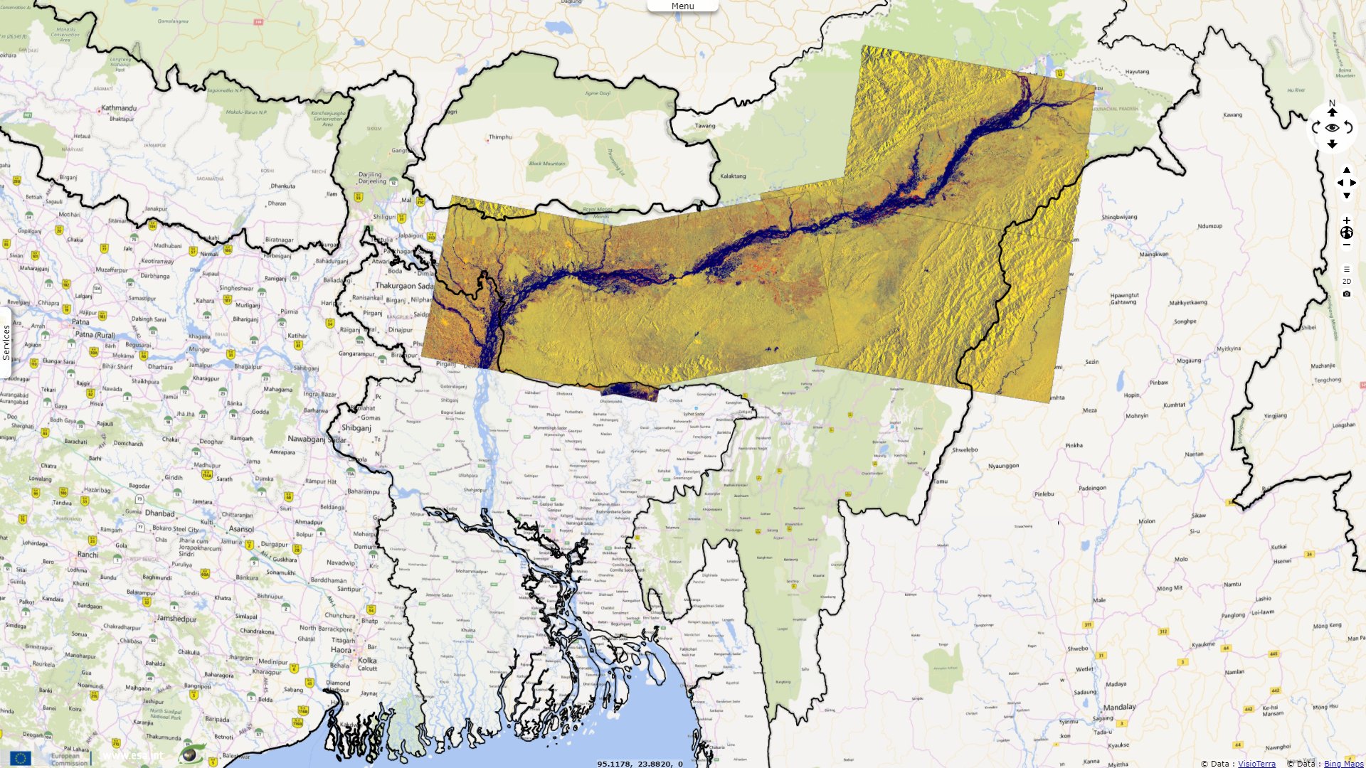
The Assam State Disaster Management Authority said a total of 258,191 people have now been affected by the floods across 732 villages in 16 districts.
The views expressed herein can in no way be taken to reflect the official opinion of the European Space Agency or the European Union.
Contains modified Copernicus Sentinel data 2026, processed by VisioTerra.
Contains modified Copernicus Sentinel data 2026, processed by VisioTerra.
| More on European Commission space: |  |
 |
 |
||||
| More on ESA: | |
|
|
S-1 website | S-2 website | S-3 website | |
| More on Copernicus program: | |
|
|
Scihub portal | Cophub portal | Inthub portal | Colhub portal |
| More on VisioTerra: | |
|
|
Sentinel Vision Portal | Envisat+ERS portal | Swarm+GOCE portal | CryoSat portal |