Ascending and descending views combined over Sinabung eruptions, Indonesia
Sentinel-1 CSAR IW acquired on 27 July 2020 at 11:42:26 & 23:11:38 UTC
Sentinel-1 CSAR IW acquired on 08 August 2020 at 11:42:27 & 23:11:39 UTC
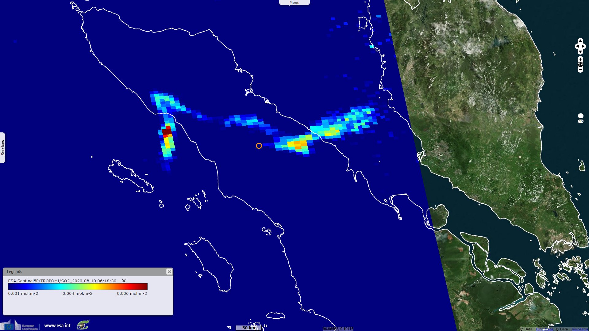
Sentinel-5P TROPOMI SO2 acquired on 10 August 2020 at 07:28:05 UTC
...
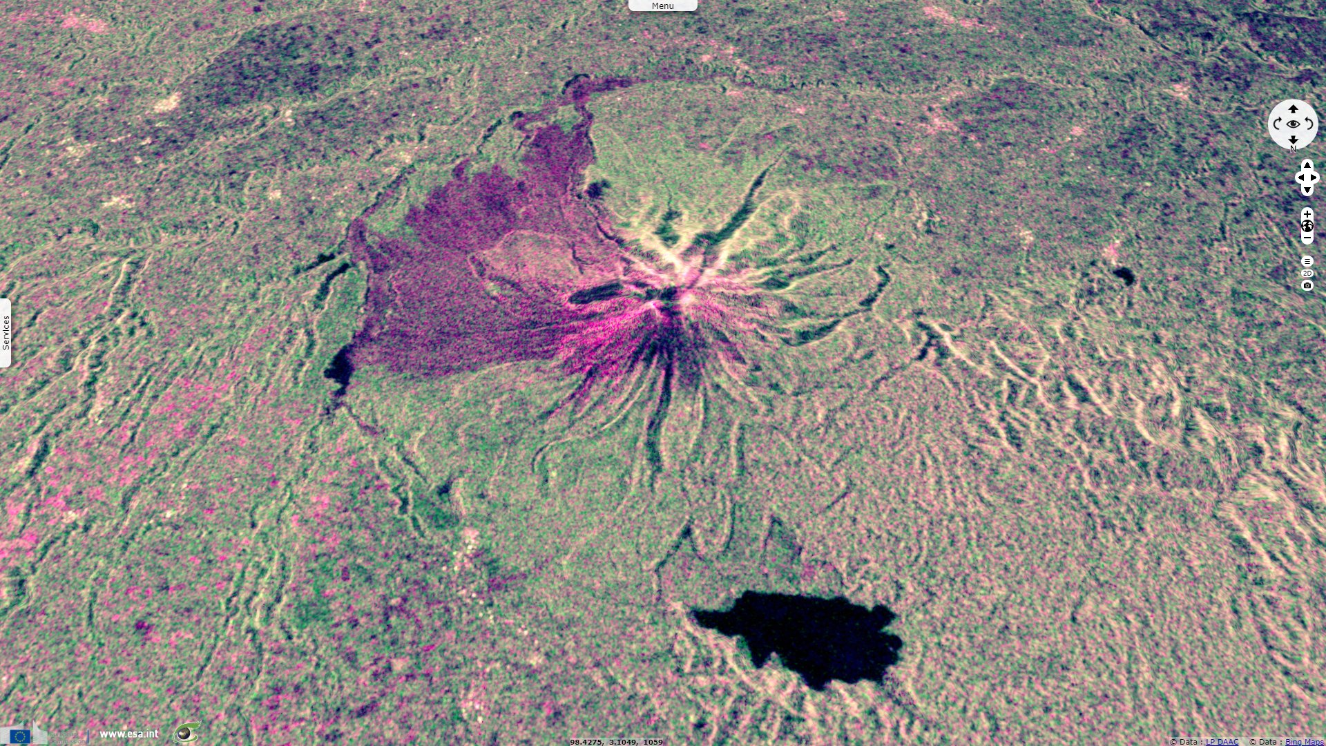
Sentinel-1 CSAR IW acquired on 20 August 2020 at 11:42:28 & 23:11:39 UTC
Sentinel-1 CSAR IW acquired on 08 August 2020 at 11:42:27 & 23:11:39 UTC
Sentinel-5P TROPOMI SO2 acquired on 10 August 2020 at 07:28:05 UTC
...
Sentinel-1 CSAR IW acquired on 20 August 2020 at 11:42:28 & 23:11:39 UTC
Keyword(s): Emergency, natural disaster, atmosphere monitoring, volcano, arc, eruption, subduction, geology, Sumatra island, Indonesia, Pacific Ring of Fire
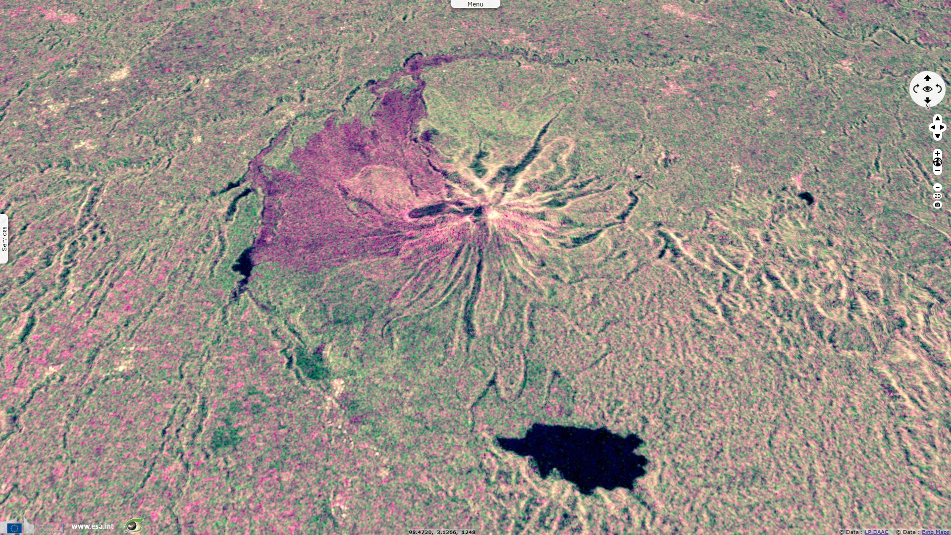
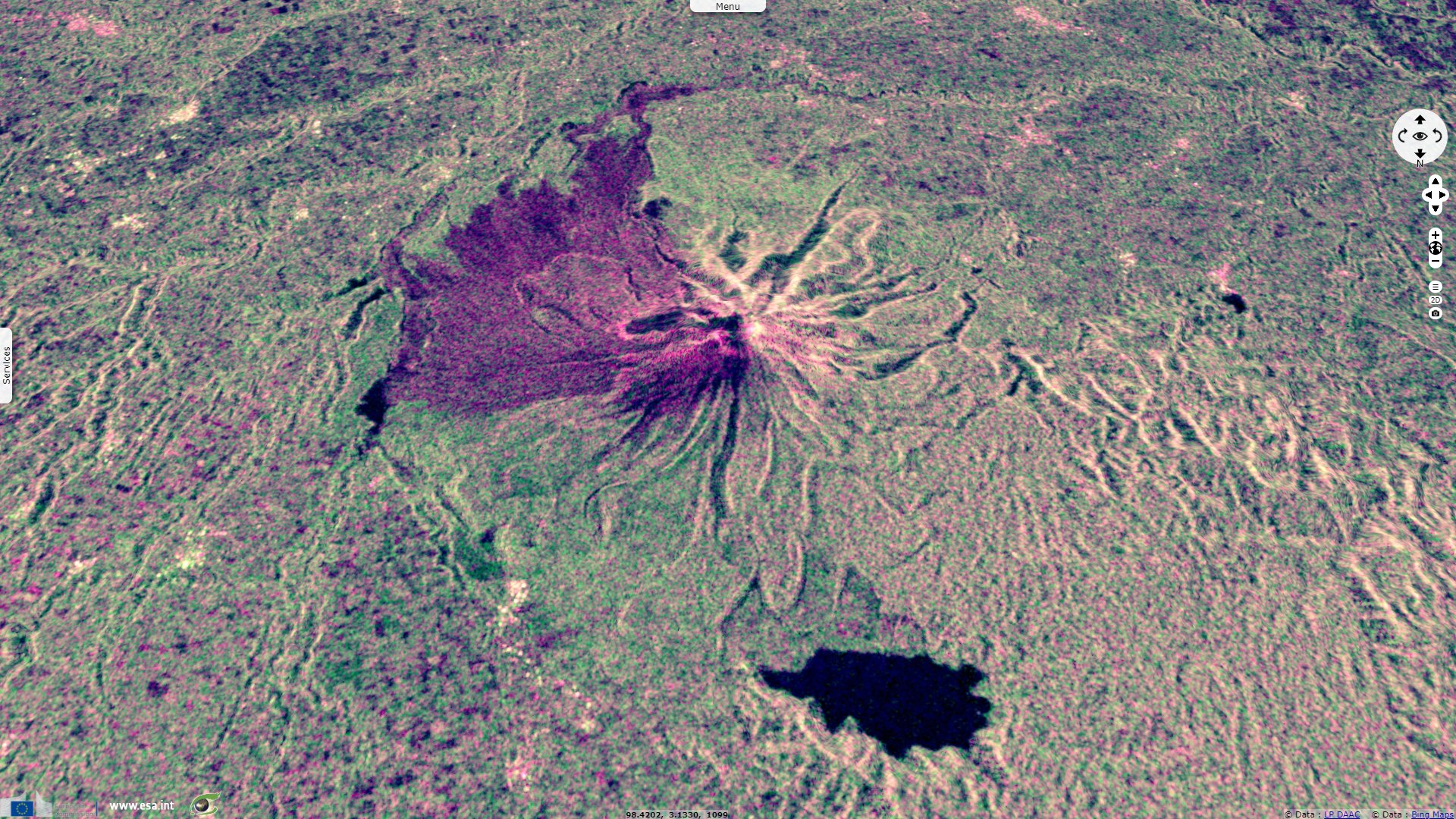
Due to the direction of the erupted material, the different phases of the eruption can only be fully seen by mixing ascending and descending point of views, as it is here. For each of the three couples of image, both ascending and descending views have been acquired on the same date.
The views expressed herein can in no way be taken to reflect the official opinion of the European Space Agency or the European Union.
Contains modified Copernicus Sentinel data 2026, processed by VisioTerra.
Contains modified Copernicus Sentinel data 2026, processed by VisioTerra.
| More on European Commission space: |  |
 |
 |
||||
| More on ESA: | |
|
|
S-1 website | S-2 website | S-3 website | |
| More on Copernicus program: | |
|
|
Scihub portal | Cophub portal | Inthub portal | Colhub portal |
| More on VisioTerra: | |
|
|
Sentinel Vision Portal | Envisat+ERS portal | Swarm+GOCE portal | CryoSat portal |