Lake Malawi through 25 years of GMES and Copernicus
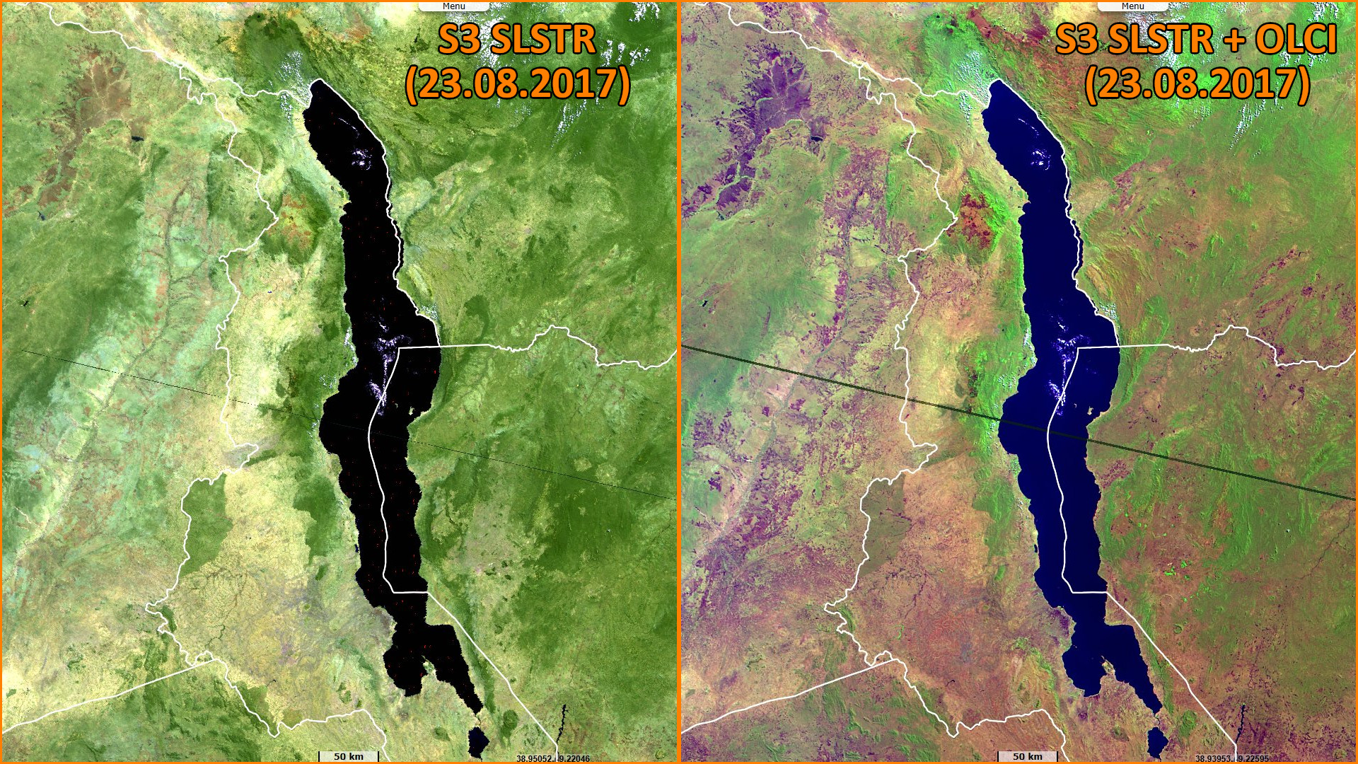
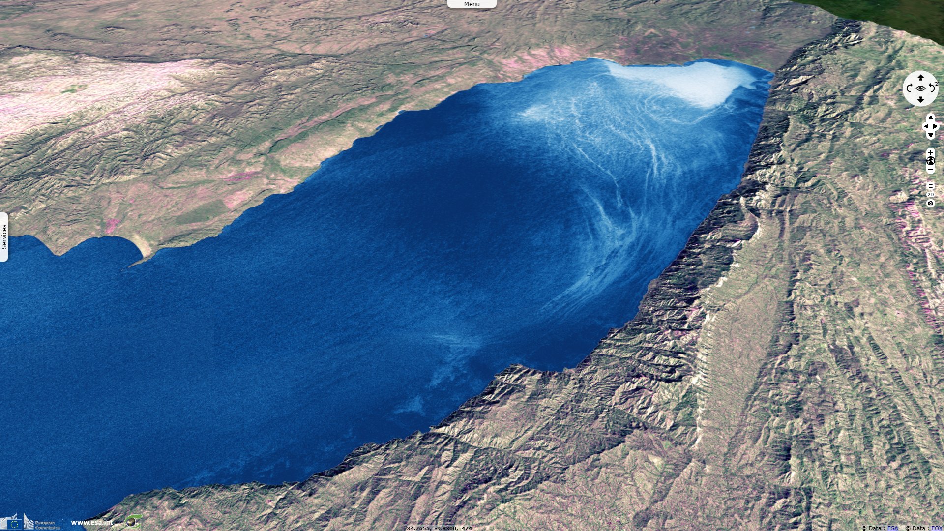
Sentinel-3 OLCI FR & SLSTR RBT acquired on 23 August 2017 at 07:24:36 UTC
...
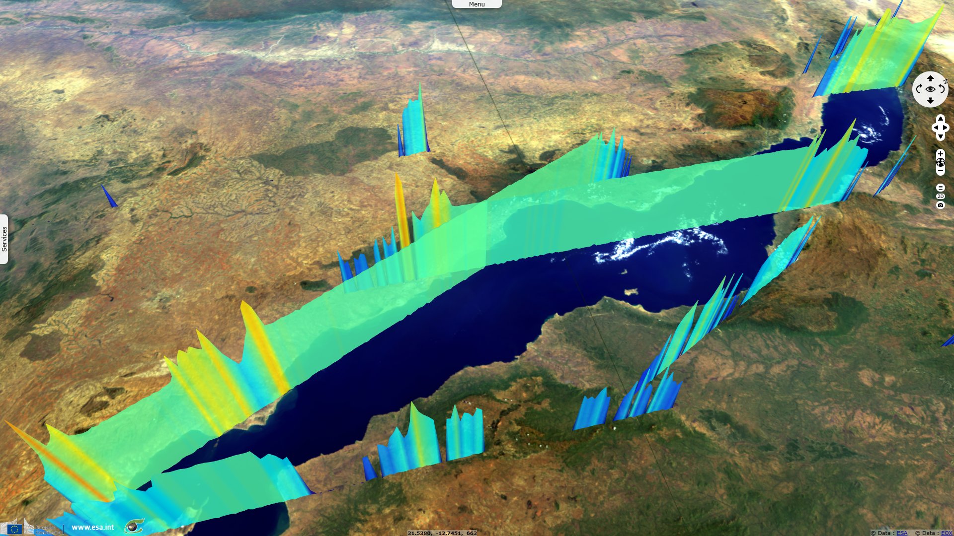
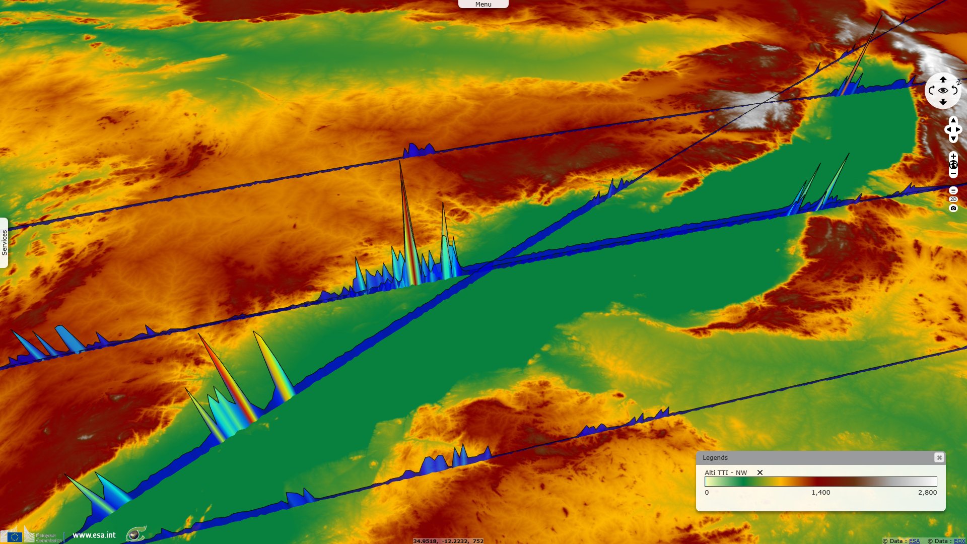
Sentinel-3 SRAL LAND acquired on 28 July 2018 at 07:11:15 UTC
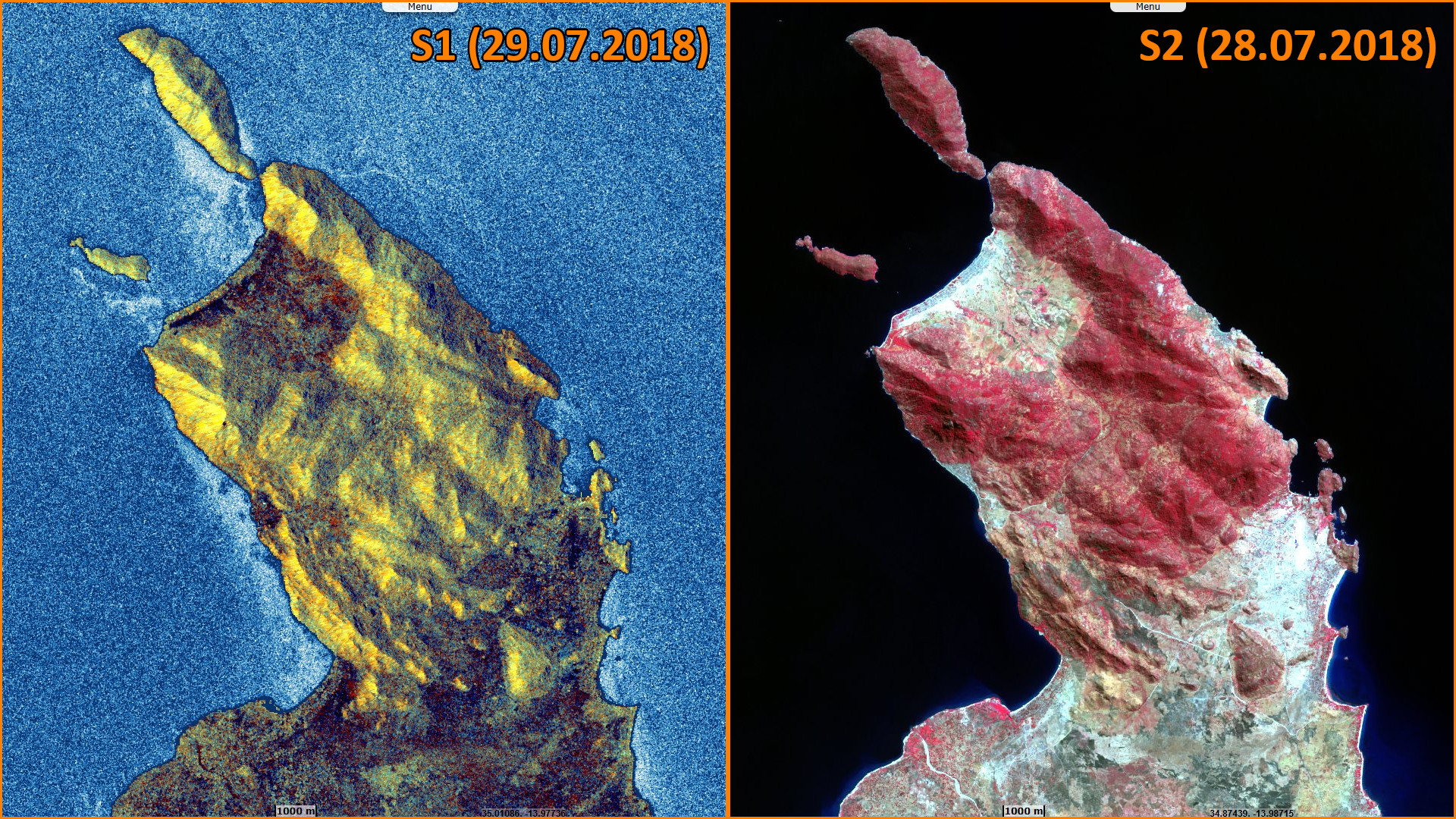
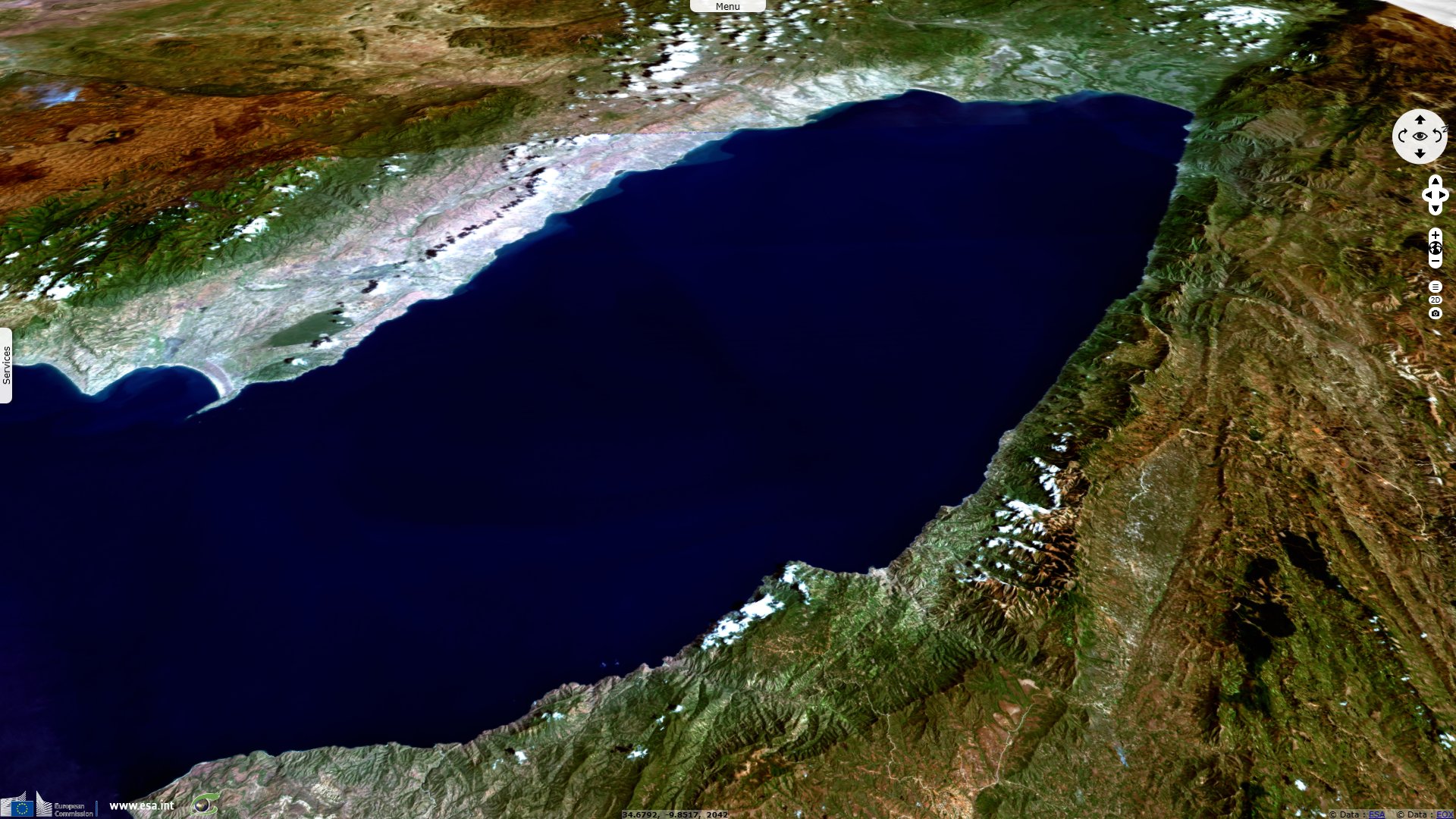
Sentinel-2 MSI acquired on 28 July 2018 at 07:36:09 UTC
Sentinel-1 CSAR IW acquired on 29 July 2018 from 16:08:12 to 16:09:27 UTC
...
Sentinel-3 SRAL LAND acquired on 28 July 2018 at 07:11:15 UTC
Sentinel-2 MSI acquired on 28 July 2018 at 07:36:09 UTC
Sentinel-1 CSAR IW acquired on 29 July 2018 from 16:08:12 to 16:09:27 UTC
Keyword(s): Lake, coastal, fishing, savannah, UNESCO World heritage site, RAMSAR wetland, biodiversity, Malawi, Mozambique, Tanzania, Africa Rift Valley
On 8 June 2023, the Swedish Presidency of the Council of the European Union and the European Commission in partnership with the European Space Agency, and the Swedish National Space Agency will celebrate the 25th anniversary of Copernicus, the EU’s Earth Observation flagship. ‘Europe’s eyes on Earth’ started in 1998 with the signature of the Baveno Manifesto, as an idea for a programme to monitor the environment. Initially known as the Global Monitoring for Environmental Security (GMES), the programme was designed to furnish valuable data that could assist in various aspects of public policy such as understanding and mitigating the effects of climate change and ensure civil security.
Since then, Copernicus has exceeded expectations and become one of the most ambitious and successful Earth Observation programme worldwide. With seven Copernicus Sentinel satellites in orbit, in addition to contributing missions, in situ sensors, and numerical models, terabytes of free and open data and information services are provided daily to hundreds of thousands of users. Copernicus has also generated significant economic benefits and supports tens of thousands of jobs. These success stories will be the highlight of the event, which will put the spotlight on the users of Copernicus.
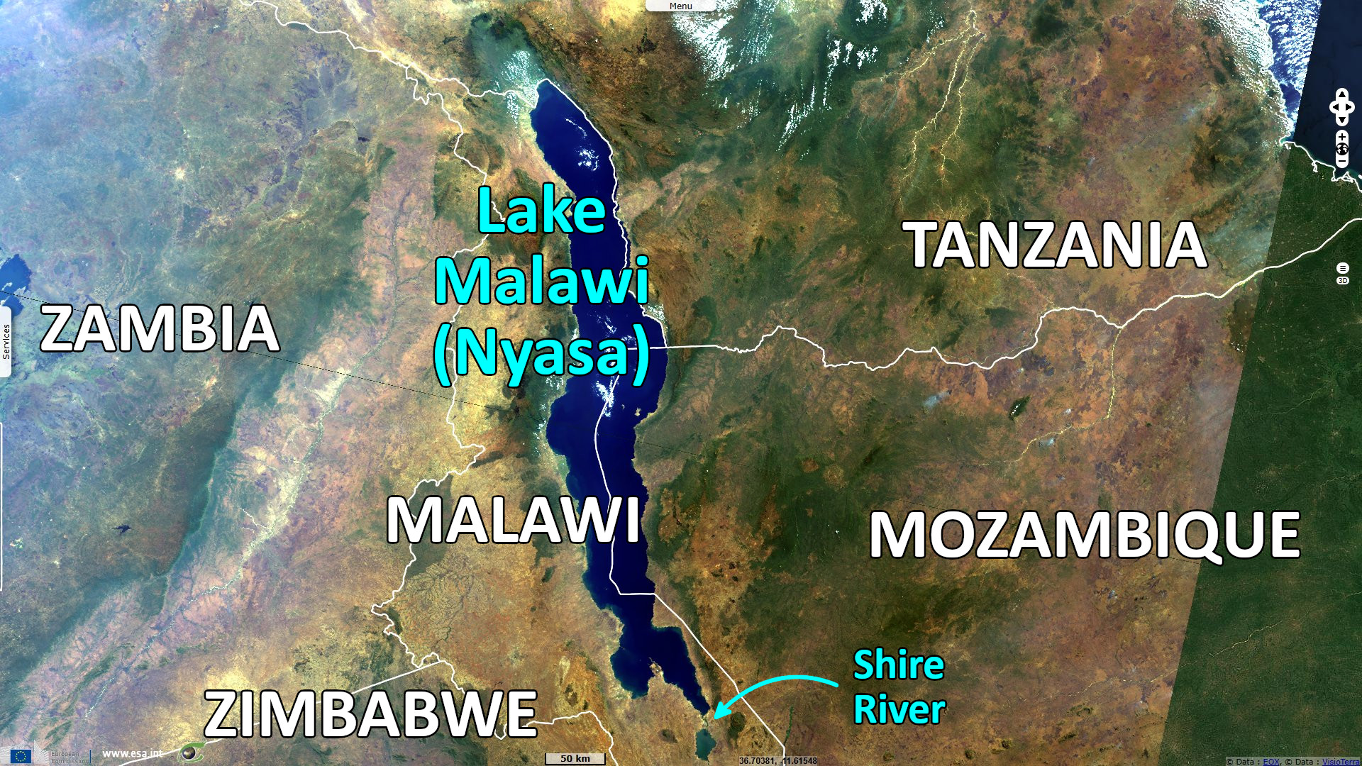
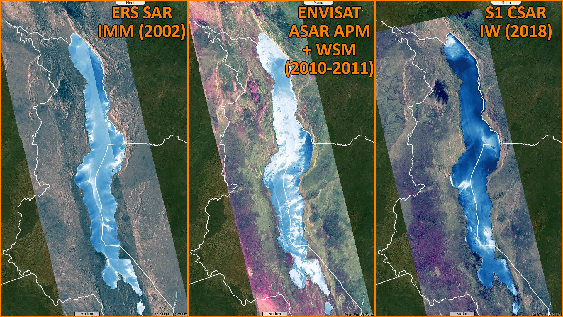
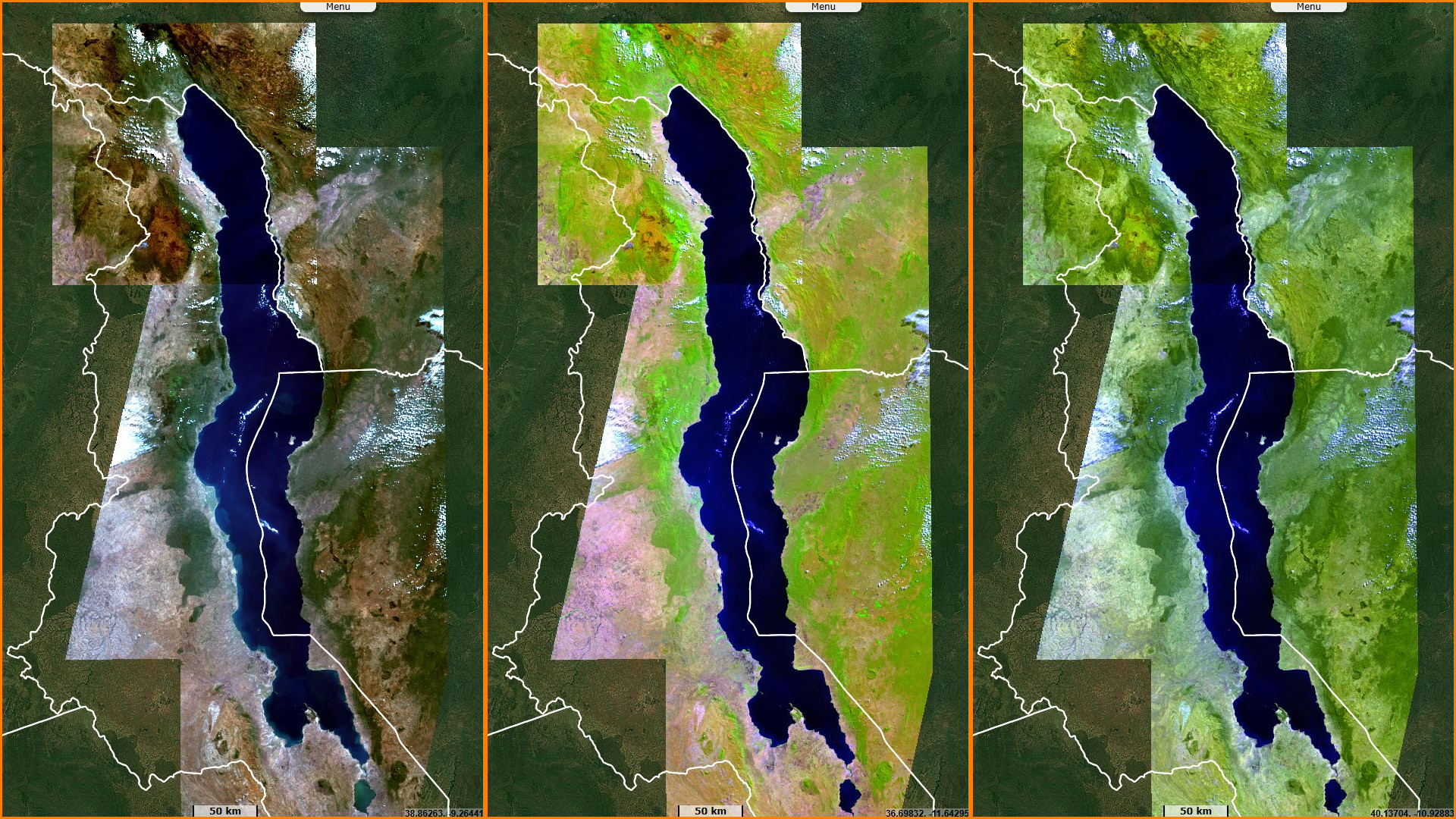
To highlight this success, the present story underscores the heritage of GMES and Copernicus from ERS to ENVISAT to Sentinels. It highlights one of the largest, deepest and oldest lakes in the World, one that hosts a biodiversity like few others.
Lake Malawi is the fifth largest fresh water lake in the world by volume, the ninth largest lake in the world by area—and the third largest and second deepest lake in Africa. It is between 560 km and 580 km long, and about 75 km wide at its widest point. The lake is 706 m at its deepest point, it has a total surface area of about 29 600 km², between the size of Armenia and Belgium.
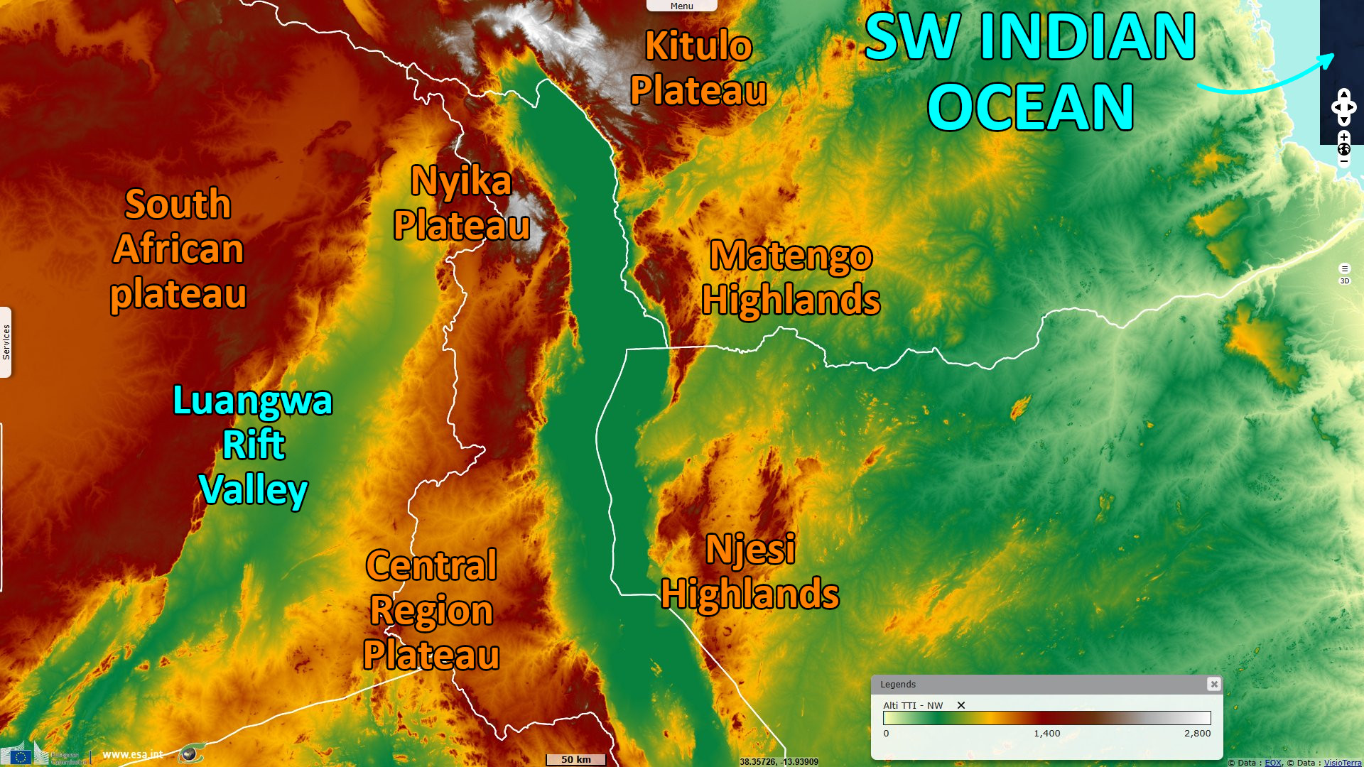
Malawi lies in a valley formed by the opening of the East African Rift, where the African tectonic plate is being split into two pieces. Recent evidence points to a formation of the basin that started about 8.6 million years ago and deep-water condition first that appeared 4.5 million years ago.
Located at the southern tip of the lake, Lake Malawi National Park is a UNESCO World Heritage site: "an area of exceptional natural beauty with its islands and clear waters set against the background of the Great African Rift Valley escarpment. Habitat types vary from rocky shorelines to sandy beaches and from wooded hillsides to swamps and lagoons. Granitic hills rise steeply from lakeshore and there are a number of sandy bays."
Lake Malawi is home to more species of fish than any other lake in the world, including at least 700 species of cichlids. Due to its exceptionnal biodiversity, the lake is inscribed as a RAMSAR protected area: "As one of the African Rift Valley great lakes, it is also part of the Miombo Woodlands ecoregion. This site has numerous unique features, from its boundaries that range from extensive plains in the South and steep sided mountains in the North, to the high levels of fish species that are endemic to the lake (90%) with more species continually being discovered. This site is also recognised for its support of threatened populations of leopard, sable antelope, and elephants amongst others. The Lake also lies within flyways of migratory birds that use the lake margins as staging areas between Africa and Europe."
"The property is an outstanding example of biological evolution. Adaptive radiation and speciation are particularly noteworthy in the small brightly coloured rocky-shore tilapiine cichlids (rockfish), known locally as mbuna. All but five of over 350 species of mbuna are endemic to Lake Malawi and represented in the park. Lake Malawi's cichlids are considered of equal value to science as the finches of the Galapagos Islands remarked on by Charles Darwin or the honeycreepers of Hawaii.", its UNESCO sheet adds.
"Lake Malawi is globally important for biodiversity conservation due to its outstanding diversity of its fresh water fishes. The property is considered to be a separate bio-geographical province with estimates of up to 1000 species of fish half occurring within the property: estimated as the largest number of fish species of any lake in the world. Endemism is very high: of particular significance are the cichlid fish, of which all but 5 of over 350 species are endemic. The lake contains 30% of all known cichlids species in the world. The property is also rich in other fauna including mammals, birds and reptiles."
"The property is sufficiently large (94.1 km² of which 7 km² is aquatic zone) to adequately represent the water features and processes that are of importance for long term conservation of the lake's rich biodiversity and exceptional natural beauty. The water area within the national park protects the most important elements of the lake's biodiversity. It also protects all major underwater vegetation types and important breeding sites for the cichlids. Many other fish species of Lake Malawi are however unprotected due to the limited size of the park in relation to the overall area of the lake."
The RAMSAR sheet warns: "While the site is facing severe threats due to the overexploitation of the lake's resources, it is important in the sustenance of the surrounding populations' livelihoods through activities such as fishing, agriculture, animal rearing, hunting, trade and handicrafts."
Within the National Park, "Utilisation of park resources is restricted to curb the illegal harvesting of resources. There are five villages included within enclaves inside the property. The local population is dependent on fishing for a livelihood as the soil is poor and crop failure frequency is high. Whilst the property's terrestrial and underwater habitats are still in good condition, management planning needs to deal more effectively with the threats of rapid growth of human population and the impacts of firewood collection, fish poaching and crowded fish landing sites." complements the UNESCO.
The views expressed herein can in no way be taken to reflect the official opinion of the European Space Agency or the European Union.
Contains modified Copernicus Sentinel data 2026, processed by VisioTerra.
Contains modified Copernicus Sentinel data 2026, processed by VisioTerra.
| More on European Commission space: |  |
 |
 |
||||
| More on ESA: | |
|
|
S-1 website | S-2 website | S-3 website | |
| More on Copernicus program: | |
|
|
Scihub portal | Cophub portal | Inthub portal | Colhub portal |
| More on VisioTerra: | |
|
|
Sentinel Vision Portal | Envisat+ERS portal | Swarm+GOCE portal | CryoSat portal |