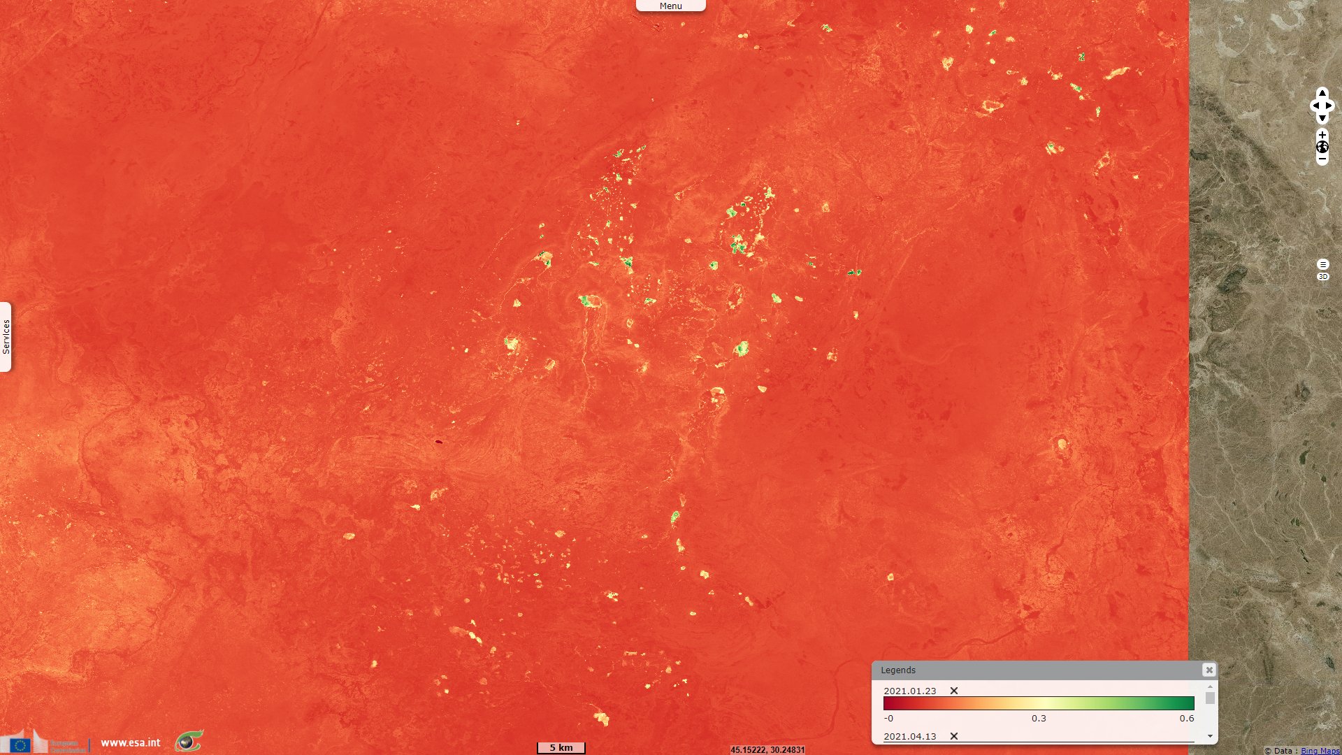
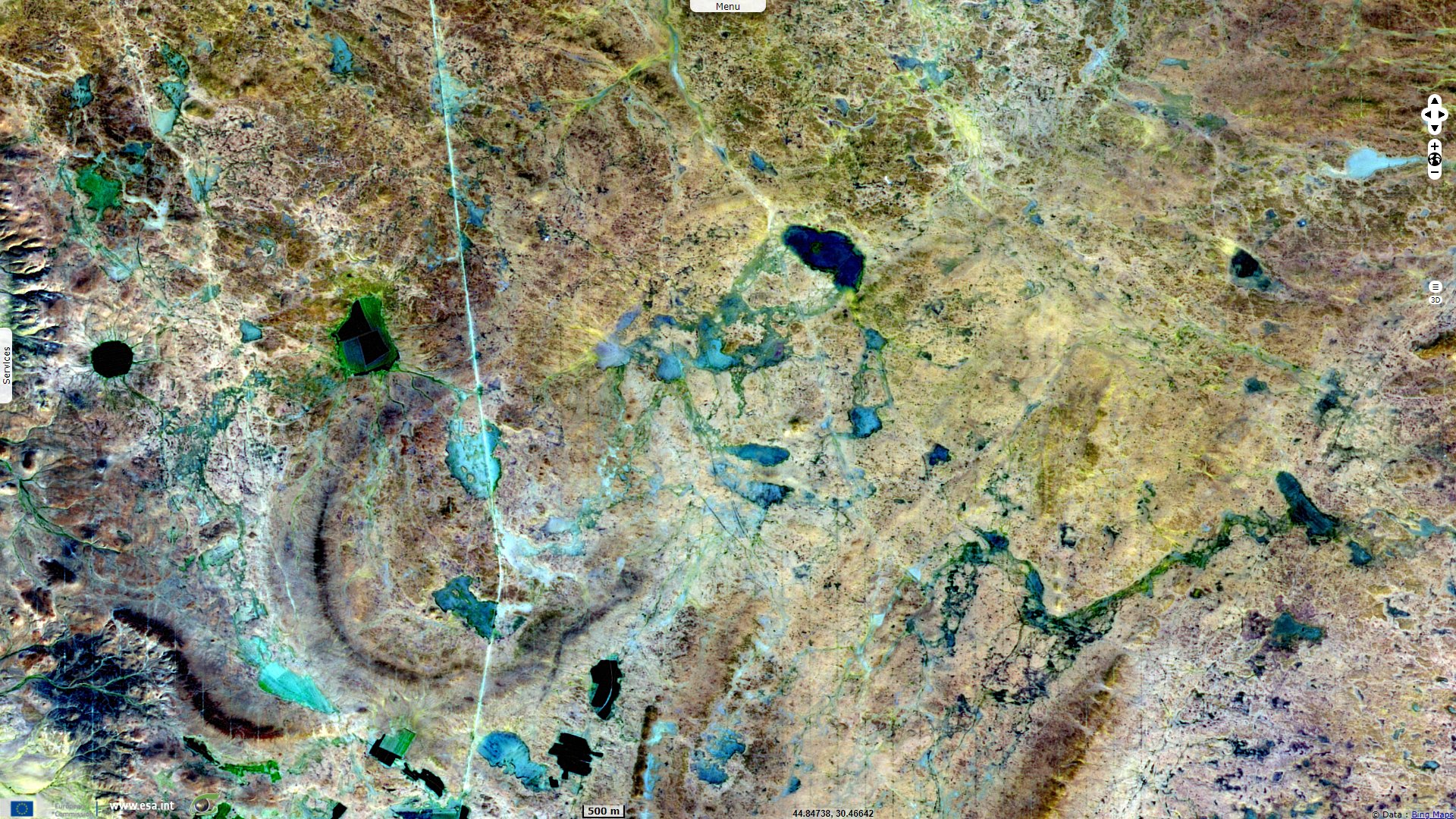
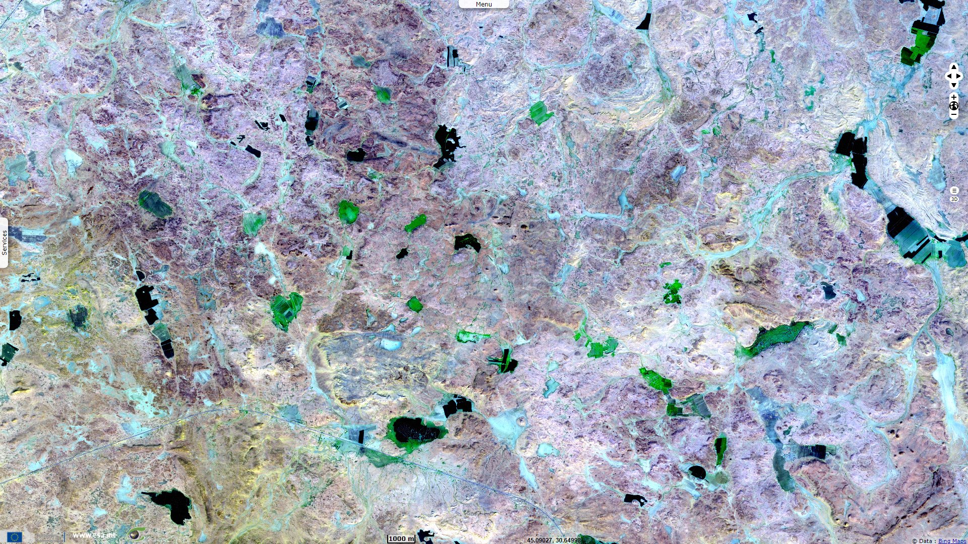
Underground network and sinkholes, South Iraq desert
Sentinel-2 MSI acquired on 23 January 2021 at 07:41:19 UTC
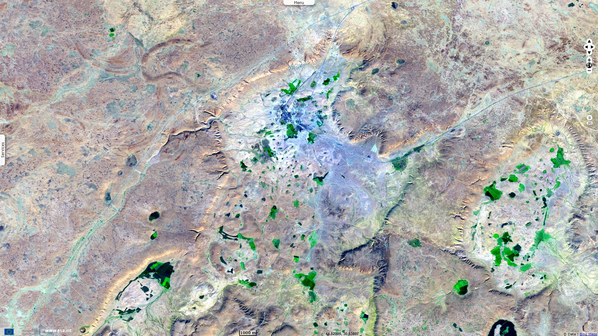
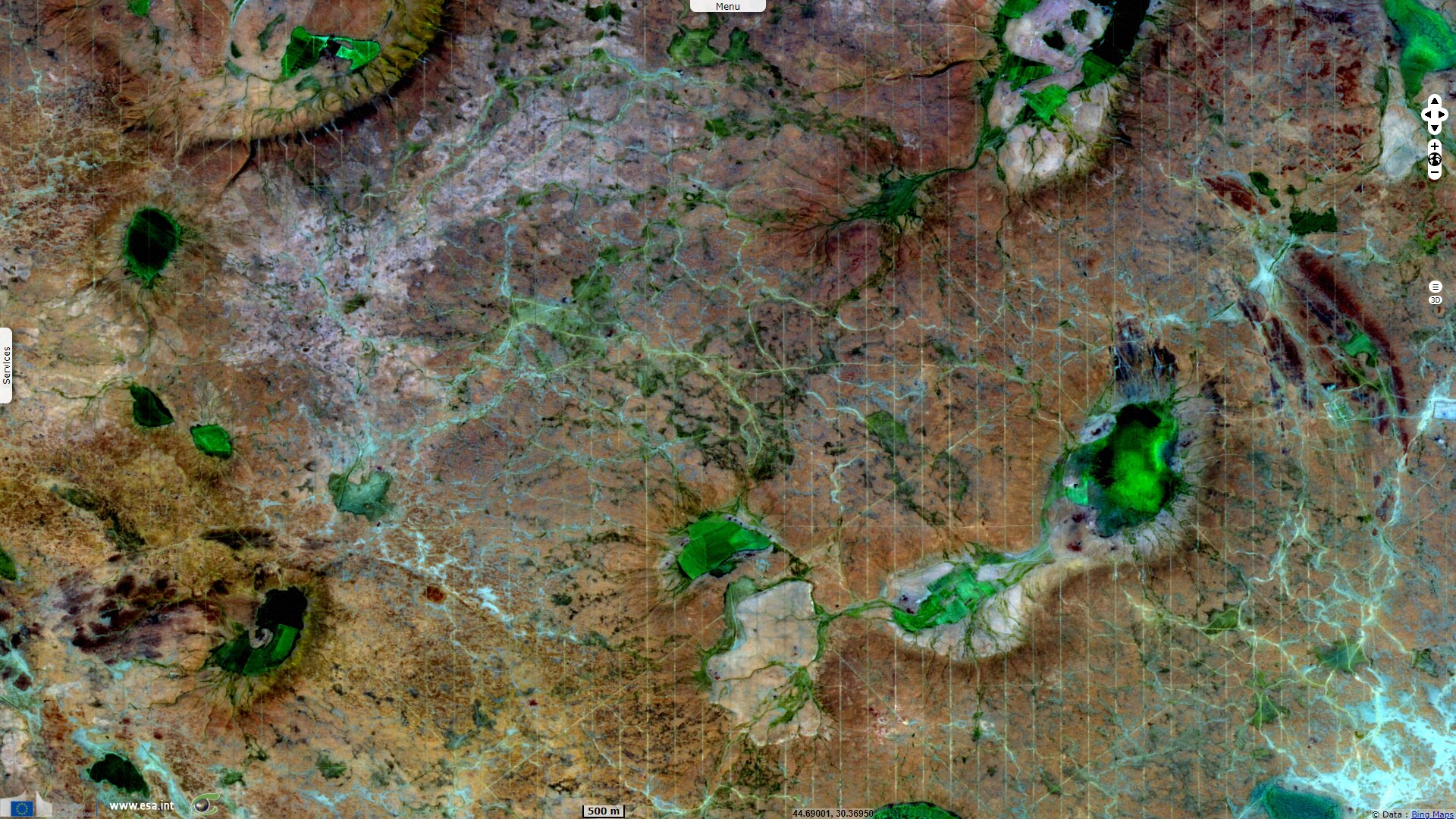
Sentinel-2 MSI acquired on 23 May 2021 at 07:36:09 UTC
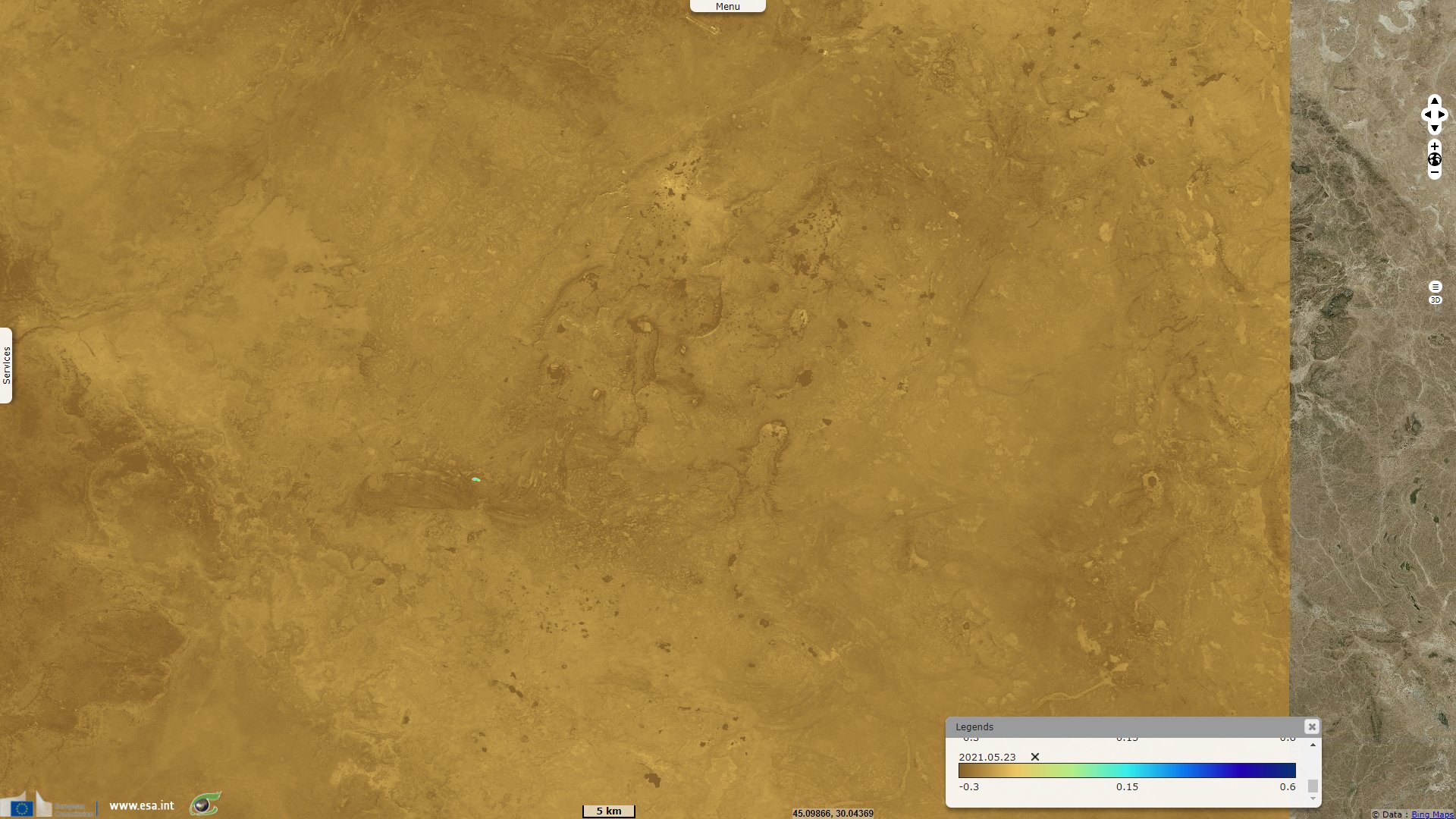
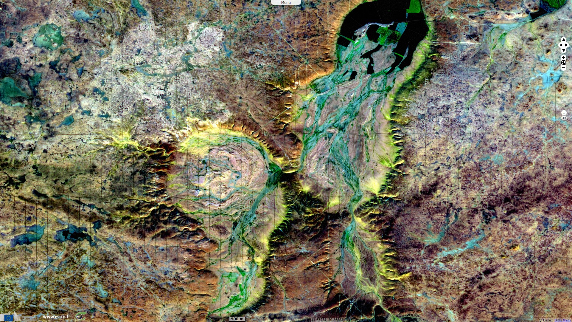
Sentinel-1 CSAR IW acquired on 25 November 2021 from 15:06:38 to 15:07:03 UTC
Sentinel-1 CSAR IW acquired on 07 December 2021 from 15:06:37 to 15:07:02 UTC
Sentinel-1 CSAR IW acquired on 19 December 2021 from 15:06:37 to 15:07:02 UTC
Sentinel-2 MSI acquired on 23 May 2021 at 07:36:09 UTC
Sentinel-1 CSAR IW acquired on 25 November 2021 from 15:06:38 to 15:07:03 UTC
Sentinel-1 CSAR IW acquired on 07 December 2021 from 15:06:37 to 15:07:02 UTC
Sentinel-1 CSAR IW acquired on 19 December 2021 from 15:06:37 to 15:07:02 UTC
Keyword(s): Hydrology, geology, erosion, karst, river, desert, Iraq, Saudi Arabia
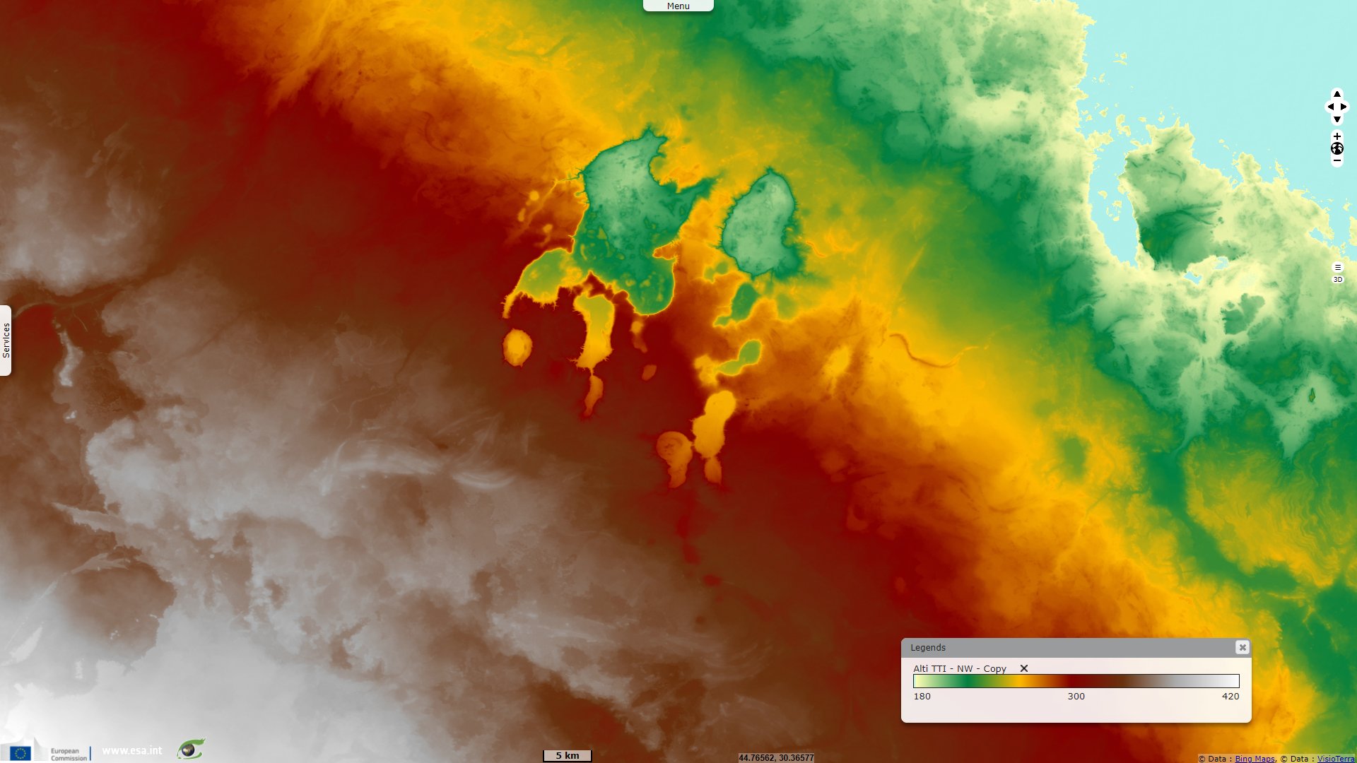
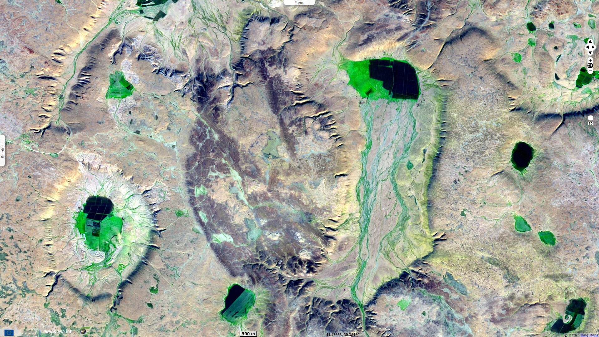
An unusual landscape can be found in the Southern Desert of Iraq, near the locality of As Salman, a network of collapsed caves and eroded rock walls. It is described in Geology of the Arabian Peninsula, South-western Iraq published in 1963 by K. M. Al Naqib for the United States Geological Survey (USGS): "Farther west, in the neighborhood of As Salman, there is a group of very deep depressions completely surrounded by cliffs, some of which have a relief of as much as 50 meters. These have no surface outlet, owing to the flatness of the country, and form several topographic closed basins of varying diameter, which may be as much as 15 kilometers. Extensive pools form in some of these depressions after rains."
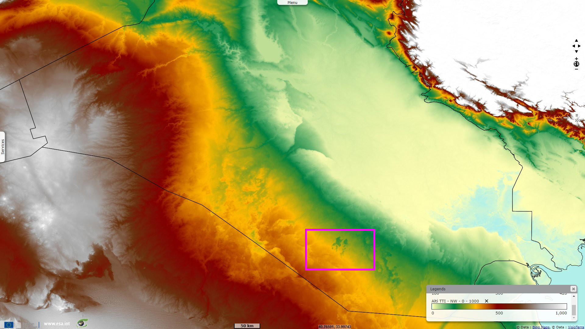
Position plan viewed on Sentinel-1.
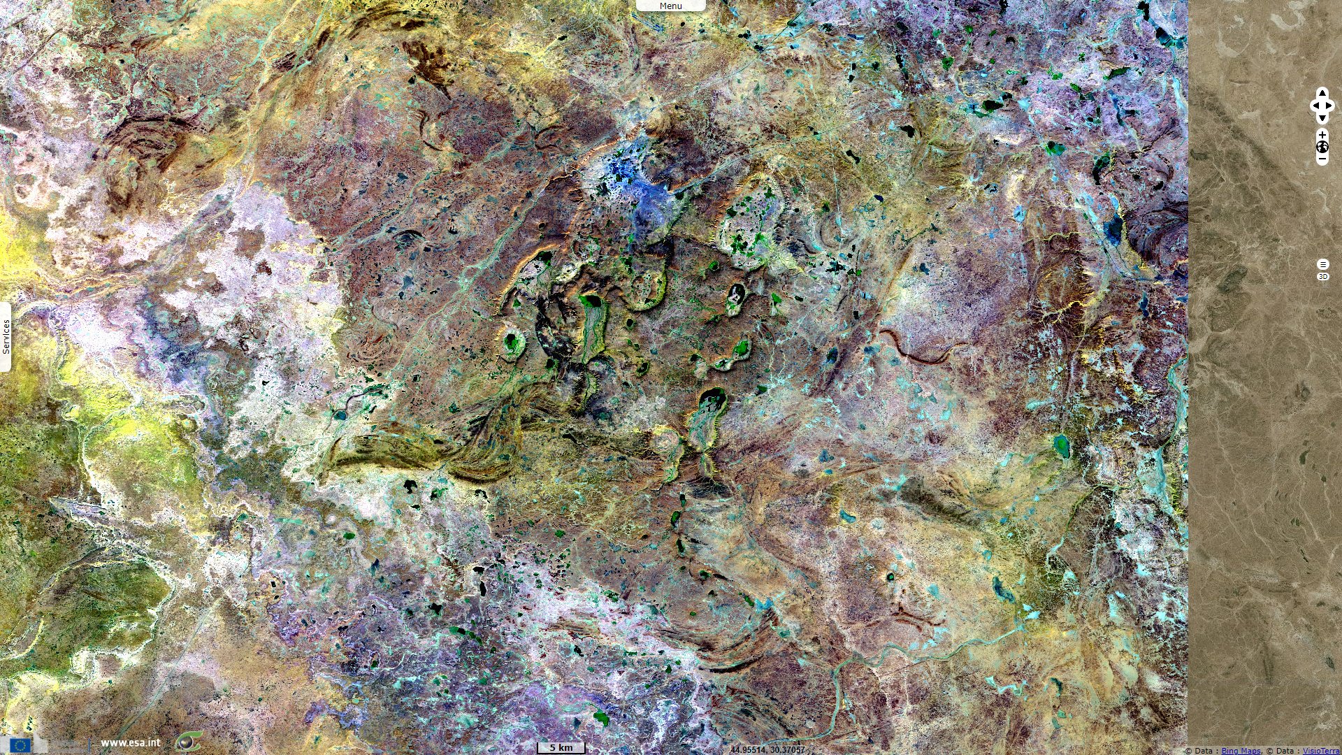
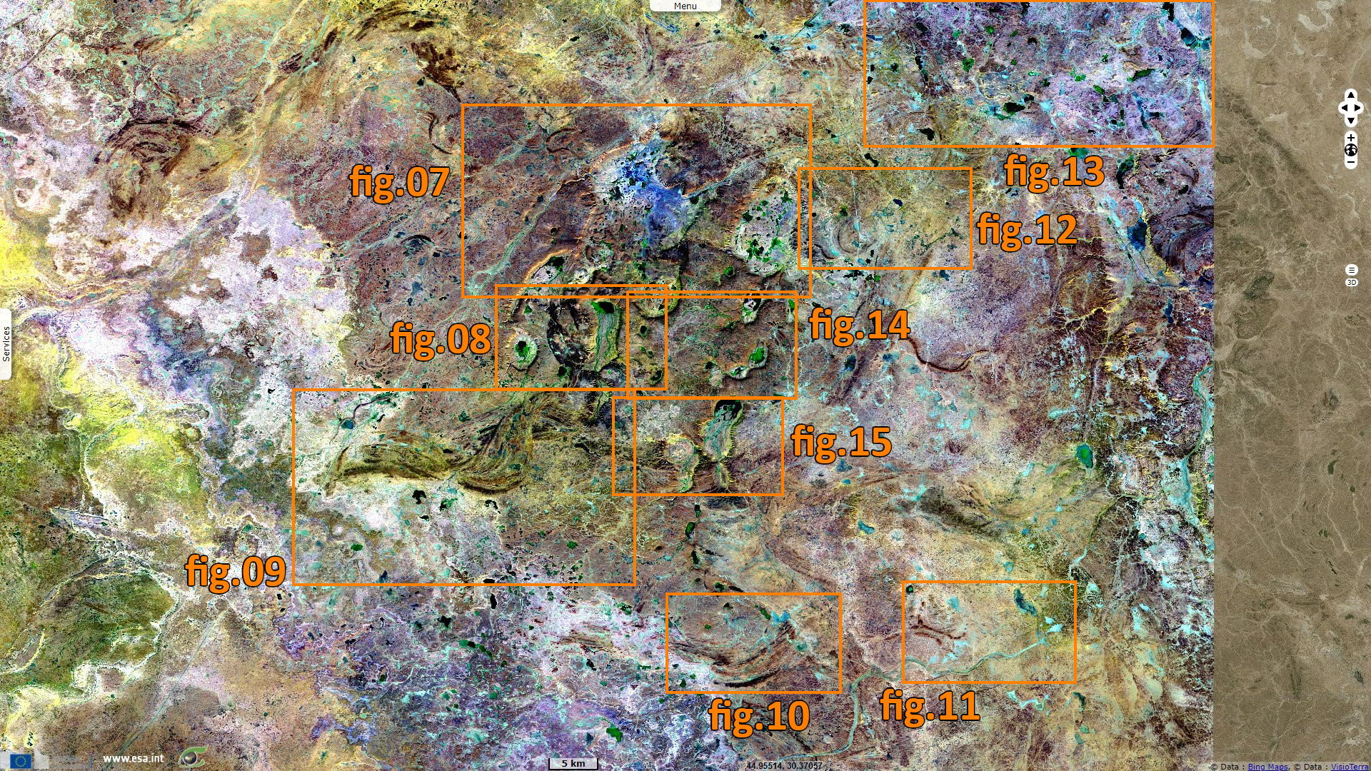
Position plan viewed on Sentinel-2.
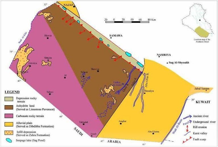
Distribution of landforms during the Pliocene-Pleistocene - Source: Iraqi Bulletin of Geology and Mining, Geology of Iraqi Southern Desert.
"They crop out in ascending sequence toward the east and trend generally northnorthwest, almost parallel to the Euphrates Eiver. Minor irregularities in this pattern are due to local topographic depressions such as those found in the As Salman and Ash Shabakah regions, where younger rocks have escaped erosion and thus occur in anomalous position".
"Limestone, mainly gray and white, well-bedded, saccharoidal, some chert nodules; sporadically vuggy and recrystallized. According to H. Huber (unpub. data, 1944), this unit contains a thin bed of gypsum in vicinity of As Salman-As Samawah track near Faydat Ash Shaykh. This possibly indicates influence of the Rus Formation; thickness, 10 m. Possible disconformity between this unit and overlying Barbak unit in southern part of Galaib 'structure.'"
"Examples occur in the As Salman group of depressions, such as Lahab and As Salman itself, where characteristic limestones and marls appear. The succession may consist of strata of white and reddish-brown marls, sandy marls, sands, irregular pinkish-white chalky concretional limestones, and conglomeratic or brecciated river deposits such as those at Saigal and As Salman."
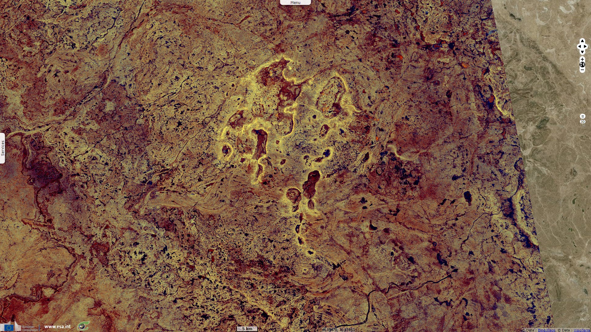
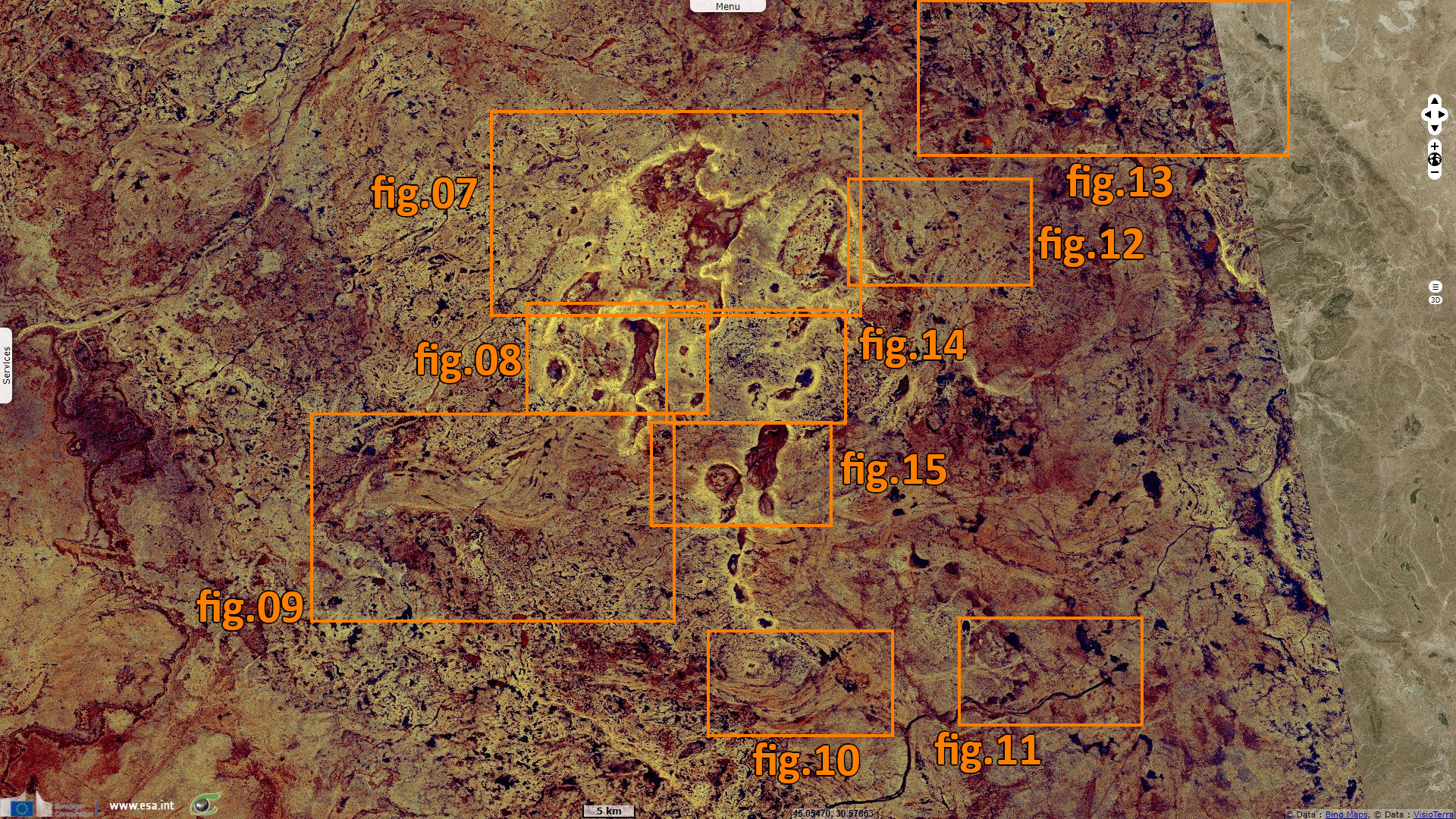
It is further described in the publication Iraqi Bulletin of Geology and Mining, Geology of Iraqi Southern Desert, released in 2009 by GeoSurvIraq: "Areas built up by limestone are marked by sinkholes, formed due to dissolved water (giving a more distincitve type of caves); even underground river channels being developed. The limestone of Al-Hajira unit is marked by sinkholes, uvalas, dolines, caverns and karst valleys. Hamza (1997) showed that the karst features (sinkholes, blind and karst valleys) are localized in the area around Al-Salman Depression."
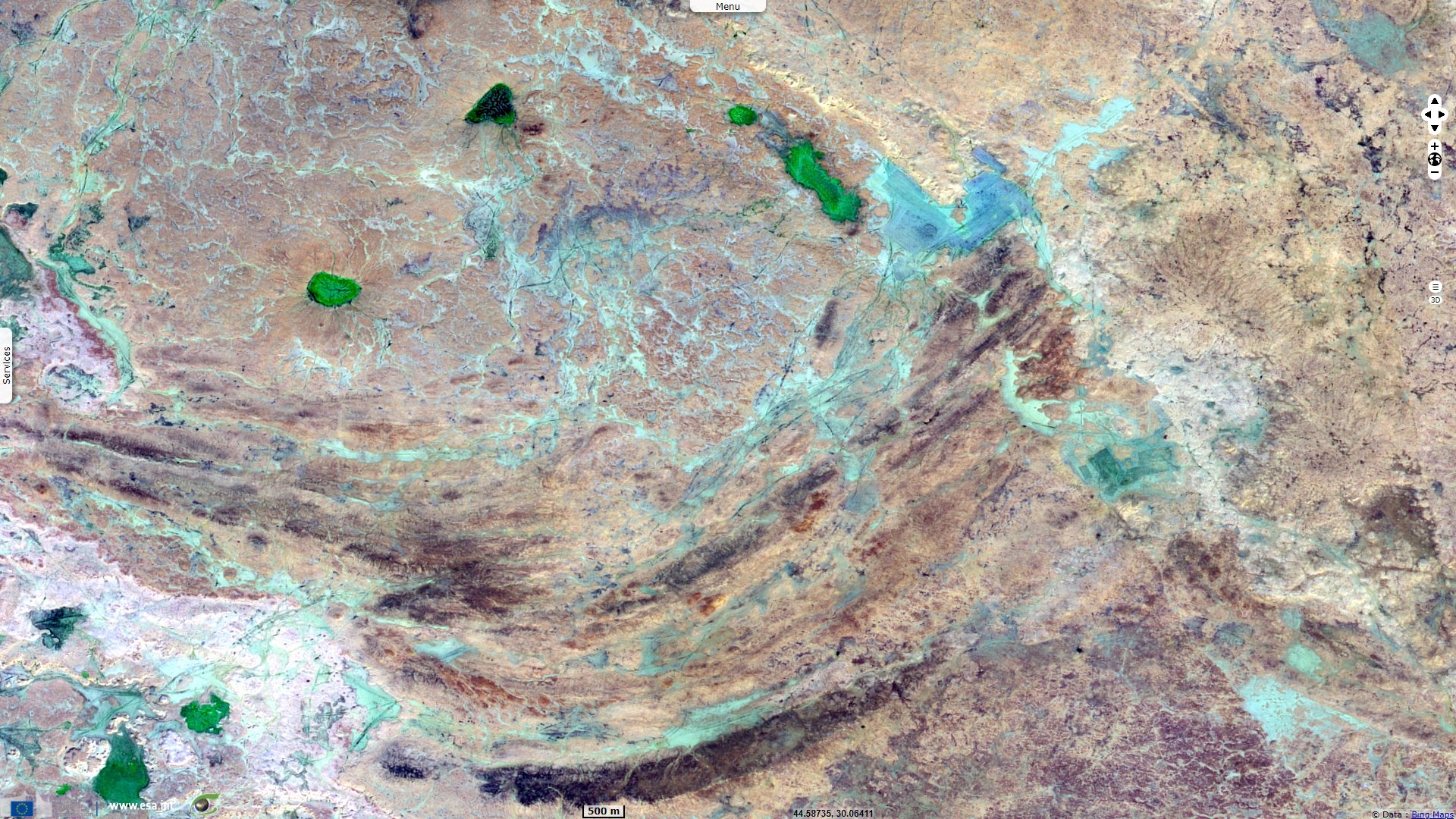
"Whereas, Sissakian and Ibrahim (2005) pointed out that the sinkholes are common types in the Southern Desert, which are developed due to dissolving of limestone. Sinkholes are well developed in the anhydrite land which can be named as Limestone Pavement (Bates and Jackson, 1983). It consists of hundreds of sinkholes which are filled by polygenetic sediments."
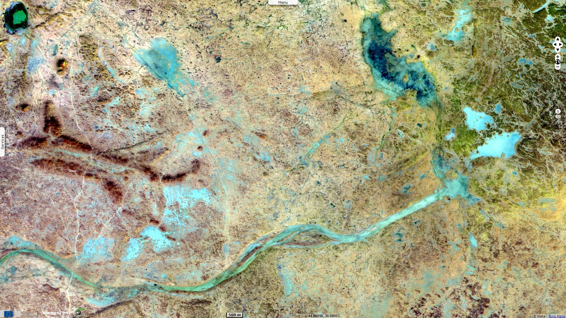
"A deep subterranean chemical weathering took place in respect to activity of groundwater as indicated from Salman with depths of 65 m from present ground surface. "Salman Depression is connected with apparent cayon like valley (63 m deep). Embleton and Thornes (1979) pointed that the chemical weathering in arid or semi arid climates produced deep subterranean hallows and caves. Jassim and Buday (2006) showed that the drainage trace in ground of Salman Depression could be observed by satellite."
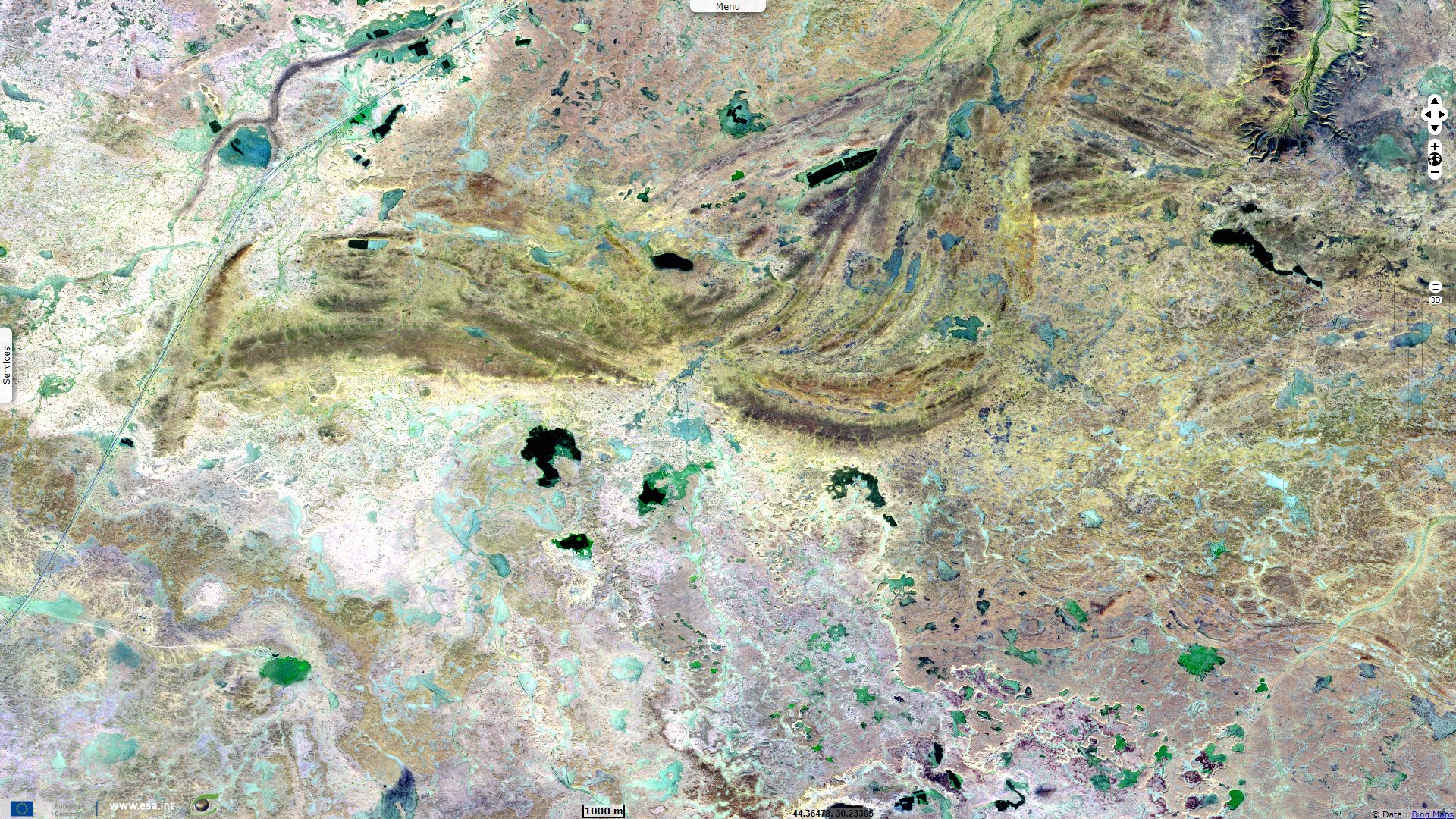
"The early Holocene climate was wet and hot with increasing of rainfall in summer season, which lead to rise of the seas level. This climate affected on some former subterranean hallows and caves, which were subdued to collapse due to their enlargement, such as Salman Depression. Some dolines are enlarged by conjunction of more dolines to form irregular depressions."
"The vertical erosion manifested itself along a canyon located south of Salman Depression. This phenomenon might be developed along dense fractures or master joint of N-S trend, associated with heavy rainfall and change in the base level of erosion during early Holocene. The perennial rivers were developed due to heavy rainfall with with humidity. Those rivers, which started from the present location of the Iraqi - Saudi Arabian borders, were running in NE direction due to the regional gradient."
The views expressed herein can in no way be taken to reflect the official opinion of the European Space Agency or the European Union.
Contains modified Copernicus Sentinel data 2026, processed by VisioTerra.
Contains modified Copernicus Sentinel data 2026, processed by VisioTerra.
| More on European Commission space: |  |
 |
 |
||||
| More on ESA: | |
|
|
S-1 website | S-2 website | S-3 website | |
| More on Copernicus program: | |
|
|
Scihub portal | Cophub portal | Inthub portal | Colhub portal |
| More on VisioTerra: | |
|
|
Sentinel Vision Portal | Envisat+ERS portal | Swarm+GOCE portal | CryoSat portal |