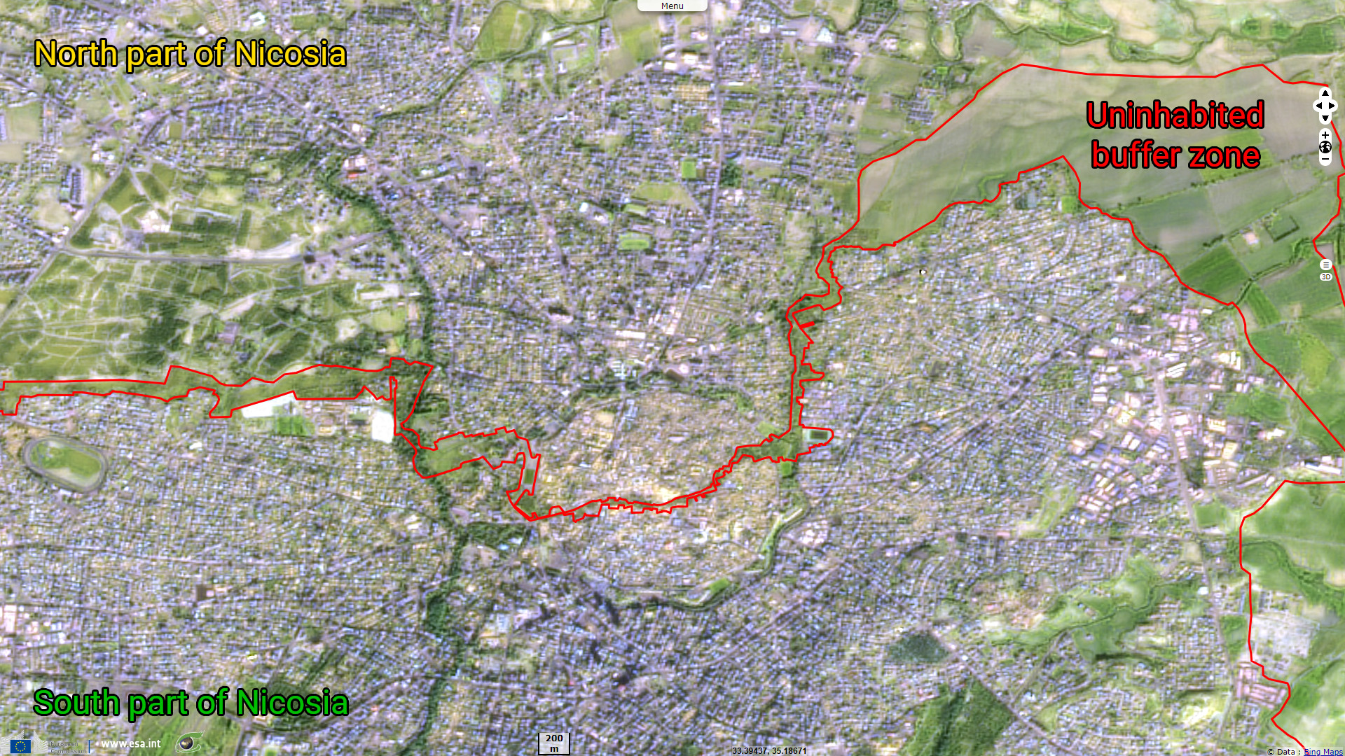
The buffer area that scars Cyprus in two
Sentinel-2 MSI acquired on 23 January 2023 at 08:32:41 UTC
Sentinel-3 SLSTR RBT acquired on 23 July 2023 at 08:14:53 UTC
Sentinel-3 SLSTR RBT acquired on 23 July 2023 at 08:14:53 UTC
Keyword(s): land, mediterranean sea, Greece, Turkey, security
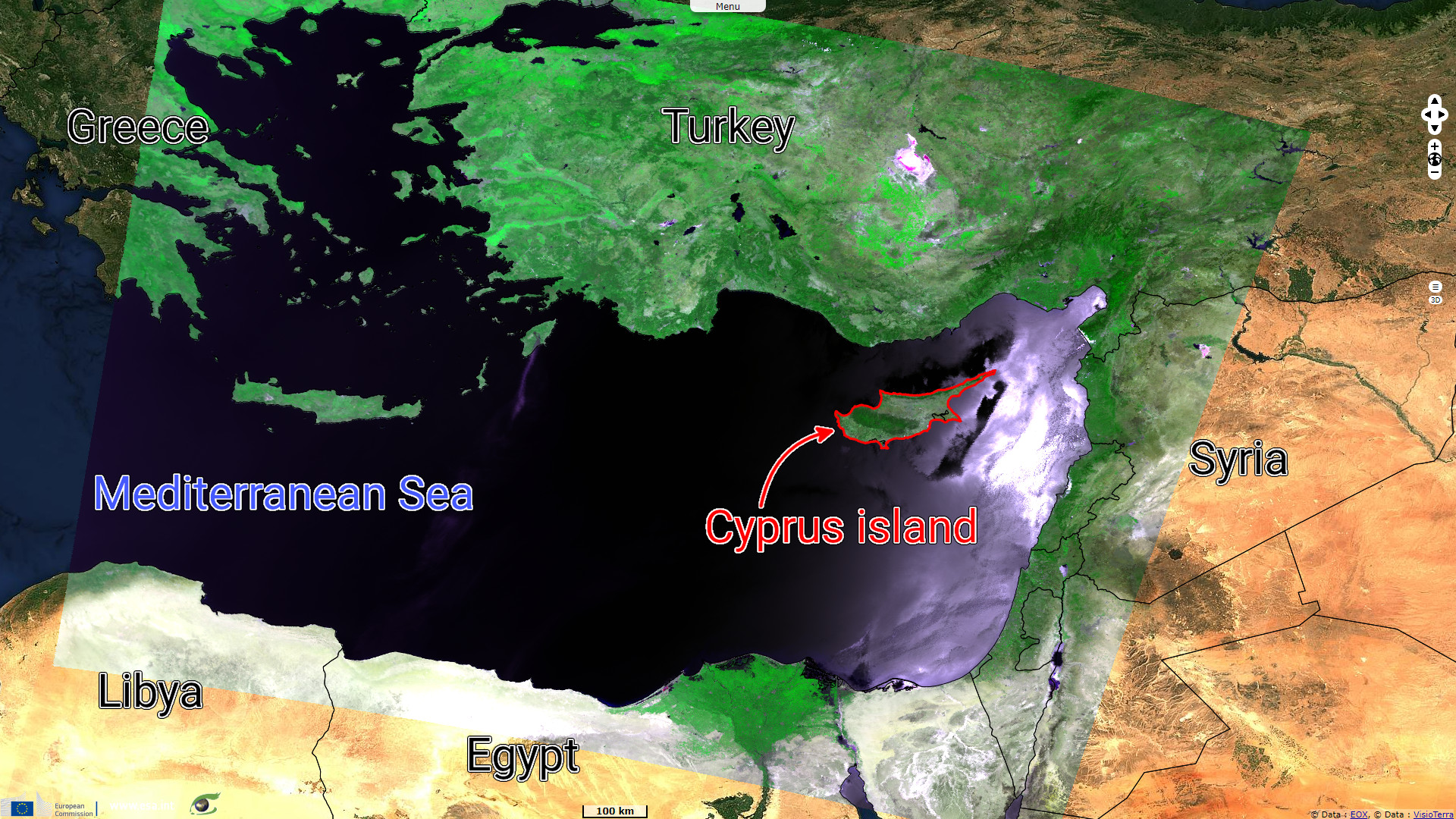
When Cyprus was granted independence from UK in 1960, it counted 77% Greeks and 18% Turks.
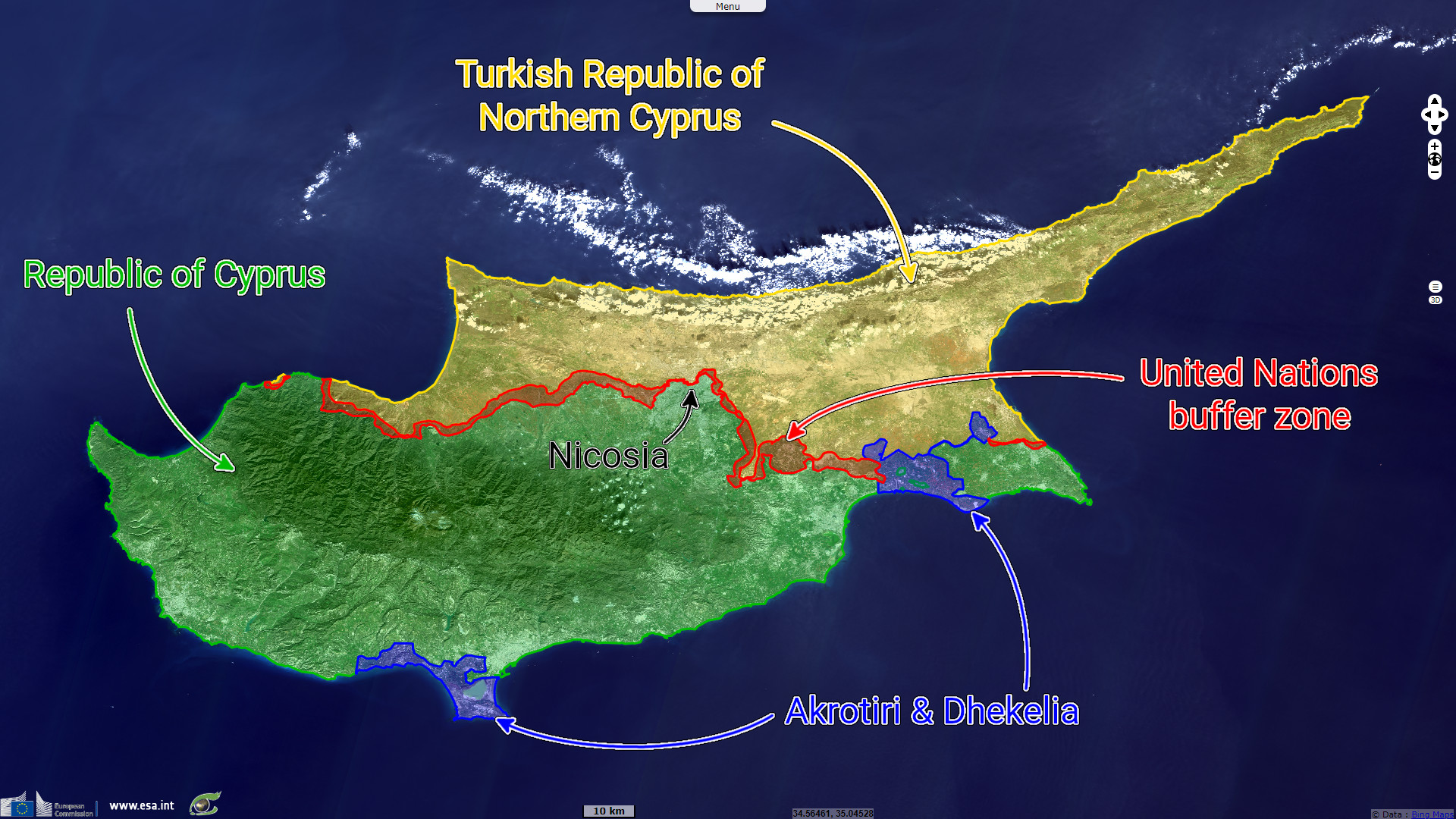
Following intercommunal violences, the Green Line buffer zione was established in 1964 to separate areas administred by each community, it is since enforced by United Nations Peacekeeping Force in Cyprus.
The Greek-junta led a coup d'état in Cyprus in 1974, ousting the legetimate president, Archbishop Makarios. It provided the pretext for the Turkish invasion in the north of the island. It led to the unrecognized Turkish Republic of Northern Cyprus territory, considered by the international community as Turkish-occupied territory of the Republic of Cyprus.
The views expressed herein can in no way be taken to reflect the official opinion of the European Space Agency or the European Union.
Contains modified Copernicus Sentinel data 2026, processed by VisioTerra.
Contains modified Copernicus Sentinel data 2026, processed by VisioTerra.
| More on European Commission space: |  |
 |
 |
||||
| More on ESA: | |
|
|
S-1 website | S-2 website | S-3 website | |
| More on Copernicus program: | |
|
|
Scihub portal | Cophub portal | Inthub portal | Colhub portal |
| More on VisioTerra: | |
|
|
Sentinel Vision Portal | Envisat+ERS portal | Swarm+GOCE portal | CryoSat portal |