Fishing zones & oil spill monitoring in North Africa
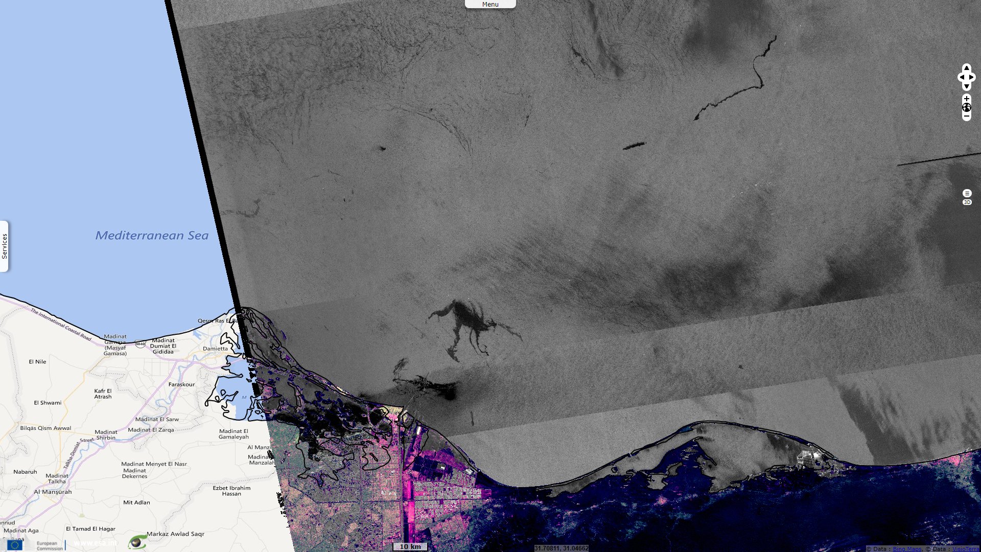
Sentinel-1 CSAR IW acquired on 04 October 2014 at 15:48:24 UTC
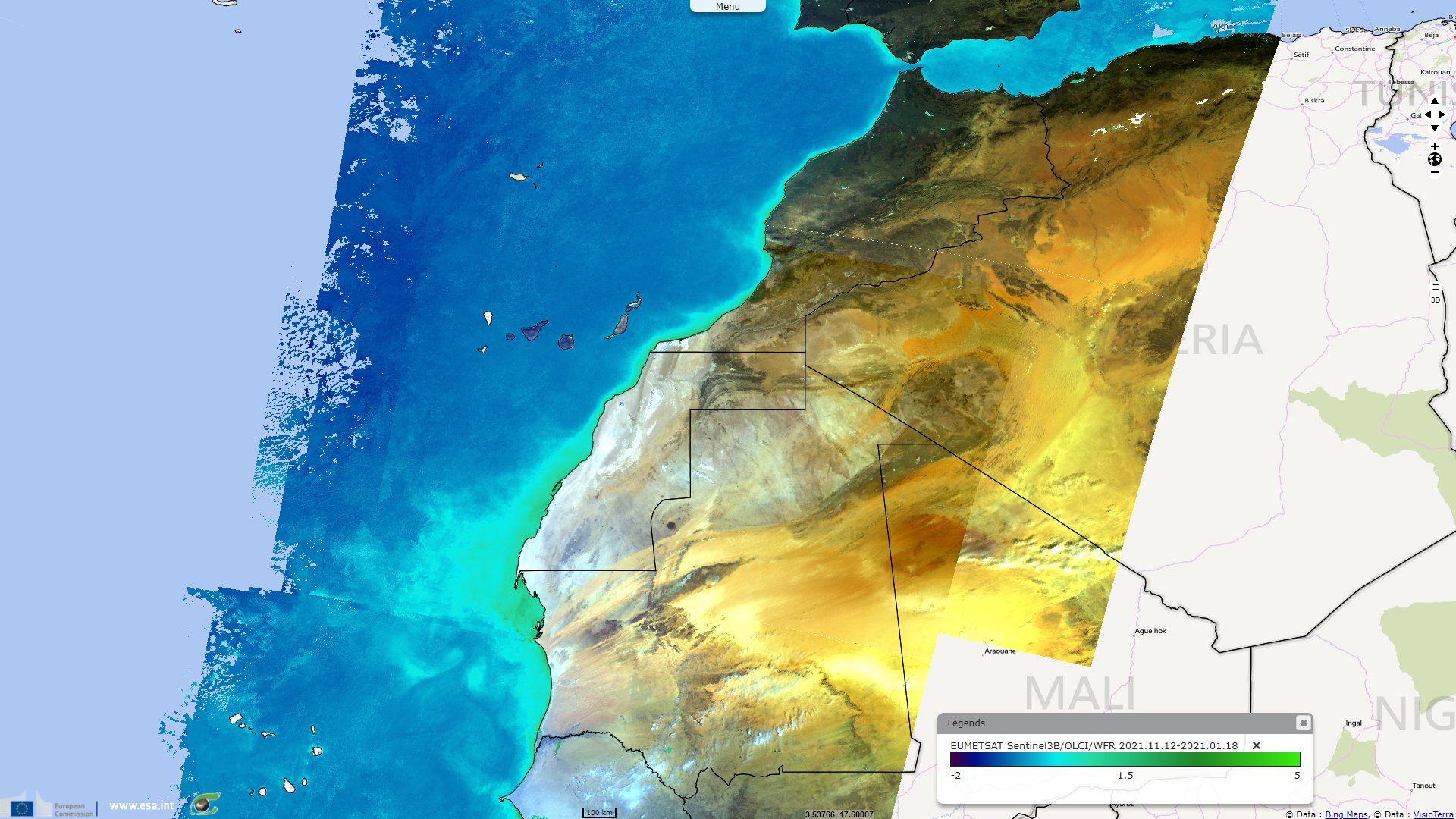
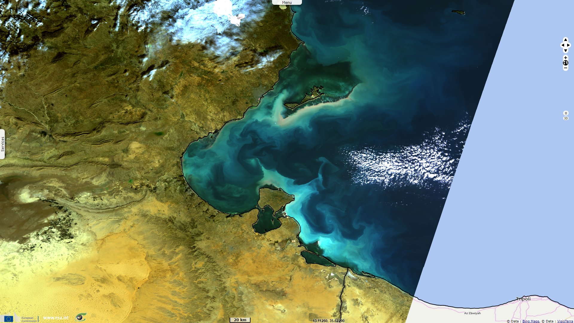
Sentinel-3 OLCI FR acquired on 21 December 2016 at 09:45:55 UTC
...
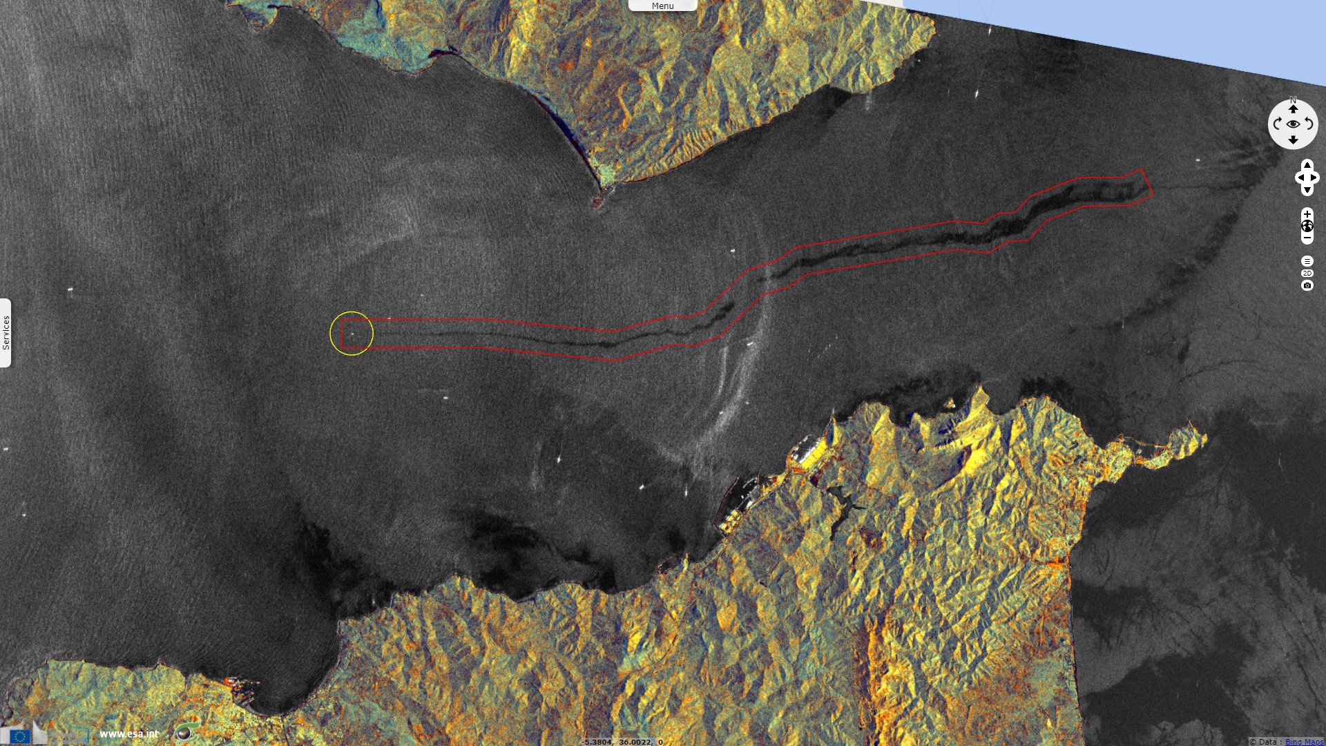
Sentinel-1 CSAR IW acquired on 17 February 2020 at 15:48:16 UTC
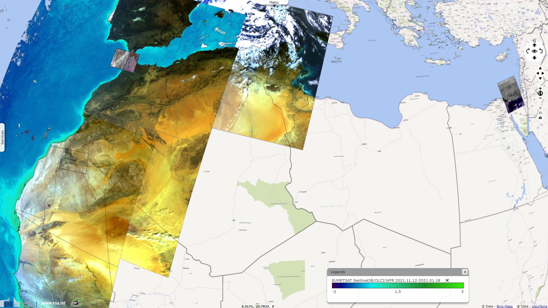
Sentinel-3 OLCI WFR acquired on 15 November 2021 at 10:43:24 UTC
Sentinel-3 OLCI FR acquired on 21 December 2016 at 09:45:55 UTC
...
Sentinel-1 CSAR IW acquired on 17 February 2020 at 15:48:16 UTC
Sentinel-3 OLCI WFR acquired on 15 November 2021 at 10:43:24 UTC
Keyword(s): Pollution, biodiversity, fishing, oil and gas, oil spills, Egypt, Morocco, Tunisia, Mauritania
The views expressed herein can in no way be taken to reflect the official opinion of the European Space Agency or the European Union.
Contains modified Copernicus Sentinel data 2026, processed by VisioTerra.
Contains modified Copernicus Sentinel data 2026, processed by VisioTerra.
| More on European Commission space: |  |
 |
 |
||||
| More on ESA: | |
|
|
S-1 website | S-2 website | S-3 website | |
| More on Copernicus program: | |
|
|
Scihub portal | Cophub portal | Inthub portal | Colhub portal |
| More on VisioTerra: | |
|
|
Sentinel Vision Portal | Envisat+ERS portal | Swarm+GOCE portal | CryoSat portal |