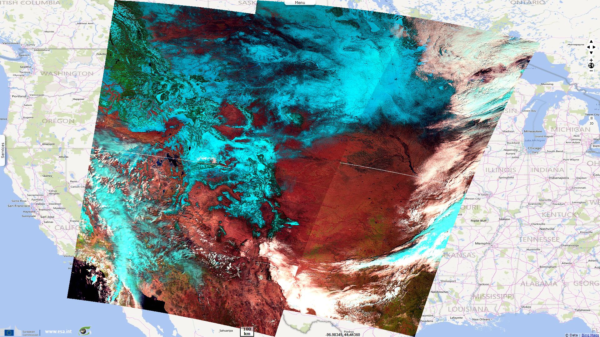
Bomb Cyclone causes blizzard & floods in US Midwest
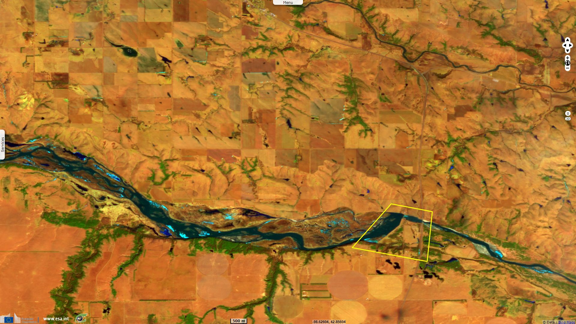
Sentinel-2 MSI acquired on 21 March 2018 at 17:09:59 UTC
...
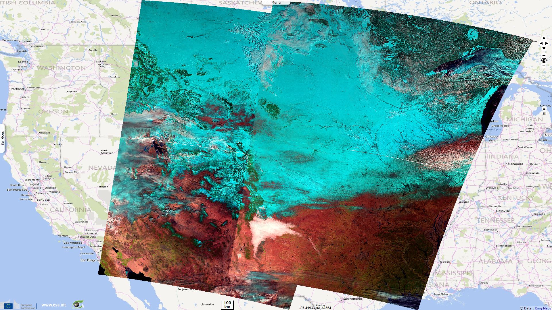
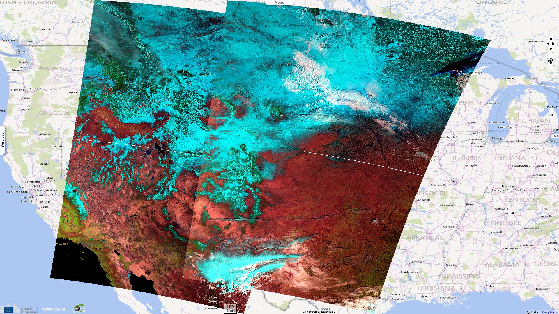
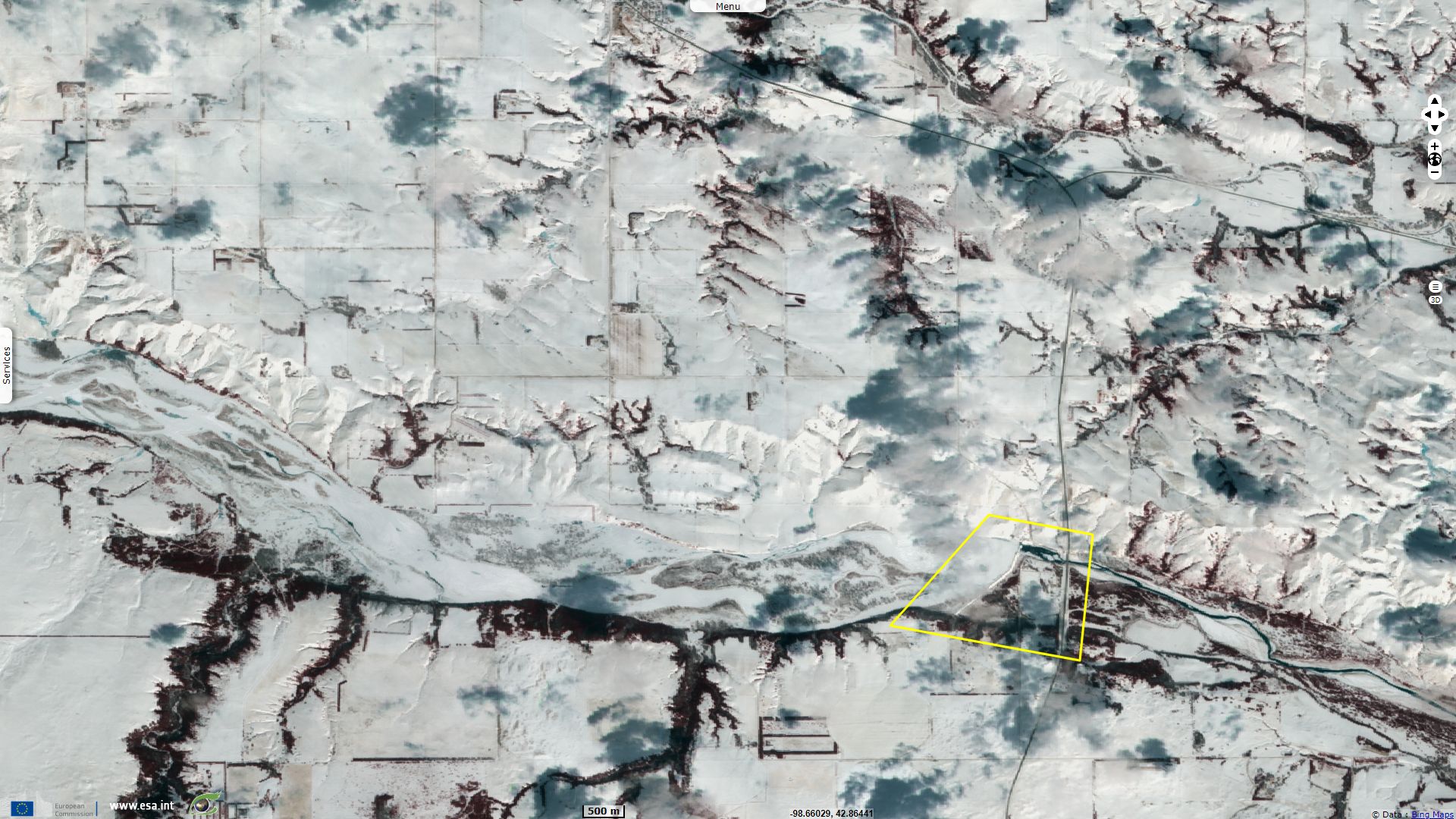
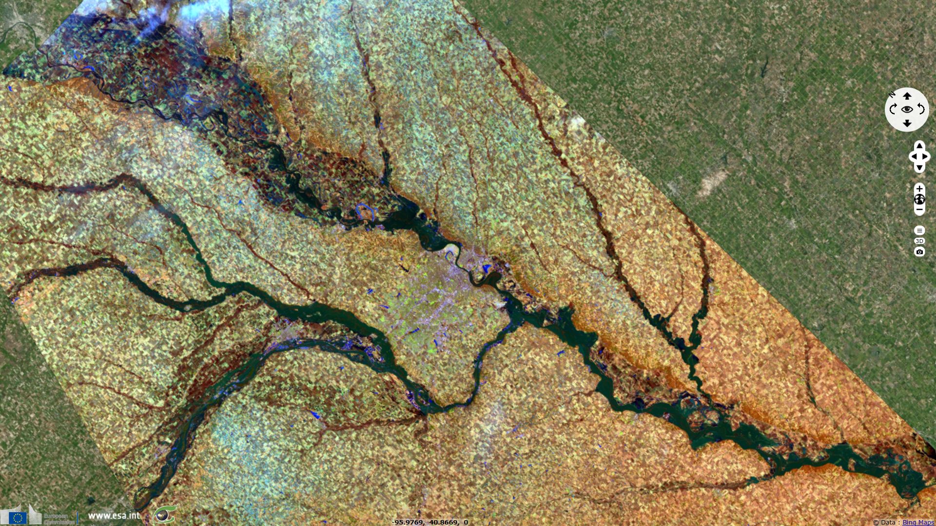
Sentinel-3 SLSTR RBT acquired on 05 March 2019 from 16:43:40 to 16:46:40 UTC and from 17:23:06 to 17:26:06 UTC
Sentinel-3 SLSTR RBT acquired on 20 March 2019 from 16:54:55 to 16:57:55 UTC and from 17:34:20 to 17:37:20 UTC
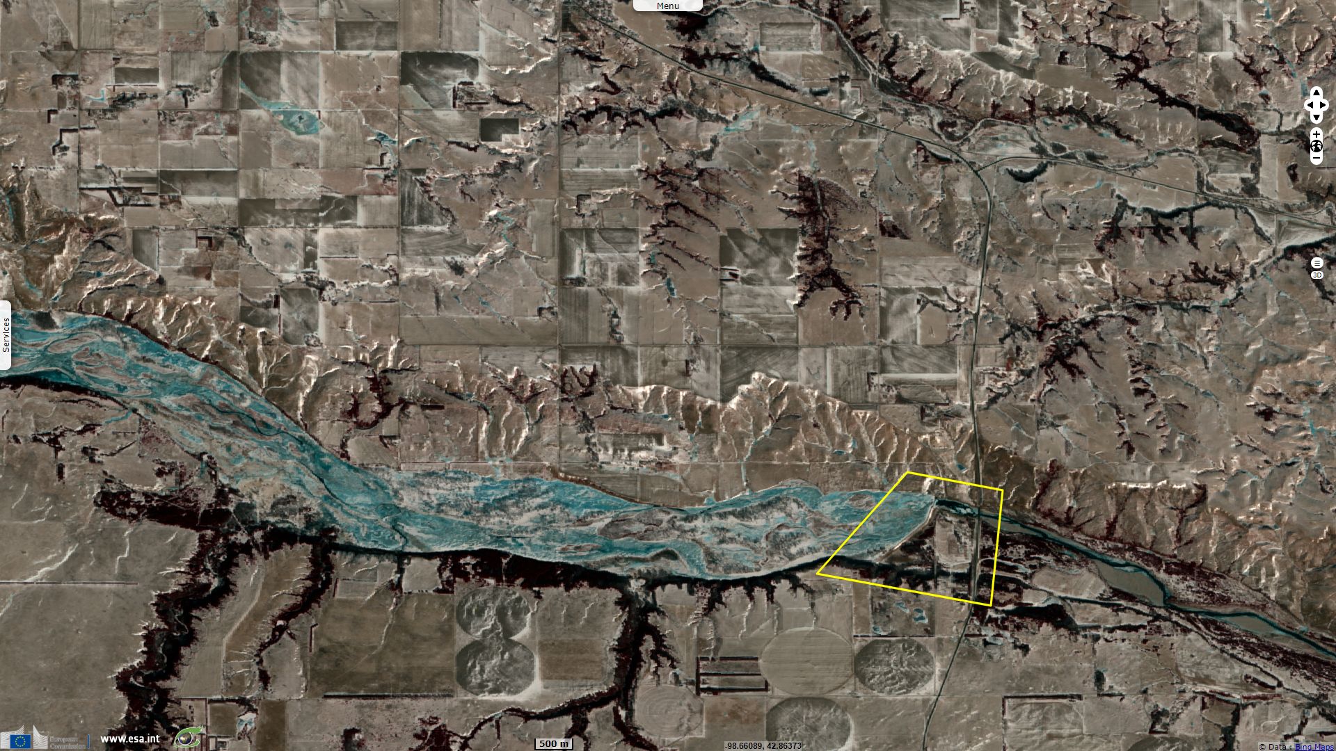
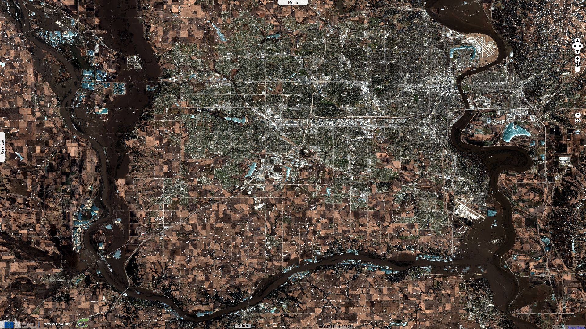
Sentinel-2 MSI acquired on 22 March 2019 at 17:30:09 UTC
...
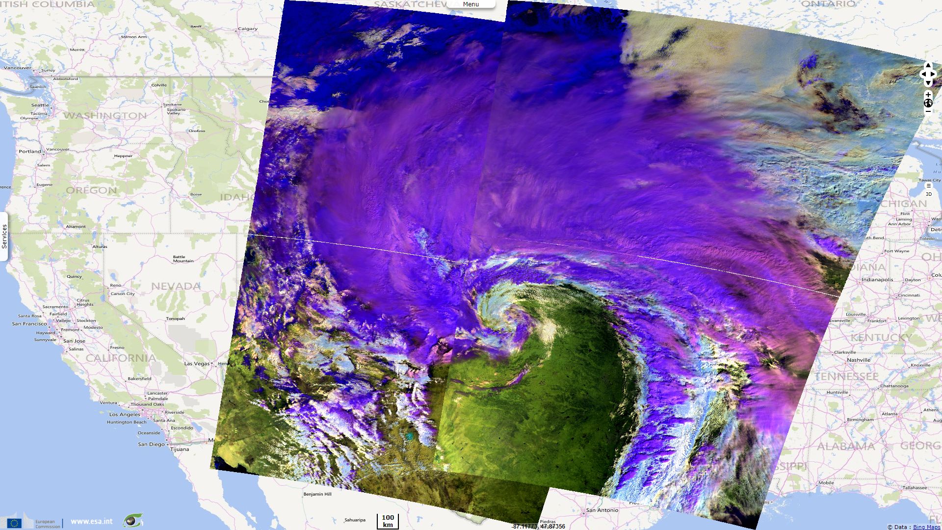
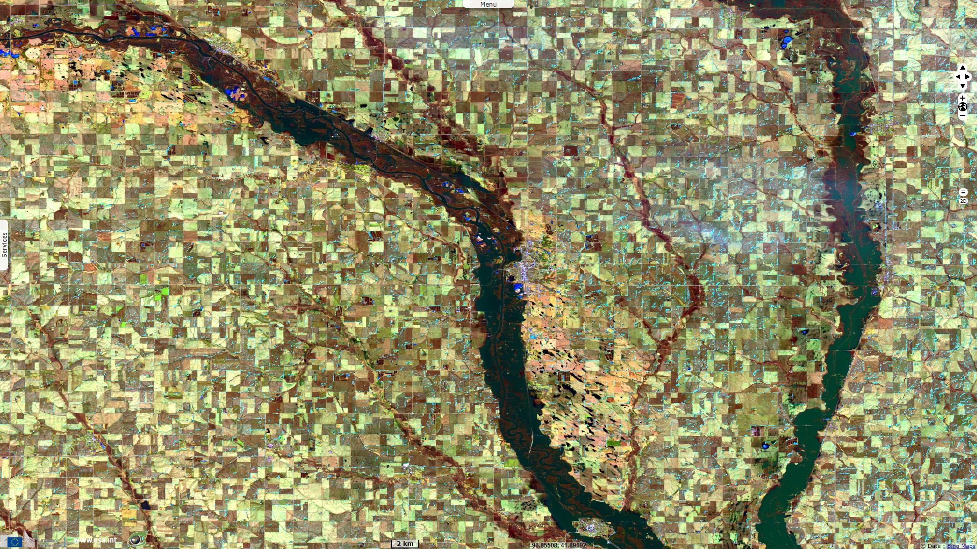
Sentinel-3 SLSTR RBT acquired on 05 March 2019 from 16:43:40 to 16:46:40 UTC and from 17:23:06 to 17:26:06 UTC
Sentinel-3 SLSTR RBT acquired on 20 March 2019 from 16:54:55 to 16:57:55 UTC and from 17:34:20 to 17:37:20 UTC
Sentinel-2 MSI acquired on 22 March 2019 at 17:30:09 UTC
Keyword(s): Emergency, natural disaster, flooding, infrastructure, dam, river, precipitations, snow, ice, USA, United States
In January and February 2019, the US midwest plains have already received a large amount of precipitations that had resulted in floodings.
On Feb. 25, 2019, the U.S. Army Corps of Engineers decided to alleviate the pressure on the infrastructure in the lower Mississippi basin: "Increasing water levels as a result of heavy rain in the Mississippi and Ohio river valleys are prompting the U.S. Army Corps of Engineers to operate the Bonnet Carré Spillway to ensure safe passage of the Mississippi river through the greater New Orleans area."
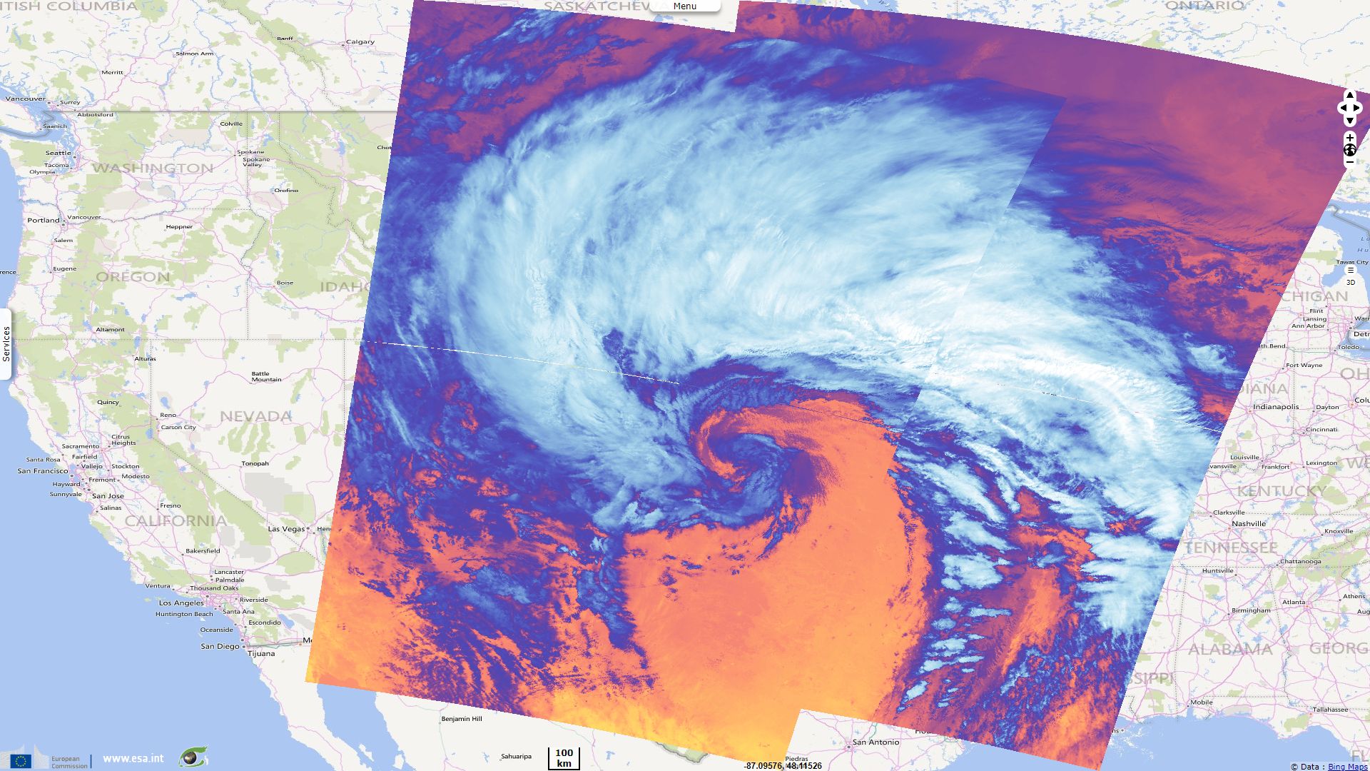
Then bomb cyclone Ulmer stormed central US between the 8th and the 16th of March, as narrates weather.com:
"Winter Storm Ulmer central pressure dropped from 994 millibars around 8 p.m. MDT Tuesday night, March 12, estimated by NOAA Weather Prediction Center meteorologist David Roth, to 970 millibars at 9 a.m. MDT Wednesday, March 13, meeting bombogenesis criteria in just over half the time." "This bomb cyclone tied or set preliminary, unofficial all-time low-pressure records in four locations." "The intensity of this Plains storm was due to a merging of two powerful jet-stream disturbances".
Ulmer caused gale- to hurricane-force winds, snow, and heavy rain from the Gulf of Mexico to the Great Lakes. In many regions, the warm rain and warm weather during and after the storm caused snow to melt quickly. Ulmer also spawned a rash of severe thunderstorms with damaging winds and tornadoes in the Ohio Valley, Tennessee Valley and piedmont of the Carolinas. Due to a combination of well-above-normal precipitation, snowmelt, saturated soils, and frozen ground the water could not be absorbed by the soil and mostly ran off into rivers and streams.
Describing a previous similar event, NOAA's National Environmental Satellite, Data, and Information Service wrote: "A mid-latitude cyclone is a synoptic (large-scale) low pressure system that forms along weather fronts in Earth's mid-latitudes (usually between 30° and 60° latitude from the equator). In the continental U.S., these storms most often occur from late fall to early spring when the temperature contrast between warm and cold air masses is greatest. During winter, strong low pressure systems can produce a wide variety of weather impacts, including heavy snow, sleet, rain, and coastal flooding... As temperatures warm and summer arrives, mid-latitude cyclones become much less common over the continental U.S."
It forms as "The low pressure system forms to the east of the upper-level trough of the jet stream. Air rises in low pressure systems because of the convergence of air at the surface and diverging air aloft which forms clouds. For the cyclone to intensify, the diverging air aloft has to be greater than the converging air at the surface. This essentially pulls more air upwards and the surface pressure of the system drops, intensifying the cyclone.", adds North Carolina climate office.
A researcher in meteorology commented: "It's like 1,000 mile wide hurricane was plopped in the middle of the Central Plains but it is snow."
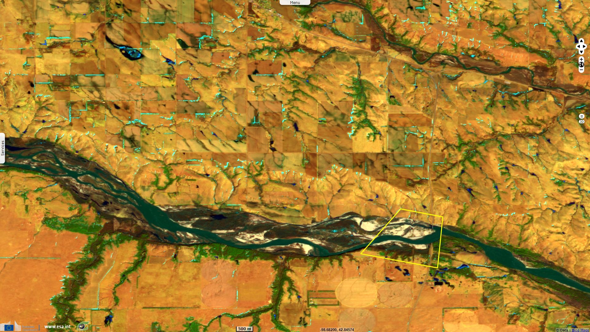
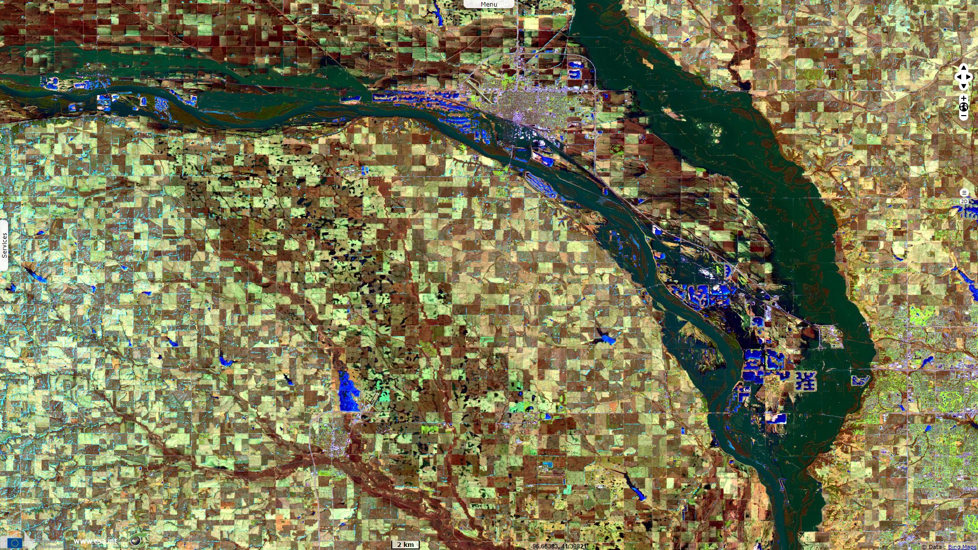
This event caused billions of damage but few victims. Half of them were killed by the failure of Spencer Dam. March 14, 2019 at 5am, the dam was breached after the March 2019 North American blizzard caused heavy rain, snowmelt and ice breakage to swell the Niobrara River. It caused a 3m water wall to be released downstream. As the floodwaters reached the Missouri River, the U.S. Army Corps of Engineers was forced to boost releases at Gavins Point Dam to 2500 m3/s, the second highest level on record. The highway bridge located just below has also been swept away along with two other bridges downstream.
Few years ago, the dam had been planned to be decommissioned, remaining in place with the gates permanently removed to allowing the river to flow freely.

In the midst of historic flooding, truck-sized ice chunks destroyed the Spencer Dam and Bridge, and also took out a campground and house downstream - Source: Engineering News Record.
Engineering News Record explains how this was made possible: "Officials from the U.S. Army Corps of Engineers, the Nebraska Dept. of Natural Resources, the state’s biggest public power utility and local fire departments were all overwhelmed by a combination of frozen ground, rain and snow in mid-March. The Platte and Missouri river systems could not drain the inundation, and it didn’t help that much of the infrastructure in place wasn’t ready for such a combined storm and cold event."
During an inspection in April 2018 the Nebraska Department of Natural Resources had warned that "deficiencies [in the dam] exist which could lead to dam failure during rare, extreme storm events." Add that "much of dam and levee infrastructure in southern Nebraska was not designed for flood control. Many of the communities in the area have focused on securing scarce water in the summer months rather than on flood control." according to ENR.
"Unfortunately, much of the water that flows down the Niobrara River into the Missouri ends up at the Gavins Point Dam on the Nebraska-South Dakota border. The Lewis and Clark Lake it creates is the only place to deposit water near Gavins Point. It has capacity to hold back less than 1% of the water in those six reservoirs.
The Corps had little choice but to open up its floodgates. The lake rose 1.6-feet higher than it ever had before. Water that was equivalent to 31 times the river’s average March flow poured into the lake. Further downstream, the Platte River dumped more water into the Missouri, swelling it to record levels. South of the Platte, levees quickly overtopped—some failed and others were structurally compromised. Beyond dams and reservoirs, wastewater and freshwater processing plants near all of southern Nebraska’s rivers announced emergency shutdowns."
The views expressed herein can in no way be taken to reflect the official opinion of the European Space Agency or the European Union.
Contains modified Copernicus Sentinel data 2026, processed by VisioTerra.
Contains modified Copernicus Sentinel data 2026, processed by VisioTerra.
| More on European Commission space: |  |
 |
 |
||||
| More on ESA: | |
|
|
S-1 website | S-2 website | S-3 website | |
| More on Copernicus program: | |
|
|
Scihub portal | Cophub portal | Inthub portal | Colhub portal |
| More on VisioTerra: | |
|
|
Sentinel Vision Portal | Envisat+ERS portal | Swarm+GOCE portal | CryoSat portal |