Taal volcano spills cinders over Luzon, Philippines
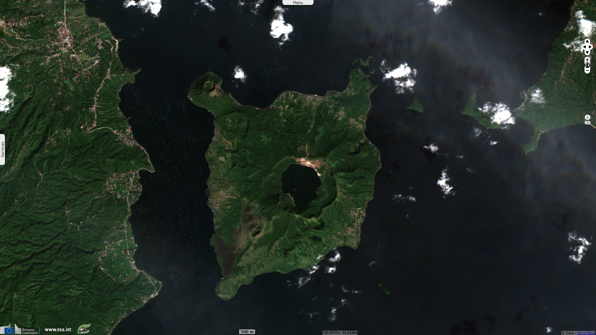
Sentinel-2 MSI acquired on 24 December 2019 at 02:21:09 UTC
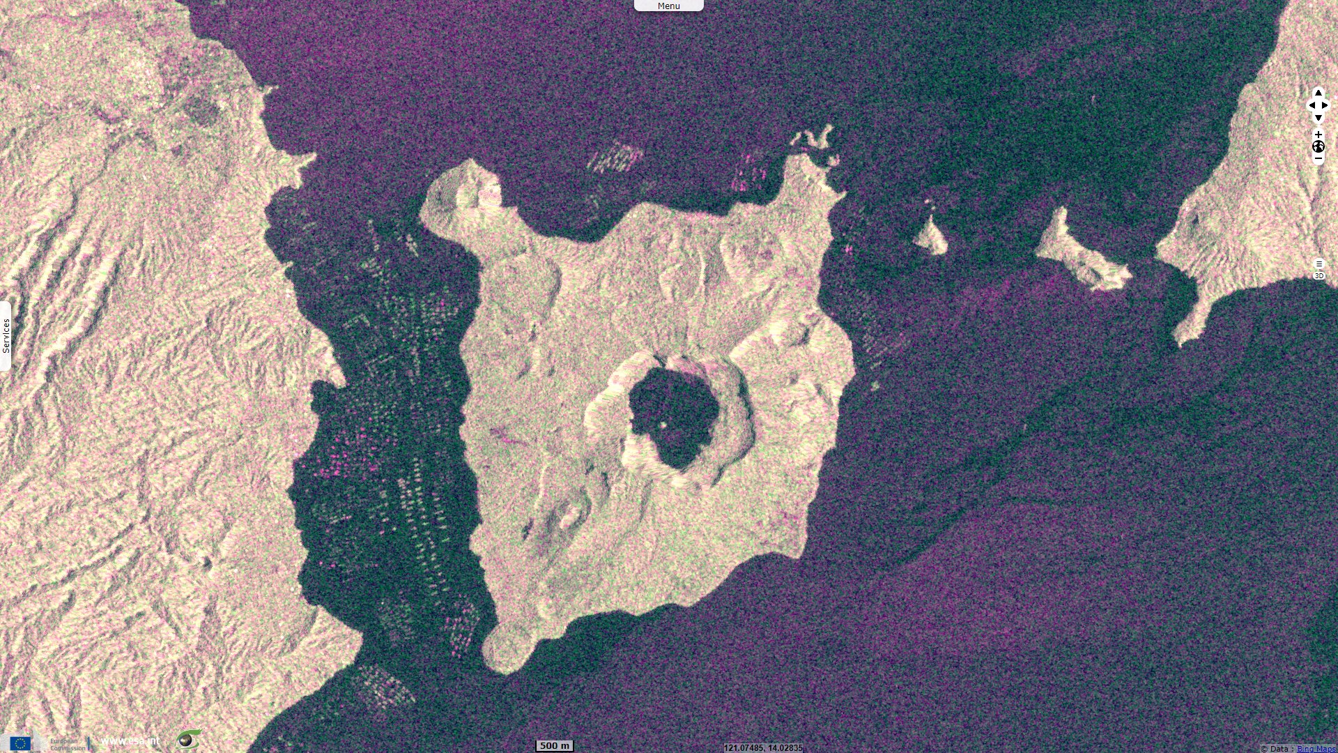
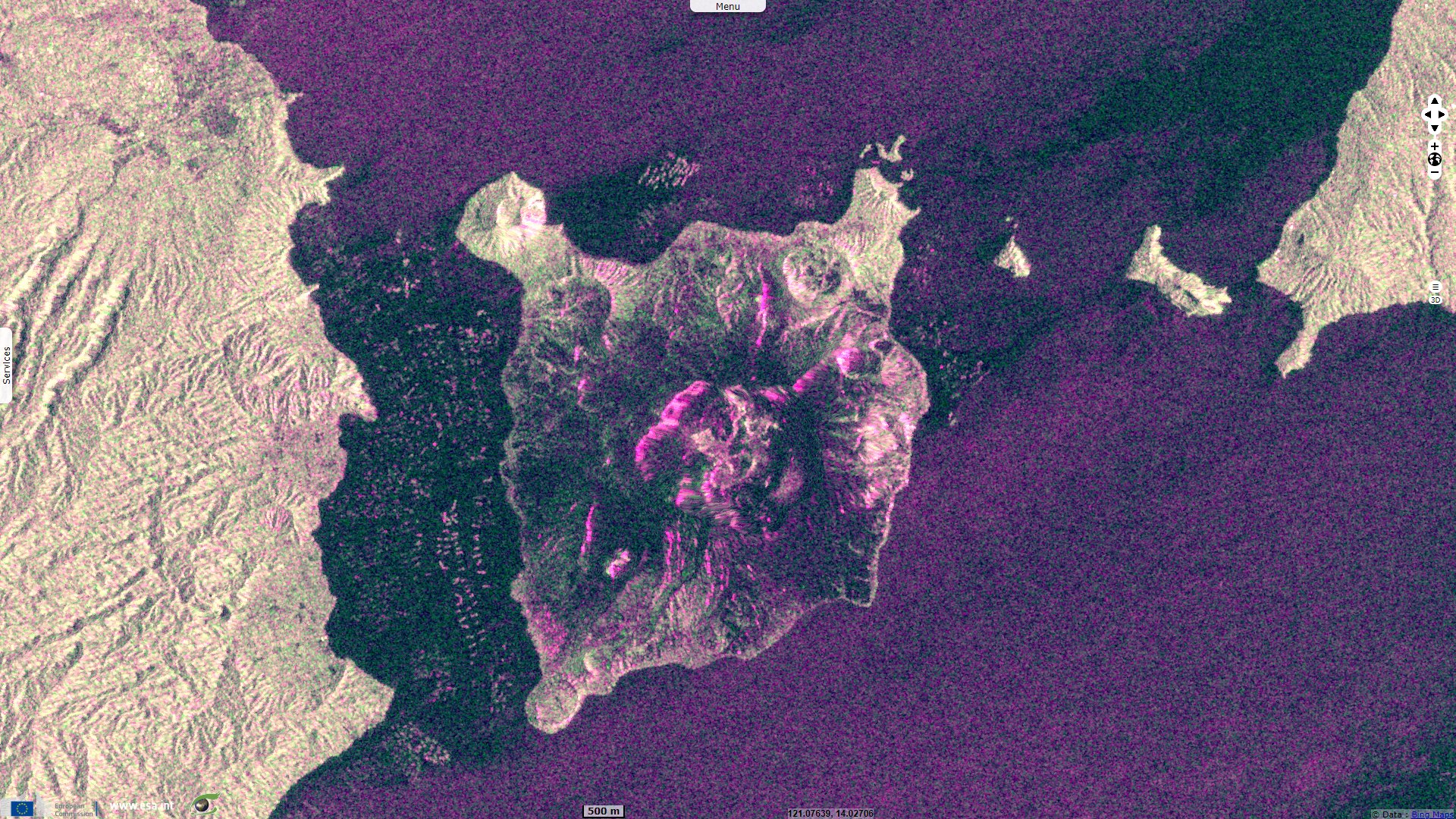
Sentinel-1 CSAR IW acquired on 09 January 2020 & 15 January 2020 at 21:46:14 UTC
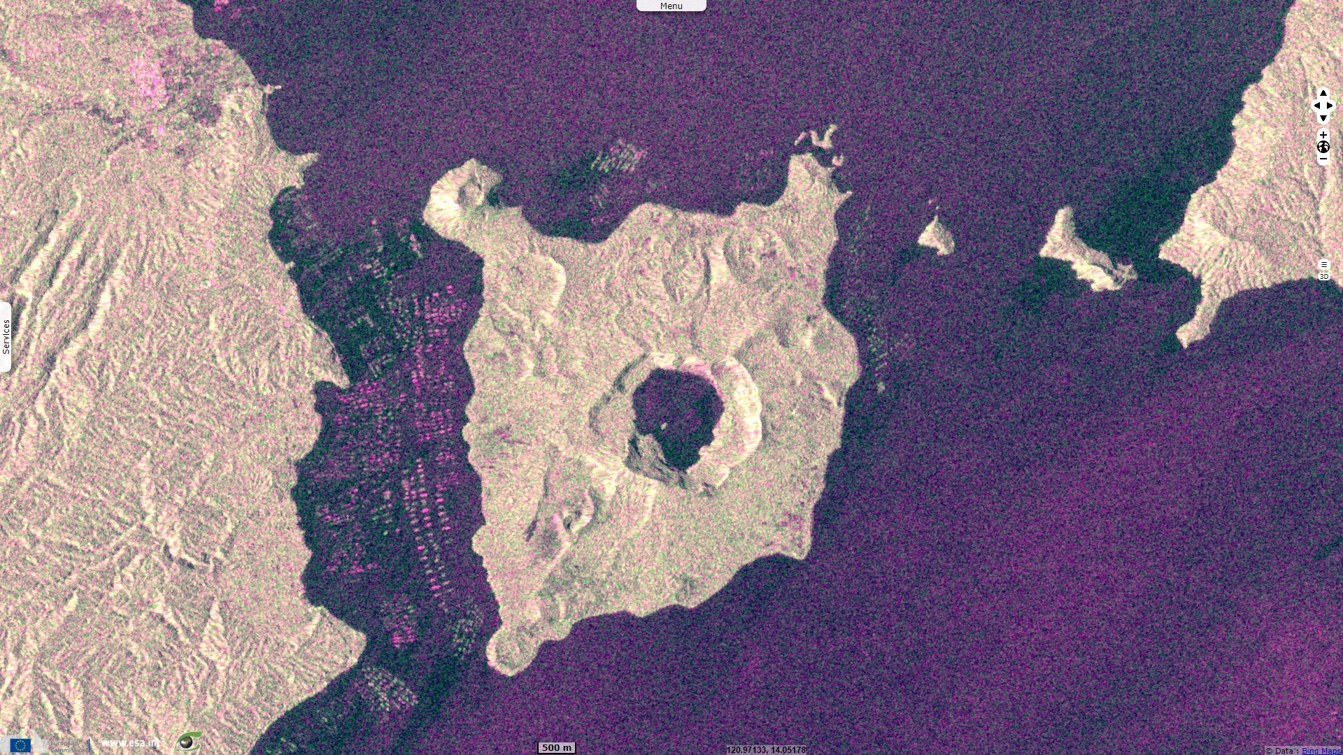
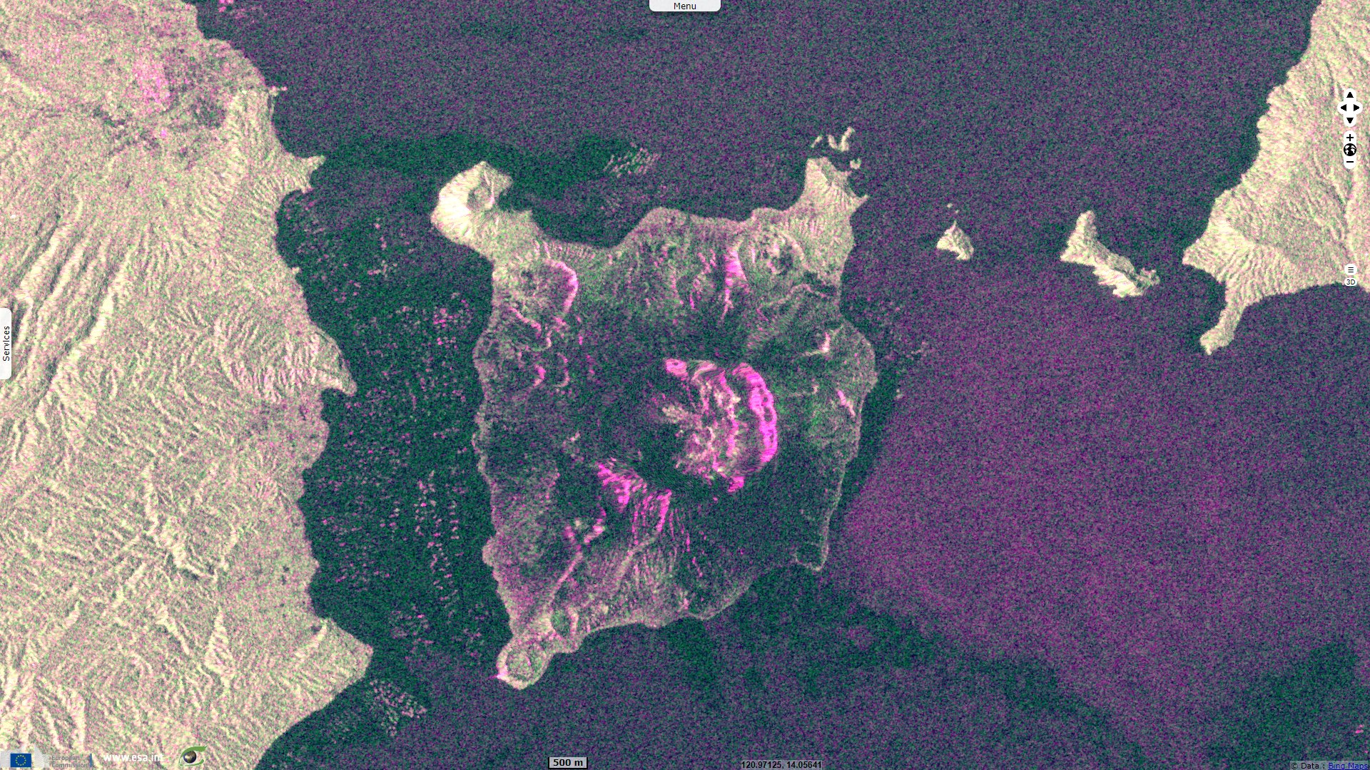
Sentinel-1 CSAR IW acquired on 11 January 2020 & 17 January 2020 at 10:06:30 UTC
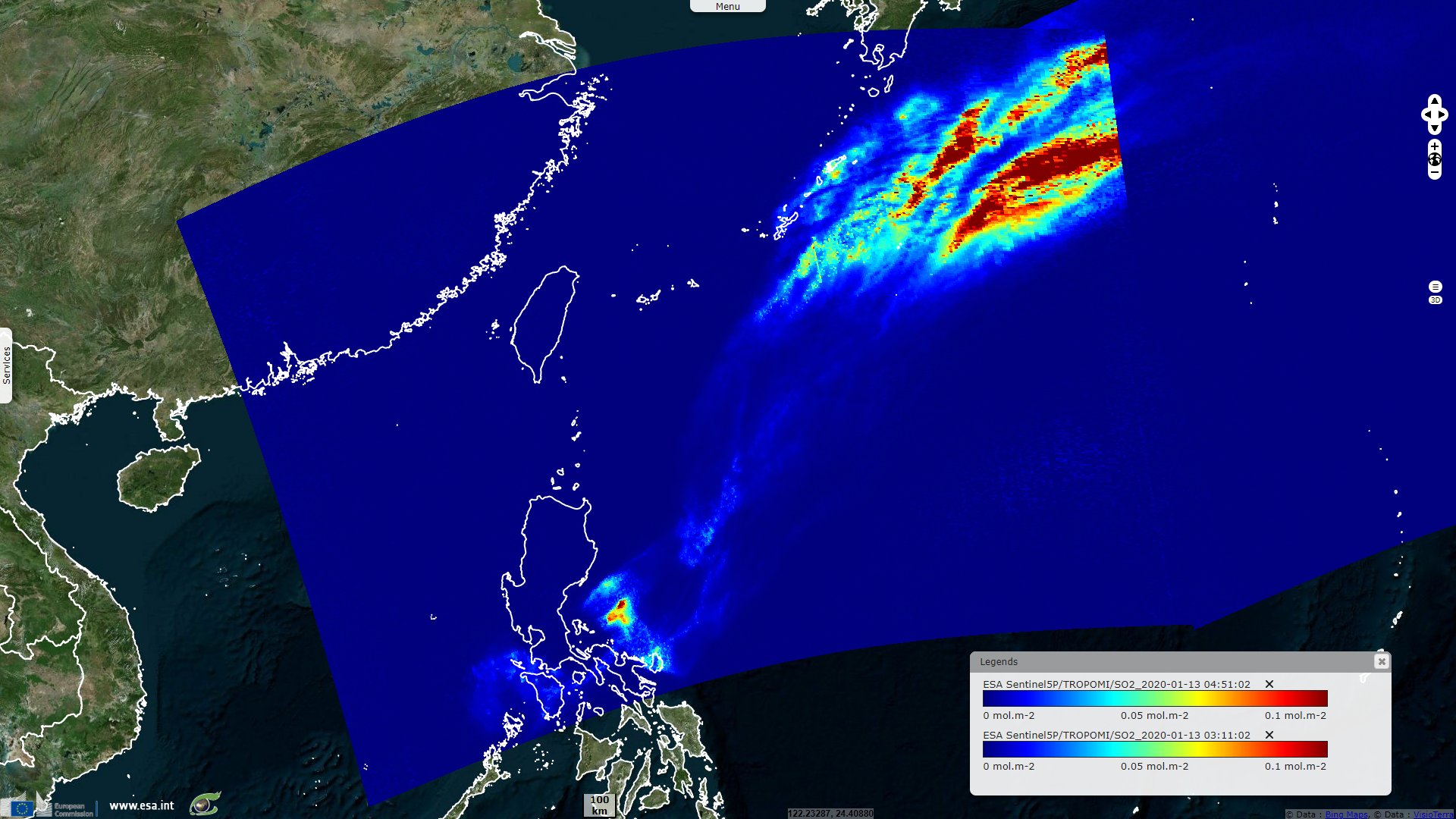
Sentinel-5P TROPOMI SO2 acquired on 13 January 2020 from 03:11:02 to 04:51:02 UTC
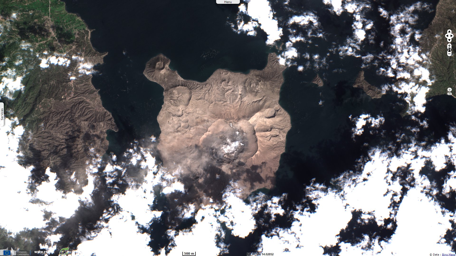
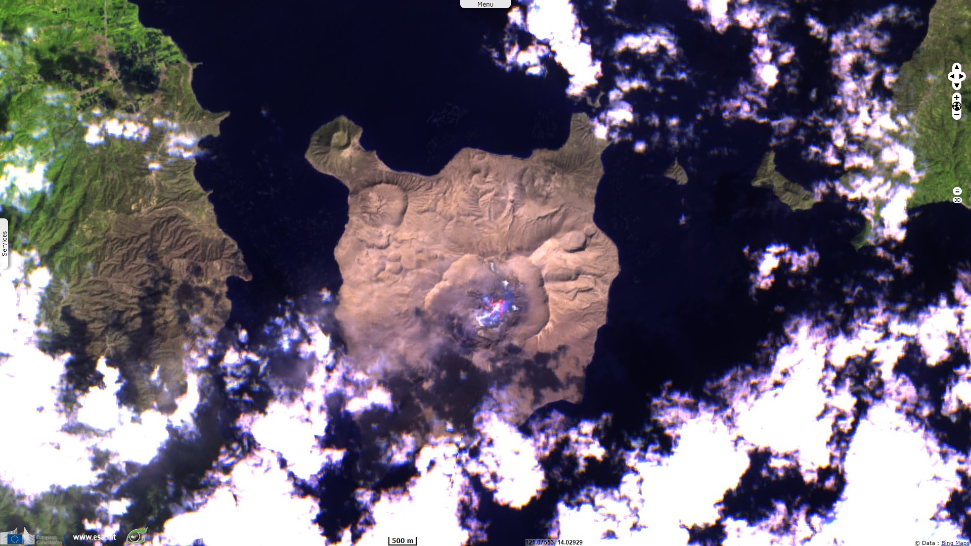
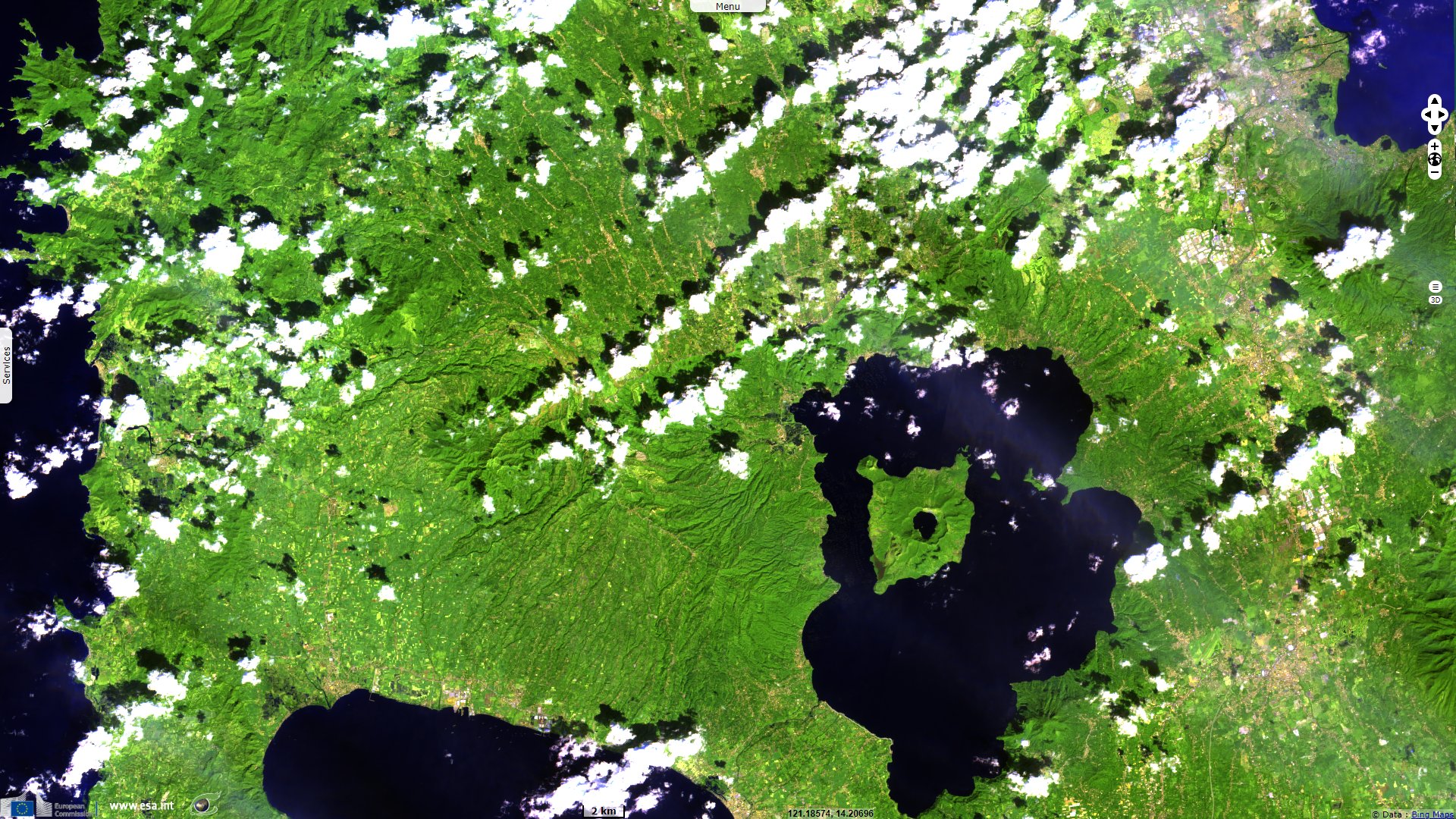
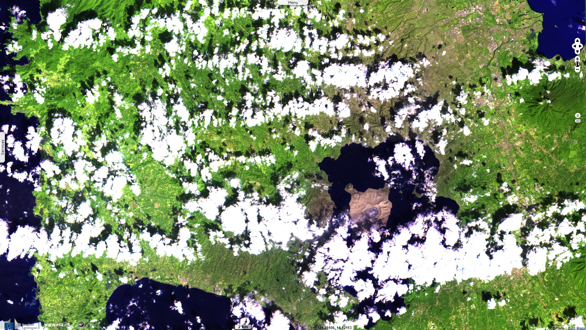
Sentinel-2 MSI acquired on 23 January 2020 at 02:19:59 UTC
Sentinel-1 CSAR IW acquired on 09 January 2020 & 15 January 2020 at 21:46:14 UTC
Sentinel-1 CSAR IW acquired on 11 January 2020 & 17 January 2020 at 10:06:30 UTC
Sentinel-5P TROPOMI SO2 acquired on 13 January 2020 from 03:11:02 to 04:51:02 UTC
Sentinel-2 MSI acquired on 23 January 2020 at 02:19:59 UTC
Keyword(s): Emergency, natural disaster, subduction volcano, ash, cinder, Philippines, Pacific ring of fire.
Taal volcano is one of the decade volcanoes, 16 volcanoes identified by the International Association of Volcanology and Chemistry of the Earth's Interior as being worthy of particular study in light of their history of large, destructive eruptions and proximity to populated areas.
The Smithsonian Institution explains the geological context of the volcano as follows: "Taal is one of the most active volcanoes in the Philippines and has produced some of its most powerful historical eruptions. Though not topographically prominent, its prehistorical eruptions have greatly changed the landscape of S-W Luzon. The 15 x 20 km Talisay (Taal) caldera is largely filled by Lake Taal, whose 267 km² surface lies only 3 m above sea level."
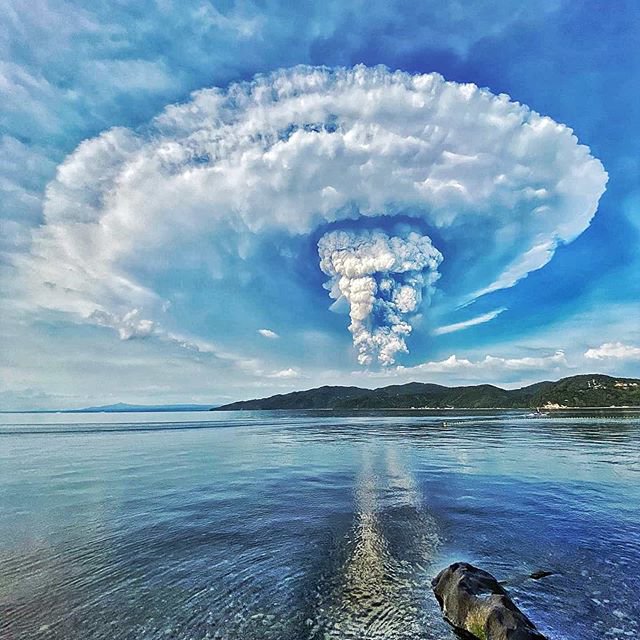
Left: Volcanic plume, 12.01.2020 - Source: @Raproxen
Right: Volcanic plume, 12.01.2020
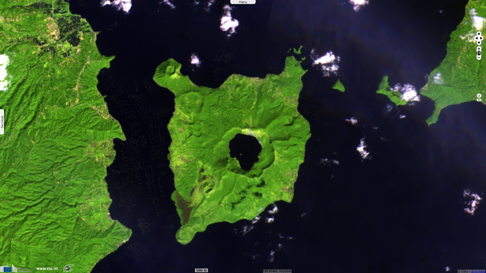
"The maximum depth of the lake is 160 m, and several eruptive centers lie submerged beneath the lake. The 5 km-wide Volcano Island in north-central Lake Taal is the location of all historical eruptions. The island is composed of coalescing small stratovolcanoes, tuff rings, and scoria cones that have grown about 25% in area during historical time. Powerful pyroclastic flows and surges from historical eruptions have caused many fatalities."
The Smithsonian Institution details the eruption of the Taal volcano in Philippines:
"PHIVOLCS reported that seismicity at Taal began to increase on 28 March 2019 and fluctuated between moderate and high levels throughout the year and into 2020. A seismic swarm beneath Taal began at 11:00 on 12 January and a phreatic eruption commenced at 13:00.
The initial eruptive activity was characterized by increased steaming from at least five vents in Main Crater and phreatic explosions that generated 100 m-high plumes. PHIVOLCS raised the Alert Level to 2 (on a scale of 0-5) and reminded the public that the entire Volcano Island (the main cone of Taal) is in a Permanent Danger Zone (PDZ)."
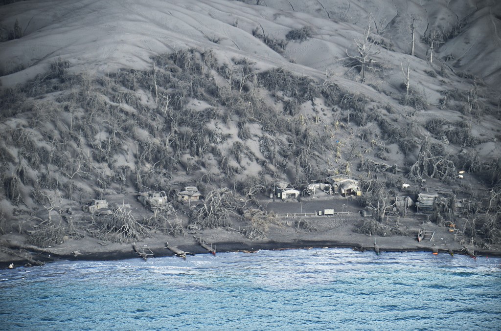
A bird's eye view of mud-covered houses at the foot of Taal volcano as seen from a Philippine airforce helicopter during an aerial survey on January 21, 2020. Philippine authorities ordered a crackdown on January 20 on evacuees' daily visits to homes in the danger zone around Taal volcano, amid a warning it could be "recharging" for a more powerful explosion - Source: Ted Aljibe for Agence France Presse.
"Booming was heard at 14:00 in Talisay, Batangas (4 km NNE, all distances are measured from the center of Main Crater lake). Activity escalated at 14:04; volcanic tremor and earthquakes felt locally were accompanied by an eruption plume that rose 1 km. Ash fell in the SSW part of Taal.
The Alert Level was raised to 3 and the evacuation of high-risk barangays was recommended. Activity again intensified around 17:30, prompting PHIVOLCS to raise the Alert Level to 4 and recommend a total evacuation of the island and high-risk areas within a 14 km radius."
"The eruption plume of steam, gas, and tephra significantly intensified and rose 10-15 km a.s.l., producing frequent lightning. Wet ash fell in areas downwind, including as far N as Quezon City (75 km). According to news articles schools and government offices were ordered to close and the Ninoy Aquino International Airport (56 km N) in Manila suspended flights. About 6000 people had been evacuated but the number was expected to rise. Residents described heavy ashfall, low visibility, and fallen trees."
"Ashfall was reported in a wide area; in a statement issued at 03:20 on 13 January PHIVOLCS noted that ashfall was reported in Tanauan (18 km NE), Batangas; Escala (11 km NW), Tagaytay; Sta. Rosa (32 km NNW), Laguna; Dasmariñas (32 km N), Bacoor (44 km N), and Silang (22 km N), Cavite; Malolos (93 km N), San Jose Del Monte (87 km N), and Meycauayan (80 km N), Bulacan; Antipolo (68 km NNE), Rizal; Muntinlupa (43 km N), Las Piñas (47 km N), Marikina (70 km NNE), Parañaque (51 km N), Pasig (62 km NNE), Quezon City, Mandaluyong (62 km N), San Juan (64 km N), Manila; Makati City (59 km N) and Taguig City (55 km N). Lapilli (2-64 mm in diameter) fell in Tanauan and Talisay; Tagaytay City (12 km N); Nuvali (25 km NNE) and Sta. Rosa, Laguna. Felt earthquakes (Intensities II-V) continued to be recorded in local areas."
"The eruption progressed to a magmatic eruption during 02:49-04:28 on 13 January, characterized by weak lava fountaining accompanied by thunder and flashes of lightning. Activity briefly waned then resumed with sporadic weak fountaining and explosions that generated 2 km-high, dark gray, steam-laden plumes. New lateral vents opened on the N flank, producing 500 m-tall lava fountains. Heavy ashfall impacted areas SW including in Cuenca (15 km SSW), Lemery (16 km SW), Talisay, and Taal (15 km SSW), Batangas."
"News articles noted that more than 300 domestic and 230 international flights were cancelled as the Manila Ninoy Aquino International Airport was closed during 12-13 January; some flights could depart in the early afternoon of 13 January. Some roads from Talisay to Lemery and Agoncillo were impassible and electricity and water services were intermittent. Ashfall in several provinces caused power outages. Authorities continued to evacuate high-risk areas within a 14 km radius of Taal; by 13 January more than 24 500 people had moved to 75 shelters out of a total number of 460 000 people within 14 km."
"In a bulletin posted at 08:00 on 14 January PHIVOLCS noted that lava fountaining continued and steam plumes rose form Main Crater. Fissures on the N flank produced 500 m-tall lava fountains. Sulfur dioxide emissions averaged 5299 tonnes/day on 13 January. By 13:00 lava fountaining generated 800 m-tall, dark gray, steam-laden plumes that drifted SW.
New ground cracks were observed in Sinisian (18 km SW), Mahabang Dahilig (14 km SW), Dayapan (15 km SW), Palanas (17 km SW), Sangalang (17 km SW), and Poblacion (19 km SW) Lemery; Pansipit (11 km SW), Agoncillo; Poblacion 1, Poblacion 2, Poblacion 3, Poblacion 5 (all around 17 km SW), Talisay, and Poblacion (11 km SW), San Nicolas. A fissure opened across the road connecting Agoncillo to Laurel, Batangas."
The views expressed herein can in no way be taken to reflect the official opinion of the European Space Agency or the European Union.
Contains modified Copernicus Sentinel data 2026, processed by VisioTerra.
Contains modified Copernicus Sentinel data 2026, processed by VisioTerra.
| More on European Commission space: |  |
 |
 |
||||
| More on ESA: | |
|
|
S-1 website | S-2 website | S-3 website | |
| More on Copernicus program: | |
|
|
Scihub portal | Cophub portal | Inthub portal | Colhub portal |
| More on VisioTerra: | |
|
|
Sentinel Vision Portal | Envisat+ERS portal | Swarm+GOCE portal | CryoSat portal |